New Lanark

Settlement in Lanarkshire

Scotland

New Lanark

Water pipelines to Bonnington Power Station The pipes bring water from above the Falls of Clyde to the hydro-electric power station.
Water pipelines to Bonnington Power Station Credit: Graham Hogg

New Lanark is a small village located in the county of Lanarkshire, Scotland. Situated on the banks of the River Clyde, it is renowned for its historical significance as an early example of a planned industrial settlement. The village was established by David Dale in 1785, and later became famous for its association with social reformer Robert Owen.

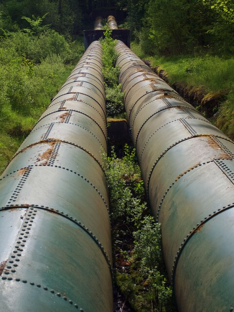
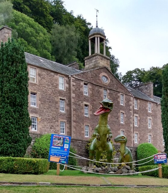
New Lanark was a cotton mill village, and during the Industrial Revolution, it played a crucial role in the cotton spinning industry. The village was designed to provide a self-sufficient and harmonious community for the workers of the cotton mills. It included housing, schools, and other amenities, which were considered revolutionary at the time. The buildings in New Lanark are characterized by their distinctive red sandstone construction.

Today, New Lanark is a UNESCO World Heritage Site and a popular tourist destination. The village has been meticulously restored, preserving its unique character and showcasing its industrial heritage. Visitors can explore the mill buildings, which now house a museum, exhibitions, and a visitor center. The New Lanark Visitor Centre offers insight into the history and working conditions of the village, as well as the life and ideas of Robert Owen.

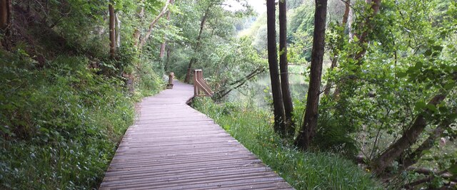
The natural beauty of the surrounding area also attracts visitors to New Lanark. The village is nestled in a picturesque valley, offering scenic walks and stunning views of the River Clyde and the nearby Falls of Clyde. The Falls of Clyde is a nature reserve, home to various species of birds and wildlife, making it a popular spot for nature enthusiasts.

In summary, New Lanark is a historically significant village in Lanarkshire, Scotland, known for its role in the cotton spinning industry. It offers visitors a chance to explore its industrial heritage, learn about the social reforms of Robert Owen, and enjoy the beauty of the surrounding countryside.

If you have any feedback on the listing, please let us know in the comments section below.
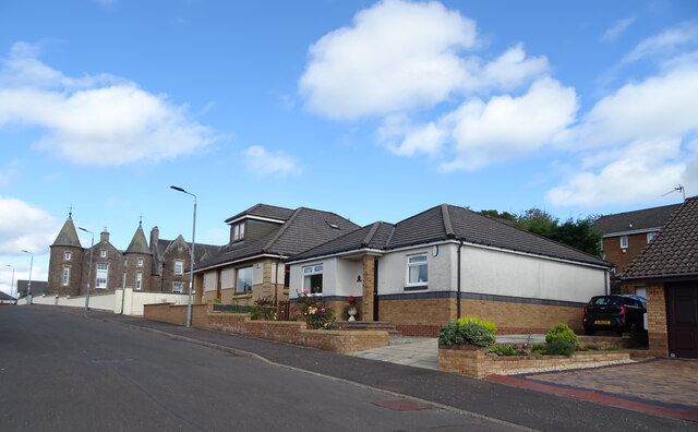
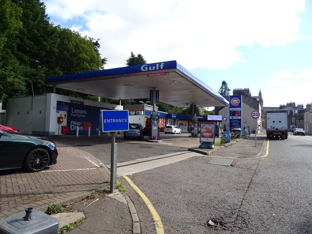
New Lanark Images

Images are sourced within 2km of 55.664032/-3.7815536 or Grid Reference NS8842. Thanks to Geograph Open Source API. All images are credited.

Water pipelines to Bonnington Power Station The pipes bring water from above the Falls of Clyde to the hydro-electric power station.
Water pipelines to Bonnington Power Station
The pipes bring water from above the Falls of Clyde to the hydro-electric power station.
Boardwalk at the Clyde Walkway Lower riverside boardwalk at the Clyde Walkway outside New Lanark.
Boardwalk at the Clyde Walkway
Lower riverside boardwalk at the Clyde Walkway outside New Lanark.
Swinging on to Bannantyne Street This HGV taking a wide course from St Leonard Street
Swinging on to Bannantyne Street
This HGV taking a wide course from St Leonard Street
Looking down High Street With St Nicholas Church at bottom
Looking down High Street
With St Nicholas Church at bottom
Jurassic Lanark Exhibit beside The Tolbooth, Lanark
Jurassic Lanark
Exhibit beside The Tolbooth, Lanark
Jurassic New Lanark A trail taking in both New Lanark as well as Lanark
Jurassic New Lanark
A trail taking in both New Lanark as well as Lanark
Roadworks on Riverside Road (A72), Kirkfieldbank Towards Lanark.
Roadworks on Riverside Road (A72), Kirkfieldbank
Towards Lanark.
Mousemill Road Towards Crossford.
Mousemill Road
Towards Crossford.
Hillside grazing, Kirkfieldbank Brae
Kirkfieldbank Brae (A72) Sharply downhill towards the River Clyde.
Kirkfieldbank Brae (A72)
Sharply downhill towards the River Clyde.
A72 approaching junction with the A73, Lanark
Bungalows on Lockhart Drive, Lanark
Lockhart Drive, Lanark Looking towards the former William Smellie Memorial Hospital.
Lockhart Drive, Lanark
Looking towards the former William Smellie Memorial Hospital.
Service station on  Westport (A73), Lanark
Service station on Westport (A73), Lanark
Lanark Museum Houses a collection of items which illustrate the ancient and varied history of the town.
Lanark Museum
Houses a collection of items which illustrate the ancient and varied history of the town.
The Clydesdale Inn, Lanark On Broomgate.
The Clydesdale Inn, Lanark
On Broomgate.
The Wallace Cave, Lanark On Broomgate.
The Wallace Cave, Lanark
On Broomgate.
St Nicholas' Parish Church, Lanark Stands at the foot of High Street.
St Nicholas' Parish Church, Lanark
Stands at the foot of High Street.
Show me another place!

New Lanark is located at Grid Ref: NS8842 (Lat: 55.664032, Lng: -3.7815536)

Unitary Authority: South Lanarkshire

Police Authority: Lanarkshire

What 3 Words

///amending.slowness.tests. Near Lanark, South Lanarkshire

Related Wikis

New Lanark

New Lanark is a village on the River Clyde, approximately 1.4 miles (2.3 kilometres) from Lanark, in Lanarkshire, and some 25 miles (40 km) southeast of...

Lanark Grammar School

Lanark Grammar School is a secondary school in Lanark, Scotland. It was founded in 1183, and celebrated its octocentenary in 1983, including a visit by...

Broomgate drill hall, Lanark

The Broomgate drill hall is a former military installation in Lanark, Scotland. == History == The property comprises two houses, one built in the 17th...

St Kentigern's Church, Lanark (Hyndford Road)

St Kentigern's Church is a scheduled monument in Lanark, South Lanarkshire. Its churchyard and burial aisles are a category B listed building. It was previously...

Corehouse

Corehouse is a country house and estate, located 2 kilometres (1.2 mi) to the south of Lanark, Scotland. The estate is by the Corra Linn Falls on the River...

St Mary's Roman Catholic Church, Lanark

St Mary's Church is a Roman Catholic church in Lanark, South Lanarkshire, Scotland. The church building and presbytery are Category A listed buildings...

Lanark Tolbooth

Lanark Tolbooth is a municipal building in Hope Street, Lanark, South Lanarkshire, Scotland. The building, which now operates as an arts and heritage centre...

St Nicholas Parish Church, Lanark

St Nicholas Parish Church is a category B listed building and Church of Scotland place of worship in the town centre of Lanark, South Lanarkshire, Scotland...

Nearby Amenities

Located within 500m of 55.664032,-3.7815536
Mini Roundabout
Direction: clockwise
Lat/Long: 55.6655514/-3.7793321
Dunduff Linn
Source: visual survey;estimate
Waterway: waterfall
Wikidata: Q109497104
Lat/Long: 55.6608763/-3.7807999
Crossing
Crossing: uncontrolled
Traffic Calming: hump
Lat/Long: 55.6639645/-3.7786641
Post Box
Collection Times: Mo-Fr 09:00; Sa 07:00
Post Box Type: wall
Ref: ML11 27D
Lat/Long: 55.6632073/-3.7798511
Bus Stop
New Lanark Visitor Centre
Bus: yes
Naptan AtcoCode: 61501676
Naptan Bearing: W
Naptan BusStopType: CUS
Naptan CommonName: New Lanark Visitor Centre
Naptan Indicator: before Rosedale Street
Naptan Landmark: Rosedale Street
Naptan NaptanCode: 75295398
Naptan Notes: custom stop for Stuarts Coaches
Naptan Street: New Lanark Road
Naptan Verified: no
Public Transport: platform
Source: naptan_import
Lat/Long: 55.6637748/-3.7811897
Wee Row Youth Hostel
Tourism: hostel
Lat/Long: 55.6642718/-3.7829248
Cafe
The Mill Pantry Cafeteria
Opening Hours: Mo-Su 10:00-17:00
Wheelchair: yes
Lat/Long: 55.6630753/-3.7813915
New Lanark Mill Hotel
Addr City: Lanark
Addr Housenumber: Mill No.1
Addr Postcode: ML11 9DB
Addr Street: New Lanark Mills
Phone: +44 1555 667200
Tourism: hotel
Website: https://www.newlanarkhotel.co.uk/
Wheelchair: yes
Wikidata: Q111368302
Lat/Long: 55.6637036/-3.7827567
Barrier: block
Bicycle: yes
Foot: yes
Horse: yes
Lat/Long: 55.664366/-3.7739803
Falls of Clyde Visitor Centre (Scottish Wildlife Trust)
Information: visitor_centre
Tourism: information
Lat/Long: 55.661695/-3.780383
New Lanark
Heritage: 1
Heritage Operator: whc
Heritage Website: http://whc.unesco.org/en/list/429
Name En: New Lanark
Name Gd: Lannraig Ùr
Place: village
Ref Whc: 429
Whc Criteria: (ii),(iv),(vi)
Whc Inscription Date: 2001
Wikidata: Q743108
Wikimedia Commons: File:New Lanark buildings 2009.jpg
Wikipedia: en:New Lanark
Lat/Long: 55.6637076/-3.7817483
Dundaff Linn
Place: locality
Lat/Long: 55.6610329/-3.7808785
Waste Basket
Lat/Long: 55.6633184/-3.7810026
New Lanark WW1 Memorial
Historic: memorial
Wikidata: Q114169357
Lat/Long: 55.6640435/-3.7814698
Telephone
Booth: K6
Covered: booth
Fee: yes
Listed Status: Category B
Phone: +44 1555 662502
Wikidata: Q17852564
Lat/Long: 55.6638215/-3.7812925
Post Box
Collection Times: Mo-Fr 17:30; Sa 11:00
Operator: Royal Mail
Ref: ML11 81
Lat/Long: 55.666688/-3.7752531
Tourism: picnic_site
Lat/Long: 55.6617869/-3.779374
Tourism: picnic_site
Lat/Long: 55.6618154/-3.7791354
Tourism: picnic_site
Lat/Long: 55.6618839/-3.7794364
Tourism: picnic_site
Lat/Long: 55.6619851/-3.7793501
Tourism: picnic_site
Lat/Long: 55.6621439/-3.77967
Barrier: bollard
Bicycle: yes
Foot: yes
Lat/Long: 55.6634835/-3.7783101
Dipper Viewpoint
Tourism: viewpoint
Lat/Long: 55.6598672/-3.7804154
Tourism: viewpoint
Lat/Long: 55.66108/-3.7804884
View above the village
Tourism: viewpoint
Lat/Long: 55.6613144/-3.7783708
Bench
Lat/Long: 55.6607821/-3.7804427
Waste Basket
Lat/Long: 55.6617966/-3.7792802
Waste Basket
Lat/Long: 55.6619232/-3.7793436
Grit Bin
Lat/Long: 55.6621627/-3.7798256
Waste Basket
Lat/Long: 55.662172/-3.7799812
Recycling
Recycling Clothes: yes
Recycling Type: container
Lat/Long: 55.6641023/-3.7833989
Recycling
Recycling Glass: yes
Recycling Type: container
Lat/Long: 55.664177/-3.7833989
Addr Housenumber: 1
Lat/Long: 55.6631563/-3.7822115
Addr Housenumber: 8
Lat/Long: 55.6635718/-3.7830773
Man Made: water_wheel
Source: survey
Lat/Long: 55.6628128/-3.7808876
Waterway: sluice_gate
Lat/Long: 55.6629647/-3.7806707
Leisure: picnic_table
Source: survey
Lat/Long: 55.6627106/-3.7807032
Leisure: picnic_table
Source: survey
Lat/Long: 55.6627154/-3.7807159
Leisure: picnic_table
Source: survey
Lat/Long: 55.6627348/-3.7805743
Leisure: picnic_table
Source: survey
Lat/Long: 55.6627818/-3.7806338
Leisure: picnic_table
Source: survey
Lat/Long: 55.6627968/-3.7806699
Leisure: picnic_table
Source: survey
Lat/Long: 55.6628093/-3.7807
Leisure: picnic_table
Source: survey
Lat/Long: 55.6628215/-3.7807314
Bench
Source: survey
Lat/Long: 55.6629005/-3.7809251
Leisure: picnic_table
Source: survey
Lat/Long: 55.6629097/-3.7809449
Leisure: picnic_table
Source: survey
Lat/Long: 55.6629204/-3.7809716
Leisure: picnic_table
Source: survey
Lat/Long: 55.6629411/-3.7810209
Power: substation
Source: survey
Lat/Long: 55.6632115/-3.7810142
Leisure: picnic_table
Source: survey
Lat/Long: 55.6632833/-3.7812127
Grit Bin
Source: survey
Lat/Long: 55.6635092/-3.7808787
Addr Housenumber: 10
Addr Street: New Lanark Road
Lat/Long: 55.6631591/-3.7797746
Addr Housenumber: 1
Addr Street: New Lanark Road
Lat/Long: 55.6634875/-3.7802559
Village Store
Shop: convenience
Source: survey
Lat/Long: 55.6632915/-3.7799292
Addr Housenumber: 2
Addr Street: New Lanark Road
Lat/Long: 55.6634225/-3.7801436
Addr Housenumber: 3
Addr Street: New Lanark Road
Lat/Long: 55.6633551/-3.780034
Power: tower
Source: Bing
Lat/Long: 55.6634008/-3.7769518
Power: tower
Lat/Long: 55.6650373/-3.7774307
Edinburgh Woollen Mill
Addr City: Lanark
Addr Housename: New Lanark Mills
Addr Housenumber: Mill 2 Level 3
Addr Postcode: ML11 9DB
Brand: Edinburgh Woollen Mill
Brand Wikidata: Q16834657
Brand Wikipedia: en:Edinburgh Woollen Mill
Shop: clothes
Source: survey
Lat/Long: 55.6632164/-3.781683
Source: survey
Tourism: viewpoint
Lat/Long: 55.664481/-3.7844802
The Rural Development Trust
Addr Housename: Offices, Level 1
Addr Postcode: ML11 9DB
Addr Street: Robert Owen's School
Building: office
Lat/Long: 55.66165/-3.7800683
New Lanark World Heritage Site
Addr City: Lanark
Addr Postcode: ML11 9DB
Addr Street: New Lanark Road
Information: visitor_centre
Phone: +44 1555 661345
Source: survey
Tourism: information
Website: http://www.newlanark.org/
Lat/Long: 55.6631303/-3.7805513
Waste Disposal
Lat/Long: 55.6634985/-3.7777831
Grave Yard
Lat/Long: 55.6642765/-3.7799917
New Lanark Woodlands
Information: board
Tourism: information
Lat/Long: 55.663585/-3.7786531
Bench
Source: survey;gps
Lat/Long: 55.6635529/-3.7788416
Bench
Source: survey;gps
Lat/Long: 55.6635878/-3.7788486
Falls of Clyde Wildlife Reserve
Information: board
Tourism: information
Lat/Long: 55.6610134/-3.7803429
Entrance: yes
Lat/Long: 55.6615172/-3.7799382
Tourism: viewpoint
Lat/Long: 55.6611647/-3.7805461
Leisure: picnic_table
Lat/Long: 55.6626833/-3.7806212
Leisure: picnic_table
Lat/Long: 55.6627079/-3.7806286
Man Made: tower
Tower Type: bell_tower
Lat/Long: 55.6637151/-3.7807748
Power: pole
Lat/Long: 55.6681165/-3.7782471
Power: pole
Lat/Long: 55.6676692/-3.777272
Power: pole
Lat/Long: 55.6672957/-3.7771514
Power: pole
Lat/Long: 55.666469/-3.7768743
Power: pole
Lat/Long: 55.6629105/-3.7740736
Power: pole
Lat/Long: 55.6624893/-3.774264
Information: map
Tourism: information
Lat/Long: 55.6639802/-3.7817875
Information: map
Tourism: information
Lat/Long: 55.6639802/-3.7817875
The data included in this document is from www.openstreetmap.org. The data is made available under ODbL.

Have you been to New Lanark?

Leave your review of New Lanark below (or comments, questions and feedback).