New Galloway

Settlement in Kirkcudbrightshire

Scotland

New Galloway

Fire Station, New Galloway The fire station on the south side of the A712 seen across a lawned area.
Fire Station, New Galloway Credit: Trevor Littlewood

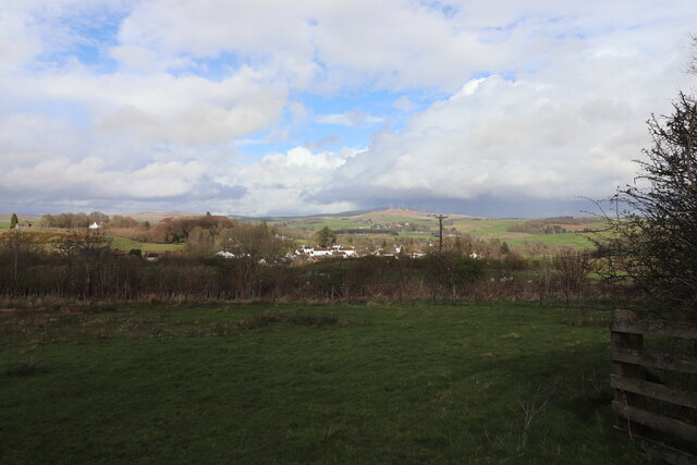
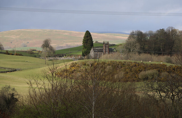
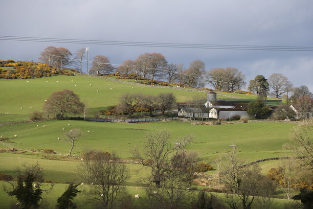
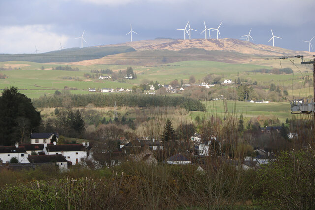
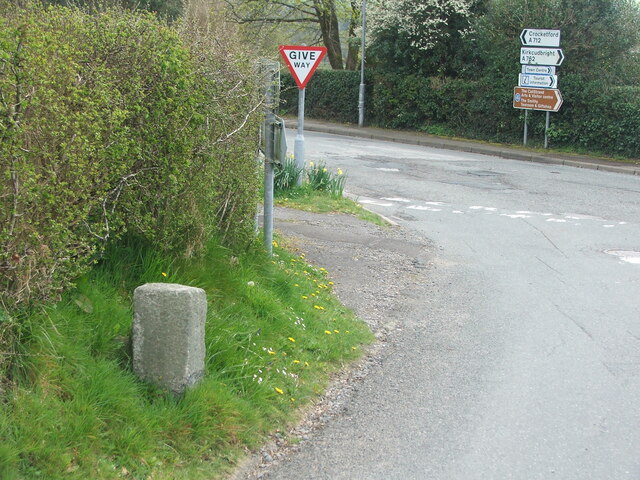
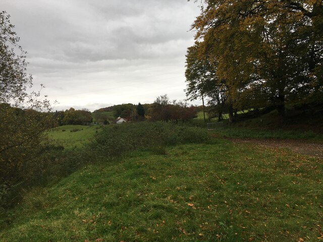
New Galloway is a small town located in the district of Kirkcudbrightshire in southwestern Scotland. Situated amidst the picturesque landscape of Dumfries and Galloway, this charming town is nestled in the Glenkens valley, surrounded by rolling hills and forests.

With a population of around 350, New Galloway is known for its tranquil and scenic setting, attracting visitors seeking a peaceful retreat. The town is positioned on the banks of the River Ken, offering beautiful riverside walks and opportunities for fishing.

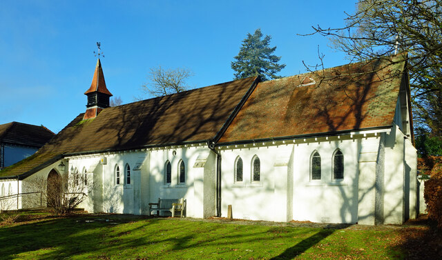
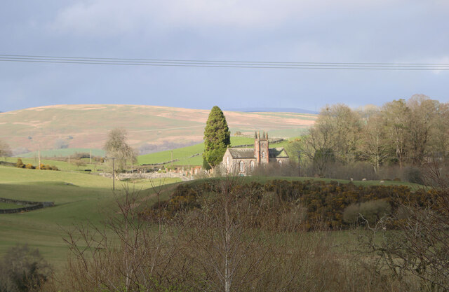
Historically, New Galloway was established in the 17th century as a planned settlement. Its town center boasts a collection of traditional stone buildings, including the St. Andrew's Church, dating back to 1823, and the former town hall, now a community-owned building. The town's architecture reflects its rich history and adds to its nostalgic character.

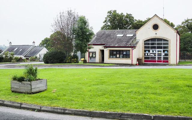
Despite its small size, New Galloway offers a range of amenities and services for residents and visitors alike. There are a few local shops, cafes, and a hotel, providing essential facilities and a warm welcome to tourists.

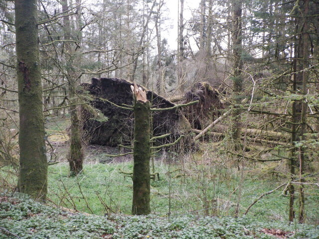
The surrounding area of New Galloway is a haven for outdoor enthusiasts. The nearby Galloway Forest Park offers vast expanses of woodland, making it a popular destination for hiking, cycling, and wildlife spotting. Loch Ken, just a short distance away, provides opportunities for various water activities, including sailing, kayaking, and fishing.

In summary, New Galloway is a quaint and peaceful town nestled in the scenic Glenkens valley, offering a tranquil escape for visitors and a close-knit community for its residents.

If you have any feedback on the listing, please let us know in the comments section below.

New Galloway Images

Images are sourced within 2km of 55.074074/-4.1396337 or Grid Reference NX6377. Thanks to Geograph Open Source API. All images are credited.

Fire Station, New Galloway The fire station on the south side of the A712 seen across a lawned area.
Fire Station, New Galloway
The fire station on the south side of the A712 seen across a lawned area.
New Galloway Episcopalian Church Located on the main route into the village from Ken Bridge.
New Galloway Episcopalian Church
Located on the main route into the village from Ken Bridge.
Farmland at New Galloway Viewed from the Old Edinburgh Road.
Farmland at New Galloway
Viewed from the Old Edinburgh Road.
Kells Parish Church, New Galloway Viewed from the Old Edinburgh Road.
Kells Parish Church, New Galloway
Viewed from the Old Edinburgh Road.
Viewfield Farm, New Galloway Viewed from the Old Edinburgh Road.
Viewfield Farm, New Galloway
Viewed from the Old Edinburgh Road.
New Galloway Viewed from the Old Edinburgh Road. With a view to a Windfarm.
New Galloway
Viewed from the Old Edinburgh Road. With a view to a Windfarm.
Kells Parish Church in Sunlight Viewed from the Old Edinburgh Road.
Kells Parish Church in Sunlight
Viewed from the Old Edinburgh Road.
Farmer and Sheepdogs, New Galloway On the Old Edinburgh Road.
Farmer and Sheepdogs, New Galloway
On the Old Edinburgh Road.
Old milestone When railways were constructed across the hills of Kirkcudbright and Wigtonshire the stations were often several miles from the nearest large settlement.   The station for New Galloway was 5 miles to the south along the west bank of Loch Ken and on to Mossdale.    Milestones of this shape are found on several of the roads leading to stations.  From New Galloway it is 5 miles to the station.   This stone is in the village centre near The Smithy Tea Room.
Old milestone
When railways were constructed across the hills of Kirkcudbright and Wigtonshire the stations were often several miles from the nearest large settlement. The station for New Galloway was 5 miles to the south along the west bank of Loch Ken and on to Mossdale. Milestones of this shape are found on several of the roads leading to stations. From New Galloway it is 5 miles to the station. This stone is in the village centre near The Smithy Tea Room.
Old milestone The next 'railway' milestone south of New Galloway is at the entrance to Todstone Cottage.  N G/ 1/ Dalry/4¼ on the left face.
Old milestone
The next 'railway' milestone south of New Galloway is at the entrance to Todstone Cottage. N G/ 1/ Dalry/4¼ on the left face.
Old milestone The right hand face is in the shade on this sunny day but beneath the lichens the inscription is N.G.St.n/4.  The property was surrounded by this high fencing and several dogs were barking.
Old milestone
The right hand face is in the shade on this sunny day but beneath the lichens the inscription is N.G.St.n/4. The property was surrounded by this high fencing and several dogs were barking.
Old milestone This milestone in the centre of New Galloway on the A712 indicates 24 miles from Dumfries.   It is another 18 miles to Newton Stewart.
Old milestone
This milestone in the centre of New Galloway on the A712 indicates 24 miles from Dumfries. It is another 18 miles to Newton Stewart.
Old milestone The crossroads in New Galloway, with a road north following the Water of Ken for 3 or 4 miles to Earlstoun Loch.   Crocketford is to the east on the way to Dumfries.
Old milestone
The crossroads in New Galloway, with a road north following the Water of Ken for 3 or 4 miles to Earlstoun Loch. Crocketford is to the east on the way to Dumfries.
Kenmure Castle An old ice-house by Kenmure Castle.
Kenmure Castle
An old ice-house by Kenmure Castle.
Kenmure Castle Part of an incised cross-slab set against the wall of the walled garden at Kenmure Castle.
Kenmure Castle
Part of an incised cross-slab set against the wall of the walled garden at Kenmure Castle.
Dalarran Standing Stone The standing stone of Dalarran.
Dalarran Standing Stone
The standing stone of Dalarran.
Windthrow near New Galloway By Sentry Knowe.
Windthrow near New Galloway
By Sentry Knowe.
Farmland near Garplefoot
Show me another place!

New Galloway is located at Grid Ref: NX6377 (Lat: 55.074074, Lng: -4.1396337)

Unitary Authority: Dumfries and Galloway

Police Authority: Dumfries and Galloway

What 3 Words

///butchers.sprain.credited. Near Castle Douglas, Dumfries & Galloway

Related Wikis

New Galloway Town Hall

The New Galloway Town Hall is a municipal building in Dumfries and Galloway, Scotland, situated on the town's high street. A tolbooth has existed on the...

New Galloway

New Galloway (Scottish Gaelic: Gall-Ghàidhealaibh Nuadh) is a town in the historical county of Kirkcudbrightshire in Dumfries and Galloway. It lies on...

Kells, Dumfries and Galloway

Kells parish, in the Stewartry of Kirkcudbright in Scotland, is located 14 miles (NWbN) from Castle-Douglas, and 19 miles (NbW) from Kirkcudbright. It...

Ken Bridge

The Ken Bridge is a road bridge about 0.8 kilometres (0.5 mi) north east of New Galloway in Dumfries and Galloway, Scotland, which carries the A712 road...

Water of Ken

The Water of Ken is a river in the historical county of Kirkcudbrightshire in Galloway, south-west Scotland. It rises on Blacklorg Hill, north-east of...

Kenmure Castle

Kenmure Castle is a fortified house or castle in The Glenkens, 1 mile (1.6 km) south of the town of New Galloway in Kirkcudbrightshire, Galloway, south...

Balmaclellan

Balmaclellan (Scottish Gaelic: Baile Mac-a-ghille-dhiolan, meaning town of the MacLellans) is a small hillside village of stone houses with slate roofs...

Galloway

Galloway (Scottish Gaelic: Gall-Ghàidhealaibh [ˈkal̪ˠaɣəl̪ˠu]; Scots: Gallowa; Latin: Gallovidia) is a region in southwestern Scotland comprising the historic...

Nearby Amenities

Located within 500m of 55.074074,-4.1396337
New Galloway
Is In: Dumfries and Galloway
Name En: New Galloway
Name Gd: Gall-Ghàidhealaibh Nuadh
Name Sco: New Gallowa
Place: village
Wikidata: Q3778560
Wikipedia: en:New Galloway
Lat/Long: 55.0739923/-4.1408085
Telephone
Booth: K6
Colour: blue
Covered: booth
Man Made: telephone_box
Tourism: information
Lat/Long: 55.0749085/-4.1409867
Bus Stop
Post Office
Naptan AtcoCode: 680000077111
Naptan Bearing: N
Naptan CommonName: Post Office
Naptan Indicator: opp PO
Naptan Landmark: Post Office
Naptan NaptanCode: 34235789
Naptan Notes: none
Naptan Street: Main Street
Naptan Verified: no
Source: naptan_import
Lat/Long: 55.0736552/-4.1409552
Bus Stop
Post Office
Naptan AtcoCode: 680000077222
Naptan Bearing: S
Naptan CommonName: Post Office
Naptan Indicator: o/s PO
Naptan Landmark: Post Office
Naptan NaptanCode: 34235787
Naptan Notes: none
Naptan Street: Main Street
Naptan Verified: no
Source: naptan_import
Lat/Long: 55.0737115/-4.1408172
Bus Stop
Braeside
Naptan AtcoCode: 680000077501
Naptan Bearing: NE
Naptan CommonName: Braeside
Naptan Indicator: Shelter
Naptan Landmark: Shelter
Naptan NaptanCode: 34235837
Naptan Notes: none
Naptan Street: Braeside
Naptan Verified: no
Source: naptan_import
Lat/Long: 55.0758588/-4.139851
Braeside
Naptan AtcoCode: 680000077502
Naptan Bearing: SW
Naptan BusStopType: CUS
Naptan CommonName: Braeside
Naptan Indicator: opp Shelter
Naptan Landmark: Shelter
Naptan NaptanCode: 34235838
Naptan Notes: none
Naptan Street: Braeside
Naptan Verified: no
Source: naptan_import
Lat/Long: 55.0757399/-4.13997
Bus Stop
East Port
Naptan AtcoCode: 680000077503
Naptan Bearing: S
Naptan CommonName: East Port
Naptan Indicator: Old Edinburgh
Naptan NaptanCode: 34238979
Naptan Street: East Port
Naptan Verified: no
Source: naptan_import
Lat/Long: 55.0738528/-4.1394306
Post Office
New Galloway Post Office
Addr City: Castle Douglas
Addr Country: GB
Addr Postcode: DG7 3RL
Addr Street: High Street
Addr Village: New Galloway
Brand: Post Office
Brand Wikidata: Q1783168
Check Date: 2022-05-27
Check Date Opening Hours: 2022‑05‑27
Contact Website: https://www.postoffice.co.uk/branch-finder/1548182/new-galloway
Opening Hours: Mo-We,Fr 09:00-13:00,14:00-16:00; Th,Sa 09:00-12:30
Ref Pol Id: 3176
Lat/Long: 55.0736349/-4.1407029
Post Box
Operator: Royal Mail
Post Box Mounting: brick_pillar
Post Box Type: wall
Ref: DG7 35
Royal Cypher: GVIR
Lat/Long: 55.0758761/-4.1398821
Shelter
Shelter Type: gazebo
Lat/Long: 55.0752807/-4.1405886
Drill Tower
Man Made: tower
Lat/Long: 55.0754786/-4.1425408
Bench
Lat/Long: 55.0757658/-4.1404485
Power: pole
Lat/Long: 55.0782082/-4.1385301
Power: pole
Lat/Long: 55.07715/-4.1444088
Power: pole
Lat/Long: 55.0733798/-4.1469593
Power: pole
Lat/Long: 55.0731864/-4.1455805
Power: pole
Lat/Long: 55.0732862/-4.1441316
Power: pole
Lat/Long: 55.0728398/-4.1459013
Power: pole
Lat/Long: 55.0726026/-4.1447392
Power: pole
Lat/Long: 55.0723824/-4.1436727
Power: pole
Lat/Long: 55.0721039/-4.1423981
Power: pole
Lat/Long: 55.0744587/-4.1379579
Power: pole
Lat/Long: 55.0748819/-4.1369701
Power: pole
Lat/Long: 55.0752955/-4.1360119
Power: pole
Lat/Long: 55.0762709/-4.1350432
Power: pole
Lat/Long: 55.0769338/-4.1347056
Power: pole
Lat/Long: 55.0747883/-4.1361139
Power: pole
Lat/Long: 55.0739928/-4.1370444
Power: pole
Lat/Long: 55.0732813/-4.136798
Power: pole
Lat/Long: 55.0725649/-4.1365452
Power: pole
Lat/Long: 55.0718606/-4.1363051
Power: pole
Lat/Long: 55.0712074/-4.1360863
Power: pole
Lat/Long: 55.0704557/-4.1356062
Power: pole
Lat/Long: 55.0770249/-4.1354999
Power: pole
Lat/Long: 55.077211/-4.13615
Cafe
Lat/Long: 55.0751718/-4.1411761
Parking
Lat/Long: 55.0739697/-4.1392049
Man Made: flagpole
Lat/Long: 55.0755169/-4.1404307
Post Box
Operator: Royal Mail
Post Box Mounting: pier
Post Box Type: lamp
Ref: DG7 26
Royal Cypher: scottish_crown
Lat/Long: 55.0736005/-4.1407976
The data included in this document is from www.openstreetmap.org. The data is made available under ODbL.

Have you been to New Galloway?

Leave your review of New Galloway below (or comments, questions and feedback).