Netteswell

Settlement in Essex Harlow

England

Netteswell

Sainsbury's supermarket car park, Harlow In front of the supermarket, a cycle path crosses the car park on a bridge.
Sainsbury's supermarket car park, Harlow Credit: Christopher Hilton

Netteswell is a small residential area located in the town of Harlow, Essex, England. Situated approximately 25 miles northeast of London, it falls within the administrative boundaries of the Harlow district. Netteswell is bordered by the neighborhoods of Mark Hall and Sumners to the north, and Great Parndon to the west.

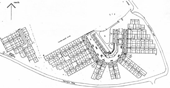
Primarily a residential area, Netteswell is characterized by a mix of housing options, including semi-detached and terraced houses, as well as some high-rise apartment buildings. The community offers a peaceful and family-friendly environment, attracting both young professionals and families looking for a quiet place to call home.

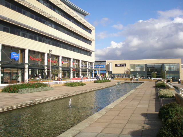
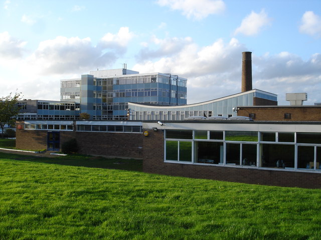
Netteswell is well-served by local amenities, with several schools in the vicinity catering to different age groups. The area benefits from easy access to nearby shopping centers, including The Harvey Centre in Harlow town center, which offers a wide range of retail stores, restaurants, and entertainment options.

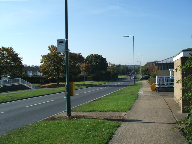
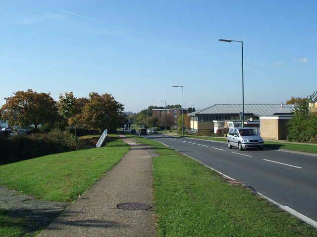
Transport links in Netteswell are convenient, with regular bus services connecting the area to Harlow town center and surrounding locations. The nearby Harlow Town railway station provides direct train connections to London Liverpool Street in approximately 35 minutes, making it an attractive choice for commuters.

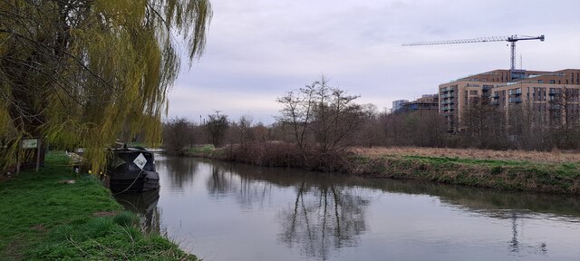
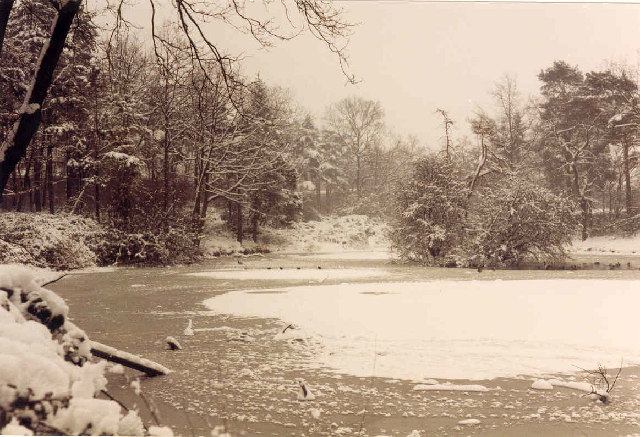
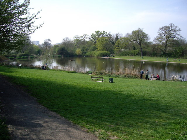
Nature enthusiasts can enjoy the nearby Harlow Town Park, which offers ample green spaces, playgrounds, and picturesque lakes for leisurely walks and outdoor activities.

Overall, Netteswell provides a peaceful residential setting with good transport links and access to amenities, making it a desirable place to live in Essex.

If you have any feedback on the listing, please let us know in the comments section below.
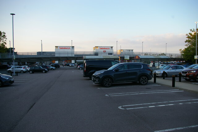
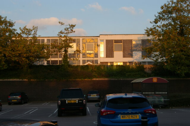
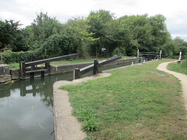
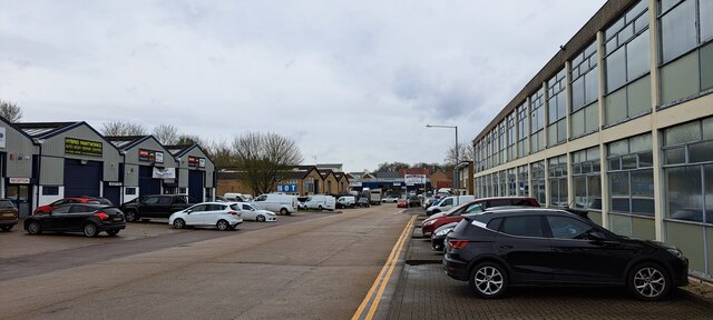
Netteswell Images

Images are sourced within 2km of 51.772522/0.106708 or Grid Reference TL4510. Thanks to Geograph Open Source API. All images are credited.

Sainsbury's supermarket car park, Harlow In front of the supermarket, a cycle path crosses the car park on a bridge.
Sainsbury's supermarket car park, Harlow
In front of the supermarket, a cycle path crosses the car park on a bridge.
Offices overlooking supermarket car park, Harlow
Lee and Stort Navigation: Lock no 9 - Latton Lock The Harcamlow Way and Three Forests Way share the same route along here. Latton Lock is near to an industrial plant. The route between this lock and the next one involves crossing a footbridge to the other side of the canal from where the railway station at Harlow Town and Burnt Mill Lock are another mile away along a clear track.
Lee and Stort Navigation: Lock no 9 - Latton Lock
The Harcamlow Way and Three Forests Way share the same route along here. Latton Lock is near to an industrial plant. The route between this lock and the next one involves crossing a footbridge to the other side of the canal from where the railway station at Harlow Town and Burnt Mill Lock are another mile away along a clear track.
Harlow industrial area: Burnt Mill Burnt Mill is a road lined with light industrial premises in the area along the northern edge of Harlow.
On the right, the distribution centre for Faber Music.
Harlow industrial area: Burnt Mill
Burnt Mill is a road lined with light industrial premises in the area along the northern edge of Harlow. On the right, the distribution centre for Faber Music.
River Stort outside the Moorhen pub, Burnt Mill Lane, Harlow
Oakwood Pond, Harlow in Winter Oakwood Pond and the surrounding wood is one of the many "nature" or green areas in Harlow New Town, thus preserving wildlife for the residents
Oakwood Pond, Harlow in Winter
Oakwood Pond and the surrounding wood is one of the many "nature" or green areas in Harlow New Town, thus preserving wildlife for the residents
Looking South from Bishopsfield. This was taken from one of the many high points in Bishopsfield and shows the view towards Epping.
Looking South from Bishopsfield.
This was taken from one of the many high points in Bishopsfield and shows the view towards Epping.
Blueprint of Bishopsfield This is why Bishopsfield was nicknamed the HORSESHOE estate for many years.
Blueprint of Bishopsfield
This is why Bishopsfield was nicknamed the HORSESHOE estate for many years.
The Playhouse, Harlow The Playhouse, Harlow was open in November 1971 and provides a wide and varied range of entertainment for theatre goers.
The Playhouse, Harlow
The Playhouse, Harlow was open in November 1971 and provides a wide and varied range of entertainment for theatre goers.
St. Paul's church, Harlow New Town, Essex This is the main church of Harlow New Town, designed by Humphrys and Hurst.
St. Paul's church, Harlow New Town, Essex
This is the main church of Harlow New Town, designed by Humphrys and Hurst.
The Clock Tower The Clock Tower by the Clock Tower Roundabout.
The Clock Tower
The Clock Tower by the Clock Tower Roundabout.
St. Andrews Community Learning Centre This pretty little church is now being used as a learning centre.
St. Andrews Community Learning Centre
This pretty little church is now being used as a learning centre.
St Andrews Community learning Centre This church building is now used as a learning centre. The Black building on the right is The Hummingbird Public House.
St Andrews Community learning Centre
This church building is now used as a learning centre. The Black building on the right is The Hummingbird Public House.
Netteswell Pond Netteswell Pond beside Second Avenue is a pretty and relaxing place to sit, fish, play or just sunbathe. It was originally used by the monks as a fishery.
Netteswell Pond
Netteswell Pond beside Second Avenue is a pretty and relaxing place to sit, fish, play or just sunbathe. It was originally used by the monks as a fishery.
The Harlow Study Centre The study centre is adjacent to the learning centre.
The Harlow Study Centre
The study centre is adjacent to the learning centre.
The new Water Gardens, Harlow
Southern Way, Harlow. Looking along Southern Way, Harlow towards Staple Tye.
Southern Way, Harlow.
Looking along Southern Way, Harlow towards Staple Tye.
Southern Way, Harlow. Looking towards Staple Tye.  Building on the right is Keats House Medical centre.
Southern Way, Harlow.
Looking towards Staple Tye. Building on the right is Keats House Medical centre.
Show me another place!

Netteswell is located at Grid Ref: TL4510 (Lat: 51.772522, Lng: 0.106708)

Administrative County: Essex

District: Harlow

Police Authority: Essex

What 3 Words

///stole.shirt.whites. Near Harlow, Essex

Related Wikis

Burnt Mill Academy

Burnt Mill Academy (formerly known de facto as Burnt Mill School) is a secondary school academy and specialist performing arts college situated on First...

Harlow College

Harlow College is a further education college in Harlow, Essex, England. This medium-sized college has 5,900 students as of 2018 of which 2,585 are on...

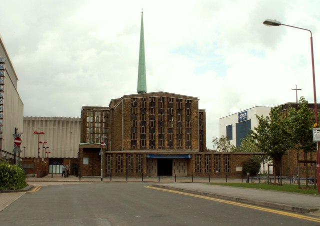
Our Lady of Fatima Church, Harlow

Our Lady of Fatima's Church is a Roman Catholic parish church in Harlow, Essex, England. It was designed between 1953 and 1954 by Gerard Goalen and was...

BMAT STEM Academy

BMAT STEM Academy is a University Technical College within the Harlow College campus in Harlow, Essex, England, which opened in September 2014 as Sir Charles...
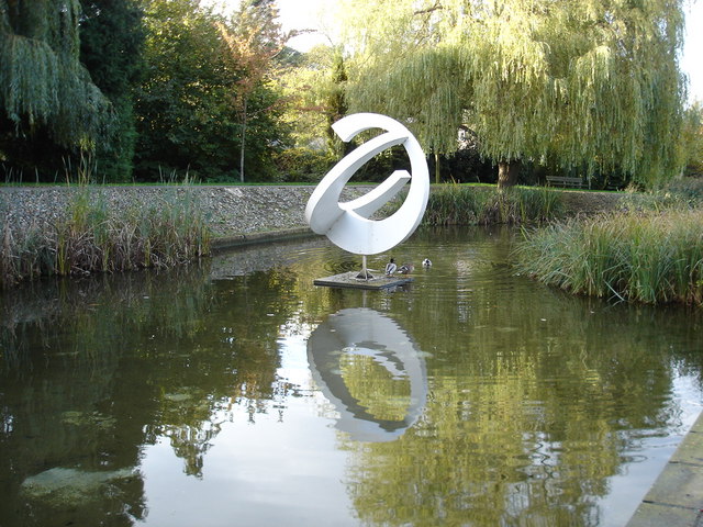
Harlow Town Park

Harlow Town Park is a 164-acre (66 ha) public park in Harlow, Essex, England. The park is one of the largest urban parks in Britain. It includes multiple...

Contrapuntal Forms (Hepworth)

Contrapuntal Forms (BH 165) is a stone sculpture by Barbara Hepworth, one of her first public commissions, made in 1950–51 for the Festival of Britain...

St Mark's West Essex Catholic School

St Mark's West Essex Catholic School is a Roman Catholic secondary school and sixth form with academy status located in Harlow, Essex, England. The school...

Harlow Sportcentre

Harlow Sportcentre was a cricket ground in Harlow, Essex. The first recorded match on the ground was in 1964, when the Essex Second XI played the Warwickshire...

Nearby Amenities

Located within 500m of 51.772522,0.106708
Created By: YahooApplet 1.0
Lat/Long: 51.7750601/0.1041275
Created By: YahooApplet 1.0
Lat/Long: 51.7728759/0.1027006
Created By: YahooApplet 1.0
Lat/Long: 51.7726038/0.1031619
Created By: YahooApplet 1.0
Lat/Long: 51.772232/0.1035374
Created By: YahooApplet 1.0
Lat/Long: 51.7724179/0.0996643
Created By: YahooApplet 1.0
Lat/Long: 51.7739846/0.1053184
Created By: YahooApplet 1.0
Lat/Long: 51.7735531/0.1054364
Turning Circle
Lat/Long: 51.7741478/0.1067748
Created By: YahooApplet 1.0
Lat/Long: 51.7736792/0.1021212
Created By: YahooApplet 1.0
Lat/Long: 51.7737257/0.1023036
Created By: YahooApplet 1.0
Lat/Long: 51.7737323/0.1025074
Created By: YahooApplet 1.0
Lat/Long: 51.773739/0.1042348
Created By: YahooApplet 1.0
Lat/Long: 51.7737788/0.1044816
Created By: YahooApplet 1.0
Lat/Long: 51.7738585/0.1047283
Created By: YahooApplet 1.0
Lat/Long: 51.7733075/0.1042133
Created By: YahooApplet 1.0
Lat/Long: 51.773261/0.1041168
Created By: YahooApplet 1.0
Lat/Long: 51.7752459/0.1033765
Created By: YahooApplet 1.0
Lat/Long: 51.7752327/0.1032156
Created By: YahooApplet 1.0
Lat/Long: 51.7753256/0.1030868
Noexit: yes
Lat/Long: 51.7755143/0.1033566
Created By: YahooApplet 1.0
Lat/Long: 51.7762749/0.1031834
Created By: YahooApplet 1.0
Lat/Long: 51.7711033/0.100072
Created By: YahooApplet 1.0
Lat/Long: 51.7711565/0.1002222
Created By: YahooApplet 1.0
Lat/Long: 51.7712361/0.1003188
Created By: YahooApplet 1.0
Lat/Long: 51.7714087/0.1002437
Created By: YahooApplet 1.0
Lat/Long: 51.7712361/0.1045567
Created By: YahooApplet 1.0
Lat/Long: 51.770778/0.1049536
Created By: YahooApplet 1.0
Lat/Long: 51.7700212/0.1053399
Created By: YahooApplet 1.0
Lat/Long: 51.7698751/0.1048893
Created By: YahooApplet 1.0
Lat/Long: 51.769729/0.104621
Created By: YahooApplet 1.0
Lat/Long: 51.7693904/0.1041919
Created By: YahooApplet 1.0
Lat/Long: 51.7686999/0.1061982
Direction: both
Traffic Calming: table
Lat/Long: 51.7682774/0.1071367
Created By: YahooApplet 1.0
Lat/Long: 51.7695232/0.109213
Created By: YahooApplet 1.0
Lat/Long: 51.7700676/0.1087302
Created By: YahooApplet 1.0
Lat/Long: 51.7696892/0.1067775
Created By: YahooApplet 1.0
Lat/Long: 51.7709971/0.1079792
Created By: YahooApplet 1.0
Lat/Long: 51.7706453/0.109964
Created By: YahooApplet 1.0
Lat/Long: 51.7716411/0.1104253
Created By: YahooApplet 1.0
Lat/Long: 51.7713689/0.1092452
Created By: YahooApplet 1.0
Lat/Long: 51.7713623/0.1090628
Created By: YahooApplet 1.0
Lat/Long: 51.7690651/0.1035374
Noexit: yes
Lat/Long: 51.7692394/0.1030063
Created By: YahooApplet 1.0
Lat/Long: 51.7719/0.1135367
Created By: YahooApplet 1.0
Lat/Long: 51.7709971/0.1110154
Created By: YahooApplet 1.0
Lat/Long: 51.7702203/0.1117772
Created By: YahooApplet 1.0
Lat/Long: 51.7718801/0.1123243
Created By: YahooApplet 1.0
Lat/Long: 51.7719332/0.1101357
Created By: YahooApplet 1.0
Lat/Long: 51.7721988/0.1132899
Crossing
Crossing: marked
Crossing Island: no
Tactile Paving: yes
Lat/Long: 51.7725885/0.1130595
Created By: YahooApplet 1.0
Lat/Long: 51.7729822/0.1128715
Created By: YahooApplet 1.0
Lat/Long: 51.7735597/0.1126569
Created By: YahooApplet 1.0
Lat/Long: 51.7744759/0.1124531
Created By: YahooApplet 1.0
Lat/Long: 51.7725108/0.109728
Created By: YahooApplet 1.0
Lat/Long: 51.774602/0.1091701
Created By: YahooApplet 1.0
Lat/Long: 51.7723116/0.1090199
Created By: YahooApplet 1.0
Lat/Long: 51.771827/0.1093739
Barrier: swing_gate
Lat/Long: 51.7738751/0.1078987
Created By: YahooApplet 1.0
Lat/Long: 51.7746086/0.1111978
Created By: YahooApplet 1.0
Lat/Long: 51.7743232/0.1092452
Created By: YahooApplet 1.0
Lat/Long: 51.774914/0.1091593
Created By: YahooApplet 1.0
Lat/Long: 51.7750468/0.1074856
Created By: YahooApplet 1.0
Lat/Long: 51.7759297/0.1106399
Created By: YahooApplet 1.0
Lat/Long: 51.7746949/0.1115519
Created By: YahooApplet 1.0
Lat/Long: 51.7752592/0.1122707
Created By: YahooApplet 1.0
Lat/Long: 51.7759695/0.1070565
Created By: YahooApplet 1.0
Lat/Long: 51.7749538/0.1102322
Created By: YahooApplet 1.0
Lat/Long: 51.7748012/0.1123887
Bus Stop
School Lane
Bus: yes
Naptan AtcoCode: 150035048003
Naptan Bearing: NE
Naptan CommonName: School Lane
Naptan Crossing: School Lane
Naptan Indicator: Adj
Naptan Landmark: School Lane
Naptan NaptanCode: esxapmdp
Naptan PlusbusZoneRef: HRLWTWN
Naptan Street: First Avenue
Naptan Verified: no
Public Transport: platform
Shelter: yes
Source: naptan_import
Lat/Long: 51.7754287/0.1049213
Bus Stop
School Lane
Bus: yes
Naptan AtcoCode: 150035048004
Naptan Bearing: SW
Naptan CommonName: School Lane
Naptan Crossing: School Lane
Naptan Indicator: Opp
Naptan Landmark: School Lane
Naptan NaptanCode: esxapmdt
Naptan PlusbusZoneRef: HRLWTWN
Naptan Street: First Avenue
Naptan Verified: no
Public Transport: platform
Shelter: yes
Source: naptan_import
Lat/Long: 51.7746242/0.1032528
Bus Stop
Fenner Brockway House
Bus: yes
Naptan AtcoCode: 150035049005
Naptan Bearing: NW
Naptan CommonName: Fenner Brockway House
Naptan Indicator: Adj
Naptan Landmark: Fenner Brockway House
Naptan NaptanCode: esxaptda
Naptan PlusbusZoneRef: HRLWTWN
Naptan Street: Maddox Road
Naptan Verified: no
Public Transport: platform
Source: naptan_import
Lat/Long: 51.7683464/0.1067917
Bus Stop
Fenner Brockway House
Bus: yes
Naptan AtcoCode: 150035049006
Naptan Bearing: SE
Naptan CommonName: Fenner Brockway House
Naptan Indicator: Opp
Naptan Landmark: Fenner Brockway House
Naptan NaptanCode: esxaptdg
Naptan PlusbusZoneRef: HRLWTWN
Naptan Street: Maddox Road
Naptan Verified: no
Public Transport: platform
Source: naptan_import
Lat/Long: 51.7685218/0.1065636
Bus Stop
The Dashes
Bus: yes
Naptan AtcoCode: 150035049010
Naptan Bearing: NW
Naptan CommonName: The Dashes
Naptan Indicator: Adj
Naptan Landmark: The Dashes
Naptan NaptanCode: esxaptdp
Naptan PlusbusZoneRef: HRLWTWN
Naptan Street: Maddox Road
Naptan Verified: no
Public Transport: platform
Source: naptan_import
Lat/Long: 51.7723748/0.1033221
Bus Stop
The Dashes
Bus: yes
Naptan AtcoCode: 150035049011
Naptan Bearing: SE
Naptan CommonName: The Dashes
Naptan Indicator: Opp
Naptan Landmark: The Dashes
Naptan NaptanCode: esxaptdt
Naptan PlusbusZoneRef: HRLWTWN
Naptan Street: Maddox Road
Naptan Verified: no
Public Transport: platform
Source: naptan_import
Lat/Long: 51.7729549/0.1025663
Bus Stop
Arkwrights
Bus: yes
Naptan AtcoCode: 150035050003
Naptan Bearing: SE
Naptan CommonName: Arkwrights
Naptan Indicator: Adj
Naptan Landmark: Arkwrights
Naptan NaptanCode: esxaptpj
Naptan PlusbusZoneRef: HRLWTWN
Naptan Street: Howard Way
Naptan Verified: no
Public Transport: platform
Source: naptan_import
Lat/Long: 51.7720944/0.1134413
Bus Stop
Arkwrights
Bus: yes
Naptan AtcoCode: 150035050004
Naptan Bearing: NW
Naptan CommonName: Arkwrights
Naptan Indicator: Opp
Naptan Landmark: Arkwrights
Naptan NaptanCode: esxaptpw
Naptan PlusbusZoneRef: HRLWTWN
Naptan Street: Howard Way
Naptan Verified: no
Public Transport: platform
Source: naptan_import
Lat/Long: 51.7722862/0.113239
Burnt Mill School
Bench: yes
Naptan AtcoCode: 1500IM1034
Naptan Bearing: E
Naptan BusStopType: CUS
Naptan CommonName: Burnt Mill School
Naptan Indicator: o/s
Naptan Landmark: Burnt Mill School
Naptan NaptanCode: esxadjat
Naptan PlusbusZoneRef: HRLWTWN
Naptan Street: First Avenue
Naptan Verified: no
Public Transport: platform
Shelter: yes
Source: naptan_import
Lat/Long: 51.7762909/0.1086071
Burnt Mill School
Bench: yes
Naptan AtcoCode: 1500IM1034B
Naptan Bearing: W
Naptan BusStopType: CUS
Naptan CommonName: Burnt Mill School
Naptan Indicator: Opp
Naptan Landmark: Burnt Mill School
Naptan NaptanCode: esxagajd
Naptan PlusbusZoneRef: HRLWTWN
Naptan Street: First Avenue
Naptan Verified: no
Public Transport: platform
Shelter: yes
Source: naptan_import
Lat/Long: 51.7763963/0.1102501
Bus Stop
The Stow Lower
Bench: yes
Bin: yes
Bus: yes
Naptan AtcoCode: 1500IM1034C
Naptan Bearing: N
Naptan CommonName: The Stow
Naptan Indicator: Opp
Naptan Landmark: The Stow
Naptan NaptanCode: esxaptpt
Naptan PlusbusZoneRef: HRLWTWN
Naptan Street: Howard Way
Naptan Verified: no
Public Transport: platform
Shelter: yes
Source: naptan_import
Tactile Paving: no
Lat/Long: 51.7753004/0.112185
Bus Stop
Park Lane
Bus: yes
Naptan AtcoCode: 1500IM1409
Naptan Bearing: NE
Naptan CommonName: First Avenue
Naptan Indicator: o/s
Naptan Landmark: Swimming Pool
Naptan NaptanCode: esxapmdw
Naptan PlusbusZoneRef: HRLWTWN
Naptan Street: First Avenue
Naptan Verified: no
Public Transport: platform
Source: naptan_import
Lat/Long: 51.7742835/0.1020683
Bus Stop
Park Lane
Bus: yes
Naptan AtcoCode: 1500IM1409B
Naptan Bearing: W
Naptan CommonName: First Avenue
Naptan Indicator: Opp
Naptan Landmark: Swimming Pool
Naptan NaptanCode: esxapmga
Naptan PlusbusZoneRef: HRLWTWN
Naptan Street: First Avenue
Naptan Verified: no
Public Transport: platform
Source: naptan_import
Lat/Long: 51.7734377/0.0997041
Fishers Hatch
Naptan AtcoCode: 1500IM1423
Naptan Bearing: NW
Naptan BusStopType: CUS
Naptan CommonName: Fishers Hatch
Naptan Indicator: NW-bound
Naptan Landmark: Fishers Hatch
Naptan NaptanCode: esxgtwpj
Naptan PlusbusZoneRef: HRLWTWN
Naptan Street: Maddox Road
Naptan Verified: no
Public Transport: platform
Source: naptan_import
Lat/Long: 51.7713488/0.104376
Fishers Hatch
Naptan AtcoCode: 1500IM1423A
Naptan Bearing: SE
Naptan BusStopType: CUS
Naptan CommonName: Fishers Hatch
Naptan Indicator: SE-bound
Naptan Landmark: Fishers Hatch
Naptan NaptanCode: esxgtwpm
Naptan PlusbusZoneRef: HRLWTWN
Naptan Street: Maddox Road
Naptan Verified: no
Public Transport: platform
Source: naptan_import
Lat/Long: 51.7713921/0.104465
Bus Stop
Garden Tiger
Bus: yes
Naptan AtcoCode: 1500IM2614
Naptan Bearing: N
Naptan CommonName: Garden Tiger
Naptan Indicator: Opp
Naptan Landmark: Garden Tiger
Naptan NaptanCode: esxaptdm
Naptan PlusbusZoneRef: HRLWTWN
Naptan Street: Maddox Road
Naptan Verified: no
Public Transport: platform
Source: naptan_import
Lat/Long: 51.770237/0.105194
Bus Stop
Garden Tiger
Bus: yes
Naptan AtcoCode: 1500IM2614B
Naptan Bearing: S
Naptan CommonName: Garden Tiger
Naptan Indicator: o/s
Naptan Landmark: Garden Tiger
Naptan NaptanCode: esxaptdj
Naptan PlusbusZoneRef: HRLWTWN
Naptan Street: Maddox Road
Naptan Verified: no
Public Transport: platform
Source: naptan_import
Lat/Long: 51.7701797/0.1053797
Noexit: yes
Lat/Long: 51.7721876/0.1042122
Crossing
Crossing: zebra
Crossing Island: yes
Crossing Markings: zebra
Crossing Ref: zebra
Tactile Paving: yes
Lat/Long: 51.7749329/0.1123548
Crossing
Crossing: marked
Crossing Ref: puffin
Lat/Long: 51.7751686/0.1044315
Crossing
Crossing: traffic_signals
Crossing Ref: puffin
Lat/Long: 51.7763565/0.1093222
Netteswell
Place: suburb
Lat/Long: 51.7715547/0.1086568
Building: school
Lat/Long: 51.7766267/0.1089951
Noexit: yes
Lat/Long: 51.7744162/0.1004537
Noexit: yes
Lat/Long: 51.775455/0.104488
Noexit: yes
Lat/Long: 51.7703502/0.109978
Noexit: yes
Lat/Long: 51.7700448/0.1092967
Noexit: yes
Lat/Long: 51.7708105/0.1090997
Noexit: yes
Lat/Long: 51.771114/0.1100796
Noexit: yes
Lat/Long: 51.7711999/0.1114733
Crossing
Crossing: unmarked
Crossing Island: no
Tactile Paving: no
Traffic Calming: table
Lat/Long: 51.7717874/0.1102751
Noexit: yes
Lat/Long: 51.7731374/0.0995709
Noexit: yes
Lat/Long: 51.7715629/0.1045039
Noexit: yes
Lat/Long: 51.7716077/0.1047507
Direction: both
Traffic Calming: table
Lat/Long: 51.7715754/0.1054475
Barrier: bollard
Lat/Long: 51.771044/0.1061884
Noexit: yes
Lat/Long: 51.7749022/0.1071057
Noexit: yes
Lat/Long: 51.7757519/0.1117566
Noexit: yes
Lat/Long: 51.775577/0.1103428
Crossing
Crossing: unmarked
Lat/Long: 51.7761702/0.1090054
Noexit: yes
Lat/Long: 51.772648/0.1068782
Noexit: yes
Lat/Long: 51.7750014/0.1110718
Noexit: yes
Lat/Long: 51.776604/0.107496
Post Box
Brand: Royal Mail
Brand Wikidata: Q638098
Brand Wikipedia: en:Royal Mail
Operator: Royal Mail
Operator Wikidata: Q638098
Lat/Long: 51.768835/0.1059804
Noexit: yes
Lat/Long: 51.7703405/0.1085808
Crossing
Lat/Long: 51.7742517/0.1008843
Place Of Worship
Freshwaters Christian Fellowship
Religion: christian
Lat/Long: 51.772197/0.1032104
Noexit: yes
Lat/Long: 51.7745125/0.1018924
Noexit: yes
Lat/Long: 51.7746748/0.1017374
Noexit: yes
Lat/Long: 51.7754994/0.1040428
Bus Stop
The Stow Lower
Bus: yes
Naptan AtcoCode: 150035050005
Naptan NaptanCode: esxaptpm
Naptan Verified: no
Public Transport: platform
Shelter: yes
Source: naptan
Lat/Long: 51.7741922/0.1126393
Crossing
Crossing: unmarked
Lat/Long: 51.7741814/0.1125186
Crossing
Crossing: unmarked
Lat/Long: 51.7741102/0.1126191
Crossing
Lat/Long: 51.7744258/0.1013732
Noexit: yes
Lat/Long: 51.7746974/0.1006169
Crossing
Crossing: unmarked
Crossing Island: yes
Crossing Markings: no
Lat/Long: 51.7740713/0.101646
Bicycle Parking
Bicycle Parking: stands
Lat/Long: 51.774514/0.1006343
Waste Basket
Waste: dog_excrement
Lat/Long: 51.7747937/0.1007899
Barrier: swing_gate
Lat/Long: 51.773776/0.1070886
Noexit: yes
Lat/Long: 51.7704034/0.107377
Noexit: yes
Lat/Long: 51.7768527/0.1060464
Direction: both
Traffic Calming: cushion
Lat/Long: 51.7741525/0.1051217
Direction: both
Traffic Calming: cushion
Lat/Long: 51.772438/0.105212
Noexit: yes
Lat/Long: 51.7755725/0.1066586
Post Box
Lat/Long: 51.775493/0.1090939
Crossing
Lat/Long: 51.7689568/0.1028057
Bus Stop
Bus: yes
Public Transport: platform
Lat/Long: 51.7722862/0.113239
Direction: both
Traffic Calming: cushion
Lat/Long: 51.7736127/0.1095589
Direction: both
Traffic Calming: cushion
Lat/Long: 51.7742178/0.1093045
Barrier: swing_gate
Lat/Long: 51.7723922/0.1031842
Access: private
Barrier: lift_gate
Lat/Long: 51.7741246/0.1127011
Noexit: yes
Lat/Long: 51.7742856/0.1131238
Donkey
Artist Name: Willi Soukop
Artwork Type: statue
Heritage: 2
Heritage Operator: he
Heritage Website: https://historicengland.org.uk/listing/the-list/list-entry/1431399
Listed Status: Grade II
Material: bronze
Nhle Inscription Date: 2016-01-19
Ref GB Nhle: 1431399
Start Date: 1955
Tourism: artwork
Lat/Long: 51.7736296/0.1084256
Noexit: yes
Lat/Long: 51.7724272/0.107069
Post Box
Operator: Royal Mail
Operator Wikidata: Q638098
Post Box Design: type_a
Post Box Type: pillar
Ref: CM20 11
Royal Cypher: EIIR
Royal Cypher Wikidata: Q33102113
Lat/Long: 51.7732343/0.1018886
Morrisons Daily
Addr Country: GB
Addr Housename: Fishers Hatch
Addr Postcode: CM20 3PP
Addr Street: Maddox Road
Addr Unit: 3
Brand: Morrisons Daily
Brand Wikidata: Q99752411
Fhrs Id: 872232
Operator: McColl's
Operator Wikidata: Q16997477
Shop: convenience
Website: https://my.morrisons.com/storefinder/66356/morrisons-daily-harlow-fishers-hatch
Lat/Long: 51.7710315/0.1050789
Direction: forward
Traffic Calming: choker
Lat/Long: 51.7713789/0.1044075
Barrier: bollard
Lat/Long: 51.7717657/0.1101895
Barrier: swing_gate
Lat/Long: 51.7718178/0.1103919
Barrier: block
Lat/Long: 51.7736712/0.1005402
Barrier: bollard
Lat/Long: 51.7726269/0.113205
The data included in this document is from www.openstreetmap.org. The data is made available under ODbL.

Have you been to Netteswell?

Leave your review of Netteswell below (or comments, questions and feedback).