Netteswell Cross

Settlement in Essex Harlow

England

Netteswell Cross

Sainsbury's supermarket car park, Harlow In front of the supermarket, a cycle path crosses the car park on a bridge.
Sainsbury's supermarket car park, Harlow Credit: Christopher Hilton

Netteswell Cross is a small village located in the county of Essex, in the eastern part of England. It is situated approximately 3 miles southeast of the town of Harlow. The village is part of the larger Harlow district and falls within the civil parish of Harlow Common.

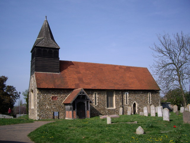
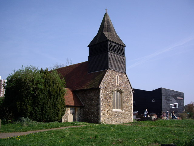
Netteswell Cross has a rich history, dating back to the medieval period. The village is named after a stone cross that once stood at a crossroads in the area, acting as a marker for travelers. Today, only the base of the cross remains, serving as a reminder of the village's past.

The village has a close-knit community with a population of around 1,500 residents. It primarily consists of residential properties, including a mix of detached houses, semi-detached houses, and some modern apartment buildings. The majority of the houses are privately owned, with a smaller number being rented.

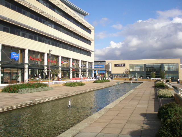
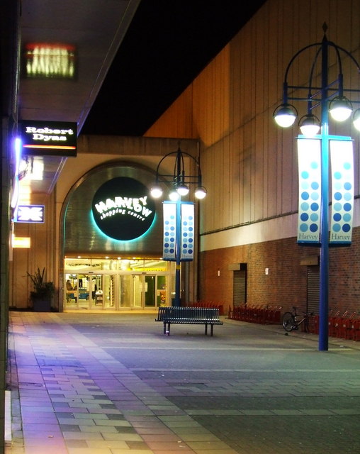
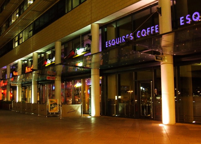
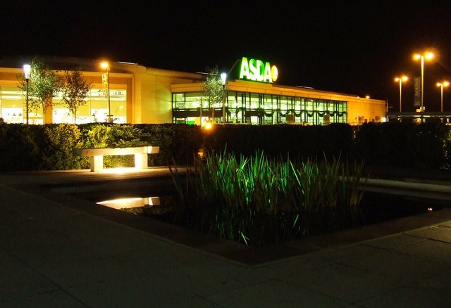
Netteswell Cross benefits from its proximity to Harlow, which provides residents with access to a wide range of amenities and services. These include schools, shops, restaurants, and recreational facilities. The village itself has limited amenities, with a small convenience store and a local pub being the main focal points.

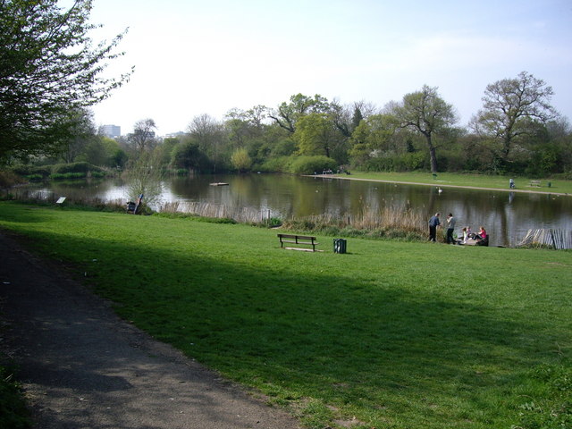
The surrounding area of Netteswell Cross is characterized by picturesque countryside and green spaces, making it an ideal location for those seeking a peaceful and rural lifestyle. It offers easy access to the nearby Epping Forest, which is renowned for its natural beauty and recreational opportunities.

Overall, Netteswell Cross is a charming village that offers a tranquil setting while still being conveniently located near the amenities of Harlow.

If you have any feedback on the listing, please let us know in the comments section below.

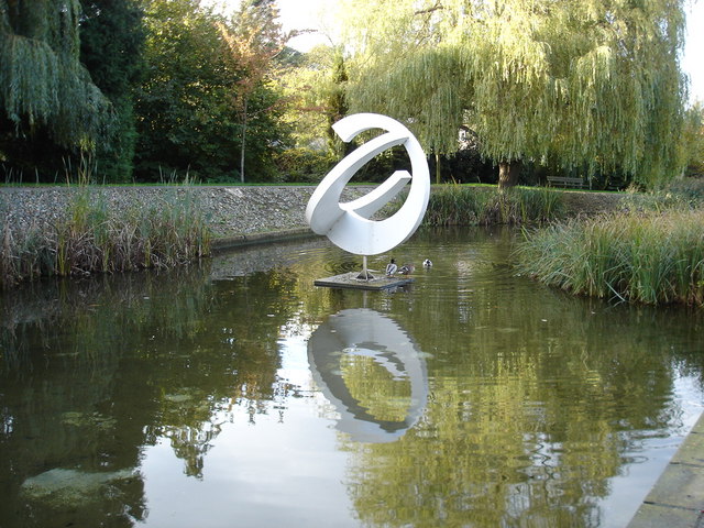
Netteswell Cross Images

Images are sourced within 2km of 51.777996/0.10151301 or Grid Reference TL4510. Thanks to Geograph Open Source API. All images are credited.

Sainsbury's supermarket car park, Harlow In front of the supermarket, a cycle path crosses the car park on a bridge.
Sainsbury's supermarket car park, Harlow
In front of the supermarket, a cycle path crosses the car park on a bridge.
Offices overlooking supermarket car park, Harlow
Lee and Stort Navigation: Lock no 9 - Latton Lock The Harcamlow Way and Three Forests Way share the same route along here. Latton Lock is near to an industrial plant. The route between this lock and the next one involves crossing a footbridge to the other side of the canal from where the railway station at Harlow Town and Burnt Mill Lock are another mile away along a clear track.
Lee and Stort Navigation: Lock no 9 - Latton Lock
The Harcamlow Way and Three Forests Way share the same route along here. Latton Lock is near to an industrial plant. The route between this lock and the next one involves crossing a footbridge to the other side of the canal from where the railway station at Harlow Town and Burnt Mill Lock are another mile away along a clear track.
Harlow industrial area: Burnt Mill Burnt Mill is a road lined with light industrial premises in the area along the northern edge of Harlow.
On the right, the distribution centre for Faber Music.
Harlow industrial area: Burnt Mill
Burnt Mill is a road lined with light industrial premises in the area along the northern edge of Harlow. On the right, the distribution centre for Faber Music.
River Stort outside the Moorhen pub, Burnt Mill Lane, Harlow
Oakwood Pond, Harlow in Winter Oakwood Pond and the surrounding wood is one of the many "nature" or green areas in Harlow New Town, thus preserving wildlife for the residents
Oakwood Pond, Harlow in Winter
Oakwood Pond and the surrounding wood is one of the many "nature" or green areas in Harlow New Town, thus preserving wildlife for the residents
The Playhouse, Harlow The Playhouse, Harlow was open in November 1971 and provides a wide and varied range of entertainment for theatre goers.
The Playhouse, Harlow
The Playhouse, Harlow was open in November 1971 and provides a wide and varied range of entertainment for theatre goers.
St. Paul's church, Harlow New Town, Essex This is the main church of Harlow New Town, designed by Humphrys and Hurst.
St. Paul's church, Harlow New Town, Essex
This is the main church of Harlow New Town, designed by Humphrys and Hurst.
St. Andrews Community Learning Centre This pretty little church is now being used as a learning centre.
St. Andrews Community Learning Centre
This pretty little church is now being used as a learning centre.
St Andrews Community learning Centre This church building is now used as a learning centre. The Black building on the right is The Hummingbird Public House.
St Andrews Community learning Centre
This church building is now used as a learning centre. The Black building on the right is The Hummingbird Public House.
Netteswell Pond Netteswell Pond beside Second Avenue is a pretty and relaxing place to sit, fish, play or just sunbathe. It was originally used by the monks as a fishery.
Netteswell Pond
Netteswell Pond beside Second Avenue is a pretty and relaxing place to sit, fish, play or just sunbathe. It was originally used by the monks as a fishery.
The Harlow Study Centre The study centre is adjacent to the learning centre.
The Harlow Study Centre
The study centre is adjacent to the learning centre.
The new Water Gardens, Harlow
Harvey Harlow shopping centre In Harlow town centre.
Harvey Harlow shopping centre
In Harlow town centre.
Harlow town centre The New Water Gardens. See also <a href="https://www.geograph.org.uk/photo/403337">TL4409 : The new Water Gardens, Harlow</a>
Harlow town centre
The New Water Gardens. See also TL4409 : The new Water Gardens, Harlow
ASDA Harlow At the New Water Gardens centre.
ASDA Harlow
At the New Water Gardens centre.
Harlow Civic Centre Viewed from the Water Gardens.
Harlow Civic Centre
Viewed from the Water Gardens.
Harlow Cvic Centre Viewed from the Water Gardens
Harlow Cvic Centre
Viewed from the Water Gardens
Show me another place!

Netteswell Cross is located at Grid Ref: TL4510 (Lat: 51.777996, Lng: 0.10151301)

Administrative County: Essex

District: Harlow

Police Authority: Essex

What 3 Words

///lined.teeth.mice. Near Harlow, Essex

Related Wikis

Harlow Town Park

Harlow Town Park is a 164-acre (66 ha) public park in Harlow, Essex, England. The park is one of the largest urban parks in Britain. It includes multiple...

Burnt Mill Academy

Burnt Mill Academy (formerly known de facto as Burnt Mill School) is a secondary school academy and specialist performing arts college situated on First...

Harlow Town railway station

Harlow Town railway station is on the West Anglia Main Line serving the town of Harlow in Essex, England. It is 22 miles 59 chains (36.6 km) down the line...
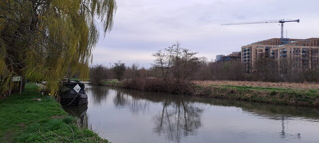
Stort Navigation

The Stort Navigation is the canalised section of the River Stort running 22 kilometres (14 mi) from the town of Bishop's Stortford, Hertfordshire, downstream...

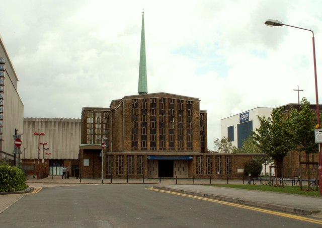
Our Lady of Fatima Church, Harlow

Our Lady of Fatima's Church is a Roman Catholic parish church in Harlow, Essex, England. It was designed between 1953 and 1954 by Gerard Goalen and was...

Harlow Sportcentre

Harlow Sportcentre was a cricket ground in Harlow, Essex. The first recorded match on the ground was in 1964, when the Essex Second XI played the Warwickshire...

Contrapuntal Forms (Hepworth)

Contrapuntal Forms (BH 165) is a stone sculpture by Barbara Hepworth, one of her first public commissions, made in 1950–51 for the Festival of Britain...

Harlow Marsh

Harlow Marsh is a 13.8 hectare Local Nature Reserve in Harlow in Essex. It is owned and managed by Harlow District Council.The site is in three separate...

Related Videos

1 Day as a Tourist in Harlow, Essex, England | UK Travel Vlog

In my latest Uk travel Vlog I take a trip to Harlow in Essex, starting at the historic old town where I take a surprise trip with Sue and ...

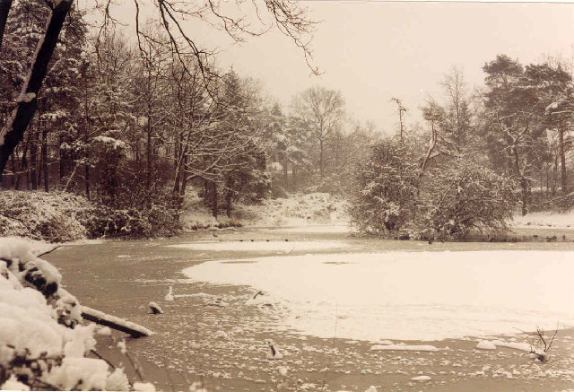
Winter moments 2 Beautiful Winter Amazing Nature Scenery Walking in a Snow White Forest Snowy Woods

Winter moments 2 In this movie you can see images from the winter. The clips in the movie keep the original sound. Superb ...

Walk from Harlow Tesco to Showroom #shorts

Walk from Harlow Tesco, East Road CM20 2TG to our Showroom On South Road CM20 2BZ TASK: Time-lapse a 5 min Walk from ...

Nearby Amenities

Located within 500m of 51.777996,0.10151301
Created By: YahooApplet 1.0
Lat/Long: 51.7750601/0.1041275
Created By: YahooApplet 1.0
Lat/Long: 51.7736792/0.1021212
Created By: YahooApplet 1.0
Lat/Long: 51.7737257/0.1023036
Created By: YahooApplet 1.0
Lat/Long: 51.7737323/0.1025074
Created By: YahooApplet 1.0
Lat/Long: 51.7743431/0.0985163
Created By: YahooApplet 1.0
Lat/Long: 51.7747348/0.0978726
Created By: YahooApplet 1.0
Lat/Long: 51.7751729/0.0977009
Created By: YahooApplet 1.0
Lat/Long: 51.7753654/0.0979477
Created By: YahooApplet 1.0
Lat/Long: 51.7757239/0.0984627
Created By: YahooApplet 1.0
Lat/Long: 51.7761443/0.0989531
Created By: YahooApplet 1.0
Lat/Long: 51.7765796/0.0993169
Created By: YahooApplet 1.0
Lat/Long: 51.7752459/0.1033765
Created By: YahooApplet 1.0
Lat/Long: 51.7752327/0.1032156
Created By: YahooApplet 1.0
Lat/Long: 51.7753256/0.1030868
Noexit: yes
Lat/Long: 51.7755143/0.1033566
Created By: YahooApplet 1.0
Lat/Long: 51.7762749/0.1031834
Created By: YahooApplet 1.0
Lat/Long: 51.7759695/0.1070565
Created By: YahooApplet 1.0
Lat/Long: 51.7811405/0.1066595
Created By: YahooApplet 1.0
Lat/Long: 51.7810409/0.1064557
Crossing
Crossing: unmarked
Crossing Markings: no
Lat/Long: 51.7802467/0.0983526
Bus Stop
Sports Centre
Bus: yes
Naptan AtcoCode: 150035031001
Naptan Bearing: N
Naptan CommonName: Sports Centre
Naptan Indicator: o/s
Naptan Landmark: Sports Centre
Naptan NaptanCode: esxatapw
Naptan PlusbusZoneRef: HRLWTWN
Naptan Street: Allende Avenue
Naptan Verified: no
Public Transport: platform
Source: naptan_import
Lat/Long: 51.7756157/0.0960797
Bus Stop
School Lane
Bus: yes
Naptan AtcoCode: 150035048003
Naptan Bearing: NE
Naptan CommonName: School Lane
Naptan Crossing: School Lane
Naptan Indicator: Adj
Naptan Landmark: School Lane
Naptan NaptanCode: esxapmdp
Naptan PlusbusZoneRef: HRLWTWN
Naptan Street: First Avenue
Naptan Verified: no
Public Transport: platform
Shelter: yes
Source: naptan_import
Lat/Long: 51.7754287/0.1049213
Bus Stop
School Lane
Bus: yes
Naptan AtcoCode: 150035048004
Naptan Bearing: SW
Naptan CommonName: School Lane
Naptan Crossing: School Lane
Naptan Indicator: Opp
Naptan Landmark: School Lane
Naptan NaptanCode: esxapmdt
Naptan PlusbusZoneRef: HRLWTWN
Naptan Street: First Avenue
Naptan Verified: no
Public Transport: platform
Shelter: yes
Source: naptan_import
Lat/Long: 51.7746242/0.1032528
Bus Stop
Park Lane
Bus: yes
Naptan AtcoCode: 1500IM1409
Naptan Bearing: NE
Naptan CommonName: First Avenue
Naptan Indicator: o/s
Naptan Landmark: Swimming Pool
Naptan NaptanCode: esxapmdw
Naptan PlusbusZoneRef: HRLWTWN
Naptan Street: First Avenue
Naptan Verified: no
Public Transport: platform
Source: naptan_import
Lat/Long: 51.7742835/0.1020683
Traffic Signals
Traffic Signals Direction: forward
Lat/Long: 51.7779731/0.0950594
Crossing
Bicycle: yes
Crossing: traffic_signals
Crossing Island: no
Crossing Markings: yes
Crossing Ref: toucan
Tactile Paving: yes
Traffic Signals: yes
Traffic Signals Direction: 80;260
Lat/Long: 51.7798498/0.0951757
Pub
The Greyhound
Wikidata: Q26405487
Lat/Long: 51.7782146/0.1017577
Barrier: bollard
Motor Vehicle: no
Lat/Long: 51.7803716/0.0997337
Barrier: cycle_barrier
Lat/Long: 51.7813103/0.1024468
Barrier: cycle_barrier
Lat/Long: 51.7811374/0.1025368
Noexit: yes
Lat/Long: 51.7744744/0.0995929
Crossing
Bicycle: yes
Crossing: marked
Crossing Ref: toucan
Lat/Long: 51.7754567/0.0962228
Traffic Signals
Traffic Signals Direction: forward
Lat/Long: 51.7777029/0.0953889
Crossing
Crossing: marked
Crossing Ref: puffin
Lat/Long: 51.7751686/0.1044315
Traffic Signals
Traffic Signals Direction: 220
Lat/Long: 51.7779461/0.0945511
Harlow Town
Public Transport: stop_position
Train: yes
Lat/Long: 51.7820132/0.0982666
Noexit: yes
Lat/Long: 51.7821532/0.1041658
Noexit: yes
Lat/Long: 51.782048/0.1042602
Barrier: bollard
Motor Vehicle: no
Source: local_knowledge
Lat/Long: 51.7805193/0.0993683
Crossing
Crossing: unmarked
Crossing Island: no
Tactile Paving: no
Lat/Long: 51.7777223/0.1004796
Direction: forward;320;240
Traffic Calming: table
Lat/Long: 51.7773018/0.0945665
War Memorial
Historic: memorial
Lat/Long: 51.7780557/0.1019964
Noexit: yes
Lat/Long: 51.7806781/0.1014894
Noexit: yes
Lat/Long: 51.7808574/0.0982826
Noexit: yes
Lat/Long: 51.7744162/0.1004537
Noexit: yes
Lat/Long: 51.775455/0.104488
Noexit: yes
Lat/Long: 51.7782968/0.1082393
Noexit: yes
Lat/Long: 51.7794618/0.1082211
Noexit: yes
Lat/Long: 51.7803314/0.1064294
Noexit: yes
Lat/Long: 51.776604/0.107496
Entrance: main
Lat/Long: 51.7803323/0.0974085
Noexit: yes
Lat/Long: 51.7816091/0.1030313
Crossing
Lat/Long: 51.7778419/0.1021099
Crossing
Lat/Long: 51.7742517/0.1008843
Noexit: yes
Lat/Long: 51.7745125/0.1018924
Noexit: yes
Lat/Long: 51.7746748/0.1017374
Crossing
Bicycle: yes
Crossing: marked
Crossing Markings: yes
Crossing Ref: toucan
Lat/Long: 51.7783345/0.09474
Crossing
Bicycle: yes
Crossing: marked
Crossing Markings: yes
Crossing Ref: toucan
Lat/Long: 51.7782208/0.0946889
Noexit: yes
Lat/Long: 51.7754994/0.1040428
Cafe
Spurriers House Café
Addr City: Harlow
Addr Housename: Spurriers House Café
Addr Postcode: CM20 2QG
Addr Street: Park Lane
Check Date: 2024-01-06
Cuisine: coffee_shop;sandwich
Diet Vegan: no
Diet Vegetarian: yes
Indoor Seating: yes
Opening Hours: Spring/Summer 09.00 – 17.30. Autumn/Winter 09.00 – 16.00
Outdoor Seating: patio
Lat/Long: 51.779433/0.0990911
Crossing
Crossing: marked
Lat/Long: 51.7802524/0.0960879
Noexit: yes
Lat/Long: 51.7807116/0.0971921
Toilets
Lat/Long: 51.7785396/0.0996406
Crossing
Bicycle: yes
Crossing: marked
Crossing Ref: toucan
Tactile Paving: yes
Lat/Long: 51.7779695/0.0945931
Crossing
Bicycle: yes
Crossing: marked
Crossing Ref: toucan
Lat/Long: 51.7754218/0.0960861
Direction: both
Traffic Calming: hump
Lat/Long: 51.7767199/0.0950456
Noexit: yes
Lat/Long: 51.7763046/0.0972219
Noexit: yes
Lat/Long: 51.7758289/0.0952465
Barrier: swing_gate
Locked: no
Lat/Long: 51.7778842/0.1007074
Noexit: yes
Lat/Long: 51.7805963/0.1024553
Traffic Calming: island
Lat/Long: 51.7801093/0.0976166
Crossing
Crossing: unmarked
Crossing Markings: no
Lat/Long: 51.7801389/0.0975885
Crossing
Crossing: unmarked
Crossing Markings: no
Lat/Long: 51.7800414/0.0976174
Crossing
Crossing: unmarked
Crossing Island: yes
Crossing Markings: no
Traffic Island: yes
Lat/Long: 51.780393/0.0978204
Traffic Calming: island
Lat/Long: 51.780291/0.098263
Crossing
Crossing: unmarked
Crossing Markings: no
Lat/Long: 51.7803351/0.0982569
Turning Circle
Lat/Long: 51.7803332/0.0998386
Noexit: yes
Lat/Long: 51.7804109/0.0999542
Crossing
Lat/Long: 51.7813475/0.1027142
Traffic Signals
Traffic Signals Direction: forward
Lat/Long: 51.7783622/0.0946839
Crossing
Lat/Long: 51.7744258/0.1013732
Noexit: yes
Lat/Long: 51.7746974/0.1006169
Crossing
Crossing: unmarked
Crossing Island: yes
Crossing Markings: no
Lat/Long: 51.7740713/0.101646
Bicycle Parking
Bicycle Parking: stands
Lat/Long: 51.774514/0.1006343
Waste Basket
Waste: dog_excrement
Lat/Long: 51.7747937/0.1007899
Traffic Signals
Traffic Signals Direction: forward
Lat/Long: 51.7753774/0.0960702
Traffic Signals
Traffic Signals Direction: forward
Lat/Long: 51.7754967/0.0962224
Crossing
Bicycle: yes
Crossing: marked
Crossing Ref: toucan
Tactile Paving: yes
Lat/Long: 51.7779487/0.0947331
Noexit: yes
Lat/Long: 51.7768527/0.1060464
Traffic Calming: island
Lat/Long: 51.777975/0.0946575
Traffic Calming: island
Lat/Long: 51.7782632/0.0946873
Traffic Calming: island
Lat/Long: 51.7754402/0.0961566
Direction: both
Traffic Calming: cushion
Lat/Long: 51.7741525/0.1051217
Noexit: yes
Lat/Long: 51.7755725/0.1066586
Barrier: bollard
Lat/Long: 51.780704/0.0977452
Noexit: yes
Lat/Long: 51.7739539/0.0993931
Bicycle Parking
Lat/Long: 51.7805315/0.0972391
Noexit: yes
Lat/Long: 51.7803084/0.095529
Bench
Lat/Long: 51.7774414/0.1003782
Bench
Lat/Long: 51.7774257/0.1003527
Noexit: yes
Lat/Long: 51.7772034/0.1012981
Ports of Call I, XII, XV
Artist Name: Jonathan Clarke
Artwork Type: sculpture
Material: aluminium
Start Date: 2006
Tourism: artwork
Lat/Long: 51.7758838/0.0958419
Leah Manning Mural
Artist Name: Christopher Dean
Artwork Type: relief
Material: stone
Start Date: 1980
Tourism: artwork
Lat/Long: 51.7745863/0.0985559
Shoal
Artist Name: Will Spankie
Artwork Type: sculpture
Material: limestone
Start Date: 2009
Tourism: artwork
Lat/Long: 51.775313/0.1002408
Pisces
Artist Name: Jesse Watkins
Artwork Type: sculpture
Material: steel
Start Date: 1973
Tourism: artwork
Lat/Long: 51.7767736/0.1003183
Aphrodite
Artist Name: Ernest Adsetts
Artwork Type: statue
Start Date: 1957
Tourism: artwork
Lat/Long: 51.7775148/0.1007502
Crossing
Crossing: marked
Crossing Markings: yes
Lat/Long: 51.7805854/0.0972564
Parking Entrance
Lat/Long: 51.7808955/0.097463
Parking Entrance
Lat/Long: 51.7810167/0.0992958
Entrance: main
Lat/Long: 51.7813394/0.0996208
Noexit: yes
Lat/Long: 51.7775699/0.101794
Noexit: yes
Lat/Long: 51.7778249/0.1015502
Crossing
Crossing: unmarked
Crossing Island: yes
Crossing Markings: no
Tactile Paving: yes
Lat/Long: 51.7808447/0.1004553
Barrier: block
Lat/Long: 51.7736712/0.1005402
Parking Entrance
Lat/Long: 51.780763/0.0994218
Parking
Access: permit
Fee: no
Layer: -1
Parking: underground
Surface: asphalt
Lat/Long: 51.7809179/0.0991639
Cafe
Cafe Belle Vie
Addr City: Harlow
Addr Housename: Harlow Exchange
Addr Housenumber: 4A
Addr Postcode: CM20 2JA
Addr Street: Mill Court
Cuisine: regional;coffee_shop;sandwich;salad;breakfast;burger
Delivery: no
Diet Vegan: yes
Diet Vegetarian: yes
Drive Through: no
Internet Access: wlan
Internet Access Fee: customers
Level: 0
Opening Hours: Mo,We-Sa 08:00-17:00; Su 09:00-16:00
Outdoor Seating: yes
Phone: +44 01279 909555
Takeaway: yes
Website: https://cafebellevieonline.com
Lat/Long: 51.7806177/0.0957524
Anytime Fitness
Brand: Anytime Fitness
Brand Wikidata: Q4778364
Leisure: fitness_centre
Website: https://www.anytimefitness.co.uk/gyms/uk-0038/harlow-east-of-england-cm20-2ja/
Lat/Long: 51.7806068/0.0956771
Fast Food
Pizza GoGo
Addr City: Harlow
Addr Housename: Harlow Exchange
Addr Housenumber: 1
Addr Postcode: CM20 2JA
Addr Street: Edinburgh Gate
Brand Wikidata: Q118121277
Cuisine: pizza
Drive Through: no
Opening Hours: Mo-Th,Su 12:00-23:00; Fr-Sa 12:00-24:00
Outdoor Seating: no
Phone: +44 01279 439751
Takeaway: only
Website: https://www.pizzagogo.co.uk/
Wheelchair: yes
Lat/Long: 51.7806802/0.096078
Veterinary
Walton Lodge Veterinary Group Harlow
Addr City: Harlow
Addr Housename: Harlow Exchange
Addr Housenumber: 2
Addr Postcode: CM20 2JA
Addr Street: Mill Court
Opening Hours: Mo-Fr 08:30-19:00
Operator: Walton Lodge Veterinary Group
Phone: +44 01279 439 359
Website: https://www.waltonlodgevets.com/
Lat/Long: 51.7806698/0.0959984
Bladez Barbers
Addr City: Harlow
Addr Housenumber: 3B
Addr Postcode: CM20 2JA
Addr Street: Mill Court
Male: yes
Phone: +44 07424 424 348
Shop: hairdresser
Lat/Long: 51.7806566/0.095921
Moore House
Building: apartments
Lat/Long: 51.7814172/0.0980796
Godfrey House
Building: apartments
Lat/Long: 51.7815035/0.0985302
Ackroyd House
Building: apartments
Lat/Long: 51.781603/0.0989754
Austin House
Addr City: Harlow
Addr Street: Edinburgh Way
Building: apartments
Building Levels: 8
Lat/Long: 51.7808638/0.0986898
Hepworth House
Addr City: Harlow
Addr Street: Edinburgh Way
Building: apartments
Lat/Long: 51.7809982/0.0992021
The data included in this document is from www.openstreetmap.org. The data is made available under ODbL.

Have you been to Netteswell Cross?

Leave your review of Netteswell Cross below (or comments, questions and feedback).