Nether End

Settlement in Derbyshire Derbyshire Dales

England

Nether End

Wellington's Monument Now that the trees have grown up, the monument no longer has the commanding views over the Derwent valley. There are often a lot of people around it.
Wellington's Monument Credit: Bill Boaden

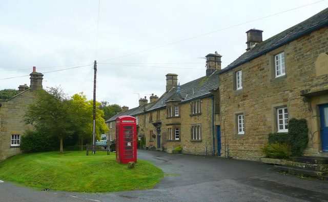
Nether End is a charming village located in the county of Derbyshire, England. Situated in the picturesque Peak District National Park, this rural settlement offers stunning natural beauty and a peaceful atmosphere. With a population of around 500 residents, Nether End is a close-knit community that is known for its friendly locals and strong sense of community spirit.

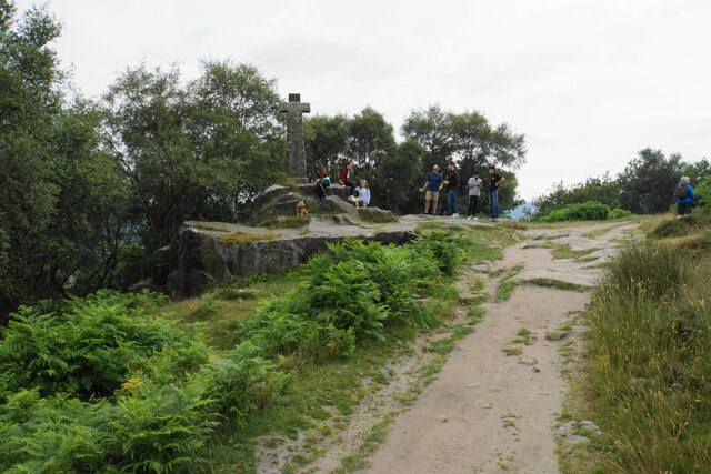
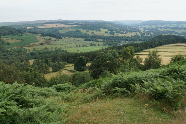
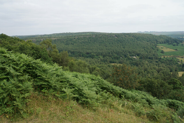
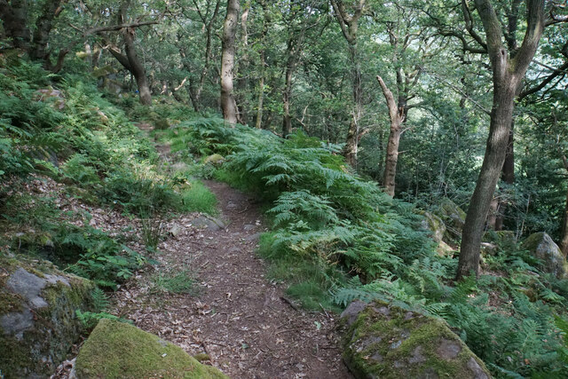
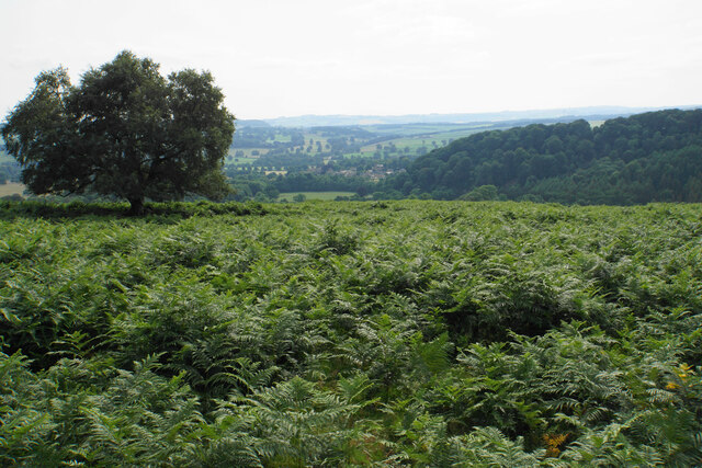
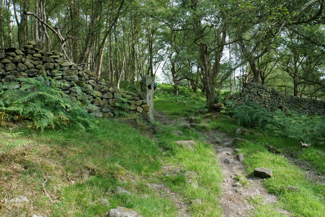
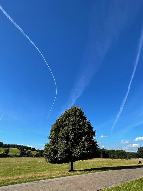
The village is surrounded by rolling hills, lush green fields, and scenic woodland, making it a haven for nature lovers and outdoor enthusiasts. It is particularly popular among hikers and walkers, as it provides easy access to various trails and pathways that lead to the breathtaking landscapes of the Peak District.

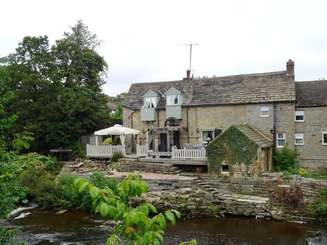
Despite its small size, Nether End boasts a few amenities that cater to the needs of its residents. The village has a well-regarded primary school, a welcoming pub that serves traditional British fare, and a small convenience store for everyday essentials. However, for more extensive shopping and entertainment options, the nearby market town of Bakewell is just a short drive away.

Nether End also has a rich history, with several historic buildings and landmarks scattered throughout the area. One notable attraction is the 12th-century church, which showcases stunning architectural features and serves as a reminder of the village's past.

Overall, Nether End offers a tranquil and idyllic setting for those seeking a peaceful countryside retreat while still being within reach of modern conveniences.

If you have any feedback on the listing, please let us know in the comments section below.
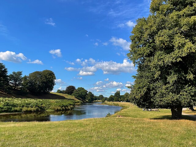
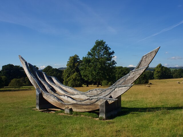
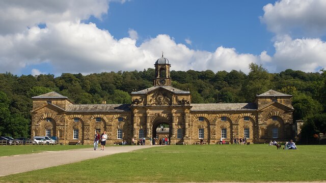
Nether End Images

Images are sourced within 2km of 53.246183/-1.614824 or Grid Reference SK2572. Thanks to Geograph Open Source API. All images are credited.

Wellington's Monument Now that the trees have grown up, the monument no longer has the commanding views over the Derwent valley. There are often a lot of people around it.
Wellington's Monument
Now that the trees have grown up, the monument no longer has the commanding views over the Derwent valley. There are often a lot of people around it.
Blackstone Edge The top of the edge near Wellington's Monument with a view down the Derwent valley.
Blackstone Edge
The top of the edge near Wellington's Monument with a view down the Derwent valley.
Blackstone Edge The line of Gardom's Edge is prominent on the other side of Bar Brook, with Birchen Edge above that.
Blackstone Edge
The line of Gardom's Edge is prominent on the other side of Bar Brook, with Birchen Edge above that.
Path below Blackstone Edge Having battled through head-high ferns, this part of the path is a very pleasant descent through woodland.
Path below Blackstone Edge
Having battled through head-high ferns, this part of the path is a very pleasant descent through woodland.
See of ferns below Gardom's Edge Looking down towards Baslow.
See of ferns below Gardom's Edge
Looking down towards Baslow.
Old gateway below Gardom's Edge The path is a steady climb up from Bar Brook.
Old gateway below Gardom's Edge
The path is a steady climb up from Bar Brook.
Lady Wall Well Lady Wall Well is on a corner of Bar Road, an old packhorse way to the top of Baslow Edge. "bar" is an old word for a steeply-climbing horse road. From the top of Baslow Edge, the old road continues on towards Chesterfield, for a way, before disappearing under modern tarmac.
Lady Wall Well
Lady Wall Well is on a corner of Bar Road, an old packhorse way to the top of Baslow Edge. "bar" is an old word for a steeply-climbing horse road. From the top of Baslow Edge, the old road continues on towards Chesterfield, for a way, before disappearing under modern tarmac.
Derwent Aqueduct access gates and discharge well The Derwent Aqueduct was laid to bring water from the Derwent to Derby, Nottingham and Leicester. Its line is marked by these distinctive access gates and, in this case, a discharge well. The building, in the background and in a neighbouring grid square, is a valve house.
Derwent Aqueduct access gates and discharge well
The Derwent Aqueduct was laid to bring water from the Derwent to Derby, Nottingham and Leicester. Its line is marked by these distinctive access gates and, in this case, a discharge well. The building, in the background and in a neighbouring grid square, is a valve house.
Former flour mill Hodgkinson's Corn Mill became disused in the early 20th century.
Former flour mill
Hodgkinson's Corn Mill became disused in the early 20th century.
Entrance gate to Chatsworth House The visitor entrance is just beyond the extreme left of the view.

Camera: Olympus Mju II
Film: Fuji Superia Reala 100
Scanner: Nikon D7200
Conversion software: Grain2Pixel (unedited)
Entrance gate to Chatsworth House
The visitor entrance is just beyond the extreme left of the view. Camera: Olympus Mju II Film: Fuji Superia Reala 100 Scanner: Nikon D7200 Conversion software: Grain2Pixel (unedited)
Greenhouses in the Kitchen Garden, Chatsworth House Showing the Stables in the background.

Camera: Olympus Mju II
Film: Fuji Superia Reala 100
Scanner: Nikon D7200
Conversion software: Grain2Pixel (unedited)
Greenhouses in the Kitchen Garden, Chatsworth House
Showing the Stables in the background. Camera: Olympus Mju II Film: Fuji Superia Reala 100 Scanner: Nikon D7200 Conversion software: Grain2Pixel (unedited)
The Conservative Wall, Chatsworth House Also showing "Flora's Temple" on the left. The Conservative wall is a very shallow cascading glasshouse; a truly striking feature.

Camera: Olympus Mju II
Film: Fuji Superia Reala 100
Scanner: Nikon D7200
Conversion software: Grain2Pixel (unedited)
The Conservative Wall, Chatsworth House
Also showing "Flora's Temple" on the left. The Conservative wall is a very shallow cascading glasshouse; a truly striking feature. Camera: Olympus Mju II Film: Fuji Superia Reala 100 Scanner: Nikon D7200 Conversion software: Grain2Pixel (unedited)
Solitary tree and contrails in Chatsworth Park Looks like the pilot was taking evasive action.
Solitary tree and contrails in Chatsworth Park
Looks like the pilot was taking evasive action.
Contrails above Chatsworth House Accidentally forming the Scottish saltire
Contrails above Chatsworth House
Accidentally forming the Scottish saltire
The River Derwent in Chatsworth Park
Plantation Cottage A holiday cottage on the Chatsworth Estate
Plantation Cottage
A holiday cottage on the Chatsworth Estate
Sculpture or horse jumping fence  A permanent feature in the parkland used, I believe, when horse events take place.
Sculpture or horse jumping fence
A permanent feature in the parkland used, I believe, when horse events take place.
Former stable block at Chatsworth House Now used primarily as a café and restaurant.
Former stable block at Chatsworth House
Now used primarily as a café and restaurant.
Show me another place!

Nether End is located at Grid Ref: SK2572 (Lat: 53.246183, Lng: -1.614824)

Administrative County: Derbyshire

District: Derbyshire Dales

Police Authority: Derbyshire

What 3 Words

///stow.resources.reporter. Near Baslow, Derbyshire

Related Wikis

Baslow

Baslow is a village in Derbyshire, England, in the Peak District, situated between Sheffield and Bakewell, just over 1 mile (1.6 km) north of Chatsworth...

St Anne's Church, Baslow

St. Anne’s Church, Baslow, is a Grade II* listed parish church in Baslow, England. == History == The church dates from the thirteenth century. It was subject...

Baslow Hall

Baslow Hall is a Grade II listed building in Baslow, Derbyshire. == History == Baslow Hall, just off Calver Road, was built in 1907 to the designs of the...

Gardom's Edge

Gardom's Edge is a rocky outcrop near Baslow in Derbyshire, England. The shelf between Gardom's Edge and Birchen Edge is now moorland used for grazing...

Cliff College

Cliff College is a Christian theological college in Calver, Derbyshire, that teaches Biblical Theology at the undergraduate level and a number of mission...
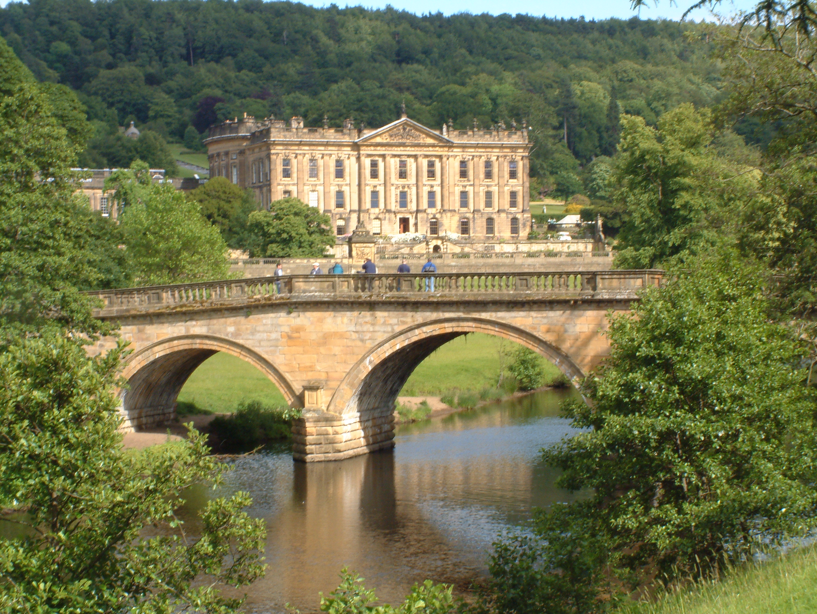
Chatsworth House

Chatsworth House is a stately home in the Derbyshire Dales, 4 miles (6.4 km) north-east of Bakewell and 9 miles (14 km) west of Chesterfield, England....

Pilsley, Derbyshire Dales

Pilsley is a small village and civil parish in Derbyshire, England. At the 2011 Census the population of the civil parish was 152. It is close to Chatsworth...
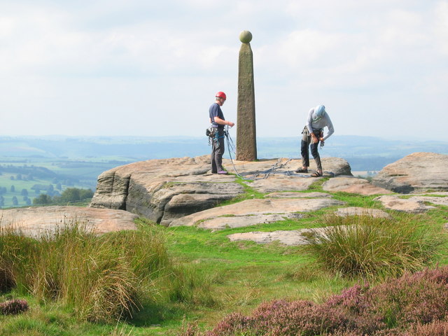
Birchen Edge

Birchen Edge is a gritstone rock face in the Peak District, England, popular with walkers and novice climbers as most of the climbing routes are in the...

Nearby Amenities

Located within 500m of 53.246183,-1.614824
Crossing
Crossing: marked
Crossing Island: no
Tactile Paving: yes
Lat/Long: 53.2462211/-1.6203742
Baslow
Is In: Derbyshire, England, UK
Place: village
Wikidata: Q4867787
Wikipedia: en:Baslow
Lat/Long: 53.2469579/-1.6201639
Pub
The Devonshire Arms
Addr City: Bakewell
Addr Postcode: DE45 1SR
Addr Street: Nether End
Addr Village: Baslow
Fhrs Id: 1685498
Phone: +44 1246 582551
Website: https://thedevonshirebaslow.com/
Lat/Long: 53.2459014/-1.6133234
Restaurant
Il Lupo
Addr City: Bakewell
Addr Postcode: DE45 1SB
Addr Street: Eaton Hill
Addr Village: Baslow
Cuisine: italian;italian_pizza;pizza;pasta
Email: illupobaslow@gmail.com
Fhrs Id: 1626463
Note: Pretty sure it's right on the corner.
Phone: +44 1246 583164
Website: https://www.illupo.uk/
Lat/Long: 53.246057/-1.6149795
Spar
Addr City: Bakewell
Addr Country: GB
Addr Housename: Matlock House
Addr Postcode: DE45 1RZ
Addr Street: School Lane
Addr Village: Baslow
Brand: Spar
Brand Wikidata: Q610492
Brand Wikipedia: en:SPAR (retailer)
Fhrs Id: 1627093
Shop: convenience
Website: https://www.spar.co.uk/store-locator/afb32163-spar-baslow/
Lat/Long: 53.249233/-1.618678
Pub
The Wheatsheaf
Addr City: Bakewell
Addr Postcode: DE45 1SR
Addr Street: Nether End
Addr Village: Baslow
Fhrs Id: 1626524
Food: yes
Outdoor Area: yes
Parking: yes
Real Ale: 4 from Marstons
Lat/Long: 53.2465269/-1.6124122
Restaurant
Cavendish Hotel and Restaurant
Addr City: Bakewell
Addr Postcode: DE45 1SP
Addr Street: Church Lane
Addr Village: Baslow
Fhrs Id: 1626479
Lat/Long: 53.2456866/-1.6164244
Cafe
Cafe on the Green
Addr City: Bakewell
Addr Postcode: DE45 1SR
Addr Street: Nether End
Addr Village: Baslow
Fhrs Id: 1699015
Lat/Long: 53.2456766/-1.6136065
Bench
Backrest: no
Ele: 109.7154541
Lat/Long: 53.2419583/-1.6144751
Post Box
Ele: 127.7399902
Post Box Type: wall
Ref: DE45 1264
Lat/Long: 53.249115/-1.6175623
Bench
Ele: 127.7399902
Lat/Long: 53.2490321/-1.6175241
Telephone
Booth: KX100
Covered: booth
Ele: 107.5523682
Lat/Long: 53.2457093/-1.6146433
Toilets
Check Date: 2022-04-18
Ele: 108.0330811
Lat/Long: 53.2456684/-1.6144587
Bench
Backrest: no
Ele: 110.1960449
Lat/Long: 53.2420803/-1.6144751
Place Of Worship
Baslow Methodist Church
Denomination: methodist
Ele: 116.6848145
Religion: christian
Lat/Long: 53.2483078/-1.6207514
Bench
Ele: 119.0881348
Lat/Long: 53.2485004/-1.6198234
Baslow Nether End
Bus: yes
Public Transport: stop_position
Lat/Long: 53.2457107/-1.6141924
Barrier: kissing_gate
Lat/Long: 53.244879/-1.6170215
Barrier: kissing_gate
Lat/Long: 53.2441879/-1.615602
Barrier: kissing_gate
Lat/Long: 53.2441263/-1.6154489
Post Box
Brand: Royal Mail
Brand Wikidata: Q638098
Brand Wikipedia: en:Royal Mail
Collection Times: Mo-Fr 09:00; Sa 07:00
Operator: Royal Mail
Operator Wikidata: Q638098
Post Box Type: lamp
Ref: DE45 1279
Royal Cypher: EIIR
Royal Cypher Wikidata: Q33102113
Source: survey
Lat/Long: 53.2457202/-1.6147086
Barrier: entrance
Source: survey;gps
Lat/Long: 53.2457441/-1.6140739
Defibrillator
Access: yes
Check Date: 2023-03-09
Defibrillator Location: outside Baslow Village Hall - facing car park
Emergency: defibrillator
Indoor: no
Ref GB The Circuit: 4D76F19D-4167-4EEB-B09C-ADA30171AD6C
Source: survey
Lat/Long: 53.2456643/-1.6147453
Barrier: stile
Material: stone
Source: survey;gps
Stile: squeezer
Lat/Long: 53.2447825/-1.6136477
Barrier: entrance
Source: survey;gps
Lat/Long: 53.2457085/-1.6139296
Information: board
Tourism: information
Lat/Long: 53.2458398/-1.6144571
Barrier: entrance
Source: survey;gps
Lat/Long: 53.2458925/-1.6137
Recycling
Lat/Long: 53.24547/-1.614384
Defibrillator
Access: yes
Check Date: 2023-03-09
Defibrillator Location: On outside wall. Available 24/7.
Emergency: defibrillator
Indoor: no
Opening Hours: 24/7
Ref GB The Circuit: D5C43D20-A10B-446E-B5D4-ADA3017258B1
Lat/Long: 53.2458807/-1.6203157
Defibrillator
Access: yes
Check Date: 2023-03-09
Emergency: defibrillator
Indoor: no
Lat/Long: 53.2492454/-1.618597
Post Office
Baslow Post Office
Addr City: Bakewell
Addr Country: GB
Addr Postcode: DE45 1RZ
Addr Street: School Lane
Addr Village: Baslow
Brand: Post Office
Brand Wikidata: Q1783168
Fhrs Id: 1627093
Opening Hours: Mo-Sa 08:00-20:00; Su 09:00-20:00
Operator: Spar
Ref Pol Id: 125716
Website: https://www.postoffice.co.uk/branch-finder/6084583/baslow
Lat/Long: 53.2491915/-1.6186266
Bus Stop
Baslow Nether End
Bus: yes
Naptan AtcoCode: 1000DBNE3204
Naptan NaptanCode: dbsgmajp
Public Transport: platform
Lat/Long: 53.2458198/-1.6144739
Bus Stop
Baslow Nether End
Bus: yes
Naptan AtcoCode: 1000DBNE3205
Naptan NaptanCode: dbsgmajt
Public Transport: platform
Lat/Long: 53.2456621/-1.6142188
Cavendish Hotel
Aeroway: helipad
Operator: Cavendish Hotel
Surface: grass
Lat/Long: 53.2451239/-1.6170517
Sweet Gene's
Addr City: Bakewell
Addr Postcode: DE45 1SR
Addr Street: Nether End
Addr Village: Baslow
Fhrs Id: 1626356
Shop: confectionery
Lat/Long: 53.2456252/-1.6141999
Izzi
Addr City: Bakewell
Addr Postcode: DE45 1SR
Addr Street: Cock Hill
Addr Village: Baslow
Shop: clothes
Website: https://www.izziofbaslow.com/
Lat/Long: 53.2461126/-1.6129711
Bus Stop
Baslow (Golden Gates)
Bus: yes
Naptan AtcoCode: 100000021969
Naptan NaptanCode: dbsgpdap
Public Transport: platform
Lat/Long: 53.2471727/-1.6097981
Baslow (Golden Gates)
Bus: yes
Public Transport: stop_position
Lat/Long: 53.2472154/-1.6098404
Bus Stop
Baslow (Golden Gates)
Bus: yes
Naptan AtcoCode: 100000021964
Naptan NaptanCode: dbsgpdaj
Public Transport: platform
Lat/Long: 53.2472658/-1.6097968
Baslow (Golden Gates)
Bus: yes
Public Transport: stop_position
Lat/Long: 53.2472417/-1.6097701
Baslow Nether End
Bus: yes
Public Transport: stop_position
Lat/Long: 53.2457799/-1.6144892
Generator Method: photovoltaic
Generator Output Electricity: yes
Generator Source: solar
Generator Type: solar_photovoltaic_panel
Location: roof
Power: generator
Lat/Long: 53.249417/-1.6160727
Generator Method: photovoltaic
Generator Output Electricity: yes
Generator Source: solar
Generator Type: solar_photovoltaic_panel
Location: roof
Power: generator
Lat/Long: 53.2486936/-1.6162179
Historic Operator: Derwent Valley Water Board
Operator: Severn Trent Water
Pipeline: valve
Lat/Long: 53.2431992/-1.6094956
Historic Operator: Derwent Valley Water Board
Operator: Severn Trent Water
Pipeline: valve
Lat/Long: 53.2431916/-1.6094573
Bench
Backrest: yes
Lat/Long: 53.2449838/-1.6205892
Leisure: picnic_table
Lat/Long: 53.2452508/-1.6199447
Barrier: stile
Step Count: 1
Stile: stepover
Lat/Long: 53.2460227/-1.6195155
Dough & Dolci
Addr City: Bakewell
Addr Housename: H G M House
Addr Postcode: DE45 1SR
Addr Village: Baslow
Fhrs Id: 1626848
Phone: +44 1246 469572
Shop: bakery
Website: https://doughanddolci.co.uk/
Lat/Long: 53.2462665/-1.6124518
Historic Operator: Derwent Valley Water Board
Operator: Severn Trent Water
Pipeline: valve
Lat/Long: 53.2457022/-1.6085119
Historic Operator: Derwent Valley Water Board
Operator: Severn Trent Water
Pipeline: valve
Lat/Long: 53.2457074/-1.6085613
The data included in this document is from www.openstreetmap.org. The data is made available under ODbL.

Have you been to Nether End?

Leave your review of Nether End below (or comments, questions and feedback).