Nesscliffe

Settlement in Shropshire

England

Nesscliffe

By Valeswood Lane Small field north of Valeswood Lane.
By Valeswood Lane Credit: Richard Webb

Nesscliffe is a small village located in the county of Shropshire, England. Situated approximately 9 miles northwest of the county town of Shrewsbury, Nesscliffe lies on the border between England and Wales and is surrounded by picturesque countryside.

The village is known for its historical significance, with evidence of human habitation dating back to the Roman period. The most prominent feature of Nesscliffe is its imposing sandstone cliffs, which are popular among rock climbers and walkers. The cliffs offer breathtaking panoramic views of the surrounding landscape, including the Welsh hills in the distance.

Nesscliffe is also home to a number of historical landmarks. The most notable is the Nesscliffe Hill Country Park, which covers an area of 200 acres and provides visitors with numerous walking trails and picnic spots. The park is home to a diverse range of flora and fauna, making it a haven for nature enthusiasts.

The village itself is small but charming, with a close-knit community. It has a handful of amenities, including a village hall and a primary school. For more extensive facilities, residents can easily access the nearby town of Shrewsbury, which offers a wider range of shops, restaurants, and leisure activities.

Overall, Nesscliffe offers a tranquil and scenic setting for those seeking a peaceful retreat in the heart of the Shropshire countryside. Its natural beauty, coupled with its historical significance, make it an attractive destination for both locals and visitors alike.

If you have any feedback on the listing, please let us know in the comments section below.

Nesscliffe Images

Images are sourced within 2km of 52.768194/-2.916817 or Grid Reference SJ3819. Thanks to Geograph Open Source API. All images are credited.
By Valeswood Lane Small field north of Valeswood Lane.
By Valeswood Lane
Small field north of Valeswood Lane.
Old Milestone Old milestone on what would have been the A.5 near to Great Ness, Shropshire. For overall view see <a title="https://www.geograph.org.uk/photo/4776149" href="https://www.geograph.org.uk/photo/4776149">Link</a>
Old Milestone
Old milestone on what would have been the A.5 near to Great Ness, Shropshire. For overall view see Link
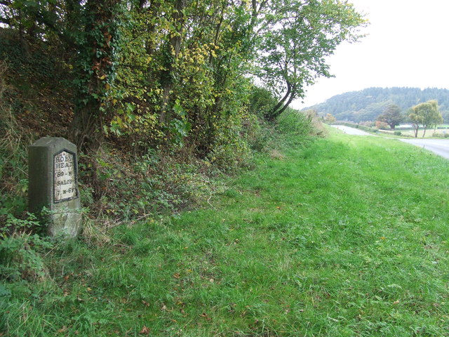
Holyhead 99 Old milestone on what would have been the A.5 near to Great Ness, Shropshire. For close up view see <a title="https://www.geograph.org.uk/photo/4776146" href="https://www.geograph.org.uk/photo/4776146">Link</a>
Holyhead 99
Old milestone on what would have been the A.5 near to Great Ness, Shropshire. For close up view see Link
Milestone Milestone on what would have been the A5 near to Nesscliffe, Shropshire; for overall view see <a title="https://www.geograph.org.uk/photo/4930458" href="https://www.geograph.org.uk/photo/4930458">Link</a>
Milestone
Milestone on what would have been the A5 near to Nesscliffe, Shropshire; for overall view see Link
Holyhead 98 Milestone on what would have been the A5 near to Nesscliffe, Shropshire; for close up view see <a title="https://www.geograph.org.uk/photo/4930452" href="https://www.geograph.org.uk/photo/4930452">Link</a>
Holyhead 98
Milestone on what would have been the A5 near to Nesscliffe, Shropshire; for close up view see Link
Kynaston's Cave, Nesscliffe Reputedly the hideaway of the highwayman Humphrey Kynaston.
Kynaston's Cave, Nesscliffe
Reputedly the hideaway of the highwayman Humphrey Kynaston.
Nesscliffe Footbridge Suspension footbridge with a lightweight FRP (fibre reinforced polymer) deck. Although FRP has been used for smaller elements for walkways and gratings its use in larger structures has been limited. This structure seems to be performing well after some early remedial work.
Nesscliffe Footbridge
Suspension footbridge with a lightweight FRP (fibre reinforced polymer) deck. Although FRP has been used for smaller elements for walkways and gratings its use in larger structures has been limited. This structure seems to be performing well after some early remedial work.
The Church of St Andrew at Great Ness Viewed from the south-east.
The Church of St Andrew at Great Ness
Viewed from the south-east.
Road in Great Ness with the option to visit St Andrew's Church Looking south-westward
Road in Great Ness with the option to visit St Andrew's Church
Looking south-westward
Ordnance Survey Flush Bracket 2765 This can be found on the wall of a house - a private dwelling - at The Prill. There is also a 'cancelled' Cut Mark at the same location which this bracket presumably supersedes.
For more detail see : <span class="nowrap"><a title="http://www.bench-marks.org.uk/bm2285" rel="nofollow ugc noopener" href="http://www.bench-marks.org.uk/bm2285">Link</a><img style="margin-left:2px;" alt="External link" title="External link - shift click to open in new window" src="https://s1.geograph.org.uk/img/external.png" width="10" height="10"/></span>
Ordnance Survey Flush Bracket 2765
This can be found on the wall of a house - a private dwelling - at The Prill. There is also a 'cancelled' Cut Mark at the same location which this bracket presumably supersedes. For more detail see : LinkExternal link
Road (the former A5) at The Prill Looking north-westward.
Road (the former A5) at The Prill
Looking north-westward.
Well Lane near Nesscliffe Looking south-westward.
Well Lane near Nesscliffe
Looking south-westward.
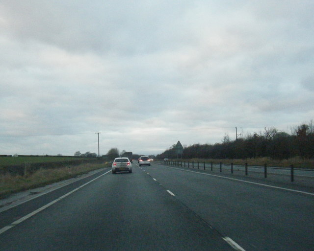
A5 north of Felton Butler
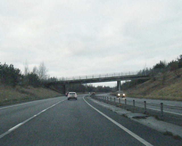
A5 overbridge crossing near Wilcott
A5 north of Kinton
A5 north of Kinton
Woodland in Spring Nesscliffe Hill Country Park.
Woodland in Spring
Nesscliffe Hill Country Park.
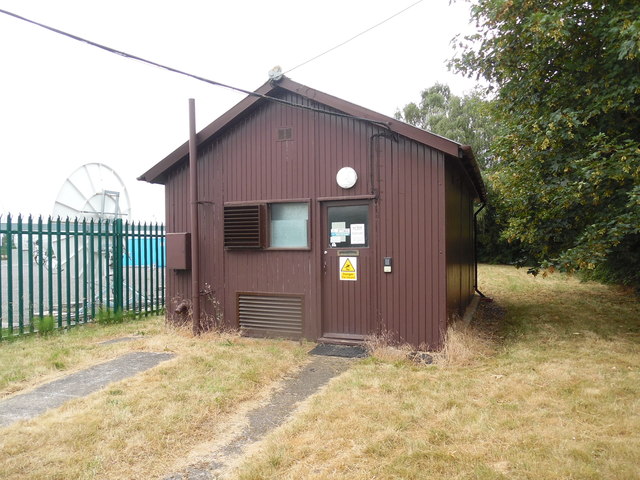
Nesscliffe Telephone Exchange Situated near Wilcott, this TE is of a design common in rural areas and has the code WNNCL. It provides telephone and broadband services to 407 residential and 42 non-residential premises in Nesscliffe plus Felton Butler, Great Ness, Hopton, Kinton, Pentre and Wilcott nearby. Ventilation louvres can be seen on the front of this TE whilst BT antennas can just be seen to the left of the photo. The numbering range of this TE is (01743) 741xxx, the (01743) referring to the Shrewsbury group of thirteen TEs, and its postcode is SY4 1BJ.
Nesscliffe Telephone Exchange
Situated near Wilcott, this TE is of a design common in rural areas and has the code WNNCL. It provides telephone and broadband services to 407 residential and 42 non-residential premises in Nesscliffe plus Felton Butler, Great Ness, Hopton, Kinton, Pentre and Wilcott nearby. Ventilation louvres can be seen on the front of this TE whilst BT antennas can just be seen to the left of the photo. The numbering range of this TE is (01743) 741xxx, the (01743) referring to the Shrewsbury group of thirteen TEs, and its postcode is SY4 1BJ.
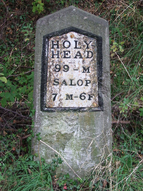
Modern Milestone by St Andrew's church, Great Ness New metal plate attached to new stone post by the UC road, in parish of GREAT NESS (SHREWSBURY AND ATCHAM District), near St Andrew's church, on the verge to the old road, on West side of road. Telford-type iron plate, erected by the parish in the 21st century. 

Inscription reads:- : HOLY- / HEAD / 99 - M / SALOP / 7 M - 6F :

The original Thomas Telford milestone is on the old A5 to the South West at Grid reference: SJ 3918 1860 

Milestone Society National ID: SA_HH099aR.
Modern Milestone by St Andrew's church, Great Ness
New metal plate attached to new stone post by the UC road, in parish of GREAT NESS (SHREWSBURY AND ATCHAM District), near St Andrew's church, on the verge to the old road, on West side of road. Telford-type iron plate, erected by the parish in the 21st century. Inscription reads:- : HOLY- / HEAD / 99 - M / SALOP / 7 M - 6F : The original Thomas Telford milestone is on the old A5 to the South West at Grid reference: SJ 3918 1860 Milestone Society National ID: SA_HH099aR.
Show me another place!

Nesscliffe is located at Grid Ref: SJ3819 (Lat: 52.768194, Lng: -2.916817)

Unitary Authority: Shropshire

Police Authority: West Mercia

What 3 Words

///drooling.grinders.threaten. Near Great Ness, Shropshire

Related Wikis

Nesscliffe

Nesscliffe is a village in Shropshire, England, located north of the River Severn. The village comes under the Great Ness parish. The A5 road, which previously...

Kinton, Shropshire

Kinton is a hamlet in Shropshire, England. It is part of the civil parish of Great Ness, and is situated to the west of the A5 road. Richard Mathews, the...

St Andrew's Church, Great Ness

St Andrew's Church is in the village of Great Ness, Shropshire, England. It is an active Anglican parish church in the deanery of Ellesmere, the archdeaconry...

Great Ness

Great Ness and Little Ness are civil parishes in Shropshire, England. == Common local governance == The two parishes share a parish council. The parishes...

Nearby Amenities

Located within 500m of 52.768194,-2.916817
Nesscliffe
Place: village
Lat/Long: 52.7683369/-2.9168255
Crossing
Crossing: unmarked
Tactile Paving: no
Lat/Long: 52.7693983/-2.9214516
Generator Method: photovoltaic
Generator Output Electricity: yes
Generator Source: solar
Generator Type: solar_photovoltaic_panel
Location: roof
Power: generator
Lat/Long: 52.7706557/-2.9167038
Generator Method: photovoltaic
Generator Output Electricity: yes
Generator Source: solar
Generator Type: solar_photovoltaic_panel
Location: roof
Power: generator
Lat/Long: 52.7708374/-2.9171464
Crossing
Crossing: unmarked
Tactile Paving: no
Lat/Long: 52.7695036/-2.9217649
Give Way
Direction: forward
Lat/Long: 52.7661621/-2.9152979
Give Way
Direction: backward
Lat/Long: 52.7682722/-2.9167655
Entrance: main
Lat/Long: 52.7720178/-2.9160678
Entrance: yes
Lat/Long: 52.771892/-2.9161826
Kynaston's Cave
Natural: cave_entrance
Wikidata: Q17140435
Lat/Long: 52.7677477/-2.9137952
Nesscliffe War Memorial
Historic: memorial
Memorial: war_memorial
Wikidata: Q26676676
Lat/Long: 52.7680456/-2.9165046
The data included in this document is from www.openstreetmap.org. The data is made available under ODbL.

Have you been to Nesscliffe?

Leave your review of Nesscliffe below (or comments, questions and feedback).