Neath Abbey

Settlement in Glamorgan

Wales

Neath Abbey

Neath Abbey View south along the west range
Neath Abbey Credit: Kevin Waterhouse

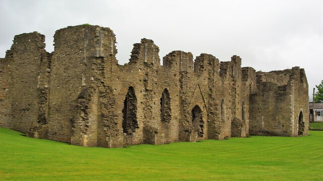
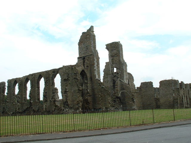
Neath Abbey is a historical site located in Glamorgan, Wales. It was originally a Cistercian monastery founded in 1130, making it one of the earliest such establishments in Wales. The abbey was built near the banks of the River Neath, hence its name, and it played a significant role in the region's religious and cultural history.

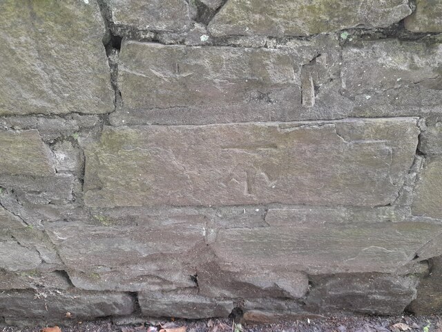
The abbey's architecture is a blend of different styles that evolved over the centuries. The earliest surviving sections showcase the simple yet elegant Romanesque style, while later additions reflect the more elaborate Gothic style. The ruins of the abbey feature a well-preserved chapter house, an ornate west front, and the remains of a large church.

Throughout its existence, Neath Abbey was a hub of religious activity and a center of learning. The monks living here engaged in various activities, including agriculture, brewing, and manuscript production. The abbey also had an important economic role, as it owned extensive lands and had a thriving market.

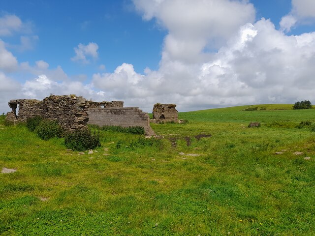
Sadly, the abbey's decline began in the 16th century with the dissolution of the monasteries under King Henry VIII. The site was later abandoned and fell into disrepair. In the 18th century, parts of the abbey were dismantled and used as building materials for nearby structures.

Today, Neath Abbey is managed by Cadw, the historic environment service of the Welsh Government. Visitors can explore the ruins and admire the architectural remnants that have survived the test of time. The site provides a glimpse into the rich religious and cultural heritage of the region.

If you have any feedback on the listing, please let us know in the comments section below.
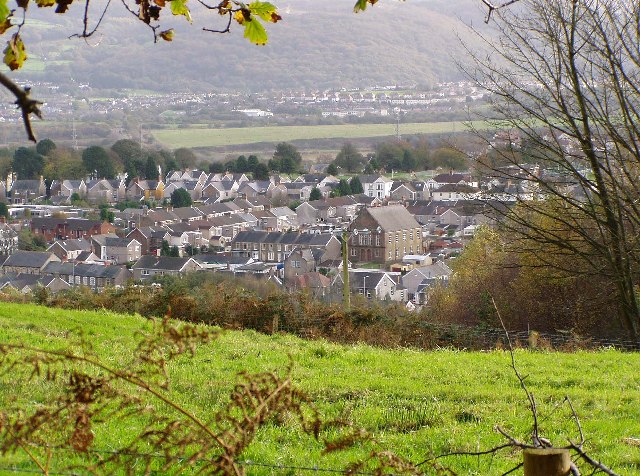
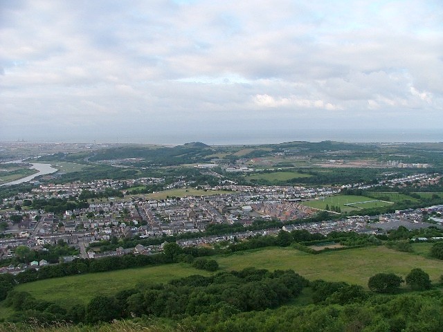
Neath Abbey Images

Images are sourced within 2km of 51.663879/-3.834084 or Grid Reference SS7397. Thanks to Geograph Open Source API. All images are credited.

Neath Abbey View south along the west range
Neath Abbey
View south along the west range
Tudor Mansion The south-east part of the cloisters became a mansion after the dissolution of Neath Abbey
Tudor Mansion
The south-east part of the cloisters became a mansion after the dissolution of Neath Abbey
McDonald's fast food off the A465 at Pen-yr-Heol
Ordnance Survey Rivet This damaged OS rivet can be found on the flat rock at the track junction. It marked a point 228.628m above mean sea level.
Ordnance Survey Rivet
This damaged OS rivet can be found on the flat rock at the track junction. It marked a point 228.628m above mean sea level.
Ordnance Survey Cut Mark This OS cut mark can be found on the gatepost NE side of the rack. It marks a point 111.944m above mean sea level.
Ordnance Survey Cut Mark
This OS cut mark can be found on the gatepost NE side of the rack. It marks a point 111.944m above mean sea level.
Ordnance Survey Cut Mark This OS cut mark can be found on the concrete retaining wall north side of Drumau Road. It marks a point 101.675m above mean sea level.
Ordnance Survey Cut Mark
This OS cut mark can be found on the concrete retaining wall north side of Drumau Road. It marks a point 101.675m above mean sea level.
Ordnance Survey Cut Mark This OS cut mark can be found on the wall south side of Drumau Road. It marks a point 105.153m above mean sea level.
Ordnance Survey Cut Mark
This OS cut mark can be found on the wall south side of Drumau Road. It marks a point 105.153m above mean sea level.
Pen-lan Farm Building (Ruin)
Wetland area beside River Neath
Neath railway station, Station Square
Culvert
Culvert
Gateway to Overgrown Culvert
Ordnance Survey Cut Mark This OS cut mark can be found on the supporting wall of the railway bridge. It marks a point 6.770m above mean sea level.
Ordnance Survey Cut Mark
This OS cut mark can be found on the supporting wall of the railway bridge. It marks a point 6.770m above mean sea level.
Entrance to Customer Care Centre & Depot Part of the site of Trade Centre Wales, used car dealers, on Neath Abbey Business Park.
Entrance to Customer Care Centre & Depot
Part of the site of Trade Centre Wales, used car dealers, on Neath Abbey Business Park.
Trade Centre House, Newby Business Centre Offices and associated car park of Trade Centre Wales, Neath
Trade Centre House, Newby Business Centre
Offices and associated car park of Trade Centre Wales, Neath
Neath Abbey Viewed from the back of the industrial area (north)
Neath Abbey
Viewed from the back of the industrial area (north)
Skewen View from the north west
Skewen
View from the north west
Show me another place!

Neath Abbey is located at Grid Ref: SS7397 (Lat: 51.663879, Lng: -3.834084)

Unitary Authority: Neath Port Talbot

Police Authority: South Wales

What 3 Words

///packages.worldwide.pines. Near Neath, Neath Port Talbot

Related Wikis

Neath Abbey television relay station

The Neath Abbey television relay station is sited on a hill north of the town of Neath. It was originally built in the 1980s as a fill-in relay for UHF...

Neath Abbey railway station

Neath Abbey railway station served the town of Neath, in the historical county of Glamorganshire, Wales, from 1863 to 1936 on the Vale of Neath Railway...

Skewen

Skewen (Welsh: Sgiwen) is a village within the county borough of Neath Port Talbot, in Wales. The village is served by Skewen railway station and has...

A4230 road

The A4230 is a suburban main road in south Wales. The A4230 is a single carriageway road for its whole length. It begins at the Peniel Green roundabout...

Related Videos

Walking & Wild Outdoor Lake Swimming | Llyn Fach & Llyn Fawr | Neath

After a 2 month break, I finally got back into the water! Those breathing exercises were well and truly needed as it was bloody ...

Filipina life in Wales UK (Walking at winter time)

Hi guys welcome back to my channel, this vedio guys ng lalakad po ako nito gusto ko lng ipakita sa inyo kung anu ren ang na ...

Nearby Amenities

Located within 500m of 51.663879,-3.834084
Neath Abbey
Name Cy: Abaty Nedd
Name En: Neath Abbey
Place: village
Lat/Long: 51.6625571/-3.8289019
Barrier: bollard
Lat/Long: 51.6627004/-3.831926
Barrier: bollard
Bicycle: yes
Foot: yes
Lat/Long: 51.6602261/-3.8351597
Crossing
Crossing: uncontrolled
Crossing Ref: zebra
Lat/Long: 51.6610017/-3.8349082
Turning Circle
Lat/Long: 51.6652529/-3.8404069
Access: no
Barrier: bollard
Bicycle: yes
Foot: yes
Horse: yes
Motor Vehicle: no
Lat/Long: 51.6670406/-3.8385444
Neath Abbey Hill
Ele: 102
Natural: peak
Lat/Long: 51.6650798/-3.8353998
Neath Abbey
Abandoned Railway: station
Railway: site
Lat/Long: 51.6603537/-3.8323447
Turning Circle
Lat/Long: 51.6673512/-3.8336482
Neath Abbey TV Relay Station
Communication Television: yes
Height: 12
Man Made: mast
Tower Type: communication
Wikidata: Q15261444
Wikipedia: en:Neath Abbey television relay station
Lat/Long: 51.667086/-3.8354789
Direction: W
Generator Method: photovoltaic
Generator Output Electricity: yes
Generator Solar Modules: 8
Generator Source: solar
Generator Type: solar_photovoltaic_panel
Location: roof
Power: generator
Lat/Long: 51.6619265/-3.840116
Direction: S
Generator Method: photovoltaic
Generator Output Electricity: yes
Generator Solar Modules: 8
Generator Source: solar
Generator Type: solar_photovoltaic_panel
Location: roof
Power: generator
Lat/Long: 51.6618787/-3.8400657
Direction: S
Generator Method: photovoltaic
Generator Output Electricity: yes
Generator Solar Modules: 10
Generator Source: solar
Generator Type: solar_photovoltaic_panel
Location: roof
Power: generator
Lat/Long: 51.6618849/-3.8402823
Direction: 185
Generator Method: photovoltaic
Generator Output Electricity: yes
Generator Solar Modules: 5
Generator Source: solar
Generator Type: solar_photovoltaic_panel
Location: roof
Power: generator
Lat/Long: 51.6609956/-3.8381298
Direction: 185
Generator Method: photovoltaic
Generator Output Electricity: yes
Generator Solar Modules: 5
Generator Source: solar
Generator Type: solar_photovoltaic_panel
Location: roof
Power: generator
Lat/Long: 51.6609873/-3.8380373
Direction: 170
Generator Method: photovoltaic
Generator Output Electricity: yes
Generator Solar Modules: 13
Generator Source: solar
Generator Type: solar_photovoltaic_panel
Location: roof
Power: generator
Lat/Long: 51.6610959/-3.8349289
Direction: 165
Generator Method: photovoltaic
Generator Output Electricity: yes
Generator Solar Modules: 10
Generator Source: solar
Generator Type: solar_photovoltaic_panel
Location: roof
Power: generator
Lat/Long: 51.660969/-3.83345
Direction: 125
Generator Method: photovoltaic
Generator Output Electricity: yes
Generator Solar Modules: 14
Generator Source: solar
Generator Type: solar_photovoltaic_panel
Location: roof
Power: generator
Lat/Long: 51.6658379/-3.8391477
Direction: 235
Generator Method: photovoltaic
Generator Output Electricity: yes
Generator Solar Modules: 15
Generator Source: solar
Generator Type: solar_photovoltaic_panel
Location: roof
Power: generator
Lat/Long: 51.6664302/-3.8397968
Direction: 255
Generator Method: photovoltaic
Generator Output Electricity: yes
Generator Solar Modules: 16
Generator Source: solar
Generator Type: solar_photovoltaic_panel
Location: roof
Power: generator
Lat/Long: 51.6646143/-3.8290465
The data included in this document is from www.openstreetmap.org. The data is made available under ODbL.

Have you been to Neath Abbey?

Leave your review of Neath Abbey below (or comments, questions and feedback).