Abaty Nedd

Heritage Site in Glamorgan

Wales

Abaty Nedd

River Neath at Neath
River Neath at Neath Credit: Chris Morgan

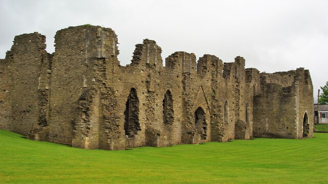
Abaty Nedd, also known as Neath Abbey, is a historical heritage site located in the county of Glamorgan, Wales. Founded in 1130 AD, it was initially established as a Cistercian monastery by Richard de Granville and the Lord of Glamorgan, Sir Richard de Clare. The abbey played a significant role in the religious and cultural life of medieval Wales.

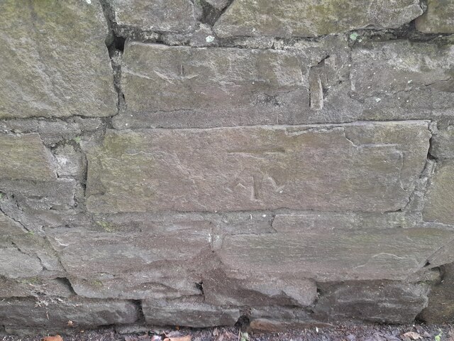
The abbey complex showcases a remarkable combination of architectural styles, reflecting its evolution over the centuries. The original structure was built in the Early Gothic style, with later additions incorporating Decorated and Perpendicular Gothic elements. The ruins that remain today give visitors a sense of the abbey's grandeur and scale.

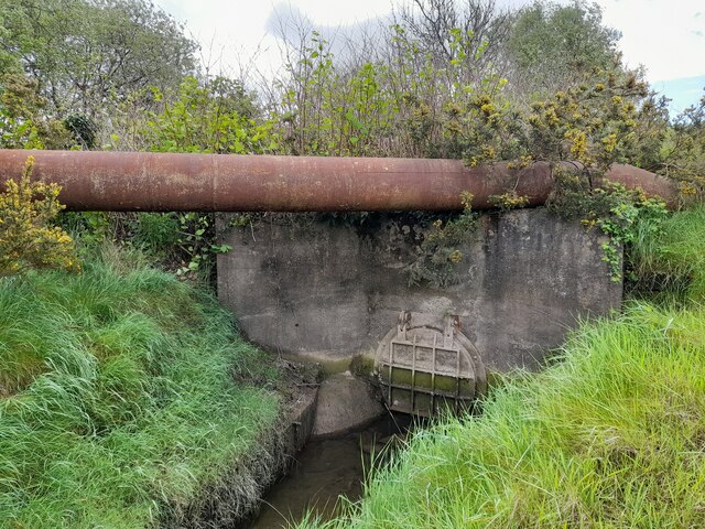
Neath Abbey was well-known for its economic power and agricultural productivity. The monks utilized advanced farming techniques, leading to successful crop yields and the establishment of a prosperous grange system. The abbey also operated a thriving ironworks, which contributed to the local economy and industrial development.

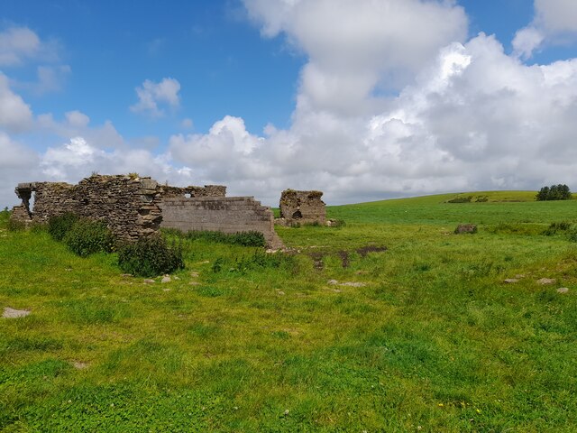
During the Dissolution of the Monasteries in the 16th century, Abaty Nedd fell into ruin. The site was partially dismantled, and the materials were repurposed for other buildings in the area. Today, the remains of the abbey stand as a testament to its former glory, attracting visitors from across the world.

Managed by Cadw, the Welsh government's historic environment service, Abaty Nedd offers a unique opportunity to explore the history, architecture, and religious significance of medieval monastic life. The site features informative displays, guided tours, and a visitor center, providing an immersive experience for history enthusiasts and those interested in Wales' rich cultural heritage.

If you have any feedback on the listing, please let us know in the comments section below.

Abaty Nedd Images

Images are sourced within 2km of 51.6612/-3.826 or Grid Reference SS7397. Thanks to Geograph Open Source API. All images are credited.

River Neath at Neath
Neath Abbey View south along the west range
Neath Abbey
View south along the west range
Tudor Mansion The south-east part of the cloisters became a mansion after the dissolution of Neath Abbey
Tudor Mansion
The south-east part of the cloisters became a mansion after the dissolution of Neath Abbey
McDonald's fast food off the A465 at Pen-yr-Heol
Ordnance Survey Rivet This damaged OS rivet can be found on the flat rock at the track junction. It marked a point 228.628m above mean sea level.
Ordnance Survey Rivet
This damaged OS rivet can be found on the flat rock at the track junction. It marked a point 228.628m above mean sea level.
Ordnance Survey Cut Mark This OS cut mark can be found on the gatepost NE side of the rack. It marks a point 111.944m above mean sea level.
Ordnance Survey Cut Mark
This OS cut mark can be found on the gatepost NE side of the rack. It marks a point 111.944m above mean sea level.
Ordnance Survey Cut Mark This OS cut mark can be found on the concrete retaining wall north side of Drumau Road. It marks a point 101.675m above mean sea level.
Ordnance Survey Cut Mark
This OS cut mark can be found on the concrete retaining wall north side of Drumau Road. It marks a point 101.675m above mean sea level.
Ordnance Survey Cut Mark This OS cut mark can be found on the wall south side of Drumau Road. It marks a point 105.153m above mean sea level.
Ordnance Survey Cut Mark
This OS cut mark can be found on the wall south side of Drumau Road. It marks a point 105.153m above mean sea level.
Pen-lan Farm Building (Ruin)
Ordnance Survey Rivet This OS rivet can be found on the wall at the junction of Herbert Road. It marks a point 34.574m above mean sea level.
Ordnance Survey Rivet
This OS rivet can be found on the wall at the junction of Herbert Road. It marks a point 34.574m above mean sea level.
Clock Tower of St David's Church (1869), Neath View from Victoria Gardens with the Howel Gwyn statue in the foreground.
Clock Tower of St David's Church (1869), Neath
View from Victoria Gardens with the Howel Gwyn statue in the foreground.
Victoria Gardens, Neath
Wetland area beside River Neath
Neath railway station, Station Square
Culvert
Culvert
Gateway to Overgrown Culvert
Ordnance Survey Cut Mark This OS cut mark can be found on the supporting wall of the railway bridge. It marks a point 6.770m above mean sea level.
Ordnance Survey Cut Mark
This OS cut mark can be found on the supporting wall of the railway bridge. It marks a point 6.770m above mean sea level.
Show me another place!

Abaty Nedd is located at Grid Ref: SS7397 (Lat: 51.6612, Lng: -3.826)

Unitary Authority: Neath Port Talbot

Police Authority: South Wales

Also known as: Neath Abbey

What 3 Words

///divisions.woods.city. Near Neath, Neath Port Talbot

Related Wikis

Neath Abbey

Neath Abbey (Welsh: Abaty Nedd) was a Cistercian monastery, located near the present-day town of Neath in South Wales, UK. It was once the largest abbey...

A4230 road

The A4230 is a suburban main road in south Wales. The A4230 is a single carriageway road for its whole length. It begins at the Peniel Green roundabout...

Neath Abbey railway station

Neath Abbey railway station served the town of Neath, in the historical county of Glamorganshire, Wales, from 1863 to 1936 on the Vale of Neath Railway...

Nation Radio Wales

Nation Radio Wales is a regional radio station, broadcasting to south and west Wales on FM and across Wales on DAB. It is owned and operated by Nation...

Cwrt Herbert

Cwrt Herbert, also sometimes called Court Herbert, is a small community to the east of Neath Abbey in south Wales It developed as a mining village servicing...

Neath Abbey television relay station

The Neath Abbey television relay station is sited on a hill north of the town of Neath. It was originally built in the 1980s as a fill-in relay for UHF...

Nidum

Nidum (or NIDVM) is a Roman fort found in Cwrt Herbert near the town of Neath, in Wales. An Auxiliary fort first built in around 74AD from earth banks...

Skewen

Skewen (Welsh: Sgiwen) is a village within the county borough of Neath Port Talbot, in Wales. The village is served by Skewen railway station and has...

Related Videos

Walking & Wild Outdoor Lake Swimming | Llyn Fach & Llyn Fawr | Neath

After a 2 month break, I finally got back into the water! Those breathing exercises were well and truly needed as it was bloody ...

Filipina life in Wales UK (Walking at winter time)

Hi guys welcome back to my channel, this vedio guys ng lalakad po ako nito gusto ko lng ipakita sa inyo kung anu ren ang na ...

Nearby Amenities

Located within 500m of 51.6612,-3.826
Fuel
Tesco
Brand: Tesco
Brand Wikidata: Q487494
Name Cy: Tesco
Operator: Tesco
Lat/Long: 51.6625845/-3.8219499
Motorway Junction
Neath Abbey
Lat/Long: 51.6592354/-3.8218872
Mini Roundabout
Direction: clockwise
Lat/Long: 51.6627212/-3.8224458
Mini Roundabout
Direction: clockwise
Lat/Long: 51.6630736/-3.8265024
Mini Roundabout
Direction: clockwise
Lat/Long: 51.6641379/-3.8264462
Mini Roundabout
Direction: clockwise
Lat/Long: 51.6630913/-3.8262471
Neath Abbey
Name Cy: Abaty Nedd
Name En: Neath Abbey
Place: village
Lat/Long: 51.6625571/-3.8289019
Traffic Signals
Traffic Signals: crossing
Lat/Long: 51.6628218/-3.8217446
Turning Loop
Lat/Long: 51.6637352/-3.8240674
Barrier: bollard
Lat/Long: 51.6627004/-3.831926
Neath Abbey
Abandoned Railway: station
Railway: site
Lat/Long: 51.6603537/-3.8323447
Direction: 170
Generator Method: photovoltaic
Generator Output Electricity: yes
Generator Solar Modules: 16
Generator Source: solar
Generator Type: solar_photovoltaic_panel
Location: roof
Power: generator
Lat/Long: 51.6597386/-3.8299343
Direction: 125
Generator Method: photovoltaic
Generator Output Electricity: yes
Generator Solar Modules: 8
Generator Source: solar
Generator Type: solar_photovoltaic_panel
Location: roof
Power: generator
Lat/Long: 51.6644067/-3.8230803
Direction: 125
Generator Method: photovoltaic
Generator Output Electricity: yes
Generator Solar Modules: 8
Generator Source: solar
Generator Type: solar_photovoltaic_panel
Location: roof
Power: generator
Lat/Long: 51.6644629/-3.8230139
Direction: SSE
Generator Method: photovoltaic
Generator Output Electricity: yes
Generator Solar Modules: 16
Generator Source: solar
Generator Type: solar_photovoltaic_panel
Location: roof
Power: generator
Lat/Long: 51.6635587/-3.8242427
Direction: 255
Generator Method: photovoltaic
Generator Output Electricity: yes
Generator Solar Modules: 16
Generator Source: solar
Generator Type: solar_photovoltaic_panel
Location: roof
Power: generator
Lat/Long: 51.6646143/-3.8290465
Traffic Signals
Traffic Signals: crossing
Lat/Long: 51.6629217/-3.8218835
Bus Stop
Bus: yes
Public Transport: platform
Shelter: yes
Lat/Long: 51.6628771/-3.8221826
Crossing
Button Operated: yes
Crossing: traffic_signals
Crossing Island: no
Crossing Markings: dots
Crossing Ref: pelican
Tactile Paving: yes
Lat/Long: 51.6628407/-3.8218169
Crossing
Button Operated: yes
Crossing: traffic_signals
Crossing Island: no
Crossing Markings: dots
Crossing Ref: pelican
Tactile Paving: yes
Lat/Long: 51.6629113/-3.8218416
Bus Stop
Bus: yes
Public Transport: platform
Shelter: yes
Lat/Long: 51.6630612/-3.8223191
The data included in this document is from www.openstreetmap.org. The data is made available under ODbL.

Have you been to Abaty Nedd?

Leave your review of Abaty Nedd below (or comments, questions and feedback).