Nantgwynant

Settlement in Caernarfonshire

Wales

Nantgwynant

Moorland and hillocks, near Llyn Dinas
Moorland and hillocks, near Llyn Dinas Credit: Eirian Evans

Nantgwynant is a small village located in the county of Caernarfonshire, in North Wales. Situated in the heart of Snowdonia National Park, it is renowned for its breathtaking natural beauty and is a popular destination for outdoor enthusiasts and nature lovers.

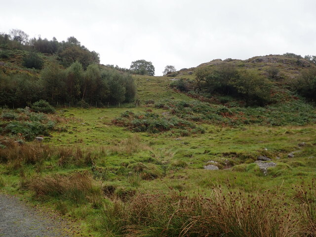
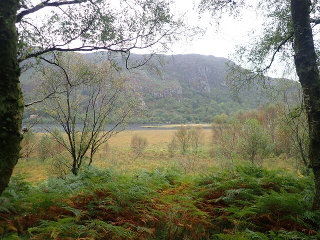
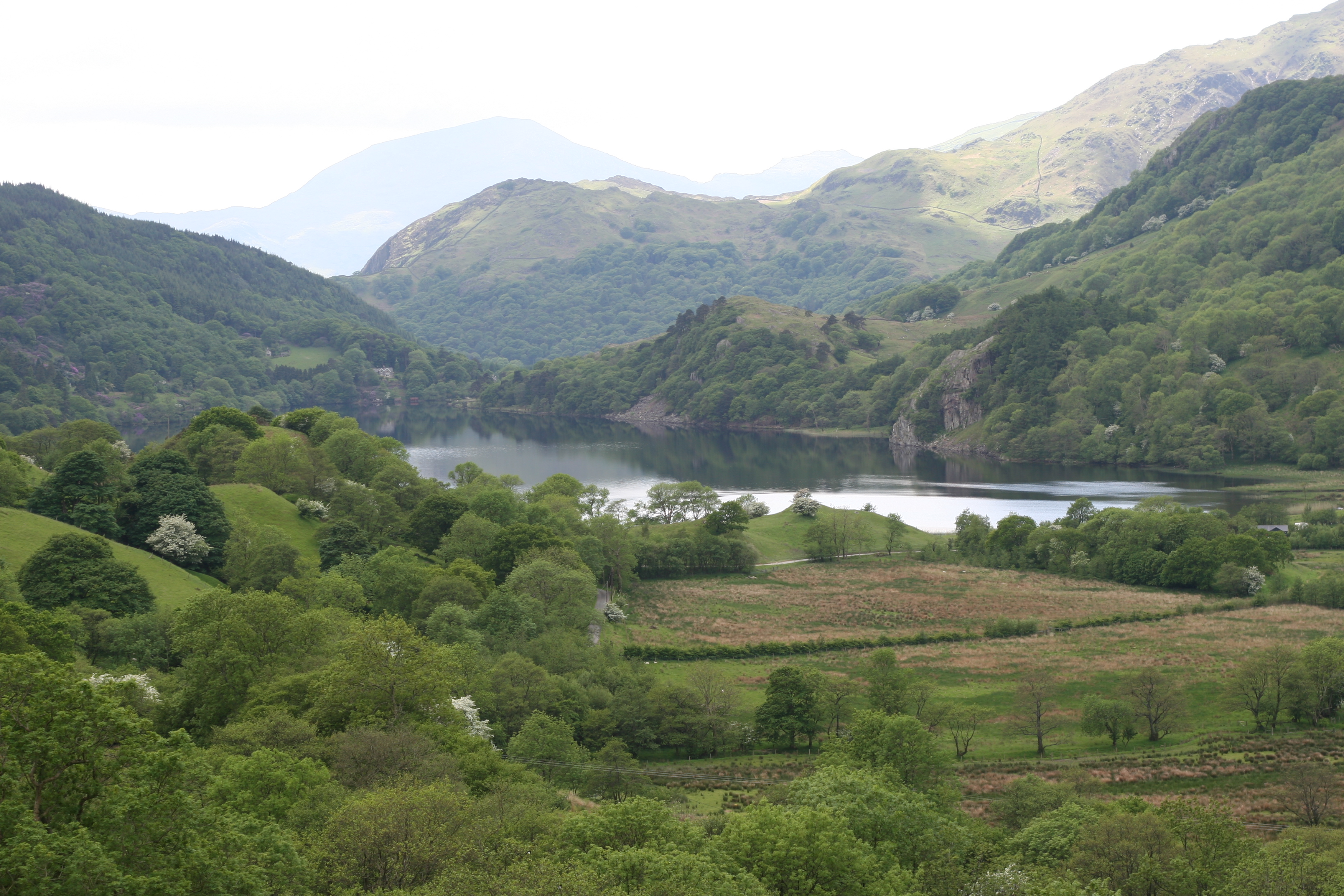
Surrounded by picturesque mountains, Nantgwynant is nestled between the iconic peaks of Snowdon and Moel Hebog. The village is blessed with stunning landscapes, including the tranquil Llyn Gwynant, a glacial lake that adds to the area's allure. The lake is a haven for water activities such as fishing and kayaking, attracting visitors from far and wide.

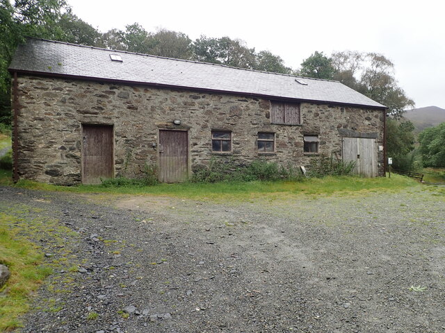
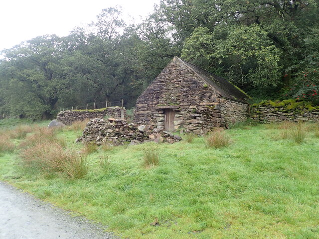
The village itself is a charming and peaceful place, with a small but friendly community. It boasts a few traditional cottages and houses, adding to its quaint appeal. While there are no major amenities in Nantgwynant, the nearby town of Beddgelert offers a range of facilities, including shops, restaurants, and accommodation options.

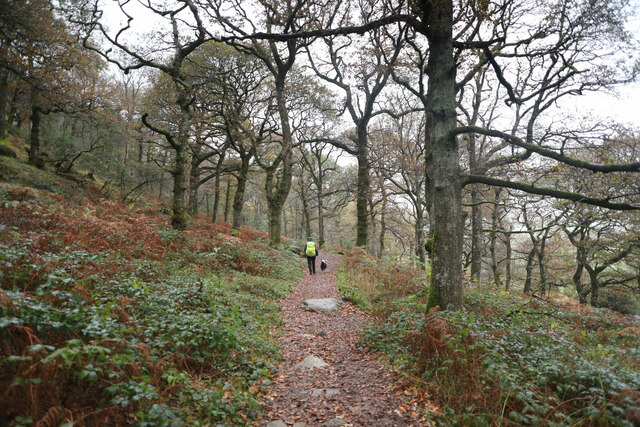
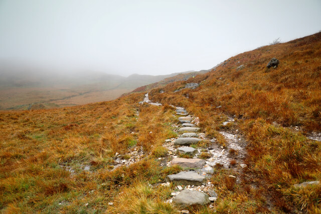
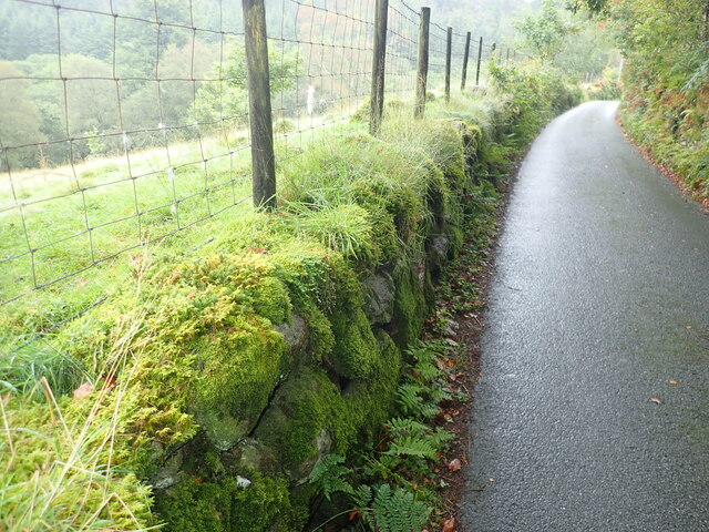
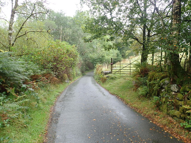
Nantgwynant is a paradise for hikers, with numerous trails leading through the enchanting Welsh countryside. The popular Watkin Path, one of the six main routes to the summit of Mount Snowdon, begins in Nantgwynant and provides breathtaking views along the way. Other nearby attractions include the Aberglaslyn Pass, renowned for its dramatic scenery and wildlife.

Whether it's mountain climbing, hiking, or simply immersing oneself in the tranquility of nature, Nantgwynant offers a serene and idyllic escape from the hustle and bustle of everyday life. Its stunning landscapes and proximity to Snowdonia National Park make it a must-visit destination for anyone seeking to explore the natural wonders of North Wales.

If you have any feedback on the listing, please let us know in the comments section below.
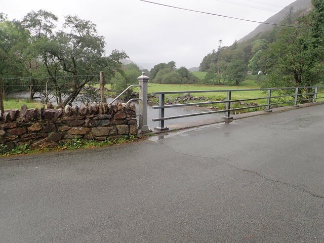
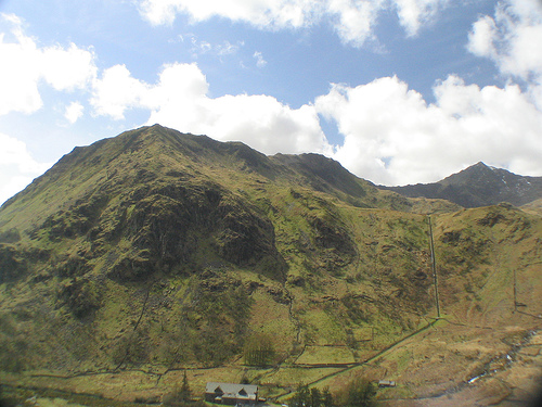
Nantgwynant Images

Images are sourced within 2km of 53.040571/-4.0395586 or Grid Reference SH6351. Thanks to Geograph Open Source API. All images are credited.

Moorland and hillocks, near Llyn Dinas
Barn at Llyndy Isaf
Barn at Llyndy Isaf
Slate slab bridge on Afon Cwm Llan This bridge was built by miners to provide a short cut to the copper mines on slopes of Lliwedd.
Slate slab bridge on Afon Cwm Llan
This bridge was built by miners to provide a short cut to the copper mines on slopes of Lliwedd.
Waterfall on Afon Cwm Llan Afon Cwm Llan is a spate river.
Waterfall on Afon Cwm Llan
Afon Cwm Llan is a spate river.
Rhaeadr Cwm Llan waterfall
Cwm Llan waterfall in full spate
Ruined copper mine buildings near Plas Cwm Llan
The start of the Watkin path in Parc Hafod-y-llan From the road by the confluence of the Afon Llynedno with the Afon Glaslyn, the Watkin path is one of the classic routes up Snowdon. With cloudbase barely above the treetops, that's not an ideal destination for a day like this, but the track also gives access to various lower-level rooutes and industrial remains, so was far from deserted. The woodland is moderately natural, no plantation conifers, but plenty of invasive weed sycamore which no-one seems to be seeking to exterminate.
The start of the Watkin path in Parc Hafod-y-llan
From the road by the confluence of the Afon Llynedno with the Afon Glaslyn, the Watkin path is one of the classic routes up Snowdon. With cloudbase barely above the treetops, that's not an ideal destination for a day like this, but the track also gives access to various lower-level rooutes and industrial remains, so was far from deserted. The woodland is moderately natural, no plantation conifers, but plenty of invasive weed sycamore which no-one seems to be seeking to exterminate.
Hawthorns by the route to Cwm Llan Hawthorns stand out against the low contrast background of Cwm Llan in low cloud on a dreich November day. The Watkin path heads up there past the Afon Cwm Llan waterfalls, and straight into the clouds that are starting to bring the level up. The weather might mean a less crowded ascent to Snowdon, but the views would hardly be the most rewarding, so this was a lower-level walk aiming to stay below cloudbase and return to Llyn Dinas via a permissive path to Craflwyn.
Hawthorns by the route to Cwm Llan
Hawthorns stand out against the low contrast background of Cwm Llan in low cloud on a dreich November day. The Watkin path heads up there past the Afon Cwm Llan waterfalls, and straight into the clouds that are starting to bring the level up. The weather might mean a less crowded ascent to Snowdon, but the views would hardly be the most rewarding, so this was a lower-level walk aiming to stay below cloudbase and return to Llyn Dinas via a permissive path to Craflwyn.
Permissive path to Cwm y Bleiddiaid mines Leaving the Watkin path up Snowdon just below the point where it crosses an old mineral working incline, this path makes its way across bleak and soggy hillside above the Afon Gorsen via a (long) series of well-placed stepping stones through the most vulnerable bits of wetland. It eventually reaches a more substantial path in Cwm y Bleiddiaid, where there are more old mine workings, and then a choice of two routes down to Craflwyn, but no direct descent to the road near Llyn Dinas.
Permissive path to Cwm y Bleiddiaid mines
Leaving the Watkin path up Snowdon just below the point where it crosses an old mineral working incline, this path makes its way across bleak and soggy hillside above the Afon Gorsen via a (long) series of well-placed stepping stones through the most vulnerable bits of wetland. It eventually reaches a more substantial path in Cwm y Bleiddiaid, where there are more old mine workings, and then a choice of two routes down to Craflwyn, but no direct descent to the road near Llyn Dinas.
View across Llyn Dinas Towards the cliffs of Craig y Llyn on the southern slopes of Snowdon
View across Llyn Dinas
Towards the cliffs of Craig y Llyn on the southern slopes of Snowdon
Old stone farm building near Llyndy Isaf Still in pretty good condition, with a sound roof
Old stone farm building near Llyndy Isaf
Still in pretty good condition, with a sound roof
Minor road heading up from Bethania, at the northern end of Llyn Dinas Moss-covered dry stone wall on the left
Minor road heading up from Bethania, at the northern end of Llyn Dinas
Moss-covered dry stone wall on the left
Minor road near Hafod Tan-y-Graig
Bridge over the River Glaslyn at Bethania
Afon Glaslyn Looking upstream from the road bridge at Bethania
Afon Glaslyn
Looking upstream from the road bridge at Bethania
Bryn Dinas Camping Pods Four neat little pods just north of Llyn Dinas
Bryn Dinas Camping Pods
Four neat little pods just north of Llyn Dinas
Glan Dinas A handsome house at the northern end of Llyn Dinas
Glan Dinas
A handsome house at the northern end of Llyn Dinas
Show me another place!

Nantgwynant is located at Grid Ref: SH6351 (Lat: 53.040571, Lng: -4.0395586)

Unitary Authority: Gwynedd

Police Authority: North Wales

What 3 Words

///lizards.storeroom.dissolve. Near Blaenau-Ffestiniog, Gwynedd

Related Wikis

Nant Gwynant

Nant Gwynant (also spelt Nantgwynant) is a valley in northern Wales. The A498 road descends 600 feet (180 m) into the valley in about two miles (3 km)...

Plas Gwynant

Plas Gwynant is an educational resort in Snowdonia, Wales. This country estate also includes a woodland and riverside walks, as well as a parkland and...

Llyn Gwynant

Llyn Gwynant is a lake in Snowdonia, Wales. Llyn Gwynant lies on the River Glaslyn, in the Nant Gwynant valley, and is about 1ΒΌ miles (2 km) north east...

Lliwedd Bach

Lliwedd Bach is a top of Y Lliwedd in the Snowdonia National Park, North Wales. It is the last "top" on the main ridge of Y Lliwedd, the other being Y...

Gallt y Wenallt

Gallt y Wenallt is a subsidiary summit of Y Lliwedd in Snowdonia National Park, north Wales. It lies at the end of the north ridge. Its northern face is...

Y Lliwedd East Peak

Y Lliwedd East Peak is the twin top of Y Lliwedd in the Snowdonia National Park, North Wales. It is only 5 metres shorter than the main summit of Y Lliwedd...
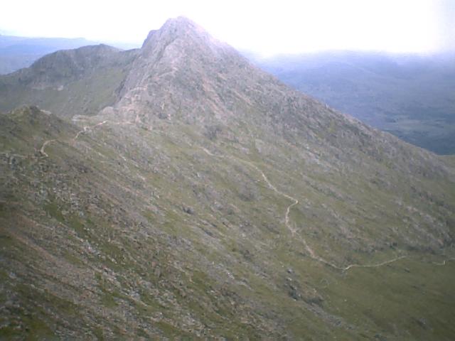
Y Lliwedd

Y Lliwedd is a mountain, connected to Snowdon in the Snowdonia National Park, North Wales. Its summit lies 898 metres (2,946 ft) above sea level. The eastern...

Yr Aran

Yr Aran is a mountain peak on a ridge radiating south from Snowdon, Wales' highest mountain, with beautiful views of the summit of Snowdon, Moel Hebog...

Related Videos

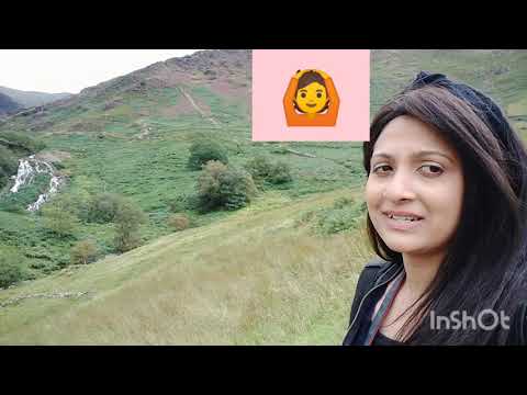
Holiday To North wales Day 2. Trip 2: Watkin path waterfall πŸ€—

In our day 2 of holiday to north Wales... we made to mountain railway to snowden Mountain in morning and later from there we ...
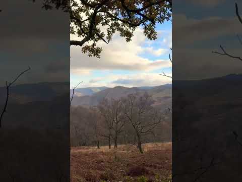
πŸ“Y Lliwedd - A view worth shouting about 😍 #hiking #hikingviews #shortsvideo #snowdonia

Views from Y Lliwedd, part of the Yr Wyddfa Horseshoe. What an amazing hike this was!!

Nearby Amenities

Located within 500m of 53.040571,-4.0395586
Source: npe
Lat/Long: 53.0430741/-4.0341809
Source: npe
Lat/Long: 53.0431583/-4.0371187
Source: npe
Lat/Long: 53.0421631/-4.0373309
Source: npe
Lat/Long: 53.0417127/-4.039676
Source: npe
Lat/Long: 53.0405066/-4.040707
Source: npe
Lat/Long: 53.0400083/-4.0415026
Source: npe
Lat/Long: 53.0386429/-4.0455796
Barrier: cattle_grid
Source: survey;gps
Lat/Long: 53.0429978/-4.0377136
Barrier: entrance
Lat/Long: 53.0433701/-4.0383168
Ford: yes
Lat/Long: 53.041931/-4.045826
Nantgwynant
Place: hamlet
Source: OS_OpenData_StreetView
Lat/Long: 53.0402347/-4.0432231
Coederyr
Ele: 244
Natural: peak
Source: OS 1:25k
Lat/Long: 53.0378719/-4.0355717
Charging Station
Hafod Y Llan Farm, National Trust Campsite
Operator: Zero Carbon World
Socket Bs1363: 1
Socket Type2: 1
Lat/Long: 53.0415316/-4.0464511
Barrier: stile
Lat/Long: 53.0430012/-4.0377179
Toilets
Access: customers
Fee: no
Lat/Long: 53.0415886/-4.0465222
Shower
Access: customers
Fee: no
Lat/Long: 53.0415806/-4.0465627
Campsite: reception
Note: self check-in
Lat/Long: 53.0415922/-4.0464348
Hiking: yes
Information: guidepost
Source: GPS survey
Tourism: information
Lat/Long: 53.0429256/-4.0384385
Barrier: stile
Stile: ladder
Lat/Long: 53.04298/-4.0376918
Power: pole
Lat/Long: 53.0440303/-4.0360513
Hiking: yes
Information: guidepost
Source: GPS survey
Tourism: information
Lat/Long: 53.0421081/-4.0402839
Line Management: transition
Location Transition: yes
Power: pole
Lat/Long: 53.0420508/-4.0465582
Recycling
Recycling Waste: yes
Recycling Type: container
Lat/Long: 53.0417251/-4.0464154
Drinking Water
Lat/Long: 53.0416001/-4.0464922
Note: this position is approximate
Power: pole
Lat/Long: 53.0413102/-4.0469197
The data included in this document is from www.openstreetmap.org. The data is made available under ODbL.

Have you been to Nantgwynant?

Leave your review of Nantgwynant below (or comments, questions and feedback).