Nantgarw

Settlement in Glamorgan

Wales

Nantgarw

Construction of the new Metro depot at Taffs Well The ground is clear and construction work on the new Taffs Well Metro depot for Transport for Wales is underway; this building has been erected at the northern end of the site.
Construction of the new Metro depot at Taffs Well Credit: Gareth James

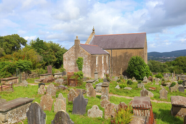
Nantgarw is a village located in the county of Glamorgan, Wales. It is situated along the River Taff and is known for its picturesque surroundings and historic charm. The village is home to a number of notable landmarks, including the Nantgarw Pottery, which was established in the early 19th century and is now a popular tourist attraction.

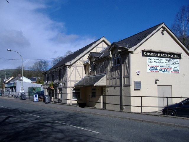
Nantgarw is also known for its rich industrial heritage, with a history of coal mining and ironworks dating back to the 18th century. The village has a small but vibrant community, with a range of amenities including shops, pubs, and restaurants.

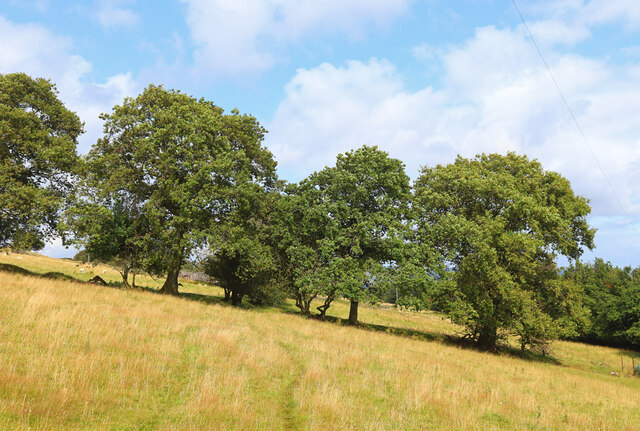
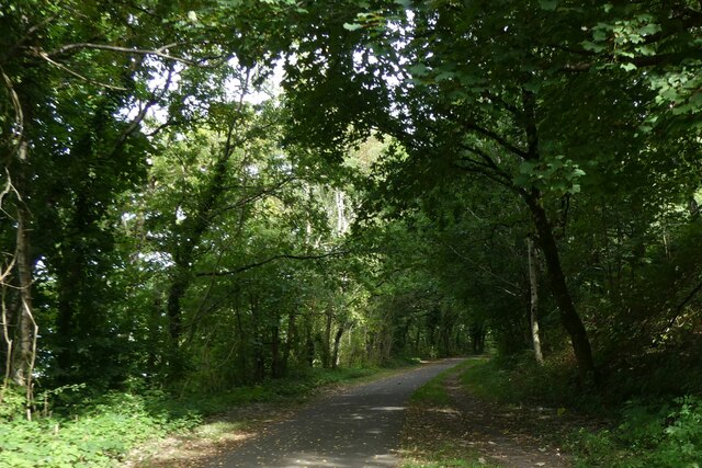
The surrounding countryside offers plenty of opportunities for outdoor activities such as hiking, cycling, and fishing. The nearby Taff Trail provides a scenic route for walkers and cyclists to explore the area.

Overall, Nantgarw is a charming village with a rich history and beautiful natural surroundings. It offers a peaceful and idyllic setting for residents and visitors alike to enjoy.

If you have any feedback on the listing, please let us know in the comments section below.

Nantgarw Images

Images are sourced within 2km of 51.559955/-3.267118 or Grid Reference ST1285. Thanks to Geograph Open Source API. All images are credited.

Construction of the new Metro depot at Taffs Well The ground is clear and construction work on the new Taffs Well Metro depot for Transport for Wales is underway; this building has been erected at the northern end of the site.
Construction of the new Metro depot at Taffs Well
The ground is clear and construction work on the new Taffs Well Metro depot for Transport for Wales is underway; this building has been erected at the northern end of the site.
Groeswen Chapel Cemetery and former chapel at Groeswen.
Groeswen Chapel
Cemetery and former chapel at Groeswen.
Rhymney Valley Ridgeway Footpath near Groeswen.
Rhymney Valley Ridgeway
Footpath near Groeswen.
Abandoned Building On the Rhymney Valley Ridgeway.
Abandoned Building
On the Rhymney Valley Ridgeway.
Road to Rockwood Riding Centre
Y Groes Wen Chapel First built in 1742, possibly to the designs of William Edwards who built Libanus in Morriston in 1782 (NPRN 13492), Groeswen Independent Chapel was the first meeting place in Wales of the Calvinistic Methodists. The chapel was enlarged/rebuilt in 1766, enlarged further in 1830 to the design of architect William Lewis and the burial ground extended in 1865. The present chapel is built in the Sub-Classical style with two storeys, a gable-entry plan and a large arch in the facade. Groeswen is now Grade 2 Listed for its historical association with a number of religious leaders and their burial in the graveyard.
Y Groes Wen Chapel
First built in 1742, possibly to the designs of William Edwards who built Libanus in Morriston in 1782 (NPRN 13492), Groeswen Independent Chapel was the first meeting place in Wales of the Calvinistic Methodists. The chapel was enlarged/rebuilt in 1766, enlarged further in 1830 to the design of architect William Lewis and the burial ground extended in 1865. The present chapel is built in the Sub-Classical style with two storeys, a gable-entry plan and a large arch in the facade. Groeswen is now Grade 2 Listed for its historical association with a number of religious leaders and their burial in the graveyard.
Cemetery at Y Groes Wen See also <a href="https://www.geograph.org.uk/photo/7202834">ST1287 : Y Groes Wen Chapel</a>.
Cemetery at Y Groes Wen
Cemetery at Y Groes Wen See also <a href="https://www.geograph.org.uk/photo/7202834">ST1287 : Y Groes Wen Chapel</a>.
Cemetery at Y Groes Wen
Terraced houses at Groeswen
Main Road, Gwaelod-y-Garth Main Road in Gwaelod-y-Garth near to Cardiff.
Main Road, Gwaelod-y-Garth
Main Road in Gwaelod-y-Garth near to Cardiff.
River Taff from Gwaelod-y-Garth Footbridge
Valley Lines electrification work in progress north of Taffs Well Work is underway to wire the line, as viewed from Fforest Fawr.
Valley Lines electrification work in progress north of Taffs Well
Work is underway to wire the line, as viewed from Fforest Fawr.
Valley Lines electrification work in progress north of Taffs Well Work is underway to wire the line, as viewed from Fforest Fawr.
Valley Lines electrification work in progress north of Taffs Well
Work is underway to wire the line, as viewed from Fforest Fawr.
Valley Lines electrification work in progress north of Taffs Well Work is underway to wire the line, as viewed from Fforest Fawr.
Valley Lines electrification work in progress north of Taffs Well
Work is underway to wire the line, as viewed from Fforest Fawr.
Timber Yard, off Taff Trail
Bridge over temporary section of Taff Trail At the time of the picture, the Taff Trail had been diverted for construction of a light railway, so the real trail is on the bridge above
Bridge over temporary section of Taff Trail
At the time of the picture, the Taff Trail had been diverted for construction of a light railway, so the real trail is on the bridge above
Taff Trail in Glan-y-llyn woodland
Taff Trail west of Craig yr Allt The ridge of Craig yr Allt means that the Taff Trail and two roads are squeezed into about 200m of woods between hill and river; the woods keep the noise of the roads away from cyclists
Taff Trail west of Craig yr Allt
The ridge of Craig yr Allt means that the Taff Trail and two roads are squeezed into about 200m of woods between hill and river; the woods keep the noise of the roads away from cyclists
Show me another place!

Nantgarw is located at Grid Ref: ST1285 (Lat: 51.559955, Lng: -3.267118)

Unitary Authority: Rhondda Cynon Taf

Police Authority: South Wales

What 3 Words

///keeps.rushed.knots. Near Pentyrch, Cardiff

Related Wikis

Nantgarw (High Level) Halt railway station

Nantgarw (High Level) Halt railway station was a halt on the disused Pontypridd, Caerphilly & Newport Railway. == History and description == The halt opened...

Nantgarw

Nantgarw is a village in the county borough of Rhondda Cynon Taf, Wales, near Cardiff. From an electoral and administrative perspective Nantgarw falls...

Nantgarw (Low Level) Halt railway station

Nantgarw (Low Level) Halt railway station was a halt on the now-disused Cardiff Railway. == History == The halt opened along with the line in 1911. It...

Nantgarw Colliery

Nantgarw Colliery was a coal mine and later developed Coking coal works, located in the village on Nantgarw, Mid Glamorgan, Wales located just north of...

Nearby Amenities

Located within 500m of 51.559955,-3.267118
Motorway Junction
Nantgarw Interchange
Lat/Long: 51.5574686/-3.2694663
Access: yes
Barrier: cattle_grid
Foot: no
Lat/Long: 51.5590617/-3.2685986
Nantgarw
Is In: South Glamorgan
Place: village
Wikidata: Q13130355
Lat/Long: 51.5620667/-3.2637425
Traffic Signals
Lat/Long: 51.562473/-3.2619711
Traffic Signals
Lat/Long: 51.5623816/-3.262033
Traffic Signals
Lat/Long: 51.5624155/-3.261654
Barrier: cycle_barrier
Lat/Long: 51.5555327/-3.2682931
nantgarw China Works Museum
Tourism: museum
Wikidata: Q24083482
Lat/Long: 51.5610724/-3.2701374
Motorway Junction
Nantgarw Interchange
Lat/Long: 51.561867/-3.2697755
Crossing
Lat/Long: 51.5610979/-3.2723306
Bus Stop
Cross Keys Inn
Bench: yes
Bin: no
Bus: yes
Mapillary: 2553494638291137
Naptan AtcoCode: 5520AWA11164
Naptan NaptanCode: rhogajw
Public Transport: platform
Shelter: yes
Survey Date: 2021-04-23
Lat/Long: 51.5602225/-3.2720181
Bus Stop
Cross Keys Inn
Bus: yes
Naptan AtcoCode: 5520AWA11165
Naptan NaptanCode: rhogama
Public Transport: platform
Lat/Long: 51.5592954/-3.2715567
Bus Stop
Cross Keys Inn
Bus: yes
Public Transport: platform
Lat/Long: 51.5605931/-3.2716224
Bus Stop
Cross Keys Inn
Bus: yes
Public Transport: platform
Lat/Long: 51.5607019/-3.2713904
Crossing
Lat/Long: 51.5613728/-3.2636322
Crossing
Lat/Long: 51.5611846/-3.2636958
Crossing
Crossing: unmarked
Lat/Long: 51.5593078/-3.2694029
Crossing
Crossing: unmarked
Lat/Long: 51.559092/-3.2685979
Communication Television: yes
Description: Taffs Well
Height: 35
Man Made: mast
Tower Construction: lattice_steel
Tower Type: communication
Lat/Long: 51.555662/-3.2650648
Power: transformer
Lat/Long: 51.5630697/-3.2694881
Power: transformer
Lat/Long: 51.5632923/-3.2695203
Power: tower
Lat/Long: 51.5632773/-3.2692051
Cafe
Lat/Long: 51.5607636/-3.2721038
Direction: 275
Generator Method: photovoltaic
Generator Output Electricity: yes
Generator Solar Modules: 16
Generator Source: solar
Generator Type: solar_photovoltaic_panel
Location: roof
Power: generator
Lat/Long: 51.5615713/-3.2709358
Direction: WSW
Generator Method: photovoltaic
Generator Output Electricity: yes
Generator Solar Modules: 10
Generator Source: solar
Generator Type: solar_photovoltaic_panel
Location: roof
Power: generator
Lat/Long: 51.5625968/-3.2674516
Direction: ENE
Generator Method: photovoltaic
Generator Output Electricity: yes
Generator Solar Modules: 6
Generator Source: solar
Generator Type: solar_photovoltaic_panel
Location: roof
Power: generator
Lat/Long: 51.5626074/-3.2673916
Power: pole
Lat/Long: 51.559906/-3.2600878
Post Box
Mapillary: 958968171519078
Operator: Royal Mail
Operator Wikidata: Q638098
Post Box Mounting: pier
Post Box Type: lamp
Royal Cypher: EIIR
Lat/Long: 51.5601886/-3.2719554
The data included in this document is from www.openstreetmap.org. The data is made available under ODbL.

Have you been to Nantgarw?

Leave your review of Nantgarw below (or comments, questions and feedback).