Nantgaredig

Settlement in Carmarthenshire

Wales

Nantgaredig

Holy Trinity Church near Pontargothi On the north side of the quiet Cothi valley, over a kilometre upstream from the village of Pontargothi along narrow back roads, lies this church in quite spacious grounds.
Holy Trinity Church near Pontargothi Credit: Nigel Davies

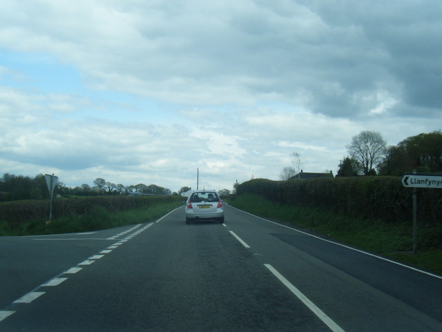
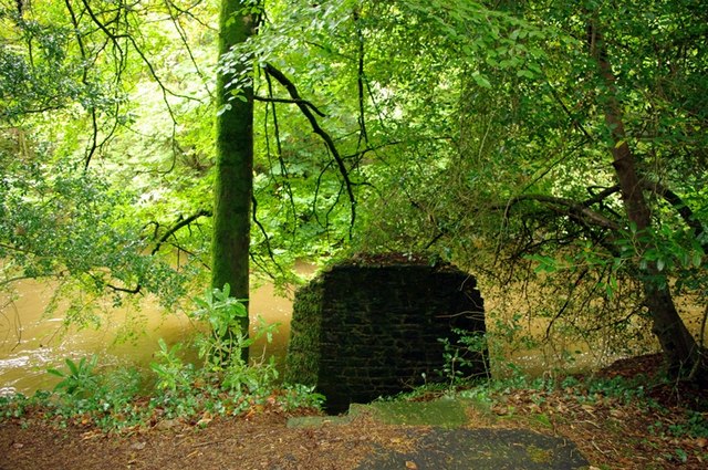
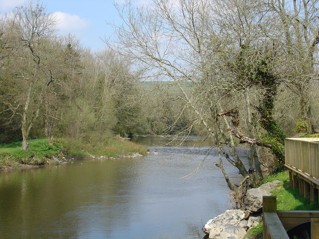
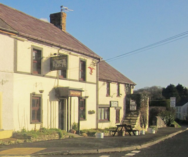
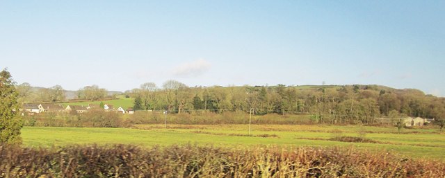
Nantgaredig is a small village located in Carmarthenshire, Wales. It is situated along the River Towy, surrounded by lush green countryside and rolling hills. The village is known for its picturesque setting and peaceful atmosphere, making it a popular destination for those seeking a tranquil retreat.

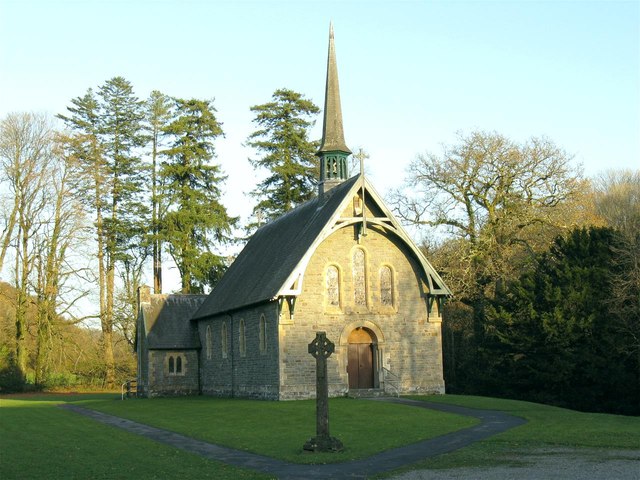
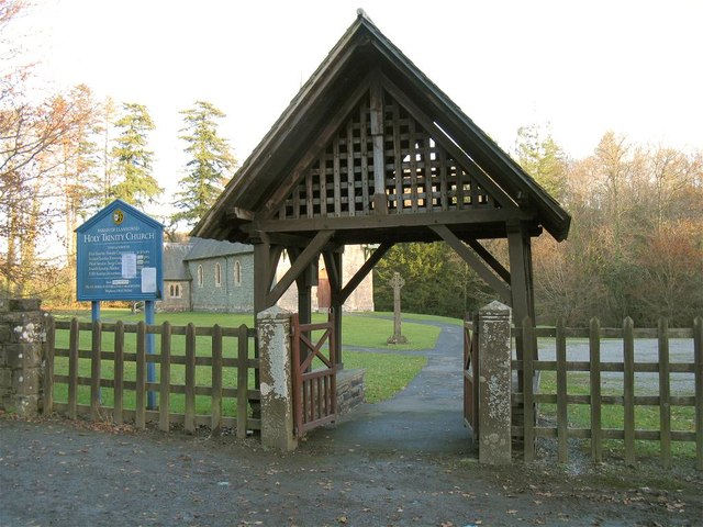
Nantgaredig has a rich history dating back to ancient times, with several historic landmarks and archaeological sites in the area. The village is home to a charming church, St. Caredig's Church, which dates back to the 13th century and is a prominent feature in the local landscape.

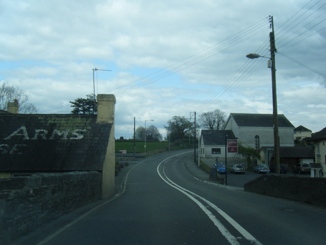
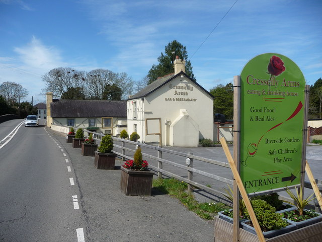
The community in Nantgaredig is close-knit and friendly, with a strong sense of pride in their village. The village is well-served by local amenities, including a primary school, post office, and a few shops and pubs.

Overall, Nantgaredig is a charming and idyllic village, offering a peaceful and scenic setting for residents and visitors alike. Its rich history, beautiful surroundings, and welcoming community make it a delightful place to visit or call home.

If you have any feedback on the listing, please let us know in the comments section below.
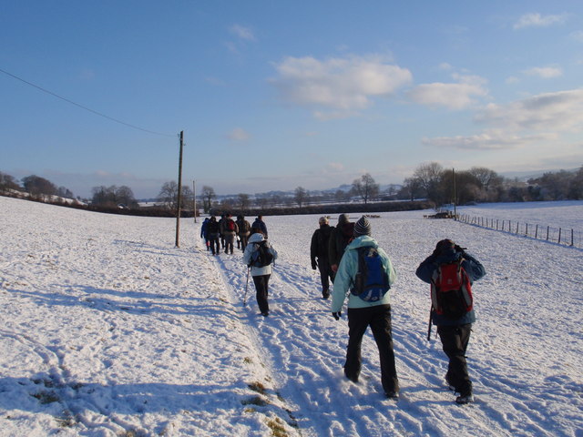
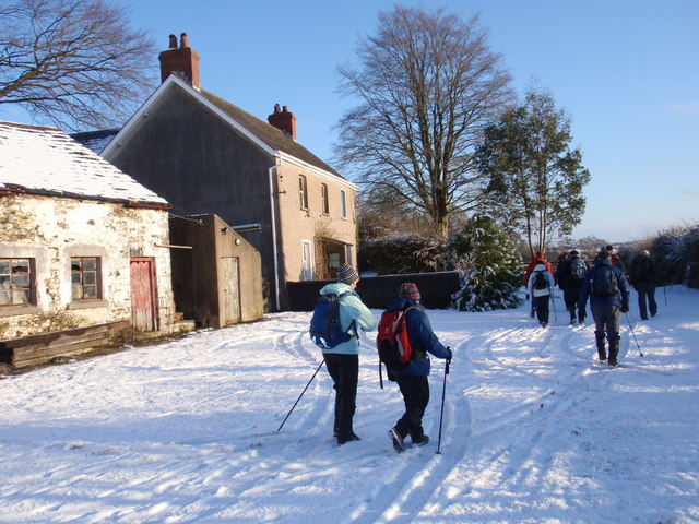
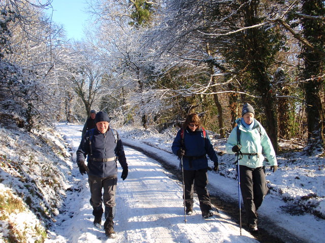
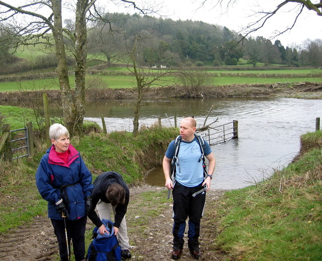
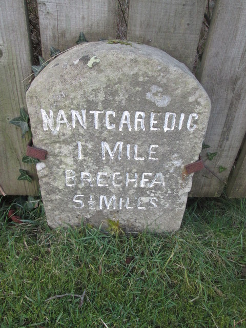
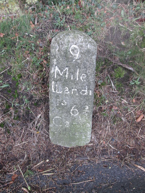
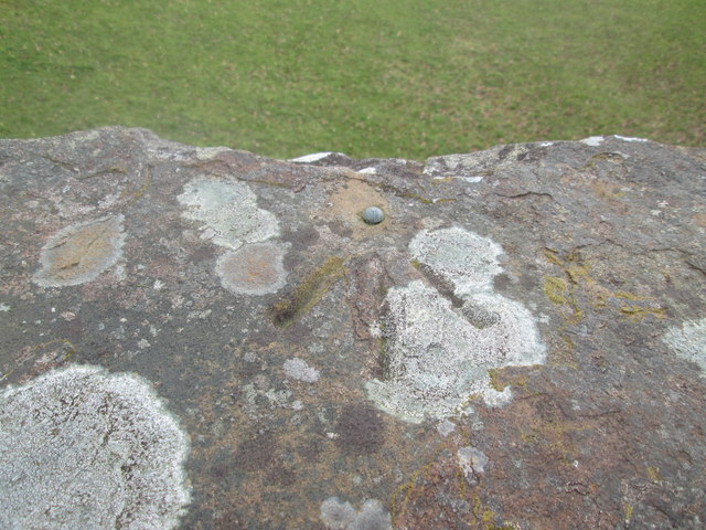
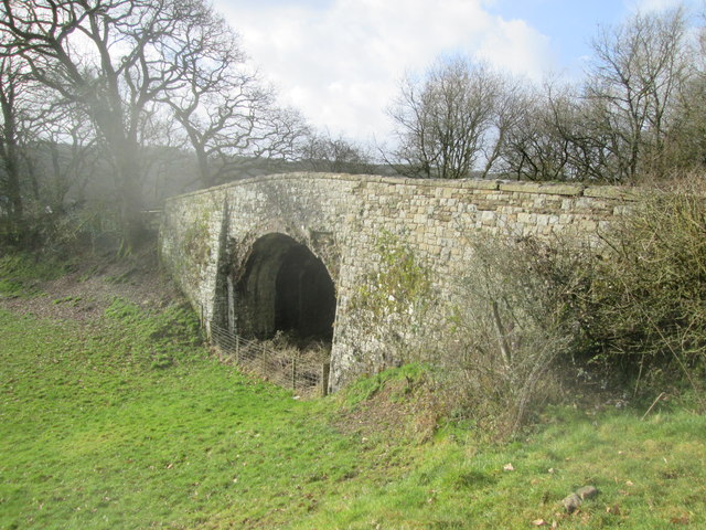
Nantgaredig Images

Images are sourced within 2km of 51.870595/-4.187492 or Grid Reference SN4921. Thanks to Geograph Open Source API. All images are credited.

Holy Trinity Church near Pontargothi On the north side of the quiet Cothi valley, over a kilometre upstream from the village of Pontargothi along narrow back roads, lies this church in quite spacious grounds.
Holy Trinity Church near Pontargothi
On the north side of the quiet Cothi valley, over a kilometre upstream from the village of Pontargothi along narrow back roads, lies this church in quite spacious grounds.
Lychgate, Holy Trinity Church This is the gate at <a href="https://www.geograph.org.uk/photo/2714525">SN5022 : Holy Trinity Church near Pontargothi</a>
Lychgate, Holy Trinity Church
Pont-ar-Gothi, bridge over River Cothi
A40 lane junction east of Pont-ar-Gothi
Another missing Carmarthenshire footbridge This is one of 44 bridges in the county in need of replacement, and another example of the shocking state of public footpaths in Carmarthenshire
Another missing Carmarthenshire footbridge
This is one of 44 bridges in the county in need of replacement, and another example of the shocking state of public footpaths in Carmarthenshire
The Cresselly Arms, Pont-ar-Gothi A well known and long established roadside hostelry.
The Cresselly Arms, Pont-ar-Gothi
A well known and long established roadside hostelry.
Ordnance Survey Flush Bracket (873) This OS Flush Bracket (873) can be found on the south east face of Pont ar Ffinnant. It was used during the Second Geodetic Levelling of England & Wales (1912-21) Carmarthen - Llandovery Levelling Line. Also the Third Geodetic Levelling of England & Wales (1950-68) Llandovery - Carmarthen Levelling Line. It marks a point 63.6340ft above mean sea level.
Ordnance Survey Flush Bracket (873)
This OS Flush Bracket (873) can be found on the south east face of Pont ar Ffinnant. It was used during the Second Geodetic Levelling of England & Wales (1912-21) Carmarthen - Llandovery Levelling Line. Also the Third Geodetic Levelling of England & Wales (1950-68) Llandovery - Carmarthen Levelling Line. It marks a point 63.6340ft above mean sea level.
The River Cothi at Pont-ar-gothi From the garden of the Cresselly Arms.
The River Cothi at Pont-ar-gothi
From the garden of the Cresselly Arms.
Llwybr Llwchgwyn Path Cerddwyr yn dilyn llwybr cyhoeddus tuag at Ffarm Llwchgwyn.

Walkers following a public footpath in the direction of Llwchgwyn Farm (trans. fair lake/ pond?).
Llwybr Llwchgwyn Path
Cerddwyr yn dilyn llwybr cyhoeddus tuag at Ffarm Llwchgwyn. Walkers following a public footpath in the direction of Llwchgwyn Farm (trans. fair lake/ pond?).
Ffarm Llwch Gwyn Farm Cerddwyr yn mynd heibio i Ffarm Llwchgwyn wrth iddynt anelu at bentre Llanegwad.

Walkers passing Llwchgwyn Farm (trans. fair pond / lake?) on route to the village of Llanegwad (St Egwad's Church).
Ffarm Llwch Gwyn Farm
Cerddwyr yn mynd heibio i Ffarm Llwchgwyn wrth iddynt anelu at bentre Llanegwad. Walkers passing Llwchgwyn Farm (trans. fair pond / lake?) on route to the village of Llanegwad (St Egwad's Church).
Heol Alltyferin Road Cerddwyr yn dilyn llwybr cyhoeddus i bentre Pontargothi. Mae'r heol yn arwain at gyn Plasty Allyferin.


Walkers following a public footpath to Pontargothi (trans. bridge on the Cothi river). The way is an access road to the former Alltyferin Mansion.
Heol Alltyferin Road
Cerddwyr yn dilyn llwybr cyhoeddus i bentre Pontargothi. Mae'r heol yn arwain at gyn Plasty Allyferin. Walkers following a public footpath to Pontargothi (trans. bridge on the Cothi river). The way is an access road to the former Alltyferin Mansion.
Llwybr Afon Cothi Path Cerddwyr yn cael seibiant ar lan Afon Cothi. Mae'r ffarmwr yn rhydio'r afon yn y fan hon gan fod tir ganddo ar yr ochr arall. 

Walkers having a rest on the banks on the Cothi River. The farmer fords the river at this location as he owns land on the other side.
Llwybr Afon Cothi Path
Cerddwyr yn cael seibiant ar lan Afon Cothi. Mae'r ffarmwr yn rhydio'r afon yn y fan hon gan fod tir ganddo ar yr ochr arall. Walkers having a rest on the banks on the Cothi River. The farmer fords the river at this location as he owns land on the other side.
Milestone - Nantgaredig 1
Milestone - Llandeilo 9
Ordnance Survey Rivet This OS rivet can be found on the east parapet of the railway bridge. It marks a point 23.302m above mean sea level. <a title="https://www.geograph.org.uk/photo/4369367" href="https://www.geograph.org.uk/photo/4369367">Link</a>
Ordnance Survey Rivet
This OS rivet can be found on the east parapet of the railway bridge. It marks a point 23.302m above mean sea level. Link
Railway Bridge Dismantled railway line. There is an Ordnance Survey rivet on the east parapet of the bridge. <a title="https://www.geograph.org.uk/photo/4369363" href="https://www.geograph.org.uk/photo/4369363">Link</a>
Railway Bridge
Dismantled railway line. There is an Ordnance Survey rivet on the east parapet of the bridge. Link
The Salutation, Pont-ar-Gothi A pub beside the A40.
The Salutation, Pont-ar-Gothi
A pub beside the A40.
Fields east of Pont-ar-Gothi From the A40. The buildings, including the farm at Cilarddu on the right, are in <a href="https://www.geograph.org.uk/gridref/SN5122">SN5122</a>.
Fields east of Pont-ar-Gothi
From the A40. The buildings, including the farm at Cilarddu on the right, are in SN5122.
Show me another place!

Nantgaredig is located at Grid Ref: SN4921 (Lat: 51.870595, Lng: -4.187492)

Unitary Authority: Carmarthenshire

Police Authority: Dyfed Powys

What 3 Words

///napped.races.stirs. Near Llanddarog, Carmarthenshire

Nearby Locations

Nantgaredig

Related Wikis

Nantgaredig

Nantgaredig is a village in Carmarthenshire, Wales. It is about 4 miles (6.4 km) east of the county town of Carmarthen on the A40 in the parish of Llanegwad...

Afon Cothi

The Afon Cothi (also known as the River Cothy) in Carmarthenshire is the largest tributary of the River Tywi in south Wales. From its source at Blaen Cothi...

Nantgaredig railway station

Nantgaredig railway station served to village of Nantgaredig, Carmarthenshire, Wales from 1865 to 1963 on the Llanelly Railway. == History == The station...

Pont-ar-Gothi

Pont-ar-gothi (otherwise Pontargothi or Cothi Bridge) is a village in Carmarthenshire, West Wales. The village takes its name from the bridge where the...

Nearby Amenities

Located within 500m of 51.870595,-4.187492
Stop
Lat/Long: 51.8738387/-4.1896233
Post Box
Collection Times: Mo-Fr 09:00; Sa 07:00
Post Box Type: lamp
Ref: SA32 393D
Royal Cypher: EIIR
Royal Cypher Wikidata: Q33102113
Lat/Long: 51.8740176/-4.1896118
Post Box
Collection Times: Mo-Fr 16:30; Sa 09:00
Post Box Type: lamp
Ref: SA32 588
Royal Cypher: EIIR
Royal Cypher Wikidata: Q33102113
Lat/Long: 51.8708105/-4.1895915
Power: pole
Lat/Long: 51.8678116/-4.192121
Power: pole
Lat/Long: 51.8672071/-4.1917965
Power: pole
Lat/Long: 51.8677901/-4.19229
Power: pole
Lat/Long: 51.8671409/-4.1920218
Direction: W
Generator Method: photovoltaic
Generator Output Electricity: yes
Generator Solar Modules: 6
Generator Source: solar
Generator Type: solar_photovoltaic_panel
Location: roof
Power: generator
Lat/Long: 51.8703491/-4.1904477
Direction: SSE
Generator Method: photovoltaic
Generator Output Electricity: yes
Generator Solar Modules: 16
Generator Source: solar
Generator Type: solar_photovoltaic_panel
Location: roof
Power: generator
Lat/Long: 51.871286/-4.1810693
Direction: SW
Generator Method: photovoltaic
Generator Output Electricity: yes
Generator Solar Modules: 12
Generator Source: solar
Generator Type: solar_photovoltaic_panel
Location: roof
Power: generator
Lat/Long: 51.8682505/-4.190332
Direction: 215
Generator Method: photovoltaic
Generator Output Electricity: yes
Generator Solar Modules: 16
Generator Source: solar
Generator Type: solar_photovoltaic_panel
Location: roof
Power: generator
Lat/Long: 51.8685727/-4.1906418
Direction: S
Generator Method: photovoltaic
Generator Output Electricity: yes
Generator Solar Modules: 10
Generator Source: solar
Generator Type: solar_photovoltaic_panel
Location: roof
Power: generator
Lat/Long: 51.874479/-4.1895139
Direction: S
Generator Method: photovoltaic
Generator Output Electricity: yes
Generator Solar Modules: 16
Generator Source: solar
Generator Type: solar_photovoltaic_panel
Location: roof
Power: generator
Lat/Long: 51.8703787/-4.1903749
Direction: 255
Generator Method: photovoltaic
Generator Output Electricity: yes
Generator Solar Modules: 12
Generator Source: solar
Generator Type: solar_photovoltaic_panel
Location: roof
Power: generator
Lat/Long: 51.8702578/-4.1897895
Direction: 75
Generator Method: photovoltaic
Generator Output Electricity: yes
Generator Solar Modules: 7
Generator Source: solar
Generator Type: solar_photovoltaic_panel
Location: roof
Power: generator
Lat/Long: 51.8695071/-4.1897181
Direction: 255
Generator Method: photovoltaic
Generator Output Electricity: yes
Generator Solar Modules: 7
Generator Source: solar
Generator Type: solar_photovoltaic_panel
Location: roof
Power: generator
Lat/Long: 51.8695043/-4.1897543
Stop
Lat/Long: 51.8737841/-4.1894066
Traffic Calming: cushion
Lat/Long: 51.8717265/-4.1895956
Defibrillator
Defibrillator Location: On wall, on road.
Emergency: defibrillator
Lat/Long: 51.8716628/-4.1897159
The data included in this document is from www.openstreetmap.org. The data is made available under ODbL.

Have you been to Nantgaredig?

Leave your review of Nantgaredig below (or comments, questions and feedback).