Nant Mawr

Settlement in Flintshire

Wales

Nant Mawr

Benchmark on Bannel Bridge, Bannel Lane, Buckley Ordnance Survey benchmark on the north parapet of Bannel Bridge, which carries Bannel Lane over the Wrexham to Bidston railway line. Levelled at 127.202m above Newlyn Datum, verified 1959. For a view of the bridge see <a href="https://www.geograph.org.uk/photo/7516810">SJ2963 : Railway Bridge on Bannel Lane, Buckley</a>                                     <span class="nowrap"><a title="https://www.bench-marks.org.uk/bm195190" rel="nofollow ugc noopener" href="https://www.bench-marks.org.uk/bm195190">Link</a><img style="margin-left:2px;" alt="External link" title="External link - shift click to open in new window" src="https://s1.geograph.org.uk/img/external.png" width="10" height="10"/></span>
Benchmark on Bannel Bridge, Bannel Lane, Buckley Credit: John S Turner

Nant Mawr is a small village located in Flintshire, a county in the northeast of Wales, United Kingdom. The village is situated in a rural area, surrounded by picturesque countryside and rolling hills. It is approximately 6 miles northeast of the town of Mold and 12 miles southwest of the city of Chester.

Nant Mawr is known for its tranquil and idyllic setting, making it an attractive destination for those seeking a peaceful retreat from the hustle and bustle of city life. The village is characterized by its charming stone houses and traditional architecture, which adds to its quaint and timeless appeal.

The village is well-connected to neighboring areas, with good road links that make it easily accessible. This allows residents and visitors to explore the wider region and take advantage of the amenities and attractions available nearby.

Despite its small size, Nant Mawr boasts a strong sense of community, with a close-knit population that actively participates in local events and initiatives. The residents take pride in their village and work together to maintain its beauty and heritage.

Nature enthusiasts will find Nant Mawr to be a paradise, as it is surrounded by an abundance of natural beauty. The village is located close to the Clwydian Range and Dee Valley Area of Outstanding Natural Beauty, offering stunning landscapes, hiking trails, and opportunities for outdoor activities.

In summary, Nant Mawr is a charming and tranquil village nestled in the heart of Flintshire's countryside. It provides a peaceful escape for residents and visitors alike, with its beautiful surroundings and strong community spirit.

If you have any feedback on the listing, please let us know in the comments section below.
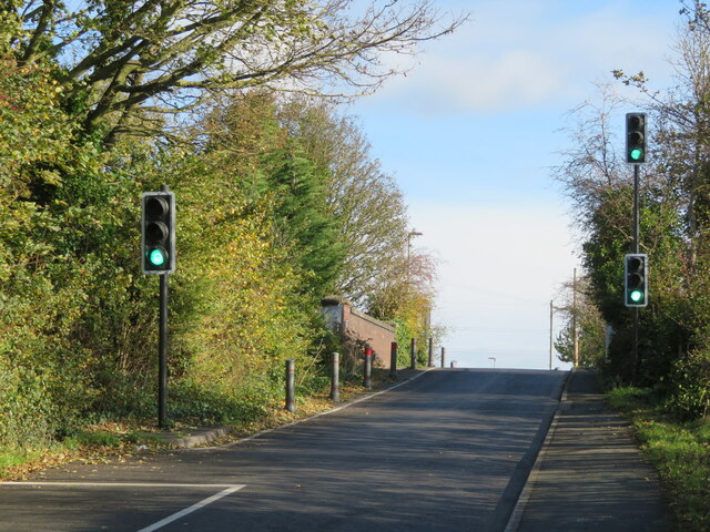
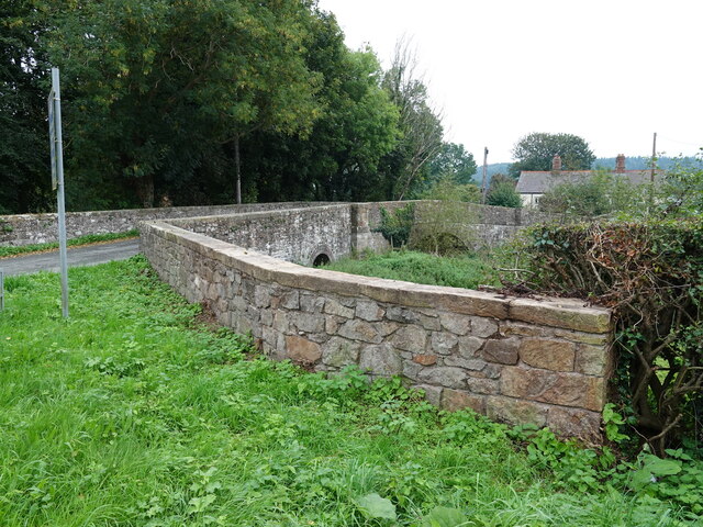
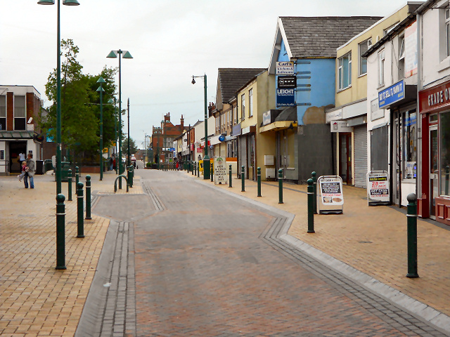
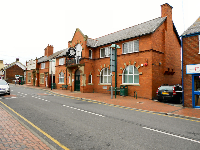
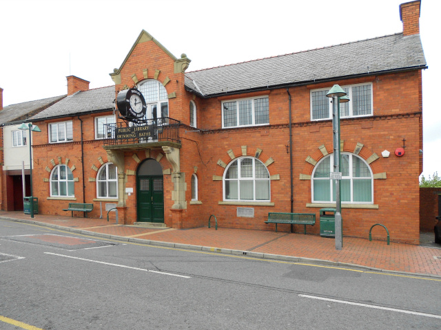
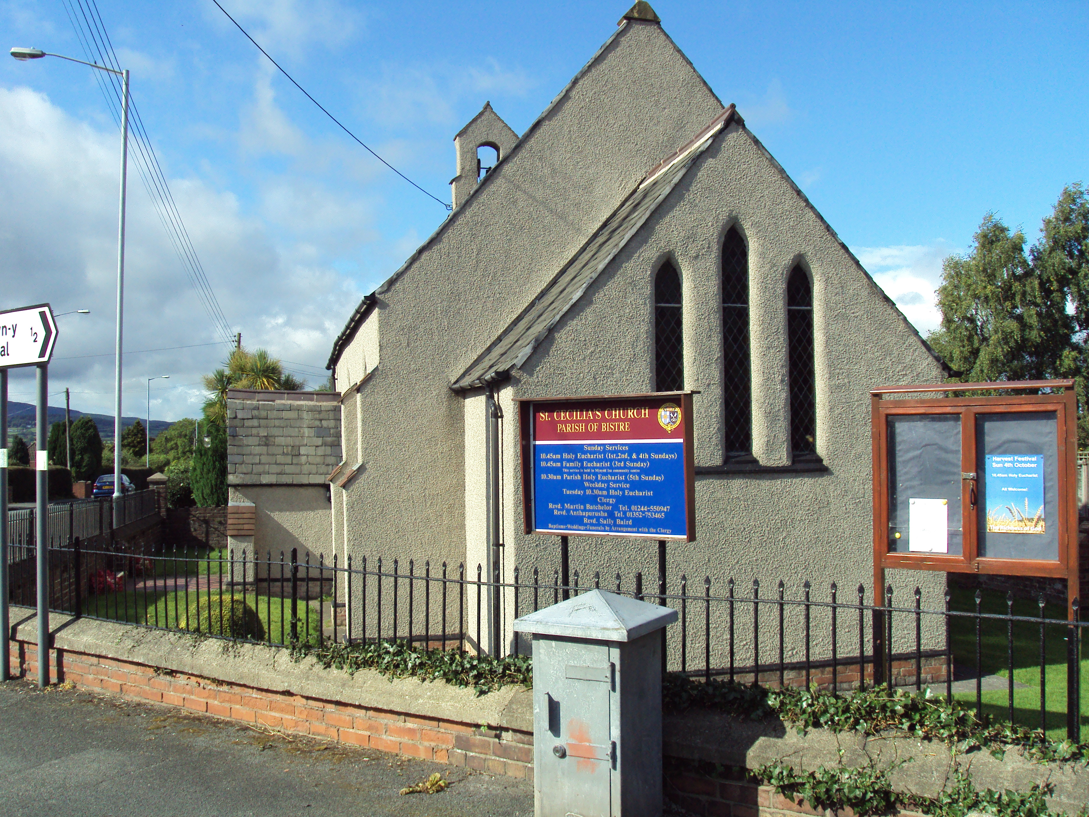
Nant Mawr Images

Images are sourced within 2km of 53.164572/-3.083516 or Grid Reference SJ2763. Thanks to Geograph Open Source API. All images are credited.

Benchmark on Bannel Bridge, Bannel Lane, Buckley Ordnance Survey benchmark on the north parapet of Bannel Bridge, which carries Bannel Lane over the Wrexham to Bidston railway line. Levelled at 127.202m above Newlyn Datum, verified 1959. For a view of the bridge see <a href="https://www.geograph.org.uk/photo/7516810">SJ2963 : Railway Bridge on Bannel Lane, Buckley</a>                                     <span class="nowrap"><a title="https://www.bench-marks.org.uk/bm195190" rel="nofollow ugc noopener" href="https://www.bench-marks.org.uk/bm195190">Link</a><img style="margin-left:2px;" alt="External link" title="External link - shift click to open in new window" src="https://s1.geograph.org.uk/img/external.png" width="10" height="10"/></span>
Benchmark on Bannel Bridge, Bannel Lane, Buckley
Ordnance Survey benchmark on the north parapet of Bannel Bridge, which carries Bannel Lane over the Wrexham to Bidston railway line. Levelled at 127.202m above Newlyn Datum, verified 1959. For a view of the bridge see SJ2963 : Railway Bridge on Bannel Lane, Buckley LinkExternal link
Railway Bridge on Bannel Lane, Buckley Bannel Lane is very busy so the hump back railway bridge is controlled by traffic lights. There is an Ordnance Survey benchmark on the left/north parapet <a href="https://www.geograph.org.uk/photo/7499864">SJ2963 : Benchmark on Bannel Bridge, Bannel Lane, Buckley</a>
Railway Bridge on Bannel Lane, Buckley
Bannel Lane is very busy so the hump back railway bridge is controlled by traffic lights. There is an Ordnance Survey benchmark on the left/north parapet SJ2963 : Benchmark on Bannel Bridge, Bannel Lane, Buckley
Benchmark on Bistre Methodist Chapel, Spon Green, Buckley Ordnance Survey benchmark on the northeast corner of Bistre Methodist Chapel, Spon Green, Buckley. Levelled at 142.055m above Newlyn Datum, verified 1959. For a view of the chapel from the opposite side see <a href="https://www.geograph.org.uk/photo/7517001">SJ2863 : Bistre Methodist Chapel, Spon Green, Buckley</a>                
Benchmark database: <span class="nowrap"><a title="https://www.bench-marks.org.uk/bm195201" rel="nofollow ugc noopener" href="https://www.bench-marks.org.uk/bm195201">Link</a><img style="margin-left:2px;" alt="External link" title="External link - shift click to open in new window" src="https://s1.geograph.org.uk/img/external.png" width="10" height="10"/></span>
Benchmark on Bistre Methodist Chapel, Spon Green, Buckley
Ordnance Survey benchmark on the northeast corner of Bistre Methodist Chapel, Spon Green, Buckley. Levelled at 142.055m above Newlyn Datum, verified 1959. For a view of the chapel from the opposite side see SJ2863 : Bistre Methodist Chapel, Spon Green, Buckley Benchmark database: LinkExternal link
Bistre Methodist Chapel, Spon Green, Buckley Looking across Spon Green towards the Bistre Methodist Chapel. There is an Ordnance Survey benchmark on the other side of the building, on the far right hand corner <a href="https://www.geograph.org.uk/photo/7516911">SJ2863 : Benchmark on Bistre Methodist Chapel, Spon Green, Buckley</a>   In 2023 the chapel has closed its doors and a planning application has been made to convert it into living accommodation.
Bistre Methodist Chapel, Spon Green, Buckley
Looking across Spon Green towards the Bistre Methodist Chapel. There is an Ordnance Survey benchmark on the other side of the building, on the far right hand corner SJ2863 : Benchmark on Bistre Methodist Chapel, Spon Green, Buckley In 2023 the chapel has closed its doors and a planning application has been made to convert it into living accommodation.
Benchmark in Mount Pleasant Road, Burntwood Pentre Ordnance Survey benchmark on an old bridge abutment, which is no longer a bridge, in Mount Pleasant Road, Burntwood Pentre. Levelled at 141.830m above Newlyn Datum. For a wider view see <a href="https://www.geograph.org.uk/photo/7517250">SJ2864 : Bridge abutment in Mount Pleasant Road, Burntwood Pentre</a> 
Benchmark database: <span class="nowrap"><a title="https://www.bench-marks.org.uk/bm195205" rel="nofollow ugc noopener" href="https://www.bench-marks.org.uk/bm195205">Link</a><img style="margin-left:2px;" alt="External link" title="External link - shift click to open in new window" src="https://s1.geograph.org.uk/img/external.png" width="10" height="10"/></span>
Benchmark in Mount Pleasant Road, Burntwood Pentre
Ordnance Survey benchmark on an old bridge abutment, which is no longer a bridge, in Mount Pleasant Road, Burntwood Pentre. Levelled at 141.830m above Newlyn Datum. For a wider view see SJ2864 : Bridge abutment in Mount Pleasant Road, Burntwood Pentre Benchmark database: LinkExternal link
Bridge abutment in Mount Pleasant Road, Burntwood Pentre The brick abutment is the only sign that there was ever a railway bridge crossing the road here. In times past this area was a hive of activity with brick and tile works as well as coal mines to power the furnaces, all long gone. There is an Ordnance Survey benchmark low down on the corner of the abutment, but it is partly hidden by ivy <a href="https://www.geograph.org.uk/photo/7517223">SJ2864 : Benchmark in Mount Pleasant Road, Burntwood Pentre</a>
Bridge abutment in Mount Pleasant Road, Burntwood Pentre
The brick abutment is the only sign that there was ever a railway bridge crossing the road here. In times past this area was a hive of activity with brick and tile works as well as coal mines to power the furnaces, all long gone. There is an Ordnance Survey benchmark low down on the corner of the abutment, but it is partly hidden by ivy SJ2864 : Benchmark in Mount Pleasant Road, Burntwood Pentre
Rivet benchmark on St Matthew's parish church tower, Buckley Ordnance Survey rivet benchmark on the south west buttress of  the tower of St Matthew's parish church, Buckley. Levelled at 160.413m above Newlyn Datum, verified 1959. For a view of the buttress see <a href="https://www.geograph.org.uk/photo/7518145">SJ2864 : Tower door of St Matthew's parish church, Buckley</a>                             
Benchmark database: <span class="nowrap"><a title="https://www.bench-marks.org.uk/bm102814" rel="nofollow ugc noopener" href="https://www.bench-marks.org.uk/bm102814">Link</a><img style="margin-left:2px;" alt="External link" title="External link - shift click to open in new window" src="https://s1.geograph.org.uk/img/external.png" width="10" height="10"/></span>
Rivet benchmark on St Matthew's parish church tower, Buckley
Ordnance Survey rivet benchmark on the south west buttress of the tower of St Matthew's parish church, Buckley. Levelled at 160.413m above Newlyn Datum, verified 1959. For a view of the buttress see SJ2864 : Tower door of St Matthew's parish church, Buckley Benchmark database: LinkExternal link
Tower door of St Matthew's parish church, Buckley There is an Ordnance Survey rivet benchmark on the angled buttress below the lamp <a href="https://www.geograph.org.uk/photo/7518130">SJ2864 : Rivet benchmark on St Matthew's parish church tower, Buckley</a>
Tower door of St Matthew's parish church, Buckley
There is an Ordnance Survey rivet benchmark on the angled buttress below the lamp SJ2864 : Rivet benchmark on St Matthew's parish church tower, Buckley
Benchmark on the Horse & Jockey in Drury Lane, Buckley Ordnance Survey benchmark on the side wall of the Horse & Jockey public house in Drury Lane, Buckley. Levelled at 157.070m above Newlyn Datum. For a wider view see <a href="https://www.geograph.org.uk/photo/7518246">SJ2864 : The side wall of the Horse & Jockey, Drury Lane, Buckley</a>                          
Benchmark database: <span class="nowrap"><a title="https://www.bench-marks.org.uk/bm195298" rel="nofollow ugc noopener" href="https://www.bench-marks.org.uk/bm195298">Link</a><img style="margin-left:2px;" alt="External link" title="External link - shift click to open in new window" src="https://s1.geograph.org.uk/img/external.png" width="10" height="10"/></span>
Benchmark on the Horse & Jockey in Drury Lane, Buckley
Ordnance Survey benchmark on the side wall of the Horse & Jockey public house in Drury Lane, Buckley. Levelled at 157.070m above Newlyn Datum. For a wider view see SJ2864 : The side wall of the Horse & Jockey, Drury Lane, Buckley Benchmark database: LinkExternal link
The side wall of the Horse & Jockey, Drury Lane, Buckley The side wall of the Horse & Jockey in Drury Lane has an Ordnance Survey benchmark <a href="https://www.geograph.org.uk/photo/7518234">SJ2864 : Benchmark on the Horse & Jockey in Drury Lane, Buckley</a>
The side wall of the Horse & Jockey, Drury Lane, Buckley
The side wall of the Horse & Jockey in Drury Lane has an Ordnance Survey benchmark SJ2864 : Benchmark on the Horse & Jockey in Drury Lane, Buckley
Rivet benchmark on the River Alyn bridge at Llong Covered with ivy for many years this Ordnance Survey rivet benchmark has just re-appeared as the bridge has now been tidied up and a lot of the ivy has been removed. It is recorded on the 1888-1913 map as levelled at 315 feet above Liverpool Datum. For a wider view see <a href="https://www.geograph.org.uk/photo/7599763">SJ2662 : River Alyn bridge at Llong</a>

Benchmark Database: <span class="nowrap"><a title="https://www.bench-marks.org.uk/bm203154" rel="nofollow ugc noopener" href="https://www.bench-marks.org.uk/bm203154">Link</a><img style="margin-left:2px;" alt="External link" title="External link - shift click to open in new window" src="https://s1.geograph.org.uk/img/external.png" width="10" height="10"/></span>
Rivet benchmark on the River Alyn bridge at Llong
Covered with ivy for many years this Ordnance Survey rivet benchmark has just re-appeared as the bridge has now been tidied up and a lot of the ivy has been removed. It is recorded on the 1888-1913 map as levelled at 315 feet above Liverpool Datum. For a wider view see SJ2662 : River Alyn bridge at Llong Benchmark Database: LinkExternal link
River Alyn bridge at Llong After many years the River Alyn bridge has had its ivy removed thus revealing an Ordnance Survey rivet benchmark on the parapet corner to the right <a href="https://www.geograph.org.uk/photo/7599757">SJ2662 : Rivet benchmark on the River Alyn bridge at Llong</a>
River Alyn bridge at Llong
After many years the River Alyn bridge has had its ivy removed thus revealing an Ordnance Survey rivet benchmark on the parapet corner to the right SJ2662 : Rivet benchmark on the River Alyn bridge at Llong
Buckley Station
Buckley Station
Buckley Station
Buckley Station
Buckley Fire Station
Brunswick Road, Buckley
Buckley Swimming Baths and Public Library The swimming baths and library on Brunswick Road. The council offices can be seen further down the road.
Buckley Swimming Baths and Public Library
The swimming baths and library on Brunswick Road. The council offices can be seen further down the road.
Public Library and Swimming Baths The library and swimming baths on Brunswick Road, Buckley.
Public Library and Swimming Baths
The library and swimming baths on Brunswick Road, Buckley.
Show me another place!

Nant Mawr is located at Grid Ref: SJ2763 (Lat: 53.164572, Lng: -3.083516)

Unitary Authority: Flintshire

Police Authority: North Wales

What 3 Words

///shocking.went.albatross. Near Buckley, Flintshire

Nearby Locations

Nant Mawr

Related Wikis

District of Alyn and Deeside

Alyn and Deeside (Welsh: Alun a Glannau Dyfrdwy) was one of six local government districts in the county of Clwyd, north-east Wales from 1974 to 1996....

Elfed High School

Elfed High School (Welsh: Ysgol Uwchradd Elfed) is an 11–16 mixed, English-medium community secondary school in Buckley, Flintshire, Wales. == History... ==

Buckley, Flintshire

Buckley (Welsh: Bwcle [ˈbʊklɛ]) is a town and community in Flintshire, north-east Wales, two miles (3 km) from the county town of Mold and contiguous with...

St Matthew's Church, Buckley

St Matthew's Church, is in the town of Buckley, Flintshire, Wales. It is an active Anglican parish church in the Borderlands Mission Area, the archdeaconry...

Argoed, Flintshire

Argoed (Welsh for 'wooded area' / 'in the wood') is a community in Flintshire, Wales, located between the towns of Mold and Buckley. The largest settlement...

Padeswood and Buckley railway station

Padeswood & Buckley railway station was a station in Padeswood, Flintshire, Wales. The station was opened around October 1850 and closed on 6 January 1958...

Etna Park

Etna Park is a park near the town of Buckley.The area was a clay hole during the Industrial Revolution, and was later used as a landfill. The site has...

Buckley Town F.C.

Buckley Town Football Club (Welsh: Clwb Pêl-Droed Tref Bwcle) is a Welsh football team based in Buckley, Flintshire, Wales. They currently play in the...

Nearby Amenities

Located within 500m of 53.164572,-3.083516
Traffic Signals
Lat/Long: 53.1682492/-3.0809262
Pub
White Lion
Addr Postcode: CH7 2NH
Addr Street: Mold Road
Fhrs Id: 1109418
Source Addr: FHRS Open Data
Wikidata: Q80855065
Lat/Long: 53.168104/-3.086801
Post Box
Lat/Long: 53.1625417/-3.0796539
Pharmacy
Rowlands Pharmacy
Brand: Rowlands Pharmacy
Brand Wikidata: Q62663235
Healthcare: pharmacy
Opening Hours: Mo-Fr 21:00-18:00, Sa 21:00-15:00; PH,Su off
Website: https://rowlandspharmacy.co.uk/find-local-pharmacy#!/l/buckley/12-brunswick-road/1051
Lat/Long: 53.1680118/-3.0799656
Library
Buckley
Lat/Long: 53.1673745/-3.0794485
Barrier: bollard
Bicycle: yes
Bollard: fixed
Foot: yes
Lat/Long: 53.1651956/-3.0765521
Pub
The Black Horse
Addr Postcode: CH7 2JB
Addr Street: Mold Road
Fhrs Id: 1196996
Source Addr: FHRS Open Data
Wikidata: Q80855058
Lat/Long: 53.1685805/-3.0830591
Barrier: bollard
Bollard: fixed
Lat/Long: 53.1681634/-3.0790054
Toilets
Check Date: 2021-09-06
Fee: no
Wheelchair: yes
Lat/Long: 53.1671645/-3.0795114
Police
Disused: yes
Lat/Long: 53.168523/-3.0823294
Place Of Worship
Buckly Methodist Church
Check Date: 2024-03-23
Denomination: methodist
Religion: christian
Lat/Long: 53.1676384/-3.0804547
Crossing
Crossing: zebra
Crossing Island: no
Tactile Paving: yes
Lat/Long: 53.1658874/-3.0785788
Pub
The Nant Inn
Addr Postcode: CH7 2JN
Addr Street: Padeswood Road North
Fhrs Id: 1220256
Source Addr: FHRS Open Data
Wikidata: Q80855063
Lat/Long: 53.1650101/-3.0798079
Disused Shop: yes
Lat/Long: 53.1679911/-3.0802014
Buckley War Memorial
Historic: memorial
Lat/Long: 53.1666131/-3.0792365
Direction: 255
Generator Method: photovoltaic
Generator Output Electricity: yes
Generator Solar Modules: 8
Generator Source: solar
Generator Type: solar_photovoltaic_panel
Location: roof
Power: generator
Lat/Long: 53.1641402/-3.0908968
Direction: 260
Generator Method: photovoltaic
Generator Output Electricity: yes
Generator Solar Modules: 8
Generator Source: solar
Generator Type: solar_photovoltaic_panel
Location: roof
Power: generator
Lat/Long: 53.1643983/-3.0900358
Direction: 80
Generator Method: photovoltaic
Generator Output Electricity: yes
Generator Solar Modules: 8
Generator Source: solar
Generator Type: solar_photovoltaic_panel
Location: roof
Power: generator
Lat/Long: 53.1644064/-3.089964
Direction: WSW
Generator Method: photovoltaic
Generator Output Electricity: yes
Generator Solar Modules: 4
Generator Source: solar
Generator Type: solar_photovoltaic_panel
Location: roof
Power: generator
Lat/Long: 53.1651315/-3.0885364
Direction: SSE
Generator Method: photovoltaic
Generator Output Electricity: yes
Generator Solar Modules: 6
Generator Source: solar
Generator Type: solar_photovoltaic_panel
Location: roof
Power: generator
Lat/Long: 53.1651191/-3.0884828
Direction: SSE
Generator Method: photovoltaic
Generator Output Electricity: yes
Generator Solar Modules: 6
Generator Source: solar
Generator Type: solar_photovoltaic_panel
Location: roof
Power: generator
Lat/Long: 53.1652409/-3.0886028
Direction: WSW
Generator Method: photovoltaic
Generator Output Electricity: yes
Generator Solar Modules: 6
Generator Source: solar
Generator Type: solar_photovoltaic_panel
Location: roof
Power: generator
Lat/Long: 53.1652525/-3.0886604
Direction: 165
Generator Method: photovoltaic
Generator Output Electricity: yes
Generator Solar Modules: 28
Generator Source: solar
Generator Type: solar_photovoltaic_panel
Location: roof
Power: generator
Lat/Long: 53.1637707/-3.0865704
Direction: 165
Generator Method: photovoltaic
Generator Output Electricity: yes
Generator Solar Modules: 28
Generator Source: solar
Generator Type: solar_photovoltaic_panel
Location: roof
Power: generator
Lat/Long: 53.163708/-3.0867689
Direction: 165
Generator Method: photovoltaic
Generator Output Electricity: yes
Generator Solar Modules: 36
Generator Source: solar
Generator Type: solar_photovoltaic_panel
Location: roof
Power: generator
Lat/Long: 53.1636565/-3.0869807
Direction: SSE
Generator Method: photovoltaic
Generator Output Electricity: yes
Generator Solar Modules: 12
Generator Source: solar
Generator Type: solar_photovoltaic_panel
Location: roof
Power: generator
Lat/Long: 53.1622728/-3.0874032
Direction: S
Generator Method: photovoltaic
Generator Output Electricity: yes
Generator Solar Modules: 13
Generator Source: solar
Generator Type: solar_photovoltaic_panel
Location: roof
Power: generator
Lat/Long: 53.1635115/-3.0772913
Direction: S
Generator Method: photovoltaic
Generator Output Electricity: yes
Generator Solar Modules: 14
Generator Source: solar
Generator Type: solar_photovoltaic_panel
Location: roof
Power: generator
Lat/Long: 53.1635525/-3.0774441
Direction: 185
Generator Method: photovoltaic
Generator Output Electricity: yes
Generator Solar Modules: 16
Generator Source: solar
Generator Type: solar_photovoltaic_panel
Location: roof
Power: generator
Lat/Long: 53.165179/-3.0782281
Direction: 260
Generator Method: photovoltaic
Generator Output Electricity: yes
Generator Solar Modules: 16
Generator Source: solar
Generator Type: solar_photovoltaic_panel
Location: roof
Power: generator
Lat/Long: 53.1644537/-3.0801969
Direction: 185
Generator Method: photovoltaic
Generator Output Electricity: yes
Generator Solar Modules: 7
Generator Source: solar
Generator Type: solar_photovoltaic_panel
Location: roof
Power: generator
Lat/Long: 53.1659212/-3.0849417
Direction: 95
Generator Method: photovoltaic
Generator Output Electricity: yes
Generator Solar Modules: 7
Generator Source: solar
Generator Type: solar_photovoltaic_panel
Location: roof
Power: generator
Lat/Long: 53.165944/-3.0849055
Bus Stop
Buckley, Brunswick Road / Black Lion
Bench: yes
Bin: yes
Bus: yes
Naptan AtcoCode: 5120AWD71402
Naptan Bearing: W
Naptan CommonName: Black Lion
Naptan Crossing: Mill Lane
Naptan Indicator: o/s
Naptan Landmark: Black Lion PH
Naptan LocalityName: Buckley
Naptan NaptanCode: flidjmj
Naptan ShortCommonName: Buckley Cross
Naptan Street: Brunswick Road
Naptan Verified: no
Public Transport: platform
Public Transport Version: 2
Shelter: yes
Source: naptan_import
Tactile Paving: yes
Lat/Long: 53.1683394/-3.0825986
Bus Stop
Buckley, Brunswick Road / Buckley Police Station
Bench: yes
Bin: yes
Bus: yes
Naptan AtcoCode: 5120AWD71401
Naptan Bearing: E
Naptan CommonName: Buckley Police Station
Naptan Crossing: Mill Lane
Naptan Indicator: after
Naptan Landmark: Buckley Police Station
Naptan LocalityName: Buckley
Naptan NaptanCode: flidjmg
Naptan ShortCommonName: Buckley Cross
Naptan Street: Brunswick Road
Naptan Verified: no
Public Transport: platform
Public Transport Version: 2
Shelter: yes
Source: naptan_import
Tactile Paving: yes
Lat/Long: 53.168447/-3.0821601
Bus Stop
Fraser Drive
Bus: yes
Naptan AtcoCode: 5120WDB22319
Naptan Bearing: SE
Naptan CommonName: Fraser Drive
Naptan Crossing: Fraser Drive
Naptan NaptanCode: flimgjt
Naptan Street: Springfield Drive
Naptan Verified: no
Public Transport: platform
Public Transport Version: 2
Source: naptan
Lat/Long: 53.1659699/-3.0895722
Bus Stop
Fraser Drive
Bus: yes
Naptan AtcoCode: 5120AWF80572
Naptan Bearing: NW
Naptan CommonName: Fraser Drive
Naptan Crossing: Fraser Drive
Naptan NaptanCode: flidjmt
Naptan Street: Springfield Drive
Naptan Verified: no
Public Transport: platform
Public Transport Version: 2
Source: naptan
Lat/Long: 53.1659056/-3.0896795
Bus Stop
Nant Mawr Crescent
Bus: yes
Naptan AtcoCode: 5120WDB22318
Naptan Bearing: NW
Naptan CommonName: Nant Mawr Crescent
Naptan Crossing: Nant Mawr Crescent
Naptan NaptanCode: flimgjp
Naptan Street: Nant Mawr Road
Naptan Verified: no
Public Transport: platform
Public Transport Version: 2
Source: naptan
Lat/Long: 53.1638803/-3.0877697
Bus Stop
Nant Mawr Crescent
Bus: yes
Naptan AtcoCode: 5120AWF80573
Naptan Bearing: SE
Naptan CommonName: Nant Mawr Crescent
Naptan Crossing: Nant Mawr Crescent
Naptan NaptanCode: flidjpj
Naptan Street: Nant Mawr Road
Naptan Verified: no
Public Transport: platform
Public Transport Version: 2
Source: naptan
Lat/Long: 53.1639237/-3.0876142
Bus Stop
Moel View
Bus: yes
Naptan AtcoCode: 5120WDB22317
Naptan Bearing: SW
Naptan CommonName: Moel View
Naptan Crossing: Princess Avenue
Naptan NaptanCode: flimgjm
Naptan Street: Nant Mawr Road
Naptan Verified: no
Public Transport: platform
Public Transport Version: 2
Source: naptan
Lat/Long: 53.1624885/-3.0811447
Bus Stop
Moel View
Bus: yes
Naptan AtcoCode: 5120AWF80574
Naptan Bearing: NE
Naptan CommonName: Moel View
Naptan Crossing: Princess Avenue
Naptan NaptanCode: fliagpt
Naptan Street: Nant Mawr Road
Naptan Verified: no
Public Transport: platform
Public Transport Version: 2
Source: naptan
Lat/Long: 53.1625633/-3.0811809
Bus Stop
Lea Drive
Bus: yes
Naptan AtcoCode: 5120WDB22068
Naptan Bearing: N
Naptan CommonName: Lea Drive
Naptan Crossing: Berwyn Close
Naptan NaptanCode: flijptw
Naptan Street: The Precinct Way
Naptan Verified: no
Public Transport: platform
Public Transport Version: 2
Source: naptan
Lat/Long: 53.1644568/-3.0784611
Bus Stop
Lea Drive
Bus: yes
Naptan AtcoCode: 5120AWF80576
Naptan Bearing: S
Naptan CommonName: Lea Drive
Naptan Crossing: Berwyn Close
Naptan NaptanCode: fliagpm
Naptan Street: The Precinct Way
Naptan Verified: no
Public Transport: platform
Public Transport Version: 2
Source: naptan
Lat/Long: 53.1644729/-3.0782801
Bus Stop
Central Precinct
Bus: yes
Naptan AtcoCode: 5120WDB22008
Naptan Bearing: S
Naptan CommonName: Central Precinct
Naptan Crossing: Brunswick Road
Naptan Landmark: Central Precinct
Naptan NaptanCode: flijmwm
Naptan Street: The Precinct Way
Naptan Verified: no
Public Transport: platform
Public Transport Version: 2
Shelter: yes
Source: naptan
Lat/Long: 53.166913/-3.0780427
Bus Stop
Central Precinct
Bench: yes
Bin: yes
Bus: yes
Naptan AtcoCode: 5120AWF80577
Naptan Bearing: N
Naptan CommonName: Central Precinct
Naptan Crossing: Brunswick Road
Naptan Landmark: Central Precinct
Naptan NaptanCode: fliagtd
Naptan Street: The Precinct Way
Naptan Verified: no
Public Transport: platform
Public Transport Version: 2
Shelter: yes
Source: naptan
Lat/Long: 53.1669596/-3.0784209
Fast Food
Kam Xin Fish and Chips
Lat/Long: 53.168478/-3.0870981
Dentist
Bistre Dental Practice
Healthcare: dentist
Lat/Long: 53.1683832/-3.0859099
Nant Mawr
Place: neighbourhood
Lat/Long: 53.1645608/-3.0841475
The Cross
Note: Marked as such by OS
Place: neighbourhood
Source: local knowledge
Lat/Long: 53.1683727/-3.0811085
Direction: 170
Generator Method: photovoltaic
Generator Output Electricity: yes
Generator Solar Modules: 15
Generator Source: solar
Generator Type: solar_photovoltaic_panel
Location: roof
Power: generator
Lat/Long: 53.1666203/-3.0830973
Direction: WSW
Generator Method: photovoltaic
Generator Output Electricity: yes
Generator Solar Modules: 6
Generator Source: solar
Generator Type: solar_photovoltaic_panel
Location: roof
Power: generator
Lat/Long: 53.1654996/-3.0882713
Direction: ENE
Generator Method: photovoltaic
Generator Output Electricity: yes
Generator Solar Modules: 6
Generator Source: solar
Generator Type: solar_photovoltaic_panel
Location: roof
Power: generator
Lat/Long: 53.1655189/-3.0882284
Direction: ENE
Generator Method: photovoltaic
Generator Output Electricity: yes
Generator Solar Modules: 8
Generator Source: solar
Generator Type: solar_photovoltaic_panel
Location: roof
Power: generator
Lat/Long: 53.1638755/-3.0778617
Direction: WSW
Generator Method: photovoltaic
Generator Output Electricity: yes
Generator Solar Modules: 8
Generator Source: solar
Generator Type: solar_photovoltaic_panel
Location: roof
Power: generator
Lat/Long: 53.1638642/-3.077918
Crossing
Crossing: zebra
Crossing Island: no
Tactile Paving: yes
Lat/Long: 53.1673025/-3.0780934
Bus Stop
Buckley, Mold Road / White Lion
Bus: yes
Naptan AtcoCode: 5120AWD71400
Naptan Bearing: E
Naptan CommonName: White Lion
Naptan Crossing: South Lane
Naptan Indicator: before
Naptan Landmark: White Lion PH
Naptan LocalityName: Buckley
Naptan NaptanCode: flidjta
Naptan Street: Mold Road
Public Transport: platform
Source: naptan_import
Lat/Long: 53.1684597/-3.0872252
Iceland
Addr Housename: Central Parade
Addr Postcode: CH7 2EF
Addr Street: Brunswick Road
Addr Unit: Unit 22
Brand: Iceland
Brand Wikidata: Q721810
Shop: frozen_food
Website: https://www.iceland.co.uk/store-finder/store?StoreID=1351&StoreName=BUCKLEY
Lat/Long: 53.1673455/-3.0792269
Post Office
Addr City: Buckley
Addr Housename: Inside Spar
Addr Housenumber: 11
Addr Postcode: CH7 2ED
Addr Street: Brunswick Road
Brand: Post Office
Brand Wikidata: Q1783168
Opening Hours: Mo-Su 08:00-20:00
Lat/Long: 53.168304/-3.0797487
The data included in this document is from www.openstreetmap.org. The data is made available under ODbL.

Have you been to Nant Mawr?

Leave your review of Nant Mawr below (or comments, questions and feedback).