Bensham

Settlement in Durham

England

Bensham

The Tyne Bridge The Tyne Bridge is a through arch bridge and spans the River Tyne joining Newcastle to Gateshead. It was opened by George V in 1928.
Wikipedia: <span class="nowrap"><a title="http://en.wikipedia.org/wiki/Tyne_Bridge" rel="nofollow ugc noopener" href="http://en.wikipedia.org/wiki/Tyne_Bridge">Link</a><img style="margin-left:2px;" alt="External link" title="External link - shift click to open in new window" src="https://s1.geograph.org.uk/img/external.png" width="10" height="10"/></span>
The Tyne Bridge Credit: Philip Cornwall

Bensham is a residential suburb located in the county of Durham, in the northeast of England. Situated on the outskirts of the town of Gateshead, it is approximately 2 miles southwest of Newcastle upon Tyne. Bensham has a population of around 10,000 people.

The area of Bensham is characterized by its Victorian-era terraced housing, which dominates the landscape. These houses were originally built to accommodate workers in the local mining and industrial sectors during the 19th century. Today, many of these properties have been renovated and modernized, attracting a mix of families, young professionals, and students.

Bensham is known for its strong sense of community and is home to various amenities and facilities. The neighborhood features several local shops, small businesses, and supermarkets that serve the daily needs of its residents. There are also a few pubs, restaurants, and cafes, providing options for socializing and dining out.

The area is well-connected to surrounding towns and cities, with regular bus services running through Bensham. It is also within easy reach of major road networks, such as the A1(M) and the A167, allowing for convenient travel to nearby destinations.

Bensham benefits from its proximity to the vibrant city of Newcastle upon Tyne, with its cultural attractions, shopping centers, and entertainment venues. Additionally, the beautiful landscapes of the nearby Derwent Valley and North Pennines are easily accessible, offering opportunities for outdoor activities and exploration.

Overall, Bensham offers a pleasant residential environment, with a strong community spirit and convenient access to a range of amenities and nearby attractions.

If you have any feedback on the listing, please let us know in the comments section below.

Bensham Images

Images are sourced within 2km of 54.958799/-1.615017 or Grid Reference NZ2462. Thanks to Geograph Open Source API. All images are credited.

The Tyne Bridge The Tyne Bridge is a through arch bridge and spans the River Tyne joining Newcastle to Gateshead. It was opened by George V in 1928.
Wikipedia: <span class="nowrap"><a title="http://en.wikipedia.org/wiki/Tyne_Bridge" rel="nofollow ugc noopener" href="http://en.wikipedia.org/wiki/Tyne_Bridge">Link</a><img style="margin-left:2px;" alt="External link" title="External link - shift click to open in new window" src="https://s1.geograph.org.uk/img/external.png" width="10" height="10"/></span>
The Tyne Bridge
The Tyne Bridge is a through arch bridge and spans the River Tyne joining Newcastle to Gateshead. It was opened by George V in 1928. Wikipedia: LinkExternal link
Gino D'Acampo, Newcastle Quayside
Painted concrete planters, Newcastle Quayside
'Blacksmith's Needle', Newcastle Quayside See description here: <a href="https://www.geograph.org.uk/photo/1682397">NZ2564 : 'Blacksmith's Needle', Quayside</a>
'Blacksmith's Needle', Newcastle Quayside
3D street-art, Newcastle Quayside Crossing a virtual (broken) pipe over a virtual canyon. The street artists, 3D Joe & Max, achieve a striking trompe-l'œil only through the wide angle lens of a smartphone camera.
3D Joe & Max: <span class="nowrap"><a title="http://3djoeandmax.com/" rel="nofollow ugc noopener" href="http://3djoeandmax.com/">Link</a><img style="margin-left:2px;" alt="External link" title="External link - shift click to open in new window" src="https://s1.geograph.org.uk/img/external.png" width="10" height="10"/></span> <span class="nowrap"><a title="https://web.archive.org/web/20210813211529/http://3djoeandmax.com/" rel="nofollow ugc noopener" href="https://web.archive.org/web/20210813211529/http://3djoeandmax.com/">Archive Link</a><img style="margin-left:2px;" alt="External link" title="External link - shift click to open in new window" src="https://s1.geograph.org.uk/img/external.png" width="10" height="10"/></span>
3D street-art, Newcastle Quayside
Crossing a virtual (broken) pipe over a virtual canyon. The street artists, 3D Joe & Max, achieve a striking trompe-l'œil only through the wide angle lens of a smartphone camera. 3D Joe & Max: LinkExternal link Archive LinkExternal link
Vinyl art, Newcastle Quayside "Internationally renowned artist, Tim Gresham, otherwise known as the artist ‘Mr. Penfold’, has been commissioned by NE1 to create a 75-metre-long pavement vinyl to be installed along the busiest stretch of the Quayside, creating a vibrant, colourful, and very Instagrammable piece of art."
<span class="nowrap"><a title="https://newcastlegateshead.com/events/ne1-summer-in-the-city" rel="nofollow ugc noopener" href="https://newcastlegateshead.com/events/ne1-summer-in-the-city">Link</a><img style="margin-left:2px;" alt="External link" title="External link - shift click to open in new window" src="https://s1.geograph.org.uk/img/external.png" width="10" height="10"/></span> <span class="nowrap"><a title="https://web.archive.org/web/20210813210952/https://newcastlegateshead.com/events/ne1-summer-in-the-city" rel="nofollow ugc noopener" href="https://web.archive.org/web/20210813210952/https://newcastlegateshead.com/events/ne1-summer-in-the-city">Archive Link</a><img style="margin-left:2px;" alt="External link" title="External link - shift click to open in new window" src="https://s1.geograph.org.uk/img/external.png" width="10" height="10"/></span>
Vinyl art, Newcastle Quayside
"Internationally renowned artist, Tim Gresham, otherwise known as the artist ‘Mr. Penfold’, has been commissioned by NE1 to create a 75-metre-long pavement vinyl to be installed along the busiest stretch of the Quayside, creating a vibrant, colourful, and very Instagrammable piece of art." LinkExternal link Archive LinkExternal link
Popup park, Newcastle Quayside
Wave Field, Newcastle Quayside "Central to the park will be ‘Wave-Field’ created by CS Design and Lateral Office with soundscape by Mitchell Akiyama, a fun installation for young and old alike featuring eight giant see-saws, four large and four small. The see-saws light up and emit a unique sound sequence while people interact with the park attraction.

Have a go! The free installation will be available to use between 9am – 9pm.

Take a seat in an illuminating doughnut-shaped seat while you marvel at the iconic bridges or catch up with friends day or night. Enjoy a break in an innovative light-up swivel chair and dichroic installations designed and built by raskl – an art and architectural company based in the Ouseburn. The film reacts to sun and acts as a kaleidoscope casting colourful light and shadows which will create a dramatic installation in the area which is south facing, and thus enjoys direct sunlight throughout the day."
<span class="nowrap"><a title="https://newcastlegateshead.com/events/ne1-summer-in-the-city" rel="nofollow ugc noopener" href="https://newcastlegateshead.com/events/ne1-summer-in-the-city">Link</a><img style="margin-left:2px;" alt="External link" title="External link - shift click to open in new window" src="https://s1.geograph.org.uk/img/external.png" width="10" height="10"/></span> <span class="nowrap"><a title="https://web.archive.org/web/20210813210952/https://newcastlegateshead.com/events/ne1-summer-in-the-city" rel="nofollow ugc noopener" href="https://web.archive.org/web/20210813210952/https://newcastlegateshead.com/events/ne1-summer-in-the-city">Archive Link</a><img style="margin-left:2px;" alt="External link" title="External link - shift click to open in new window" src="https://s1.geograph.org.uk/img/external.png" width="10" height="10"/></span>
Wave Field, Newcastle Quayside
"Central to the park will be ‘Wave-Field’ created by CS Design and Lateral Office with soundscape by Mitchell Akiyama, a fun installation for young and old alike featuring eight giant see-saws, four large and four small. The see-saws light up and emit a unique sound sequence while people interact with the park attraction. Have a go! The free installation will be available to use between 9am – 9pm. Take a seat in an illuminating doughnut-shaped seat while you marvel at the iconic bridges or catch up with friends day or night. Enjoy a break in an innovative light-up swivel chair and dichroic installations designed and built by raskl – an art and architectural company based in the Ouseburn. The film reacts to sun and acts as a kaleidoscope casting colourful light and shadows which will create a dramatic installation in the area which is south facing, and thus enjoys direct sunlight throughout the day." LinkExternal link Archive LinkExternal link
Benchmark on south face of Newcastle Castle keep Ordnance Survey cut mark benchmark described on the Bench Mark Database at <span class="nowrap"><a title="www.bench-marks.org.uk/bm41987" rel="nofollow ugc noopener" href="http://www.bench-marks.org.uk/bm41987">Link</a><img style="margin-left:2px;" alt="External link" title="External link - shift click to open in new window" src="https://s1.geograph.org.uk/img/external.png" width="10" height="10"/></span>
Benchmark on south face of Newcastle Castle keep
Ordnance Survey cut mark benchmark described on the Bench Mark Database at LinkExternal link
The spire of St Nicholas Cathedral
The Tyne Bridge advertising the Great North Run Other bridges beyond...
The Tyne Bridge advertising the Great North Run
Other bridges beyond...
Pop-Up Park, Blackett Street, Newcastle
Life Science Centre, Central Parkway, Newcastle
Life Science Centre, Forth Banks, Newcastle
Forth Banks (B1600), Newcastle
Forth Banks (B1600), Newcastle The Queen Elizabeth II Bridge crosses the street in the background.
Forth Banks (B1600), Newcastle
The Queen Elizabeth II Bridge crosses the street in the background.
King Edward VII Bridge, River Tyne, Newcastle The bridge was designed and engineered by Charles A. Harrison, the Chief Civil Engineer of the North Eastern Railway, and built by the Cleveland Bridge & Engineering Company in Darlington between 1902 and 1906 <span class="nowrap"><a title="http://www.flickr.com/photos/newcastlelibraries/4083334603/" rel="nofollow ugc noopener" href="http://www.flickr.com/photos/newcastlelibraries/4083334603/">Link</a><img style="margin-left:2px;" alt="External link" title="External link - shift click to open in new window" src="https://s1.geograph.org.uk/img/external.png" width="10" height="10"/></span> <span class="nowrap"><a title="http://www.flickr.com/photos/newcastlelibraries/4081741856/" rel="nofollow ugc noopener" href="http://www.flickr.com/photos/newcastlelibraries/4081741856/">Link</a><img style="margin-left:2px;" alt="External link" title="External link - shift click to open in new window" src="https://s1.geograph.org.uk/img/external.png" width="10" height="10"/></span>

The bridge is not particularly elegant but functional, consisting of four lattice steel spans <a href="https://www.geograph.org.uk/photo/2721669">NZ2463 : Cross Country train crossing King Edward VII Bridge</a> resting on concrete-filled caissons, used in the construction <span class="nowrap"><a title="http://www.flickr.com/photos/newcastlelibraries/4080980325/" rel="nofollow ugc noopener" href="http://www.flickr.com/photos/newcastlelibraries/4080980325/">Link</a><img style="margin-left:2px;" alt="External link" title="External link - shift click to open in new window" src="https://s1.geograph.org.uk/img/external.png" width="10" height="10"/></span> <span class="nowrap"><a title="http://www.flickr.com/photos/newcastlelibraries/4080979893/" rel="nofollow ugc noopener" href="http://www.flickr.com/photos/newcastlelibraries/4080979893/">Link</a><img style="margin-left:2px;" alt="External link" title="External link - shift click to open in new window" src="https://s1.geograph.org.uk/img/external.png" width="10" height="10"/></span>

The total length of the bridge is 1,150 feet (350 m) and 112 ft (34 m) above high water mark. It was built with the aid of the largest cableway in the world, 463.5m long, suspended 61m above high water made of 7.6cm diameter steel <span class="nowrap"><a title="http://www.flickr.com/photos/newcastlelibraries/4083335177/" rel="nofollow ugc noopener" href="http://www.flickr.com/photos/newcastlelibraries/4083335177/">Link</a><img style="margin-left:2px;" alt="External link" title="External link - shift click to open in new window" src="https://s1.geograph.org.uk/img/external.png" width="10" height="10"/></span> It carried over 23,000 tons of material. After the bridge was finished, the cable was sent to the Swan Hunter and Wigham Richardson shipyard, where it was used to launch the Mauritania.

Originally trains used the High Level Bridge to reach Newcastle Central Station and had to leave the station in the same direction they had entered from, which involved the tedious task of reversing.

The construction of the King Edward VII Bridge provided four more rail tracks <a href="https://www.geograph.org.uk/photo/1348907">NZ2463 : King Edward VII Bridge</a>, and a direct line through the station enabling trains to enter or leave from either side and thus eased rail congestion <a href="https://www.geograph.org.uk/photo/2719661">NZ2463 : Cross Country train approaches Newcastle Central</a>
<span class="nowrap"><a title="http://www.flickr.com/photos/newcastlelibraries/4082798872/" rel="nofollow ugc noopener" href="http://www.flickr.com/photos/newcastlelibraries/4082798872/">Link</a><img style="margin-left:2px;" alt="External link" title="External link - shift click to open in new window" src="https://s1.geograph.org.uk/img/external.png" width="10" height="10"/></span>

The bridge was opened by King Edward VII and Queen Alexandra on 10 July 1906. The total cost amounted to £500,000.

Wikipedia: <span class="nowrap"><a title="http://en.wikipedia.org/wiki/King_Edward_VII_Bridge" rel="nofollow ugc noopener" href="http://en.wikipedia.org/wiki/King_Edward_VII_Bridge">Link</a><img style="margin-left:2px;" alt="External link" title="External link - shift click to open in new window" src="https://s1.geograph.org.uk/img/external.png" width="10" height="10"/></span>
Tyne & Wear Museums: <span class="nowrap"><a title="https://web.archive.org/web/20120429085232/http://www.twmuseums.org.uk/discovery/buildingbridges/the-king-edward-vii-railway-bridge/" rel="nofollow ugc noopener" href="https://web.archive.org/web/20120429085232/http://www.twmuseums.org.uk/discovery/buildingbridges/the-king-edward-vii-railway-bridge/">Archive Link</a><img style="margin-left:2px;" alt="External link" title="External link - shift click to open in new window" src="https://s1.geograph.org.uk/img/external.png" width="10" height="10"/></span>
Bridges on the Tyne: <span class="nowrap"><a title="http://www.bridgesonthetyne.co.uk/keb.html" rel="nofollow ugc noopener" href="http://www.bridgesonthetyne.co.uk/keb.html">Link</a><img style="margin-left:2px;" alt="External link" title="External link - shift click to open in new window" src="https://s1.geograph.org.uk/img/external.png" width="10" height="10"/></span> <span class="nowrap"><a title="https://web.archive.org/web/20191220075328/http://www.bridgesonthetyne.co.uk/keb.html" rel="nofollow ugc noopener" href="https://web.archive.org/web/20191220075328/http://www.bridgesonthetyne.co.uk/keb.html">Archive Link</a><img style="margin-left:2px;" alt="External link" title="External link - shift click to open in new window" src="https://s1.geograph.org.uk/img/external.png" width="10" height="10"/></span>
SINE: <span class="nowrap"><a title="https://web.archive.org/web/20150402162647/http://sine.ncl.ac.uk/view_structure_information.asp?struct_id=1453" rel="nofollow ugc noopener" href="https://web.archive.org/web/20150402162647/http://sine.ncl.ac.uk/view_structure_information.asp?struct_id=1453">Archive Link</a><img style="margin-left:2px;" alt="External link" title="External link - shift click to open in new window" src="https://s1.geograph.org.uk/img/external.png" width="10" height="10"/></span>
King Edward VII Bridge, River Tyne, Newcastle
The bridge was designed and engineered by Charles A. Harrison, the Chief Civil Engineer of the North Eastern Railway, and built by the Cleveland Bridge & Engineering Company in Darlington between 1902 and 1906 LinkExternal link LinkExternal link The bridge is not particularly elegant but functional, consisting of four lattice steel spans NZ2463 : Cross Country train crossing King Edward VII Bridge resting on concrete-filled caissons, used in the construction LinkExternal link LinkExternal link The total length of the bridge is 1,150 feet (350 m) and 112 ft (34 m) above high water mark. It was built with the aid of the largest cableway in the world, 463.5m long, suspended 61m above high water made of 7.6cm diameter steel LinkExternal link It carried over 23,000 tons of material. After the bridge was finished, the cable was sent to the Swan Hunter and Wigham Richardson shipyard, where it was used to launch the Mauritania. Originally trains used the High Level Bridge to reach Newcastle Central Station and had to leave the station in the same direction they had entered from, which involved the tedious task of reversing. The construction of the King Edward VII Bridge provided four more rail tracks NZ2463 : King Edward VII Bridge, and a direct line through the station enabling trains to enter or leave from either side and thus eased rail congestion NZ2463 : Cross Country train approaches Newcastle Central LinkExternal link The bridge was opened by King Edward VII and Queen Alexandra on 10 July 1906. The total cost amounted to £500,000. Wikipedia: LinkExternal link Tyne & Wear Museums: Archive LinkExternal link Bridges on the Tyne: LinkExternal link Archive LinkExternal link SINE: Archive LinkExternal link
Bridges over the Tyne, Newcastle The River Tyne is 100 miles long and flows generally eastward towards its mouth at Tynemouth just east of Newcastle. The River has two sources. The South Tyne rises on Alston Moor and the North Tyne rises north of Kielder Water.
Wikipedia: <span class="nowrap"><a title="http://en.wikipedia.org/wiki/River_Tyne" rel="nofollow ugc noopener" href="http://en.wikipedia.org/wiki/River_Tyne">Link</a><img style="margin-left:2px;" alt="External link" title="External link - shift click to open in new window" src="https://s1.geograph.org.uk/img/external.png" width="10" height="10"/></span>
Bridges over the Tyne, Newcastle
The River Tyne is 100 miles long and flows generally eastward towards its mouth at Tynemouth just east of Newcastle. The River has two sources. The South Tyne rises on Alston Moor and the North Tyne rises north of Kielder Water. Wikipedia: LinkExternal link
Show me another place!

Bensham is located at Grid Ref: NZ2462 (Lat: 54.958799, Lng: -1.615017)

Unitary Authority: Gateshead

Police Authority: Northumbria

What 3 Words

///sofa.keeps.silly. Near Gateshead, Tyne & Wear

Nearby Locations

Bensham

Related Wikis

Redheugh railway station

Redheugh railway station served the town of Gateshead, Tyne and Wear, England from 1837 to 1854 on the Newcastle and Carlisle Railway. == History == The...

Gateshead TMD

Gateshead TMD was a railway traction maintenance depot situated in Gateshead, England. The depot code was 52A during the steam era and GD later on. It...

Forth Banks Power Station

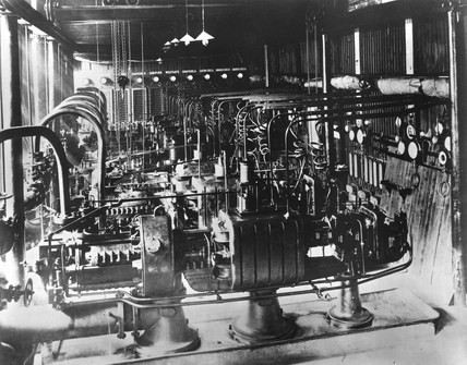
Forth Banks Power Station was a coal-fired power station in North East England. It was situated in the city centre of Newcastle upon Tyne on Forth Banks...

Close Power Station

Close Power Station was a coal-fired power station situated on Newcastle upon Tyne's Quayside, in modern Tyne and Wear. The station was built by the Newcastle...

Gateshead Talmudical College

Gateshead Talmudical College (Hebrew: ישיבת בית יוסף גייטסהעד), popularly known as Gateshead Yeshiva, is located in the Bensham area of Gateshead in North...

Gateshead Civic Centre

Gateshead Civic Centre is a municipal building in the Regent Street, Gateshead, England. == History == The civic centre was commissioned to replace the...

Gateshead Jewish Academy for Girls

Gateshead Jewish Academy for Girls (Hebrew בית חיה רחל), is a two-year post-secondary school college, or "seminary". It was founded in Gateshead, England...

Gateshead Interchange

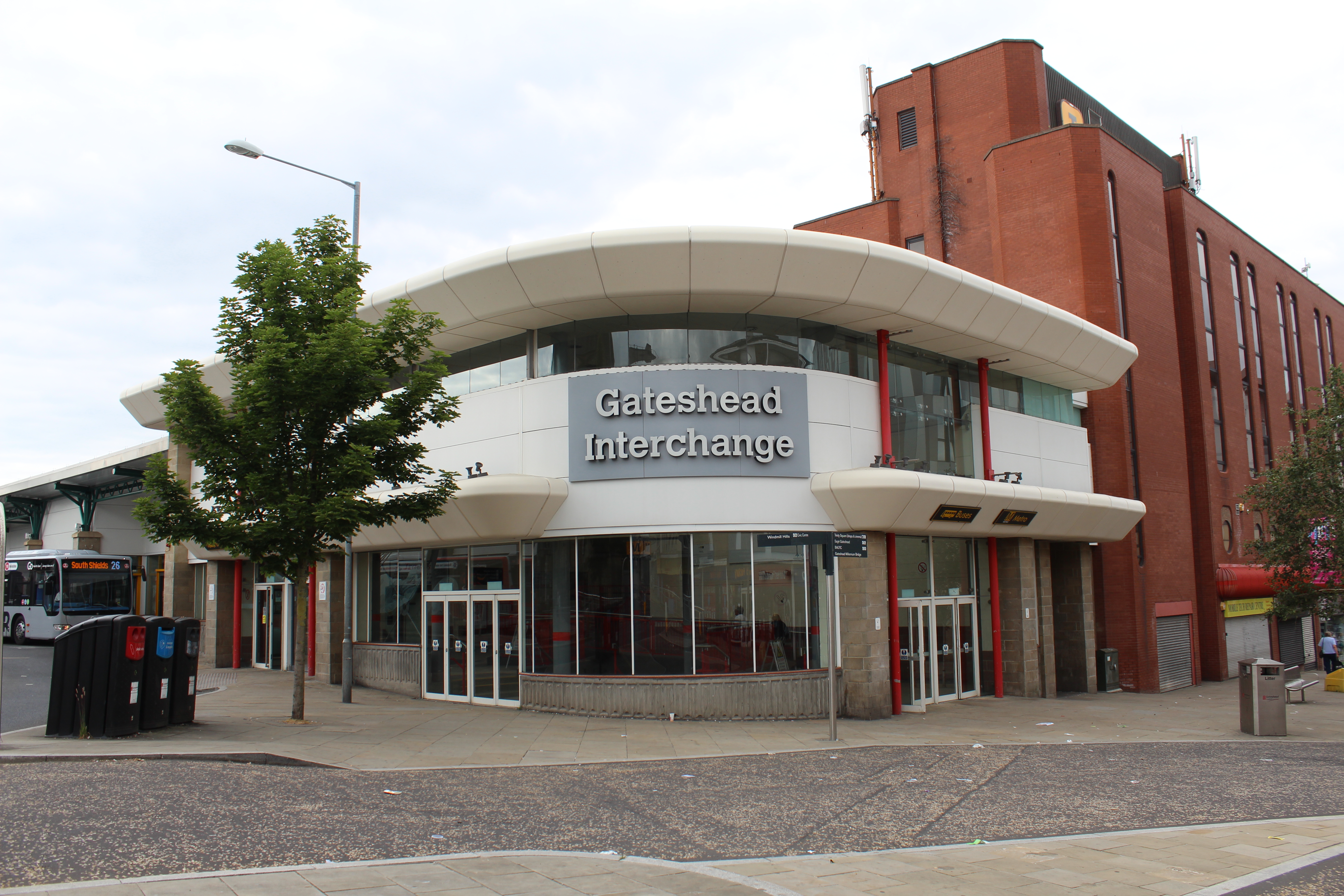
Gateshead Interchange is a Tyne and Wear Metro station, serving the town of Gateshead in Tyne and Wear, England. It joined the network on 15 November 1981...

Related Videos

Walking in NEWCASTLE / England (UK) 🇬🇧- Newcastle upon Tyne - 4K 60fps (UHD)

Newcastle upon Tyne is a port city in the North East of England. The city was a major shipbuilding and manufacturing hub during ...

Sunny walk in Newcastle upon Tyne | walking city tour.

Amazing walk in Newcastle upon Tyne or simply Newcastle, is a city and metropolitan borough in Tyne and Wear, England.

Newcastle upon Tyne amazing Walk in a rainy day .

Amazing walk in Newcastle upon tyne in a rainy day! Thanks for watching and sharing, please Like and subscribe to this YouTube ...

Nearby Amenities

Located within 500m of 54.958799,-1.615017
Motorway Junction
Lat/Long: 54.9584199/-1.6148691
Motorway Junction
Redheugh Bridge Roundabout
Lat/Long: 54.9606893/-1.6172727
Source: PGS
Lat/Long: 54.9629975/-1.6142529
Source: PGS
Lat/Long: 54.9628005/-1.6144643
Source: PGS
Lat/Long: 54.9624531/-1.6148508
Source: PGS
Lat/Long: 54.9621986/-1.6153396
Source: PGS
Lat/Long: 54.9619855/-1.6158252
Source: PGS
Lat/Long: 54.96176/-1.6164606
Source: PGS
Lat/Long: 54.9616335/-1.6168196
Source: PGS
Lat/Long: 54.9613732/-1.6175202
Source: PGS
Lat/Long: 54.961136/-1.6181676
Source: PGS
Lat/Long: 54.960961/-1.6186422
Source: PGS
Lat/Long: 54.960768/-1.6191727
Source: PGS
Lat/Long: 54.9605549/-1.6197625
Source: PGS
Lat/Long: 54.9603607/-1.6204374
Source: PGS
Lat/Long: 54.9601323/-1.621249
Source: PGS
Lat/Long: 54.96/-1.6217002
Source: PGS
Lat/Long: 54.9597652/-1.6225256
Traffic Signals
Lat/Long: 54.9555897/-1.6139392
Railway: switch
Lat/Long: 54.9623015/-1.6114403
Railway: switch
Lat/Long: 54.9601246/-1.6154881
Traffic Signals
Traffic Signals Direction: both
Lat/Long: 54.9586236/-1.610348
Bus: yes
Bus Bay: left
Public Transport: stop_position
Lat/Long: 54.9597879/-1.6168395
Bus Stop
BENSHAM COURT
Bus: yes
Local Ref: N
Naptan AtcoCode: 410000014017
Naptan Bearing: N
Naptan CommonName: BENSHAM COURT
Naptan Indicator: N
Naptan Landmark: OUTSIDE ST CUTHBERT'S CHURCH
Naptan NaptanCode: twrawjpj
Naptan PlusbusZoneRef: NWCSTLE
Naptan Street: BENSHAM ROAD
Naptan Verified: no
Public Transport: platform
Shelter: yes
Source: naptan_import
Lat/Long: 54.9550999/-1.6143496
Bus Stop
REDHEUGH BRIDGE ROAD-S/B
Local Ref: SW
Naptan AtcoCode: 410000014045
Naptan Bearing: SW
Naptan CommonName: REDHEUGH BRIDGE ROAD-S/B
Naptan Indicator: SW
Naptan Landmark: REDHEUGH BRIDGE ROAD SLIP ROADSOUTH END
Naptan NaptanCode: twrawmdj
Naptan PlusbusZoneRef: NWCSTLE
Naptan Street: REDHEUGH BRIDGE ROAD
Naptan Verified: no
Source: naptan_import
Lat/Long: 54.9601747/-1.6163468
Bus Stop
Redheugh Bridge Road
Bench: no
Bus: yes
Departures Board: timetable
Local Ref: N
Naptan AtcoCode: 410000014046
Naptan Bearing: N
Naptan Indicator: N-Bound
Naptan Landmark: Redheugh Bridge Road Slip Road South End
Naptan NaptanCode: twrawmdm
Naptan PlusbusZoneRef: NWCSTLE
Naptan Street: Redheugh Bridge Road
Naptan Verified: no
Passenger Information Display: no
Public Transport: platform
Shelter: no
Source: naptan_import
Lat/Long: 54.959758/-1.6169245
Bus Stop
ASKEW ROAD-GARAGE-SW/B
Bench: yes
Bin: no
Bus: yes
Check Date Shelter: 2023-09-18
Departures Board: timetable
Local Ref: SW
Naptan AtcoCode: 410000014048
Naptan Bearing: SW
Naptan CommonName: ASKEW ROAD-GARAGE-SW/B
Naptan Indicator: SW
Naptan Landmark: OUTSIDE GARAGE / OPPOSITE PLAYING FIELD
Naptan NaptanCode: twrawmdt
Naptan PlusbusZoneRef: NWCSTLE
Naptan Street: ASKEW ROAD WEST
Naptan Verified: no
Public Transport: platform
Shelter: yes
Source: naptan_import
Tactile Paving: no
Lat/Long: 54.9570554/-1.6189064
Bus Stop
Askew Road West-Park
Bench: yes
Bin: yes
Bus: yes
Local Ref: NE
Naptan AtcoCode: 410000014070
Naptan Bearing: NE
Naptan Indicator: NE-Bound
Naptan Landmark: Park And Playing Area
Naptan NaptanCode: twrawmpw
Naptan PlusbusZoneRef: NWCSTLE
Naptan Street: ASKEW ROAD WEST
Naptan Verified: no
Public Transport: platform
Shelter: yes
Source: naptan_import
Tactile Paving: no
Lat/Long: 54.9569326/-1.6194434
Bus Stop
Askew Road -Redheugh Bridge
Bench: no
Bus: yes
Departures Board: timetable
Local Ref: N
Naptan AtcoCode: 410000014071
Naptan Bearing: SW
Naptan Indicator: SW-Bound
Naptan Landmark: Opposite Shell Garage
Naptan NaptanCode: twrawmta
Naptan PlusbusZoneRef: NWCSTLE
Naptan Street: ASKEW ROAD WEST
Naptan Verified: no
Passenger Information Display: no
Public Transport: platform
Shelter: no
Source: naptan_import
Lat/Long: 54.9580083/-1.6173076
Bus Stop
Askew Road-St Cuthberts
Bench: no
Bus: yes
Local Ref: S
Naptan AtcoCode: 410000014073
Naptan Bearing: SW
Naptan Indicator: SW-Bound
Naptan Landmark: Outside The Mitre Public House
Naptan NaptanCode: twrawmtd
Naptan PlusbusZoneRef: NWCSTLE
Naptan Street: Askew Road West
Naptan Verified: no
Public Transport: platform
Shelter: no
Source: naptan_import
Tactile Paving: no
Lat/Long: 54.9603867/-1.612378
Bus Stop
Askew Road
Bench: no
Bus: yes
Local Ref: NE
Naptan AtcoCode: 410000014075
Naptan Bearing: NE
Naptan Indicator: NE-Bound
Naptan Landmark: Opposite The Mitre Public House
Naptan NaptanCode: twrawmtj
Naptan PlusbusZoneRef: NWCSTLE
Naptan Street: Askew Road
Naptan Verified: yes
Public Transport: platform
Shelter: yes
Source: Bing
Tactile Paving: no
Lat/Long: 54.96059/-1.6125959
Bus Stop
Tyne Road East
Bench: no
Bus: yes
Local Ref: W
Naptan AtcoCode: 410000014076
Naptan Bearing: W
Naptan Indicator: W-Bound
Naptan Landmark: Opposite Lovett Walk
Naptan NaptanCode: twrawmtm
Naptan PlusbusZoneRef: NWCSTLE
Naptan Street: Tyne Road
Naptan Verified: no
Public Transport: platform
Shelter: no
Source: naptan_import
Tactile Paving: no
Lat/Long: 54.9598475/-1.6180522
Bus Stop
TEAMS
Local Ref: SW
Naptan AtcoCode: 410000014077
Naptan Bearing: SW
Naptan CommonName: TEAMS
Naptan Indicator: SW
Naptan Landmark: OUTSIDE TYNE VIEW PRIMARY SCHOOLS
Naptan NaptanCode: twrawmtp
Naptan PlusbusZoneRef: NWCSTLE
Naptan Street: ROSE STREET
Naptan Verified: no
Source: naptan_import
Lat/Long: 54.9585844/-1.6222183
Bus Stop
TEAMS
Local Ref: NE
Naptan AtcoCode: 410000014092
Naptan Bearing: NE
Naptan CommonName: TEAMS
Naptan Indicator: NE
Naptan Landmark: OPPOSITE TYNE VIEW PRIMARY SCHOOLS
Naptan NaptanCode: twrawpaw
Naptan PlusbusZoneRef: NWCSTLE
Naptan Street: ROSE STREET
Naptan Verified: no
Source: naptan_import
Lat/Long: 54.9585313/-1.6224842
Bus Stop
TYNE ROAD EAST-E/B
Local Ref: E
Naptan AtcoCode: 410000014093
Naptan Bearing: E
Naptan CommonName: TYNE ROAD EAST-E/B
Naptan Indicator: E
Naptan Landmark: OUTSIDE LOVETT WALK
Naptan NaptanCode: twrawpda
Naptan PlusbusZoneRef: NWCSTLE
Naptan Street: TYNE ROAD EAST
Naptan Verified: no
Source: naptan_import
Lat/Long: 54.9598229/-1.6187865
Bus Stop
SCHOOL STREET-S/B
Local Ref: S
Naptan AtcoCode: 410000014095
Naptan Bearing: S
Naptan CommonName: SCHOOL STREET-S/B
Naptan Indicator: S
Naptan Landmark: OUTSIDE CUTHBERT HOUSE
Naptan NaptanCode: twrawpdg
Naptan PlusbusZoneRef: NWCSTLE
Naptan Street: SCHOOL STREET
Naptan Verified: no
Source: naptan_import
Lat/Long: 54.9555441/-1.6155477
Bus Stop
DERWENTWATER ROAD-SOUTH HILL ROAD-W/B
Local Ref: W
Naptan AtcoCode: 410000014096
Naptan Bearing: W
Naptan CommonName: DERWENTWATER ROAD-SOUTH HILL ROAD-W/B
Naptan Indicator: W
Naptan Landmark: OPPOSITE THE VINEYARD FELLOWSHIP
Naptan NaptanCode: twrawpdj
Naptan PlusbusZoneRef: NWCSTLE
Naptan Street: DERWENTWATER ROAD
Naptan Verified: no
Source: naptan_import
Lat/Long: 54.9549066/-1.6185988
Bus Stop
DERWENTWATER ROAD-SOUTH HILL ROAD-E/B
Local Ref: E
Naptan AtcoCode: 410000014101
Naptan Bearing: E
Naptan CommonName: DERWENTWATER ROAD-SOUTH HILL ROAD-E/B
Naptan Indicator: E
Naptan Landmark: OUTSIDE THE VINEYARD FELLOWSHIP
Naptan NaptanCode: twrawpga
Naptan PlusbusZoneRef: NWCSTLE
Naptan Street: DERWENTWATER ROAD
Naptan Verified: no
Source: naptan_import
Lat/Long: 54.9550135/-1.6183011
Bus Stop
SCHOOL STREET-N/B
Local Ref: N
Naptan AtcoCode: 410000014102
Naptan Bearing: N
Naptan CommonName: SCHOOL STREET-N/B
Naptan Indicator: N
Naptan Landmark: OPPOSITE CUTHBERT HOUSE
Naptan NaptanCode: twrawpgd
Naptan PlusbusZoneRef: NWCSTLE
Naptan Street: SCHOOL STREET
Naptan Verified: no
Source: naptan_import
Lat/Long: 54.9557419/-1.6155771
Bus Stop
BENSHAM
Bus: yes
Lit: yes
Local Ref: S
Naptan AtcoCode: 410000015317
Naptan Bearing: S
Naptan CommonName: BENSHAM
Naptan Indicator: S
Naptan Landmark: OUTSIDE WINDMILL HILLS PRIMARY SCHOOL
Naptan NaptanCode: twrdgmtj
Naptan PlusbusZoneRef: NWCSTLE
Naptan Street: BENSHAM ROAD
Naptan Verified: no
Public Transport: platform
Shelter: yes
Source: naptan_import
Lat/Long: 54.9582603/-1.6106338
Bus Stop
Bensham
Bench: yes
Bus: yes
Departures Board: timetable
Local Ref: N
Naptan AtcoCode: 410000015318
Naptan Bearing: N
Naptan Indicator: N-Bound
Naptan Landmark: Opposite Windmill Hills Primary School
Naptan NaptanCode: twrdgmtm
Naptan PlusbusZoneRef: NWCSTLE
Naptan Street: Bensham Road
Naptan Verified: no
Public Transport: platform
Shelter: yes
Source: naptan_import
Lat/Long: 54.9582178/-1.6109877
Bus Stop
Bensham Road-Alexandra Villas
Bench: yes
Bus: yes
Local Ref: SW
Naptan AtcoCode: 410000015058
Naptan Bearing: SW
Naptan Indicator: SW-Bound
Naptan Landmark: Opposite The Borough Arms Public House
Naptan NaptanCode: twrdatpw
Naptan PlusbusZoneRef: NWCSTLE
Naptan Street: Bensham Road
Naptan Verified: no
Public Transport: platform
Shelter: yes
Source: naptan_import
Lat/Long: 54.9592467/-1.608732
Bus Stop
Bensham Road
Bench: yes
Bus: yes
Departures Board: timetable
Local Ref: NE
Naptan AtcoCode: 410000015078
Naptan Bearing: NE
Naptan Indicator: NE-Bound
Naptan Landmark: Outside Borough Arms Public House
Naptan NaptanCode: twrdawdp
Naptan PlusbusZoneRef: NWCSTLE
Naptan Street: Bensham Road
Naptan Verified: no
Public Transport: platform
Shelter: yes
Source: naptan_import
Lat/Long: 54.9594167/-1.6087353
Bus Stop
TYNE ROAD-S/B
Local Ref: S
Naptan AtcoCode: 410000014251
Naptan Bearing: S
Naptan CommonName: TYNE ROAD-S/B
Naptan Indicator: S
Naptan Landmark: OPPOSITE WESTWOOD HOME FOR THE AGED
Naptan NaptanCode: twrdadmp
Naptan PlusbusZoneRef: NWCSTLE
Naptan Street: TYNE ROAD
Naptan Verified: no
Source: naptan_import
Lat/Long: 54.9583646/-1.6180195
Bus Stop
TYNE ROAD-N/B
Local Ref: N
Naptan AtcoCode: 410000014252
Naptan Bearing: N
Naptan CommonName: TYNE ROAD-N/B
Naptan Indicator: N
Naptan Landmark: OUTSIDE CHADWICK WALK
Naptan NaptanCode: twrdadmt
Naptan PlusbusZoneRef: NWCSTLE
Naptan Street: TYNE ROAD
Naptan Verified: no
Source: naptan_import
Lat/Long: 54.959351/-1.6173229
Bus Stop
CUTHBERT STREET-S/B
Bench: yes
Covered: yes
Local Ref: SE
Naptan AtcoCode: 410000014253
Naptan Bearing: SE
Naptan CommonName: CUTHBERT STREET-S/B
Naptan Indicator: SE
Naptan Landmark: OUTSIDE THE LIBRARY
Naptan NaptanCode: twrdadmw
Naptan PlusbusZoneRef: NWCSTLE
Naptan Street: CUTHBERT STREET
Naptan Verified: no
Shelter: yes
Source: naptan_import
Lat/Long: 54.9574846/-1.6172074
Bus Stop
ST CUTHBERTS VILLAGE
Local Ref: NE
Naptan AtcoCode: 410000060062
Naptan Bearing: NE
Naptan CommonName: ST CUTHBERTS VILLAGE
Naptan Indicator: NE
Naptan Landmark: OUTSIDE ST CUTHBERTS COURT
Naptan NaptanCode: twrgpmwg
Naptan PlusbusZoneRef: NWCSTLE
Naptan Street: ST CUTHBERTS VILLAGE
Naptan Verified: no
Source: naptan_import
Lat/Long: 54.9604282/-1.6112844
Barrier: bollard
Lat/Long: 54.9593465/-1.6097778
Noexit: yes
Lat/Long: 54.9606009/-1.6091683
Noexit: yes
Lat/Long: 54.960349/-1.608704
Barrier: bollard
Lat/Long: 54.9564375/-1.612664
Motorway Junction
Redheugh Bridge Roundabout
Lat/Long: 54.9568708/-1.6178638
Turning Circle
Lat/Long: 54.9558314/-1.6170981
Fuel
Shell Redheugh Bridge
Addr Postcode: NE8 2JX
Addr Street: Askew Road West
Brand: Shell
Brand Wikidata: Q110716465
Opening Hours: 24/7
Phone: +44 191 478 7311
Ref Navads: NVDS353_10019222
Website: https://find.shell.com/gb/fuel/10019222-shell-redheugh-bridge
Lat/Long: 54.9581069/-1.6163987
Railway: switch
Lat/Long: 54.962451/-1.6110014
Railway: signal
Railway Signal Direction: forward
Railway Signal Main: GB-NR:main
Railway Signal Main Design: individual
Railway Signal Main Form: light
Railway Signal Main Height: normal
Railway Signal Main States: red;green;yellow;flashing_yellow;double_yellow;flashing_double_yellow
Railway Signal Operator: Network Rail
Railway Signal Position: left
Ref: T 245
Lat/Long: 54.9618573/-1.6148713
Railway: switch
Lat/Long: 54.962028/-1.6149608
Barrier: block
Bicycle: yes
Foot: yes
Motor Vehicle: no
Source: Bing
Lat/Long: 54.9597515/-1.6143841
Railway: switch
Lat/Long: 54.9587594/-1.6171961
Railway: switch
Lat/Long: 54.9592452/-1.6166176
Railway: switch
Lat/Long: 54.9594359/-1.6163907
Railway: switch
Lat/Long: 54.959706/-1.615993
Railway: switch
Lat/Long: 54.9605848/-1.6151728
Railway: signal
Railway Signal Direction: forward
Railway Signal Main: GB-NR:main
Railway Signal Main Design: individual
Railway Signal Main Form: light
Railway Signal Main Height: normal
Railway Signal Main States: red;green;yellow;flashing_yellow;double_yellow;flashing_double_yellow
Railway Signal Operator: Network Rail
Railway Signal Position: left
Railway Signal Route: GB-NR:junction
Railway Signal Route Design: feather
Railway Signal Route Form: light
Railway Signal Route States: position_4;off
Ref: T 236
Lat/Long: 54.9606785/-1.6151091
Railway: signal
Railway Signal Direction: backward
Railway Signal Main: GB-NR:main
Railway Signal Main Design: individual
Railway Signal Main Form: light
Railway Signal Main Height: normal
Railway Signal Main States: red;green;yellow;flashing_yellow;double_yellow;flashing_double_yellow
Railway Signal Operator: Network Rail
Railway Signal Position: left
Ref: T 238
Lat/Long: 54.9606571/-1.6151918
Railway: signal
Railway Signal Direction: backward
Railway Signal Main: GB-NR:main
Railway Signal Main Design: individual
Railway Signal Main Form: light
Railway Signal Main Height: normal
Railway Signal Main States: red;green;yellow;flashing_yellow;double_yellow;flashing_double_yellow
Railway Signal Operator: Network Rail
Railway Signal Position: left
Ref: T 243
Lat/Long: 54.9618466/-1.6149528
Railway: signal
Railway Signal Direction: forward
Railway Signal Main: GB-NR:main
Railway Signal Main Design: individual
Railway Signal Main Form: light
Railway Signal Main Height: normal
Railway Signal Main States: red;green;yellow;flashing_yellow;double_yellow;flashing_double_yellow
Railway Signal Operator: Network Rail
Railway Signal Position: left
Ref: T 241
Lat/Long: 54.9618375/-1.6150059
King Edward Bridge North Junction
Railway: switch
Lat/Long: 54.962484/-1.6153488
Bench
Fixme: check exact position
Lat/Long: 54.9617054/-1.6164811
Street Lamp
Lat/Long: 54.9596789/-1.6226697
Street Lamp
Lat/Long: 54.9598217/-1.6221872
Street Lamp
Lat/Long: 54.9599503/-1.621703
Street Lamp
Lat/Long: 54.9600828/-1.6212369
Street Lamp
Lat/Long: 54.9602199/-1.620756
Street Lamp
Lat/Long: 54.960356/-1.6202849
Street Lamp
Lat/Long: 54.9604932/-1.6198351
Street Lamp
Lat/Long: 54.9606547/-1.6193624
Street Lamp
Lat/Long: 54.9608218/-1.6189027
Street Lamp
Lat/Long: 54.9609759/-1.6184594
Street Lamp
Lat/Long: 54.9615046/-1.6170904
Street Lamp
Lat/Long: 54.9616609/-1.6166356
Street Lamp
Lat/Long: 54.9618333/-1.6161392
Street Lamp
Lat/Long: 54.9626804/-1.6145322
Street Lamp
Lat/Long: 54.9629487/-1.6142419
Street Lamp
Lat/Long: 54.963205/-1.6139377
Railway: switch
Lat/Long: 54.9569526/-1.6183701
Railway: switch
Lat/Long: 54.9573461/-1.6180817
Pub
Nursery House working Mens Club
Addr City: Gateshead
Addr County: Tyne and Wear
Addr Housename: The Bensham Arms Public House
Addr Postcode: NE8 1SU
Addr Street: Claremont Street
Fhrs Id: 339746
Source Addr: FHRS Open Data
Lat/Long: 54.9558286/-1.6096105
Recycling
Lat/Long: 54.9558784/-1.6093071
JEM's
Addr City: Gateshead
Addr Street: Coatsworth Road
Shop: gift
Lat/Long: 54.9562937/-1.6085582
Superstar Bargains
Addr City: Gateshead
Addr Street: Coatsworth Road
Shop: variety_store
Lat/Long: 54.9563587/-1.6085989
Ladbrokes
Addr City: Gateshead
Addr Street: Coatsworth Road
Brand: Ladbrokes
Brand Wikidata: Q1799875
Brand Wikipedia: en:Ladbrokes Coral
Shop: bookmaker
Lat/Long: 54.9564268/-1.6086325
Telephone
Lat/Long: 54.9565335/-1.6086134
Bus Stop
Bench: yes
Covered: yes
Naptan AtcoCode: 410000015077
Naptan NaptanCode: twrdawdm
Shelter: yes
Lat/Long: 54.9566403/-1.6086187
Bench
Backrest: yes
Lat/Long: 54.9565734/-1.608787
Bench
Backrest: yes
Lat/Long: 54.9565419/-1.608771
Bench
Backrest: yes
Lat/Long: 54.9565327/-1.6086755
Waste Basket
Lat/Long: 54.9566039/-1.6086065
Fast Food
Deli Licious
Addr City: Gateshead
Addr Street: Coatsworth Road
Lat/Long: 54.9564677/-1.6083197
Kurdish Bakery
Addr City: Gateshead
Addr Housenumber: 60
Addr Postcode: NE8 1QP
Addr Street: Coatsworth Road
Addr Suburb: Bensham
Fhrs Id: 639075
Shop: bakery
Source Addr: FHRS Open Data
Lat/Long: 54.9565235/-1.6083427
Thompson Kimti
Addr City: Gateshead
Addr Housenumber: 52-58
Addr Postcode: NE8 1QN
Addr Street: Coatsworth Road
Office: accountant
Phone: +44 191 477 9539
Lat/Long: 54.9566948/-1.6083767
Little Pet Store
Addr City: Gateshead
Addr Street: Coatsworth Road
Shop: pet
Lat/Long: 54.9572092/-1.6086266
Adam's Butcher Shop
Addr City: Gateshead
Addr Street: Coatsworth Road
Shop: butcher
Lat/Long: 54.9573668/-1.6087316
Frenchies Cakes
Addr City: Gateshead
Addr Street: Coatsworth Road
Craft: confectionery
Lat/Long: 54.9574359/-1.6087471
Fast Food
Bamboo Garden
Addr City: Gateshead
Addr Street: Coatsworth Road
Cuisine: chinese
Drive Through: no
Phone: +44 191 478 1610
Takeaway: only
Lat/Long: 54.9573293/-1.6090231
Hardly Harrods
Addr City: Gateshead
Addr Street: Coatsworth Road
Shop: yes
Lat/Long: 54.9572689/-1.6090091
Del Boy
Addr City: Gateshead
Addr Street: Coatsworth Road
Shop: yes
Lat/Long: 54.9572234/-1.6089904
Fast Food
The Curry Garden
Addr City: Gateshead
Addr Housenumber: 53
Addr Postcode: NE8 1QL
Addr Street: Coatsworth Road
Addr Suburb: Bensham
Drive Through: no
Fhrs Id: 339935
Phone: +44 191 477 2644
Source Addr: FHRS Open Data
Takeaway: only
Lat/Long: 54.9571697/-1.608974
Adams Store
Addr City: Gateshead
Addr Street: Coatsworth Road
Shop: greengrocer
Lat/Long: 54.9571201/-1.608953
Phone EXperts
Addr City: Gateshead
Addr Street: Coatsworth Road
Shop: mobile_phone
Lat/Long: 54.9570732/-1.608932
Frazers Angling & Outdoors
Addr City: Gateshead
Addr Street: Coatsworth Road
Shop: outdoor
Lat/Long: 54.9569351/-1.6088853
Restaurant
Adam's Halal Restaurant
Addr City: Gateshead
Addr Street: Coatsworth Road
Lat/Long: 54.9568909/-1.6088643
Creations
Addr City: Gateshead
Addr Street: Coatsworth Road
Phone: +44 191 477 1979
Shop: hairdresser
Lat/Long: 54.9568278/-1.6088363
Exhause Systems
Addr City: Gateshead
Addr Street: Barrington Place
Phone: +44 191 478 2977
Shop: car_repair
Lat/Long: 54.9563812/-1.6121953
Place Of Worship
Eden Progressive S N U spiritualist Church
Addr City: Gateshead
Religion: christian
Lat/Long: 54.9552801/-1.6133414
Bensham Launderette
Shop: laundry
Lat/Long: 54.9547323/-1.6143031
Cotfield Mirrors
Addr City: Gateshead
Addr Street: Bensham Road
Craft: yes
Phone: +44 7941 960 639
Lat/Long: 54.9552428/-1.6145403
Hotel Express
Addr City: Gateshead
Addr Postcode: NE8 1AF
Addr Street: Cuthbert Street
Phone: +44 191 499 8165
Tourism: hotel
Website: https://www.hotelxpress.co.uk/
Lat/Long: 54.9559579/-1.6142657
Post Box
Ref: NE8 32
Lat/Long: 54.9600894/-1.611915
Recycling
Lat/Long: 54.960144/-1.6118453
Crossing
Crossing: zebra
Lat/Long: 54.9594897/-1.6080077
Street Lamp
Lat/Long: 54.9576929/-1.6178281
Street Lamp
Lat/Long: 54.9593615/-1.615581
Crossing
Crossing: marked
Crossing Island: no
Crossing Markings: yes
Lit: yes
Tactile Paving: yes
Lat/Long: 54.9564697/-1.6201707
Man Made: mast
Tower Type: communication
Lat/Long: 54.9573642/-1.6169711
Man Made: mast
Tower Type: communication
Lat/Long: 54.9613193/-1.6137666
Easigrass
Shop: yes
Lat/Long: 54.9571068/-1.6185585
Boz Barbering
Shop: hairdresser
Lat/Long: 54.9571293/-1.6117484
King Edward Bridge North Junction
Railway: junction
Lat/Long: 54.9622458/-1.6150654
Railway: signal
Railway Signal Direction: backward
Railway Signal Main: GB-NR:main
Railway Signal Main Design: combined
Railway Signal Main Form: light
Railway Signal Main Height: normal
Railway Signal Main States: red;green;yellow;flashing_yellow;double_yellow;flashing_double_yellow
Railway Signal Operator: Network Rail
Railway Signal Position: left
Railway Signal Route: GB-NR:junction
Railway Signal Route Design: feather
Railway Signal Route Form: light
Railway Signal Route States: position_1;position_2;off
Lat/Long: 54.9568866/-1.6183457
Railway: signal
Railway Signal Direction: backward
Railway Signal Main: GB-NR:main
Railway Signal Main Design: individual
Railway Signal Main Form: light
Railway Signal Main Height: normal
Railway Signal Main States: red;green;yellow;flashing_yellow;double_yellow;flashing_double_yellow
Railway Signal Operator: Network Rail
Railway Signal Position: right
Railway Signal Route: GB-NR:junction
Railway Signal Route Design: feather
Railway Signal Route Form: light
Railway Signal Route States: position_4;position_5;off
Ref: T 234
Lat/Long: 54.9606746/-1.6150385
Railway: signal
Railway Signal Direction: forward
Railway Signal Main: GB-NR:main
Railway Signal Main Design: combined
Railway Signal Main Form: light
Railway Signal Main Height: normal
Railway Signal Main States: red;green;yellow;?
Railway Signal Operator: Network Rail
Railway Signal Position: bridge
Railway Signal Route: GB-NR:junction
Railway Signal Route Design: feather
Railway Signal Route Form: light
Railway Signal Route States: position_1;off
Ref: T 242
Lat/Long: 54.9625192/-1.6153901
Railway: signal
Railway Signal Direction: backward
Railway Signal Main: GB-NR:main
Railway Signal Main Design: combined
Railway Signal Main Form: light
Railway Signal Main Height: normal
Railway Signal Main States: red;green;yellow;?
Railway Signal Operator: Network Rail
Railway Signal Position: bridge
Ref: T 244
Lat/Long: 54.9625037/-1.6154294
Railway: signal
Railway Signal Direction: forward
Railway Signal Main: GB-NR:main
Railway Signal Main Design: combined
Railway Signal Main Form: light
Railway Signal Main Height: normal
Railway Signal Main States: red;green;yellow;?
Railway Signal Operator: Network Rail
Railway Signal Position: bridge
Ref: T 246
Lat/Long: 54.9624869/-1.6154719
Railway: signal
Railway Signal Direction: backward
Railway Signal Main: GB-NR:main
Railway Signal Main Design: combined
Railway Signal Main Form: light
Railway Signal Main Height: normal
Railway Signal Main States: red;green;yellow;?
Railway Signal Operator: Network Rail
Railway Signal Position: bridge
Ref: T 248
Lat/Long: 54.9624689/-1.6155179
King Edward Bridge South Junction
Railway: junction
Lat/Long: 54.9601549/-1.6155622
King Edward Bridge East Junction
Railway: junction
Lat/Long: 54.9620668/-1.6122338
Generator Method: photovoltaic
Generator Output Electricity: yes
Generator Solar Modules: 18
Generator Source: solar
Generator Type: solar_photovoltaic_panel
Location: roof
Power: generator
Lat/Long: 54.9583539/-1.6119484
Generator Method: photovoltaic
Generator Output Electricity: yes
Generator Solar Modules: 10
Generator Source: solar
Generator Type: solar_photovoltaic_panel
Location: roof
Power: generator
Lat/Long: 54.9585616/-1.6117625
Generator Method: photovoltaic
Generator Output Electricity: yes
Generator Solar Modules: 18
Generator Source: solar
Generator Type: solar_photovoltaic_panel
Location: roof
Power: generator
Lat/Long: 54.9551194/-1.6107492
Generator Method: photovoltaic
Generator Output Electricity: yes
Generator Source: solar
Generator Type: solar_photovoltaic_panel
Location: roof
Power: generator
Lat/Long: 54.9581176/-1.6123405
Generator Method: photovoltaic
Generator Output Electricity: yes
Generator Solar Modules: 8
Generator Source: solar
Generator Type: solar_photovoltaic_panel
Location: roof
Power: generator
Lat/Long: 54.9600854/-1.6090637
Generator Method: photovoltaic
Generator Output Electricity: yes
Generator Solar Modules: 20
Generator Source: solar
Generator Type: solar_photovoltaic_panel
Location: roof
Power: generator
Lat/Long: 54.9586058/-1.610753
Generator Method: photovoltaic
Generator Output Electricity: yes
Generator Source: solar
Generator Type: solar_photovoltaic_panel
Location: roof
Power: generator
Lat/Long: 54.9580872/-1.612263
Generator Method: photovoltaic
Generator Output Electricity: yes
Generator Solar Modules: 8
Generator Source: solar
Generator Type: solar_photovoltaic_panel
Location: roof
Power: generator
Lat/Long: 54.9589703/-1.6118209
Generator Method: photovoltaic
Generator Output Electricity: yes
Generator Source: solar
Generator Type: solar_photovoltaic_panel
Location: roof
Power: generator
Lat/Long: 54.9581085/-1.6076271
Generator Method: photovoltaic
Generator Output Electricity: yes
Generator Source: solar
Generator Type: solar_photovoltaic_panel
Location: roof
Power: generator
Lat/Long: 54.958529/-1.6076182
Generator Method: photovoltaic
Generator Output Electricity: yes
Generator Source: solar
Generator Type: solar_photovoltaic_panel
Location: roof
Power: generator
Lat/Long: 54.9583451/-1.6073006
Generator Method: photovoltaic
Generator Output Electricity: yes
Generator Source: solar
Generator Type: solar_photovoltaic_panel
Location: roof
Power: generator
Lat/Long: 54.9588188/-1.6084063
Telephone
Lat/Long: 54.9590319/-1.6092612
W. Hildyard & Son
Craft: watchmaker
Lat/Long: 54.958679/-1.6098542
Beauty: nails
Shop: beauty
Lat/Long: 54.9586411/-1.6099401
Addr Housenumber: 124
Lat/Long: 54.9583329/-1.611197
Riverside Rivets
Artist Name: Andrew McKeown
Artwork Type: sculpture
Material: metal
Tourism: artwork
Website: https://www.gateshead.gov.uk/article/4595/Riverside-Rivets
Lat/Long: 54.9618814/-1.6152151
Barrier: bollard
Lat/Long: 54.9617218/-1.6146188
Riverside Rivets
Artist Name: Andrew McKeown
Artwork Type: sculpture
Material: metal
Tourism: artwork
Website: https://www.gateshead.gov.uk/article/4595/Riverside-Rivets
Lat/Long: 54.9609755/-1.6167261
Once Upon a Time
Artist Name: Richard Deacon
Artwork Type: sculpture
Material: metal
Tourism: artwork
Website: https://www.gateshead.gov.uk/article/4590/Once-Upon-a-Time-
Lat/Long: 54.9605803/-1.6177674
Phoenix Cobbles
Artist Name: Maggy Howarth
Artwork Type: mosaic
Material: cobbles
Tourism: artwork
Website: https://www.gateshead.gov.uk/article/4590/Once-Upon-a-Time-
Lat/Long: 54.9605254/-1.6177067
Barrier: bollard
Lat/Long: 54.9604914/-1.6176721
Bus: yes
Public Transport: stop_position
Lat/Long: 54.9569031/-1.6193435
Bus: yes
Public Transport: stop_position
Lat/Long: 54.957094/-1.6189867
Street Lamp
Lamp Mount: pole
Lat/Long: 54.9598517/-1.6165663
Barrier: bollard
Lat/Long: 54.9583149/-1.6113811
Tourism: viewpoint
Lat/Long: 54.9608835/-1.6087199
Crossing
Crossing: uncontrolled
Crossing Ref: zebra
Lat/Long: 54.9581346/-1.6215445
Barrier: bollard
Foot: yes
Lat/Long: 54.9602396/-1.6090599
Barrier: bollard
Foot: yes
Lat/Long: 54.9601348/-1.6088735
Give Way
Lat/Long: 54.9567831/-1.615966
Give Way
Lat/Long: 54.9568861/-1.6161476
The data included in this document is from www.openstreetmap.org. The data is made available under ODbL.

Have you been to Bensham?

Leave your review of Bensham below (or comments, questions and feedback).