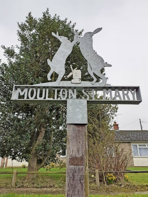
Moulton St Mary

Settlement in Norfolk Broadland

England

Moulton St Mary

Halvergate: Crop
Halvergate: Crop Credit: Michael Garlick

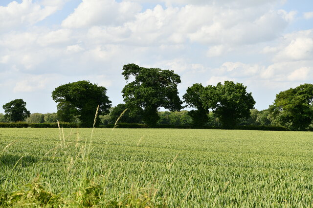
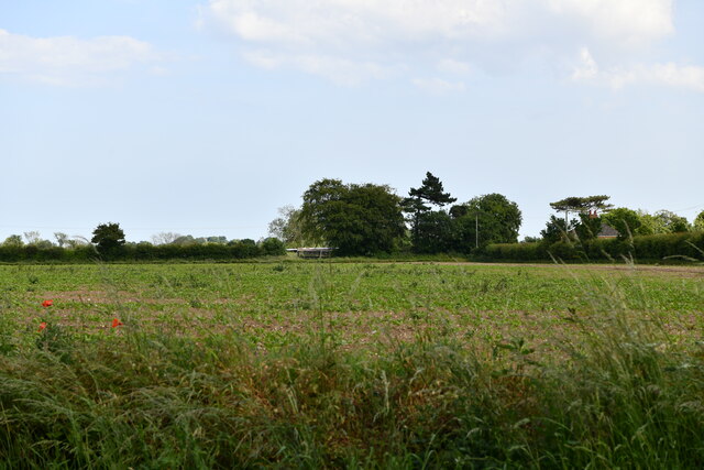
Moulton St Mary is a small village located in the county of Norfolk, England. Situated approximately 10 miles south of the city of Norwich, it is part of the South Norfolk district. The village is surrounded by picturesque countryside, with the River Yare flowing nearby.

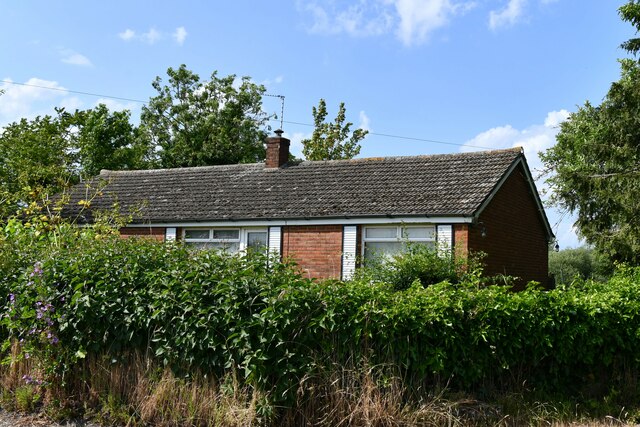
With a population of around 300 residents, Moulton St Mary has a close-knit community feel. The village is primarily rural, characterized by its charming thatched cottages and traditional Norfolk architecture. The local church, St Mary's, is a prominent landmark and dates back to the 14th century. It is known for its beautiful stained glass windows and historic features.

Despite its small size, Moulton St Mary offers a range of amenities for its residents. These include a village hall, a primary school, and a local pub. The surrounding area provides ample opportunities for outdoor activities, such as walking, cycling, and boating along the nearby river.

The village is well-connected, with good transport links to nearby towns and cities. The A146 road passes close by, providing easy access to Norwich and the wider Norfolk area. Public transportation is also available, with regular bus services connecting Moulton St Mary to surrounding villages and towns.

Overall, Moulton St Mary is a quaint and peaceful village, perfect for those seeking a quiet rural lifestyle while still having access to nearby amenities and attractions. Its rich history, stunning countryside, and friendly community make it a desirable place to live or visit in Norfolk.

If you have any feedback on the listing, please let us know in the comments section below.

Moulton St Mary Images

Images are sourced within 2km of 52.612278/1.536995 or Grid Reference TG3907. Thanks to Geograph Open Source API. All images are credited.

Halvergate: Crop
Halvergate: Crop
Beighton: 'Montrose'
Moulton St Mary village sign The sign depicts boxing hares and the old postmill with once stood south of the village not far from the church.
The sign was designed and created by local resident Jamie Mack in 2017
Moulton St Mary village sign
The sign depicts boxing hares and the old postmill with once stood south of the village not far from the church. The sign was designed and created by local resident Jamie Mack in 2017
Beighton village sign The sign depicts the church, chapel, the agricultural nature of the village and a barn owl for good measure. <a href="https://www.geograph.org.uk/photo/7200691">TG3807 : Beighton village sign</a>
It takes a similar form to the sign at neighbouring Moulton St Mary which was made by the same hand. <a title="https://www.geograph.org.uk/photo/7200701" href="https://www.geograph.org.uk/photo/7200701">Link</a>
Beighton village sign
The sign depicts the church, chapel, the agricultural nature of the village and a barn owl for good measure. TG3807 : Beighton village sign It takes a similar form to the sign at neighbouring Moulton St Mary which was made by the same hand. Link
Beighton village sign The sign depicts the church, chapel, the agricultural nature of the village and a barn owl for good measure.  <a href="https://www.geograph.org.uk/photo/7200688">TG3807 : Beighton village sign</a>
It takes a similar form to the sign at neighbouring Moulton St Mary which was made by the same hand. <a title="https://www.geograph.org.uk/photo/7200701" href="https://www.geograph.org.uk/photo/7200701">Link</a>
Beighton village sign
The sign depicts the church, chapel, the agricultural nature of the village and a barn owl for good measure. TG3807 : Beighton village sign It takes a similar form to the sign at neighbouring Moulton St Mary which was made by the same hand. Link
Moulton St Mary village sign The sign depicts boxing hares and the old postmill with once stood south of the village not far from the church. <a href="https://www.geograph.org.uk/photo/7200701">TG3907 : Moulton St Mary village sign</a>
The village sign at neighbouring Beighton was made by the same hand. <a title="https://www.geograph.org.uk/photo/7200688" href="https://www.geograph.org.uk/photo/7200688">Link</a>
Moulton St Mary village sign
The sign depicts boxing hares and the old postmill with once stood south of the village not far from the church. TG3907 : Moulton St Mary village sign The village sign at neighbouring Beighton was made by the same hand. Link
Moulton St Mary village sign The sign depicts boxing hares and the old postmill with once stood south of the village not far from the church. <a href="https://www.geograph.org.uk/photo/7200695">TG3907 : Moulton St Mary village sign</a>
The village sign at neighbouring Beighton was made by the same hand. <a title="https://www.geograph.org.uk/photo/7200688" href="https://www.geograph.org.uk/photo/7200688">Link</a>
Moulton St Mary village sign
The sign depicts boxing hares and the old postmill with once stood south of the village not far from the church. TG3907 : Moulton St Mary village sign The village sign at neighbouring Beighton was made by the same hand. Link
Moulton st Mary: Moulton Nurseries Plant Centre
Acle: Crop
Acle: Crop
Trees on field boundary
St Mary's church St Mary's church > <a title="https://www.geograph.org.uk/photo/1696743" href="https://www.geograph.org.uk/photo/1696743">Link</a> at Moulton St Mary is situated about one kilometre to the south-east of the village, adjoined only by Manor Hall Farmhouse > <a title="https://www.geograph.org.uk/photo/1696782" href="https://www.geograph.org.uk/photo/1696782">Link</a> and several barn conversions. Its Norman round tower has a later conical tiled roof.   The south porch was added in Tudor times and has a mass dial on its upper south-western corner > <a title="https://www.geograph.org.uk/photo/455863" href="https://www.geograph.org.uk/photo/455863">Link</a>.  The Georgian east wall of the chancel is built in brick.  The church houses the original 13th century font > <a title="https://www.geograph.org.uk/photo/1696776" href="https://www.geograph.org.uk/photo/1696776">Link</a> and its walls are adorned with 14th century paintings, depicting St Christopher and scenes from the Acts of Mercy > <a title="https://www.geograph.org.uk/photo/1696775" href="https://www.geograph.org.uk/photo/1696775">Link</a>.  Pulpit > <a title="https://www.geograph.org.uk/photo/1696747" href="https://www.geograph.org.uk/photo/1696747">Link</a> and Commandments boards (on the west wall) date from the 17th century > <a title="https://www.geograph.org.uk/photo/1696771" href="https://www.geograph.org.uk/photo/1696771">Link</a>. St Mary's church is in the care of the Churches Conservation Trust and open every day.
St Mary's church
St Mary's church > Link at Moulton St Mary is situated about one kilometre to the south-east of the village, adjoined only by Manor Hall Farmhouse > Link and several barn conversions. Its Norman round tower has a later conical tiled roof. The south porch was added in Tudor times and has a mass dial on its upper south-western corner > Link. The Georgian east wall of the chancel is built in brick. The church houses the original 13th century font > Link and its walls are adorned with 14th century paintings, depicting St Christopher and scenes from the Acts of Mercy > Link. Pulpit > Link and Commandments boards (on the west wall) date from the 17th century > Link. St Mary's church is in the care of the Churches Conservation Trust and open every day.
Manor Hall Farm (farmhouse)
New barn conversion
New barn conversion
Old brick shed
Old brick shed
Old brick shed
Old brick shed
Access road to Manor Hall Farm
Access road to Hall's Farm
Show me another place!

Moulton St Mary is located at Grid Ref: TG3907 (Lat: 52.612278, Lng: 1.536995)

Administrative County: Norfolk

District: Broadland

Police Authority: Norfolk

What 3 Words

///squares.lengthen.attends. Near Acle, Norfolk

Nearby Locations

Beighton Moulton St Mary

Related Wikis

St Mary's Church, Moulton

St Mary's Church is a redundant Anglican round-tower church near the village of Moulton St Mary, Norfolk, England. It is recorded in the National Heritage...

Beighton, Norfolk

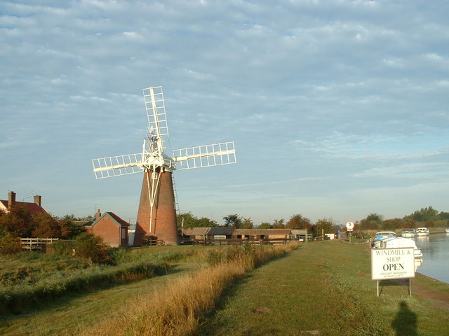
Beighton is a village and civil parish in the Broadland district of Norfolk, England, about two miles (3 km) South-West of Acle about 12.8 miles (20.6...

Decoy Carr, Acle

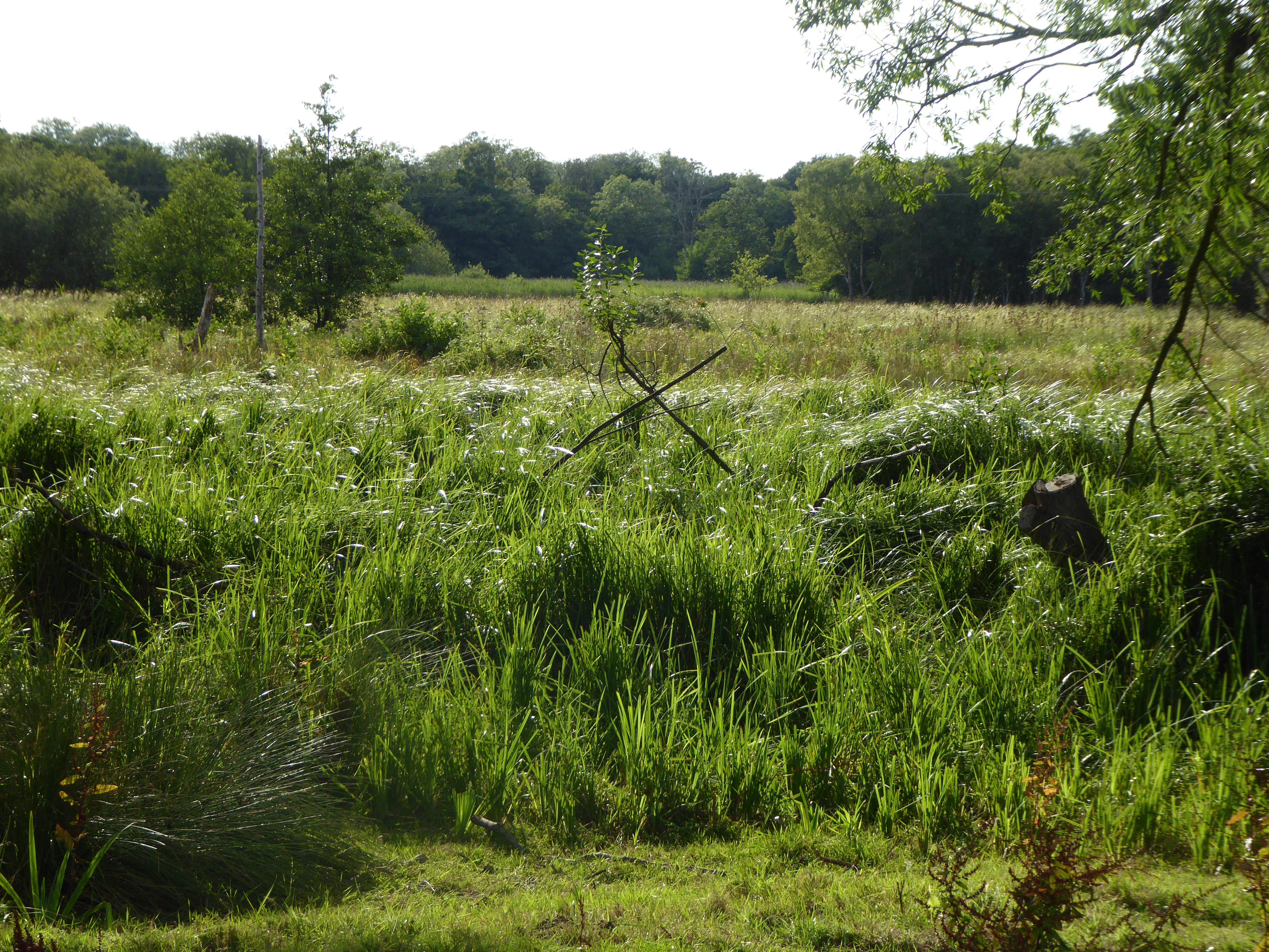
Decoy Carr, Acle is a 56-hectare (140-acre) biological Site of Special Scientific Interest south of Acle in Norfolk. It is part of the Broadland Ramsar...

Moulton St Mary

Moulton St Mary is a village and former civil parish, now in the parish of Beighton, in the Broadland district, in the county of Norfolk, England. It is...

Southwood, Norfolk

Southwood is a hamlet and former civil parish, 10 miles (16 km) east of Norwich, now in the parish of Cantley, Limpenhoe and Southwood, in the Broadland...

Blofield and Flegg Rural District

Blofield and East and West Flegg Rural Districts were adjacent rural districts in Norfolk, England from 1894 to 1935.They were formed under the Local Government...

Tunstall, Norfolk

Tunstall is a village and former civil parish, now in the parish of Halvergate, in the Broadland district of Norfolk, England. It lies some 14 miles (22...

Acle railway station

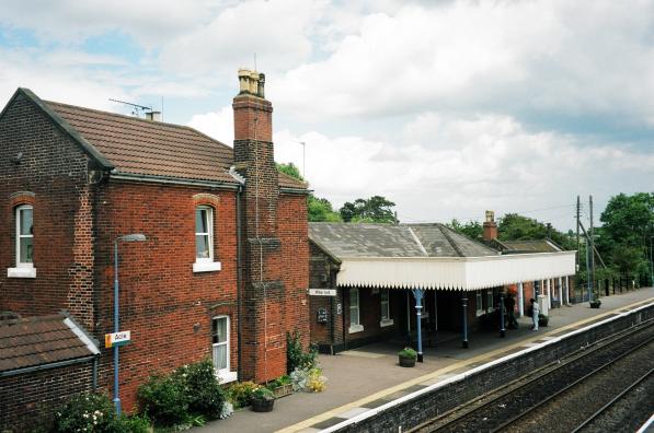
Acle railway station is on the Wherry Lines in the east of England, serving the town of Acle, Norfolk. It is 10 miles 34 chains (16.8 km) down the line...

Nearby Amenities

Located within 500m of 52.612278,1.536995
Moulton St Mary
Alt Name: Moulton Saint Mary
Place: village
Website: https://beightonpc.norfolkparishes.gov.uk/
Wikidata: Q6919062
Lat/Long: 52.6148983/1.5385943
Post Box
Lat/Long: 52.6143917/1.5433331
Bus Stop
Reedham Road, adj
Naptan AtcoCode: 2900B2320
Naptan Bearing: N
Naptan BusStopType: CUS
Naptan CommonName: Reedham Road
Naptan Indicator: adj
Naptan Landmark: Council Houses
Naptan Locality: Moulton St Mary
Naptan NaptanCode: nfogmama
Naptan ShortCommonName: Reedham Road
Naptan Street: Reedham Road
Naptan Verified: no
Source: naptan_import
Lat/Long: 52.6162896/1.5380817
Bus Stop
Peacock Corner, adj
Naptan AtcoCode: 2900B233
Naptan Bearing: NW
Naptan BusStopType: CUS
Naptan CommonName: Peacock Corner
Naptan Indicator: adj
Naptan Locality: Moulton St Mary
Naptan NaptanCode: nfoadwat
Naptan Street: Peacock Corner
Naptan Verified: no
Source: naptan_import
Lat/Long: 52.6142959/1.5388813
Bus Stop
Peacock Corner, opp
Naptan AtcoCode: 2900B2313
Naptan Bearing: SE
Naptan BusStopType: CUS
Naptan CommonName: Peacock Corner
Naptan Indicator: opp
Naptan Locality: Moulton St Mary
Naptan NaptanCode: nfoadwaj
Naptan Street: Morley Road
Naptan Verified: no
Source: naptan_import
Lat/Long: 52.6143753/1.538932
Cafe
Moulton Nursery & Cafe
Addr Street: Acle Road
Cuisine: local
Lat/Long: 52.6129772/1.5407935
Give Way
Lat/Long: 52.6128782/1.5306026
The data included in this document is from www.openstreetmap.org. The data is made available under ODbL.

Have you been to Moulton St Mary?

Leave your review of Moulton St Mary below (or comments, questions and feedback).