Moulton Seas End

Settlement in Lincolnshire South Holland

England

Moulton Seas End

Road junction
Road junction Credit: Alex McGregor

Moulton Seas End is a small village located in the South Holland district of Lincolnshire, England. Situated approximately 6 miles east of Spalding, the village is nestled in the heart of the Fens, a flat and fertile region known for its rich agricultural land.

With a population of around 500 residents, Moulton Seas End exudes a peaceful and close-knit community atmosphere. The village is primarily residential, with a scattering of traditional brick and thatched cottages, along with a few modern houses. The charm of Moulton Seas End lies in its picturesque rural setting, surrounded by vast expanses of fields and farmland.

Although small in size, the village boasts a few local amenities to cater to its residents. These include a primary school, a village hall, and a church, providing essential services and gathering spaces for the community. Additionally, Moulton Seas End benefits from its proximity to nearby towns such as Spalding and Boston, which offer a wider range of amenities including shops, supermarkets, and leisure facilities.

The village is well-connected by road, with the A17 passing nearby, providing easy access to surrounding areas. Public transportation is limited, but regular bus services operate in the region, connecting Moulton Seas End to nearby towns and villages.

Overall, Moulton Seas End offers a tranquil and idyllic countryside setting, making it an ideal place for those seeking a peaceful and rural lifestyle in the heart of Lincolnshire.

If you have any feedback on the listing, please let us know in the comments section below.

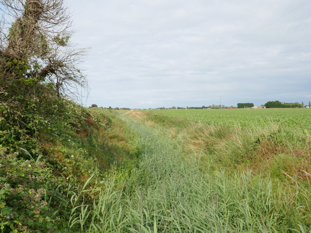
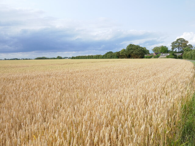
Moulton Seas End Images

Images are sourced within 2km of 52.823922/-0.043902 or Grid Reference TF3126. Thanks to Geograph Open Source API. All images are credited.

Road junction
Road junction
Goddam's Lane
Goddam's Lane
Spalding Gate
Spalding Gate
Spalding Gate
Spalding Gate
Drain off Goddam's Lane
Fields off Spalding Gate
Whaplode River near Welland House There is some water in there somewhere!
Whaplode River near Welland House
There is some water in there somewhere!
Wheat field off Saltney Gate
Underneath the wires near Penn's Farm
Field edge off Low Gate
Farm track off Low Gate
Straw stacks off Low Gate
House Repair This house in Loosegate is by the side of Seas End Road.  If global warming raises sea level as it is expected this house will, I assume, become a beach hut.
House Repair
This house in Loosegate is by the side of Seas End Road. If global warming raises sea level as it is expected this house will, I assume, become a beach hut.
Big Field Big Tent The white spot on the horizon is a large marquee.  There is something a little uncomfortable about the fact that weeds grow happily at this field margin but the rest of the field remains lifeless.
Big Field Big Tent
The white spot on the horizon is a large marquee. There is something a little uncomfortable about the fact that weeds grow happily at this field margin but the rest of the field remains lifeless.
Paddock and Halesgate The buildings that lie beyond this paddock are part of Halesgate.
Paddock and Halesgate
The buildings that lie beyond this paddock are part of Halesgate.
Golden Lion This Golden Lion pub stands at the junction of Pipwell Gate and Seas End Road.
Golden Lion
This Golden Lion pub stands at the junction of Pipwell Gate and Seas End Road.
Footpath and Farm The footpath leads to the River Welland.  The farm is clearly operating on an industrial scale in its food production.
Footpath and Farm
The footpath leads to the River Welland. The farm is clearly operating on an industrial scale in its food production.
Farm Track and Shadow This farm track leads over the flat fields to the A17.  The white and red dots on the horizon, left, are lorries which are using this busy route.
Farm Track and Shadow
This farm track leads over the flat fields to the A17. The white and red dots on the horizon, left, are lorries which are using this busy route.
Show me another place!

Moulton Seas End is located at Grid Ref: TF3126 (Lat: 52.823922, Lng: -0.043902)

Division: Parts of Holland

Administrative County: Lincolnshire

District: South Holland

Police Authority: Lincolnshire

What 3 Words

///streetcar.inches.depth. Near Whaplode, Lincolnshire

Nearby Locations

Moulton Seas End

Related Wikis

Moulton Seas End

Moulton Seas End is a village in the civil parish of The Moultons and the South Holland district of Lincolnshire, England. It is 5 miles (8 km) north...

Parts of Holland

The Parts of Holland is a historical division of Lincolnshire, England, encompassing the south-east of the county. The name is still recognised locally...

Holbeach Clough

Holbeach Clough (today synonymous with Saracen's Head) is a fenland village in the South Holland district of Lincolnshire, England. It is just under 2...

Whaplode

Whaplode is a village and civil parish in the South Holland district of Lincolnshire, England. It is just west of the Prime Meridian. The parish includes...

Nearby Amenities

Located within 500m of 52.823922,-0.043902
Bus Stop
Golden Lion PH
Naptan AtcoCode: 270000010597
Naptan Bearing: N
Naptan CommonName: Golden Lion PH
Naptan Indicator: opp
Naptan Landmark: Golden Lion PH
Naptan NaptanCode: linjpaja
Naptan Street: Seas End Road
Naptan Verified: no
Source: naptan_import
Lat/Long: 52.8252021/-0.0404183
Bus Stop
Golden Lion PH
Naptan AtcoCode: 2700LMSE6678
Naptan Bearing: S
Naptan CommonName: Golden Lion PH
Naptan Indicator: adj
Naptan Landmark: Golden Lion PH
Naptan NaptanCode: lingdtpd
Naptan Street: Seas End Road
Naptan Verified: no
Source: naptan_import
Lat/Long: 52.8252258/-0.0402243
Post Box
Collection Times: Mo-Fr 09:00; Sa 07:00
Description: On W side of road. Next to white house, which sticks out into the pavement, making it only visible from the N./Seas End Road,B1357
Operator: Royal Mail
Operator Wikidata: Q638098
Post Box Mounting: pier
Post Box Type: lamp
Ref: PE12 79
Lat/Long: 52.8269866/-0.0394478
Earlsfield
Place: locality
Source: Bing
Lat/Long: 52.8280008/-0.0408259
Hall Farm
Place: farm
Source: Bing
Lat/Long: 52.8246457/-0.048512
Jack Bucks Farm
Place: farm
Source: Bing
Lat/Long: 52.8214946/-0.03804
Rig House
Place: isolated_dwelling
Lat/Long: 52.8197287/-0.045742
Barrier: yes
Lat/Long: 52.8252338/-0.05029
The data included in this document is from www.openstreetmap.org. The data is made available under ODbL.

Have you been to Moulton Seas End?

Leave your review of Moulton Seas End below (or comments, questions and feedback).