Morley Park

Settlement in Derbyshire Amber Va

England

Morley Park

Street Lane Methodists Church Street Lane Methodists Church, Street Lane (road name), Street Lane (Village name), Derbyshire. This village and church sit on the old Ryknield Street Roman Road.
Street Lane Methodists Church Credit: Rob Bradford

Morley Park is a picturesque village located in the county of Derbyshire, England. Nestled amidst the rolling hills of the Amber Valley, it is renowned for its natural beauty and tranquil atmosphere. The village is situated just 5 miles east of Derby, making it easily accessible for both locals and visitors.

Morley Park is characterized by its charming stone-built cottages, which date back to the 17th century, giving the village a timeless and quintessentially English feel. The village is surrounded by lush green fields and woodlands, offering ample opportunities for exploring the great outdoors.

One of the highlights of Morley Park is its local park, which is a popular spot for both residents and tourists. The park features well-maintained paths for walking and cycling, as well as a children's playground and a tranquil lake where visitors can enjoy a picnic or go fishing. The park also hosts various events throughout the year, such as summer festivals and outdoor concerts, adding to the vibrant community spirit of the village.

Morley Park is also home to a number of historical landmarks, including the Grade II listed Morley Hall, a magnificent country house built in the 18th century. The village church, St. Matthew's, is another notable landmark, with its beautiful stained glass windows and peaceful churchyard.

In addition to its natural beauty and historical charm, Morley Park offers a range of amenities, including a post office, a village shop, and a cozy pub, where locals and visitors can enjoy a pint of local ale and hearty pub food.

Overall, Morley Park is a delightful village that offers a perfect blend of natural beauty, historical heritage, and community spirit, making it a must-visit destination in Derbyshire.

If you have any feedback on the listing, please let us know in the comments section below.
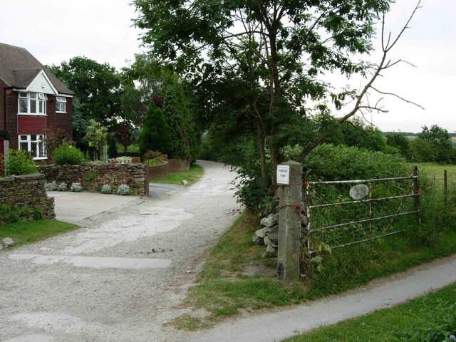
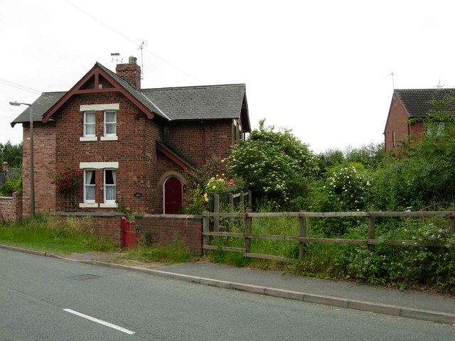
Morley Park Images

Images are sourced within 2km of 53.027945/-1.4348669 or Grid Reference SK3848. Thanks to Geograph Open Source API. All images are credited.

Street Lane Methodists Church Street Lane Methodists Church, Street Lane (road name), Street Lane (Village name), Derbyshire. This village and church sit on the old Ryknield Street Roman Road.
Street Lane Methodists Church
Street Lane Methodists Church, Street Lane (road name), Street Lane (Village name), Derbyshire. This village and church sit on the old Ryknield Street Roman Road.
Denby Pottery Denby Pottery Factory and Visitor Centre, Denby, Derbyshire.
Denby Pottery
Denby Pottery Factory and Visitor Centre, Denby, Derbyshire.
Marehay Car dealership and housing at Marehay on the main road leading up into Ripley.
Marehay
Car dealership and housing at Marehay on the main road leading up into Ripley.
Site of Kilburn Station This was the site of Kilburn Station on the branch to Ripley.  The station was closed to passenger traffic in 1930, but the line continued for freight traffic as far as Denby until recently.  This fence has now replaced the level crossing gates here on the A609 Ilkeston - Belper road.
Site of Kilburn Station
This was the site of Kilburn Station on the branch to Ripley. The station was closed to passenger traffic in 1930, but the line continued for freight traffic as far as Denby until recently. This fence has now replaced the level crossing gates here on the A609 Ilkeston - Belper road.
Kilburn Road, Openwoodgate From this point the A609 descends into the Derwent Valley at Belper.  The pub is the Seven Stars.
Kilburn Road, Openwoodgate
From this point the A609 descends into the Derwent Valley at Belper. The pub is the Seven Stars.
Over Lane, Openwoodgate Looking towards Heage.
Over Lane, Openwoodgate
Looking towards Heage.
Morley Close, Openwoodgate A small modern development of bungalows off Over Lane between Openwoodgate and Heage.
Morley Close, Openwoodgate
A small modern development of bungalows off Over Lane between Openwoodgate and Heage.
Park Lane, Heage At the southern end of Heage, Park Lane becomes a 'road used as a public path' leading to Morley Park.
Park Lane, Heage
At the southern end of Heage, Park Lane becomes a 'road used as a public path' leading to Morley Park.
Street Lane Street Lane, running from Upper Hartshay towards Kilburn, is part of the Roman Ryknild Street - hence the straightness.
Street Lane
Street Lane, running from Upper Hartshay towards Kilburn, is part of the Roman Ryknild Street - hence the straightness.
Denby Station House, Smithy Houses This was the site of Denby Station (actually in Smithy Houses, some distance from Denby village).  The station closed to passengers in 1930, but traces of the platform are still visible in the undergrowth.
Denby Station House, Smithy Houses
This was the site of Denby Station (actually in Smithy Houses, some distance from Denby village). The station closed to passengers in 1930, but traces of the platform are still visible in the undergrowth.
Zion Chapel 1903, Marehay
Footpath at White Moor This footpath leads from White Moor towards Heage. Suburban development on the northern edge of Belper can be seen in the distance.
Footpath at White Moor
This footpath leads from White Moor towards Heage. Suburban development on the northern edge of Belper can be seen in the distance.
St Marks Church, Openwoodgate. The wrought iron gates to this church were made and erected as a memorial for the second world war.
St Marks Church, Openwoodgate.
The wrought iron gates to this church were made and erected as a memorial for the second world war.
Openwood Road Originally known as the Gang Road, this was an un-adopted un-surfaced lane which the council refused to maintain. In the early 50s a group of residence found old written records which enabled them to take the council to court and win the case. The first house on the right was built as a chip shop.
Openwood Road
Originally known as the Gang Road, this was an un-adopted un-surfaced lane which the council refused to maintain. In the early 50s a group of residence found old written records which enabled them to take the council to court and win the case. The first house on the right was built as a chip shop.
134 miles to London Old milestone by what is now the B6179 near Denby Pottery. 
The road was originally the A61 from Chesterfield to Derby.

The stone has since been cleaned up - <a href="https://www.geograph.org.uk/photo/5436385">SK3947 : Milepost at Denby Potteries</a>.
134 miles to London
Old milestone by what is now the B6179 near Denby Pottery. The road was originally the A61 from Chesterfield to Derby. The stone has since been cleaned up - SK3947 : Milepost at Denby Potteries.
Modern Factory Outlet of Denby Potteries Part of the factory outlet complex of Denby Potteries, looking north east from the car park.
Modern Factory Outlet of Denby Potteries
Part of the factory outlet complex of Denby Potteries, looking north east from the car park.
Denby Visitor Centre
Denby Pottery on B6179
Show me another place!

Morley Park is located at Grid Ref: SK3848 (Lat: 53.027945, Lng: -1.4348669)

Administrative County: Derbyshire

District: Amber Va

Police Authority: Derbyshire

What 3 Words

///interrupt.responds.bibs. Near Ripley, Derbyshire

Nearby Locations

Street Lane Morley Park

Related Wikis

Street Lane

Street Lane is a hamlet in the Amber Valley district of Derbyshire, England. It is in close proximity to the nearby town of Ripley. Street Lane is a linear...

Denby railway station

Denby railway station was a railway station which served the village of Denby in Derbyshire, England. It was opened in 1856 as Smithy Houses by the Midland...

Denby

Denby is a village in the English county of Derbyshire that is notable as the birthplace of John Flamsteed, England's first Astronomer Royal, and the location...

John Flamsteed Community School

John Flamsteed Community School is an 11–16 mixed secondary school with academy status in Denby, Derbyshire, England. It is named after Sir John Flamsteed...

Nearby Amenities

Located within 500m of 53.027945,-1.4348669
Barrier: stile
Lat/Long: 53.0252879/-1.4316455
Barrier: stile
Lat/Long: 53.0260674/-1.4310018
Barrier: stile
Lat/Long: 53.0264094/-1.4305529
Barrier: stile
Steps: 2
Stile: stepover
Lat/Long: 53.0283528/-1.442271
Barrier: stile
Steps: 1
Stile: stepover
Lat/Long: 53.0283554/-1.4419381
Barrier: stile
Steps: 1
Stile: stepover
Lat/Long: 53.0279928/-1.4394546
Barrier: stile
Steps: 1
Stile: stepover
Lat/Long: 53.0271297/-1.4356177
Barrier: kissing_gate
Lat/Long: 53.0265273/-1.4345822
Barrier: stile
Steps: 1
Stile: stepover
Lat/Long: 53.0269608/-1.4311977
Content: water
Man Made: storage_tank
Lat/Long: 53.0306341/-1.4313419
Content: water
Man Made: storage_tank
Lat/Long: 53.0263644/-1.4297348
Content: water
Man Made: storage_tank
Lat/Long: 53.026424/-1.4297301
The data included in this document is from www.openstreetmap.org. The data is made available under ODbL.

Have you been to Morley Park?

Leave your review of Morley Park below (or comments, questions and feedback).