Morley Hole

Settlement in Yorkshire

England

Morley Hole

Shops on Town Street, Gildersome Currently comprising a pizza takeaway, laundrette, fish-and-chip shop and sandwich shop.
Shops on Town Street, Gildersome Credit: Stephen Craven

The requested URL returned error: 429 Too Many Requests

If you have any feedback on the listing, please let us know in the comments section below.
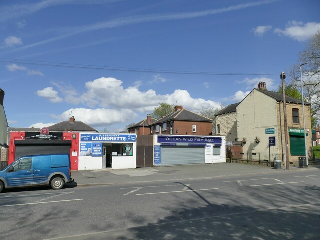
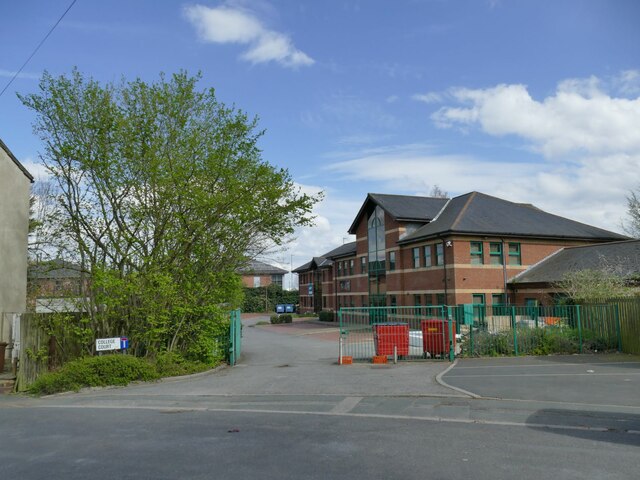
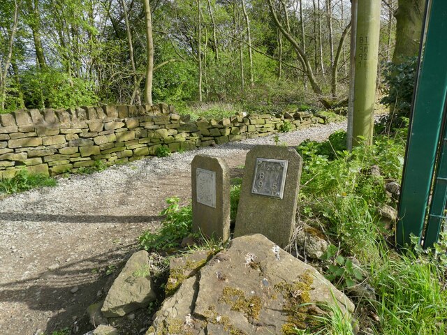
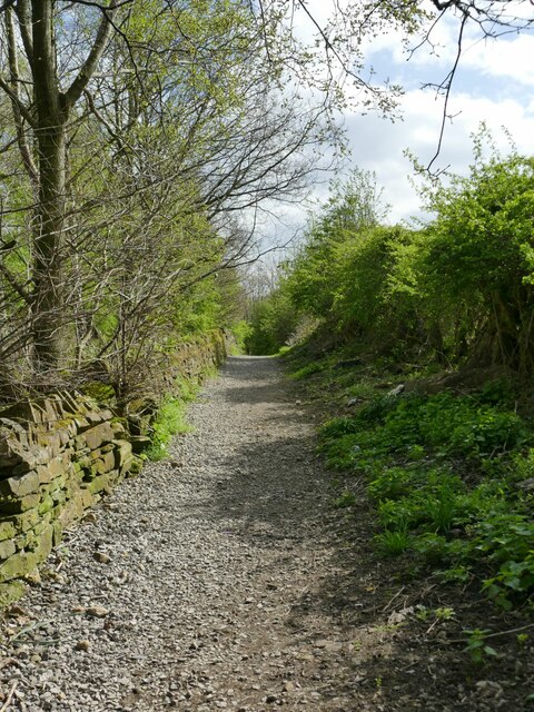
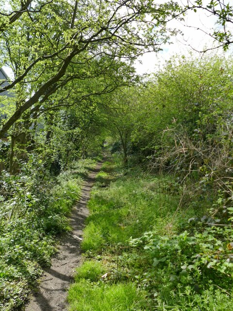
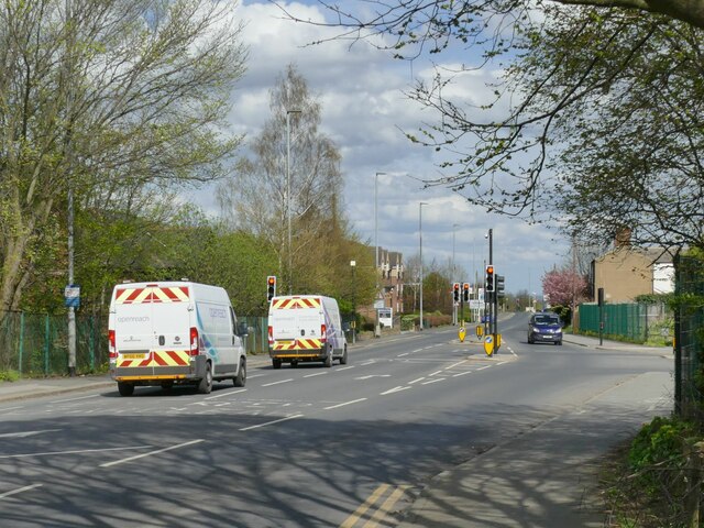
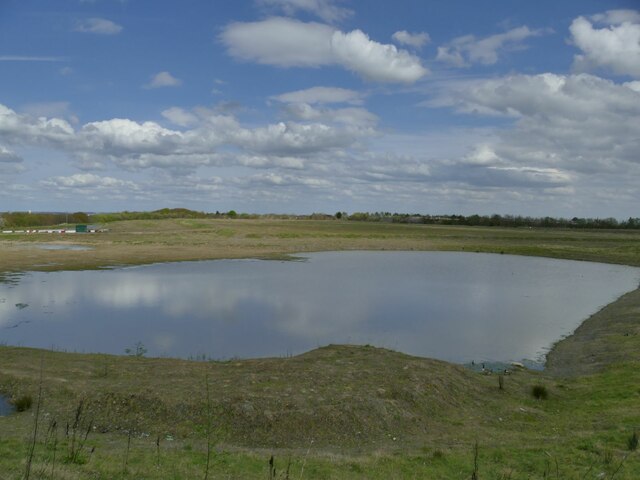
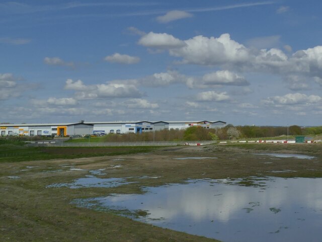
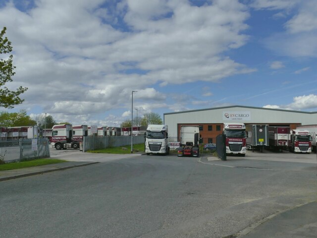
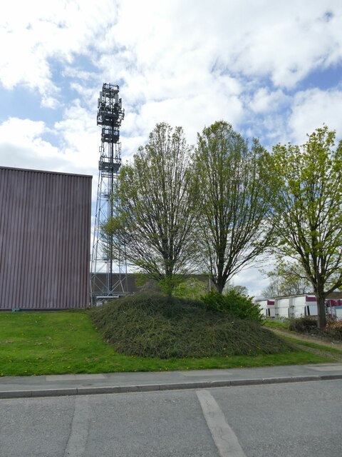
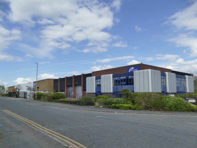
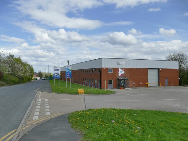
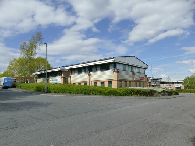
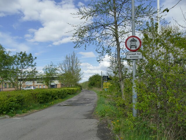
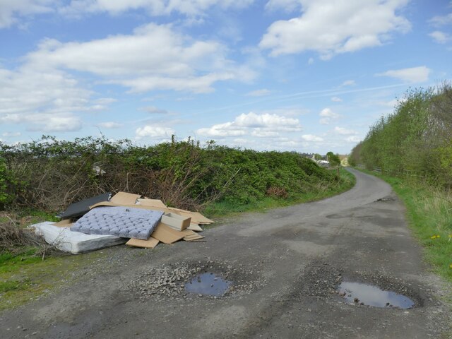
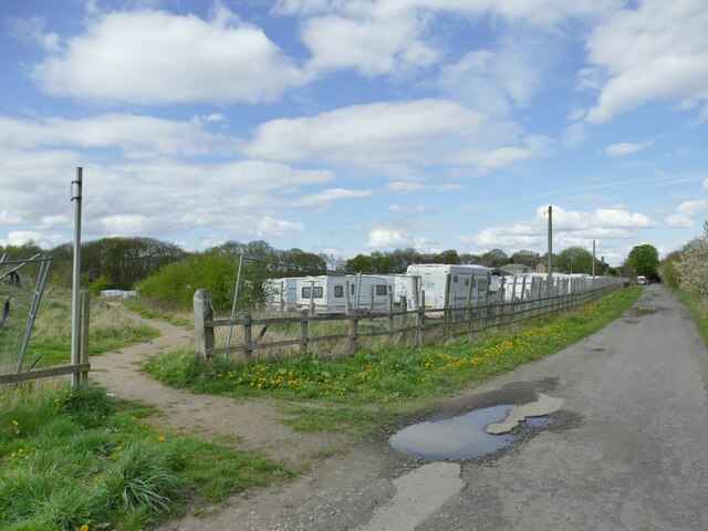
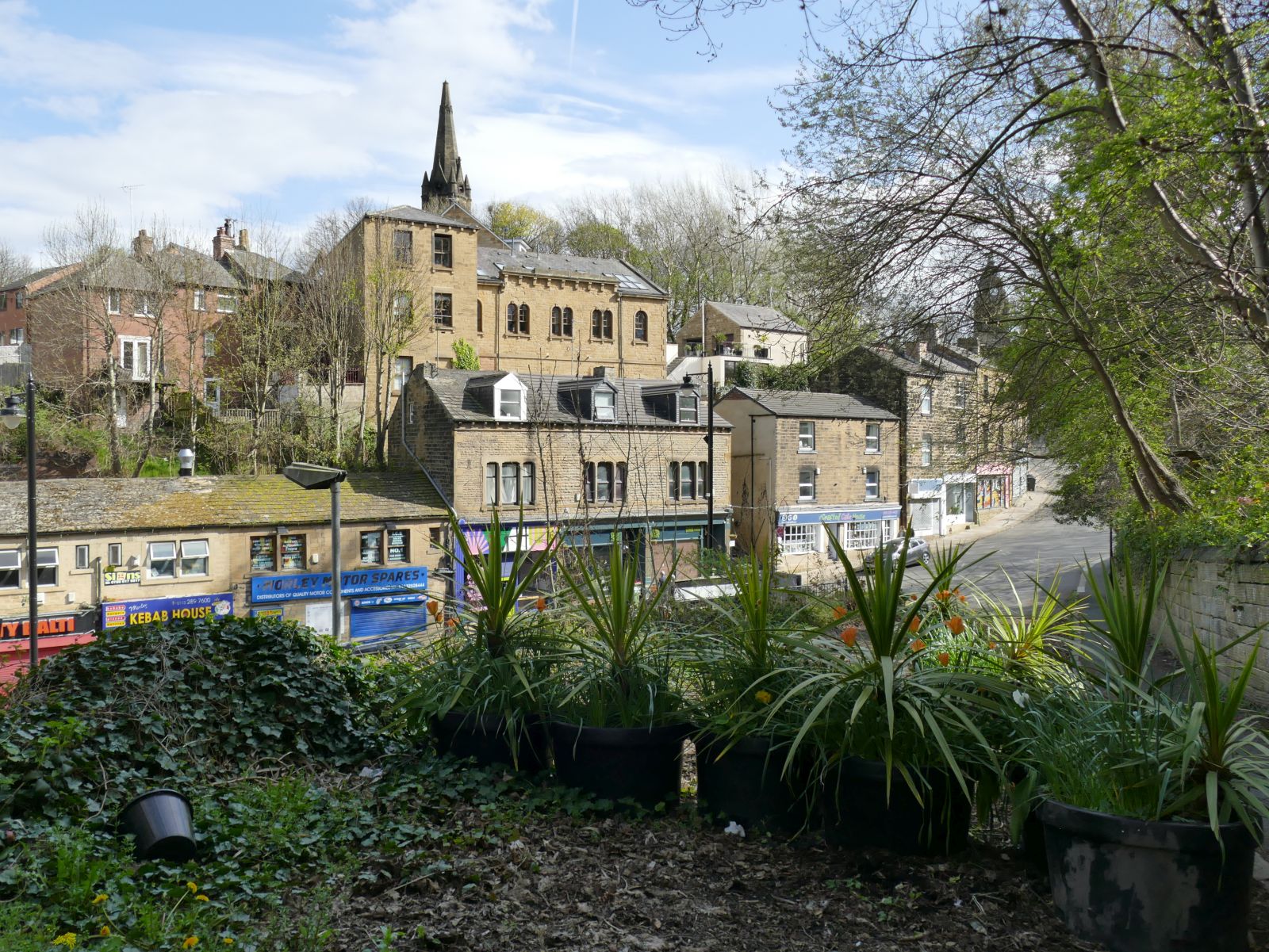
Morley Hole Images

Images are sourced within 2km of 53.749523/-1.607202 or Grid Reference SE2628. Thanks to Geograph Open Source API. All images are credited.

Shops on Town Street, Gildersome Currently comprising a pizza takeaway, laundrette, fish-and-chip shop and sandwich shop.
Shops on Town Street, Gildersome
Currently comprising a pizza takeaway, laundrette, fish-and-chip shop and sandwich shop.
Ukrainian flag, Town Street, Gildersome The flagpole by the war memorial seems to be used for marking particular occasions, as the last time I passed it was flying the NHS flag during the Covid-19 pandemic <a href="https://www.geograph.org.uk/photo/6786905">SE2429 : Gildersome village cenotaph</a>. This time it was marking the war in Ukraine, although the Union flag has also been seen <a href="https://www.geograph.org.uk/photo/6393017">SE2429 : War Memorial, Gildersome</a>.
Ukrainian flag, Town Street, Gildersome
The flagpole by the war memorial seems to be used for marking particular occasions, as the last time I passed it was flying the NHS flag during the Covid-19 pandemic SE2429 : Gildersome village cenotaph. This time it was marking the war in Ukraine, although the Union flag has also been seen SE2429 : War Memorial, Gildersome.
College Court, Gildersome A modern small business park, though Mill Court may have been a better name as it's built on the site of the former Allied Woollens mill.
College Court, Gildersome
A modern small business park, though Mill Court may have been a better name as it's built on the site of the former Allied Woollens mill.
Water valve markers, Gelderd Road, Gildersome Two metal plates indicating valves on a six-inch main belonging to Morley Corporation Water Works.  The MCWW sourced its water from reservoirs in upper Calderdale
Water valve markers, Gelderd Road, Gildersome
Two metal plates indicating valves on a six-inch main belonging to Morley Corporation Water Works. The MCWW sourced its water from reservoirs in upper Calderdale
Stone Pits Lane, off Gelderd Road, Gildersome Part of a public footpath from Gildersome to Bruntcliffe (now cut off by the M621 motorway).
Stone Pits Lane, off Gelderd Road, Gildersome
Part of a public footpath from Gildersome to Bruntcliffe (now cut off by the M621 motorway).
Windmill Lane, Gildersome The windmill itself was in the opposite direction and is long vanished (the site now being part of an industrial estate).
Windmill Lane, Gildersome
The windmill itself was in the opposite direction and is long vanished (the site now being part of an industrial estate).
New junction on Gelderd Road Only the latest maps show this junction, which has been equipped with traffic lights in anticipation of traffic into and out of a new industrial estate (to the right) that's still being developed.
New junction on Gelderd Road
Only the latest maps show this junction, which has been equipped with traffic lights in anticipation of traffic into and out of a new industrial estate (to the right) that's still being developed.
Flooded opencast workings near Gildersome This site is currently being developed as an industrial estate. According to the 2014 planning application available online, "The site has previously been part of a larger site used for opencast coal mining in the 1980s, and has been restored to grassland with some tree planting to the boundary". So what we see here is probably a filled quarry and the water may not actually be very deep.
Flooded opencast workings near Gildersome
This site is currently being developed as an industrial estate. According to the 2014 planning application available online, "The site has previously been part of a larger site used for opencast coal mining in the 1980s, and has been restored to grassland with some tree planting to the boundary". So what we see here is probably a filled quarry and the water may not actually be very deep.
New industrial estate near Gildersome This site is currently being developed as an industrial estate. According to the 2014 planning application available online, "The site has previously been part of a larger site used for opencast coal mining in the 1980s, and has been restored to grassland with some tree planting to the boundary". 

The photo is taken looking roughly along the alignment of a disused railway tunnel running beneath the site: the 2.1km long Gildersome Tunnel on the LNWR's Heaton Lodge and Wortley line (Leeds New Line) built in 1900 and abandoned in 1967, although passenger services ceased in 1953. According to contributor Phill D, When the M62 and M621 were built over it, a section extending from the southern portal was infilled with 30,000 cubic yards of colliery waste for reinforcement, so there is no chance of it being reopened as a cycle route, for example. See <a href="https://www.geograph.org.uk/photo/706925">SE2529 : Gildersome railway tunnel.</a> for one of Phill's photos of the tunnel interior.
New industrial estate near Gildersome
This site is currently being developed as an industrial estate. According to the 2014 planning application available online, "The site has previously been part of a larger site used for opencast coal mining in the 1980s, and has been restored to grassland with some tree planting to the boundary". The photo is taken looking roughly along the alignment of a disused railway tunnel running beneath the site: the 2.1km long Gildersome Tunnel on the LNWR's Heaton Lodge and Wortley line (Leeds New Line) built in 1900 and abandoned in 1967, although passenger services ceased in 1953. According to contributor Phill D, When the M62 and M621 were built over it, a section extending from the southern portal was infilled with 30,000 cubic yards of colliery waste for reinforcement, so there is no chance of it being reopened as a cycle route, for example. See SE2529 : Gildersome railway tunnel. for one of Phill's photos of the tunnel interior.
C M Downton's haulage depot, Stone Pits Lane Built on the site of a former iron foundry.
C M Downton's haulage depot, Stone Pits Lane
Built on the site of a former iron foundry.
Communication mast off Stone Pits Lane The mast is in the heart of an industrial estate but may not be related to any particular business. Rather, the location seems to be strategically chosen as it is on high ground, and within a 1km radius covers the whole of the complex Gildersome Interchange (M62/M621/A62/A650) and a good length of the M621.
Communication mast off Stone Pits Lane
The mast is in the heart of an industrial estate but may not be related to any particular business. Rather, the location seems to be strategically chosen as it is on high ground, and within a 1km radius covers the whole of the complex Gildersome Interchange (M62/M621/A62/A650) and a good length of the M621.
Belgrade Insulation, Stone Pits Lane Part of the Nepshaw Lane industrial estate.
Belgrade Insulation, Stone Pits Lane
Part of the Nepshaw Lane industrial estate.
Pinnacle Group, Nepshaw Lane A facilities management company, located on the Nepshaw Lane industrial estate.
Pinnacle Group, Nepshaw Lane
A facilities management company, located on the Nepshaw Lane industrial estate.
Telescope, Nepshaw Lane South Web and print designers, based on an industrial estate near Morley.
Telescope, Nepshaw Lane South
Web and print designers, based on an industrial estate near Morley.
End of public access, Nepshaw Lane South Vehicle access is restricted from this point northwards for about 550 metres, the lane having public byway status.
End of public access, Nepshaw Lane South
Vehicle access is restricted from this point northwards for about 550 metres, the lane having public byway status.
Flytipping, Nepshaw Lane South Restrictions on vehicle access haven't prevented tipping of old mattresses and furniture.
Flytipping, Nepshaw Lane South
Restrictions on vehicle access haven't prevented tipping of old mattresses and furniture.
Hoarding, Nepshaw Lane South The large developer's hoarding on the edge of the site for a new industrial estate   is probably intended to be seen by drivers on the M621 rather than walkers on the byway immediately adjacent.
Hoarding, Nepshaw Lane South
The large developer's hoarding on the edge of the site for a new industrial estate is probably intended to be seen by drivers on the M621 rather than walkers on the byway immediately adjacent.
Diverted footpath, Nepshaw Lane North The public right of way across what is currently being developed as an industrial estate has been diverted around the perimeter. The path gives access to Dean Wood. To the right is a caravan storage site.
Diverted footpath, Nepshaw Lane North
The public right of way across what is currently being developed as an industrial estate has been diverted around the perimeter. The path gives access to Dean Wood. To the right is a caravan storage site.
Show me another place!

Morley Hole is located at Grid Ref: SE2628 (Lat: 53.749523, Lng: -1.607202)

Division: West Riding

Unitary Authority: Leeds

Police Authority: West Yorkshire

What 3 Words

///tall.them.drop. Near Morley, West Yorkshire

Nearby Locations

Morley Hole Troy Hill

Related Wikis

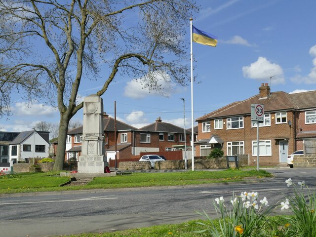
Morley War Memorial, Scatcherd Park

The Morley War Memorial is a British national war memorial situated in Scatcherd Park, Morley, Leeds, England. Sculpted by Walter Henry Gilbert and cast...

Morley, West Yorkshire

Morley is a market town and a civil parish within the City of Leeds metropolitan borough, in West Yorkshire, England. Morley is the largest town in the...

Morley and Rothwell (UK Parliament constituency)

Morley and Rothwell was a parliamentary constituency represented in the House of Commons of the Parliament of the United Kingdom. It elected one Member...

Morley and Outwood (UK Parliament constituency)

Morley and Outwood is a constituency in West Yorkshire represented in the House of Commons of the UK Parliament since 2015 by Andrea Jenkyns of the Conservative...

Nearby Amenities

Located within 500m of 53.749523,-1.607202
Mini Roundabout
Direction: clockwise
Lat/Long: 53.7493615/-1.6074615
Mini Roundabout
Direction: clockwise
Lat/Long: 53.7497879/-1.6071201
Mini Roundabout
Direction: clockwise
Lat/Long: 53.7451653/-1.6061704
Traffic Signals
Crossing: traffic_signals
Crossing Ref: pelican
Lat/Long: 53.7488616/-1.6102828
Traffic Signals
Morley Bottoms
Source: local knowledge
Lat/Long: 53.7491582/-1.6022523
Turning Circle
Lat/Long: 53.7468923/-1.6107845
Turning Circle
Lat/Long: 53.7482016/-1.6104437
Turning Circle
Lat/Long: 53.7472306/-1.6129138
Noexit: yes
Lat/Long: 53.7488818/-1.6110381
Post Box
Operator: Royal Mail
Post Box Type: lamp
Ref: LS27 339
Lat/Long: 53.7491534/-1.6088236
Turning Circle
Lat/Long: 53.7519807/-1.6120337
Pub
The Arkle
Addr City: Leeds
Addr Housenumber: 105
Addr Postcode: LS27 9PP
Addr Street: Springfield Avenue
Addr Suburb: Morley
Designation: Public House
Fhrs Id: 842603
Lat/Long: 53.7535042/-1.6078381
Crossing
Crossing: uncontrolled
Crossing Ref: zebra
Lat/Long: 53.7529866/-1.6071483
Booth: KX200
Removed Amenity: telephone
Lat/Long: 53.7525148/-1.60976
Post Box Type: pillar
Ref: LS27 941
Removed Amenity: post_box
Royal Cypher: EIIR
Lat/Long: 53.7525312/-1.6096772
Nisa Local
Addr City: Leeds
Addr Postcode: LS27 9NU
Addr Street: Victoria Road
Addr Suburb: Morley
Atm: yes
Fhrs Id: 801129
Shop: convenience
Lat/Long: 53.7522329/-1.6014409
Post Box
Operator: Royal Mail
Post Box Type: pillar
Ref: LS27 82
Lat/Long: 53.7469729/-1.6083197
Turning Circle
Lat/Long: 53.747996/-1.6075365
Turning Circle
Lat/Long: 53.7482894/-1.6070689
Turning Circle
Lat/Long: 53.7483541/-1.6051154
Turning Circle
Lat/Long: 53.748428/-1.6046474
Turning Circle
Lat/Long: 53.7484992/-1.6041967
Place Of Worship
National Spiritualist Church
Denomination: spiritualist
Religion: christian
Lat/Long: 53.7473777/-1.600958
Crossing
Crossing: uncontrolled
Crossing Ref: zebra
Lat/Long: 53.7498627/-1.6069234
Bus Stop
Asquith Avenue Asquith Drive
Bench: yes
Local Ref: 45010332
Naptan AtcoCode: 450010332
Naptan Bearing: SE
Naptan CommonName: Asquith Avenue Asquith Drive
Naptan Crossing: Asquith Drive
Naptan Indicator: Stop 45010332
Naptan PlusbusZoneRef: LEEDS
Naptan ShortCommonName: Asquith Drive
Naptan Street: Asquith Avenue
Naptan Verified: yes
Shelter: yes
Source: naptan_import
Timetable: yes
Lat/Long: 53.751551/-1.610171
Bus Stop
Church Street Croft House Road
Local Ref: 45010333
Naptan AtcoCode: 450010333
Naptan Bearing: NW
Naptan CommonName: Church Street Croft House Road
Naptan Crossing: Croft House Road
Naptan Indicator: Stop 45010333
Naptan Landmark: Garage
Naptan PlusbusZoneRef: LEEDS
Naptan ShortCommonName: Croft House Road
Naptan Street: Church Street
Naptan Verified: yes
Shelter: yes
Source: naptan_import
Timetable: yes
Towards: Holbeck, Leeds, Middleton, Moor Allerton
Lat/Long: 53.750952/-1.6002584
Bus Stop
Queen Street Dawson Hill
Local Ref: 45010334
Naptan AtcoCode: 450010334
Naptan Bearing: N
Naptan CommonName: Queen Street Dawson Hill
Naptan Crossing: Dawson Hill
Naptan Indicator: Stop 45010334
Naptan PlusbusZoneRef: LEEDS
Naptan ShortCommonName: Dawson Hill
Naptan Street: Queen Street
Naptan Verified: yes
Shelter: yes
Source: naptan_import
Timetable: yes
Lat/Long: 53.7484883/-1.6026929
Bus Stop
Morley Town Hall A
Bus: yes
Live Display: yes
Local Ref: 45010335
Naptan AtcoCode: 450010335
Naptan Bearing: NE
Naptan CommonName: A Morley Town Hall
Naptan Crossing: Queen Street
Naptan Indicator: Stop 45010335
Naptan Landmark: Town Hall
Naptan PlusbusZoneRef: LEEDS
Naptan ShortCommonName: A -Morley Town Hall
Naptan Street: Wellington Street
Naptan Verified: yes
Public Transport: platform
Ref: A
Shelter: yes
Source: naptan_import
Timetable: yes
Lat/Long: 53.7466577/-1.6020557
Bus Stop
Bruntcliffe Lane Wynyard Drive
Local Ref: 45011128
Naptan AtcoCode: 450011128
Naptan Bearing: SW
Naptan CommonName: Bruntcliffe Lane Wynyard Drive
Naptan Crossing: Wynyard Drive
Naptan Indicator: Stop 45011128
Naptan Landmark: Industrial Estate
Naptan PlusbusZoneRef: LEEDS
Naptan ShortCommonName: Wynyard Drive
Naptan Street: Bruntcliffe Lane
Naptan Verified: no
Source: naptan_import
Lat/Long: 53.7473005/-1.6132735
Bus Stop
Bruntcliffe Lane Wynyard Drive
Local Ref: 45011129
Naptan AtcoCode: 450011129
Naptan Bearing: NE
Naptan CommonName: Bruntcliffe Lane Wynyard Drive
Naptan Crossing: Wynyard Drive
Naptan Indicator: Stop 45011129
Naptan Landmark: Industrial Estate
Naptan PlusbusZoneRef: LEEDS
Naptan ShortCommonName: Wynyard Drive
Naptan Street: Bruntcliffe Lane
Naptan Verified: no
Source: naptan_import
Lat/Long: 53.747605/-1.612937
Bus Stop
Bruntcliffe Lane Brunswick Street
Local Ref: 45011130
Naptan AtcoCode: 450011130
Naptan Bearing: SW
Naptan CommonName: Bruntcliffe Lane Brunswick Street
Naptan Crossing: Brunswick Street
Naptan Indicator: Stop 45011130
Naptan PlusbusZoneRef: LEEDS
Naptan ShortCommonName: Brunswick Street
Naptan Street: Bruntcliffe Lane
Naptan Verified: yes
Shelter: no
Source: naptan_import
Timetable: yes
Lat/Long: 53.7491616/-1.6078729
Bus Stop
Victoria Road Ingle Avenue
Local Ref: 45011359
Naptan AtcoCode: 450011359
Naptan Bearing: NE
Naptan CommonName: Victoria Road Ingle Avenue
Naptan Crossing: Ingle Avenue
Naptan Indicator: Stop 45011359
Naptan PlusbusZoneRef: LEEDS
Naptan ShortCommonName: Ingle Avenue
Naptan Street: Victoria Road
Naptan Verified: no
Shelter: no
Source: naptan_import
Lat/Long: 53.7510811/-1.6039423
Bus Stop
Victoria Road Ingle Avenue
Local Ref: 45011360
Naptan AtcoCode: 450011360
Naptan Bearing: SW
Naptan CommonName: Victoria Road Ingle Avenue
Naptan Crossing: Ingle Avenue
Naptan Indicator: Stop 45011360
Naptan Notes: New TF shelter and 3P tt case fitted
Naptan PlusbusZoneRef: LEEDS
Naptan ShortCommonName: Ingle Avenue
Naptan Street: Victoria Road
Naptan Verified: no
Shelter: yes
Source: naptan_import
Lat/Long: 53.7513186/-1.6031193
Bus Stop
Victoria Road Bank Street
Local Ref: 45011361
Naptan AtcoCode: 450011361
Naptan Bearing: W
Naptan CommonName: Victoria Road Bank Street
Naptan Crossing: Bank Street
Naptan Indicator: Stop 45011361
Naptan PlusbusZoneRef: LEEDS
Naptan ShortCommonName: Bank Street
Naptan Street: Victoria Road
Naptan Verified: no
Source: naptan_import
Lat/Long: 53.7500452/-1.6059842
Bus Stop
Victoria Road Bank Street
Local Ref: 45011362
Naptan AtcoCode: 450011362
Naptan Bearing: E
Naptan CommonName: Victoria Road Bank Street
Naptan Crossing: Bank Street
Naptan Indicator: Stop 45011362
Naptan PlusbusZoneRef: LEEDS
Naptan ShortCommonName: Bank Street
Naptan Street: Victoria Road
Naptan Verified: no
Source: naptan_import
Lat/Long: 53.7500998/-1.6061808
Bus Stop
Corporation Street Wynyard Drive
Local Ref: 45011078
Naptan AtcoCode: 450011078
Naptan Bearing: SE
Naptan CommonName: Corporation Street Wynyard Drive
Naptan Crossing: Wynyard Drive
Naptan Indicator: Stop 45011078
Naptan PlusbusZoneRef: LEEDS
Naptan ShortCommonName: Wynyard Drive
Naptan Street: Corporation Street
Naptan Verified: yes
Source: naptan_import
Timetable: yes
Lat/Long: 53.7460764/-1.6072041
Bus Stop
Corporation Street
Local Ref: 45011079
Naptan AtcoCode: 450011079
Naptan Bearing: SE
Naptan CommonName: Corporation Street
Naptan Crossing: Bright Street
Naptan Indicator: Stop 45011079
Naptan Landmark: School
Naptan PlusbusZoneRef: LEEDS
Naptan ShortCommonName: Bright Street
Naptan Street: Corporation Street
Naptan Verified: yes
Source: naptan_import
Timetable: yes
Lat/Long: 53.7474295/-1.6087079
Bus Stop
Wynyard Drive Bruntcliffe Lane
Local Ref: 45011080
Naptan AtcoCode: 450011080
Naptan Bearing: SE
Naptan CommonName: Wynyard Drive Bruntcliffe Lane
Naptan Crossing: Bruntcliffe Lane
Naptan Indicator: Stop 45011080
Naptan PlusbusZoneRef: LEEDS
Naptan ShortCommonName: Bruntcliffe Lane
Naptan Street: Wynyard Drive
Naptan Verified: no
Source: naptan_import
Lat/Long: 53.7473781/-1.6122416
Bus Stop
Wynyard Drive Dean Hall Close
Local Ref: 45011081
Naptan AtcoCode: 450011081
Naptan Bearing: SE
Naptan CommonName: Wynyard Drive Dean Hall Close
Naptan Crossing: Dean Hall Close
Naptan Indicator: Stop 45011081
Naptan Notes: L/C-9
Naptan PlusbusZoneRef: LEEDS
Naptan ShortCommonName: Dean Hall Close
Naptan Street: Wynyard Drive
Naptan Verified: no
Source: naptan_import
Lat/Long: 53.7460603/-1.6105402
Bus Stop
I Queensway
Local Ref: 45011082
Naptan AtcoCode: 450011082
Naptan Bearing: SW
Naptan CommonName: I Queensway
Naptan Crossing: Corporation Street
Naptan Indicator: Stop 45011082
Naptan Landmark: Leisure Centre
Naptan PlusbusZoneRef: LEEDS
Naptan ShortCommonName: Queensway
Naptan Street: Queensway
Naptan Verified: yes
Source: naptan_import
Timetable: yes
Lat/Long: 53.7453427/-1.6054975
Bus Stop
H Queensway
Local Ref: 45011083
Naptan AtcoCode: 450011083
Naptan Bearing: NE
Naptan CommonName: H Queensway
Naptan Crossing: Nr-At Corporation Street
Naptan Indicator: Stop 45011083
Naptan Landmark: Leisure Centre
Naptan PlusbusZoneRef: LEEDS
Naptan ShortCommonName: Queensway
Naptan Street: Queensway
Naptan Verified: yes
Source: naptan_import
Timetable: yes
Lat/Long: 53.7456738/-1.6050546
Bus Stop
Queen Street Dawson Hill
Local Ref: 45011084
Naptan AtcoCode: 450011084
Naptan Bearing: S
Naptan CommonName: Queen Street Dawson Hill
Naptan Crossing: Dawson Hill
Naptan Indicator: Stop 45011084
Naptan PlusbusZoneRef: LEEDS
Naptan ShortCommonName: Dawson Hill
Naptan Street: Queen Street
Naptan Verified: yes
Source: naptan_import
Timetable: yes
Lat/Long: 53.7485594/-1.6024496
Bus Stop
Brunswick Street Bank Street
Local Ref: 45011087
Naptan AtcoCode: 450011087
Naptan Bearing: W
Naptan CommonName: Brunswick Street Bank Street
Naptan Crossing: Bank Street
Naptan Indicator: Stop 45011087
Naptan PlusbusZoneRef: LEEDS
Naptan ShortCommonName: Bank Street
Naptan Street: Brunswick Street
Naptan Verified: yes
Source: naptan_import
Timetable: yes
Lat/Long: 53.7494622/-1.6036391
Bus Stop
Brunswick Street Bank Street
Local Ref: 45011088
Naptan AtcoCode: 450011088
Naptan Bearing: SW
Naptan CommonName: Brunswick Street Bank Street
Naptan Crossing: Bank Street
Naptan Indicator: Stop 45011088
Naptan PlusbusZoneRef: LEEDS
Naptan ShortCommonName: Bank Street
Naptan Street: Brunswick Street
Naptan Verified: yes
Source: naptan_import
Timetable: yes
Lat/Long: 53.7492655/-1.6039594
Bus Stop
Brunswick Street Victoria Grange Drive
Local Ref: 45011089
Naptan AtcoCode: 450011089
Naptan Bearing: E
Naptan CommonName: Brunswick Street Victoria Grange Drive
Naptan Crossing: Victoria Grange Drive
Naptan Indicator: Stop 45011089
Naptan Notes: L/C-2
Naptan PlusbusZoneRef: LEEDS
Naptan ShortCommonName: Victoria Grange Dr
Naptan Street: Brunswick Street
Naptan Verified: yes
Source: naptan_import
Timetable: yes
Lat/Long: 53.7492832/-1.6065828
Bus Stop
Asquith Avenue Morley
Local Ref: 45011483
Naptan AtcoCode: 450011483
Naptan Bearing: NW
Naptan CommonName: Asquith Avenue
Naptan Crossing: Nepshaw Lane
Naptan Indicator: Stop 45011483
Naptan Landmark: School
Naptan PlusbusZoneRef: LEEDS
Naptan ShortCommonName: Nepshaw Lane
Naptan Street: Asquith Avenue
Naptan Verified: yes
Shelter: no
Source: naptan_import
Timetable: yes
Towards: Bradford, Drighlington, Gildersome, Pudsey
Lat/Long: 53.7500417/-1.6076676
Bus Stop
Asquith Avenue Deanfield Avenue
Local Ref: 45011484
Naptan AtcoCode: 450011484
Naptan Bearing: NW
Naptan CommonName: Asquith Avenue Deanfield Avenue
Naptan Crossing: Deanfield Avenue
Naptan Indicator: Stop 45011484
Naptan PlusbusZoneRef: LEEDS
Naptan ShortCommonName: Deanfield Avenue
Naptan Street: Asquith Avenue
Naptan Verified: yes
Shelter: no
Source: naptan_import
Timetable: yes
Towards: Bradford, Drighlington, Gildersome, Pudsey
Lat/Long: 53.7519406/-1.611138
Bus Stop
Ingle Avenue Ingle Grove
Local Ref: 45012968
Naptan AtcoCode: 450012968
Naptan Bearing: NW
Naptan CommonName: Ingle Avenue Ingle Grove
Naptan Crossing: Ingle Grove
Naptan Indicator: Stop 45012968
Naptan Notes: LC-10
Naptan PlusbusZoneRef: LEEDS
Naptan ShortCommonName: Ingle Grove
Naptan Street: Ingle Avenue
Naptan Verified: no
Source: naptan_import
Lat/Long: 53.7527938/-1.6081727
Bus Stop
Corporation Street
Local Ref: 45025210
Naptan AtcoCode: 450025210
Naptan Bearing: NW
Naptan CommonName: Corporation Street
Naptan Crossing: Nr-At Highcliffe Road
Naptan Indicator: Stop 45025210
Naptan Landmark: School
Naptan PlusbusZoneRef: LEEDS
Naptan ShortCommonName: Highcliffe Road
Naptan Street: Corporation Street
Naptan Verified: yes
Source: naptan_import
Timetable: yes
Lat/Long: 53.7476557/-1.6091607
Bus Stop
Ingle Avenue Ingle Grove
Local Ref: 45026131
Naptan AtcoCode: 450026131
Naptan Bearing: SE
Naptan CommonName: Ingle Avenue Ingle Grove
Naptan Crossing: Ingle Grove
Naptan Indicator: Stop 45026131
Naptan PlusbusZoneRef: LEEDS
Naptan ShortCommonName: Ingle Grove
Naptan Street: Ingle Avenue
Naptan Verified: no
Source: naptan_import
Lat/Long: 53.7528475/-1.6080812
Bus Stop
Wynyard Drive Gerard Avenue
Naptan AtcoCode: 450029048
Naptan Bearing: W
Naptan CommonName: Wynyard Drive Gerard Avenue
Naptan Crossing: Gerard Avenue
Naptan Landmark: Unknown
Naptan ShortCommonName: Gerard Avenue
Naptan Street: Wynyard Drive
Naptan Verified: no
Source: naptan_import
Lat/Long: 53.7456165/-1.6094981
Bus Stop
Ingle Avenue Victoria Road
Local Ref: 45012208
Naptan AtcoCode: 450012208
Naptan Bearing: SE
Naptan CommonName: Ingle Avenue Victoria Road
Naptan Crossing: Victoria Road
Naptan Indicator: Stop 45012208
Naptan Notes: LC-1
Naptan PlusbusZoneRef: LEEDS
Naptan ShortCommonName: Victoria Road
Naptan Street: Ingle Avenue
Naptan Verified: no
Source: naptan_import
Lat/Long: 53.7511189/-1.6044879
Bus Stop
Ingle Avenue Victoria Road
Local Ref: 45050055
Naptan AtcoCode: 450050055
Naptan Bearing: NW
Naptan BusStopType: CUS
Naptan CommonName: Ingle Avenue Victoria Road
Naptan Indicator: Stop 45050055
Naptan PlusbusZoneRef: LEEDS
Naptan ShortCommonName: Victoria Road
Naptan Street: Ingle Avenue
Naptan Verified: no
Source: naptan_import
Lat/Long: 53.7510204/-1.6046102
Crossing
Crossing: uncontrolled
Crossing Ref: zebra
Lat/Long: 53.7499188/-1.607311
Pub
Cross Church Street Working Mens Club
Addr City: Leeds
Addr Postcode: LS27 9DX
Addr Street: Victoria Avenue
Fhrs Id: 467316
Lat/Long: 53.7510155/-1.6019534
Noexit: yes
Lat/Long: 53.751292/-1.600492
Noexit: yes
Lat/Long: 53.7513552/-1.6011988
Crossing
Crossing: uncontrolled
Crossing Ref: zebra
Lat/Long: 53.7454928/-1.6052454
Historic: memorial
Lat/Long: 53.7477069/-1.6033974
Traffic Signals
Access: yes
Bicycle: yes
Bus: yes
Colour: silver
Foot: yes
Horse: yes
Motor Vehicle: yes
Psv: yes
Traffic Signals: signal
Lat/Long: 53.7489356/-1.6023916
Noexit: yes
Lat/Long: 53.7488354/-1.6111165
Crossing
Crossing: uncontrolled
Crossing Ref: zebra
Lat/Long: 53.7518696/-1.6017953
Fuel
Brookfields
Addr City: Leeds
Addr Postcode: LS27 9NU
Addr Suburb: Morley
Brand: Shell
Brand Wikidata: Q110716465
Fuel Diesel: yes
Opening Hours: 24/7
Phone: +44 113 238 2500
Ref Navads: NVDS353_12271741
Website: https://find.shell.com/gb/fuel/12271741-morley-service-station
Lat/Long: 53.7521539/-1.6012626
Post Office
Victoria Road Post Office
Lat/Long: 53.7522601/-1.6013404
Fast Food
Hillycroft Fisheries
Addr City: Leeds
Addr Postcode: LS27 9LP
Addr Street: Bruntcliffe Lane
Addr Suburb: Morley
Cuisine: fish_and_chips
Fhrs Id: 1075917
Lat/Long: 53.7491238/-1.6076423
Traffic Signals
Crossing: traffic_signals
Crossing Ref: pelican
Kerb: flush
Tactile Paving: yes
Lat/Long: 53.7484038/-1.6114103
Traffic Signals
Crossing: traffic_signals
Crossing Ref: pelican
Kerb: flush
Tactile Paving: yes
Lat/Long: 53.7487308/-1.610423
Crossing
Crossing: traffic_signals
Crossing Ref: pelican
Kerb: flush
Tactile Paving: yes
Lat/Long: 53.7487734/-1.6102279
Traffic Signals
Crossing: traffic_signals
Crossing Ref: pelican
Kerb: flush
Tactile Paving: yes
Lat/Long: 53.7487972/-1.6099794
Crossing
Crossing: traffic_signals
Crossing Ref: pelican
Kerb: flush
Tactile Paving: yes
Lat/Long: 53.7488337/-1.6104507
Note: e.g. 9 Victoria Court
Postal Code: LS27 9SE
Lat/Long: 53.7517036/-1.6009298
Building: collapsed
Lat/Long: 53.7478303/-1.6014447
Crossing
Crossing: traffic_signals
Crossing Ref: pelican
Lat/Long: 53.7452771/-1.6063561
Religion Hair & Beauty
Shop: hairdresser
Lat/Long: 53.751729/-1.6016677
Optiview Eye Care
Shop: optician
Lat/Long: 53.7517591/-1.6015792
Post Box
Collection Times: Mo-Fr 17:00; Sa 12:00
Post Box Type: pillar
Ref: LS27 765
Royal Cypher: EIIR
Royal Cypher Wikidata: Q33102113
Lat/Long: 53.752181/-1.6014585
Parcel Locker
Brand: InPost
Brand Wikidata: Q3182097
Operator: InPost
Parcel Mail In: yes
Parcel Pickup: yes
Ref: UKMOR14987
Lat/Long: 53.7522127/-1.6017482
Post Box
Collection Times: Mo-Fr 09:00; Sa 07:00
Operator: Royal Mail
Post Box Type: pillar
Ref: LS27 217D
Royal Cypher: GVIR
Royal Cypher Wikidata: Q33102169
Lat/Long: 53.7487877/-1.6023557
Atm
Lat/Long: 53.7522417/-1.6012479
Traffic Calming: hump
Lat/Long: 53.7535442/-1.6088226
Traffic Calming: cushion
Lat/Long: 53.7532316/-1.6088913
Traffic Calming: cushion
Lat/Long: 53.7528904/-1.6088117
Turning Circle
Lat/Long: 53.7507321/-1.6072391
Munchkins
Addr City: Leeds
Addr Postcode: LS27 9JF
Addr Street: Bank Avenue
Addr Suburb: Morley
Fee: yes
Fhrs Id: 899507
Indoor: yes
Leisure: playground
Website: https://www.munchkinsplay.co.uk/
Lat/Long: 53.7507615/-1.6014129
Fast Food
Sunny House
Addr City: Leeds
Addr Housenumber: 2
Addr Postcode: LS27 9PZ
Addr Street: Asquith Avenue
Addr Suburb: Morley
Cuisine: chinese
Fhrs Id: 321858
Takeaway: yes
Lat/Long: 53.7499376/-1.6075605
Pub
Morley Conservative Club
Addr City: Leeds
Addr Postcode: LS27 9JH
Addr Street: Chapel Hill
Addr Suburb: Morley
Fhrs Id: 467311
Lat/Long: 53.749342/-1.6016449
Fast Food
Full House
Addr City: Leeds
Addr Housenumber: 11
Addr Postcode: LS27 8EG
Addr Street: Queen Street
Addr Suburb: Morley
Cuisine: chinese
Fhrs Id: 916359
Takeaway: yes
Lat/Long: 53.7487504/-1.6022417
Bar
Resident
Addr City: Leeds
Addr Housenumber: 17
Addr Postcode: LS27 8EG
Addr Street: Queen Street
Addr Suburb: Morley
Cuisine: tapas
Fhrs Id: 1338411
Lat/Long: 53.7483809/-1.6024791
Fast Food
Tasty Balti
Addr City: Leeds
Addr Housenumber: 15
Addr Postcode: LS27 8EG
Addr Street: Queen Street
Addr Suburb: Morley
Cuisine: indian
Fhrs Id: 1399425
Takeaway: yes
Lat/Long: 53.7485395/-1.6023637
Fast Food
Morley Kebab House
Addr City: Leeds
Addr Housenumber: 17
Addr Postcode: LS27 8EG
Addr Street: Queen Street
Addr Suburb: Morley
Cuisine: kebab
Fhrs Id: 1036916
Takeaway: yes
Lat/Long: 53.7485117/-1.6023879
Restaurant
Tabbak
Addr City: Leeds
Addr Housenumber: 47-49
Addr Postcode: LS27 8EE
Addr Street: Queen Street
Addr Suburb: Morley
Cuisine: indian
Fhrs Id: 320736
Takeaway: yes
Lat/Long: 53.7478266/-1.6026065
Fast Food
Omarios
Addr City: Leeds
Addr Housenumber: 35
Addr Postcode: LS27 8EE
Addr Street: Queen Street
Addr Suburb: Morley
Cuisine: pizza;burger;chicken
Fhrs Id: 1091948
Takeaway: yes
Lat/Long: 53.748051/-1.6026534
Board To Tiers
Addr City: Leeds
Addr Housenumber: 29
Addr Postcode: LS27 8EE
Addr Street: Queen Street
Addr Suburb: Morley
Fhrs Id: 321222
Shop: pastry
Lat/Long: 53.7482056/-1.6026092
Fast Food
New Ho Ho
Addr City: Leeds
Addr Housenumber: 43
Addr Postcode: LS27 8EE
Addr Street: Queen Street
Addr Suburb: Morley
Cuisine: chinese
Fhrs Id: 1640695
Takeaway: yes
Lat/Long: 53.7479205/-1.6026608
Fast Food
Jeera
Addr City: Leeds
Addr Housenumber: 61
Addr Postcode: LS27 8EB
Addr Street: Queen Street
Addr Suburb: Morley
Cuisine: indian
Fhrs Id: 1602953
Takeaway: yes
Lat/Long: 53.7469503/-1.6021264
Cafe
Bailey's Baps
Addr City: Leeds
Addr Housenumber: 65
Addr Postcode: LS27 8EB
Addr Street: Queen Street
Addr Suburb: Morley
Fhrs Id: 1207200
Lat/Long: 53.7468598/-1.602074
Restaurant
Spice Lounge
Addr City: Leeds
Addr Housenumber: 77
Addr Postcode: LS27 8EB
Addr Street: Queen Street
Addr Suburb: Morley
Cuisine: indian
Fhrs Id: 1131646
Menu Url: https://www.chefonline.co.uk/spice-lounge-morley-leeds-ls27/menu
Opening Hours: Mo-Su 17:30-22:00
Phone: +44 1132529111
Website: https://www.spiceloungemorley.co.uk/
Lat/Long: 53.7465957/-1.6018809
Cafe
Nigella's Cafe
Addr City: Leeds
Addr Housenumber: 77
Addr Postcode: LS27 8DX
Addr Street: Queen Street
Addr Suburb: Morley
Fhrs Id: 1246319
Old Name: Mamma Dels Cafe
Lat/Long: 53.7465035/-1.601862
Fast Food
Chicken Cottage
Addr City: Leeds
Addr Housenumber: 79
Addr Postcode: LS27 8DX
Addr Street: Queen Street
Addr Suburb: Morley
Brand: Chicken Cottage
Brand Wikidata: Q5096233
Brand Wikipedia: en:Chicken Cottage
Cuisine: chicken
Old Name: Dixy Chicken
Takeaway: yes
Website: https://chickencottage.com/chicken-cottage-morley-leeds/
Lat/Long: 53.7464626/-1.6018379
Addr City: Leeds
Addr Housenumber: 73
Addr Postcode: LS27 8EB
Addr Street: Queen Street
Addr Suburb: Morley
Lat/Long: 53.7466536/-1.6019319
Re-Store
Addr City: Leeds
Addr Housenumber: 71
Addr Postcode: LS27 8EB
Addr Street: Queen Street
Addr Suburb: Morley
Lat/Long: 53.7467258/-1.6019802
Addr City: Leeds
Addr Housenumber: 69
Addr Postcode: LS27 8EB
Addr Street: Queen Street
Addr Suburb: Morley
Old Name: Vee Jays
Lat/Long: 53.7467797/-1.6020378
Millenium Models
Addr City: Leeds
Addr Housenumber: 67
Addr Postcode: LS27 8EB
Addr Street: Queen Street
Addr Suburb: Morley
Shop: toys
Lat/Long: 53.7468146/-1.602058
Cafe
The Humble Lotus
Addr City: Leeds
Addr Housenumber: 45
Addr Postcode: LS27 8EE
Addr Street: Queen Street
Addr Suburb: Morley
Fhrs Id: 1070608
Shop: tattoo
Lat/Long: 53.7478967/-1.6026474
Cafe
Lime Tree
Addr City: Leeds
Addr Housenumber: 28
Addr Postcode: LS27 9BR
Addr Street: Queen Street
Addr Suburb: Morley
Fhrs Id: 1043832
Lat/Long: 53.7466556/-1.6022934
Waste Basket
Ref UK Leedscc Bin: 2655
Lat/Long: 53.745748/-1.604295
Waste Basket
Ref UK Leedscc Bin: 2654
Lat/Long: 53.746267/-1.603318
Waste Basket
Ref UK Leedscc Bin: 2627
Lat/Long: 53.746922/-1.602155
Waste Basket
Ref UK Leedscc Bin: 2666
Lat/Long: 53.746956/-1.602749
Waste Basket
Ref UK Leedscc Bin: 2665
Lat/Long: 53.745291/-1.605639
Waste Basket
Ref UK Leedscc Bin: 792
Lat/Long: 53.74527/-1.606462
Waste Basket
Ref UK Leedscc Bin: 4410
Lat/Long: 53.748068/-1.6015
Waste Basket
Ref UK Leedscc Bin: 606
Lat/Long: 53.749962/-1.599939
Waste Basket
Ref UK Leedscc Bin: 471
Lat/Long: 53.749171/-1.606592
Waste Basket
Ref UK Leedscc Bin: 472
Lat/Long: 53.749359/-1.607219
Waste Basket
Ref UK Leedscc Bin: 668
Lat/Long: 53.750837/-1.600239
Waste Basket
Ref UK Leedscc Bin: 114
Lat/Long: 53.74996/-1.607296
Waste Basket
Ref UK Leedscc Bin: 115
Lat/Long: 53.750186/-1.607716
Waste Basket
Ref UK Leedscc Bin: 1534
Lat/Long: 53.751134/-1.604857
Waste Basket
Ref UK Leedscc Bin: 3452
Lat/Long: 53.751436/-1.602824
Waste Basket
Ref UK Leedscc Bin: 3451
Lat/Long: 53.75185/-1.601677
Waste Basket
Ref UK Leedscc Bin: 1533
Lat/Long: 53.751938/-1.606133
Waste Basket
Ref UK Leedscc Bin: 1532
Lat/Long: 53.752516/-1.607656
Waste Basket
Ref UK Leedscc Bin: 1531
Lat/Long: 53.753334/-1.608887
Generator Method: photovoltaic
Generator Output Electricity: small_installation
Generator Source: solar
Generator Type: solar_photovoltaic_panel
Location: roof
Power: generator
Lat/Long: 53.751698/-1.6125159
Generator Method: photovoltaic
Generator Output Electricity: small_installation
Generator Source: solar
Generator Type: solar_photovoltaic_panel
Location: roof
Power: generator
Lat/Long: 53.752108/-1.6117716
Webhosting UK (WHUK)
Description: Founded in 2001, Webhosting UK has grown to become one of the largest web hosting providers in the UK, serving over 35,000 customers and hosting in excess of 1,000,000 websites across our network. WHUK is a trading name of Webhosting UK COM Ltd, a company
Lat/Long: 53.7471484/-1.6016907
Vintage
Shop: tattoo
Lat/Long: 53.7463839/-1.6017843
Manning Stainton
Office: estate_agent
Lat/Long: 53.7463219/-1.6020223
Top Nail Queen
Beauty: nails
Shop: beauty
Lat/Long: 53.7464655/-1.6021426
Hair & Beauty Co.
Shop: hairdresser
Lat/Long: 53.7465028/-1.6021636
Dacre Son & Hartley
Office: estate_agent
Lat/Long: 53.7465567/-1.6022231
Bensons of Morley
Shop: funeral_directors
Lat/Long: 53.746616/-1.602264
Peakaboo
Clothes: spanish
Shop: clothes
Lat/Long: 53.7467237/-1.6023422
Nat's Thai Spa
Shop: massage
Lat/Long: 53.7467714/-1.6023726
Bar
Bottle & Tap
Lat/Long: 53.7492268/-1.6021892
Bar
Otto
Lat/Long: 53.7491357/-1.6026021
Bar
Seven Hills
Lat/Long: 53.7490756/-1.6025173
Bar
Oscars
Lat/Long: 53.7490401/-1.6024881
The data included in this document is from www.openstreetmap.org. The data is made available under ODbL.

Have you been to Morley Hole?

Leave your review of Morley Hole below (or comments, questions and feedback).