Beltinge

Settlement in Kent Canterbury

England

Beltinge

Hillborough buildings [1] The church of St Mary the Virgin in Reculver Lane was built in 1878. Constructed, as a Gothic Revival church in the Early English style, of knapped flint with limestone dressings under a tile roof. The south doorway is a 13th century one reused from the ancient church at Reculver as are a few stones at the junction of the nave and chancel. Listed, grade II, with details at: <span class="nowrap"><a title="https://historicengland.org.uk/listing/the-list/list-entry/1318906" rel="nofollow ugc noopener" href="https://historicengland.org.uk/listing/the-list/list-entry/1318906">Link</a><img style="margin-left:2px;" alt="External link" title="External link - shift click to open in new window" src="https://s1.geograph.org.uk/img/external.png" width="10" height="10"/></span>
Hillborough is a suburb of the town of Herne Bay, a seaside town on the Thames Estuary, some 6 miles north of Canterbury and about 4 miles east of Whitstable. It neighbours the ancient villages of Herne and Reculver.
Hillborough buildings [1] Credit: Michael Dibb

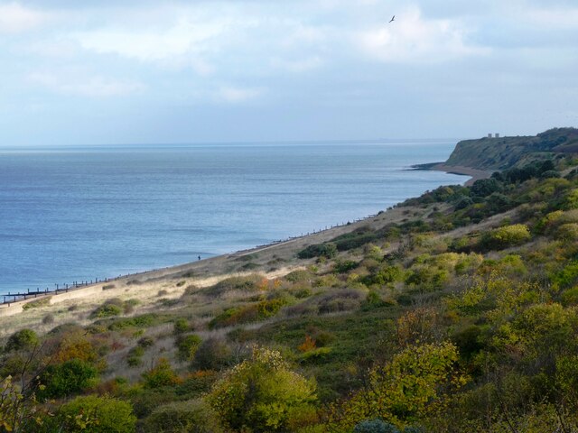
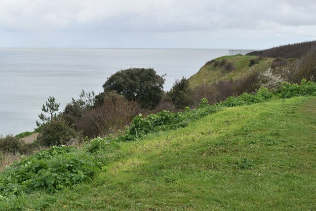
Beltinge is a picturesque village located in the district of Kent, England. Situated on the northeast coast of Kent, it is part of the larger administrative area of Herne Bay, a popular seaside town. Beltinge is known for its stunning coastal scenery, attracting both locals and tourists alike.

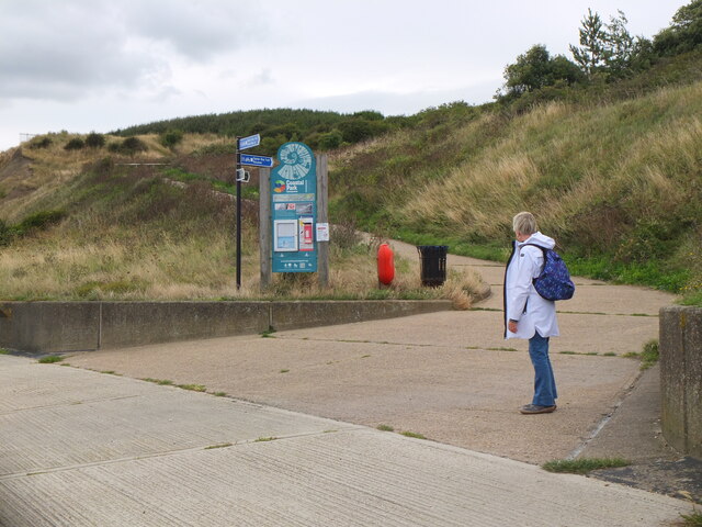
The village itself is relatively small, with a population of around 5,000 residents. It is renowned for its peaceful and friendly atmosphere, making it an ideal place for families and retirees. Beltinge offers a range of amenities, including a local convenience store, cafes, and a few traditional pubs, providing residents with all the essentials just a stone's throw away.

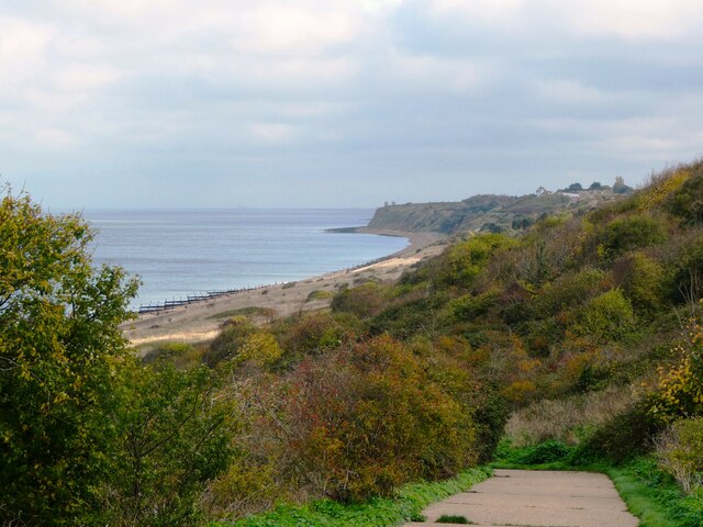
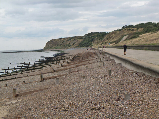
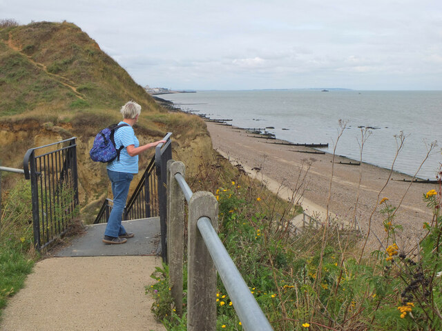
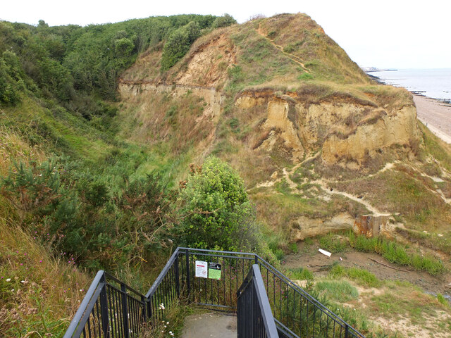
One of Beltinge's main attractions is its beautiful pebble beach, which stretches for miles along the coast. The beach is perfect for leisurely strolls, picnics, and enjoying the stunning views of the English Channel. It is also popular among fossil hunters, as the area is rich in geological history and often yields interesting prehistoric finds.

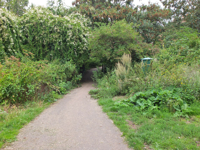
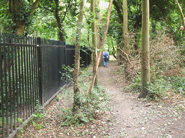
For those who enjoy outdoor activities, Beltinge offers plenty of opportunities for walking, cycling, and exploring the nearby countryside. The village is surrounded by lush green fields and rolling hills, providing a tranquil escape from the hustle and bustle of city life.

Overall, Beltinge is a charming village that offers a peaceful coastal lifestyle, breathtaking natural beauty, and a strong sense of community. It is a hidden gem within the lovely county of Kent, providing a perfect retreat for those seeking a quiet and idyllic place to call home.

If you have any feedback on the listing, please let us know in the comments section below.

Beltinge Images

Images are sourced within 2km of 51.37022/1.157243 or Grid Reference TR1968. Thanks to Geograph Open Source API. All images are credited.

Hillborough buildings [1] The church of St Mary the Virgin in Reculver Lane was built in 1878. Constructed, as a Gothic Revival church in the Early English style, of knapped flint with limestone dressings under a tile roof. The south doorway is a 13th century one reused from the ancient church at Reculver as are a few stones at the junction of the nave and chancel. Listed, grade II, with details at: <span class="nowrap"><a title="https://historicengland.org.uk/listing/the-list/list-entry/1318906" rel="nofollow ugc noopener" href="https://historicengland.org.uk/listing/the-list/list-entry/1318906">Link</a><img style="margin-left:2px;" alt="External link" title="External link - shift click to open in new window" src="https://s1.geograph.org.uk/img/external.png" width="10" height="10"/></span>
Hillborough is a suburb of the town of Herne Bay, a seaside town on the Thames Estuary, some 6 miles north of Canterbury and about 4 miles east of Whitstable. It neighbours the ancient villages of Herne and Reculver.
Hillborough buildings [1]
The church of St Mary the Virgin in Reculver Lane was built in 1878. Constructed, as a Gothic Revival church in the Early English style, of knapped flint with limestone dressings under a tile roof. The south doorway is a 13th century one reused from the ancient church at Reculver as are a few stones at the junction of the nave and chancel. Listed, grade II, with details at: LinkExternal link Hillborough is a suburb of the town of Herne Bay, a seaside town on the Thames Estuary, some 6 miles north of Canterbury and about 4 miles east of Whitstable. It neighbours the ancient villages of Herne and Reculver.
War memorial The Reculver war memorial is in the churchyard of the church of St Mary. Erected in 1919, it is a stone remembrance of rough-hewn granite. Listed, grade II, with details at: <span class="nowrap"><a title="https://historicengland.org.uk/listing/the-list/list-entry/1393473" rel="nofollow ugc noopener" href="https://historicengland.org.uk/listing/the-list/list-entry/1393473">Link</a><img style="margin-left:2px;" alt="External link" title="External link - shift click to open in new window" src="https://s1.geograph.org.uk/img/external.png" width="10" height="10"/></span>
Hillborough is a suburb of the town of Herne Bay, a seaside town on the Thames Estuary, some 6 miles north of Canterbury and about 4 miles east of Whitstable. It neighbours the ancient villages of Herne and Reculver.
War memorial
The Reculver war memorial is in the churchyard of the church of St Mary. Erected in 1919, it is a stone remembrance of rough-hewn granite. Listed, grade II, with details at: LinkExternal link Hillborough is a suburb of the town of Herne Bay, a seaside town on the Thames Estuary, some 6 miles north of Canterbury and about 4 miles east of Whitstable. It neighbours the ancient villages of Herne and Reculver.
Hillborough buildings [2] Part of the churchyard.
The church of St Mary the Virgin in Reculver Lane was built in 1878. Constructed, as a Gothic Revival church in the Early English style, of knapped flint with limestone dressings under a tile roof. The south doorway is a 13th century one reused from the ancient church at Reculver as are a few stones at the junction of the nave and chancel. Listed, grade II, with details at: <span class="nowrap"><a title="https://historicengland.org.uk/listing/the-list/list-entry/1318906" rel="nofollow ugc noopener" href="https://historicengland.org.uk/listing/the-list/list-entry/1318906">Link</a><img style="margin-left:2px;" alt="External link" title="External link - shift click to open in new window" src="https://s1.geograph.org.uk/img/external.png" width="10" height="10"/></span>
Hillborough is a suburb of the town of Herne Bay, a seaside town on the Thames Estuary, some 6 miles north of Canterbury and about 4 miles east of Whitstable. It neighbours the ancient villages of Herne and Reculver.
Hillborough buildings [2]
Part of the churchyard. The church of St Mary the Virgin in Reculver Lane was built in 1878. Constructed, as a Gothic Revival church in the Early English style, of knapped flint with limestone dressings under a tile roof. The south doorway is a 13th century one reused from the ancient church at Reculver as are a few stones at the junction of the nave and chancel. Listed, grade II, with details at: LinkExternal link Hillborough is a suburb of the town of Herne Bay, a seaside town on the Thames Estuary, some 6 miles north of Canterbury and about 4 miles east of Whitstable. It neighbours the ancient villages of Herne and Reculver.
Hillborough buildings [3] The Reculver Church of England Primary School in Reculver Lane.
Hillborough is a suburb of the town of Herne Bay, a seaside town on the Thames Estuary, some 6 miles north of Canterbury and about 4 miles east of Whitstable. It neighbours the ancient villages of Herne and Reculver.
Hillborough buildings [3]
The Reculver Church of England Primary School in Reculver Lane. Hillborough is a suburb of the town of Herne Bay, a seaside town on the Thames Estuary, some 6 miles north of Canterbury and about 4 miles east of Whitstable. It neighbours the ancient villages of Herne and Reculver.
Hillborough buildings [4] St Mary's Cottage is, probably, 17th century. Now partly stuccoed and partly pebbledashed, all under a thatch roof. Listed, grade II, with details at: <span class="nowrap"><a title="https://historicengland.org.uk/listing/the-list/list-entry/1336864" rel="nofollow ugc noopener" href="https://historicengland.org.uk/listing/the-list/list-entry/1336864">Link</a><img style="margin-left:2px;" alt="External link" title="External link - shift click to open in new window" src="https://s1.geograph.org.uk/img/external.png" width="10" height="10"/></span>
Hillborough is a suburb of the town of Herne Bay, a seaside town on the Thames Estuary, some 6 miles north of Canterbury and about 4 miles east of Whitstable. It neighbours the ancient villages of Herne and Reculver.
Hillborough buildings [4]
St Mary's Cottage is, probably, 17th century. Now partly stuccoed and partly pebbledashed, all under a thatch roof. Listed, grade II, with details at: LinkExternal link Hillborough is a suburb of the town of Herne Bay, a seaside town on the Thames Estuary, some 6 miles north of Canterbury and about 4 miles east of Whitstable. It neighbours the ancient villages of Herne and Reculver.
Hillborough buildings [5] Forge House, Reculver Lane, is an 18th century building. Constructed of rendered brick under a tile roof. There is a modern extension on the right. Listed, grade II, with details at: <span class="nowrap"><a title="https://historicengland.org.uk/listing/the-list/list-entry/1084988" rel="nofollow ugc noopener" href="https://historicengland.org.uk/listing/the-list/list-entry/1084988">Link</a><img style="margin-left:2px;" alt="External link" title="External link - shift click to open in new window" src="https://s1.geograph.org.uk/img/external.png" width="10" height="10"/></span>
Hillborough is a suburb of the town of Herne Bay, a seaside town on the Thames Estuary, some 6 miles north of Canterbury and about 4 miles east of Whitstable. It neighbours the ancient villages of Herne and Reculver.
Hillborough buildings [5]
Forge House, Reculver Lane, is an 18th century building. Constructed of rendered brick under a tile roof. There is a modern extension on the right. Listed, grade II, with details at: LinkExternal link Hillborough is a suburb of the town of Herne Bay, a seaside town on the Thames Estuary, some 6 miles north of Canterbury and about 4 miles east of Whitstable. It neighbours the ancient villages of Herne and Reculver.
227, Reculver Road In May 2019, the location was a <a href="https://www.geograph.org.uk/photo/6178362">TR2068 : Building site, 227, Reculver Road</a>.
227, Reculver Road
In May 2019, the location was a TR2068 : Building site, 227, Reculver Road.
208, Reculver Road Planning permission has been approved by Canterbury City Council under application number CA/21/02321 for a “detached dwelling with associated external works following demolition of existing bungalow”. 

The view shows the bungalow during demolition.
208, Reculver Road
Planning permission has been approved by Canterbury City Council under application number CA/21/02321 for a “detached dwelling with associated external works following demolition of existing bungalow”. The view shows the bungalow during demolition.
Coast north of Bishopsboiurne Herne Bay Viewed from Ocean View and looking towards Reculver.
Coast north of Bishopsboiurne Herne Bay
Viewed from Ocean View and looking towards Reculver.
Coast north of Bishopsboiurne Herne Bay Looking eastwards towards Reculver.
Coast north of Bishopsboiurne Herne Bay
Looking eastwards towards Reculver.
Coast below Ocean View Car Park
Shingle beach, Herne Bay Wooden groynes to keep in check mass transport of the shingle by wave action.
Shingle beach, Herne Bay
Wooden groynes to keep in check mass transport of the shingle by wave action.
Junction for the path to Reculver The Oyster Bay Trail heads up the slope to cross the Bishopstone Glen, also known as the Oldhaven Gap, a gap between two sand cliffs. Drainage work has helped to stabilise the slope of London Clay (information from the nearby board).
Junction for the path to Reculver
The Oyster Bay Trail heads up the slope to cross the Bishopstone Glen, also known as the Oldhaven Gap, a gap between two sand cliffs. Drainage work has helped to stabilise the slope of London Clay (information from the nearby board).
Path in Bishopstone Glen, Herne Bay The coastal path swings inland around the short valley of Bishopstone Glen, formed by a gap between two sand cliffs.
Path in Bishopstone Glen, Herne Bay
The coastal path swings inland around the short valley of Bishopstone Glen, formed by a gap between two sand cliffs.
Path above Bishopstone Glen, Herne Bay The railings fence off the steep bank of the stream below.
Path above Bishopstone Glen, Herne Bay
The railings fence off the steep bank of the stream below.
Wooden sculpture, Bishopstone Glen Formerly the path here crossed through 'Fairy Woods' where local resident James Robinson had turned the bottom of his garden into an attraction with fairy houses, gnomes and crazy paving (from the information board on the coastal path).
Wooden sculpture, Bishopstone Glen
Formerly the path here crossed through 'Fairy Woods' where local resident James Robinson had turned the bottom of his garden into an attraction with fairy houses, gnomes and crazy paving (from the information board on the coastal path).
Top of the 100 steps, Bishopstone Glen, Herne Bay Steps up from the eastern side of the glen, a gap formed between two sand cliffs.
Top of the 100 steps, Bishopstone Glen, Herne Bay
Steps up from the eastern side of the glen, a gap formed between two sand cliffs.
Bishopstone Glen, Herne Bay A short steep-sided valley between two sand cliffs. The cliffs are sandstone with London Clay on top, in which fossils up to 60 million years old have been found (from the information board by the coastal path).
Bishopstone Glen, Herne Bay
A short steep-sided valley between two sand cliffs. The cliffs are sandstone with London Clay on top, in which fossils up to 60 million years old have been found (from the information board by the coastal path).
Show me another place!

Beltinge is located at Grid Ref: TR1968 (Lat: 51.37022, Lng: 1.157243)

Administrative County: Kent

District: Canterbury

Police Authority: Kent

What 3 Words

///define.spoken.clip. Near Herne Bay, Kent

Nearby Locations

Beltinge Beltinge Cliff

Related Wikis

Beltinge

Beltinge is a low cliff-top suburb of Herne Bay in Kent, England. It forms the easternmost part of the urban area of Herne Bay and is just west of the...

A299 road

The A299, better known as the Thanet Way, is a major road of 22 miles (35 km) in the county of Kent, England, and runs from Brenley Corner near Faversham...

Hillborough

Hillborough is an area of eastern Herne Bay in Kent, England. The population is included in the Reculver ward of Herne Bay. == External links == Media...

Broomfield, Herne Bay

Broomfield is a village in Kent, England, divided by the Thanet Way from the seaside town of Herne Bay. It is part of the Herne and Broomfield civil parish...

Nearby Amenities

Located within 500m of 51.37022,1.157243
Parking
Lat/Long: 51.3725773/1.1611343
Post Box
Brand: Royal Mail
Brand Wikidata: Q638098
Brand Wikipedia: en:Royal Mail
Collection Times: Mo-Fr 17:00; Sa 12:15
Operator: Royal Mail
Operator Wikidata: Q638098
Post Box Design: type_b
Post Box Type: pillar
Postal Code: CT6
Ref: CT6 187
Royal Cypher: GR
Royal Cypher Wikidata: Q33102273
Lat/Long: 51.3696109/1.1544793
Post Box
Brand: Royal Mail
Brand Wikidata: Q638098
Brand Wikipedia: en:Royal Mail
Collection Times: Mo-Fr 09:00; Sa 07:00
Operator: Royal Mail
Operator Wikidata: Q638098
Post Box Mounting: brick_pillar
Post Box Type: wall
Ref: CT6 174
Royal Cypher: GR
Royal Cypher Wikidata: Q33102273
Lat/Long: 51.370549/1.1616166
Post Office
Beltinge Post Office
Addr City: Herne Bay
Addr Country: GB
Addr County: Kent
Addr Housenumber: 150
Addr Postcode: CT6 6PL
Addr Street: Reculver Road
Brand: Post Office
Brand Wikidata: Q1783168
Contact Website: https://www.postoffice.co.uk/branch-finder/0579092/beltinge
Ref Pol Id: 229
Lat/Long: 51.3705122/1.1563886
Bus Stop
Osborne Gardens
Naptan AtcoCode: 2400A041410A
Naptan Bearing: NE
Naptan CommonName: Osborne Gardens
Naptan Indicator: opp
Naptan Landmark: Osborne Gardens
Naptan NaptanCode: kntdtdjm
Naptan PlusbusZoneRef: HRNEBAY
Naptan Street: Reculver Road
Naptan Verified: no
Public Transport: platform
Ref: kntdtdjm
Source: naptan_import
Source Date: 2018-08-20T12:45:00
Lat/Long: 51.3695514/1.154171
Bus Stop
Terminus Drive
Naptan AtcoCode: 2400A041420A
Naptan Bearing: NE
Naptan CommonName: Terminus Drive
Naptan Indicator: opp
Naptan Landmark: Terminus Drive
Naptan NaptanCode: kntdtdjp
Naptan PlusbusZoneRef: HRNEBAY
Naptan Street: Reculver Road
Naptan Verified: no
Public Transport: platform
Ref: kntdtdjp
Source: naptan_import
Source Date: 2018-08-20T12:47:00
Lat/Long: 51.371041/1.1567057
Bus Stop
Coventry Gardens
Naptan AtcoCode: 2400A041430A
Naptan Bearing: NE
Naptan CommonName: Coventry Gardens
Naptan Indicator: opp
Naptan Landmark: Coventry Gardens
Naptan NaptanCode: kntdtdjt
Naptan PlusbusZoneRef: HRNEBAY
Naptan Street: Reculver Road
Naptan Verified: no
Public Transport: platform
Ref: kntdtdjt
Source: naptan_import
Source Date: 2018-08-20T12:49:00
Lat/Long: 51.3717791/1.1583516
Bus Stop
Gainsborough Drive
Naptan AtcoCode: 2400A041440A
Naptan Bearing: SE
Naptan CommonName: Gainsborough Drive
Naptan Indicator: adj
Naptan Landmark: Gainsborough Drive
Naptan NaptanCode: kntdtdjw
Naptan PlusbusZoneRef: HRNEBAY
Naptan Street: Reculver Road
Naptan Verified: no
Public Transport: platform
Ref: kntdtdjw
Source: naptan_import
Source Date: 2008-06-02T16:03:00
Lat/Long: 51.3707181/1.1616699
Bus Stop
Gainsborough Drive
Naptan AtcoCode: 2400A041490A
Naptan Bearing: NW
Naptan CommonName: Gainsborough Drive
Naptan Indicator: opp
Naptan Landmark: Gainsborough Drive
Naptan NaptanCode: kntdtdmp
Naptan PlusbusZoneRef: HRNEBAY
Naptan Street: Reculver Road
Naptan Verified: no
Public Transport: platform
Ref: kntdtdmp
Source: naptan_import
Source Date: 2018-08-20T12:53:00
Lat/Long: 51.3704839/1.1616825
Bus Stop
Coventry Gardens
Naptan AtcoCode: 2400A041500A
Naptan Bearing: SW
Naptan CommonName: Coventry Gardens
Naptan Indicator: adj
Naptan Landmark: Coventry Gardens
Naptan NaptanCode: kntdtdmt
Naptan PlusbusZoneRef: HRNEBAY
Naptan Street: Reculver Road
Naptan Verified: no
Public Transport: platform
Ref: kntdtdmt
Source: naptan_import
Source Date: 2018-08-20T12:50:00
Lat/Long: 51.3717187/1.1585917
Bus Stop
Terminus Drive
Naptan AtcoCode: 2400A041510A
Naptan Bearing: SW
Naptan CommonName: Terminus Drive
Naptan Indicator: adj
Naptan Landmark: Terminus Drive
Naptan NaptanCode: kntdtdmw
Naptan PlusbusZoneRef: HRNEBAY
Naptan Street: Reculver Road
Naptan Verified: no
Public Transport: platform
Ref: kntdtdmw
Source: naptan_import
Source Date: 2018-08-20T12:48:00
Lat/Long: 51.3707849/1.15653
Bus Stop
Osborne Gardens
Naptan AtcoCode: 2400A041520A
Naptan Bearing: SW
Naptan CommonName: Osborne Gardens
Naptan Indicator: adj
Naptan Landmark: Osborne Gardens
Naptan NaptanCode: kntdtdpa
Naptan PlusbusZoneRef: HRNEBAY
Naptan Street: Reculver Road
Naptan Verified: no
Public Transport: platform
Ref: kntdtdpa
Source: naptan_import
Source Date: 2018-08-20T12:46:00
Lat/Long: 51.36929/1.1539267
Post Box
Brand: Royal Mail
Brand Wikidata: Q638098
Brand Wikipedia: en:Royal Mail
Collection Times: Mo-Fr 09:00; Sa 07:00
Operator: Royal Mail
Operator Wikidata: Q638098
Post Box Mounting: metal_post
Post Box Type: lamp
Postal Code: CT6
Ref: CT6 390
Royal Cypher: EIIR
Royal Cypher Wikidata: Q33102113
Source: survey
Lat/Long: 51.3675867/1.1567289
Crossing
Crossing: uncontrolled
Crossing Ref: zebra
Source: survey
Lat/Long: 51.369868/1.1547905
Beltinge
Place: suburb
Source: OS_OpenData_StreetView
Lat/Long: 51.369314/1.1552631
Communication Microwave: yes
Communication Mobile Phone: yes
Man Made: mast
Tower Type: communication
Lat/Long: 51.3689885/1.1519998
Atm
Drive Through: no
Operator: Co op
Lat/Long: 51.3706652/1.1563769
Atm
Operator: Post Office
Lat/Long: 51.3706174/1.1562799
Generator Method: photovoltaic
Generator Orientation: 157
Generator Output Electricity: yes
Generator Source: solar
Generator Type: solar_photovoltaic_panel
Location: roof
Power: generator
Lat/Long: 51.3722927/1.1614072
Generator Method: photovoltaic
Generator Orientation: 155
Generator Output Electricity: yes
Generator Source: solar
Generator Type: solar_photovoltaic_panel
Location: roof
Power: generator
Lat/Long: 51.3724602/1.1620697
Generator Method: photovoltaic
Generator Output Electricity: yes
Generator Source: solar
Generator Type: solar_photovoltaic_panel
Power: generator
Lat/Long: 51.3681032/1.1562762
Generator Method: photovoltaic
Generator Orientation: 244
Generator Output Electricity: yes
Generator Source: solar
Generator Type: solar_photovoltaic_panel
Location: roof
Power: generator
Lat/Long: 51.3713224/1.161017
Man Made: beacon
Lat/Long: 51.3726885/1.1611593
Leisure: picnic_table
Material: wood
Lat/Long: 51.3727674/1.1613334
Leisure: picnic_table
Material: wood
Lat/Long: 51.3727443/1.1612902
Board Type: nature
Information: board
Tourism: information
Lat/Long: 51.3727827/1.1611624
Generator Method: photovoltaic
Generator Output Electricity: yes
Generator Solar Modules: 6
Generator Source: solar
Generator Type: solar_photovoltaic_panel
Location: roof
Power: generator
Lat/Long: 51.3680429/1.1633036
Generator Method: photovoltaic
Generator Output Electricity: yes
Generator Solar Modules: 10
Generator Source: solar
Generator Type: solar_photovoltaic_panel
Location: roof
Power: generator
Lat/Long: 51.3681099/1.1632687
Generator Method: photovoltaic
Generator Output Electricity: yes
Generator Solar Modules: 2
Generator Source: solar
Generator Type: solar_photovoltaic_panel
Location: roof
Power: generator
Lat/Long: 51.3690669/1.1627054
Generator Method: photovoltaic
Generator Output Electricity: yes
Generator Solar Modules: 10
Generator Source: solar
Generator Type: solar_photovoltaic_panel
Location: roof
Power: generator
Lat/Long: 51.3691029/1.1625391
Generator Method: photovoltaic
Generator Output Electricity: yes
Generator Solar Modules: 9
Generator Source: solar
Generator Type: solar_photovoltaic_panel
Location: roof
Power: generator
Lat/Long: 51.3694629/1.1624211
Generator Method: photovoltaic
Generator Output Electricity: yes
Generator Solar Modules: 6
Generator Source: solar
Generator Type: solar_photovoltaic_panel
Location: roof
Power: generator
Lat/Long: 51.3694127/1.1623286
Generator Method: photovoltaic
Generator Output Electricity: yes
Generator Solar Modules: 6
Generator Source: solar
Generator Type: solar_photovoltaic_panel
Location: roof
Power: generator
Lat/Long: 51.369424/1.1622769
Generator Method: photovoltaic
Generator Output Electricity: yes
Generator Solar Modules: 2
Generator Source: solar
Generator Type: solar_photovoltaic_panel
Location: roof
Power: generator
Lat/Long: 51.3709457/1.162637
Generator Method: photovoltaic
Generator Output Electricity: yes
Generator Solar Modules: 2
Generator Source: solar
Generator Type: solar_photovoltaic_panel
Location: roof
Power: generator
Lat/Long: 51.3709532/1.1626625
Generator Method: photovoltaic
Generator Output Electricity: yes
Generator Solar Modules: 2
Generator Source: solar
Generator Type: solar_photovoltaic_panel
Location: roof
Power: generator
Lat/Long: 51.3709817/1.1626746
Generator Method: photovoltaic
Generator Output Electricity: yes
Generator Solar Modules: 2
Generator Source: solar
Generator Type: solar_photovoltaic_panel
Location: roof
Power: generator
Lat/Long: 51.3709591/1.1625941
Generator Method: photovoltaic
Generator Output Electricity: yes
Generator Source: solar
Generator Type: solar_photovoltaic_panel
Location: roof
Power: generator
Lat/Long: 51.372281/1.1614877
Generator Method: photovoltaic
Generator Output Electricity: yes
Generator Source: solar
Generator Type: solar_photovoltaic_panel
Location: roof
Power: generator
Lat/Long: 51.3719286/1.1599226
Generator Method: photovoltaic
Generator Output Electricity: yes
Generator Source: solar
Generator Type: solar_photovoltaic_panel
Location: roof
Power: generator
Lat/Long: 51.3718892/1.158603
Generator Method: photovoltaic
Generator Output Electricity: yes
Generator Source: solar
Generator Type: solar_photovoltaic_panel
Location: roof
Power: generator
Lat/Long: 51.3721722/1.1585212
Generator Method: photovoltaic
Generator Output Electricity: yes
Generator Source: solar
Generator Type: solar_photovoltaic_panel
Location: roof
Power: generator
Lat/Long: 51.3722032/1.1586379
Generator Method: photovoltaic
Generator Output Electricity: yes
Generator Source: solar
Generator Type: solar_photovoltaic_panel
Location: roof
Power: generator
Lat/Long: 51.3712211/1.1569333
Generator Method: photovoltaic
Generator Output Electricity: yes
Generator Solar Modules: 4
Generator Source: solar
Generator Type: solar_photovoltaic_panel
Location: roof
Power: generator
Lat/Long: 51.3702139/1.1555198
Generator Method: photovoltaic
Generator Output Electricity: yes
Generator Solar Modules: 3
Generator Source: solar
Generator Type: solar_photovoltaic_panel
Location: roof
Power: generator
Lat/Long: 51.3702165/1.1556029
Generator Method: photovoltaic
Generator Output Electricity: yes
Generator Solar Modules: 4
Generator Source: solar
Generator Type: solar_photovoltaic_panel
Location: roof
Power: generator
Lat/Long: 51.37026/1.1555949
Generator Method: photovoltaic
Generator Output Electricity: yes
Generator Solar Modules: 4
Generator Source: solar
Generator Type: solar_photovoltaic_panel
Location: roof
Power: generator
Lat/Long: 51.3702558/1.1555251
Generator Method: photovoltaic
Generator Output Electricity: yes
Generator Source: solar
Generator Type: solar_photovoltaic_panel
Location: roof
Power: generator
Lat/Long: 51.3710771/1.1553293
Generator Method: photovoltaic
Generator Output Electricity: yes
Generator Source: solar
Generator Type: solar_photovoltaic_panel
Location: roof
Power: generator
Lat/Long: 51.3711223/1.1554071
Generator Method: photovoltaic
Generator Output Electricity: yes
Generator Source: solar
Generator Type: solar_photovoltaic_panel
Location: roof
Power: generator
Lat/Long: 51.3709716/1.1594546
Generator Method: photovoltaic
Generator Output Electricity: yes
Generator Source: solar
Generator Type: solar_photovoltaic_panel
Location: roof
Power: generator
Lat/Long: 51.3709733/1.159527
Generator Method: photovoltaic
Generator Output Electricity: yes
Generator Source: solar
Generator Type: solar_photovoltaic_panel
Location: roof
Power: generator
Lat/Long: 51.3710068/1.1595431
Generator Method: photovoltaic
Generator Output Electricity: yes
Generator Solar Modules: 16
Generator Source: solar
Generator Type: solar_photovoltaic_panel
Location: roof
Power: generator
Lat/Long: 51.3701562/1.1594251
Generator Method: photovoltaic
Generator Output Electricity: yes
Generator Solar Modules: 10
Generator Source: solar
Generator Type: solar_photovoltaic_panel
Location: roof
Power: generator
Lat/Long: 51.3704408/1.1585373
Generator Method: photovoltaic
Generator Output Electricity: yes
Generator Solar Modules: 8
Generator Source: solar
Generator Type: solar_photovoltaic_panel
Location: roof
Power: generator
Lat/Long: 51.3706853/1.1588994
Generator Method: photovoltaic
Generator Output Electricity: yes
Generator Source: solar
Generator Type: solar_photovoltaic_panel
Location: roof
Power: generator
Lat/Long: 51.3706284/1.1604081
Generator Method: photovoltaic
Generator Output Electricity: yes
Generator Source: solar
Generator Type: solar_photovoltaic_panel
Location: roof
Power: generator
Lat/Long: 51.3706309/1.1604846
Generator Method: photovoltaic
Generator Output Electricity: yes
Generator Source: solar
Generator Type: solar_photovoltaic_panel
Location: roof
Power: generator
Lat/Long: 51.3712127/1.15637
Generator Method: photovoltaic
Generator Output Electricity: yes
Generator Source: solar
Generator Type: solar_photovoltaic_panel
Location: roof
Power: generator
Lat/Long: 51.3712554/1.1564183
Generator Method: photovoltaic
Generator Output Electricity: yes
Generator Source: solar
Generator Type: solar_photovoltaic_panel
Location: roof
Power: generator
Lat/Long: 51.3693893/1.1641672
Generator Method: photovoltaic
Generator Output Electricity: yes
Generator Source: solar
Generator Type: solar_photovoltaic_panel
Location: roof
Power: generator
Lat/Long: 51.3673346/1.1566651
Generator Method: photovoltaic
Generator Output Electricity: yes
Generator Source: solar
Generator Type: solar_photovoltaic_panel
Location: roof
Power: generator
Lat/Long: 51.369838/1.1561769
Bus Stop
Thornhurst
Fixme: Can somebody confirm is there is a bus stop here?
Flag: no
Naptan AtcoCode: 2400A070350A
Naptan Bearing: NE
Naptan BusStopType: CUS
Naptan CommonName: Thornhurst
Naptan Indicator: o/s
Naptan Landmark: Thornhurst
Naptan NaptanCode: kntgdgta
Naptan Street: Churchill Avenue
Naptan Verified: no
Public Transport: platform
Ref: kntgdgta
Source: NAPTAN
Source Date: 2018-08-20T12:51:00
Lat/Long: 51.3672876/1.1558007
Turning Circle
Lat/Long: 51.3669478/1.1524728
Generator Method: photovoltaic
Generator Output Electricity: yes
Generator Solar Modules: 3
Generator Source: solar
Generator Type: solar_photovoltaic_panel
Location: roof
Power: generator
Lat/Long: 51.3703801/1.1586358
Generator Method: photovoltaic
Generator Output Electricity: yes
Generator Solar Modules: 1
Generator Source: solar
Generator Type: solar_photovoltaic_panel
Location: roof
Power: generator
Lat/Long: 51.3690443/1.1625572
The data included in this document is from www.openstreetmap.org. The data is made available under ODbL.

Have you been to Beltinge?

Leave your review of Beltinge below (or comments, questions and feedback).