Belthorn

Settlement in Lancashire

England

Belthorn

Heading down Jackson Height Following an indistinct footpath over rough ground towards Pickup Bank
Heading down Jackson Height Credit: Chris Heaton

Belthorn is a small village located in the borough of Blackburn with Darwen, Lancashire, England. Situated on the southern edge of the West Pennine Moors, it is nestled between the towns of Blackburn and Darwen. The village is part of the larger civil parish of Over Darwen.

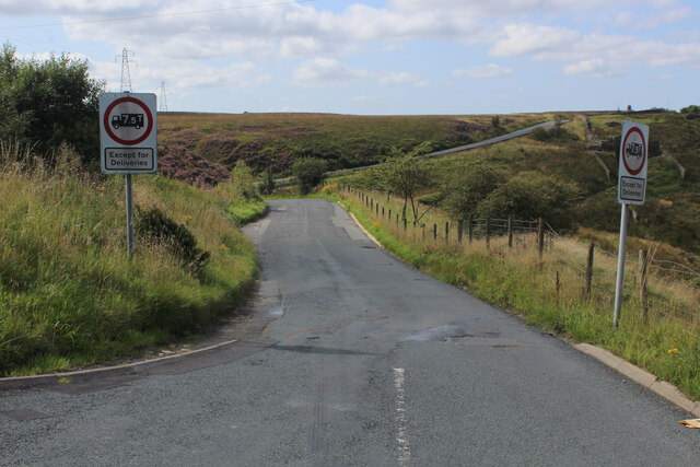
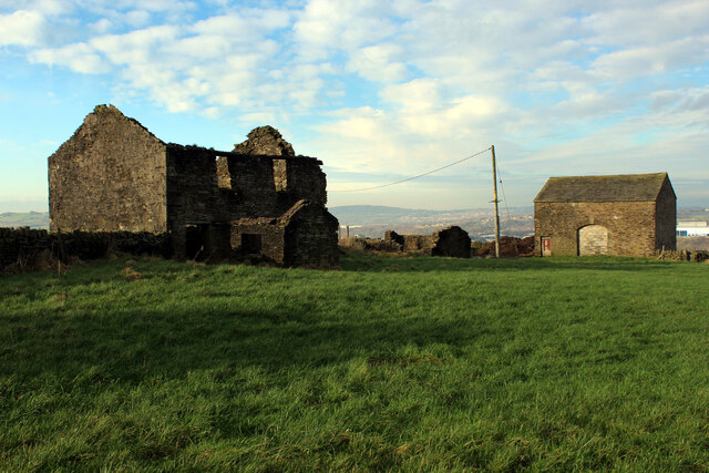
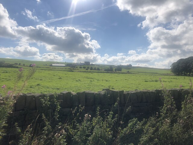
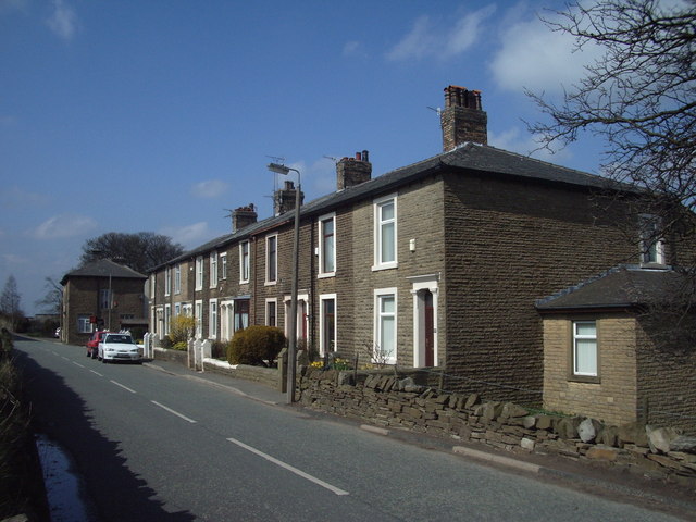
Belthorn is known for its picturesque surroundings and stunning views of the surrounding countryside. The village is predominantly rural, with a scattering of houses and farms set against a backdrop of rolling hills and woodlands. The area is popular with walkers and nature enthusiasts, offering a variety of scenic trails and paths to explore.

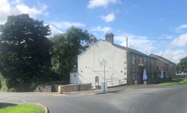
The village has a close-knit community, with a small population and a friendly atmosphere. It boasts a local pub, The Pack Horse Inn, which serves as a hub for socializing and community gatherings. A primary school, St. Peter's Church of England Primary School, caters to the educational needs of the village and nearby areas.

Belthorn is well-connected to neighboring towns and cities. The A666 road passes through the village, providing easy access to Blackburn and Bolton. The M65 motorway is also within close proximity, offering convenient links to Manchester and other major cities in the region.

In summary, Belthorn is a charming rural village in Lancashire, offering a tranquil escape from the hustle and bustle of urban life. With its stunning natural beauty and strong sense of community, it is a delightful place to live or visit for those seeking a peaceful countryside experience.

If you have any feedback on the listing, please let us know in the comments section below.

Belthorn Images

Images are sourced within 2km of 53.717483/-2.431073 or Grid Reference SD7124. Thanks to Geograph Open Source API. All images are credited.

Heading down Jackson Height Following an indistinct footpath over rough ground towards Pickup Bank
Heading down Jackson Height
Following an indistinct footpath over rough ground towards Pickup Bank
On Jackson Height
On Jackson Height
Long Hey Lane Descending to cross Mean Brook
Long Hey Lane
Descending to cross Mean Brook
Hoddlesden Reservoir Popular local leisure facility - especially with walkers and the fishing fraternity
Hoddlesden Reservoir
Popular local leisure facility - especially with walkers and the fishing fraternity
Hoddlesden Reservoir Embankment Popular destination for walkers and anglers
Hoddlesden Reservoir Embankment
Popular destination for walkers and anglers
Johnson New Road Section of road between Hoddlesden and Waterside
Johnson New Road
Section of road between Hoddlesden and Waterside
Harwood Fold A group of buildings in a pasture near Pot House, consisting of two in a ruinous state including a farmhouse - and a stone barn, still in service.
Harwood Fold
A group of buildings in a pasture near Pot House, consisting of two in a ruinous state including a farmhouse - and a stone barn, still in service.
Entering Eccleshill Gardens Approaching on Johnson Road from the south east
Entering Eccleshill Gardens
Approaching on Johnson Road from the south east
View towards Belthorn Looking north east towards the village on the skyline, from Johnson Road
View towards Belthorn
Looking north east towards the village on the skyline, from Johnson Road
Cleared Site at Waterside Business Park Demolished buildings clearing space, currently used as a car and lorry park
Cleared Site at Waterside Business Park
Demolished buildings clearing space, currently used as a car and lorry park
View over farmland To Higher Bold Venture Farm
View over farmland
To Higher Bold Venture Farm
The Britannia At the junction of the Darwen road and Haslingden Road
The Britannia
At the junction of the Darwen road and Haslingden Road
Clough by side of Long Hey Lane The remains of Mean are visible on the hillside beyond as parallel walls
Clough by side of Long Hey Lane
The remains of Mean are visible on the hillside beyond as parallel walls
Centurion Court, Blackburn A corner of the Walker Park Industrial Estate in Blackburn
Centurion Court, Blackburn
A corner of the Walker Park Industrial Estate in Blackburn
Warehouse Yard off Centurion Way, Blackburn Part of the Walker Park Industrial Estate, Blackburn
Warehouse Yard off Centurion Way, Blackburn
Part of the Walker Park Industrial Estate, Blackburn
Neptune Way, Blackburn Serves units on the Walker Park Industrial Estate, Blackburn
Neptune Way, Blackburn
Serves units on the Walker Park Industrial Estate, Blackburn
Centurion Way, Blackburn Serves part of the large Walker Park Industrial Estate in Blackburn
Centurion Way, Blackburn
Serves part of the large Walker Park Industrial Estate in Blackburn
Manor House Farm This is a small hamlet, with several residences being formed from the conversion of old farm buildings.
Manor House Farm
This is a small hamlet, with several residences being formed from the conversion of old farm buildings.
Show me another place!

Belthorn is located at Grid Ref: SD7124 (Lat: 53.717483, Lng: -2.431073)

Unitary Authority: Blackburn with Darwen

Police Authority: Lancashire

What 3 Words

///united.probe.older. Near Darwen, Lancashire

Nearby Locations

Bank Fold Belthorn

Related Wikis

Belthorn

Belthorn is a small moorland village situated to the south-east of Blackburn in Lancashire, England. It is about two-thirds of a mile (1.1 km) away from...

Bank Fold

Bank Fold is a hamlet near Belthorn in Lancashire, England.

Guide, Lancashire

Guide is a village on the edge of Blackburn, in Lancashire, England. It is located south of the town centre, and the M65 Motorway passes around the south...

Eccleshill, Lancashire

Eccleshill is a civil parish in the Borough of Blackburn with Darwen, Lancashire, England. The population of the parish was only 319, at the census of...

Nearby Amenities

Located within 500m of 53.717483,-2.431073
Belthorn
Place: village
Source: npe
Lat/Long: 53.7178962/-2.4317213
Rann
Place: hamlet
Source: npe
Lat/Long: 53.7195757/-2.4356565
Higher Eden Farm
Place: farm
Lat/Long: 53.719925/-2.4263907
Charging Station
Authentication App: yes
Fee: yes
Motorcar: yes
Network: Charge My Street
Operator: Dog Inn
Payment App: yes
Ref: EG-06310
Socket Type2: 1
Socket Type2 Current: 32
Socket Type2 Output: 22 kW
Socket Type2 Voltage: 415
Lat/Long: 53.7177044/-2.4309402
Charging Station
Authentication App: yes
Fee: yes
Motorcar: yes
Network: Charge My Street
Operator: Dog Inn
Payment App: yes
Ref: EG-06309
Socket Type2: 1
Socket Type2 Current: 32
Socket Type2 Output: 22 kW
Socket Type2 Voltage: 415
Lat/Long: 53.7176992/-2.4309319
The data included in this document is from www.openstreetmap.org. The data is made available under ODbL.

Have you been to Belthorn?

Leave your review of Belthorn below (or comments, questions and feedback).