Moorfields

Settlement in Gloucestershire

England

Moorfields

Greenbank Cemetery Greenbank Cemetery taken from Greenbank View, Bristol
Greenbank Cemetery Credit: Kate Lambert

Moorfields is a small village located in the county of Gloucestershire, England. Situated in the picturesque Cotswolds area, this rural community is known for its peaceful surroundings and charming countryside views. The village is nestled amidst rolling hills and meadows, creating a tranquil atmosphere that attracts nature enthusiasts and those seeking a break from the hustle and bustle of city life.

The origins of Moorfields can be traced back to medieval times, with evidence of settlements dating back several centuries. Today, the village retains its traditional character, with a cluster of stone houses and cottages lining its narrow lanes. Its historic charm is complemented by well-preserved buildings, including the local church, which stands as a testament to the village's rich heritage.

Despite its small size, Moorfields boasts a strong sense of community. The villagers actively participate in various social activities and events, fostering a warm and welcoming atmosphere. The village pub serves as a hub where locals gather to socialize and share stories, creating a friendly and inclusive environment.

Nature lovers are drawn to Moorfields for its idyllic surroundings, offering ample opportunities for outdoor activities. The nearby countryside is a haven for walkers and hikers, with scenic trails and pathways showcasing the area's natural beauty. Visitors can also explore the surrounding Cotswolds region, which is renowned for its picturesque villages, historic landmarks, and stunning landscapes.

In conclusion, Moorfields is a charming village in Gloucestershire, offering a peaceful retreat in the heart of the Cotswolds. With its historical architecture, strong community spirit, and breathtaking natural scenery, it continues to attract visitors seeking a quintessential English countryside experience.

If you have any feedback on the listing, please let us know in the comments section below.
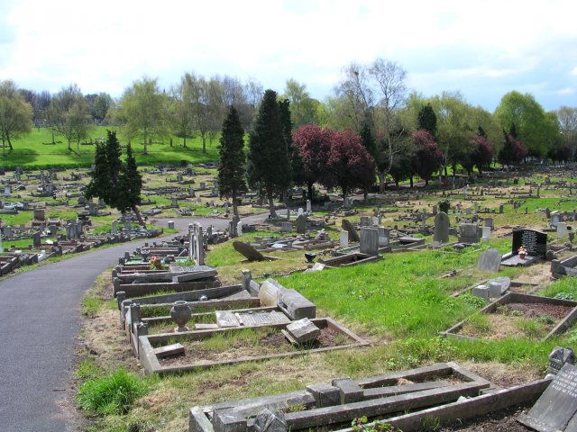
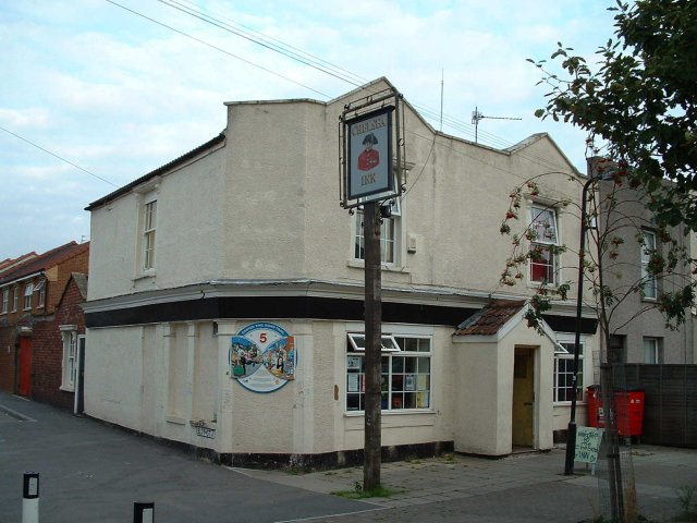
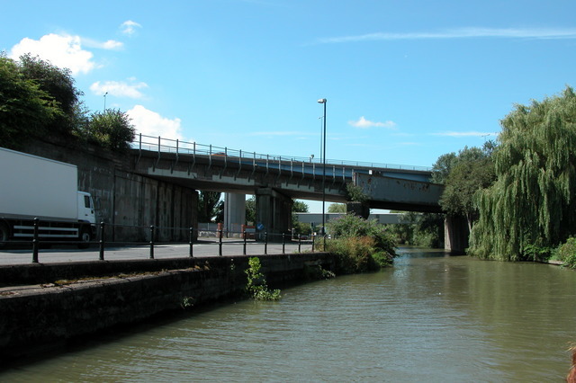
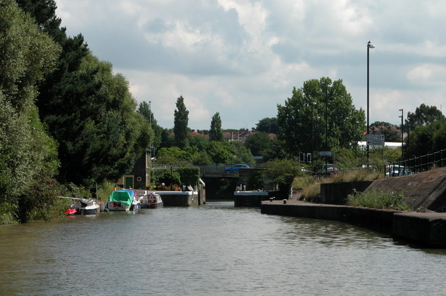
Moorfields Images

Images are sourced within 2km of 51.459725/-2.5629683 or Grid Reference ST6073. Thanks to Geograph Open Source API. All images are credited.

Greenbank Cemetery Greenbank Cemetery taken from Greenbank View, Bristol
Greenbank Cemetery
Greenbank Cemetery taken from Greenbank View, Bristol
The Chelsea Pub, Easton Bristol Good ale in a very mixed urban area
The Chelsea Pub, Easton Bristol
Good ale in a very mixed urban area
Road and rail bridges crossing the Bristol Harbour feeder  canal, entering Bristol. This is the feeder canal leading from the river Avon into Bristol Floating Harbour.
Road and rail bridges crossing the Bristol Harbour feeder canal, entering Bristol.
This is the feeder canal leading from the river Avon into Bristol Floating Harbour.
Netham lock. This lock is at the entrance to the Bristol Harbour feeder canal, off the river Avon. It is one of the few locks left with a keeper, as it is necessary to purchase a permit to enter the harbour.
Netham lock.
This lock is at the entrance to the Bristol Harbour feeder canal, off the river Avon. It is one of the few locks left with a keeper, as it is necessary to purchase a permit to enter the harbour.
River Avon passing St Annes Park, Bristol
Bristol St George: Avonview Cemetery Chapel This chapel is no longer used for services but instead houses the equipment store of the gardeners.
Bristol St George: Avonview Cemetery Chapel
This chapel is no longer used for services but instead houses the equipment store of the gardeners.
Bristol,  Redfield: Former Methodist Church This is the former Wesleyan Methodist Church in Redfield. It faces Church Road and is still in use as a place of worship but for members of the Hindu faith.
More information on <span class="nowrap"><a title="http://www.churchcrawler.pwp.blueyonder.co.uk/bristol3/wesleyan.htm" rel="nofollow ugc noopener" href="http://www.churchcrawler.pwp.blueyonder.co.uk/bristol3/wesleyan.htm">Link</a><img style="margin-left:2px;" alt="External link" title="External link - shift click to open in new window" src="https://s1.geograph.org.uk/img/external.png" width="10" height="10"/></span>
Bristol, Redfield: Former Methodist Church
This is the former Wesleyan Methodist Church in Redfield. It faces Church Road and is still in use as a place of worship but for members of the Hindu faith. More information on LinkExternal link
BRISTOL Eastville Park Methodist Church Originally built as a United Free Methodist Chapel, it is now a Pentecostal church. More history on <span class="nowrap"><a title="http://www.churchcrawler.pwp.blueyonder.co.uk/bristol3/ufrmeth.htm" rel="nofollow ugc noopener" href="http://www.churchcrawler.pwp.blueyonder.co.uk/bristol3/ufrmeth.htm">Link</a><img style="margin-left:2px;" alt="External link" title="External link - shift click to open in new window" src="https://s1.geograph.org.uk/img/external.png" width="10" height="10"/></span>
BRISTOL Eastville Park Methodist Church
Originally built as a United Free Methodist Chapel, it is now a Pentecostal church. More history on LinkExternal link
Head for Heights This two-stage footbridge across the M32 at Baptist Mills, Bristol, is quite narrow and open to the elements. Not a crossing for those suffering from vertigo. The red brick building behind it is St. Werburgh's Community Hall.
Head for Heights
This two-stage footbridge across the M32 at Baptist Mills, Bristol, is quite narrow and open to the elements. Not a crossing for those suffering from vertigo. The red brick building behind it is St. Werburgh's Community Hall.
Trees and Roundabout by Tesco Eastgate centre Looking east.
Trees and Roundabout by Tesco Eastgate centre
Looking east.
The Wackum Inn, Whitehall Road Looking approximately west from Brook Road. The mini roundabout leads east onto Speedwell Road and west onto Whitehall Road.
The Wackum Inn, Whitehall Road
Looking approximately west from Brook Road. The mini roundabout leads east onto Speedwell Road and west onto Whitehall Road.
Quayside Village, River Avon, Crew's Hole Downwind of Bristol, this area was long home to noxious chemical industries. The housing development on the right bank is the former site of the Crew's Hole Tar Works.
Quayside Village, River Avon, Crew's Hole
Downwind of Bristol, this area was long home to noxious chemical industries. The housing development on the right bank is the former site of the Crew's Hole Tar Works.
Warehouses, Crew's Hole Warehouses on the north bank of the Avon opposite St Anne's
Warehouses, Crew's Hole
Warehouses on the north bank of the Avon opposite St Anne's
Waterside housing, St Anne's Park Housing backing onto former industrial wharf on south bank of the Avon, probably formerly part of St Anne's Board Mills.
Waterside housing, St Anne's Park
Housing backing onto former industrial wharf on south bank of the Avon, probably formerly part of St Anne's Board Mills.
River Avon north of St Anne's Park Looking downstream. Straight ahead on the left bank is the former St Anne's Board Mills quay.
River Avon north of St Anne's Park
Looking downstream. Straight ahead on the left bank is the former St Anne's Board Mills quay.
St Anne's Footbridge Looking downstream along the quayside of the former St Anne's Board Mills site. The north end of the bridge is in <a href="https://www.geograph.org.uk/gridref/ST6273">ST6273</a>.
St Anne's Footbridge
Looking downstream along the quayside of the former St Anne's Board Mills site. The north end of the bridge is in ST6273.
River Avon,  New Brislington Bridge The river heads under the bridge to Netham Weir. Boats head right for Netham Lock and the Feeder Canal.
River Avon, New Brislington Bridge
The river heads under the bridge to Netham Weir. Boats head right for Netham Lock and the Feeder Canal.
Netham Bailey Bridge The top entrance to Netham Lock and the Feeder Canal, viewed from the Avon. The lock is normally left open to keep the Floating Harbour topped up.
Netham Bailey Bridge
The top entrance to Netham Lock and the Feeder Canal, viewed from the Avon. The lock is normally left open to keep the Floating Harbour topped up.
Show me another place!

Moorfields is located at Grid Ref: ST6073 (Lat: 51.459725, Lng: -2.5629683)

Unitary Authority: Bristol

Police Authority: Avon and Somerset

What 3 Words

///spot.jumpy.legs. Near Bristol

Related Wikis

Nearby Amenities

Located within 500m of 51.459725,-2.5629683
Junction: yes
Lat/Long: 51.4578902/-2.5623818
Sidewalk: both
Lat/Long: 51.4578757/-2.5631192
Crossing
Crossing: zebra
Mapillary: 847649252774987
Survey Date: 2019-06-23
Tactile Paving: yes
Lat/Long: 51.4563447/-2.5630301
Crossing
Crossing: traffic_signals
Crossing Island: yes
Crossing Ref: puffin
Traffic Signals Sound: yes
Lat/Long: 51.45797/-2.5643796
Lawrence Hill
Addr City: Bristol
Addr Postcode: BS5 0AF
Addr Street: Church Road
Naptan AtcoCode: 9100LAWRNCH
Network: National Rail
Network Website: https://www.nationalrail.co.uk/stations/lwh/
Network Wikidata: Q26334
Operator: Great Western Railway
Operator Website: https://www.gwr.com/stations-and-destinations/stations/lawrence-hill
Operator Wikidata: Q1419438
Railway: station
Ref Crs: LWH
Wheelchair: limited
Wikidata: Q4785868
Wikipedia: en:Lawrence Hill railway station
Lat/Long: 51.45858/-2.56417
Crossing
Crossing: uncontrolled
Crossing Ref: zebra
Lat/Long: 51.4617273/-2.5574172
Post Box
Post Box Type: pillar
Ref: BS5 221
Royal Cypher: EIIR
Royal Cypher Wikidata: Q33102113
Lat/Long: 51.4588182/-2.5566198
Post Box
Collection Times: Mo-Fr 17:00; Sa 12:15
Post Box Type: pillar
Ref: BS5 190
Royal Cypher: EVIIR
Royal Cypher Wikidata: Q33102324
Lat/Long: 51.457903/-2.5655594
Lawrence Hill Junction
Historic Railway: junction
Railway: site
Lat/Long: 51.4585693/-2.5668104
Crossing
Crossing: unmarked
Crossing Island: yes
Tactile Paving: yes
Lat/Long: 51.4582328/-2.5677871
Colston Road
Lat/Long: 51.4636184/-2.5631372
Turning Circle
Lat/Long: 51.4566509/-2.5663104
Railway: switch
Lat/Long: 51.4600886/-2.5639814
Railway: buffer_stop
Lat/Long: 51.4596779/-2.5644058
Turning Circle
Lat/Long: 51.4630737/-2.5588324
Post Box
Ref: BS5 225
Lat/Long: 51.456879/-2.561257
Bus Stop
Lat/Long: 51.458982/-2.5626871
Bus Stop
Lat/Long: 51.4561796/-2.5640947
Bus Stop
Lat/Long: 51.4556982/-2.5641119
Barrier: bollard
Lat/Long: 51.4616672/-2.5629508
Atm
Lat/Long: 51.4578894/-2.5654975
Bus Stop
Morley Street
Naptan AtcoCode: 0100BRA10220
Naptan Bearing: NW
Naptan CommonName: Morley Street
Naptan Crossing: Barton Hill Road
Naptan NaptanCode: bstjtaj
Naptan PlusbusZoneRef: BRSTLTM
Naptan Street: Ducie Road
Naptan Verified: no
Source: naptan_import
Lat/Long: 51.4561507/-2.5641259
Bus Stop
Morley Street
Naptan AtcoCode: 0100BRA10221
Naptan Bearing: SE
Naptan CommonName: Morley Street
Naptan Crossing: Morley Street
Naptan NaptanCode: bstjtdg
Naptan PlusbusZoneRef: BRSTLTM
Naptan Street: Ducie Road
Naptan Verified: no
Source: naptan_import
Lat/Long: 51.4561967/-2.5639106
Bus Stop
Lawrence Hill Station
Bus: yes
Departures Board: timetable
Naptan AtcoCode: 0100BRA10454
Naptan Bearing: E
Naptan CommonName: Lawrence Hl Stn a
Naptan Crossing: Ducie Road
Naptan Landmark: Lawrence Hill Station
Naptan NaptanCode: bstjpwg
Naptan PlusbusZoneRef: BRSTLTM
Naptan Street: Lawrence Hill
Naptan Verified: no
Network: first
Public Transport: platform
Ref: bstjpwg
Shelter: yes
Source: naptan_import
Lat/Long: 51.4580005/-2.5646669
Bus Stop
Lawrence Hl Stn b
Naptan AtcoCode: 0100BRA10455
Naptan Bearing: E
Naptan CommonName: Lawrence Hl Stn b
Naptan Crossing: Ducie Road
Naptan Landmark: Lawrence Hill Station
Naptan NaptanCode: bstjtda
Naptan PlusbusZoneRef: BRSTLTM
Naptan Street: Lawrence Hill
Naptan Verified: no
Source: naptan_import
Lat/Long: 51.4579765/-2.5640477
Bus Stop
Lawrence Hl Stn c
Bench: yes
Bin: yes
Mapillary: 199581705377809
Naptan AtcoCode: 0100BRA10456
Naptan Bearing: W
Naptan CommonName: Lawrence Hl Stn c
Naptan Crossing: Ducie Road
Naptan Landmark: Lawrence Hill Station
Naptan NaptanCode: bstjptp
Naptan PlusbusZoneRef: BRSTLTM
Naptan Street: Lawrence Hill
Naptan Verified: no
Passenger Information Display: yes
Public Transport: platform
Shelter: yes
Source: naptan_import
Survey Date: 2021-06-09
Lat/Long: 51.4578934/-2.5648716
Bus Stop
Heber Street
Bench: yes
Bin: yes
Mapillary: 375362523831783
Naptan AtcoCode: 0100BRA10457
Naptan Bearing: W
Naptan CommonName: Heber Street
Naptan Crossing: Heber Street
Naptan Indicator: Adj
Naptan Landmark: Morrfields House
Naptan NaptanCode: bstjwaj
Naptan PlusbusZoneRef: BRSTLTM
Naptan Street: Church Road
Naptan Verified: no
Passenger Information Display: yes
Public Transport: platform
Shelter: yes
Source: naptan_import
Survey Date: 2019-06-23
Tactile Paving: yes
Lat/Long: 51.4579376/-2.560895
Bus Stop
Edward Street
Bench: yes
Bin: no
Mapillary: 278750373920187
Naptan AtcoCode: 0100BRA10458
Naptan Bearing: E
Naptan CommonName: Edward Street
Naptan Crossing: Edward Street
Naptan NaptanCode: bstjwmg
Naptan PlusbusZoneRef: BRSTLTM
Naptan Street: Church Road
Naptan Verified: no
Public Transport: platform
Shelter: yes
Source: naptan_import
Survey Date: 2021-06-09
Tactile Paving: yes
Lat/Long: 51.458621/-2.5582708
Bus Stop
Edward Street
Bench: yes
Bin: yes
Mapillary: 369192211336610
Naptan AtcoCode: 0100BRA10459
Naptan Bearing: W
Naptan CommonName: Edward Street
Naptan Crossing: Gilbert Road
Naptan NaptanCode: bstjwtg
Naptan PlusbusZoneRef: BRSTLTM
Naptan Street: Church Road
Naptan Verified: no
Public Transport: platform
Shelter: yes
Source: naptan_import
Survey Date: 2019-06-23
Tactile Paving: yes
Lat/Long: 51.4585811/-2.5579522
Bus Stop
Gilbert Road
Bench: yes
Bin: no
Bus: yes
Mapillary: 817980688822534
Naptan AtcoCode: 0100BRA10460
Naptan Bearing: E
Naptan CommonName: Gilbert Road
Naptan Crossing: Gilbert Road
Naptan NaptanCode: bstmadt
Naptan PlusbusZoneRef: BRSTLTM
Naptan Street: Church Road
Naptan Verified: no
Public Transport: platform
Shelter: yes
Source: naptan_import
Survey Date: 2021-06-09
Lat/Long: 51.4590915/-2.555973
Bus Stop
Russell Town Avenue
Naptan AtcoCode: 0100BRA10492
Naptan Bearing: N
Naptan CommonName: Russell Town Avenue
Naptan Crossing: Cattybrook Street
Naptan Landmark: St George Community School
Naptan NaptanCode: bstjtjd
Naptan PlusbusZoneRef: BRSTLTM
Naptan Street: Russell Town Avenue
Naptan Verified: no
Source: naptan_import
Lat/Long: 51.4600399/-2.5631663
Bus Stop
Russell Town Avenue
Naptan AtcoCode: 0100BRA10493
Naptan Bearing: S
Naptan CommonName: Russell Town Avenue
Naptan Crossing: Cattybrook Street
Naptan Landmark: St George Community School
Naptan NaptanCode: bstjtgt
Naptan PlusbusZoneRef: BRSTLTM
Naptan Street: Russell Town Avenue
Naptan Verified: no
Source: naptan_import
Lat/Long: 51.4591701/-2.5626518
Bus Stop
Devon Road
Naptan AtcoCode: 0100BRA10494
Naptan Bearing: E
Naptan CommonName: Devon Road
Naptan Crossing: Devon Road
Naptan NaptanCode: bstjwjm
Naptan PlusbusZoneRef: BRSTLTM
Naptan Street: Whitehall Road
Naptan Verified: no
Source: naptan_import
Lat/Long: 51.4618691/-2.5585969
Bus Stop
Devon Road
Naptan AtcoCode: 0100BRA10495
Naptan Bearing: W
Naptan CommonName: Devon Road
Naptan Crossing: Devon Road
Naptan NaptanCode: bstjwjd
Naptan PlusbusZoneRef: BRSTLTM
Naptan Street: Whitehall Road
Naptan Verified: no
Source: naptan_import
Lat/Long: 51.4617769/-2.5590708
Bus Stop
Lawrence Hill Depot
Naptan AtcoCode: 0100BRA10812
Naptan Bearing: SW
Naptan CommonName: Lawrence Hill Depot
Naptan Crossing: Croydon Street
Naptan Indicator: Adj
Naptan Landmark: Lawrence Hill Depot
Naptan NaptanCode: bstjmwd
Naptan PlusbusZoneRef: BRSTLTM
Naptan Street: Easton Road
Naptan Verified: no
Source: naptan_import
Lat/Long: 51.4602619/-2.5693153
Bus Stop
Lawrence Hill Depot
Naptan AtcoCode: 0100BRA10813
Naptan Bearing: NE
Naptan CommonName: Lawrence Hill Depot
Naptan Crossing: Croydon Street
Naptan Indicator: Opp
Naptan Landmark: Lawrence Hill Depot
Naptan NaptanCode: bstjpga
Naptan PlusbusZoneRef: BRSTLTM
Naptan Street: Easton Road
Naptan Verified: no
Source: naptan_import
Lat/Long: 51.4610431/-2.5676985
Bus Stop
Kilburn Street
Naptan AtcoCode: 0100BRA10814
Naptan Bearing: W
Naptan CommonName: Kilburn Street
Naptan Crossing: Kilburn Street
Naptan NaptanCode: bstpdmd
Naptan PlusbusZoneRef: BRSTLTM
Naptan Street: Easton Road
Naptan Verified: no
Source: naptan_import
Lat/Long: 51.46161/-2.5638765
Bus Stop
Kilburn Street
Naptan AtcoCode: 0100BRA10815
Naptan Bearing: E
Naptan CommonName: Kilburn Street
Naptan Crossing: Kilburn Street
Naptan NaptanCode: bstjtgm
Naptan PlusbusZoneRef: BRSTLTM
Naptan Street: Easton Road
Naptan Verified: no
Source: naptan_import
Lat/Long: 51.461649/-2.5632581
Bus Stop
Croydon Street (C)
Bench: yes
Bin: no
Lit: yes
Naptan AtcoCode: 0100BRA16924
Naptan Bearing: N
Naptan CommonName: Croydon Street (c)
Naptan NaptanCode: bstpagp
Naptan PlusbusZoneRef: BRSTLTM
Naptan Street: Lawrence Hill
Naptan Verified: no
Shelter: yes
Source: naptan_import
Tactile Paving: yes
Lat/Long: 51.458586/-2.5681718
Bus Stop
Croydon Street (A)
Bench: yes
Bin: yes
Lit: yes
Mapillary: 782139125826704
Naptan AtcoCode: 0100BRA46649
Naptan Bearing: E
Naptan CommonName: Croydon Street a
Naptan Crossing: Croydon Street
Naptan NaptanCode: bstpdta
Naptan PlusbusZoneRef: BRSTLTM
Naptan Street: Lawrence Hill
Naptan Verified: no
Public Transport: platform
Shelter: yes
Source: naptan_import
Survey Date: 2021-04-23
Tactile Paving: yes
Lat/Long: 51.4583918/-2.5684649
Bus Stop
Croydon Street (B)
Bench: yes
Bin: yes
Naptan AtcoCode: 0100BRA46651
Naptan Bearing: W
Naptan CommonName: Croydon Street b
Naptan Crossing: Croydon Street
Naptan Landmark: Berkeley House
Naptan NaptanCode: bstpdtg
Naptan PlusbusZoneRef: BRSTLTM
Naptan Street: Lawrence Hill
Naptan Verified: no
Shelter: yes
Source: naptan_import
Tactile Paving: yes
Lat/Long: 51.4582394/-2.5691894
Post Box
Post Box Type: pillar
Ref: BS5 192
Royal Cypher: EIIR
Royal Cypher Wikidata: Q33102113
Lat/Long: 51.4618001/-2.5574754
Telephone
Booth: KX100
Covered: booth
Lat/Long: 51.4631953/-2.5629724
Traffic Signals
Traffic Signals: signal
Traffic Signals Direction: forward
Lat/Long: 51.4584357/-2.569879
Crossing
Crossing: unmarked
Crossing Island: no
Crossing Markings: no
Tactile Paving: yes
Lat/Long: 51.4583652/-2.5680128
Traffic Signals
Traffic Signals: signal
Traffic Signals Direction: forward
Lat/Long: 51.4583535/-2.5697593
Traffic Calming: cushion
Lat/Long: 51.4608747/-2.562928
Crossing
Crossing: marked
Crossing Island: no
Tactile Paving: yes
Lat/Long: 51.4606455/-2.5631986
Easton Road Junction
Historic Railway: junction
Railway: site
Lat/Long: 51.4620693/-2.5636523
Easton Community Centre
Lat/Long: 51.4616589/-2.5630375
Felix Road Adventure Playground
Check Date: 2023-09-25
Historic: memorial
Information: board
Memorial: plaque
Plaque: Easton Time Signs Trail
Tourism: information
Lat/Long: 51.4630309/-2.5678498
Turning Circle
Lat/Long: 51.459579/-2.5625595
Crossing
Lat/Long: 51.4604798/-2.5626788
Crossing
Lat/Long: 51.4605077/-2.5623856
Crossing
Lat/Long: 51.4606259/-2.5618238
Crossing
Crossing: traffic_signals
Crossing Ref: toucan
Mapillary: 833837784217599
Survey Date: 2021-04-23
Tactile Paving: yes
Lat/Long: 51.46019/-2.5697984
Drinking Water
Description: railway path
Source: wetap.org
Wetap Status: working
Lat/Long: 51.460114/-2.564467
Barrier: bollard
Lat/Long: 51.4626147/-2.5667635
Post Box
Collection Times: Mo-Fr 09:00; Sa 07:00
Post Box Type: pillar
Ref: BS5 189
Lat/Long: 51.4585609/-2.5681345
Cafe
Olive Grove Cafe
Addr City: Bristol
Addr Postcode: BS5 0RT
Addr Suburb: Easton
Lat/Long: 51.4620764/-2.5690052
Post Box
Post Box Type: pillar
Ref: BS5 170
Lat/Long: 51.4616561/-2.5680026
Man Made: mast
Lat/Long: 51.4588494/-2.5636181
Power: substation
Lat/Long: 51.458962/-2.5629169
Rt. Rev. Dr Mervyn Stockwood
Historic: memorial
Inscription: Rt Rev. Dr Mervyn Stockwood 1913 - 1995 Vicar of this parish from 1941 - 1955 Bishop of Southwark 1959 - 1980 As a Christian he inspired generosity. As a leader he fought for tolerance.
Memorial: blue_plaque
Openplaques Id: 921
Lat/Long: 51.4580452/-2.5596088
Traffic Signals
Crossing: traffic_signals
Crossing Ref: puffin
Tactile Paving: yes
Traffic Signals: pedestrian_crossing
Traffic Signals Direction: both
Lat/Long: 51.4584776/-2.5587019
Barrier: bollard
Bicycle: yes
Foot: yes
Lat/Long: 51.4569931/-2.5580844
Barrier: bollard
Bicycle: yes
Foot: yes
Lat/Long: 51.457044/-2.5601198
Telephone
Booth: KX100
Covered: booth
Lat/Long: 51.4582415/-2.5684395
Redfield
Place: suburb
Wikidata: Q15272174
Lat/Long: 51.4585386/-2.5583954
Railway: switch
Lat/Long: 51.4572039/-2.5648279
Railway: switch
Lat/Long: 51.457513/-2.5647034
Post Box
Post Box Type: pillar
Ref: BS5 1195
Royal Cypher: EIIR
Royal Cypher Wikidata: Q33102113
Lat/Long: 51.463183/-2.5629708
Bicycle Parking
Capacity: 3
Lat/Long: 51.4631689/-2.5629762
Waste Basket
Lat/Long: 51.4632142/-2.5629758
Bloy Street
Historic: memorial
Memorial: plaque
Plaque: Easton Time Signs Trail
Ref: 5
Lat/Long: 51.4641344/-2.5630542
Kindergarten
The Silai Centre
Lat/Long: 51.4614225/-2.5668787
Shop: hairdresser
Lat/Long: 51.4613822/-2.5669801
Waste Basket
Lat/Long: 51.4618679/-2.5655382
Barrier: bollard
Lat/Long: 51.4586724/-2.5682026
Crossing
Button Operated: yes
Crossing: traffic_signals
Crossing Markings: dots
Crossing Ref: puffin
Tactile Paving: yes
Traffic Signals Sound: no
Lat/Long: 51.458324/-2.5682137
Crossing
Button Operated: yes
Crossing: traffic_signals
Crossing Markings: dots
Crossing Ref: puffin
Tactile Paving: yes
Traffic Signals Sound: no
Lat/Long: 51.4582673/-2.5683294
Barrier: bollard
Lat/Long: 51.4591784/-2.568805
Bicycle Parking
Capacity: 6
Lat/Long: 51.4627442/-2.566783
Carol Williiams
Historic: memorial
Memorial: plaque
Plaque: metal
Lat/Long: 51.4630144/-2.5678442
Post Box
Post Box Type: pillar
Ref: BS5 1196
Royal Cypher: EIIR
Royal Cypher Wikidata: Q33102113
Lat/Long: 51.4630188/-2.5664128
Church Road
Addr Suburb: Easton
Information: map
Tourism: information
Lat/Long: 51.4586999/-2.557366
Bicycle Parking
Capacity: 8
Lat/Long: 51.4586635/-2.5574068
Telephone
Booth: KX100
Covered: booth
Mapillary: 180749653949774
Survey Date: 2019-06-23
Lat/Long: 51.4587075/-2.5573257
Telephone
Booth: KX100
Covered: booth
Mapillary: 2784196698464332
Survey Date: 2019-06-23
Lat/Long: 51.4587095/-2.5573076
Clock
Lat/Long: 51.4577563/-2.5620792
Crossing
Crossing: traffic_signals
Crossing Island: yes
Crossing Ref: puffin
Tactile Paving: yes
Lat/Long: 51.45788/-2.5627881
Traffic Signals
Traffic Signals: signal
Traffic Signals Direction: backward
Lat/Long: 51.4579089/-2.5619772
Traffic Signals
Crossing: traffic_signals
Crossing Ref: puffin
Tactile Paving: yes
Traffic Signals: pedestrian_crossing
Traffic Signals Direction: both
Lat/Long: 51.4579461/-2.5613798
Traffic Signals
Crossing: traffic_signals
Traffic Signals: signal
Lat/Long: 51.4580453/-2.5624027
Grit Bin
Lat/Long: 51.4580452/-2.5673154
Information: map
Tourism: information
Lat/Long: 51.458169/-2.5679375
Bureau De Change
Lat/Long: 51.458482/-2.5582316
Lawrence Hill
Place: neighbourhood
Wikidata: Q6504157
Wikipedia: en:Lawrence Hill, Bristol
Lat/Long: 51.458305/-2.5679853
Fixme: This telephone box appears to be missing on Street Level Imagery. Please confirm.
Mapillary: 117961593954911
Removed Amenity: telephone
Survey Date: 2021-06-09
Lat/Long: 51.4580778/-2.5658427
Crossing
Button Operated: yes
Crossing: traffic_signals
Crossing Markings: dots
Crossing Ref: puffin
Tactile Paving: yes
Lat/Long: 51.4580274/-2.5654911
William Herapath
Historic: memorial
Memorial: blue_plaque
Lat/Long: 51.4579877/-2.5666488
Waste Basket
Lat/Long: 51.4580399/-2.5669203
Power: substation
Lat/Long: 51.4583557/-2.5678356
Community Notice Board
Information: board
Tourism: information
Lat/Long: 51.4581576/-2.5681642
Barrier: bollard
Bicycle: yes
Bollard: fixed
Foot: yes
Lat/Long: 51.45817/-2.5682846
Waste Basket
Lat/Long: 51.4577992/-2.5628038
Community Notice Board
Information: board
Tourism: information
Lat/Long: 51.4577962/-2.5627495
Information: map
Tourism: information
Lat/Long: 51.458026/-2.5645888
Bicycle Parking
Capacity: 4
Lat/Long: 51.458001/-2.56456
Waste Basket
Lat/Long: 51.4578941/-2.5648933
Waste Basket
Lat/Long: 51.4587714/-2.5575232
Atm
Lat/Long: 51.4586171/-2.5577341
Waste Basket
Lat/Long: 51.4586181/-2.5582856
Traffic Signals
Crossing: traffic_signals
Crossing Ref: puffin
Traffic Signals Direction: both
Lat/Long: 51.458977/-2.5561995
Bicycle Parking
Capacity: 4
Lat/Long: 51.458847/-2.5566421
Lawrence Hill
Information: map
Tourism: information
Lat/Long: 51.4584593/-2.5688381
Barrier: swing_gate
Bicycle: yes
Foot: yes
Lat/Long: 51.4602713/-2.5644486
Grit Bin
Lat/Long: 51.4559476/-2.5618438
Barrier: bollard
Lat/Long: 51.4558866/-2.5629107
Crossing
Crossing: unmarked
Mapillary: 134517945385443
Survey Date: 2019-06-23
Tactile Paving: yes
Lat/Long: 51.4556338/-2.5643207
Waste Basket
Lat/Long: 51.4608788/-2.5644104
Bench
Lat/Long: 51.4609043/-2.564448
Bench
Lat/Long: 51.4608963/-2.5644714
Waste Basket
Lat/Long: 51.4625979/-2.5651313
Waste Basket
Lat/Long: 51.4616508/-2.5651634
Defibrillator
Defibrillator Location: outside Easton Community Centre
Emergency: defibrillator
Indoor: no
Lat/Long: 51.4617058/-2.5629533
Easton Community Centre
Information: board
Tourism: information
Lat/Long: 51.46165/-2.5629493
Waste Basket
Lat/Long: 51.4616943/-2.5629936
Waste Basket
Lat/Long: 51.464099/-2.5631759
Grit Bin
Lat/Long: 51.4641345/-2.5631625
Grit Bin
Lat/Long: 51.4609485/-2.5675567
Atm
Lat/Long: 51.4611697/-2.5669662
Community Notice Board
Information: board
Tourism: information
Lat/Long: 51.4616675/-2.5669693
Grit Bin
Lat/Long: 51.4619048/-2.5661083
Entrance: main
Lat/Long: 51.4622549/-2.564502
Crossing
Crossing: unmarked
Tactile Paving: yes
Lat/Long: 51.4630871/-2.5646015
Crossing
Crossing: unmarked
Tactile Paving: yes
Lat/Long: 51.4637618/-2.5644842
Barrier: lift_gate
Lat/Long: 51.460926/-2.5673541
Barrier: lift_gate
Lat/Long: 51.4609657/-2.5672207
Waste Basket
Lat/Long: 51.4616851/-2.5669257
Pipeline: marker
Substance: gas
Lat/Long: 51.4616496/-2.56698
Cinema
Easton Community Cinema
Fixme: approximate
Lat/Long: 51.4623314/-2.5652741
Community Centre
The Pickle Factory
Fixme: approximate
Lat/Long: 51.4623314/-2.5651561
Aim High
Artwork Type: mural
Tourism: artwork
Lat/Long: 51.4623089/-2.5649656
Entrance: main
Lat/Long: 51.4593319/-2.5619466
Traffic Calming: bump
Lat/Long: 51.4603691/-2.5629251
Entrance: yes
Lat/Long: 51.4603855/-2.5623452
Entrance: yes
Lat/Long: 51.4605113/-2.5617762
Entrance: yes
Lat/Long: 51.4594079/-2.5618444
Entrance: yes
Lat/Long: 51.4600593/-2.5621425
Entrance: main
Lat/Long: 51.4599397/-2.5628421
Ben Tillett
Board Type: history
Historic: memorial
Information: board
Memorial: plaque
Openplaques Id: 949
Plaque: Easton Time Signs Trail
Tourism: information
Lat/Long: 51.4621741/-2.5665699
Atm
Lat/Long: 51.4629943/-2.566399
Waste Basket
Lat/Long: 51.4629854/-2.5664601
Entrance: staircase
Lat/Long: 51.4615819/-2.5692532
Entrance: staircase
Lat/Long: 51.4604492/-2.5694521
Entrance: main
Lat/Long: 51.4609874/-2.5698578
Entrance: staircase
Lat/Long: 51.4612712/-2.5692524
Entrance: staircase
Lat/Long: 51.46107/-2.568477
John William Henry Wall
Historic: memorial
Information: board
Memorial: blue_plaque
Operator: Living Easton
Ref: 1j
Tourism: information
Lat/Long: 51.459574/-2.5686093
Entrance: staircase
Lat/Long: 51.4595847/-2.5686092
Entrance: staircase
Lat/Long: 51.4591113/-2.5698098
Entrance: staircase
Lat/Long: 51.4598088/-2.5696431
Ruby Helder
Historic: memorial
Memorial: blue_plaque
Lat/Long: 51.4598285/-2.5696629
Operator: Network Rail
Railway: signal
Railway Signal Direction: forward
Railway Signal Main: GB-NR:main
Railway Signal Main Design: combined
Railway Signal Main Form: light
Railway Signal Main States: red;green
Railway Signal Position: left
Ref: BL 1812
Lat/Long: 51.4601166/-2.5635704
Railway: signal
Railway Signal Direction: forward
Railway Signal Main: GB-NR:main
Ref: BL 1813
Lat/Long: 51.4581291/-2.5641279
Railway: signal
Railway Signal Direction: forward
Railway Signal Main: GB-NR:main
Ref: BL 1815
Lat/Long: 51.4580661/-2.5643746
Railway: switch
Lat/Long: 51.4568397/-2.5650409
Fire Hydrant
Emergency: fire_hydrant
Fire Hydrant Diameter: 100
Fire Hydrant Position: lane
Fire Hydrant Type: underground
Lat/Long: 51.4627134/-2.5669977
Crossing
Crossing: unmarked
Tactile Paving: yes
Lat/Long: 51.4627423/-2.566942
Fire Hydrant
Emergency: fire_hydrant
Fire Hydrant Diameter: 100
Fire Hydrant Position: lane
Fire Hydrant Type: underground
Lat/Long: 51.4630809/-2.5677672
Crossing
Crossing: unmarked
Tactile Paving: yes
Lat/Long: 51.4635475/-2.5661028
Crossing
Crossing: unmarked
Tactile Paving: yes
Lat/Long: 51.4631632/-2.5664653
Crossing
Crossing: unmarked
Tactile Paving: yes
Lat/Long: 51.4630698/-2.5663491
Man Made: street_cabinet
Street Cabinet: cable_tv
Lat/Long: 51.4638241/-2.5656952
Fire Hydrant
Emergency: fire_hydrant
Fire Hydrant Diameter: 75
Fire Hydrant Position: sidewalk
Fire Hydrant Type: underground
Lat/Long: 51.4622508/-2.5649489
Crossing
Crossing: unmarked
Tactile Paving: yes
Lat/Long: 51.4631987/-2.5646488
Fire Hydrant
Emergency: fire_hydrant
Fire Hydrant Diameter: 100
Fire Hydrant Position: sidewalk
Fire Hydrant Type: underground
Lat/Long: 51.4614035/-2.5620179
Waste Basket
Lat/Long: 51.4638161/-2.564566
Entrance: main
Lat/Long: 51.4561829/-2.5637947
Waste Basket
Lat/Long: 51.4562628/-2.5639504
Grit Bin
Lat/Long: 51.4561188/-2.563996
Bench
Lat/Long: 51.4560679/-2.5638941
Bench
Lat/Long: 51.456029/-2.5639843
Railway: switch
Lat/Long: 51.4562306/-2.5653851
Traffic Calming: choker
Lat/Long: 51.4572893/-2.5581689
Traffic Calming: choker
Lat/Long: 51.457261/-2.5585674
Fixme: Boots closed in 2021. Has a new pharmacy opened? https://www.bristolpost.co.uk/news/bristol-news/pharmacy-closure-barton-hill-having-6168163
Old Name: Boots
Lat/Long: 51.4557367/-2.5616039
Doctors
Wellspring Surgery
Healthcare: doctor
Phone: +44 117 9557711
Website: https://www.wellspringsurgerybristol.nhs.uk/
Lat/Long: 51.4558058/-2.5613174
Power: substation
Lat/Long: 51.4620849/-2.5665896
Street Lamp
Lat/Long: 51.4603092/-2.5560257
Street Lamp
Lat/Long: 51.4604118/-2.5562372
Street Lamp
Lat/Long: 51.4590402/-2.5595568
Street Lamp
Lat/Long: 51.4585703/-2.5608717
Bicycle Parking
Capacity: 10
Covered: no
Lat/Long: 51.4556449/-2.5613269
Waste Basket
Waste: dog_excrement
Lat/Long: 51.4556446/-2.5614841
Fire Hydrant
Emergency: fire_hydrant
Fire Hydrant Diameter: 75
Fire Hydrant Position: sidewalk
Fire Hydrant Type: underground
Lat/Long: 51.4553001/-2.5642146
Barrier: kerb
Kerb: lowered
Tactile Paving: yes
Lat/Long: 51.4556534/-2.5643599
Barrier: kerb
Kerb: lowered
Tactile Paving: yes
Lat/Long: 51.455615/-2.564283
Barrier: kerb
Kerb: lowered
Tactile Paving: yes
Lat/Long: 51.4563326/-2.5630158
Barrier: kerb
Kerb: lowered
Tactile Paving: yes
Lat/Long: 51.456374/-2.5630619
Crossing
Crossing: unmarked
Mapillary: 487688139101319
Survey Date: 2019-06-23
Tactile Paving: yes
Lat/Long: 51.4555564/-2.5643148
Waste Basket
Lat/Long: 51.4554268/-2.5624325
Waste Basket
Waste: dog_excrement
Lat/Long: 51.4558047/-2.5628162
The Urban Park
Information: board
Tourism: information
Lat/Long: 51.4554848/-2.5624752
Entrance: yes
Lat/Long: 51.4552946/-2.5621593
Bench
Backrest: yes
Lat/Long: 51.4552439/-2.5635011
Bench
Backrest: yes
Lat/Long: 51.4554834/-2.5623032
Waste Basket
Waste: dog_excrement
Lat/Long: 51.4554267/-2.5624599
The Urban Park
Information: board
Tourism: information
Lat/Long: 51.4557598/-2.5628232
Barrier: kerb
Kerb: flush
Tactile Paving: yes
Lat/Long: 51.455583/-2.5616176
Entrance: main
Lat/Long: 51.4553091/-2.5617291
Barrier: kerb
Kerb: flush
Tactile Paving: yes
Lat/Long: 51.4556271/-2.5616139
Entrance: main
Lat/Long: 51.4557279/-2.5614365
Waste Basket
Lat/Long: 51.4557825/-2.5628125
Bench
Backrest: yes
Lat/Long: 51.4557875/-2.5617436
Barrier: bollard
Lat/Long: 51.4558224/-2.5622269
Camera Mount: pole
Camera Type: dome
Man Made: surveillance
Operator: Bristol City Council
Surveillance: outdoor
Surveillance Type: camera
Lat/Long: 51.4555579/-2.5621835
Barrier: bollard
Lat/Long: 51.4555279/-2.5618633
Bench
Backrest: yes
Lat/Long: 51.4555571/-2.5621084
Entrance: main
Lat/Long: 51.4557085/-2.5634796
Bench
Backrest: yes
Lat/Long: 51.4555055/-2.5634804
Crossing
Crossing: unmarked
Tactile Paving: yes
Lat/Long: 51.4556062/-2.5616157
Entrance: yes
Lat/Long: 51.4576791/-2.5621318
Entrance: yes
Lat/Long: 51.4577162/-2.5620865
Entrance: yes
Lat/Long: 51.457617/-2.5623101
Crossing
Button Operated: yes
Crossing: traffic_signals
Crossing Markings: dots
Crossing Ref: puffin
Tactile Paving: yes
Lat/Long: 51.4579663/-2.565499
Crossing
Button Operated: yes
Crossing: traffic_signals
Crossing Markings: dots
Crossing Ref: puffin
Tactile Paving: yes
Lat/Long: 51.4580761/-2.5653247
Crossing
Button Operated: yes
Crossing: traffic_signals
Crossing Markings: dots
Crossing Ref: puffin
Tactile Paving: yes
Lat/Long: 51.4580745/-2.5652116
Crossing
Button Operated: yes
Crossing: traffic_signals
Crossing Markings: dots
Crossing Ref: puffin
Tactile Paving: yes
Lat/Long: 51.4579482/-2.5650993
Crossing
Button Operated: yes
Crossing: traffic_signals
Crossing Markings: dots
Crossing Ref: puffin
Tactile Paving: yes
Lat/Long: 51.4580058/-2.56509
Bicycle Parking
Capacity: 4
Lat/Long: 51.4586439/-2.5577525
Bicycle Parking
Capacity: 2
Covered: no
Lat/Long: 51.458538/-2.5587277
Crossing
Crossing: unmarked
Crossing Island: yes
Tactile Paving: yes
Lat/Long: 51.4567113/-2.5622914
Crossing
Crossing: unmarked
Traffic Calming: table
Lat/Long: 51.4560785/-2.5637556
Bicycle Parking
Capacity: 14
Covered: no
Lat/Long: 51.4571679/-2.5659306
Traffic Signals
Traffic Signals: signal
Lat/Long: 51.4579418/-2.5649876
Direction: 240
Generator Method: photovoltaic
Generator Output Electricity: yes
Generator Solar Modules: 8
Generator Source: solar
Generator Type: solar_photovoltaic_panel
Location: roof
Power: generator
Lat/Long: 51.455851/-2.5646726
Direction: 240
Generator Method: photovoltaic
Generator Output Electricity: yes
Generator Solar Modules: 11
Generator Source: solar
Generator Type: solar_photovoltaic_panel
Location: roof
Power: generator
Lat/Long: 51.4557076/-2.5649781
Direction: 150
Generator Method: photovoltaic
Generator Output Electricity: yes
Generator Solar Modules: 8
Generator Source: solar
Generator Type: solar_photovoltaic_panel
Location: roof
Power: generator
Lat/Long: 51.4555083/-2.5650067
Direction: 200
Generator Method: photovoltaic
Generator Output Electricity: yes
Generator Solar Modules: 14
Generator Source: solar
Generator Type: solar_photovoltaic_panel
Location: roof
Power: generator
Lat/Long: 51.456948/-2.564575
Direction: 200
Generator Method: photovoltaic
Generator Output Electricity: yes
Generator Solar Modules: 8
Generator Source: solar
Generator Type: solar_photovoltaic_panel
Location: roof
Power: generator
Lat/Long: 51.4569069/-2.5645966
Direction: 200
Generator Method: photovoltaic
Generator Output Electricity: yes
Generator Solar Modules: 4
Generator Source: solar
Generator Type: solar_photovoltaic_panel
Location: roof
Power: generator
Lat/Long: 51.4568607/-2.5646047
Direction: 130
Generator Method: photovoltaic
Generator Output Electricity: yes
Generator Solar Modules: 10
Generator Source: solar
Generator Type: solar_photovoltaic_panel
Location: roof
Power: generator
Lat/Long: 51.4572824/-2.5677397
Direction: 240
Generator Method: photovoltaic
Generator Output Electricity: yes
Generator Solar Modules: 6
Generator Source: solar
Generator Type: solar_photovoltaic_panel
Location: roof
Power: generator
Lat/Long: 51.4580135/-2.5684871
Direction: 240
Generator Method: photovoltaic
Generator Output Electricity: yes
Generator Solar Modules: 6
Generator Source: solar
Generator Type: solar_photovoltaic_panel
Location: roof
Power: generator
Lat/Long: 51.4579717/-2.568396
Direction: 240
Generator Method: photovoltaic
Generator Output Electricity: yes
Generator Solar Modules: 6
Generator Source: solar
Generator Type: solar_photovoltaic_panel
Location: roof
Power: generator
Lat/Long: 51.4579161/-2.5683384
Direction: 150
Generator Method: photovoltaic
Generator Output Electricity: yes
Generator Solar Modules: 6
Generator Source: solar
Generator Type: solar_photovoltaic_panel
Location: roof
Power: generator
Lat/Long: 51.4578179/-2.5685066
Direction: 150
Generator Method: photovoltaic
Generator Output Electricity: yes
Generator Solar Modules: 6
Generator Source: solar
Generator Type: solar_photovoltaic_panel
Location: roof
Power: generator
Lat/Long: 51.4577812/-2.5685938
Direction: 160
Generator Method: photovoltaic
Generator Output Electricity: yes
Generator Solar Modules: 138
Generator Source: solar
Generator Type: solar_photovoltaic_panel
Location: roof
Power: generator
Lat/Long: 51.460622/-2.5667441
Direction: 160
Generator Method: photovoltaic
Generator Output Electricity: yes
Generator Solar Modules: 58
Generator Source: solar
Generator Type: solar_photovoltaic_panel
Location: roof
Power: generator
Lat/Long: 51.4603941/-2.5665038
Direction: 160
Generator Method: photovoltaic
Generator Output Electricity: yes
Generator Solar Modules: 52
Generator Source: solar
Generator Type: solar_photovoltaic_panel
Location: roof
Power: generator
Lat/Long: 51.4605555/-2.5659143
Direction: 160
Generator Method: photovoltaic
Generator Output Electricity: yes
Generator Solar Modules: 32
Generator Source: solar
Generator Type: solar_photovoltaic_panel
Location: roof
Power: generator
Lat/Long: 51.4604758/-2.5659895
Direction: 160
Generator Method: photovoltaic
Generator Output Electricity: yes
Generator Solar Modules: 100
Generator Source: solar
Generator Type: solar_photovoltaic_panel
Location: roof
Power: generator
Lat/Long: 51.4606303/-2.5662294
Direction: 160
Generator Method: photovoltaic
Generator Output Electricity: yes
Generator Solar Modules: 106
Generator Source: solar
Generator Type: solar_photovoltaic_panel
Location: roof
Power: generator
Lat/Long: 51.4605897/-2.566205
Direction: 160
Generator Method: photovoltaic
Generator Output Electricity: yes
Generator Solar Modules: 47
Generator Source: solar
Generator Type: solar_photovoltaic_panel
Location: roof
Power: generator
Lat/Long: 51.4611791/-2.5667682
Direction: 160
Generator Method: photovoltaic
Generator Output Electricity: yes
Generator Solar Modules: 42
Generator Source: solar
Generator Type: solar_photovoltaic_panel
Location: roof
Power: generator
Lat/Long: 51.4613759/-2.5669001
Recycling
Recycling Cans: yes
Recycling Magazines: yes
Recycling Newspaper: yes
Recycling Plastic Bottles: yes
Recycling Type: container
Lat/Long: 51.4581624/-2.564229
Waste Basket
Lat/Long: 51.4581539/-2.5642341
Barrier: bollard
Lat/Long: 51.4607037/-2.5632923
Traffic Signals
Traffic Signals: crossing
Lat/Long: 51.4579725/-2.5644399
Cycleway: asl
Lat/Long: 51.458032/-2.5655888
Traffic Signals
Traffic Signals: signal
Lat/Long: 51.458036/-2.5656218
Traffic Signals
Traffic Signals: signal
Lat/Long: 51.4581144/-2.5652192
Cycleway: asl
Lat/Long: 51.4579423/-2.5650417
Cycleway: asl
Direction: forward
Lat/Long: 51.4578796/-2.5628394
Traffic Signals
Traffic Signals: signal
Traffic Signals Direction: forward
Lat/Long: 51.4578787/-2.5629022
Cycleway: asl
Direction: backward
Lat/Long: 51.4579064/-2.5620257
Junction: yes
Lat/Long: 51.4578878/-2.5624727
Cycleway: asl
Lat/Long: 51.4580078/-2.5623976
Traffic Signals
Traffic Signals: crossing
Lat/Long: 51.4582603/-2.568274
Traffic Signals
Traffic Signals: crossing
Lat/Long: 51.458331/-2.5682753
Bicycle Parking
Lat/Long: 51.4627327/-2.5678665
Parcel Locker
Brand: InPost
Brand Wikidata: Q3182097
Parcel Mail In: yes
Parcel Pickup: yes
Lat/Long: 51.4584696/-2.5646208
Traffic Signals
Traffic Signals: crossing
Lat/Long: 51.4579076/-2.5643278
Crossing
Crossing: traffic_signals
Crossing Island: yes
Crossing Ref: puffin
Traffic Signals Sound: yes
Lat/Long: 51.4579108/-2.5643978
Railway: signal
Railway Signal Direction: forward
Railway Signal Main: GB-NR:main
Ref: BL 1810
Lat/Long: 51.4600599/-2.563745
Ticket Validator
Lat/Long: 51.4581498/-2.5642288
Shelter
Bench: yes
Shelter Type: public_transport
Lat/Long: 51.4581818/-2.564216
The data included in this document is from www.openstreetmap.org. The data is made available under ODbL.

Have you been to Moorfields?

Leave your review of Moorfields below (or comments, questions and feedback).