Minstead

Settlement in Hampshire New Forest

England

Minstead

The Rufus Stone
The Rufus Stone Credit: Helen Steed

Minstead is a picturesque village located in the New Forest National Park in Hampshire, England. It is nestled amongst lush greenery and rolling hills, offering a peaceful and idyllic setting for residents and visitors alike. The village is situated approximately 12 miles to the southwest of the city of Southampton.

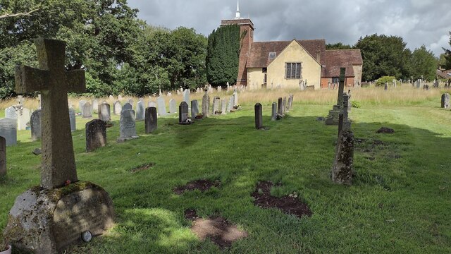
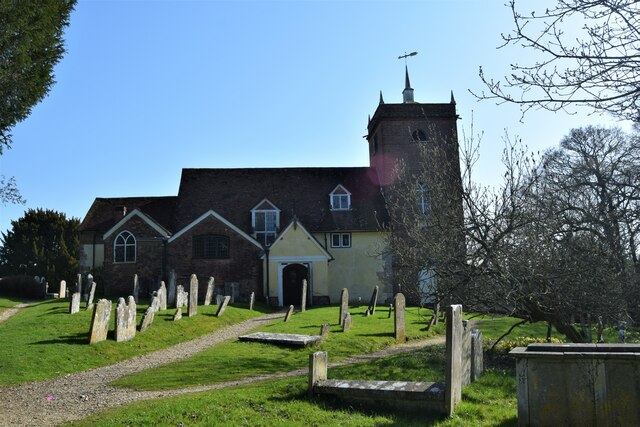
Known for its historic charm, Minstead boasts a number of traditional thatched-roof cottages and historic buildings, giving it a quintessential English village feel. The village is home to the 13th-century All Saints Church, which features stunning architecture and a serene atmosphere. Additionally, the Minstead Trust, a charity supporting adults with learning disabilities, is based in the village and plays an important role in the local community.

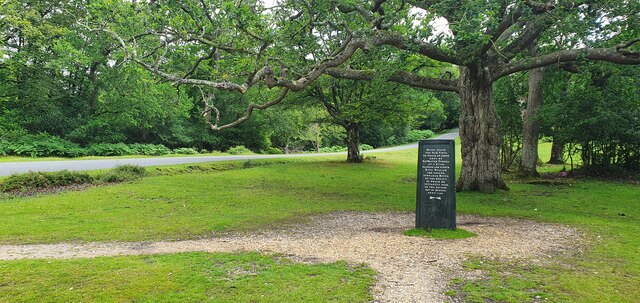
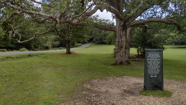
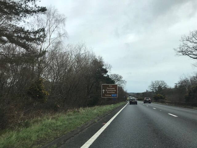
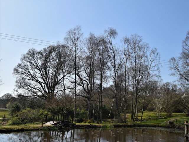
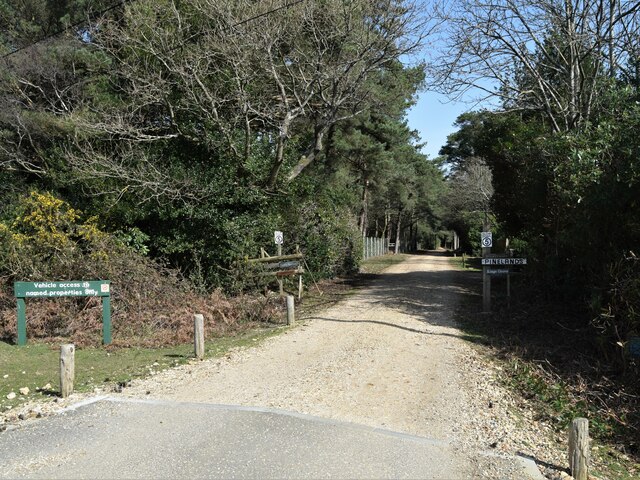
Nature lovers are drawn to Minstead for its proximity to the New Forest, a vast area of ancient woodland and heathland. This provides ample opportunities for outdoor activities such as walking, cycling, and horse riding. The village is also surrounded by an abundance of wildlife, including deer, ponies, and various bird species, making it a popular destination for wildlife enthusiasts.

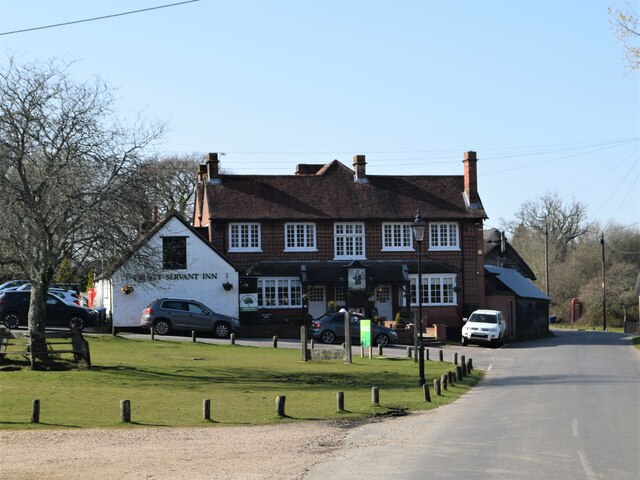
Minstead offers a range of amenities to cater to both residents and visitors. These include a village shop, a pub serving delicious local food and drink, and a village hall that hosts community events and activities. The village also has a strong sense of community spirit, with various clubs and societies that bring people together.

Overall, Minstead is a charming and tranquil village that offers a perfect blend of history, natural beauty, and community spirit, making it an appealing destination for both locals and tourists seeking a peaceful escape.

If you have any feedback on the listing, please let us know in the comments section below.
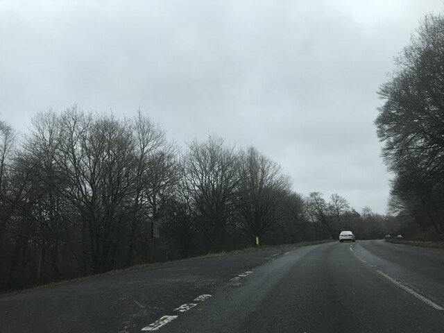
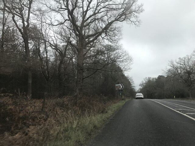
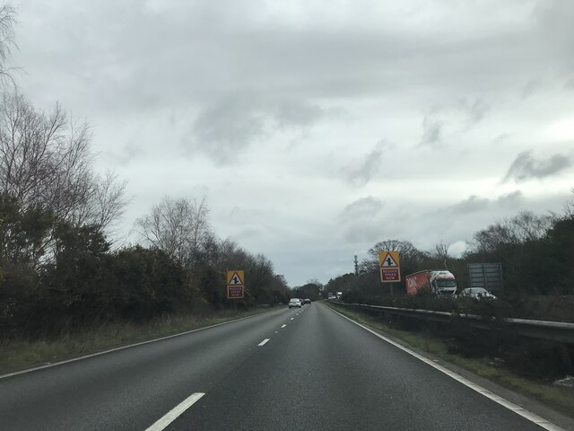
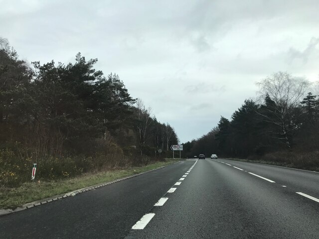
Minstead Images

Images are sourced within 2km of 50.898148/-1.600999 or Grid Reference SU2811. Thanks to Geograph Open Source API. All images are credited.

The Rufus Stone
The Rufus Stone
Minstead : The A31 Looking along the A31.
Minstead : The A31
Looking along the A31.
Minstead : The A31 Looking along the A31.
Minstead : The A31
Looking along the A31.
Rufus Stone Rufus Stone encased in a protective cover
Rufus Stone
Rufus Stone encased in a protective cover
Sir Arthur Conan Doyle's Grave Sir Arthur Conan Doyle and his wife's grave All Saints Church
Sir Arthur Conan Doyle's Grave
Sir Arthur Conan Doyle and his wife's grave All Saints Church
The Compton Arms, Stoney Cross c.1970 Before it became the corporate and characterless Little Chef and the Travelodge of today, The Compton Arms was a long established country inn - a free house, with a reputation for fine food and good ale. Named after a local squire, Henry Compton, its origins lie much further back than when this photograph was taken. In the 18th century it was a posting inn that catered for the local gentry by supplying horses and post chaises for hire, and because of the number of influential personages residing in the locality, a Post Office was established at the inn in 1837. This would have benefitted the local inhabitants considerably, as Stoney Cross was on the mail coach route from London to Poole via Southampton. Interestingly, although the building long ago had given up its post office, in 2008 it still retained its now disused Edwardian GPO postbox. <a title="https://www.geograph.org.uk/photo/962737" href="https://www.geograph.org.uk/photo/962737">Link</a>

At sometime in the past, in order to accommodate the ever increasing number of motorists, the building had been sensitively extended to the east, the extension incorporating a new bay window to match the old one to the west. Since then, the old coaching inn has been remodelled, and now compares unfavourably with the photo above in this Sept. 2021 Streetview image: <span class="nowrap"><a title="https://media.geograph.org.uk/files/7eabe3a1649ffa2b3ff8c02ebfd5659f/Compton_Arms_GE-original.jpg" rel="nofollow ugc noopener" href="https://media.geograph.org.uk/files/7eabe3a1649ffa2b3ff8c02ebfd5659f/Compton_Arms_GE-original.jpg">Link</a><img style="margin-left:2px;" alt="External link" title="External link - shift click to open in new window" src="https://s1.geograph.org.uk/img/external.png" width="10" height="10"/></span> 

The Compton Arms - early 20th century: <span class="nowrap"><a title="https://media.geograph.org.uk/files/7eabe3a1649ffa2b3ff8c02ebfd5659f/MGPC004-original.jpg" rel="nofollow ugc noopener" href="https://media.geograph.org.uk/files/7eabe3a1649ffa2b3ff8c02ebfd5659f/MGPC004-original.jpg">Link</a><img style="margin-left:2px;" alt="External link" title="External link - shift click to open in new window" src="https://s1.geograph.org.uk/img/external.png" width="10" height="10"/></span>
The Compton Arms, Stoney Cross c.1970
Before it became the corporate and characterless Little Chef and the Travelodge of today, The Compton Arms was a long established country inn - a free house, with a reputation for fine food and good ale. Named after a local squire, Henry Compton, its origins lie much further back than when this photograph was taken. In the 18th century it was a posting inn that catered for the local gentry by supplying horses and post chaises for hire, and because of the number of influential personages residing in the locality, a Post Office was established at the inn in 1837. This would have benefitted the local inhabitants considerably, as Stoney Cross was on the mail coach route from London to Poole via Southampton. Interestingly, although the building long ago had given up its post office, in 2008 it still retained its now disused Edwardian GPO postbox. Link At sometime in the past, in order to accommodate the ever increasing number of motorists, the building had been sensitively extended to the east, the extension incorporating a new bay window to match the old one to the west. Since then, the old coaching inn has been remodelled, and now compares unfavourably with the photo above in this Sept. 2021 Streetview image: LinkExternal link The Compton Arms - early 20th century: LinkExternal link
Junction on A337 southbound
Signage - A337 southbound
Signage - A31 northbound
The road to Newtown and Minstead
Bridleway, King's Garn
All Saints, Minstead
The Trusty Servant Inn
The Pond Furzey Gardens
The Pond
Furzey Gardens
Private road to the Grove
Minstead -Trusty Servant Pub Sign The unusual village pub sign at Minstead, "The Trusty Servant", portrays an allegorical servant - the picture is a copy of a painting in Winchester College where servants attended to rich scholars.
<span class="nowrap"><a title="www.minstead.org.uk" rel="nofollow ugc noopener" href="http://www.minstead.org.uk">Link</a><img style="margin-left:2px;" alt="External link" title="External link - shift click to open in new window" src="https://s1.geograph.org.uk/img/external.png" width="10" height="10"/></span>
Minstead -Trusty Servant Pub Sign
The unusual village pub sign at Minstead, "The Trusty Servant", portrays an allegorical servant - the picture is a copy of a painting in Winchester College where servants attended to rich scholars. LinkExternal link
Show me another place!

Minstead is located at Grid Ref: SU2811 (Lat: 50.898148, Lng: -1.600999)

Administrative County: Hampshire

District: New Forest

Police Authority: Hampshire

What 3 Words

///directors.piglet.commenced. Near Cadnam, Hampshire

Related Wikis

Minstead Lodge

Minstead Lodge in Hampshire is a building of historical significance built in about 1830 and is Grade II listed on the English Heritage Register. Today...

Minstead

Minstead is a small village and civil parish in the New Forest, Hampshire, about 2 miles (3.2 km) north of Lyndhurst. There is a shop and a pub, the Trusty...

Cadnam

Cadnam is a village situated in Hampshire, England, within the boundaries of the New Forest National Park. The village has existed since the medieval period...

Upper Canterton

Upper Canterton is a village in Hampshire, England, located at 50°54′36″N 1°37′24″W. It is near Minstead. == References == The geographic coordinates are...

Emery Down

Emery Down is a small village in the New Forest National Park in Hampshire, England. Its nearest town is Lyndhurst, which lies approximately 1.4 miles...

Bartley Lodge

Bartley Lodge is a country house near Cadnam in Hampshire, England, within the boundaries of the New Forest National Park. It was built in the 18th century...

Christ Church, Emery Down

Christ Church is a Church of England church in Emery Down, Hampshire, England. It was designed by William Butterfield and constructed in 1863–64. The church...

Brook, New Forest

Brook is a hamlet in the civil parish of Bramshaw, in Hampshire, England. It lies just inside the New Forest. The hamlet contains a mix of 18th and 19th...

Nearby Amenities

Located within 500m of 50.898148,-1.600999
Created By: osmeditor2
Lat/Long: 50.8984364/-1.6012538
Created By: osmeditor2
Lat/Long: 50.8963427/-1.6066132
Minstead
Place: village
Lat/Long: 50.8975655/-1.6007673
Booth: K6
Disused Amenity: telephone
Man Made: telephone_box
Note: kiosk retained - future use unclear
Lat/Long: 50.8986518/-1.6015676
Post Box
Collection Plate: CP1D
Collection Times: Mo-Fr 09:00; Sa 07:00
Old Ref: SO43 8
Operator: Royal Mail
Operator Wikidata: Q638098
Post Box Type: pillar
Ref: SO43 8D
Royal Cypher: EIIR
Royal Cypher Wikidata: Q33102113
Source: survey
Lat/Long: 50.897835/-1.6006096
Bus Stop
Trusty Servant Ph
Bus: yes
Naptan AtcoCode: 1900HA080189
Naptan Bearing: SE
Naptan CommonName: Trusty Servant Ph
Naptan Crossing: Congleton Close
Naptan NaptanCode: hamagpaw
Naptan Street: Unamed Road Through Village
Naptan Verified: no
Source: naptan_import
Lat/Long: 50.8982382/-1.6008984
Bus Stop
Trusty Servant Ph
Bus: yes
Naptan AtcoCode: 1900HA080190
Naptan Bearing: NW
Naptan CommonName: Trusty Servant Ph
Naptan Crossing: Congleton Close
Naptan NaptanCode: hamagpda
Naptan Street: Unamed Road Through Village
Naptan Verified: no
Source: naptan_import
Lat/Long: 50.8981303/-1.6008851
Bus Stop
Park Farm
Bus: yes
Naptan AtcoCode: 1900HA080191
Naptan Bearing: W
Naptan CommonName: Park Farm
Naptan NaptanCode: hamagpmd
Naptan Street: Unamed Road From Minstead
Naptan Verified: no
Source: naptan_import
Lat/Long: 50.896102/-1.5958276
Bus Stop
Park Farm
Bus: yes
Naptan AtcoCode: 1900HA080192
Naptan Bearing: E
Naptan CommonName: Park Farm
Naptan NaptanCode: hamagpmg
Naptan Street: Unamed Road From Minstead
Naptan Verified: no
Source: naptan_import
Lat/Long: 50.8961973/-1.5957969
Minstead Community Shop
Addr City: Lyndhurst
Addr Country: GB
Addr Place: Minstead
Addr Postcode: SO43 7FY
Shop: convenience
Lat/Long: 50.8981113/-1.6011553
Bicycle: yes
Ford: yes
Motor Vehicle: yes
Lat/Long: 50.8958815/-1.6064883
Barrier: kissing_gate
Source: survey
Lat/Long: 50.8957429/-1.6058632
Sir Arthur Conan Doyle
Access: yes
Historic: tomb
Inscription: STEEL TRUE - BLADE STRAIGHT - ARTHUR CONAN DOYLE - KNIGHT - PATRIOT, PHYSICIAN & MAN OF LETTERS - 22 MAY 1858 - 7 JULY 1930 - AND HIS BELOVED, HIS WIFE - JEAN CONAN DOYLE - REUNITED 27 JUNE 1940
Material: stone
Religion: spiritualist
Source: survey;knowledge
Start Date: 1955
Subject Wikidata: Q35610
Subject Wikipedia: en:Arthur Conan Doyle
Lat/Long: 50.8961834/-1.6015763
Barrier: kissing_gate
Source: survey
Lat/Long: 50.8970746/-1.6019575
Barrier: cattle_grid
Lat/Long: 50.897176/-1.6018822
Memorial Cross
Heritage: yes
Historic: memorial
Wikidata: Q26677364
Lat/Long: 50.8978836/-1.6011608
Post Box
Collection Plate: CP7
Collection Times: Mo-Fr 16:00; Sa 08:45
Operator: Royal Mail
Operator Wikidata: Q638098
Post Box Type: lamp
Ref: SO43 186
Royal Cypher: EIIR
Royal Cypher Wikidata: Q33102113
Lat/Long: 50.9008729/-1.5997239
Defibrillator
Defibrillator Location: To left of entrance door, on wall.
Emergency: defibrillator
Indoor: no
Lat/Long: 50.8981875/-1.6011546
The data included in this document is from www.openstreetmap.org. The data is made available under ODbL.

Have you been to Minstead?

Leave your review of Minstead below (or comments, questions and feedback).