Minskip

Settlement in Yorkshire Harrogate

England

Minskip

Milestone - A168 - Near Boroughbridge (1) Milepost on the A168 (the old A1 Great North Road) between Wetherby and Boroughbridge.
Inscriptions read: - Ferrybridge & Boroughbridge Road / Boroughbridge // Wetherby 10 1/4 Miles / Aberford 17 1/2 Miles / Ferrybridge 27 Miles / Doncaster 42 Miles // Boroughbridge 2 Miles
WR Casting
Links to photos of Ordnance Survey Benchmark Rivet located on top of the post can be seen below.
<a href="https://www.geograph.org.uk/photo/7692827">SE3963 : Milestone - A168 - Near Boroughbridge (2)</a>
<a href="https://www.geograph.org.uk/photo/7693032">SE3963 : Milestone - A168 - Near Boroughbridge</a>
Milestone - A168 - Near Boroughbridge (1) Credit: Tez Exley

The requested URL returned error: 429 Too Many Requests

If you have any feedback on the listing, please let us know in the comments section below.
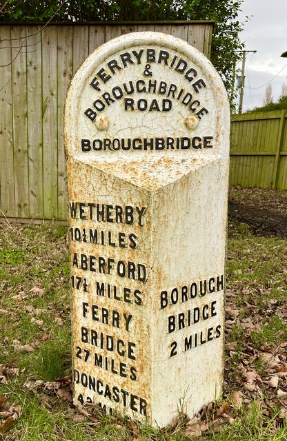
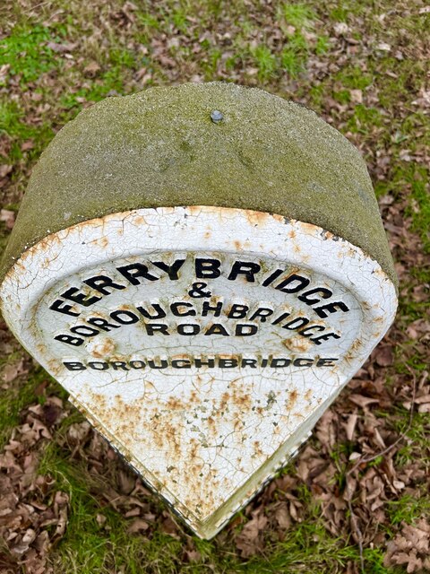
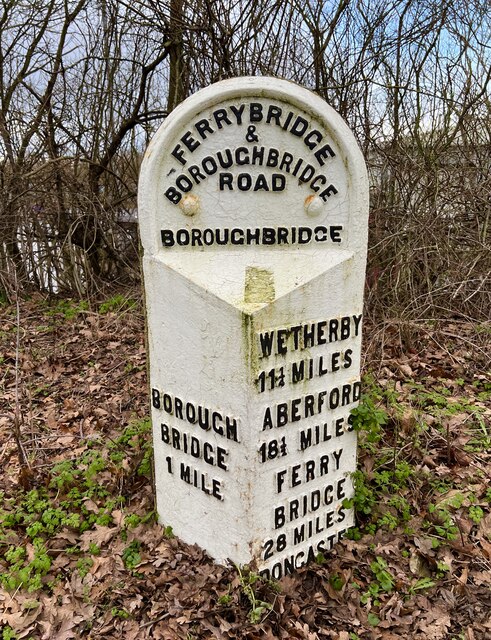
Minskip Images

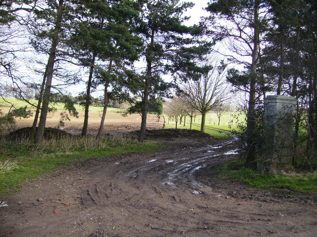
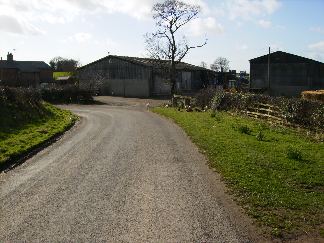
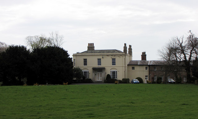
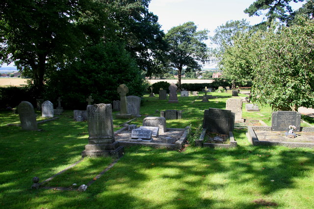
Images are sourced within 2km of 54.076768/-1.407417 or Grid Reference SE3864. Thanks to Geograph Open Source API. All images are credited.

Milestone - A168 - Near Boroughbridge (1) Milepost on the A168 (the old A1 Great North Road) between Wetherby and Boroughbridge.
Inscriptions read: - Ferrybridge & Boroughbridge Road / Boroughbridge // Wetherby 10 1/4 Miles / Aberford 17 1/2 Miles / Ferrybridge 27 Miles / Doncaster 42 Miles // Boroughbridge 2 Miles
WR Casting
Links to photos of Ordnance Survey Benchmark Rivet located on top of the post can be seen below.
<a href="https://www.geograph.org.uk/photo/7692827">SE3963 : Milestone - A168 - Near Boroughbridge (2)</a>
<a href="https://www.geograph.org.uk/photo/7693032">SE3963 : Milestone - A168 - Near Boroughbridge</a>
Milestone - A168 - Near Boroughbridge (1)
Milepost on the A168 (the old A1 Great North Road) between Wetherby and Boroughbridge. Inscriptions read: - Ferrybridge & Boroughbridge Road / Boroughbridge // Wetherby 10 1/4 Miles / Aberford 17 1/2 Miles / Ferrybridge 27 Miles / Doncaster 42 Miles // Boroughbridge 2 Miles WR Casting Links to photos of Ordnance Survey Benchmark Rivet located on top of the post can be seen below. SE3963 : Milestone - A168 - Near Boroughbridge (2) SE3963 : Milestone - A168 - Near Boroughbridge
Milestone - A168 - Near Boroughbridge (2) Milepost on the A168 (the old A1 Great North Road) between Wetherby and Boroughbridge with Ordnance Survey Benchmark Rivet located on the top
Links to full photo of Milepost and close up of benchmark rivet can be seen below.
<a href="https://www.geograph.org.uk/photo/7692826">SE3963 : Milestone - A168 - Near Boroughbridge (1)</a>
<a href="https://www.geograph.org.uk/photo/7693032">SE3963 : Milestone - A168 - Near Boroughbridge</a>
Milestone - A168 - Near Boroughbridge (2)
Milepost on the A168 (the old A1 Great North Road) between Wetherby and Boroughbridge with Ordnance Survey Benchmark Rivet located on the top Links to full photo of Milepost and close up of benchmark rivet can be seen below. SE3963 : Milestone - A168 - Near Boroughbridge (1) SE3963 : Milestone - A168 - Near Boroughbridge
Milestone - A168 - Near Boroughbridge Milepost on the A168 (the old A1 Great North Road) between Wetherby and Boroughbridge with Ordnance Survey Benchmark Rivet located on the top
Links to other photos of Milepost can be seen below.
<a href="https://www.geograph.org.uk/photo/7692826">SE3963 : Milestone - A168 - Near Boroughbridge (1)</a>
<a href="https://www.geograph.org.uk/photo/7692827">SE3963 : Milestone - A168 - Near Boroughbridge (2)</a>
Milestone - A168 - Near Boroughbridge
Milepost on the A168 (the old A1 Great North Road) between Wetherby and Boroughbridge with Ordnance Survey Benchmark Rivet located on the top Links to other photos of Milepost can be seen below. SE3963 : Milestone - A168 - Near Boroughbridge (1) SE3963 : Milestone - A168 - Near Boroughbridge (2)
Milestone - A168 - Minskip, Boroughbridge Old Milestone in great condition on the A168, this was the Southbound carriage way of the old A1 Great North Road. Milestone is located behind the highways depot just to the South of the A6055 junction to Minskip. 
Inscriptions read: - Ferrybridge & Boroughbridge Road / Boroughbridge / Boroughbridge 1 Mile / Wetherby 11 1/4 Miles / Aberford 18 1/2 Miles / Ferrybridge 28 Miles / Doncaster 43 Miles
WR casting.

Unsure as to whether this MS is listed but I would presume that it is.
Edit: The Milestone Society has informed me that this is not a listed MS due to it being moved from its original position during the construction of the Roundabout at the A6055 junction.
Milestone - A168 - Minskip, Boroughbridge
Old Milestone in great condition on the A168, this was the Southbound carriage way of the old A1 Great North Road. Milestone is located behind the highways depot just to the South of the A6055 junction to Minskip. Inscriptions read: - Ferrybridge & Boroughbridge Road / Boroughbridge / Boroughbridge 1 Mile / Wetherby 11 1/4 Miles / Aberford 18 1/2 Miles / Ferrybridge 28 Miles / Doncaster 43 Miles WR casting. Unsure as to whether this MS is listed but I would presume that it is. Edit: The Milestone Society has informed me that this is not a listed MS due to it being moved from its original position during the construction of the Roundabout at the A6055 junction.
Cornfield poppies near Boroughbridge Rich agricultural land in the Vale of York close to Aldborough and Boroughbridge.
Cornfield poppies near Boroughbridge
Rich agricultural land in the Vale of York close to Aldborough and Boroughbridge.
Pasture near Ornhams Hall Passing through this field while walking from Grafton to the A168, and onto Boroughbridge
Pasture near Ornhams Hall
Passing through this field while walking from Grafton to the A168, and onto Boroughbridge
Field of Grain near Ornhams Hall My journey was intended to follow this footpath from Grafton to Minskip. Beyond this field lies the A168, which used to be the A1. Just beyond that is the new A1(M) which has cut the right of way in two, and has not been restored. This entailed a long detour up the A168 to Boroughbridge to cross the motorway and then follow the A6055 to Minskip - be warned!
Field of Grain near Ornhams Hall
My journey was intended to follow this footpath from Grafton to Minskip. Beyond this field lies the A168, which used to be the A1. Just beyond that is the new A1(M) which has cut the right of way in two, and has not been restored. This entailed a long detour up the A168 to Boroughbridge to cross the motorway and then follow the A6055 to Minskip - be warned!
View of Park Farm Seen from side of A168
View of Park Farm
Seen from side of A168
Track forming rear entrance to Heaton House
Glebelands Farm
Glebelands Farm
Ornhams Hall, Boroughbridge Set back from the A168 south of Boroughbridge.
Ornhams Hall, Boroughbridge
Set back from the A168 south of Boroughbridge.
Chapel Hill Cemetery Close to the site of a Roman Burial Ground at Aldborough.
Chapel Hill Cemetery
Close to the site of a Roman Burial Ground at Aldborough.
Bridleway to Heaton House This bridleway runs for some 500m past Heaton House to emerge on the B6265 road.
Bridleway to Heaton House
This bridleway runs for some 500m past Heaton House to emerge on the B6265 road.
Grafton Lane Looking north along Grafton Lane towards Glebelands Farm.
Grafton Lane
Looking north along Grafton Lane towards Glebelands Farm.
A168 south of Boroughbridge The photo position would once have been in the central reservation of the A1 dual carriageway, but now the road has been upgraded to motorway and has been rebuilt some 200m further west. The old southbound carriageway now serves as the A168, a road which consistently grows in length and now reaches as far south as A1[M] junction 45 beyond Wetherby.
A168 south of Boroughbridge
The photo position would once have been in the central reservation of the A1 dual carriageway, but now the road has been upgraded to motorway and has been rebuilt some 200m further west. The old southbound carriageway now serves as the A168, a road which consistently grows in length and now reaches as far south as A1[M] junction 45 beyond Wetherby.
Yolk Farm, Minskip Happy hens entertaining visitors to the farmshop and egg restaurant
Yolk Farm, Minskip
Happy hens entertaining visitors to the farmshop and egg restaurant
River Ure at Boroughbridge Camping and Caravan Club Site
Weeping Willow at Roecliffe
Show me another place!

Minskip is located at Grid Ref: SE3864 (Lat: 54.076768, Lng: -1.407417)

Division: West Riding

Administrative County: North Yorkshire

District: Harrogate

Police Authority: North Yorkshire

What 3 Words

///bandwagon.plotter.typhoon. Near Boroughbridge, North Yorkshire

Nearby Locations

Minskip Buck Hill

Related Wikis

Minskip

Minskip is a village in the civil parish of Boroughbridge, in North Yorkshire, England. It is on the A6055 road and 1 mile south-west of Boroughbridge...

Roecliffe

Roecliffe is a village and civil parish in the Harrogate district of North Yorkshire, England. It is situated near the A1 road motorway which connects...

Devil's Arrows

The Devil's Arrows are four standing stones or menhirs in an alignment approximately 660 feet (200 m) to the east of the A1(M), adjacent to Roecliffe Lane...

St Mary's Church, Roecliffe

St Mary's Church is a redundant Church of England parish church in the village of Roecliffe, North Yorkshire, England (grid reference SE375659). It is...

Nearby Amenities

Located within 500m of 54.076768,-1.407417
Minskip
Created By: Potlatch 0.4a
Place: village
Wikidata: Q6869470
Lat/Long: 54.0776433/-1.4071577
Booth: K6
Covered: booth
Note: Empty
Source: survey
Survey Date: 6/08/21
Lat/Long: 54.0775487/-1.4067255
Post Box
Post Box Type: lamp
Ref: YO51 182
Royal Cypher: EIIR
Royal Cypher Wikidata: Q33102113
Lat/Long: 54.0752433/-1.4087347
Bench
Lat/Long: 54.0750734/-1.4088473
Bus Stop
Naptan AtcoCode: 3200YND57410
Naptan NaptanCode: 32057410
Lat/Long: 54.0750387/-1.4088742
Pub
The White Swan
Addr City: Minskip
Addr Postcode: YO51 9JF
Addr Street: Main Street
Lat/Long: 54.0778853/-1.4069269
Bus Stop
Naptan AtcoCode: 3200YND57600
Naptan NaptanCode: 32057600
Lat/Long: 54.0775613/-1.4067579
The data included in this document is from www.openstreetmap.org. The data is made available under ODbL.

Have you been to Minskip?

Leave your review of Minskip below (or comments, questions and feedback).