Millthorpe

Settlement in Derbyshire North East Derbyshire

England

Millthorpe

St Swithin's Church in Holmesfield Across the road from the George and Dragon pub.
St Swithin's Church in Holmesfield Credit: steven ruffles

Millthorpe is a small village situated in the county of Derbyshire, England. It is located in the beautiful Peak District National Park, approximately 12 miles southwest of the city of Sheffield. With a population of around 200 residents, it exudes a tranquil and close-knit community atmosphere.

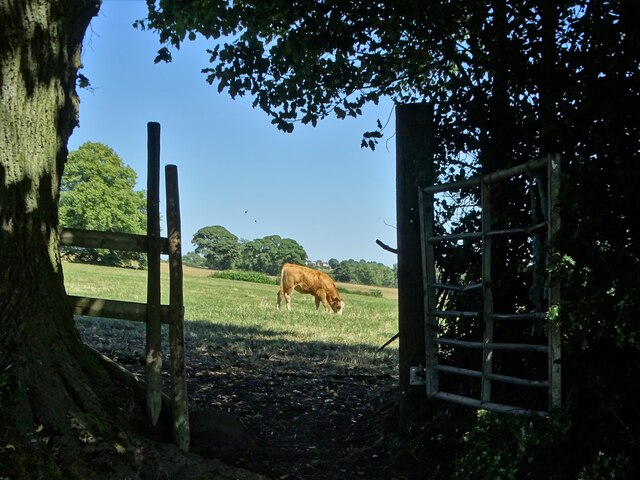
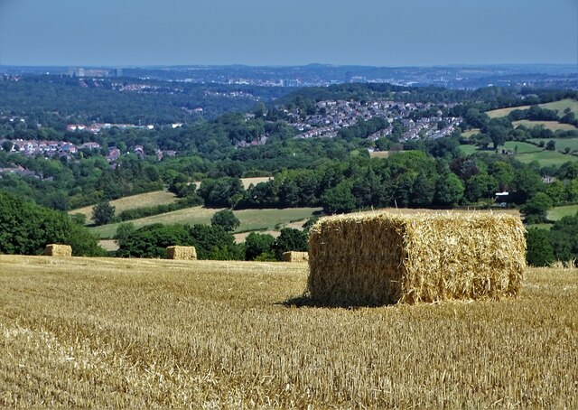
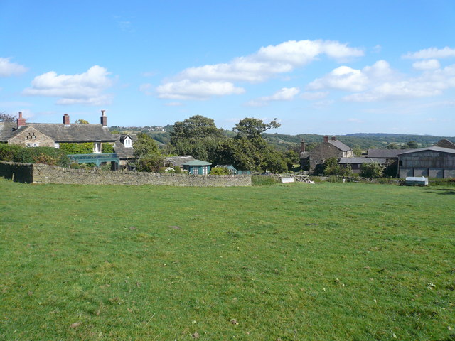
The village is nestled in a picturesque setting, surrounded by rolling hills, green meadows, and enchanting woodlands. Its idyllic location provides ample opportunities for outdoor activities such as hiking, cycling, and horseback riding. The nearby River Derwent adds to its natural charm, offering a serene spot for fishing and picnicking.

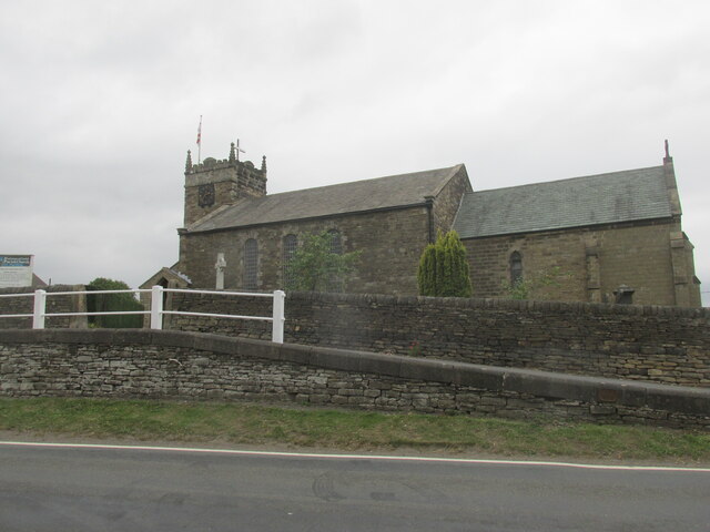
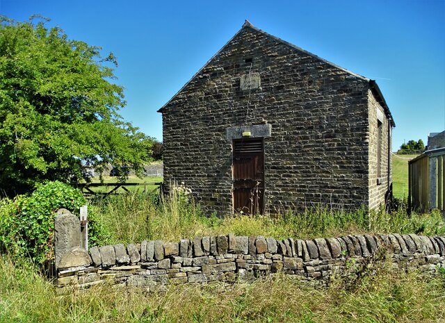
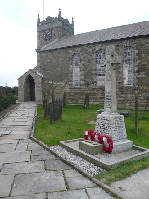
Millthorpe boasts a rich history, with some of its buildings dating back several centuries. The village church, dedicated to St. Matthew, is a notable landmark, featuring stunning architecture and stained glass windows. The village also has a few quaint stone cottages, which add to its traditional and timeless appeal.

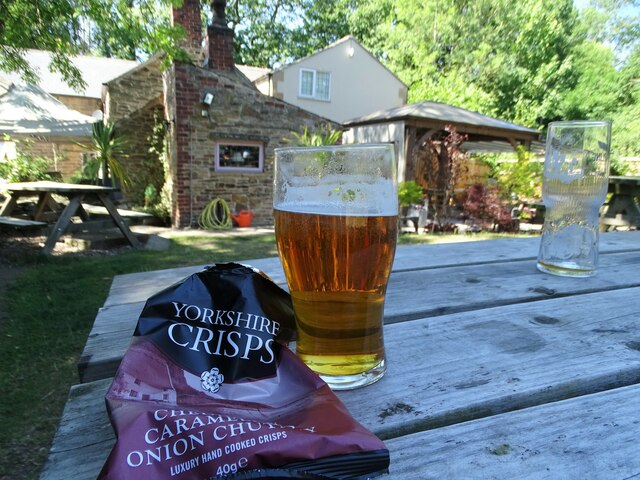
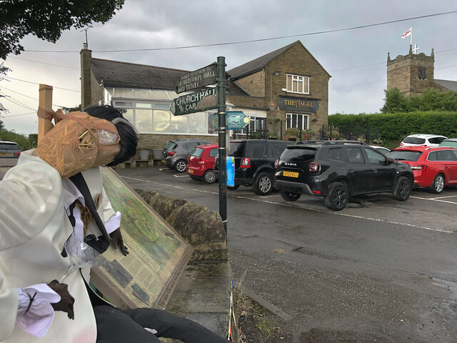
Despite its small size, Millthorpe offers a few amenities for its residents and visitors. There is a local pub, The Devonshire Arms, known for its warm hospitality and traditional British fare. Additionally, a community hall hosts various events and gatherings throughout the year, fostering a strong sense of community spirit.

For those seeking a peaceful retreat or a base to explore the natural wonders of the Peak District, Millthorpe provides an ideal destination. Its scenic beauty, historical charm, and welcoming community make it a hidden gem within Derbyshire's landscape.

If you have any feedback on the listing, please let us know in the comments section below.
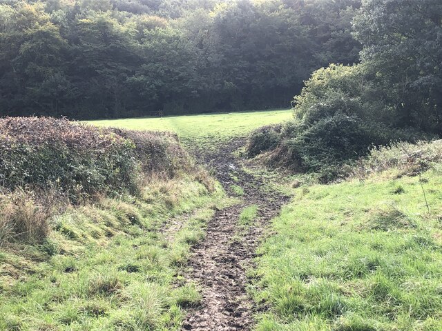
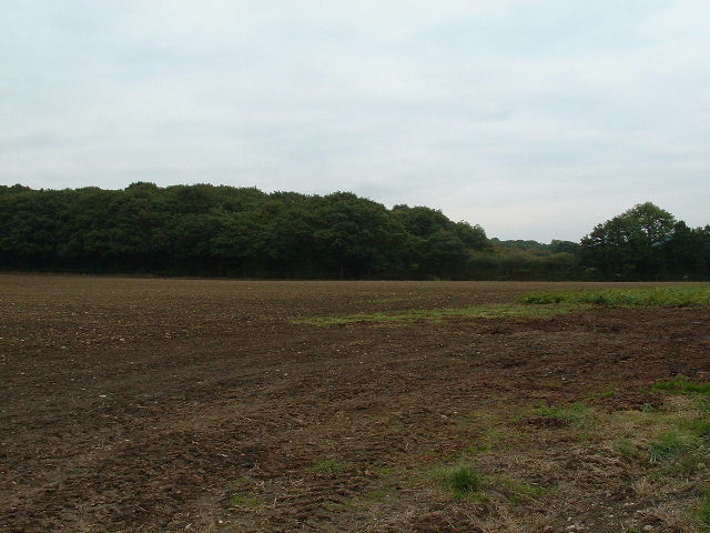
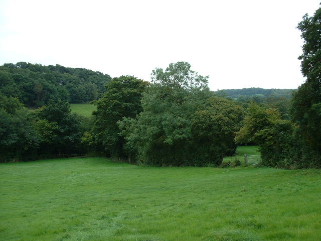
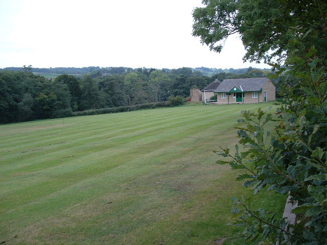
Millthorpe Images

Images are sourced within 2km of 53.283173/-1.527497 or Grid Reference SK3176. Thanks to Geograph Open Source API. All images are credited.

St Swithin's Church in Holmesfield Across the road from the George and Dragon pub.
St Swithin's Church in Holmesfield
Across the road from the George and Dragon pub.
A field of sunflowers At Barlow Village Sunflowers
A field of sunflowers
At Barlow Village Sunflowers
Giant sunflowers Two of the thousands in a field at Barlow Village Sunflowers
Giant sunflowers
Two of the thousands in a field at Barlow Village Sunflowers
A giant sunflower One of thousands in a field at Barlow Village Sunflowers
A giant sunflower
One of thousands in a field at Barlow Village Sunflowers
Young cow grazing at Horsleygate
Shandy and crisps at "The Royal Oak", Millthorpe On another hot summer's day in August 2022
Shandy and crisps at "The Royal Oak", Millthorpe
On another hot summer's day in August 2022
Gatepost at Holmesfield Common
After the Harvest Harvested field at Lydgate, Holmesfield with a view of Sheffield's southern  suburbs.
After the Harvest
Harvested field at Lydgate, Holmesfield with a view of Sheffield's southern suburbs.
Disused chapel at Holmesfield Common This Wesleyan Reform Chapel was erected in 1848. It could accommodate a hundred people.
Disused chapel at Holmesfield Common
This Wesleyan Reform Chapel was erected in 1848. It could accommodate a hundred people.
Angel and scarecrow, Holmesfield Popular gastro-pub next to St Swithin's Church. The rather dishevelled figure on the left would appear to be a remnant of the village's scarecrow hunt/festival/competition, maybe deliberately so, given the champagne glass in its hand, but in no worse a state than many of the others nearby.
Angel and scarecrow, Holmesfield
Popular gastro-pub next to St Swithin's Church. The rather dishevelled figure on the left would appear to be a remnant of the village's scarecrow hunt/festival/competition, maybe deliberately so, given the champagne glass in its hand, but in no worse a state than many of the others nearby.
A field full of sunflowers A seasonal visitor attraction at Village Sunflowers
A field full of sunflowers
A seasonal visitor attraction at Village Sunflowers
Strange sight in a field of barley One of the features of the visitor attraction at Village Sunflowers
Strange sight in a field of barley
One of the features of the visitor attraction at Village Sunflowers
The path from Unthank Lane, looking into Stripes Wood
Fields near Bradley lane farm
Farmland near Millthorpe East of Millthorpe near B6051
Farmland near Millthorpe
East of Millthorpe near B6051
Millthorpe cricket field Just west of Millthorpe village
Millthorpe cricket field
Just west of Millthorpe village
Meadows near Cordwell Looking east-ish near north of square
Meadows near Cordwell
Looking east-ish near north of square
Holmsfield. This picture shows the main road passing through Holmsfield.
Holmsfield.
This picture shows the main road passing through Holmsfield.
Show me another place!

Millthorpe is located at Grid Ref: SK3176 (Lat: 53.283173, Lng: -1.527497)

Administrative County: Derbyshire

District: North East Derbyshire

Police Authority: Derbyshire

What 3 Words

///corner.challenge.bookings. Near Dronfield, Derbyshire

Nearby Locations

Millthorpe Horsleygate

Related Wikis

Unthank, Derbyshire

Unthank is a hamlet in the North East Derbyshire district of Derbyshire, England. It is sited on a narrow lane on the southern slopes of the Cordwell Valley...

Barlow Woodseats Hall

Barlow Woodseats Hall is a Grade II* listed manor house situated at Barlow Woodseats, on the edge of the village of Barlow, in Derbyshire. It remains the...

Holmesfield

Holmesfield is a village and civil parish in the English county of Derbyshire. The population of the civil parish at the 2011 census was 971. The name...

St Swithin's Church, Holmesfield

St Swithin's Church is a Grade II listed parish church in the Church of England in Holmesfield, Derbyshire. == History == The church dates from 1727 with...

Nearby Amenities

Located within 500m of 53.283173,-1.527497
Millthorpe
Is In Country: UK
Is In County: Derbyshire
Place: hamlet
Lat/Long: 53.2836261/-1.5263687
Ford: yes
Lat/Long: 53.2856377/-1.5241922
Ford: yes
Lat/Long: 53.2823791/-1.5256774
Barrier: stile
Foot: yes
Material: stone
Steps: 3
Stile: stepover
Lat/Long: 53.2817848/-1.5277516
Barrier: stile
Foot: yes
Material: steel
Stile: stepover
Lat/Long: 53.2814997/-1.5252425
Barrier: stile
Foot: yes
Lat/Long: 53.2809322/-1.5249814
Barrier: stile
Foot: yes
Lat/Long: 53.2801935/-1.5254637
Barrier: stile
Foot: yes
Lat/Long: 53.2799626/-1.5256997
Public Bookcase
Booth: K6
Colour: red
Covered: booth
Disused Amenity: telephone
Man Made: telephone_box
Public Bookcase Type: phone_box
Lat/Long: 53.2839463/-1.5256481
Ele: 143.3612061
Information: board
Tourism: information
Lat/Long: 53.2840515/-1.5252526
Bus Stop
Bus: yes
Ele: 158.2615967
Naptan AtcoCode: 1000DMMN7665
Naptan NaptanCode: dbsatwpd
Public Transport: platform
Lat/Long: 53.2854703/-1.5230458
Barrier: stile
Ele: 147.4467773
Stile: stepover
Lat/Long: 53.2839485/-1.527946
Barrier: stile
Ele: 162.3471680
Steps: 3
Stile: wall
Lat/Long: 53.285983/-1.5299418
Ele: 164.7503662
Lat/Long: 53.2861235/-1.5313944
Barrier: stile
Ele: 165.9520264
Steps: 1
Stile: stepover
Lat/Long: 53.2861568/-1.5313848
Ele: 153.0000000
Lat/Long: 53.284133/-1.5309018
Barrier: stile
Ele: 166.0000000
Steps: 1
Stile: stepover
Lat/Long: 53.2850495/-1.5311073
Barrier: stile
Ele: 159.0000000
Steps: 2
Stile: stepover
Lat/Long: 53.285542/-1.5240348
Ele: 165.0000000
Lat/Long: 53.286008/-1.5236005
Barrier: stile
Material: wood
Steps: 1
Stile: stepover
Lat/Long: 53.2806942/-1.5244015
Post Box
Collection Times: Mo-Fr 09:00; Sa 07:00
Post Box Type: lamp
Ref: S18 260D
Royal Cypher: EIIR
Royal Cypher Wikidata: Q33102113
Lat/Long: 53.2839978/-1.5324906
Barrier: cattle_grid
Bicycle: yes
Foot: yes
Lat/Long: 53.2815004/-1.5253948
Bench
Lat/Long: 53.2839654/-1.5254334
Bench
Lat/Long: 53.283993/-1.5253776
Barrier: stile
Material: wood
Source: survey;gps
Stile: stepover
Lat/Long: 53.2815547/-1.5251702
Ford: yes
Lat/Long: 53.2790977/-1.5292337
Generator Method: photovoltaic
Generator Output Electricity: yes
Generator Source: solar
Generator Type: solar_photovoltaic_panel
Location: roof
Power: generator
Lat/Long: 53.2827183/-1.5227613
Generator Method: photovoltaic
Generator Output Electricity: yes
Generator Source: solar
Generator Type: solar_photovoltaic_panel
Location: roof
Power: generator
Lat/Long: 53.2827199/-1.5226245
Generator Method: photovoltaic
Generator Output Electricity: yes
Generator Source: solar
Generator Type: solar_photovoltaic_panel
Location: roof
Power: generator
Lat/Long: 53.2825964/-1.5208489
Generator Method: photovoltaic
Generator Output Electricity: yes
Generator Source: solar
Generator Type: solar_photovoltaic_panel
Location: roof
Power: generator
Lat/Long: 53.2827462/-1.5262562
Post Box
Collection Times: Mo-Fr 16:00; Sa 10:15
Post Box Type: wall
Ref: S18 489
Royal Cypher: EIIR
Royal Cypher Wikidata: Q33102113
Lat/Long: 53.2835185/-1.5253009
Advertising: board
Operator: Holmesfield Parish Council
Support: wall_mounted
Lat/Long: 53.28395/-1.5255921
Colour: green
Man Made: street_cabinet
Lat/Long: 53.284055/-1.5252422
Colour: BROWN
Man Made: utility_pole
Material: wood
Utility: telecom
Lat/Long: 53.2839477/-1.5255873
Colour: BROWN
Man Made: utility_pole
Material: wood
Utility: telecom
Lat/Long: 53.2839496/-1.5255971
Man Made: utility_pole
Material: wood
Utility: telecom
Lat/Long: 53.2839789/-1.5252777
Waste Basket
Material: plastic
Lat/Long: 53.2839789/-1.5252744
Colour: green
Man Made: street_cabinet
Lat/Long: 53.2839795/-1.5254083
Man Made: utility_pole
Material: wood
Utility: telecom
Lat/Long: 53.2839282/-1.5275248
Colour: BROWN
Man Made: utility_pole
Material: wood
Utility: telecom
Lat/Long: 53.2821968/-1.5227883
Colour: BROWN
Man Made: utility_pole
Material: wood
Utility: telecom
Lat/Long: 53.2821091/-1.52199
Colour: brown
Man Made: utility_pole
Material: wood
Utility: telecom
Lat/Long: 53.2822222/-1.5208704
Colour: brown
Man Made: utility_pole
Material: wood
Utility: telecom
Lat/Long: 53.2820013/-1.5206361
The data included in this document is from www.openstreetmap.org. The data is made available under ODbL.

Have you been to Millthorpe?

Leave your review of Millthorpe below (or comments, questions and feedback).