Millikenpark

Settlement in Renfrewshire

Scotland

Millikenpark

National Cycle Network Route 7 Looking towards Kilbarchan.
National Cycle Network Route 7 Credit: Thomas Nugent

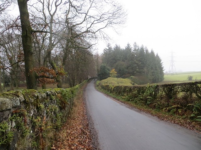
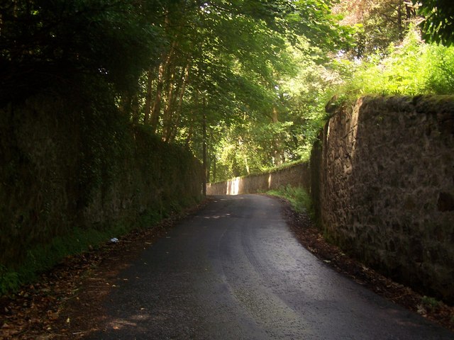
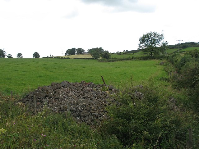
Millikenpark is a small village located in the Renfrewshire council area of Scotland. Situated on the banks of the River Gryffe, it is approximately 10 miles west of Glasgow and 4 miles south of Paisley. The village is nestled amidst scenic countryside, offering picturesque views and a tranquil atmosphere.

Millikenpark has a rich history, with its origins dating back to the 17th century. It was primarily a farming community until the early 19th century when industrialization began to shape the region. The village saw the establishment of various mills, which played a significant role in its development and gave it its name.

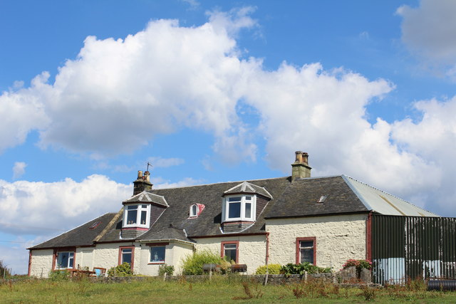
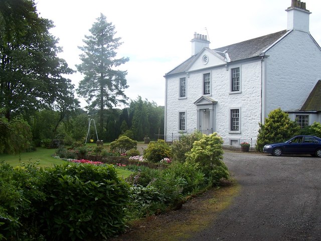
Today, Millikenpark is a residential area with a close-knit community. The village is characterized by traditional stone houses and cottages, adding to its charm and rural feel. The local amenities include a primary school, a community center, and a local shop catering to the everyday needs of residents.

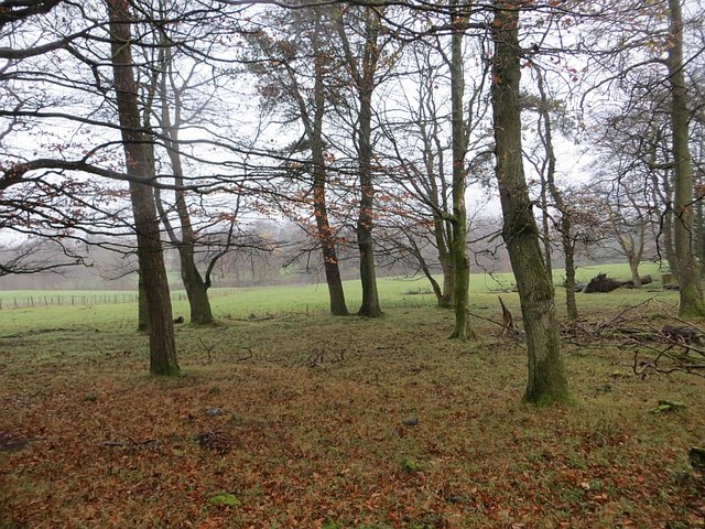
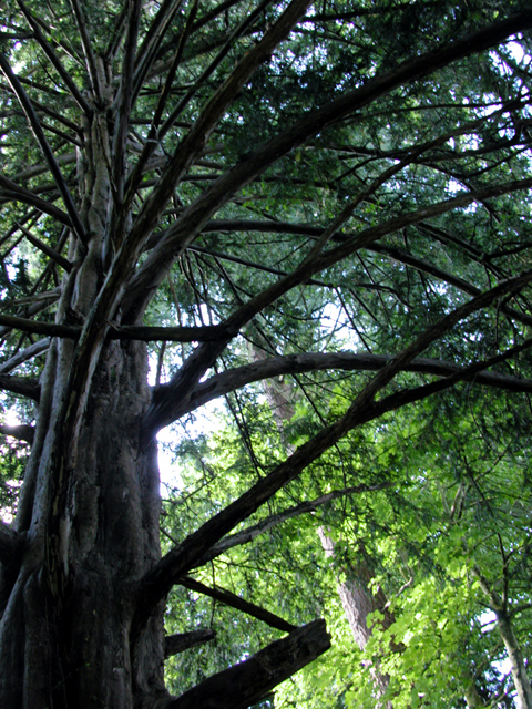
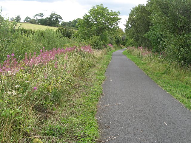
Nature lovers can take advantage of the surrounding countryside, which provides ample opportunities for walking, cycling, and exploring the great outdoors. The nearby Gryffe Reservoir also offers fishing and birdwatching activities.

Millikenpark benefits from excellent transport links, with regular bus services connecting it to nearby towns and cities. The proximity to Glasgow and Paisley makes it an attractive location for commuters looking for a peaceful place to reside while having easy access to urban amenities.

Overall, Millikenpark is a serene and historically significant village that offers a peaceful and rural lifestyle, making it an appealing place to live for residents seeking a quiet escape from the hustle and bustle of city life.

If you have any feedback on the listing, please let us know in the comments section below.
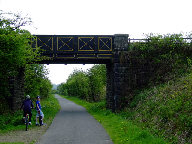
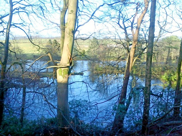
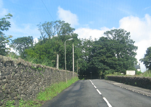
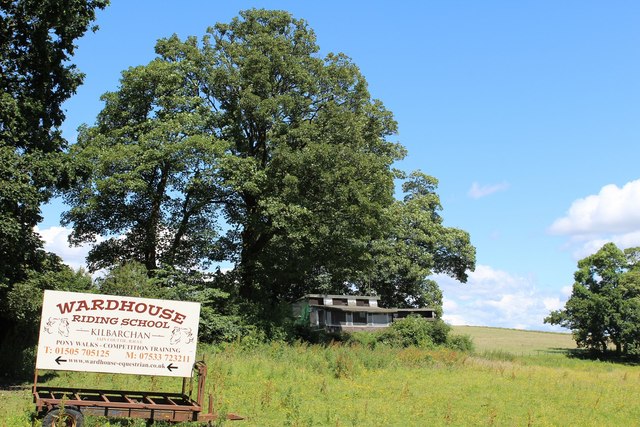
Millikenpark Images

Images are sourced within 2km of 55.83009/-4.537765 or Grid Reference NS4162. Thanks to Geograph Open Source API. All images are credited.

National Cycle Network Route 7 Looking towards Kilbarchan.
National Cycle Network Route 7
Looking towards Kilbarchan.
National Cycle Network Route 7 Between Kilbarchan and Lochwinnoch.
National Cycle Network Route 7
Between Kilbarchan and Lochwinnoch.
Glentyan House lake, Kilbarchan Taken from road above.
Glentyan House lake, Kilbarchan
Taken from road above.
Locher Road at Forehouse Ward House riding stables to the right
Locher Road at Forehouse
Ward House riding stables to the right
Sign for Wardhouse Riding School by Locher Road At the junction with Forehouse Road
Sign for Wardhouse Riding School by Locher Road
At the junction with Forehouse Road
Kibbleston
Kibbleston
Forehouse Road, Kilbarchan Glentyan policy wall on the left.
Forehouse Road, Kilbarchan
Glentyan policy wall on the left.
Strip wood, Glentyan Alongside Forehouse Road.
Strip wood, Glentyan
Alongside Forehouse Road.
West Renfrewshire from the air Kilbarchan is on the right, Bridge of Weir in the centre, with Kilmacolm, Port Glasgow and the Firth of Clyde in the distance.
West Renfrewshire from the air
Kilbarchan is on the right, Bridge of Weir in the centre, with Kilmacolm, Port Glasgow and the Firth of Clyde in the distance.
Glentyan Estate Woodland that forms part of Glentyan Estate, south of Burntshields Road, Kilbarchan.
Glentyan Estate
Woodland that forms part of Glentyan Estate, south of Burntshields Road, Kilbarchan.
Kilbarchan,  Forehouse
Kilbarchan, Forehouse
Kilbarchan, Burntshields Road A bridge once crossed the road at this point from Glentyan Estate to other parts of the Estate. A postcard dated 1906 names it "Roaring Bridge".
Kilbarchan, Burntshields Road
A bridge once crossed the road at this point from Glentyan Estate to other parts of the Estate. A postcard dated 1906 names it "Roaring Bridge".
Tree Clearing
Tree Clearing
Pylon
Pylon
Thirdpart Hall Farm View towards Howwood. The farm just over the grey bin.
Thirdpart Hall Farm
View towards Howwood. The farm just over the grey bin.
Kibbleston Road, Howwood Kibbleston farm on the right.
Kibbleston Road, Howwood
Kibbleston farm on the right.
Stone pile, Auchenames A pile of stones cleared from the fields?
Stone pile, Auchenames
A pile of stones cleared from the fields?
Kilbarchan loop Disused railway, now a cycle path. Most of its course appears to be within cuttings. The railway was built to relieve congestion between Paisley and Ayrshire. The last stretch at  Kilbirnie was finally closed in the early 1970s.
The railway is also known as the Lochwinnoch Loop or Dalry and North Johnstone Line.
Kilbarchan loop
Disused railway, now a cycle path. Most of its course appears to be within cuttings. The railway was built to relieve congestion between Paisley and Ayrshire. The last stretch at Kilbirnie was finally closed in the early 1970s. The railway is also known as the Lochwinnoch Loop or Dalry and North Johnstone Line.
Show me another place!

Millikenpark is located at Grid Ref: NS4162 (Lat: 55.83009, Lng: -4.537765)

Unitary Authority: Renfrewshire

Police Authority: Renfrewshire and Inverclyde

What 3 Words

///ejects.berated.ballparks. Near Kilbarchan, Renfrewshire

Related Wikis

Nation Radio Scotland

Nation Radio Scotland (formerly XFM Scotland (2014), 96.3 Rock Radio Real XS, Q96 and 96.3QFM) is a Scottish Independent Local Radio station for Renfrewshire...

Renfrewshire

Renfrewshire () (Scots: Renfrewshire; Scottish Gaelic: Siorrachd Rinn FriĆ¹) is one of the 32 council areas of Scotland. The council area has the same name...

Kilbarchan railway station

Kilbarchan railway station was a railway station serving the village of Kilbarchan, Renfrewshire, Scotland. The station was part of the Dalry and North...

Milliken Park railway station

Milliken Park railway station serves the west end of Johnstone and the south west of the village of Kilbarchan in Renfrewshire, Scotland. The station is...

Cochrane Castle

Cochrane Castle was a castle, 1 mile (1.6 km) west of Johnstone, Renfrewshire, Scotland, near the Black Cart Water. == History == The property was owned...

Kilbarchan

Kilbarchan (; Scottish Gaelic: Cill Bhearchain) is a village and civil parish in central Renfrewshire, in the west central Lowlands of Scotland. The village...

Newfield Park, Johnstone

Newfield Park was a football ground in Johnstone, Scotland. It was the home ground of Johnstone F.C. from 1894 until the club folded in 1927. == History... ==

Johnstone North railway station

Johnstone North railway station was a railway station serving the town of Johnstone, Renfrewshire, Scotland as part of the Dalry and North Johnstone Line...

Nearby Amenities

Located within 500m of 55.83009,-4.537765
Crossing
Crossing: unmarked
Crossing Island: no
Crossing Markings: no
Tactile Paving: no
Lat/Long: 55.8302381/-4.5344132
Bus Stop
Bus: yes
Naptan AtcoCode: 6140734
Naptan NaptanCode: 73924634
Public Transport: platform
Lat/Long: 55.8275539/-4.5337518
Bus Stop
Bus: yes
Public Transport: platform
Lat/Long: 55.8296796/-4.5306872
Give Way
Lat/Long: 55.8304809/-4.5348328
Power: tower
Lat/Long: 55.8304405/-4.5299875
Kilbarchan
Historic Railway: station
Railway: site
Wikidata: Q6406533
Wikipedia: en:Kilbarchan railway station
Lat/Long: 55.8320545/-4.5442937
Crossing
Crossing: unmarked
Crossing Island: yes
Crossing Markings: no
Tactile Paving: no
Lat/Long: 55.8294442/-4.5334815
E. Williams & Sons
Shop: butcher
Lat/Long: 55.8308279/-4.5369829
Post Box
Lat/Long: 55.8308054/-4.5370182
Shop: convenience
Lat/Long: 55.8307337/-4.5371076
Give Way
Direction: forward
Lat/Long: 55.8308986/-4.5354796
Give Way
Direction: forward
Lat/Long: 55.8309708/-4.5358836
Crossing
Crossing: unmarked
Crossing Island: no
Crossing Markings: no
Tactile Paving: no
Lat/Long: 55.8302622/-4.5343024
Give Way
Direction: forward
Lat/Long: 55.8304178/-4.534581
Give Way
Direction: forward
Lat/Long: 55.8306973/-4.5347803
Man Made: mast
Tower Type: communication
Lat/Long: 55.8340822/-4.5385921
Ncn Milepost: mills
Sustrans Ref: MP409
Lat/Long: 55.8332314/-4.5417372
Millikenpark
Place: neighbourhood
Lat/Long: 55.8298616/-4.5384994
Power: pole
Lat/Long: 55.8271269/-4.5430246
Power: pole
Lat/Long: 55.8268262/-4.5423434
Power: pole
Lat/Long: 55.8264635/-4.5417601
Power: pole
Lat/Long: 55.8260071/-4.5410852
Mini Roundabout
Direction: clockwise
Lat/Long: 55.8295496/-4.5332834
Traffic Calming: island
Lat/Long: 55.8295679/-4.53303
Give Way
Direction: backward
Lat/Long: 55.8311254/-4.5358477
Give Way
Direction: forward
Lat/Long: 55.8306616/-4.5343997
The data included in this document is from www.openstreetmap.org. The data is made available under ODbL.

Have you been to Millikenpark?

Leave your review of Millikenpark below (or comments, questions and feedback).