Belle Vue

Settlement in Cumberland Carlisle

England

Belle Vue

Cumberland Infirmary, Carlisle The flagship of the national PFI programme was officially opened by the Rt. Hon. Tony Blair, Prime Minister, in June 2000.
<span class="nowrap"><a title="http://www.visitcumbria.com/hospitals.htm" rel="nofollow ugc noopener" href="http://www.visitcumbria.com/hospitals.htm">Link</a><img style="margin-left:2px;" alt="External link" title="External link - shift click to open in new window" src="https://s1.geograph.org.uk/img/external.png" width="10" height="10"/></span>
Cumberland Infirmary, Carlisle Credit: Simon Ledingham

Belle Vue is a charming village located in the county of Cumberland, in the northwest region of England. Nestled amidst the picturesque landscapes of the Lake District National Park, it is renowned for its breathtaking natural beauty and tranquil surroundings. With a population of around 500 residents, Belle Vue exudes a quaint and close-knit community atmosphere.

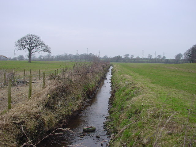
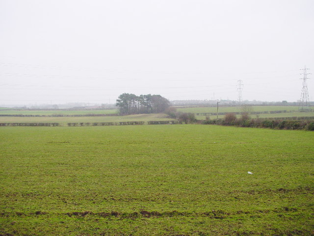
The village is characterized by its idyllic setting, surrounded by rolling hills, verdant meadows, and lush forests. It offers a peaceful retreat for nature lovers and outdoor enthusiasts, who can enjoy a variety of recreational activities such as hiking, biking, and bird watching in the nearby countryside.

Belle Vue's architecture reflects its rich history, with several well-preserved buildings showcasing traditional Cumberland style. The village church, dating back to the 12th century, stands as a testament to its historical significance. Additionally, Belle Vue is home to a charming village square, where locals and visitors can gather to socialize and enjoy the vibrant community spirit.

Despite its small size, Belle Vue boasts a strong sense of community pride and involvement. The village hosts regular events and festivals, including a summer fair and a Christmas market, which bring together residents and visitors alike. The community also supports a range of local businesses, including quaint cafes, traditional pubs, and boutique shops.

In summary, Belle Vue offers a tranquil and picturesque escape from the hustle and bustle of modern life. Its natural beauty, rich history, and vibrant community make it a truly enchanting destination for visitors seeking a slice of rural charm in the heart of Cumberland.

If you have any feedback on the listing, please let us know in the comments section below.
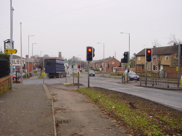
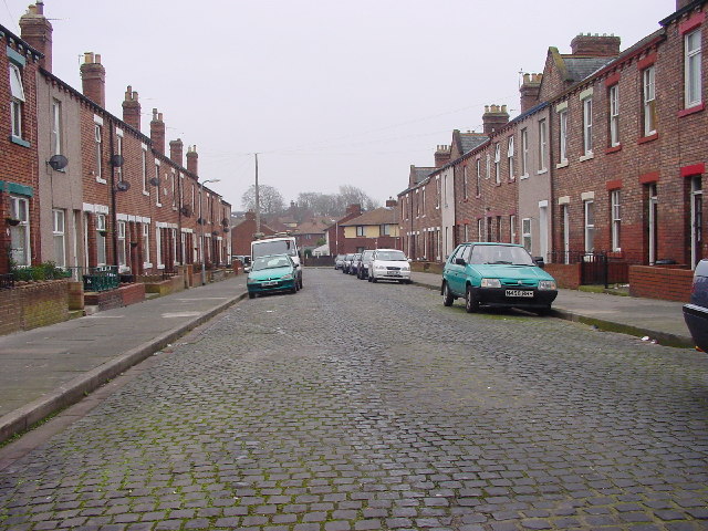
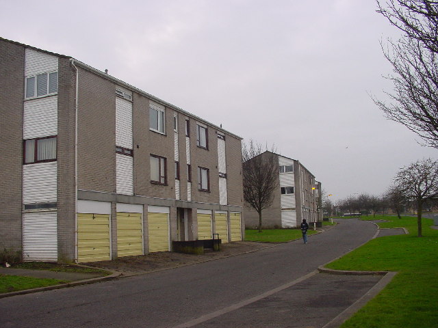
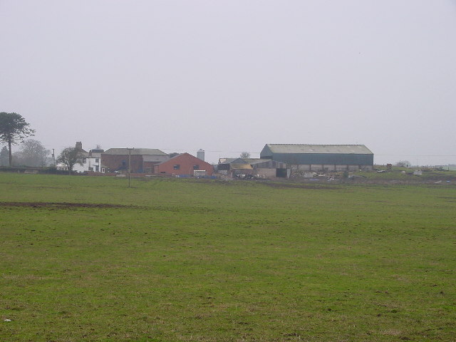
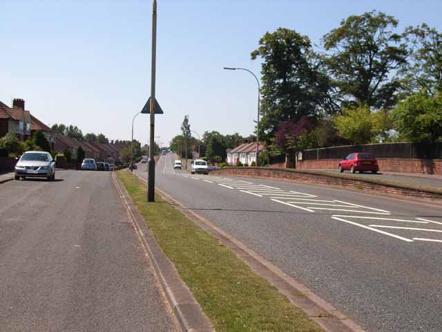
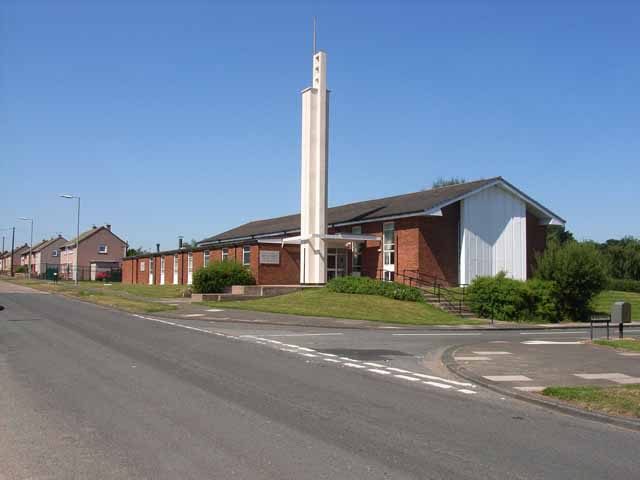
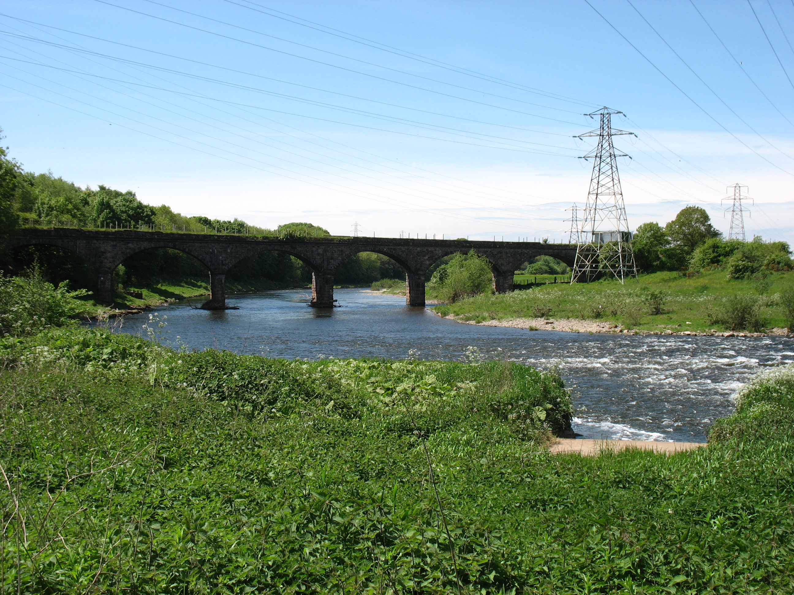
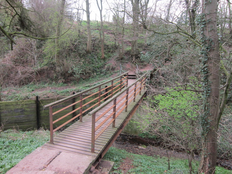
Belle Vue Images

Images are sourced within 2km of 54.894471/-2.976019 or Grid Reference NY3755. Thanks to Geograph Open Source API. All images are credited.

Cumberland Infirmary, Carlisle The flagship of the national PFI programme was officially opened by the Rt. Hon. Tony Blair, Prime Minister, in June 2000.
<span class="nowrap"><a title="http://www.visitcumbria.com/hospitals.htm" rel="nofollow ugc noopener" href="http://www.visitcumbria.com/hospitals.htm">Link</a><img style="margin-left:2px;" alt="External link" title="External link - shift click to open in new window" src="https://s1.geograph.org.uk/img/external.png" width="10" height="10"/></span>
Cumberland Infirmary, Carlisle
The flagship of the national PFI programme was officially opened by the Rt. Hon. Tony Blair, Prime Minister, in June 2000. LinkExternal link
Cumberland Infirmary, Carlisle
Carlisle Kingmoor Railway Depot It's the end of the line for Class 31175
Carlisle Kingmoor Railway Depot
It's the end of the line for Class 31175
Road Junction The minor road from the Raffles Estate and new housing areas meet the A595. Looking north-east towards Carlisle centre.
Road Junction
The minor road from the Raffles Estate and new housing areas meet the A595. Looking north-east towards Carlisle centre.
Terraces and Cobbles A small street in Carlisle, typical of many, with terraced brick-built houses and cobbled street
Terraces and Cobbles
A small street in Carlisle, typical of many, with terraced brick-built houses and cobbled street
Houses, Reeth Road
Houses, Reeth Road
Hen Moss Farm Situated to the west of the city, where the built-up area has a clear demarcation from the farmland.
Hen Moss Farm
Situated to the west of the city, where the built-up area has a clear demarcation from the farmland.
Drainage Ditch In open grazing fields
Drainage Ditch
In open grazing fields
Farmland at Knockupworth About 200 metres from the built-up housing of Carlisle City
Farmland at Knockupworth
About 200 metres from the built-up housing of Carlisle City
Bridge over Dismantled Railway Little remains of the old line. This part has been levelled to form a car park.
Bridge over Dismantled Railway
Little remains of the old line. This part has been levelled to form a car park.
Farmland at Nowtler Hill Looking SE towards Carlisle.
Farmland at Nowtler Hill
Looking SE towards Carlisle.
Wigton Road, Carlisle Pedestrian crossing of the main A595 Wigton Road in Carlisle. Queensway is off to the left.
Wigton Road, Carlisle
Pedestrian crossing of the main A595 Wigton Road in Carlisle. Queensway is off to the left.
Wigton Road, Carlisle The main A595 Wigton Road is flanked by service roads on either side which give access to the houses flanking the road.
Wigton Road, Carlisle
The main A595 Wigton Road is flanked by service roads on either side which give access to the houses flanking the road.
Church of Jesus Christ of Latter Day Saints, Carlisle Striking modern church on Langrigg Road
Church of Jesus Christ of Latter Day Saints, Carlisle
Striking modern church on Langrigg Road
River Eden Taken from the Hadrian's Wall Path.
River Eden
Taken from the Hadrian's Wall Path.
Footbridge on Hadrian's Wall Path This footbridge carries the Path and Cumbria Coastal Way over a stream. The bridge has an odd extension, as if it was originally intended to span a shorter gap.
Footbridge on Hadrian's Wall Path
This footbridge carries the Path and Cumbria Coastal Way over a stream. The bridge has an odd extension, as if it was originally intended to span a shorter gap.
Old Raffles Parade
Old Raffles Parade
Theakston Carlisle Brewery That's what it said on the water tank. I wonder what it is now?
Theakston Carlisle Brewery
That's what it said on the water tank. I wonder what it is now?
Show me another place!

Belle Vue is located at Grid Ref: NY3755 (Lat: 54.894471, Lng: -2.976019)

Administrative County: Cumbria

District: Carlisle

Police Authority: Cumbria

What 3 Words

///limes.heave.angle. Near Denton Holme, Cumbria

Nearby Locations

Belle Vue Raffles

Related Wikis

Belle Vue, Cumbria

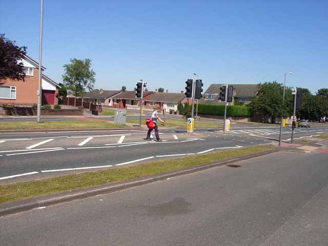
Belle Vue is a suburb of Carlisle, in the Cumberland district, in the ceremonial county of Cumbria, England. The ward population taken at the 2011 census...

Raffles, Cumbria

Raffles or the Raffles Estate is a suburb of Carlisle, Cumbria, United Kingdom. The estate consists mainly of council built and Housing association properties...

Milecastle 67

Milecastle 67 (Stainton) is a conjectured milecastle of the Roman Hadrian's Wall. The site of the milecastle has been calculated from measurement to known...

Stainton, Kingmoor

Stainton is a hamlet in the Kingmoor parish of Cumberland, Cumbria, England. It is near the city of Carlisle. Circa 1870, it had a population of 63 as...

Milecastle 68

Milecastle 68 (Boomby Gill) is a conjectured milecastle of the Roman Hadrian's Wall. The site of the milecastle (adjacent to Boomby Gill) has been calculated...

Port Carlisle Junction

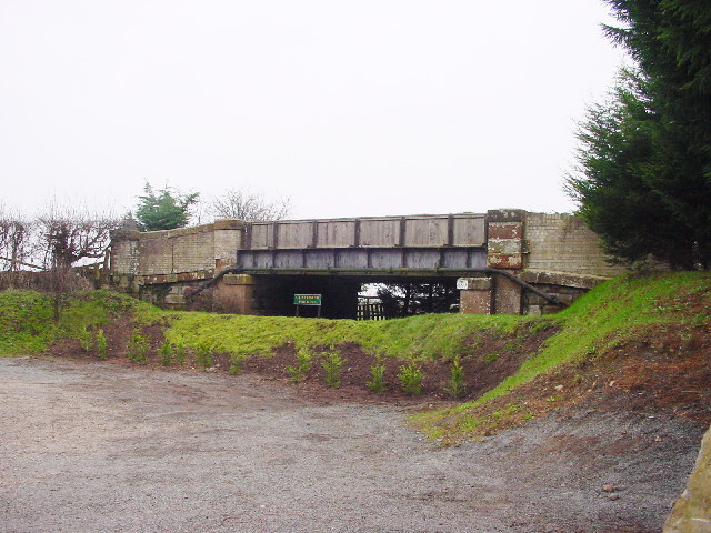
Port Carlisle Junction was a railway junction between the lines of the former Caledonian Railway and North British Railway companies lines to the north...

Cumberland Infirmary

Cumberland Infirmary is a hospital in Carlisle, Cumbria, England. It is managed by the North Cumbria Integrated Care NHS Foundation Trust. == History... ==

Carlisle power stations

Carlisle power stations were two electricity generating stations that supplied electricity to Carlisle and the surrounding area from 1899 until 1980. The...

Nearby Amenities

Located within 500m of 54.894471,-2.976019
Belle Vue
Is In: Carlisle, Cumbria, England, UK
Place: suburb
Source: npe
Lat/Long: 54.8945978/-2.9808863
Bus Stop
Sandsfield Park
Naptan AtcoCode: 090033101721
Naptan Bearing: W
Naptan CommonName: Sandsfield Park
Naptan Indicator: Near
Naptan Landmark: Junction with Carvoran Way
Naptan NaptanCode: cumamtad
Naptan PlusbusZoneRef: CARLILE
Naptan Street: Castlesteads Drive
Naptan Verified: no
Source: naptan_import
Lat/Long: 54.8913703/-2.9810686
Bus Stop
Green Lane / Crown Road in
Bench: no
Bin: no
Naptan AtcoCode: 090033101722
Naptan Bearing: E
Naptan CommonName: Green Lane / Crown Road in
Naptan Indicator: Near
Naptan Landmark: junction with Crown Road
Naptan NaptanCode: cumamtag
Naptan PlusbusZoneRef: CARLILE
Naptan Street: Green Lane
Naptan Verified: no
Shelter: no
Source: naptan_import
Tactile Paving: no
Lat/Long: 54.8930014/-2.9793932
Bus Stop
Vallum House out
Naptan AtcoCode: 090033102555
Naptan Bearing: W
Naptan CommonName: Vallum House out
Naptan Indicator: o/s
Naptan Landmark: no. 45
Naptan NaptanCode: cumapgat
Naptan PlusbusZoneRef: CARLILE
Naptan Street: Burgh Road
Naptan Verified: no
Source: naptan_import
Lat/Long: 54.8966887/-2.9746019
Bus Stop
Burgh Road in
Naptan AtcoCode: 090033102586
Naptan Bearing: E
Naptan CommonName: Burgh Road in
Naptan Indicator: o/s
Naptan Landmark: no. 93
Naptan NaptanCode: cumapgjt
Naptan PlusbusZoneRef: CARLILE
Naptan Street: Moorhouse Road
Naptan Verified: no
Source: naptan_import
Lat/Long: 54.895613/-2.9731414
Bus Stop
Greenlane / High Meadow in
Naptan AtcoCode: 090033102622
Naptan Bearing: E
Naptan CommonName: Greenlane / High Meadow in
Naptan Indicator: o/s
Naptan Landmark: no. 86
Naptan NaptanCode: cumapgtg
Naptan PlusbusZoneRef: CARLILE
Naptan Street: Green Lane
Naptan Verified: no
Source: naptan_import
Lat/Long: 54.8923559/-2.9736086
Bus Stop
Moorhouse Rd Top of Hill out
Naptan AtcoCode: 090033102623
Naptan Bearing: W
Naptan CommonName: Moorhouse Rd Top of Hill out
Naptan Indicator: o/s
Naptan Landmark: no. 87
Naptan NaptanCode: cumapgtj
Naptan PlusbusZoneRef: CARLILE
Naptan Street: Moorhouse Road
Naptan Verified: no
Source: naptan_import
Lat/Long: 54.8959225/-2.9793549
Bus Stop
Berkley Grange out
Bench: no
Bin: no
Naptan AtcoCode: 090033102667
Naptan Bearing: W
Naptan CommonName: Berkley Grange out
Naptan Indicator: o/s
Naptan Landmark: no.s 257 to 259
Naptan NaptanCode: cumapjdg
Naptan PlusbusZoneRef: CARLILE
Naptan Street: Newtown Road
Naptan Verified: no
Shelter: no
Source: naptan_import
Tactile Paving: no
Lat/Long: 54.8952104/-2.9684071
Bus Stop
Vallum House in
Bench: no
Bin: no
Naptan AtcoCode: 090033102676
Naptan Bearing: E
Naptan CommonName: Vallum House in
Naptan Indicator: o/s
Naptan Landmark: no.s 48 to 50
Naptan NaptanCode: cumapjdm
Naptan PlusbusZoneRef: CARLILE
Naptan Street: Burgh Road
Naptan Verified: no
Shelter: no
Source: naptan_import
Lat/Long: 54.8966028/-2.9741009
Bus Stop
Moorhouse Rd Top of Hill in
Naptan AtcoCode: 090033102688
Naptan Bearing: E
Naptan CommonName: Moorhouse Rd Top of Hill in
Naptan Indicator: o/s
Naptan Landmark: no.s 93
Naptan NaptanCode: cumapjga
Naptan PlusbusZoneRef: CARLILE
Naptan Street: Moorhouse Road
Naptan Verified: no
Source: naptan_import
Lat/Long: 54.8960555/-2.9795764
Bus Stop
Greenlane School in
Naptan AtcoCode: 090033102693
Naptan Bearing: E
Naptan CommonName: Greenlane School in
Naptan Indicator: o/s
Naptan Landmark: no.s 142 to 144
Naptan NaptanCode: cumapjgp
Naptan PlusbusZoneRef: CARLILE
Naptan Street: Green Lane
Naptan Verified: no
Source: naptan_import
Lat/Long: 54.8928386/-2.9761773
Bus Stop
Burgh Road out
Naptan AtcoCode: 090033102695
Naptan Bearing: W
Naptan CommonName: Burgh Road out
Naptan Indicator: o/s
Naptan Landmark: no.s 21 to 23
Naptan NaptanCode: cumapjgt
Naptan PlusbusZoneRef: CARLILE
Naptan Street: Moorhouse Road
Naptan Verified: no
Source: naptan_import
Lat/Long: 54.8956131/-2.9742485
Bus Stop
Green Lane / Beck Road out
Bench: no
Bin: no
Naptan AtcoCode: 090033104067
Naptan Bearing: E
Naptan CommonName: Green Lane / Beck Road out
Naptan Indicator: Near
Naptan Landmark: number 42
Naptan NaptanCode: cumdpjgj
Naptan PlusbusZoneRef: CARLILE
Naptan Street: Green Lane
Naptan Verified: no
Shelter: no
Source: naptan_import
Tactile Paving: no
Lat/Long: 54.8931795/-2.9818299
Bus Stop
Marks Ave in
Naptan AtcoCode: 090033104071
Naptan Bearing: E
Naptan CommonName: Marks Ave in
Naptan Indicator: Near
Naptan Landmark: number 246
Naptan NaptanCode: cumdpjgw
Naptan PlusbusZoneRef: CARLILE
Naptan Street: Brookside
Naptan Verified: no
Source: naptan_import
Lat/Long: 54.8923104/-2.9703176
Turning Circle
Lat/Long: 54.8905016/-2.9782379
Traffic Calming: table
Lat/Long: 54.8910849/-2.9801989
Turning Circle
Lat/Long: 54.8913123/-2.9793373
Turning Circle
Lat/Long: 54.8907578/-2.9743632
Turning Circle
Lat/Long: 54.8901021/-2.9746898
Turning Circle
Lat/Long: 54.890655/-2.9753861
Turning Circle
Lat/Long: 54.8918319/-2.9773651
Turning Circle
Lat/Long: 54.8907613/-2.9764028
Turning Circle
Lat/Long: 54.890497/-2.9776213
Turning Circle
Lat/Long: 54.8910603/-2.977612
Sandsfield Park
Place: suburb
Lat/Long: 54.8913408/-2.977056
Post Box
Ref: CA2 96
Lat/Long: 54.8954287/-2.9696734
Barrier: yes
Lat/Long: 54.8945438/-2.9779018
Post Box
Ref: CA2 423
Lat/Long: 54.8962435/-2.982564
Post Box
Ref: CA2 483
Lat/Long: 54.8927815/-2.9770039
Post Box
Ref: CA2 438
Lat/Long: 54.8903052/-2.9773441
Give Way
Lat/Long: 54.8955893/-2.9719992
Give Way
Direction: backward
Lat/Long: 54.8955347/-2.9717383
Crossing
Crossing: uncontrolled
Lat/Long: 54.8904707/-2.9771424
Crossing
Crossing: uncontrolled
Lat/Long: 54.8910359/-2.977177
Crossing
Crossing: unmarked
Crossing Markings: no
Lat/Long: 54.8910528/-2.9774908
Crossing
Crossing: unmarked
Crossing Markings: no
Lat/Long: 54.8904891/-2.9774947
Turning Circle
Lat/Long: 54.8926023/-2.977199
Crossing
Crossing: uncontrolled
Crossing Markings: yes
Lat/Long: 54.8928673/-2.9774654
Crossing
Crossing: unmarked
Crossing Markings: no
Lat/Long: 54.891031/-2.9802839
Crossing
Crossing: unmarked
Crossing Markings: no
Lat/Long: 54.8915406/-2.9816337
Crossing
Crossing: unmarked
Crossing Markings: no
Lat/Long: 54.8907349/-2.9796426
Crossing
Crossing: unmarked
Crossing Markings: no
Lat/Long: 54.8906579/-2.9794372
Crossing
Crossing: unmarked
Crossing Markings: no
Lat/Long: 54.891333/-2.9805922
The data included in this document is from www.openstreetmap.org. The data is made available under ODbL.

Have you been to Belle Vue?

Leave your review of Belle Vue below (or comments, questions and feedback).