Argyllshire
Historic County in
Scotland
Argyllshire
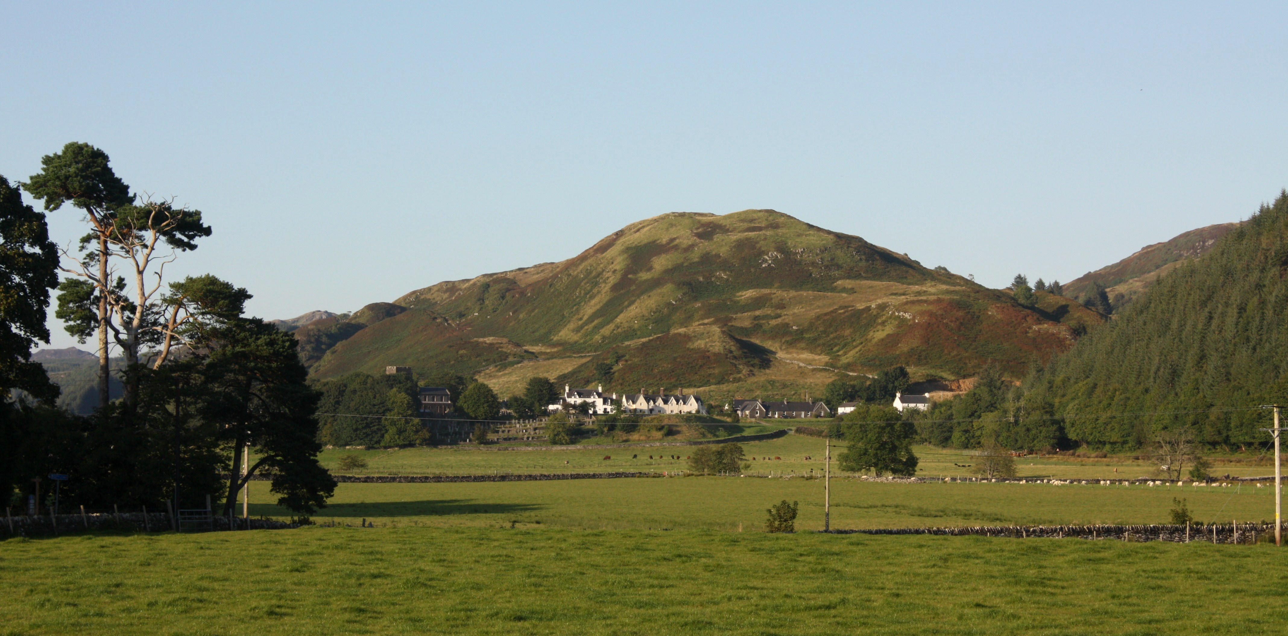
![Poltalloch House, North Lodge A Jacobean-style house built for Neill Malcolm between 1849 and 1853.
For more info. see Canmore.org.uk. Poltalloch House, North Lodge | Canmore. Available online at: <span class="nowrap"><a title="https://canmore.org.uk/site/156762/poltalloch-house-north-lodge" rel="nofollow ugc noopener" href="https://canmore.org.uk/site/156762/poltalloch-house-north-lodge">Link</a><img style="margin-left:2px;" alt="External link" title="External link - shift click to open in new window" src="https://s1.geograph.org.uk/img/external.png" width="10" height="10"/></span> [Accessed 29 May 2022].](https://s1.geograph.org.uk/geophotos/07/18/59/7185993_8e28d69c.jpg)
The requested URL returned error: 429 Too Many Requests
If you have any feedback on the listing, please let us know in the comments section below.
Argyllshire Images
Images are sourced within 2km of 56.1344/-5.4846 or Grid Reference NR8398. Thanks to Geograph Open Source API. All images are credited.

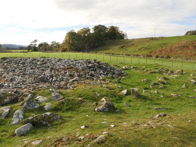
![19th-Century limekiln For more info. see Canmore.org.uk. Nether Largie | Canmore. Available online at: <span class="nowrap"><a title="https://canmore.org.uk/site/281467/nether-largie" rel="nofollow ugc noopener" href="https://canmore.org.uk/site/281467/nether-largie">Link</a><img style="margin-left:2px;" alt="External link" title="External link - shift click to open in new window" src="https://s1.geograph.org.uk/img/external.png" width="10" height="10"/></span> [Accessed 30 May 2022].](https://s2.geograph.org.uk/geophotos/07/18/68/7186878_26646268.jpg)


Argyllshire is located at Grid Ref: NR8398 (Lat: 56.1344, Lng: -5.4846)
What 3 Words
///detective.expose.label. Near Lochgilphead, Argyll & Bute
Nearby Locations
Related Wikis

Kilmartin Stones
The Kilmartin Stones are a collection of 79 ancient graveslabs (one exception being a side-slab of a tomb chest) at Kilmartin parish church in the village...

Kilmartin Glen
Kilmartin Glen is an area in Argyll north of Knapdale. It has the most important concentration of Neolithic and Bronze Age remains in mainland Scotland...

Ardscotnish
Ardscotnish, also known as Ardskeodnish, is a former location, in Argyll and Bute, Scotland approximating to the present parish of Kilmartin.
Kilmartin
Kilmartin (Scottish Gaelic: Cille Mhàrtainn, meaning "church of Màrtainn") is a small village in Argyll and Bute, western Scotland. It is best known as...
Nearby Amenities
Located within 500m of 56.1344,-5.4846Have you been to Argyllshire?
Leave your review of Argyllshire below (or comments, questions and feedback).