Whitehaven Coast

Heritage Site in Cumberland Copeland

England

Whitehaven Coast

Birkhams Quarry Now run by Marshalls who call it St Bees Quarry.
Birkhams Quarry Credit: David Medcalf

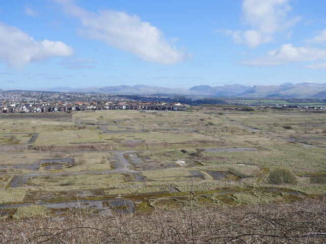
Whitehaven Coast, located in Cumberland, England, is a renowned heritage site encompassing a stretch of coastline that spans approximately 20 kilometers. This picturesque area is renowned for its natural beauty, diverse wildlife, and rich historical significance.

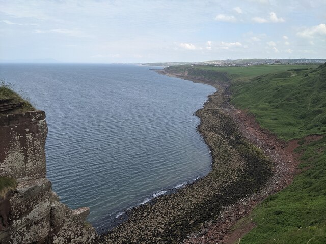
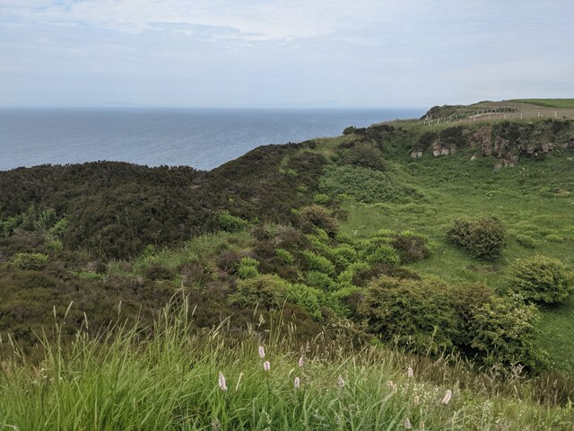
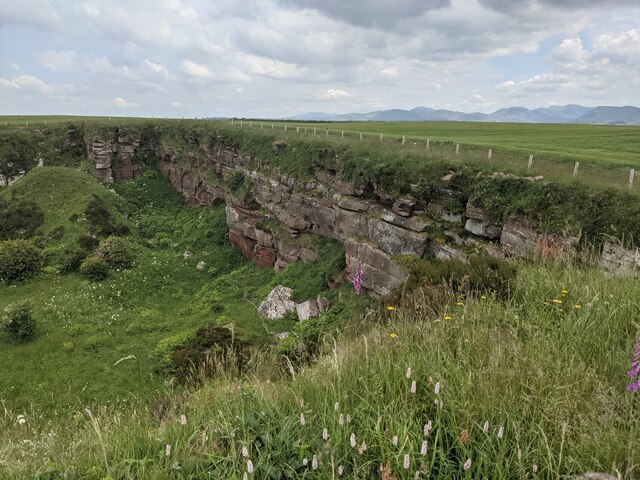
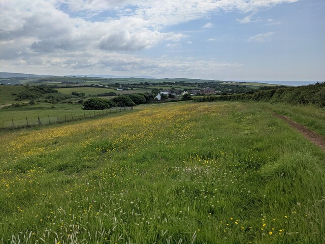
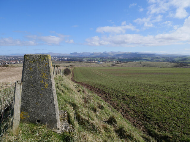
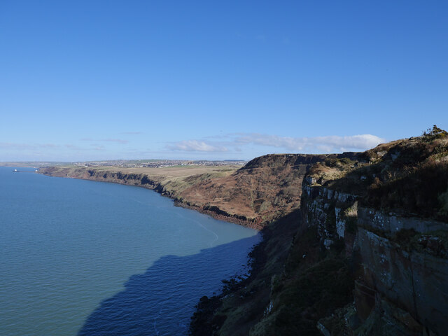
The Whitehaven Coast is characterized by its striking cliffs, sandy beaches, and rocky coves, offering breathtaking views of the Irish Sea. The coastline is interspersed with charming coastal villages and towns, including the historic harbor town of Whitehaven, which lends its name to the area.

The heritage site is home to an array of wildlife, including a variety of seabirds, marine mammals, and plant species. The coast provides important habitats for numerous bird species, such as puffins, guillemots, and kittiwakes, making it a popular destination for birdwatchers and nature enthusiasts.

Historically, the Whitehaven Coast played a significant role in the region's maritime industry. Whitehaven itself was a bustling port during the 17th to 19th centuries, serving as a hub for coal mining and trade. The remnants of this maritime heritage can still be seen today in the form of well-preserved Georgian architecture, historic buildings, and the picturesque harbor.

Visitors to the Whitehaven Coast can explore its rich history through guided tours, museums, and heritage trails. They can also indulge in various outdoor activities such as walking, cycling, and water sports, taking advantage of the stunning coastal landscape.

Overall, Whitehaven Coast in Cumberland is a captivating heritage site that offers a seamless blend of natural beauty, wildlife, and historical significance, making it a must-visit destination for both locals and tourists alike.

If you have any feedback on the listing, please let us know in the comments section below.

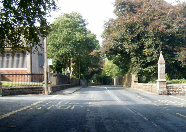
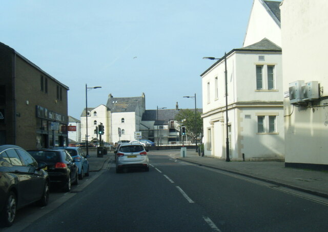
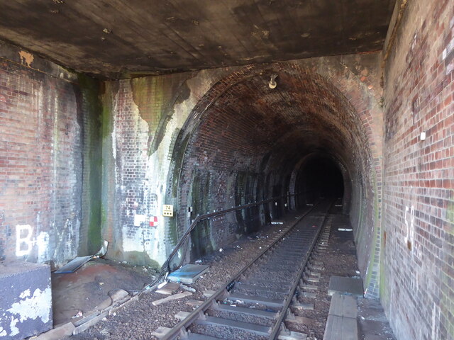
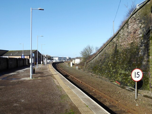
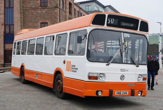
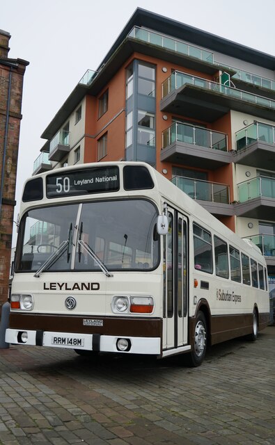
Whitehaven Coast Images

Images are sourced within 2km of 54.538/-3.603 or Grid Reference NX9617. Thanks to Geograph Open Source API. All images are credited.

Birkhams Quarry Now run by Marshalls who call it St Bees Quarry.
Birkhams Quarry
Now run by Marshalls who call it St Bees Quarry.
A great example of sandstone bedding At Birkhams/St Bees Quarry.
A great example of sandstone bedding
At Birkhams/St Bees Quarry.
A boulder beach near St Bees Head
The entrance to St Bees Quarry Formerly known as Birkham's Quarry.  See: <span class="nowrap"><a title="https://www.lakesguides.co.uk/html/lgaz/lk17309.htm" rel="nofollow ugc noopener" href="https://www.lakesguides.co.uk/html/lgaz/lk17309.htm">Link</a><img style="margin-left:2px;" alt="External link" title="External link - shift click to open in new window" src="https://s1.geograph.org.uk/img/external.png" width="10" height="10"/></span>
The entrance to St Bees Quarry
Formerly known as Birkham's Quarry. See: LinkExternal link
Disused quarry by the Coast Path
The back wall of the disused quarry
Wildflower field above Sandwith village
B5345 Low Road at Cemetery Lodge
Swingpump Lane, Whitehaven
Whitehaven Tunnel The north entrance of Whitehaven Tunnel; the end of the platform ramp of Platform 2 of Whitehaven Station (photograph <a href="https://www.geograph.org.uk/photo/7109238">NX9718 : Platform 2, Whitehaven Station</a>) is visible in the right foreground (see also photographs <a href="https://www.geograph.org.uk/photo/2322384">NX9718 : Whitehaven Tunnel</a> and <a href="https://www.geograph.org.uk/photo/6862853">NX9718 : Air Shaft No.5, Whitehaven Tunnel</a>).
The small antenna visible at the crown of the brick arch is to permit two way communication with trains in the tunnel.
The England Coast Path and National Cycle Route 72 pass over the flat roofed section of the tunnel in the foreground.
Whitehaven Tunnel
The north entrance of Whitehaven Tunnel; the end of the platform ramp of Platform 2 of Whitehaven Station (photograph NX9718 : Platform 2, Whitehaven Station) is visible in the right foreground (see also photographs NX9718 : Whitehaven Tunnel and NX9718 : Air Shaft No.5, Whitehaven Tunnel). The small antenna visible at the crown of the brick arch is to permit two way communication with trains in the tunnel. The England Coast Path and National Cycle Route 72 pass over the flat roofed section of the tunnel in the foreground.
Platform 2, Whitehaven Station Platform 2 at Whitehaven Station, formerly known as Whitehaven Bransty Station to distinguish it from Whitehaven Corkickle Station at the other end of Whitehaven Tunnel, the entrance of which is directly behind the photographer (see <a href="https://www.geograph.org.uk/photo/7102076">NX9718 : Whitehaven Tunnel</a>). 
The 15 sign denotes a speed restriction of 15 miles per hour for down (northbound) trains through the sharply curved station platform.
Platform 2, Whitehaven Station
Platform 2 at Whitehaven Station, formerly known as Whitehaven Bransty Station to distinguish it from Whitehaven Corkickle Station at the other end of Whitehaven Tunnel, the entrance of which is directly behind the photographer (see NX9718 : Whitehaven Tunnel). The 15 sign denotes a speed restriction of 15 miles per hour for down (northbound) trains through the sharply curved station platform.
The site of the former Whitehaven chemical works The site of the former Marchon, latterly Huntsman chemical works on the outskirts of Whitehaven.  The works was operational from 1943 to 2005 with the site finally being cleared about a decade ago.

This photograph was taken during the Coronavirus (COVID-19) pandemic of 2020/21/22.
The site of the former Whitehaven chemical works
The site of the former Marchon, latterly Huntsman chemical works on the outskirts of Whitehaven. The works was operational from 1943 to 2005 with the site finally being cleared about a decade ago. This photograph was taken during the Coronavirus (COVID-19) pandemic of 2020/21/22.
Barrowmouth Wood triangulation pillar A fine view from this spot, 130 metres above sea level.  In this view, the former Whitehaven chemical works site and the distant Lake District fells can be noted.

This photograph was taken during the Coronavirus (COVID-19) pandemic of 2020/21/22.
Barrowmouth Wood triangulation pillar
A fine view from this spot, 130 metres above sea level. In this view, the former Whitehaven chemical works site and the distant Lake District fells can be noted. This photograph was taken during the Coronavirus (COVID-19) pandemic of 2020/21/22.
Along the coast to Whitehaven The rugged Cumbrian coast near Whitehaven.

This photograph was taken during the Coronavirus (COVID-19) pandemic of 2020/21/22.
Along the coast to Whitehaven
The rugged Cumbrian coast near Whitehaven. This photograph was taken during the Coronavirus (COVID-19) pandemic of 2020/21/22.
Leyland Olympian on Strand Street, Whitehaven An Olympian in Northumbria livery and a familiar sight on the coast on the other side of the country in times gone by.

This photograph was taken during the Coronavirus (COVID-19) pandemic of 2020/21/22.
Leyland Olympian on Strand Street, Whitehaven
An Olympian in Northumbria livery and a familiar sight on the coast on the other side of the country in times gone by. This photograph was taken during the Coronavirus (COVID-19) pandemic of 2020/21/22.
Greater Manchester PTE Leyland National at Whitehaven Harbour Dating from 1975 and owned by the SELNEC Preservation Society.

This photograph was taken during the Coronavirus (COVID-19) pandemic of 2020/21/22.
Greater Manchester PTE Leyland National at Whitehaven Harbour
Dating from 1975 and owned by the SELNEC Preservation Society. This photograph was taken during the Coronavirus (COVID-19) pandemic of 2020/21/22.
'Best Bus Around' on West Strand, Whitehaven A Leyland National 2 on West Strand near Whitehaven Harbour resplendent in Strathtay Scottish livery.

This photograph was taken during the Coronavirus (COVID-19) pandemic of 2020/21/22.
'Best Bus Around' on West Strand, Whitehaven
A Leyland National 2 on West Strand near Whitehaven Harbour resplendent in Strathtay Scottish livery. This photograph was taken during the Coronavirus (COVID-19) pandemic of 2020/21/22.
Suburban Express at Whitehaven Harbour Dating from 1973, the Suburban Express diverged away from the standard Leyland National design, with a high flat floor front to rear.  Out of the two demonstrators produced, this is the sole survivor.

This photograph was taken during the Coronavirus (COVID-19) pandemic of 2020/21/22.
Suburban Express at Whitehaven Harbour
Dating from 1973, the Suburban Express diverged away from the standard Leyland National design, with a high flat floor front to rear. Out of the two demonstrators produced, this is the sole survivor. This photograph was taken during the Coronavirus (COVID-19) pandemic of 2020/21/22.
Show me another place!

Whitehaven Coast is located at Grid Ref: NX9617 (Lat: 54.538, Lng: -3.603)

Administrative County: Cumbria

District: Copeland

Police Authority: Cumbria

What 3 Words

///shuffle.yacht.successor. Near Whitehaven, Cumbria

Related Wikis

Kells, Whitehaven

Kells is an area of Whitehaven in Cumbria, England, elevated on a cliff to the south of the town centre, overlooking the Irish sea. The population of this...

Haig Colliery Mining Museum

Haig Colliery Mining Museum was a visitor attraction in Kells, on the site of Cumbria's last deep coal mine on the cliffs above Whitehaven in Cumbria,...

Haig Colliery

Haig Colliery was a coal mine in Whitehaven, Cumbria, in north-west England. The mine was in operation for almost 70 years and produced anthracitic coal...

Preston Street railway station

Preston Street railway station (also known as Newtown) was a railway station in Whitehaven, Cumbria, England. Opened in July 1849 the station was the original...

Recreation Ground (Whitehaven)

The Recreation Ground (known locally as the 'Recre') and for sponsorship reasons the LEL Arena is a rugby league stadium in Whitehaven, Cumbria, England...

Whitehaven A.F.C.

Whitehaven Amateur Football Club is a football club in Whitehaven, Cumbria. The club are currently members of the West Lancashire League Premier Division...

St Begh's Church, Whitehaven

St Begh's Church or St Begh's Priory Church is a Roman Catholic parish church in Whitehaven, Cumbria, England. It was built from 1865 to 1868 and designed...

Corkickle railway station

Corkickle railway station is a railway station serving the suburb of Corkickle near Whitehaven in Cumbria, England. It is on the Cumbrian Coast Line, which...

Nearby Amenities

Located within 500m of 54.538,-3.603
Created By: almien_coastlines
Source: PGS
Lat/Long: 54.542403/-3.6024198
Created By: almien_coastlines
Source: PGS
Lat/Long: 54.5420572/-3.6026075
Created By: almien_coastlines
Source: PGS
Lat/Long: 54.541497/-3.6027158
Created By: almien_coastlines
Source: PGS
Lat/Long: 54.5409561/-3.6027587
Source: PGS
Lat/Long: 54.5399624/-3.6027564
Created By: almien_coastlines
Source: PGS
Lat/Long: 54.5397286/-3.602992
Source: PGS
Lat/Long: 54.5388379/-3.6034576
Source: PGS
Lat/Long: 54.5381872/-3.6036572
Source: PGS
Lat/Long: 54.5370862/-3.6041005
Created By: almien_coastlines
Source: PGS
Lat/Long: 54.5358092/-3.6042579
Created By: almien_coastlines
Source: PGS
Lat/Long: 54.5347814/-3.6045466
Created By: almien_coastlines
Source: PGS
Lat/Long: 54.5338805/-3.6047129
Kells
Created By: Potlatch 0.10f
Is In: Whitehaven, Cumbria, UK
Place: suburb
Lat/Long: 54.5381039/-3.5960262
Bus Stop
Cliff Road
Bus: yes
Local Ref: AT
Naptan AtcoCode: 090050300124
Naptan Bearing: S
Naptan CommonName: Cliff Road
Naptan Indicator: at
Naptan Landmark: junction with High Road
Naptan NaptanCode: cumawjdm
Naptan Street: High Road
Naptan Verified: no
Public Transport: platform
Source: naptan_import
Lat/Long: 54.5383211/-3.5962557
Bus Stop
Saltom Road
Bus: yes
Local Ref: AT
Naptan AtcoCode: 090050304268
Naptan Bearing: N
Naptan CommonName: Saltom Road
Naptan Indicator: at
Naptan Landmark: Crossroads
Naptan NaptanCode: cumdtajg
Naptan Street: High Road
Naptan Verified: no
Public Transport: platform
Source: naptan_import
Lat/Long: 54.539638/-3.5959052
Post Box
Operator: Royal Mail
Operator Wikidata: Q638098
Ref: CA28 16
Lat/Long: 54.5362954/-3.5969131
Addr Housenumber: 1
Lat/Long: 54.5362644/-3.5998979
Addr Housenumber: 11
Lat/Long: 54.5349552/-3.6000318
Addr Housenumber: 12
Lat/Long: 54.5348237/-3.6007496
Addr Housenumber: 20
Lat/Long: 54.5348098/-3.5983833
Addr Housenumber: 21
Lat/Long: 54.5348038/-3.5980742
Addr Housenumber: 24
Lat/Long: 54.5351645/-3.5981154
Addr Housenumber: 25
Lat/Long: 54.5350549/-3.5983901
Addr Housenumber: 30
Lat/Long: 54.5351166/-3.5996746
Direction: S
Generator Method: photovoltaic
Generator Output Electricity: yes
Generator Solar Modules: 16
Generator Source: solar
Generator Type: solar_photovoltaic_panel
Location: roof
Power: generator
Lat/Long: 54.5356619/-3.5980412
Direction: S
Generator Method: photovoltaic
Generator Output Electricity: yes
Generator Solar Modules: 8
Generator Source: solar
Generator Type: solar_photovoltaic_panel
Location: roof
Power: generator
Lat/Long: 54.5356479/-3.5983453
Direction: W
Generator Method: photovoltaic
Generator Output Electricity: yes
Generator Solar Modules: 8
Generator Source: solar
Generator Type: solar_photovoltaic_panel
Location: roof
Power: generator
Lat/Long: 54.5358789/-3.59806
Direction: W
Generator Method: photovoltaic
Generator Output Electricity: yes
Generator Solar Modules: 8
Generator Source: solar
Generator Type: solar_photovoltaic_panel
Location: roof
Power: generator
Lat/Long: 54.5359302/-3.598069
Direction: W
Generator Method: photovoltaic
Generator Output Electricity: yes
Generator Solar Modules: 8
Generator Source: solar
Generator Type: solar_photovoltaic_panel
Location: roof
Power: generator
Lat/Long: 54.5359797/-3.5980675
Direction: W
Generator Method: photovoltaic
Generator Output Electricity: yes
Generator Solar Modules: 8
Generator Source: solar
Generator Type: solar_photovoltaic_panel
Location: roof
Power: generator
Lat/Long: 54.5360338/-3.5980637
Direction: W
Generator Method: photovoltaic
Generator Output Electricity: yes
Generator Solar Modules: 8
Generator Source: solar
Generator Type: solar_photovoltaic_panel
Location: roof
Power: generator
Lat/Long: 54.5360976/-3.5980991
Direction: W
Generator Method: photovoltaic
Generator Output Electricity: yes
Generator Solar Modules: 8
Generator Source: solar
Generator Type: solar_photovoltaic_panel
Location: roof
Power: generator
Lat/Long: 54.5361521/-3.5981066
Direction: W
Generator Method: photovoltaic
Generator Output Electricity: yes
Generator Solar Modules: 8
Generator Source: solar
Generator Type: solar_photovoltaic_panel
Location: roof
Power: generator
Lat/Long: 54.5362009/-3.598112
Direction: W
Generator Method: photovoltaic
Generator Output Electricity: yes
Generator Solar Modules: 8
Generator Source: solar
Generator Type: solar_photovoltaic_panel
Location: roof
Power: generator
Lat/Long: 54.536251/-3.5981131
Direction: S
Generator Method: photovoltaic
Generator Output Electricity: yes
Generator Solar Modules: 2
Generator Source: solar
Generator Type: solar_photovoltaic_panel
Location: roof
Note: may not be photovoltaic
Power: generator
Lat/Long: 54.5358524/-3.5990262
Direction: S
Generator Method: photovoltaic
Generator Output Electricity: yes
Generator Solar Modules: 2
Generator Source: solar
Generator Type: solar_photovoltaic_panel
Location: roof
Note: may not be photovoltaic
Power: generator
Lat/Long: 54.5358532/-3.5991067
Direction: S
Generator Method: photovoltaic
Generator Output Electricity: yes
Generator Solar Modules: 2
Generator Source: solar
Generator Type: solar_photovoltaic_panel
Location: roof
Note: may not be photovoltaic
Power: generator
Lat/Long: 54.535854/-3.5991751
Direction: S
Generator Method: photovoltaic
Generator Output Electricity: yes
Generator Solar Modules: 2
Generator Source: solar
Generator Type: solar_photovoltaic_panel
Location: roof
Note: may not be photovoltaic
Power: generator
Lat/Long: 54.5358547/-3.5993776
Direction: S
Generator Method: photovoltaic
Generator Output Electricity: yes
Generator Solar Modules: 2
Generator Source: solar
Generator Type: solar_photovoltaic_panel
Location: roof
Note: may not be photovoltaic
Power: generator
Lat/Long: 54.5358485/-3.5992435
Direction: S
Generator Method: photovoltaic
Generator Output Electricity: yes
Generator Solar Modules: 2
Generator Source: solar
Generator Type: solar_photovoltaic_panel
Location: roof
Note: may not be photovoltaic
Power: generator
Lat/Long: 54.5358508/-3.5994594
Direction: S
Generator Method: photovoltaic
Generator Output Electricity: yes
Generator Solar Modules: 2
Generator Source: solar
Generator Type: solar_photovoltaic_panel
Location: roof
Note: may not be photovoltaic
Power: generator
Lat/Long: 54.5358541/-3.5995025
Direction: S
Generator Method: photovoltaic
Generator Output Electricity: yes
Generator Solar Modules: 2
Generator Source: solar
Generator Type: solar_photovoltaic_panel
Location: roof
Note: may not be photovoltaic
Power: generator
Lat/Long: 54.5358547/-3.5995776
Direction: S
Generator Method: photovoltaic
Generator Output Electricity: yes
Generator Solar Modules: 2
Generator Source: solar
Generator Type: solar_photovoltaic_panel
Location: roof
Note: may not be photovoltaic
Power: generator
Lat/Long: 54.536175/-3.599587
Direction: S
Generator Method: photovoltaic
Generator Output Electricity: yes
Generator Solar Modules: 2
Generator Source: solar
Generator Type: solar_photovoltaic_panel
Location: roof
Note: may not be photovoltaic
Power: generator
Lat/Long: 54.5361719/-3.5995025
Direction: S
Generator Method: photovoltaic
Generator Output Electricity: yes
Generator Solar Modules: 2
Generator Source: solar
Generator Type: solar_photovoltaic_panel
Location: roof
Note: may not be photovoltaic
Power: generator
Lat/Long: 54.5361719/-3.5994315
Direction: S
Generator Method: photovoltaic
Generator Output Electricity: yes
Generator Solar Modules: 2
Generator Source: solar
Generator Type: solar_photovoltaic_panel
Location: roof
Note: may not be photovoltaic
Power: generator
Lat/Long: 54.5361734/-3.5993644
Direction: S
Generator Method: photovoltaic
Generator Output Electricity: yes
Generator Solar Modules: 2
Generator Source: solar
Generator Type: solar_photovoltaic_panel
Location: roof
Note: may not be photovoltaic
Power: generator
Lat/Long: 54.5361719/-3.5992464
Direction: S
Generator Method: photovoltaic
Generator Output Electricity: yes
Generator Solar Modules: 2
Generator Source: solar
Generator Type: solar_photovoltaic_panel
Location: roof
Note: may not be photovoltaic
Power: generator
Lat/Long: 54.5361719/-3.5991927
Direction: S
Generator Method: photovoltaic
Generator Output Electricity: yes
Generator Solar Modules: 2
Generator Source: solar
Generator Type: solar_photovoltaic_panel
Location: roof
Note: may not be photovoltaic
Power: generator
Lat/Long: 54.5361727/-3.599119
Direction: S
Generator Method: photovoltaic
Generator Output Electricity: yes
Generator Solar Modules: 2
Generator Source: solar
Generator Type: solar_photovoltaic_panel
Location: roof
Note: may not be photovoltaic
Power: generator
Lat/Long: 54.5361759/-3.5990412
Direction: E
Generator Method: photovoltaic
Generator Output Electricity: yes
Generator Solar Modules: 8
Generator Source: solar
Generator Type: solar_photovoltaic_panel
Location: roof
Power: generator
Lat/Long: 54.5359902/-3.5984876
Direction: E
Generator Method: photovoltaic
Generator Output Electricity: yes
Generator Solar Modules: 8
Generator Source: solar
Generator Type: solar_photovoltaic_panel
Location: roof
Power: generator
Lat/Long: 54.5360471/-3.5984908
Direction: E
Generator Method: photovoltaic
Generator Output Electricity: yes
Generator Solar Modules: 8
Generator Source: solar
Generator Type: solar_photovoltaic_panel
Location: roof
Power: generator
Lat/Long: 54.5361116/-3.5985391
Direction: E
Generator Method: photovoltaic
Generator Output Electricity: yes
Generator Solar Modules: 8
Generator Source: solar
Generator Type: solar_photovoltaic_panel
Location: roof
Power: generator
Lat/Long: 54.5361567/-3.5985439
Direction: E
Generator Method: photovoltaic
Generator Output Electricity: yes
Generator Solar Modules: 8
Generator Source: solar
Generator Type: solar_photovoltaic_panel
Location: roof
Power: generator
Lat/Long: 54.5362121/-3.5985465
Direction: E
Generator Method: photovoltaic
Generator Output Electricity: yes
Generator Solar Modules: 8
Generator Source: solar
Generator Type: solar_photovoltaic_panel
Location: roof
Power: generator
Lat/Long: 54.5362591/-3.5985493
Saltom Pit
Access: yes
Historic: ruins
Historic Civilization: Scheduled_Monument
Inscription: The oldest surviving undersea coal mine in North West England. Operating between 1729 and 1848
Lat/Long: 54.5411576/-3.6022484
Direction: S
Generator Method: photovoltaic
Generator Output Electricity: yes
Generator Solar Modules: 8
Generator Source: solar
Generator Type: solar_photovoltaic_panel
Location: roof
Power: generator
Lat/Long: 54.5356485/-3.5982778
Direction: S
Generator Method: photovoltaic
Generator Output Electricity: yes
Generator Solar Modules: 8
Generator Source: solar
Generator Type: solar_photovoltaic_panel
Location: roof
Power: generator
Lat/Long: 54.5356485/-3.5982086
Direction: S
Generator Method: photovoltaic
Generator Output Electricity: yes
Generator Solar Modules: 8
Generator Source: solar
Generator Type: solar_photovoltaic_panel
Location: roof
Power: generator
Lat/Long: 54.5356507/-3.5981416
Direction: S
Generator Method: photovoltaic
Generator Output Electricity: yes
Generator Solar Modules: 3
Generator Source: solar
Generator Type: solar_photovoltaic_panel
Power: generator
Lat/Long: 54.5350374/-3.5989641
Direction: S
Generator Method: photovoltaic
Generator Output Electricity: yes
Generator Solar Modules: 17
Generator Source: solar
Generator Type: solar_photovoltaic_panel
Power: generator
Lat/Long: 54.5350281/-3.5991959
Direction: 185
Generator Method: photovoltaic
Generator Output Electricity: yes
Generator Source: solar
Generator Type: solar_photovoltaic_panel
Location: roof
Power: generator
Lat/Long: 54.5347185/-3.6005692
Direction: 185
Generator Method: photovoltaic
Generator Output Electricity: yes
Generator Solar Modules: 3
Generator Source: solar
Generator Type: solar_photovoltaic_panel
Location: roof
Power: generator
Lat/Long: 54.5347723/-3.600751
The data included in this document is from www.openstreetmap.org. The data is made available under ODbL.

Have you been to Whitehaven Coast?

Leave your review of Whitehaven Coast below (or comments, questions and feedback).