The Burgs

Heritage Site in Shropshire

England

The Burgs

Shrewsbury Town FC - The Croud Meadow. FA Cup 3rd Round 2024 Home supporters in the South Stand at the Croud Meadow for the FA Cup 3rd round tie against Wrexham on January 7th, 2024 - final score of Shrewsbury 0 - 1 Wrexham
Shrewsbury Town FC - The Croud Meadow. FA Cup 3rd Round 2024 Credit: Peter Evans

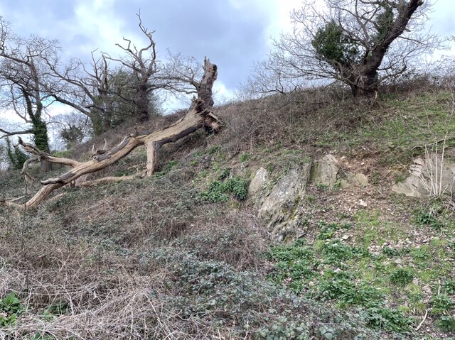
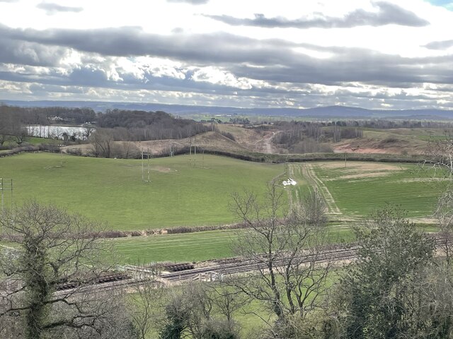
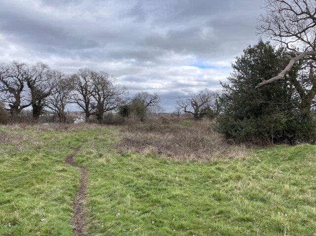
The Burgs in Shropshire is a significant heritage site that holds great historical and archaeological value. Situated near the village of Bishop's Castle, The Burgs is an ancient hillfort that dates back to the Iron Age, around 500 BC. This prehistoric site is located on a prominent hilltop, providing panoramic views of the surrounding landscape.

The hillfort at The Burgs covers an area of approximately 5 acres and is protected by a series of ramparts and ditches. These defensive earthworks, built by the early inhabitants, encircle the interior of the fort, which would have contained various structures such as houses, storage facilities, and communal spaces. The hillfort at The Burgs is believed to have been occupied for centuries, with evidence of human activity found from the Iron Age through to the Roman period.

Archaeological excavations at The Burgs have unearthed numerous artifacts, including pottery, tools, and weapons, shedding light on the daily lives and cultural practices of the ancient inhabitants. The site has also revealed evidence of Iron Age burials, further enhancing our understanding of burial customs during that time.

Today, The Burgs is open to the public and offers visitors a chance to explore this remarkable ancient site. The fort's location provides breathtaking views over the surrounding countryside, making it a popular destination for walkers and nature enthusiasts. The site is managed and maintained by the local authorities, ensuring its preservation for future generations to appreciate and learn about the rich history of the area.

If you have any feedback on the listing, please let us know in the comments section below.
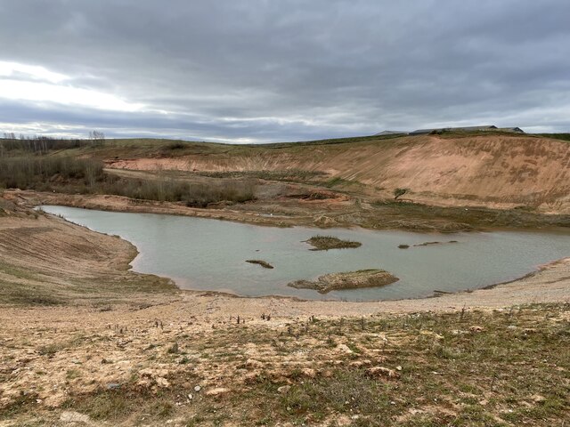
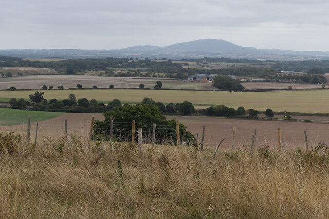
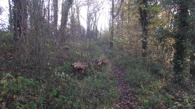
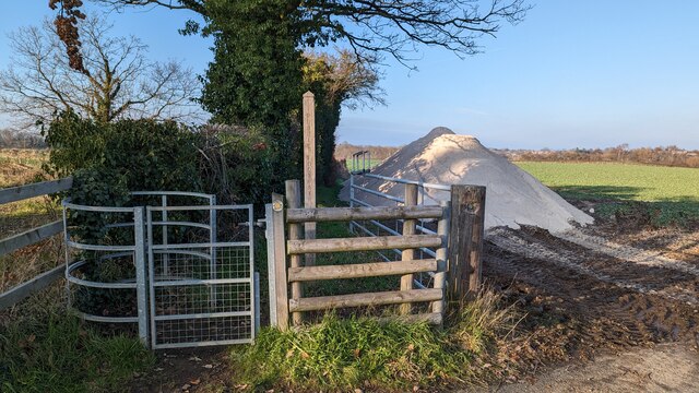
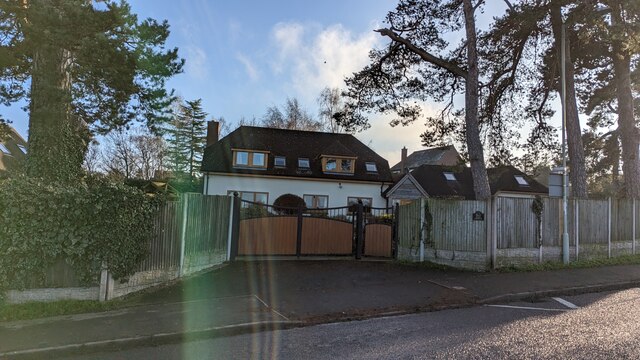
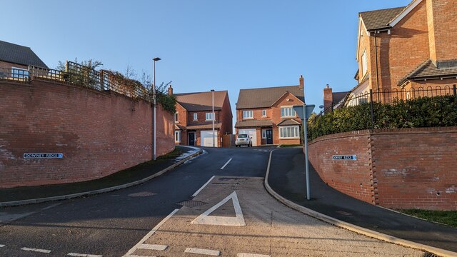
The Burgs Images

Images are sourced within 2km of 52.672/-2.762 or Grid Reference SJ4808. Thanks to Geograph Open Source API. All images are credited.

Shrewsbury Town FC - The Croud Meadow. FA Cup 3rd Round 2024 Home supporters in the South Stand at the Croud Meadow for the FA Cup 3rd round tie against Wrexham on January 7th, 2024 - final score of Shrewsbury 0 - 1 Wrexham
Shrewsbury Town FC - The Croud Meadow. FA Cup 3rd Round 2024
Home supporters in the South Stand at the Croud Meadow for the FA Cup 3rd round tie against Wrexham on January 7th, 2024 - final score of Shrewsbury 0 - 1 Wrexham
Dobbies Garden Centre, from Bayston Hill Services
Petrol station shop, Bayston Hill Services
Old alignment, A49 In the late 1960s there was a fair bit of work on straightening out the A49 between Shrewsbury and Hereford. However just south of here the work stopped and there is to this day a very windy bit of road.  The old loop was gated.
Old alignment, A49
In the late 1960s there was a fair bit of work on straightening out the A49 between Shrewsbury and Hereford. However just south of here the work stopped and there is to this day a very windy bit of road. The old loop was gated.
Muck spreading in field adjacent to Meole Brace Estate, Shrewsbury Lots of work going on here to reenergise this large arable field. The muck being spread gave a very country air to the suburbs of Shrewsbury!
Muck spreading in field adjacent to Meole Brace Estate, Shrewsbury
Lots of work going on here to reenergise this large arable field. The muck being spread gave a very country air to the suburbs of Shrewsbury!
Closed church in Bayston Hill This is the old Christ Church, which is now being converted, presumably to a “desirable dwelling”. Lovely old building which needs preserving. There is the old school building next door, also converted to a very desirable dwelling.
Closed church in Bayston Hill
This is the old Christ Church, which is now being converted, presumably to a “desirable dwelling”. Lovely old building which needs preserving. There is the old school building next door, also converted to a very desirable dwelling.
The Burgs Hill Fort, Bayston Hill This shows part of the substantial ramparts of an Iron Age hill fort. Prominent and large, yet largely unseen from the main road travelling through Bayston Hill.
The Burgs Hill Fort, Bayston Hill
This shows part of the substantial ramparts of an Iron Age hill fort. Prominent and large, yet largely unseen from the main road travelling through Bayston Hill.
Commanding view from The Burgs Iron Age hillfort Looking southeast towards Wenlock Edge on the horizon. Much of the land in the middle distance has been heavily quarried for stone and sand, hence the scars on the landscape. The main railway route to South Wales is in the foreground.
Commanding view from The Burgs Iron Age hillfort
Looking southeast towards Wenlock Edge on the horizon. Much of the land in the middle distance has been heavily quarried for stone and sand, hence the scars on the landscape. The main railway route to South Wales is in the foreground.
On The Burgs Iron Age hillfort Large flat top surrounded by oak trees and many years worth of scrub and brambles. Although it was a very windy day, this seemingly exposed spot felt sheltered and warmed by the huge ramparts.
On The Burgs Iron Age hillfort
Large flat top surrounded by oak trees and many years worth of scrub and brambles. Although it was a very windy day, this seemingly exposed spot felt sheltered and warmed by the huge ramparts.
Bayston Hill quarry This is the south eastern corner of this large quarry, where the processing plant is and where the final product is stockpiled. The rail track in the foreground is the main route to South Wales.
Bayston Hill quarry
This is the south eastern corner of this large quarry, where the processing plant is and where the final product is stockpiled. The rail track in the foreground is the main route to South Wales.
Former sand and gravel quarry Extensively quarried landscape south of Bayston Hill. This is now a peaceful spot, with wildflowers and wildlife taking advantage of its quietude.
Former sand and gravel quarry
Extensively quarried landscape south of Bayston Hill. This is now a peaceful spot, with wildflowers and wildlife taking advantage of its quietude.
Bomere Farm A working farmyard, full of all sorts of farming gear, old and new. The footpath runs through here - today dry, but this would be a mud bath after heavy rain.
Bomere Farm
A working farmyard, full of all sorts of farming gear, old and new. The footpath runs through here - today dry, but this would be a mud bath after heavy rain.
Bayston Hill quarry This is viewing the northern end of the quarry, where a new processing plant and facilities are being built. This quarry is just getting bigger and bigger and bigger!
Bayston Hill quarry
This is viewing the northern end of the quarry, where a new processing plant and facilities are being built. This quarry is just getting bigger and bigger and bigger!
Hillside view above Little Lyth With the A49 hidden by the line of trees and The Wrekin in the distance.
Hillside view above Little Lyth
With the A49 hidden by the line of trees and The Wrekin in the distance.
Footpath through woodland Footpath through Bomere Wood, Bomere lake to the right.
Footpath through woodland
Footpath through Bomere Wood, Bomere lake to the right.
Start of public footpath Not sure what the pile next to it is...
Start of public footpath
Not sure what the pile next to it is...
Pine Lodge
Pine Lodge
Downey Ridge
Downey Ridge
Show me another place!

The Burgs is located at Grid Ref: SJ4808 (Lat: 52.672, Lng: -2.762)

Unitary Authority: Shropshire

Police Authority: West Mercia

What 3 Words

///slam.twice.prone. Near Bayston Hill, Shropshire

Related Wikis

Bayston Hill

Bayston Hill is a village and civil parish in Shropshire, England. It is 3 miles (5 km) south of the county town Shrewsbury and located on the main A49...

Shrewsbury and Atcham (UK Parliament constituency)

Shrewsbury and Atcham is a constituency represented in the House of Commons of the UK Parliament since 2005 by Daniel Kawczynski, a Conservative.Under...

Pulley, Shropshire

Pulley is a small village on the southern edge of Shrewsbury in Shropshire, England. It is located between Shrewsbury and Bayston Hill. The population...

Shropshire Football Association

The Shropshire Football Association is the governing body of football in the county of Shropshire, England.Cup competitions it organises include the Shropshire...

Meole Brace

Meole Brace, sometimes known locally as simply Meole MEE-əl (pronounced like meal), is a south-western suburb of Shrewsbury, Shropshire, England. The...

Bomere Pool

Bomere Pool is a large mere lying between the villages of Bayston Hill and Condover in the county of Shropshire, England, 4.7 miles (7.6 kilometres) south...

Nobold

Nobold is a hamlet on the south-western edge of Shrewsbury in Shropshire, England. It is located on the Shrewsbury to Longden road. Nobold boasts Shropshire...

New Meadow

New Meadow, also known as The Croud Meadow for sponsorship purposes, is a stadium situated on the southern outskirts of Shrewsbury, Shropshire, between...

Nearby Amenities

Located within 500m of 52.672,-2.762
Crossing
Crossing: unmarked
Crossing Island: no
Kerb: flush
Tactile Paving: yes
Lat/Long: 52.6747536/-2.7613595
The Old Church
Source: survey
Lat/Long: 52.6748517/-2.7596083
Bayston Hill
Is In: Shrewsbury
Place: village
Wikidata: Q3811893
Lat/Long: 52.6737146/-2.7670522
Post Box
Ref: SY3 523
Lat/Long: 52.6744635/-2.759818
Pub
The Three Fishes
Addr City: Bayston Hill
Addr Country: GB
Addr Postcode: SY3 0DB
Addr Street: Hereford Road
Check Date: 2022-07-23
Fhrs Authority: Shropshire
Fhrs Id: 1652249
Fhrs Local Authority Id: 23/00647/COMM
Payment Mastercard: yes
Payment Visa: yes
Lat/Long: 52.6760848/-2.7598384
Pub
The Compasses Inn
Addr City: Bayston Hill
Addr Country: GB
Addr Postcode: SY3 0DZ
Addr Street: Hereford Road
Beer Garden: yes
Check Date: 2022-07-23
Description Floor: stone in part of bar
Fhrs Authority: Shropshire
Fhrs Id: 1546004
Fhrs Local Authority Id: 22/00675/COMM
Internet Access: no
Payment Mastercard: yes
Payment Visa: yes
Real Ale: Hobsons Best, Wye Valley HPA, +1 guest
Real Cider: 1 perry
Wheelchair: yes
Lat/Long: 52.6738761/-2.760666
Turning Circle
Turning Circle: hammer
Lat/Long: 52.6714088/-2.7638501
Post Box
Ref: SY3 377
Lat/Long: 52.6737947/-2.7626646
Give Way
Lat/Long: 52.6681836/-2.7612873
Generator Method: photovoltaic
Generator Output Electricity: yes
Generator Source: solar
Generator Type: solar_photovoltaic_panel
Location: roof
Power: generator
Lat/Long: 52.6736704/-2.7661229
Generator Method: photovoltaic
Generator Output Electricity: yes
Generator Source: solar
Generator Type: solar_photovoltaic_panel
Location: roof
Power: generator
Lat/Long: 52.6728929/-2.7662213
Generator Method: photovoltaic
Generator Output Electricity: yes
Generator Source: solar
Generator Type: solar_photovoltaic_panel
Location: roof
Power: generator
Lat/Long: 52.6719041/-2.7691289
Generator Method: photovoltaic
Generator Output Electricity: yes
Generator Source: solar
Generator Type: solar_photovoltaic_panel
Location: roof
Power: generator
Lat/Long: 52.6724668/-2.7693381
Generator Method: photovoltaic
Generator Output Electricity: yes
Generator Source: solar
Generator Type: solar_photovoltaic_panel
Location: roof
Power: generator
Lat/Long: 52.6699594/-2.7671953
Generator Method: photovoltaic
Generator Output Electricity: yes
Generator Source: solar
Generator Type: solar_photovoltaic_panel
Location: roof
Power: generator
Lat/Long: 52.6723795/-2.7628072
Generator Method: photovoltaic
Generator Output Electricity: yes
Generator Source: solar
Generator Type: solar_photovoltaic_panel
Location: roof
Power: generator
Lat/Long: 52.6740417/-2.7614983
Generator Method: photovoltaic
Generator Output Electricity: yes
Generator Source: solar
Generator Type: solar_photovoltaic_panel
Location: roof
Power: generator
Lat/Long: 52.6746239/-2.7651381
Generator Method: photovoltaic
Generator Output Electricity: yes
Generator Source: solar
Generator Type: solar_photovoltaic_panel
Location: roof
Power: generator
Lat/Long: 52.6747736/-2.7647733
Generator Method: photovoltaic
Generator Output Electricity: yes
Generator Source: solar
Generator Type: solar_photovoltaic_panel
Location: roof
Power: generator
Lat/Long: 52.6734692/-2.7685284
Generator Method: photovoltaic
Generator Output Electricity: yes
Generator Source: solar
Generator Type: solar_photovoltaic_panel
Location: roof
Power: generator
Lat/Long: 52.6730236/-2.7687215
Generator Method: photovoltaic
Generator Output Electricity: yes
Generator Source: solar
Generator Type: solar_photovoltaic_panel
Location: roof
Power: generator
Lat/Long: 52.6746239/-2.7679303
Generator Method: photovoltaic
Generator Output Electricity: yes
Generator Source: solar
Generator Type: solar_photovoltaic_panel
Location: roof
Power: generator
Lat/Long: 52.673414/-2.7667147
Generator Method: photovoltaic
Generator Output Electricity: yes
Generator Source: solar
Generator Type: solar_photovoltaic_panel
Location: roof
Power: generator
Lat/Long: 52.6731343/-2.7665538
Generator Method: photovoltaic
Generator Output Electricity: yes
Generator Source: solar
Generator Type: solar_photovoltaic_panel
Location: roof
Power: generator
Lat/Long: 52.6708036/-2.7673182
Generator Method: photovoltaic
Generator Output Electricity: yes
Generator Source: solar
Generator Type: solar_photovoltaic_panel
Location: roof
Power: generator
Lat/Long: 52.6703303/-2.7679217
Generator Method: photovoltaic
Generator Output Electricity: yes
Generator Source: solar
Generator Type: solar_photovoltaic_panel
Location: roof
Power: generator
Lat/Long: 52.6707874/-2.7684179
Generator Method: photovoltaic
Generator Output Electricity: yes
Generator Source: solar
Generator Type: solar_photovoltaic_panel
Location: roof
Power: generator
Lat/Long: 52.6711549/-2.7690053
Generator Method: photovoltaic
Generator Output Electricity: yes
Generator Source: solar
Generator Type: solar_photovoltaic_panel
Location: roof
Power: generator
Lat/Long: 52.6710671/-2.7690643
Generator Method: photovoltaic
Generator Output Electricity: yes
Generator Source: solar
Generator Type: solar_photovoltaic_panel
Location: roof
Power: generator
Lat/Long: 52.6728546/-2.7574638
Generator Method: photovoltaic
Generator Output Electricity: yes
Generator Source: solar
Generator Type: solar_photovoltaic_panel
Location: roof
Power: generator
Lat/Long: 52.6729635/-2.7631983
Generator Method: photovoltaic
Generator Output Electricity: yes
Generator Source: solar
Generator Type: solar_photovoltaic_panel
Location: roof
Power: generator
Lat/Long: 52.6741134/-2.7633941
Generator Method: photovoltaic
Generator Output Electricity: yes
Generator Source: solar
Generator Type: solar_photovoltaic_panel
Location: roof
Power: generator
Lat/Long: 52.6745948/-2.7640191
Generator Method: photovoltaic
Generator Output Electricity: yes
Generator Source: solar
Generator Type: solar_photovoltaic_panel
Location: roof
Power: generator
Lat/Long: 52.6738889/-2.7645314
Power: pole
Lat/Long: 52.6691267/-2.7569005
Power: pole
Lat/Long: 52.6703921/-2.7558625
Power: pole
Lat/Long: 52.6711924/-2.7551678
Power: pole
Lat/Long: 52.6764325/-2.7620772
Power: pole
Lat/Long: 52.6761699/-2.7612537
Power: pole
Lat/Long: 52.6762878/-2.7613382
Power: pole
Lat/Long: 52.6764073/-2.7614079
Access: no
Barrier: stile
Foot: designated
Lat/Long: 52.672338/-2.7608577
Access: no
Barrier: stile
Foot: designated
Lat/Long: 52.6726963/-2.7596125
Stop
Direction: forward
Lat/Long: 52.6738991/-2.7626179
Give Way
Direction: backward
Lat/Long: 52.6739087/-2.7627355
Fast Food
Star Kitchen
Addr City: Bayston Hill
Addr Housenumber: 13a
Addr Postcode: SY3 0EW
Addr Street: Lyth Hill Road
Cuisine: chinese;oriental
Drive Through: no
Fhrs Authority: Shropshire
Fhrs Id: 126842
Fhrs Local Authority Id: 55937
Opening Hours: Mo-Sa 17:00-22:30
Website: https://www.starkitchenpan.co.uk/
Lat/Long: 52.6737289/-2.7626151
Daisy & Tilly’s Shop on the Hill
Addr City: Bayston Hill
Addr Country: GB
Addr Housenumber: 13a
Addr Postcode: SY3 0EW
Addr Street: Lyth Hill Road
Fhrs Authority: Shropshire
Fhrs Id: 1061268
Fhrs Local Authority Id: 18/00130/COMM
Shop: convenience
Website: https://www.daisyandtillys.shop/
Lat/Long: 52.6736753/-2.7627066
Bench
Backrest: yes
Material: wood
Lat/Long: 52.6738234/-2.7626776
Townhall
Bayston Hill Parish Office
Addr City: Bayston Hill
Addr Housename: Parish Office
Addr Postcode: SY3 0EW
Addr Street: Lyth Hill Road
Operator: Bayston Hill Parish Counciil
Townhall Type: municipality
Lat/Long: 52.6736631/-2.7627277
Stop
Direction: backward
Lat/Long: 52.6744101/-2.7618175
Give Way
Direction: backward
Lat/Long: 52.6732105/-2.7608113
Access: no
Barrier: cycle_barrier
Bicycle: dismount
Foot: designated
Lat/Long: 52.6705529/-2.7681555
Give Way
Direction: backward
Lat/Long: 52.670708/-2.7680699
Give Way
Direction: forward
Lat/Long: 52.6711858/-2.7686874
Crossing
Button Operated: yes
Crossing: traffic_signals
Crossing Island: no
Crossing Markings: dots
Crossing Ref: toucan
Tactile Paving: yes
Lat/Long: 52.6753897/-2.7606057
Oak Garage
Addr City: Bayston Hill
Addr Postcode: SY3 0DD
Addr Street: Hereford Road
Opening Hours: Mo-Th 09:00-17:00; Fr, Sa 09:00-15:00
Second Hand: only
Shop: car
Website: https://www.oakgarageltd.co.uk/
Lat/Long: 52.6757164/-2.7594675
Fast Food
Hong Kong City
Addr City: Bayston Hill
Addr Housenumber: 10a
Addr Postcode: SY3 0DB
Addr Street: Hereford Road
Cuisine: chinese
Fhrs Authority: Shropshire
Fhrs Id: 1470135
Fhrs Local Authority Id: 22/00233/COMM
Opening Hours: Su-Th,PH 16:30-22:00; Fr,Sa 16:30-23:00
Website: https://hiitskkayla.wixsite.com/website/home
Lat/Long: 52.6758995/-2.7601393
Give Way
Direction: forward
Lat/Long: 52.6755999/-2.7604698
R H Jones & Son, Motor Engineers
Addr City: Bayston Hill
Addr Postcode: SY3 0DP
Addr Street: Lyth Hill Road
Service Vehicle Car Repair: yes
Service Vehicle Inspection: yes
Service Vehicle Service: yes
Shop: car_repair
Lat/Long: 52.6751006/-2.7619374
Give Way
Direction: forward
Lat/Long: 52.674953/-2.7611049
Waste Basket
Waste: dog_excrement
Lat/Long: 52.6741173/-2.7669997
Bench
Backrest: yes
Seats: 2
Lat/Long: 52.6741878/-2.7670506
Entrance: main
Lat/Long: 52.6741687/-2.76716
Give Way
Direction: backward
Lat/Long: 52.6729055/-2.7692089
Give Way
Lat/Long: 52.66808/-2.7614763
Car Rental
Bayfield Car & Van Hire
Addr City: Bayston Hill
Addr Postcode: SY3 0ET
Addr Street: Hereford Road
Website: https://bayfieldvehiclehire.co.uk/
Lat/Long: 52.6746033/-2.7611682
Bench
Backrest: yes
Lat/Long: 52.673902/-2.7616259
Crossing
Crossing: unmarked
Crossing Island: no
Crossing Markings: no
Tactile Paving: yes
Lat/Long: 52.673805/-2.7609294
The data included in this document is from www.openstreetmap.org. The data is made available under ODbL.

Have you been to The Burgs?

Leave your review of The Burgs below (or comments, questions and feedback).