The Bulwarks

Heritage Site in Gloucestershire Stroud

England

The Bulwarks

Evening over Pinfarthings – Nailsworth, Gloucestershire This photo takes me back to the 30 happy years I spent in Gloucestershire, where I felt in my element.  During this time, through a voluntary body, I met the love of my life. There were others through the years for whom I might have ticked their boxes, but she stood out from them all, like the Statue of Liberty, once met never forgotten. Neglect of my own direction and welfare though took their toll and I had very little to show her. She was my polar opposite, having lived a very active and involved life, with a number of interests and friends. I look back to those years with regret and thoughts of what might have been. Too much time and energy spent on others instead of keeping to my own road of life. The saying is a true one, that if a life is a car don't (do not) allow yourself to become a passenger in yours. Time lost can never be recovered. Time photo taken not available.
Evening over Pinfarthings – Nailsworth, Gloucestershire Credit: Martin Richard Phelan

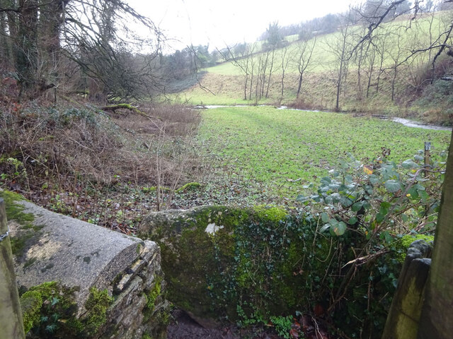
The Bulwarks is a renowned heritage site located in Gloucestershire, England. This ancient monument holds great historical significance and is considered a significant cultural landmark in the region. Situated on a hilltop, The Bulwarks overlooks the picturesque landscape of Gloucestershire and offers breathtaking views of the surrounding countryside.

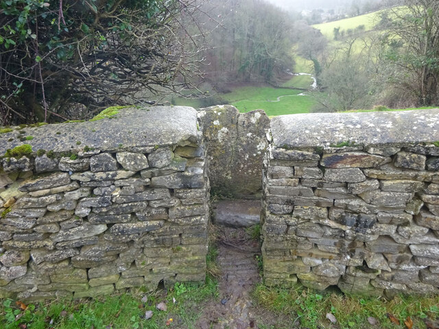
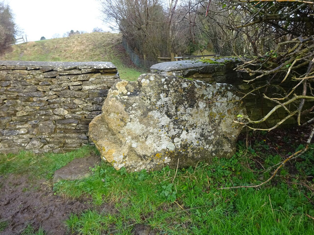
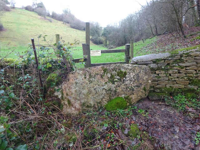
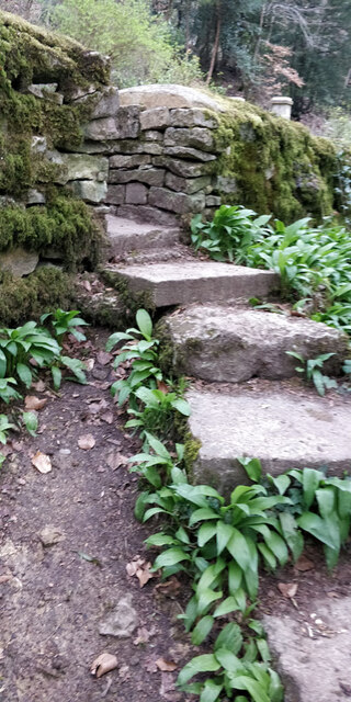
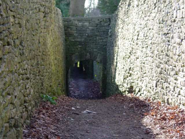
Believed to date back to the Iron Age, The Bulwarks is an impressive earthwork enclosure encompassing an area of approximately 4 hectares. The site consists of large ramparts and ditches, evidence of the ancient defensive fortifications that once protected the area. These earthworks, constructed using the local soil and stone, showcase the exceptional engineering skills of the Iron Age inhabitants.

Archaeological excavations have revealed traces of human occupation at The Bulwarks, including pottery fragments, tools, and animal bones. These findings provide valuable insights into the daily life and cultural practices of the people who lived in the area during ancient times.

Today, The Bulwarks offers visitors a chance to explore and appreciate its historical significance. The site is open to the public and provides informative panels that explain the historical context and significance of the monument. The panoramic views from The Bulwarks make it a popular destination for walking enthusiasts and nature lovers, who can enjoy the scenic beauty of Gloucestershire while immersing themselves in its rich history.

In conclusion, The Bulwarks in Gloucestershire stands as a testament to the region's ancient past. With its well-preserved earthworks and stunning views, it offers visitors a unique opportunity to connect with the heritage and natural beauty of the area.

If you have any feedback on the listing, please let us know in the comments section below.
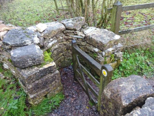
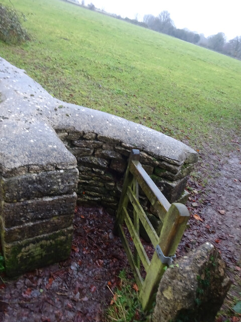
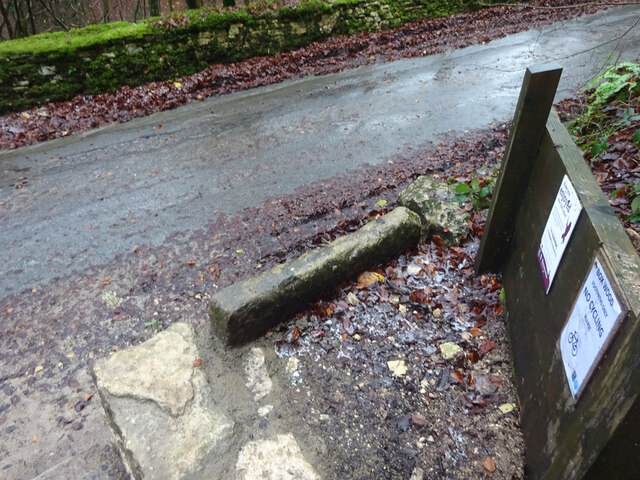
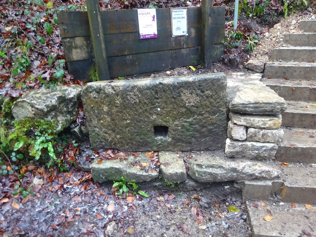
The Bulwarks Images

Images are sourced within 2km of 51.712/-2.195 or Grid Reference SO8601. Thanks to Geograph Open Source API. All images are credited.

Evening over Pinfarthings – Nailsworth, Gloucestershire This photo takes me back to the 30 happy years I spent in Gloucestershire, where I felt in my element.  During this time, through a voluntary body, I met the love of my life. There were others through the years for whom I might have ticked their boxes, but she stood out from them all, like the Statue of Liberty, once met never forgotten. Neglect of my own direction and welfare though took their toll and I had very little to show her. She was my polar opposite, having lived a very active and involved life, with a number of interests and friends. I look back to those years with regret and thoughts of what might have been. Too much time and energy spent on others instead of keeping to my own road of life. The saying is a true one, that if a life is a car don't (do not) allow yourself to become a passenger in yours. Time lost can never be recovered. Time photo taken not available.
Evening over Pinfarthings – Nailsworth, Gloucestershire
This photo takes me back to the 30 happy years I spent in Gloucestershire, where I felt in my element. During this time, through a voluntary body, I met the love of my life. There were others through the years for whom I might have ticked their boxes, but she stood out from them all, like the Statue of Liberty, once met never forgotten. Neglect of my own direction and welfare though took their toll and I had very little to show her. She was my polar opposite, having lived a very active and involved life, with a number of interests and friends. I look back to those years with regret and thoughts of what might have been. Too much time and energy spent on others instead of keeping to my own road of life. The saying is a true one, that if a life is a car don't (do not) allow yourself to become a passenger in yours. Time lost can never be recovered. Time photo taken not available.
Abandoned digger, Minchinhampton Looks like this machine has not done much work for a while.  In the distance is part of Gatcombe Wood.
Abandoned digger, Minchinhampton
Looks like this machine has not done much work for a while. In the distance is part of Gatcombe Wood.
Stone Kissing Gate Leading from Box towards equine fields.
Stone Kissing Gate
Leading from Box towards equine fields.
Stone Kissing Gate Between fields on the equine establishment.
Stone Kissing Gate
Between fields on the equine establishment.
Stone Stile, Devil's Elbow As the footpath leaves Box Wood. The view from the road is <a href="https://www.geograph.org.uk/photo/7038355">ST8699 : Stone Stile, Devil's Elbow</a>.
Stone Stile, Devil's Elbow
As the footpath leaves Box Wood. The view from the road is ST8699 : Stone Stile, Devil's Elbow.
Stone Stile, Devil's Elbow As the footpath leaves Box Wood. The view from the footpath is <a href="https://www.geograph.org.uk/photo/7038353">ST8699 : Stone Stile, Devil's Elbow</a>.
Stone Stile, Devil's Elbow
As the footpath leaves Box Wood. The view from the footpath is ST8699 : Stone Stile, Devil's Elbow.
Stone Stile, Minchinhampton Looking South to a steep escarpment beyond. The view looking up is <a href="https://www.geograph.org.uk/photo/7057420">ST8799 : Stone Stile, Minchinhampton</a>. This Gloucestershire footpath (MMH101) leads all the way to Longfords Mill.
Stone Stile, Minchinhampton
Looking South to a steep escarpment beyond. The view looking up is ST8799 : Stone Stile, Minchinhampton. This Gloucestershire footpath (MMH101) leads all the way to Longfords Mill.
Stone Stile, Minchinhampton Looking North with a steep escarpment to the rear. The view looking down is <a href="https://www.geograph.org.uk/photo/7057415">ST8799 : Stone Stile, Minchinhampton</a>. This Gloucestershire footpath (MMH101) leads all the way to Longfords Mill from Chapel Lane.
Stone Stile, Minchinhampton
Looking North with a steep escarpment to the rear. The view looking down is ST8799 : Stone Stile, Minchinhampton. This Gloucestershire footpath (MMH101) leads all the way to Longfords Mill from Chapel Lane.
Stone Stile, Minchinhampton Looking SW with Gatcombe Wood on the left on Gloucestershire footpaths MMH101 & MMH102. The view looking NE to the escarpment is <a href="https://www.geograph.org.uk/photo/7057466">ST8799 : Stone Stile, Minchinhampton</a>.
Stone Stile, Minchinhampton
Looking SW with Gatcombe Wood on the left on Gloucestershire footpaths MMH101 & MMH102. The view looking NE to the escarpment is ST8799 : Stone Stile, Minchinhampton.
Stone Stile, Minchinhampton Looking NE to the escarpment with Gatcombe Wood behind, on Gloucestershire footpaths MMH101 & MMH102. The view looking SW is <a href="https://www.geograph.org.uk/photo/7057463">ST8799 : Stone Stile, Minchinhampton</a>.
Stone Stile, Minchinhampton
Looking NE to the escarpment with Gatcombe Wood behind, on Gloucestershire footpaths MMH101 & MMH102. The view looking SW is ST8799 : Stone Stile, Minchinhampton.
Stone Stile, Nailsworth On Gloucestershire footpath ZNA39 off a road known as "The Devils Elbow". I leads through a continuation woods going SE, "Box Wood" is on the NW side of the road. This view is looking up the steep steps from below, the view from the road is <a href="https://www.geograph.org.uk/photo/75661">H4774 : Killyclogher Burn, Killyclogher</a>.
Stone Stile, Nailsworth
On Gloucestershire footpath ZNA39 off a road known as "The Devils Elbow". I leads through a continuation woods going SE, "Box Wood" is on the NW side of the road. This view is looking up the steep steps from below, the view from the road is H4774 : Killyclogher Burn, Killyclogher.
Stone Stile, Nailsworth On Gloucestershire footpath ZNA39 off a road known as "The Devils Elbow". It leads through a continuation woods going SE, "Box Wood" is on the NW side of the road. This view from the road looks East, the view looking up the steep steps from below is <a href="https://www.geograph.org.uk/photo/7275660">ST8699 : Stone Stile, Nailsworth</a>.
Stone Stile, Nailsworth
On Gloucestershire footpath ZNA39 off a road known as "The Devils Elbow". It leads through a continuation woods going SE, "Box Wood" is on the NW side of the road. This view from the road looks East, the view looking up the steep steps from below is ST8699 : Stone Stile, Nailsworth.
Stone Stile, Box On Gloucestershire footpath MMH97, looking North to Scar Hill (road), the view from the other side is <a href="https://www.geograph.org.uk/photo/7281981">ST8599 : Stone Stile, Box</a>.
Stone Stile, Box
On Gloucestershire footpath MMH97, looking North to Scar Hill (road), the view from the other side is ST8599 : Stone Stile, Box.
Stone Stile, Box On Gloucestershire footpath MMH97, looking East from Scar Hill, the view from the other side is <a href="https://www.geograph.org.uk/photo/7281978">ST8599 : Stone Stile, Box</a>.
Stone Stile, Box
On Gloucestershire footpath MMH97, looking East from Scar Hill, the view from the other side is ST8599 : Stone Stile, Box.
Stone Stile, Box, Minchinhampton A private stile off footpath MMH99 looking West from a sheep field.
The view in is <a href="https://www.geograph.org.uk/photo/7597059">ST8699 : Stone Stile, Box, Minchinhampton</a>.
Stone Stile, Box, Minchinhampton
A private stile off footpath MMH99 looking West from a sheep field. The view in is ST8699 : Stone Stile, Box, Minchinhampton.
Stone Stile, Box, Minchinhampton A private stile off footpath MMH99 looking East to a sheep field. The view out is <a href="https://www.geograph.org.uk/photo/7597057">ST8699 : Stone Stile, Box, Minchinhampton</a>.
Stone Stile, Box, Minchinhampton
A private stile off footpath MMH99 looking East to a sheep field. The view out is ST8699 : Stone Stile, Box, Minchinhampton.
Minchinhampton Common
The Footpath near Cuckoo Row
Show me another place!

The Bulwarks is located at Grid Ref: SO8601 (Lat: 51.712, Lng: -2.195)

Administrative County: Gloucestershire

District: Stroud

Police Authority: Gloucestershire

What 3 Words

///ended.synthetic.snowballs. Near Minchinhampton, Gloucestershire

Nearby Locations

The Bulwarks Burleigh

Related Wikis

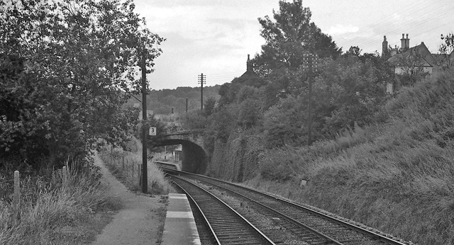
Brimscombe Bridge Halt railway station

Brimscombe Bridge Halt was opened on 1 February 1904 on what is now the Golden Valley Line between Kemble and Stroud. This line was opened in 1845 as the...

Minchinhampton Priory

Minchinhampton Priory was a priory in Gloucestershire, England. After the Norman Conquest the manor of Minchinhampton was granted to the Benedictine nuns...

Minchinhampton

Minchinhampton is a Cotswolds market town and a civil parish in the Stroud District of Gloucestershire, South West England. The town is located on a hilltop...

Brimscombe & Thrupp F.C.

Brimscombe and Thrupp Football Club is a football club based in Brimscombe, Gloucestershire, England. Affiliated to the Gloucestershire County FA, they...

Minchinhampton Common

Minchinhampton Common (grid reference SO855010) is a 182.7-hectare (451-acre) biological and geological Site of Special Scientific Interest in Gloucestershire...

Brimscombe railway station

Brimscombe was opened on 1 June 1845 on what is now the Golden Valley Line between Kemble and Stroud in Gloucestershire. This line was opened in 1845 as...

Box, Gloucestershire

Box is a small village in Gloucestershire, England. It is in the civil parish of Minchinhampton, and is located 3 miles (4.8 km) south of Stroud and 10...

Amberley, Gloucestershire

Amberley, Gloucestershire is a small village about two miles south of Stroud in Gloucestershire, England. It is situated on the edge of Minchinhampton...

Nearby Amenities

Located within 500m of 51.712,-2.195
Burleigh
Place: village
Lat/Long: 51.7132336/-2.200001
Barrier: cattle_grid
Lat/Long: 51.7081307/-2.19278
Barrier: cattle_grid
Lat/Long: 51.7135005/-2.194249
Turning Circle
Lat/Long: 51.7090741/-2.1965638
Post Box
Collection Times: Mo-Fr 16:00; Sa 10:15; Su off
Drive Through: no
Operator: Royal Mail
Operator Wikidata: Q638098
Post Box Type: lamp
Ref: GL5 90
Royal Cypher: EIIR
Royal Cypher Wikidata: Q33102113
Source: survey
Lat/Long: 51.7132401/-2.1948775
Wall's Quarry
Is In: Gloucestershire, England, UK
Place: hamlet
Lat/Long: 51.7156513/-2.1965686
Post Box
Collection Times: Mo-Fr 09:00; Sa 07:00; Su off
Drive Through: no
Operator: Royal Mail
Operator Wikidata: Q638098
Post Box Type: lamp
Postal Code: GL5
Ref: GL5 217D
Royal Cypher: EIIR
Royal Cypher Wikidata: Q33102113
Source: survey
Lat/Long: 51.7122163/-2.2021967
Barrier: cattle_grid
Lat/Long: 51.7139521/-2.1986009
Bus Stop
Stonemasons
Bus: yes
Naptan AtcoCode: 1600GL842
Naptan Bearing: NE
Naptan CommonName: Stonemasons
Naptan NaptanCode: glodjada
Naptan PlusbusZoneRef: STRUD
Naptan Street: Brimscombe Hill
Naptan Verified: no
Public Transport: platform
Shelter: yes
Source: naptan_import
Lat/Long: 51.7126233/-2.2019704
Bus Stop
Brimscombe Hill
Naptan AtcoCode: 1600GLA26344
Naptan Bearing: SW
Naptan CommonName: Brimscombe Hill
Naptan NaptanCode: glogpjpm
Naptan PlusbusZoneRef: STRUD
Naptan Street: Brimscombe Hill
Naptan Verified: no
Source: naptan_import
Lat/Long: 51.7144918/-2.1977232
Bus Stop
Dr Brown's Rd
Bus: yes
Naptan AtcoCode: 1600GLS841
Naptan Bearing: E
Naptan CommonName: Dr Brown's Rd
Naptan NaptanCode: glodjgmw
Naptan Street: Cirencester Rd
Naptan Verified: no
Public Transport: platform
Source: naptan_import
Lat/Long: 51.7098976/-2.1927408
Bus Stop
Besbury Ln
Bus: yes
Naptan AtcoCode: 1600GLS842
Naptan Bearing: W
Naptan CommonName: Besbury Ln
Naptan Indicator: Opp
Naptan NaptanCode: glodjmat
Naptan Street: Cirencester Rd
Naptan Verified: no
Public Transport: platform
Source: naptan_import
Lat/Long: 51.7100178/-2.1899895
Fixme: is there a linking road here?
Lat/Long: 51.7146184/-2.197394
Barrier: stile
Material: wood
Stile: stepover
Lat/Long: 51.7106412/-2.1884591
Power: pole
Lat/Long: 51.7120185/-2.1890259
Power: pole
Lat/Long: 51.7115561/-2.1898414
Maxheight: 1.9
Lat/Long: 51.7155981/-2.1950394
Generator Method: photovoltaic
Generator Output Electricity: yes
Generator Source: solar
Generator Type: solar_photovoltaic_panel
Location: roof
Power: generator
Lat/Long: 51.7163143/-2.1938056
Generator Method: photovoltaic
Generator Output Electricity: yes
Generator Source: solar
Generator Type: solar_photovoltaic_panel
Location: roof
Power: generator
Lat/Long: 51.7118821/-2.1919468
Generator Method: photovoltaic
Generator Output Electricity: yes
Generator Source: solar
Generator Type: solar_photovoltaic_panel
Location: roof
Power: generator
Lat/Long: 51.7112506/-2.1946344
Barrier: stile
Material: stone
Stile: squeezer
Lat/Long: 51.7104003/-2.1896467
Restaurant
Burleigh Court Hotel
Contact Phone: +44(0)1453883804
Contact Website: https://burleighcourtcotswolds.co.uk
Indoor Seating: yes
Outdoor Seating: yes
Rooms: 18
Stars: 4
Tourism: hotel
Lat/Long: 51.7155997/-2.194275
Barrier: cattle_grid
Lat/Long: 51.7084368/-2.1924631
The data included in this document is from www.openstreetmap.org. The data is made available under ODbL.

Have you been to The Bulwarks?

Leave your review of The Bulwarks below (or comments, questions and feedback).