Stane Street

Heritage Site in Sussex

England

Stane Street

Memorial at the crash site of a Douglas Skytrain A close up of the memorial marking the crash site of a Douglas Skytrain, more commonly known as an American Dakota, which crashed in poor visibility on 11th February 1945, killing all 7 people on board. The plane had been returning to the UK from Europe on postal duties.

Having taken off from Paris to return to Wiltshire the plane was picked up by the radar at Tangmere airfield, noting that the plane was flying low over the South Downs, in low cloud and fog, on an East/West course. It was subsequently concluded that the pilot had been lost and thought that he was further south flying over the sea, presumably looking for a landmark on the coast to regain their position. Unfortunately, they were flying over a high point of the Downs and crashed on Sutton Down.

The loss of live is additionally marked by the Four Nations War Memorial in the Church nearby in Upwaltham. This also commemorates the loss of the 8 airmen who died when their Avro Lancaster crashed, almost exactly a year previously to the day, on the opposite side of the valley at Crown Tegleaze.
Memorial at the crash site of a Douglas Skytrain Credit: Chris Thomas-Atkin

Stane Street is an ancient Roman road located in Sussex, England. It is considered a significant heritage site due to its historical importance and well-preserved remnants. The road was constructed in the 1st century AD and connected the Roman towns of London (Londinium) and Chichester (Noviomagus Regnorum).

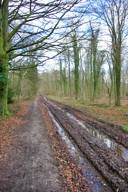
Stane Street runs in a straight line for approximately 56 miles, starting from the outskirts of London and ending in Chichester. The name "Stane Street" is derived from the Old English word "stān," meaning stone, as the road was constructed using large stones to provide a solid and durable surface.

The road played a crucial role in the Roman transportation network, facilitating the movement of troops, goods, and communication between important Roman settlements. It also served as a major trade route for merchants and traders.

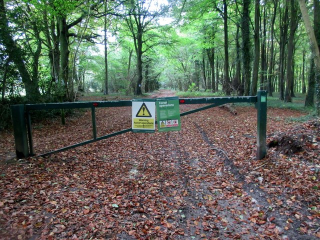
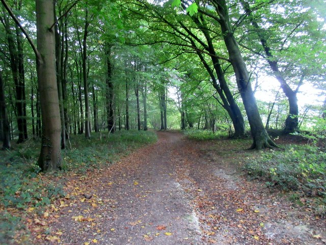
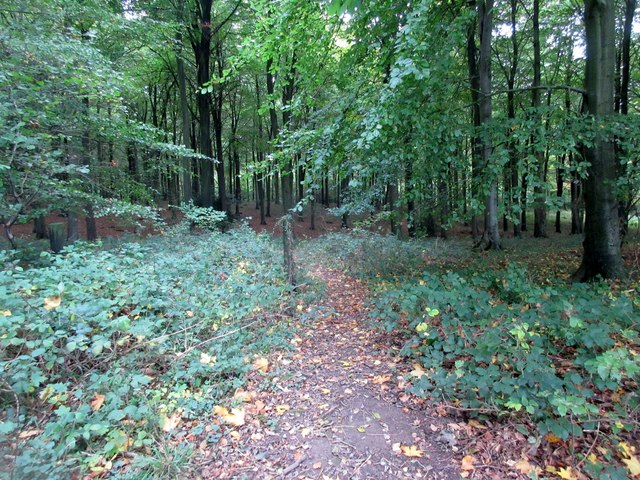
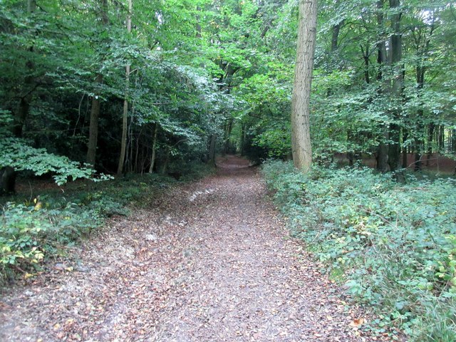
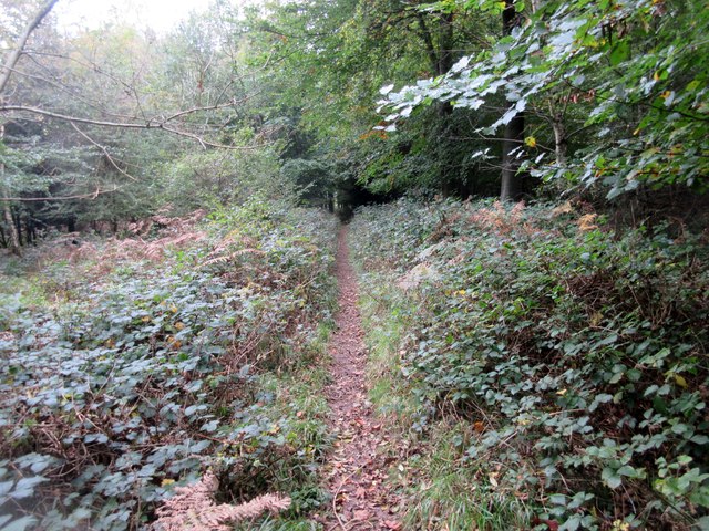
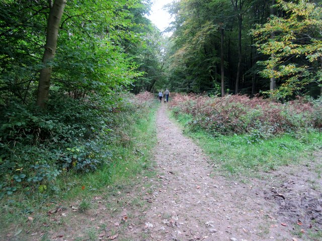
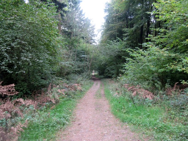
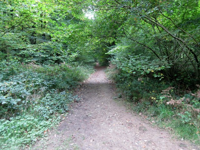
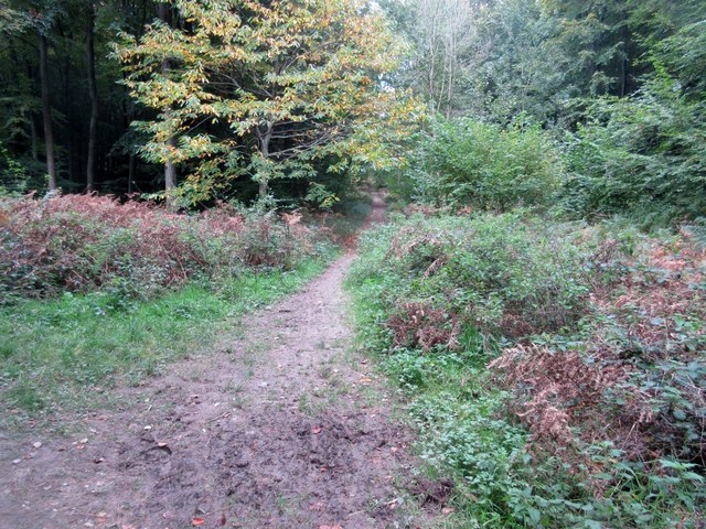
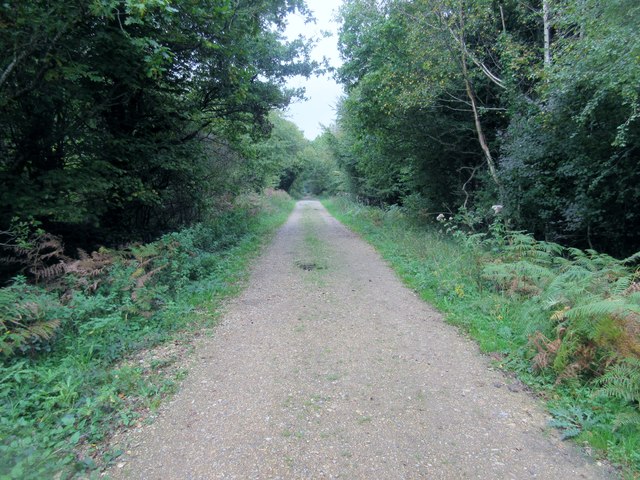
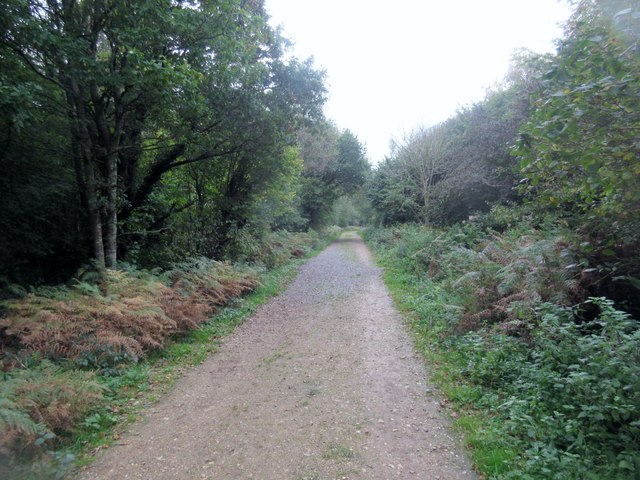
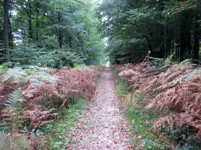
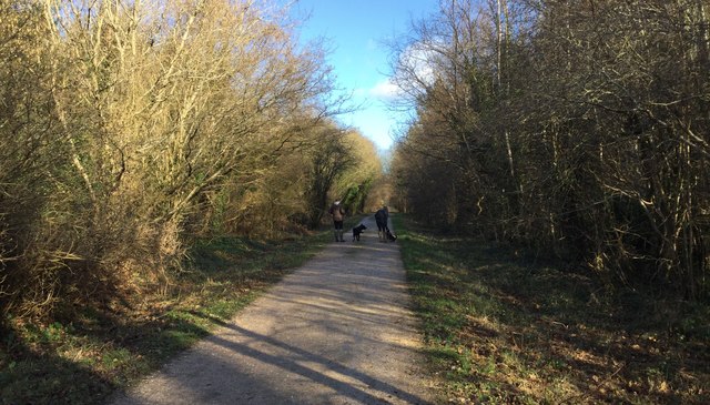
Today, Stane Street is still visible in various places along its original route. Some sections have been incorporated into modern roads, while others have been preserved as footpaths or farm tracks. The road's path can be traced using aerial photography and archaeological surveys.

Visitors to Stane Street can experience a tangible connection to Roman Britain, walking in the footsteps of the ancient Romans. The road offers a glimpse into the past, showcasing the engineering skills and infrastructure of the Roman Empire. Stane Street stands as a testament to the enduring legacy of Roman influence in Sussex and highlights the importance of preserving and studying our historical heritage.

If you have any feedback on the listing, please let us know in the comments section below.

Stane Street Images

Images are sourced within 2km of 50.895/-0.642 or Grid Reference SU9511. Thanks to Geograph Open Source API. All images are credited.

Memorial at the crash site of a Douglas Skytrain A close up of the memorial marking the crash site of a Douglas Skytrain, more commonly known as an American Dakota, which crashed in poor visibility on 11th February 1945, killing all 7 people on board. The plane had been returning to the UK from Europe on postal duties.

Having taken off from Paris to return to Wiltshire the plane was picked up by the radar at Tangmere airfield, noting that the plane was flying low over the South Downs, in low cloud and fog, on an East/West course. It was subsequently concluded that the pilot had been lost and thought that he was further south flying over the sea, presumably looking for a landmark on the coast to regain their position. Unfortunately, they were flying over a high point of the Downs and crashed on Sutton Down.

The loss of live is additionally marked by the Four Nations War Memorial in the Church nearby in Upwaltham. This also commemorates the loss of the 8 airmen who died when their Avro Lancaster crashed, almost exactly a year previously to the day, on the opposite side of the valley at Crown Tegleaze.
Memorial at the crash site of a Douglas Skytrain
A close up of the memorial marking the crash site of a Douglas Skytrain, more commonly known as an American Dakota, which crashed in poor visibility on 11th February 1945, killing all 7 people on board. The plane had been returning to the UK from Europe on postal duties. Having taken off from Paris to return to Wiltshire the plane was picked up by the radar at Tangmere airfield, noting that the plane was flying low over the South Downs, in low cloud and fog, on an East/West course. It was subsequently concluded that the pilot had been lost and thought that he was further south flying over the sea, presumably looking for a landmark on the coast to regain their position. Unfortunately, they were flying over a high point of the Downs and crashed on Sutton Down. The loss of live is additionally marked by the Four Nations War Memorial in the Church nearby in Upwaltham. This also commemorates the loss of the 8 airmen who died when their Avro Lancaster crashed, almost exactly a year previously to the day, on the opposite side of the valley at Crown Tegleaze.
Track. Eartham Wood Also a public bridleway.
Track. Eartham Wood
Also a public bridleway.
Gate across Bridleway Public bridleway 412 on access land in northern section of Eartham Wood.
Gate across Bridleway
Public bridleway 412 on access land in northern section of Eartham Wood.
Sheep grazing near Stubbs Wood Field north of access land.
Sheep grazing near Stubbs Wood
Field north of access land.
Public bridleway 412 on access land Track between Stubbs Wood to the left and Eartham Wood to the right.
Public bridleway 412 on access land
Track between Stubbs Wood to the left and Eartham Wood to the right.
Forest track, Eartham Wood  Route through access land to Stane Street.
Forest track, Eartham Wood
Route through access land to Stane Street.
Track to St Mary's Farm Public bridleway 412 on access land in northern section of Eartham Wood.
Track to St Mary's Farm
Public bridleway 412 on access land in northern section of Eartham Wood.
Track through clearing Access land in Eartham Wood
Track through clearing
Access land in Eartham Wood
Dog walkers in Eartham Wood Forest track on access land leading to St Mary's Farm.
Dog walkers in Eartham Wood
Forest track on access land leading to St Mary's Farm.
Looking south in Eartham Wood Forest track on access land leading to Stane Street.
Looking south in Eartham Wood
Forest track on access land leading to Stane Street.
Path in  Eartham Wood Forest track on access land leading to St Mary's Wood.
Path in Eartham Wood
Forest track on access land leading to St Mary's Wood.
Track in Eartham Wood Forest path on access land leading to North Wood.
Track in Eartham Wood
Forest path on access land leading to North Wood.
Looking north along well made track in Eartham Wood Forest track on access land leading to St Mary's Farm.
Looking north along well made track in Eartham Wood
Forest track on access land leading to St Mary's Farm.
Eartham Wood north of Monarch's Way Forest track on access land leading to Stane Street.
Eartham Wood north of Monarch's Way
Forest track on access land leading to Stane Street.
Eartham Wood Forest track on access land.
Eartham Wood
Forest track on access land.
Grazing sheep near Stubbs Wood Field north of access land.
Grazing sheep near Stubbs Wood
Field north of access land.
Eartham Woods Car Park The entrance to the forest car park near Eartham.
Eartham Woods Car Park
The entrance to the forest car park near Eartham.
Wide Track in Eartham Woods Heading North on a track near to the Eartham Woods car park.
Wide Track in Eartham Woods
Heading North on a track near to the Eartham Woods car park.
Show me another place!

Stane Street is located at Grid Ref: SU9511 (Lat: 50.895, Lng: -0.642)

What 3 Words

///animal.frost.streaking. Near Fontwell, West Sussex

Nearby Locations

Stane Street

Related Wikis

Nore Folly

Nore Folly (also known as Slindon Folly) is a stone construction located near the village of Slindon, West Sussex, United Kingdom. The folly resembles...

Dale Park

Dale Park was an English country house in Madehurst, West Sussex. == History == In 1780, Sir George Thomas, 3rd Baronet created Dale Park near Madehurst...

Barkhale Camp

Barkhale Camp is a Neolithic causewayed enclosure, an archaeological site on Bignor Hill, on the South Downs in West Sussex, England. Causewayed enclosures...

Upwaltham

Upwaltham is a scattered settlement and civil parish in the South Downs, in the District of Chichester of West Sussex, England. It surrounds a parish church...

Eartham

Eartham is a village and civil parish in the District of Chichester in West Sussex, England located 8.5 kilometres (5.3 mi) north east of Chichester east...

Great Ballard School

Great Ballard School is a co-educational independent school for children aged 2½ to 16 years. It was founded in 1924 and set up at its current location...

Slindon

Slindon is a mostly rural village and civil parish in the Arun District of West Sussex, England, containing a developed nucleus amid woodland. Much of...

Bignor Hill

Bignor Hill is a hill near Bignor in Sussex. The South Downs Way passes over the hill. Near the summit are the remains of a memorial to Toby Wentworth...

Nearby Amenities

Located within 500m of 50.895,-0.642
Information: guidepost
Tourism: information
Lat/Long: 50.8944257/-0.6482518
Bench
Backrest: no
Lat/Long: 50.8943145/-0.6481504
The data included in this document is from www.openstreetmap.org. The data is made available under ODbL.

Have you been to Stane Street ?

Leave your review of Stane Street below (or comments, questions and feedback).