Stane Street

Heritage Site in Surrey Epsom and Ewell

England

Stane Street

Old Milestone, now on Old Schools Lane, at the entrance to Chichester Court The milestone was located on A240, Old Kingston Road, near Hogsmill Bridge/ Tolworth Court Bridge, and is now on Old Schools Lane, at the entrance to Chichester Court, on the South side of the road on the mown lawn behind the hedge. Parish of Ewell (Epsom and Ewell district). Carved stone post, Surrey limestone pillar design, erected by the Epsom, Ewell, Tooting etc turnpike trust in the 18th century.

Inscription reads:-             2 / MILES / FROM / EWELL

Milestone Society National ID: SY_EWKG02
Old Milestone, now on Old Schools Lane, at the entrance to Chichester Court Credit: Janet Dowding

Stane Street is a historic road located in Surrey, England, which is considered a significant heritage site. It was originally constructed by the Romans in the 1st century AD and served as a major thoroughfare connecting the Roman towns of London (Londinium) and Chichester (Noviomagus Regnorum).

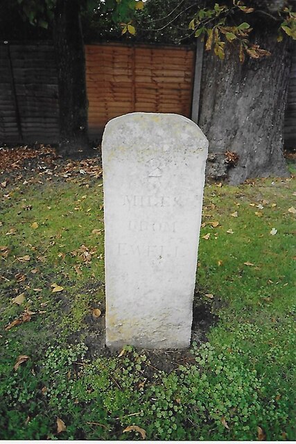
The road stretches for approximately 55 miles, with its southern end starting at the bridge over the River Arun in Pulborough, West Sussex, and continuing northwards towards Southwark in London. Stane Street follows a relatively straight path through the countryside, passing through various towns and villages along the way, including Ockley, Dorking, and Ewell.

Throughout its history, Stane Street has undergone several modifications and repairs, but its original Roman layout can still be seen in certain sections. The road was constructed using a combination of gravel and flint, with ditches on either side for drainage purposes. In some places, remnants of the original Roman pavement can still be observed.

Today, Stane Street is not only a well-preserved ancient road but also a popular tourist attraction. Visitors can explore its unique historical significance by walking or cycling along its route, taking in the picturesque countryside and experiencing a tangible connection to the Roman Empire. Several information boards and signposts along the way provide insights into the road's history and its importance during the Roman period.

Stane Street stands as a testament to the engineering skills of the Romans and serves as a reminder of the rich heritage that exists within Surrey. Its preservation as a heritage site allows visitors to appreciate the significance of this ancient road and its role in shaping the local landscape.

If you have any feedback on the listing, please let us know in the comments section below.
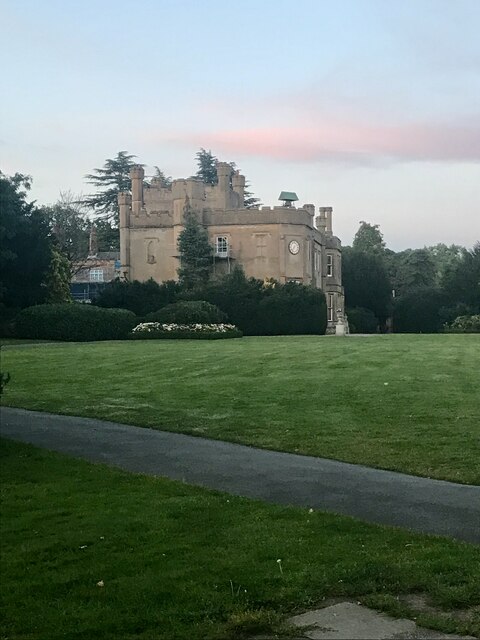
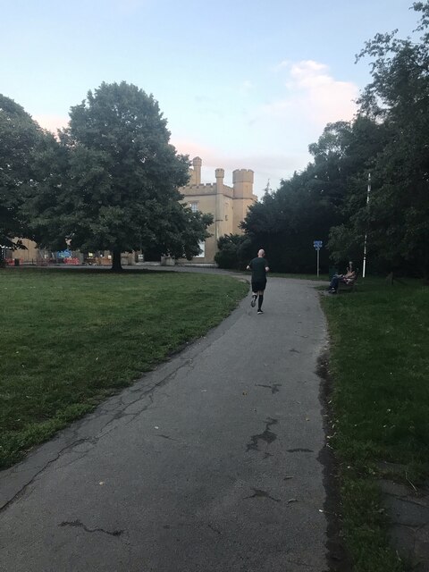
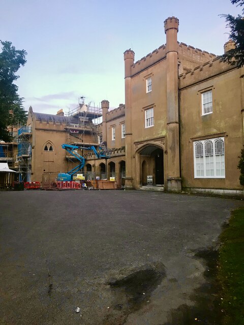
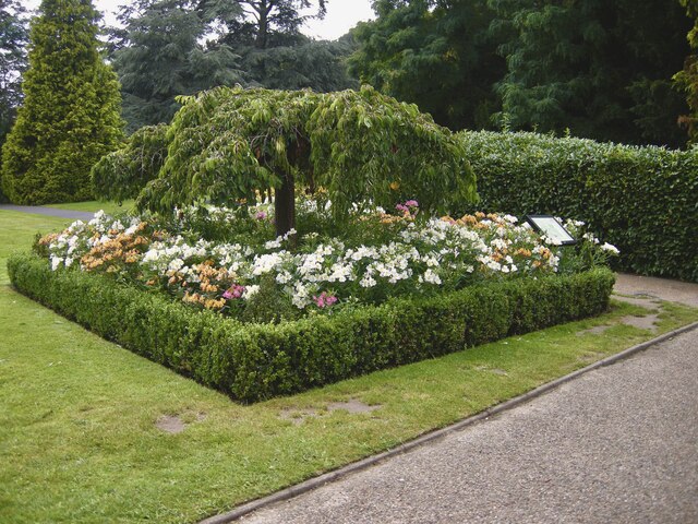
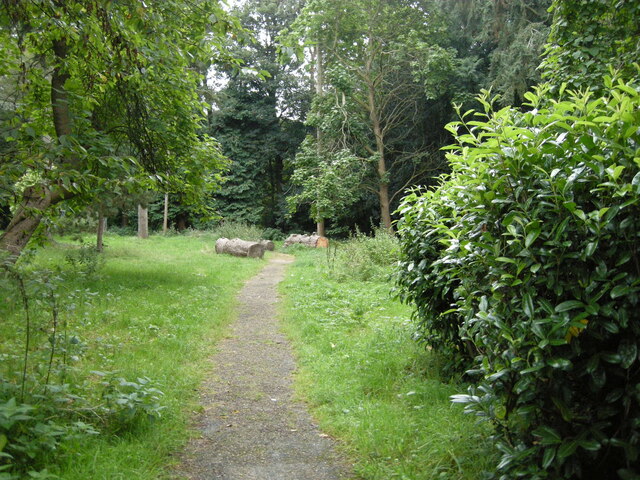
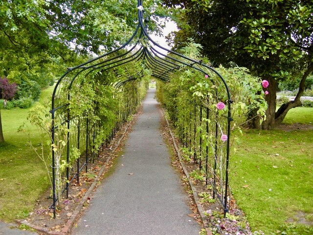
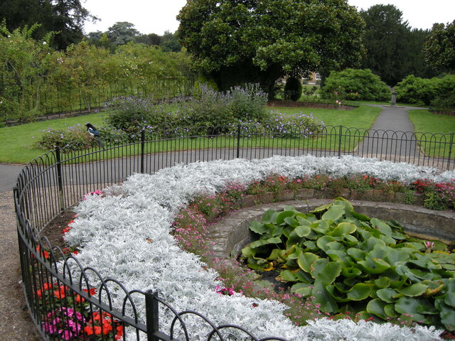
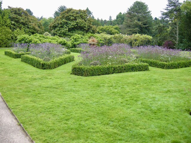
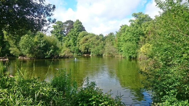
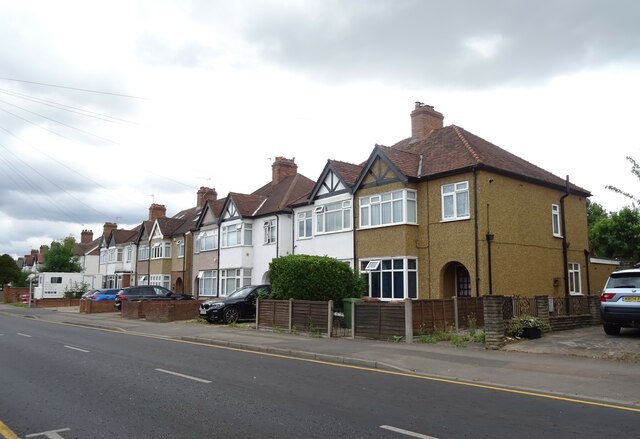
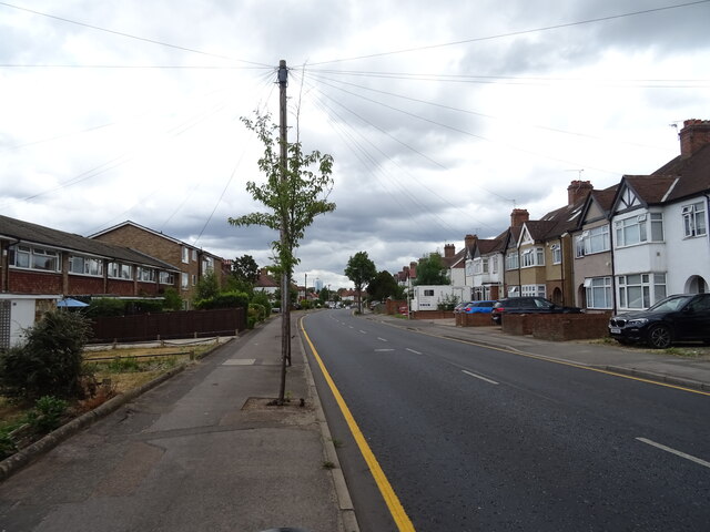
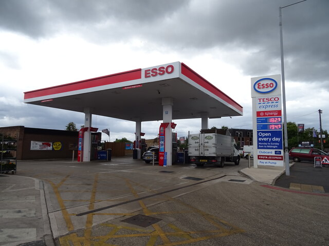
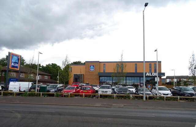
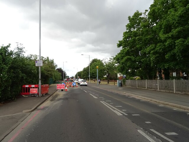
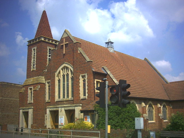
Stane Street Images

Images are sourced within 2km of 51.367/-0.24 or Grid Reference TQ2264. Thanks to Geograph Open Source API. All images are credited.

Old Milestone, now on Old Schools Lane, at the entrance to Chichester Court The milestone was located on A240, Old Kingston Road, near Hogsmill Bridge/ Tolworth Court Bridge, and is now on Old Schools Lane, at the entrance to Chichester Court, on the South side of the road on the mown lawn behind the hedge. Parish of Ewell (Epsom and Ewell district). Carved stone post, Surrey limestone pillar design, erected by the Epsom, Ewell, Tooting etc turnpike trust in the 18th century.

Inscription reads:-             2 / MILES / FROM / EWELL

Milestone Society National ID: SY_EWKG02
Old Milestone, now on Old Schools Lane, at the entrance to Chichester Court
The milestone was located on A240, Old Kingston Road, near Hogsmill Bridge/ Tolworth Court Bridge, and is now on Old Schools Lane, at the entrance to Chichester Court, on the South side of the road on the mown lawn behind the hedge. Parish of Ewell (Epsom and Ewell district). Carved stone post, Surrey limestone pillar design, erected by the Epsom, Ewell, Tooting etc turnpike trust in the 18th century. Inscription reads:- 2 / MILES / FROM / EWELL Milestone Society National ID: SY_EWKG02
Window cleaning Windows being cleaned at the Hall.
Window cleaning
Windows being cleaned at the Hall.
Tribute Memorial A memorial to the staff of Nonsuch who lost their lives in the Great War.
Tribute Memorial
A memorial to the staff of Nonsuch who lost their lives in the Great War.
Remains of glasshouses Only the walls remain of the glass house at Nonsuch Hall.
Remains of glasshouses
Only the walls remain of the glass house at Nonsuch Hall.
Evening at Nonsuch Early evening photo at Nonsuch Hall.
Evening at Nonsuch
Early evening photo at Nonsuch Hall.
Evening Exercise A jogger using the paths at Nonsuch Park.
Evening Exercise
A jogger using the paths at Nonsuch Park.
Nonsuch Mansion The rear of the Mansion from the car park, with renovation work taking place.
Nonsuch Mansion
The rear of the Mansion from the car park, with renovation work taking place.
Formal Garden One of the many attractive borders, although late in the season still colourful.
Formal Garden
One of the many attractive borders, although late in the season still colourful.
The Pinetum One of the paths through the Pinetum with a recently felled tree.
The Pinetum
One of the paths through the Pinetum with a recently felled tree.
The Rosewalk Very attractive arched walkway with scented roses.
The Rosewalk
Very attractive arched walkway with scented roses.
Formal pond Lily pond and Magpie.
Formal pond
Lily pond and Magpie.
Formal borders Well maintained borders with box and lavender plants.
Formal borders
Well maintained borders with box and lavender plants.
Bourne Hall Lake
Bourne Hall Lake
Houses on Gander Green Lane, Sutton
Gander Green Lane, Sutton
Service station on London Road, Sutton Petrol 182.9p
Diesel 194.9p.
Service station on London Road, Sutton
Petrol 182.9p Diesel 194.9p.
Aldi supermarket on London Road, Sutton
Roadworks on London Road (A24), Sutton
Show me another place!

Stane Street is located at Grid Ref: TQ2264 (Lat: 51.367, Lng: -0.24)

Administrative County: Surrey

District: Epsom and Ewell

Police Authority: Surrey

What 3 Words

///sugar.ships.tender. Near Cheam, London

Related Wikis

The Station, Stoneleigh

The Station is a Grade II listed public house at Stoneleigh Broadway, Stoneleigh, Epsom, Surrey. It was originally opened in November 1935 as "The Stoneleigh...

Stoneleigh, Surrey

Stoneleigh is a suburban area southwest of London, situated in the north of the Epsom and Ewell borough in the county of Surrey, England. It is situated...

Stoneleigh railway station

Stoneleigh railway station is in the Epsom and Ewell district of Surrey, England. The station is served by South Western Railway and is currently in Travelcard...

Worcester Park

Worcester Park is a suburban town in South West London, England. It lies in the London boroughs of Sutton and Kingston, and partly in the Surrey borough...

Cuddington, Surrey

Cuddington was a village in Surrey which was demolished to make way for Henry VIII's Nonsuch Palace near Cheam. Cuddington lay within the Copthorne hundred...
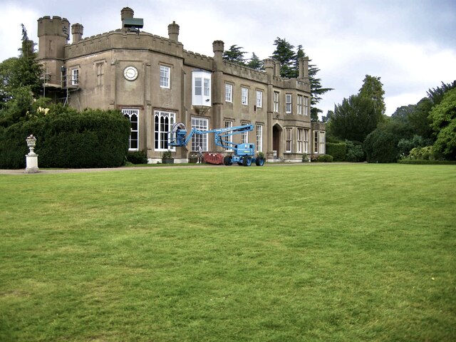
Nonsuch Mansion

Nonsuch Mansion is a historic house located within Nonsuch Park in north Surrey, England near the boundary with Greater London. It is in the borough of...

Nonsuch Park

Nonsuch Park is a public park between Stoneleigh, Cheam, and Ewell in the borough of Epsom and Ewell in Surrey, England. It borders the London Borough...

Nonsuch Palace

Nonsuch Palace was a Tudor royal palace, commissioned by Henry VIII in Surrey, England and completed in 1538. Its site lies in what is now Nonsuch Park...

Nearby Amenities

Located within 500m of 51.367,-0.24
Turning Circle
Lat/Long: 51.3693059/-0.2375175
Mini Roundabout
Direction: clockwise
Source: photo
Lat/Long: 51.36753/-0.2443359
Turning Circle
Lat/Long: 51.3680126/-0.2355284
Noexit: yes
Lat/Long: 51.3697221/-0.2431761
Post Box
Collection Times: Mo-Fr 17:30; Sa 12:00
Operator: Royal Mail
Operator Wikidata: Q638098
Post Box Type: pillar
Ref: KT4 279
Royal Cypher: GR
Royal Cypher Wikidata: Q33102273
Lat/Long: 51.3675529/-0.238615
Post Box
Collection Times: Mo-Fr 09:00; Sa 07:00
Operator: Royal Mail
Operator Wikidata: Q638098
Post Box Type: pillar
Ref: KT4 234D
Royal Cypher: GR
Royal Cypher Wikidata: Q33102273
Lat/Long: 51.368004/-0.2442811
Crossing
Button Operated: yes
Crossing: traffic_signals
Crossing Island: yes
Source: photo
Tactile Paving: yes
Traffic Signals Sound: no
Lat/Long: 51.3653377/-0.234026
Post Box
Collection Times: Mo-Fr 17:30; Sa 12:00
Operator: Royal Mail
Operator Wikidata: Q638098
Post Box Type: pillar
Ref: KT4 291
Royal Cypher: GR
Royal Cypher Wikidata: Q33102273
Lat/Long: 51.3702123/-0.2351129
Bus Stop
St.Clair Drive
Bench: no
Bin: no
Bus: yes
Lit: yes
Naptan AtcoCode: 490012647N
Naptan Bearing: N
Naptan CommonName: St.Clair Drive
Naptan Verified: no
Public Transport: platform
Shelter: no
Tactile Paving: no
Lat/Long: 51.3690207/-0.2384507
Bus Stop
St.Clair Drive
Bench: no
Bin: no
Bus: yes
Lit: yes
Naptan AtcoCode: 490012647S
Naptan Bearing: S
Naptan CommonName: St.Clair Drive
Naptan Verified: no
Public Transport: platform
Shelter: no
Tactile Paving: no
Lat/Long: 51.369921/-0.2382913
Bus Stop
The Mount
Bench: no
Bin: no
Bus: yes
Lit: yes
Naptan AtcoCode: 490013463S
Naptan Bearing: S
Naptan CommonName: The Mount Sparrow Farm Road
Naptan Verified: no
Public Transport: platform
Shelter: no
Tactile Paving: no
Lat/Long: 51.368111/-0.2382472
St. Clair Drive
Naptan AtcoCode: 40004406120A
Naptan Bearing: N
Naptan BusStopType: CUS
Naptan CommonName: St. Clair Drive
Naptan Indicator: adj
Naptan Landmark: St. Clair Drive
Naptan NaptanCode: suramajw
Naptan Street: St. Clair Drive
Naptan Verified: no
Source: naptan_import
Lat/Long: 51.3671475/-0.2388106
St. Clair Drive
Naptan AtcoCode: 40004406120B
Naptan Bearing: W
Naptan BusStopType: CUS
Naptan CommonName: St. Clair Drive
Naptan Indicator: Just Before
Naptan Landmark: Waverley Road
Naptan NaptanCode: suramama
Naptan Street: Sparrow Farm Road
Naptan Verified: no
Source: naptan_import
Lat/Long: 51.36702/-0.2381115
Bus Stop
Sparrow Farm Road
Bench: no
Bus: yes
Naptan AtcoCode: 40004406145A
Naptan Bearing: NE
Naptan CommonName: Sparrow Farm Road
Naptan Indicator: Nr
Naptan Landmark: Sparrow Farm Road
Naptan NaptanCode: suramapj
Naptan Street: London Road
Naptan Verified: no
Public Transport: platform
Shelter: no
Source: naptan_import
Tactile Paving: no
Wheelchair: yes
Lat/Long: 51.3646673/-0.2348024
Bus Stop
Sparrow Farm Road
Bench: yes
Bus: yes
Naptan AtcoCode: 40004406146A
Naptan Bearing: SW
Naptan CommonName: Sparrow Farm Road
Naptan Indicator: Opp
Naptan Landmark: Sparrow Farm Road
Naptan NaptanCode: suramapm
Naptan Street: London Road
Naptan Verified: no
Public Transport: platform
Shelter: yes
Source: naptan_import
Tactile Paving: no
Wheelchair: yes
Lat/Long: 51.3647947/-0.2344707
Noexit: yes
Lat/Long: 51.371236/-0.2417133
Noexit: yes
Lat/Long: 51.3709365/-0.2416978
Noexit: yes
Lat/Long: 51.3693601/-0.2417163
Noexit: yes
Lat/Long: 51.3700322/-0.2445981
Noexit: yes
Lat/Long: 51.3698678/-0.2446135
Noexit: yes
Lat/Long: 51.3695754/-0.2446362
Noexit: yes
Lat/Long: 51.3694086/-0.244672
Noexit: yes
Lat/Long: 51.3691395/-0.2447007
Crossing
Crossing: uncontrolled
Crossing Island: no
Crossing Ref: zebra
Tactile Paving: yes
Lat/Long: 51.3668407/-0.2367564
Ref GB Tflcid: RWG133895
Traffic Calming: hump
Lat/Long: 51.366938/-0.2371082
Traffic Signals
Lat/Long: 51.3654632/-0.233906
Noexit: yes
Lat/Long: 51.3684308/-0.2419106
Noexit: yes
Lat/Long: 51.3691727/-0.2417648
Noexit: yes
Lat/Long: 51.3684745/-0.2447744
Noexit: yes
Lat/Long: 51.3682456/-0.2448401
Noexit: yes
Lat/Long: 51.3686438/-0.2447644
Noexit: yes
Lat/Long: 51.3689462/-0.2447061
Noexit: yes
Lat/Long: 51.3682873/-0.2419462
Noexit: yes
Lat/Long: 51.367784/-0.2420699
Noexit: yes
Lat/Long: 51.3676574/-0.2419825
Post Box
Collection Times: Mo-Fr 09:00; Sa 07:00
Operator: Royal Mail
Post Box Type: pillar
Ref: KT17 46D
Royal Cypher: GR
Royal Cypher Wikidata: Q33102273
Lat/Long: 51.3633967/-0.2398565
Post Box
Collection Times: Mo-Fr 09:00; Sa 07:00
Operator: Royal Mail
Operator Wikidata: Q638098
Post Box Type: pillar
Ref: KT17 96D
Royal Cypher: GR
Royal Cypher Wikidata: Q33102273
Lat/Long: 51.3656927/-0.2415551
Noexit: yes
Lat/Long: 51.3703298/-0.2431196
Power: substation
Ref: 123101
Substation: minor_distribution
Lat/Long: 51.36308/-0.2394452
Power: substation
Substation: minor_distribution
Lat/Long: 51.3669225/-0.2399204
Power: substation
Ref: 123610
Substation: minor_distribution
Lat/Long: 51.3669172/-0.2367086
Power: substation
Substation: minor_distribution
Lat/Long: 51.3656967/-0.2347316
Noexit: yes
Lat/Long: 51.3694792/-0.2432049
Noexit: yes
Lat/Long: 51.368825/-0.2432832
Noexit: yes
Lat/Long: 51.3685605/-0.2433581
Noexit: yes
Lat/Long: 51.3705471/-0.2431208
Ref GB Tflcid: RWG133894
Traffic Calming: hump
Lat/Long: 51.3661168/-0.2353843
Ref GB Tflcid: RWG133896
Traffic Calming: hump
Lat/Long: 51.3677336/-0.2443287
Ref GB Tflcid: RWG134045
Traffic Calming: hump
Lat/Long: 51.3698447/-0.2439226
The data included in this document is from www.openstreetmap.org. The data is made available under ODbL.

Have you been to Stane Street ?

Leave your review of Stane Street below (or comments, questions and feedback).