St Mary's Church
Heritage Site in Kent Canterbury
England
St Mary's Church
![Reculver Towers and Roman Fort [1] This millennium cross was carved from Portland Stone. The design is based on the original Reculver Cross, fragments of which survive in Canterbury Cathedral.
Reculver is a village and coastal resort some 3 miles east of Herne Bay in Kent. The village is known for the ruins of a church and for being the site of a Roman fort. During the Middle Ages Reculver was a thriving township with a weekly market and a yearly fair. The village declined, due to coastal erosion and to the Wantsum Channel silting up, and was abandoned in the late 18th century. There was a revival of tourism in the 20th century and there are now two large caravan parks.](https://s3.geograph.org.uk/geophotos/07/05/83/7058379_c97f81df.jpg)
St Mary's Church, located in the picturesque county of Kent, is a renowned heritage site that stands as a testament to the rich history and architectural prowess of the region. Dating back to the 12th century, this magnificent church is a prime example of Norman architecture, with its impressive stone walls and towering spire dominating the local skyline.
The church's interior is equally impressive, featuring stunning stained glass windows that depict biblical scenes and saints. The intricate carvings on the wooden pews and pulpit showcase the craftsmanship of the time. Visitors are often captivated by the beautiful vaulted ceiling, adorned with intricate decorative patterns.
One of the most notable features of St Mary's Church is its grand bell tower, which houses a set of ancient bells that have been ringing out across the village for centuries. The tower itself stands as a symbol of the church's enduring presence in the community.
Surrounded by a serene churchyard, St Mary's offers a peaceful and tranquil atmosphere for visitors to reflect and appreciate the history and spirituality it represents. The churchyard is also home to centuries-old tombstones, providing a glimpse into the lives of the local people who have been laid to rest there.
St Mary's Church in Kent is not only a place of worship but also a cherished heritage site, attracting visitors from near and far who are keen to explore its historical and architectural significance. Its timeless beauty and cultural importance make it a must-visit destination for history enthusiasts and those seeking a moment of tranquility in the heart of Kent.
If you have any feedback on the listing, please let us know in the comments section below.
St Mary's Church Images
Images are sourced within 2km of 51.38/1.198 or Grid Reference TR2269. Thanks to Geograph Open Source API. All images are credited.
![Reculver Towers and Roman Fort [2] An information board by English Heritage who manage the site. The site is a Scheduled Ancient Monument with much detail at: <span class="nowrap"><a title="https://historicengland.org.uk/listing/the-list/list-entry/1018784" rel="nofollow ugc noopener" href="https://historicengland.org.uk/listing/the-list/list-entry/1018784">Link</a><img style="margin-left:2px;" alt="External link" title="External link - shift click to open in new window" src="https://s1.geograph.org.uk/img/external.png" width="10" height="10"/></span>
Reculver is a village and coastal resort some 3 miles east of Herne Bay in Kent. The village is known for the ruins of a church and for being the site of a Roman fort. During the Middle Ages Reculver was a thriving township with a weekly market and a yearly fair. The village declined, due to coastal erosion and to the Wantsum Channel silting up, and was abandoned in the late 18th century. There was a revival of tourism in the 20th century and there are now two large caravan parks.](https://s0.geograph.org.uk/geophotos/07/05/83/7058380_0847194f.jpg)
![Reculver Towers and Roman Fort [3] The church of St Mary was founded in 669, it was sited near the centre of the Roman fort, and was built with material from demolished Roman buildings. Greatly expanded in later centuries, the towers were added in the 12th century and there were additions and alteration in the 15th century. Coastal erosion led to the church being demolished in 1809. The remains of the church were purchased by Trinity House as the towers were an important landmark for shipping. The site is a Scheduled Ancient Monument with much detail at: <span class="nowrap"><a title="https://historicengland.org.uk/listing/the-list/list-entry/1018784" rel="nofollow ugc noopener" href="https://historicengland.org.uk/listing/the-list/list-entry/1018784">Link</a><img style="margin-left:2px;" alt="External link" title="External link - shift click to open in new window" src="https://s1.geograph.org.uk/img/external.png" width="10" height="10"/></span>
Reculver is a village and coastal resort some 3 miles east of Herne Bay in Kent. The village is known for the ruins of a church and for being the site of a Roman fort. During the Middle Ages Reculver was a thriving township with a weekly market and a yearly fair. The village declined, due to coastal erosion and to the Wantsum Channel silting up, and was abandoned in the late 18th century. There was a revival of tourism in the 20th century and there are now two large caravan parks.](https://s1.geograph.org.uk/geophotos/07/05/83/7058381_811c1f0f.jpg)
![Reculver Towers and Roman Fort [4] The church of St Mary was founded in 669, it was sited near the centre of the Roman fort, and was built with material from demolished Roman buildings. Greatly expanded in later centuries, the towers were added in the 12th century and there were additions and alteration in the 15th century. Coastal erosion led to the church being demolished in 1809. The remains of the church were purchased by Trinity House as the towers were an important landmark for shipping. The site is a Scheduled Ancient Monument with much detail at: <span class="nowrap"><a title="https://historicengland.org.uk/listing/the-list/list-entry/1018784" rel="nofollow ugc noopener" href="https://historicengland.org.uk/listing/the-list/list-entry/1018784">Link</a><img style="margin-left:2px;" alt="External link" title="External link - shift click to open in new window" src="https://s1.geograph.org.uk/img/external.png" width="10" height="10"/></span>
Reculver is a village and coastal resort some 3 miles east of Herne Bay in Kent. The village is known for the ruins of a church and for being the site of a Roman fort. During the Middle Ages Reculver was a thriving township with a weekly market and a yearly fair. The village declined, due to coastal erosion and to the Wantsum Channel silting up, and was abandoned in the late 18th century. There was a revival of tourism in the 20th century and there are now two large caravan parks.](https://s2.geograph.org.uk/geophotos/07/05/83/7058382_9522f557.jpg)
![Reculver Towers and Roman Fort [5] From near the ruins of the church is this view across the interior of the fort.
Reculver once occupied a strategic location at the northwestern end of the Wantsum Channel, a sea lane that separated the Isle of Thanet and the Kent mainland. The Romans built a small fort in 43 AD, and, late in the 2nd century, built a larger fort, called Regulbium, which later became one of the chain of Saxon Shore forts. Much of the fort has been lost to coastal erosion. The site is a Scheduled Ancient Monument with much detail at: <span class="nowrap"><a title="https://historicengland.org.uk/listing/the-list/list-entry/1018784" rel="nofollow ugc noopener" href="https://historicengland.org.uk/listing/the-list/list-entry/1018784">Link</a><img style="margin-left:2px;" alt="External link" title="External link - shift click to open in new window" src="https://s1.geograph.org.uk/img/external.png" width="10" height="10"/></span>
Reculver is a village and coastal resort some 3 miles east of Herne Bay in Kent. The village is known for the ruins of a church and for being the site of a Roman fort. During the Middle Ages Reculver was a thriving township with a weekly market and a yearly fair. The village declined, due to coastal erosion and to the Wantsum Channel silting up, and was abandoned in the late 18th century. There was a revival of tourism in the 20th century and there are now two large caravan parks.](https://s3.geograph.org.uk/geophotos/07/05/83/7058383_ce2ee88b.jpg)
![Reculver Towers and Roman Fort [6] An information board about the change to the landscape due to the silting up of the Wantsum Channel.
Reculver once occupied a strategic location at the northwestern end of the Wantsum Channel, a sea lane that separated the Isle of Thanet and the Kent mainland. The Romans built a small fort in 43 AD, and, late in the 2nd century, built a larger fort, called Regulbium, which later became one of the chain of Saxon Shore forts. Much of the fort has been lost to coastal erosion. The site is a Scheduled Ancient Monument with much detail at: <span class="nowrap"><a title="https://historicengland.org.uk/listing/the-list/list-entry/1018784" rel="nofollow ugc noopener" href="https://historicengland.org.uk/listing/the-list/list-entry/1018784">Link</a><img style="margin-left:2px;" alt="External link" title="External link - shift click to open in new window" src="https://s1.geograph.org.uk/img/external.png" width="10" height="10"/></span>
Reculver is a village and coastal resort some 3 miles east of Herne Bay in Kent. The village is known for the ruins of a church and for being the site of a Roman fort. During the Middle Ages Reculver was a thriving township with a weekly market and a yearly fair. The village declined, due to coastal erosion and to the Wantsum Channel silting up, and was abandoned in the late 18th century. There was a revival of tourism in the 20th century and there are now two large caravan parks.](https://s0.geograph.org.uk/geophotos/07/05/83/7058384_66093fbe.jpg)
![Reculver Towers and Roman Fort [7] An information board about the east gate of the fort.
Reculver once occupied a strategic location at the northwestern end of the Wantsum Channel, a sea lane that separated the Isle of Thanet and the Kent mainland. The Romans built a small fort in 43 AD, and, late in the 2nd century, built a larger fort, called Regulbium, which later became one of the chain of Saxon Shore forts. Much of the fort has been lost to coastal erosion. The site is a Scheduled Ancient Monument with much detail at: <span class="nowrap"><a title="https://historicengland.org.uk/listing/the-list/list-entry/1018784" rel="nofollow ugc noopener" href="https://historicengland.org.uk/listing/the-list/list-entry/1018784">Link</a><img style="margin-left:2px;" alt="External link" title="External link - shift click to open in new window" src="https://s1.geograph.org.uk/img/external.png" width="10" height="10"/></span>
Reculver is a village and coastal resort some 3 miles east of Herne Bay in Kent. The village is known for the ruins of a church and for being the site of a Roman fort. During the Middle Ages Reculver was a thriving township with a weekly market and a yearly fair. The village declined, due to coastal erosion and to the Wantsum Channel silting up, and was abandoned in the late 18th century. There was a revival of tourism in the 20th century and there are now two large caravan parks.](https://s1.geograph.org.uk/geophotos/07/05/83/7058385_a7211b4b.jpg)
![Reculver Towers and Roman Fort [8] The remains of the east gate of the fort.
Reculver once occupied a strategic location at the northwestern end of the Wantsum Channel, a sea lane that separated the Isle of Thanet and the Kent mainland. The Romans built a small fort in 43 AD, and, late in the 2nd century, built a larger fort, called Regulbium, which later became one of the chain of Saxon Shore forts. Much of the fort has been lost to coastal erosion. The site is a Scheduled Ancient Monument with much detail at: <span class="nowrap"><a title="https://historicengland.org.uk/listing/the-list/list-entry/1018784" rel="nofollow ugc noopener" href="https://historicengland.org.uk/listing/the-list/list-entry/1018784">Link</a><img style="margin-left:2px;" alt="External link" title="External link - shift click to open in new window" src="https://s1.geograph.org.uk/img/external.png" width="10" height="10"/></span>
Reculver is a village and coastal resort some 3 miles east of Herne Bay in Kent. The village is known for the ruins of a church and for being the site of a Roman fort. During the Middle Ages Reculver was a thriving township with a weekly market and a yearly fair. The village declined, due to coastal erosion and to the Wantsum Channel silting up, and was abandoned in the late 18th century. There was a revival of tourism in the 20th century and there are now two large caravan parks.](https://s2.geograph.org.uk/geophotos/07/05/83/7058386_12b23c14.jpg)
![Reculver Towers and Roman Fort [9] The remains of the guardhouse at the east gate of the fort.
Reculver once occupied a strategic location at the northwestern end of the Wantsum Channel, a sea lane that separated the Isle of Thanet and the Kent mainland. The Romans built a small fort in 43 AD, and, late in the 2nd century, built a larger fort, called Regulbium, which later became one of the chain of Saxon Shore forts. Much of the fort has been lost to coastal erosion. The site is a Scheduled Ancient Monument with much detail at: <span class="nowrap"><a title="https://historicengland.org.uk/listing/the-list/list-entry/1018784" rel="nofollow ugc noopener" href="https://historicengland.org.uk/listing/the-list/list-entry/1018784">Link</a><img style="margin-left:2px;" alt="External link" title="External link - shift click to open in new window" src="https://s1.geograph.org.uk/img/external.png" width="10" height="10"/></span>
Reculver is a village and coastal resort some 3 miles east of Herne Bay in Kent. The village is known for the ruins of a church and for being the site of a Roman fort. During the Middle Ages Reculver was a thriving township with a weekly market and a yearly fair. The village declined, due to coastal erosion and to the Wantsum Channel silting up, and was abandoned in the late 18th century. There was a revival of tourism in the 20th century and there are now two large caravan parks.](https://s3.geograph.org.uk/geophotos/07/05/83/7058387_e5a863d2.jpg)
![Reculver Towers and Roman Fort [10] Two odd, isolated buildings in a field to the east of the fort. Purpose unknown.
Reculver is a village and coastal resort some 3 miles east of Herne Bay in Kent. The village is known for the ruins of a church and for being the site of a Roman fort. During the Middle Ages Reculver was a thriving township with a weekly market and a yearly fair. The village declined, due to coastal erosion and to the Wantsum Channel silting up, and was abandoned in the late 18th century. There was a revival of tourism in the 20th century and there are now two large caravan parks.](https://s1.geograph.org.uk/geophotos/07/05/83/7058389_d375796f.jpg)
![Reculver Towers and Roman Fort [11] The church of St Mary was founded in 669, it was sited near the centre of the Roman fort, and was built with material from demolished Roman buildings. Greatly expanded in later centuries, the towers were added in the 12th century and there were additions and alteration in the 15th century. Coastal erosion led to the church being demolished in 1809. The remains of the church were purchased by Trinity House as the towers were an important landmark for shipping. The site is a Scheduled Ancient Monument with much detail at: <span class="nowrap"><a title="https://historicengland.org.uk/listing/the-list/list-entry/1018784" rel="nofollow ugc noopener" href="https://historicengland.org.uk/listing/the-list/list-entry/1018784">Link</a><img style="margin-left:2px;" alt="External link" title="External link - shift click to open in new window" src="https://s1.geograph.org.uk/img/external.png" width="10" height="10"/></span>
Reculver is a village and coastal resort some 3 miles east of Herne Bay in Kent. The village is known for the ruins of a church and for being the site of a Roman fort. During the Middle Ages Reculver was a thriving township with a weekly market and a yearly fair. The village declined, due to coastal erosion and to the Wantsum Channel silting up, and was abandoned in the late 18th century. There was a revival of tourism in the 20th century and there are now two large caravan parks.](https://s3.geograph.org.uk/geophotos/07/05/83/7058391_14dd80e0.jpg)
![Reculver Towers and Roman Fort [12] Looking east along the coast from the ruins of the church.
Reculver is a village and coastal resort some 3 miles east of Herne Bay in Kent. The village is known for the ruins of a church and for being the site of a Roman fort. During the Middle Ages Reculver was a thriving township with a weekly market and a yearly fair. The village declined, due to coastal erosion and to the Wantsum Channel silting up, and was abandoned in the late 18th century. There was a revival of tourism in the 20th century and there are now two large caravan parks.](https://s1.geograph.org.uk/geophotos/07/05/83/7058393_a9342aff.jpg)
![Reculver Towers and Roman Fort [13] Looking out to sea from the ruins of the church. The towers of the Kentish Flats Wind Farm, some 6 miles distant, are faintly visible.
Reculver is a village and coastal resort some 3 miles east of Herne Bay in Kent. The village is known for the ruins of a church and for being the site of a Roman fort. During the Middle Ages Reculver was a thriving township with a weekly market and a yearly fair. The village declined, due to coastal erosion and to the Wantsum Channel silting up, and was abandoned in the late 18th century. There was a revival of tourism in the 20th century and there are now two large caravan parks.](https://s2.geograph.org.uk/geophotos/07/05/83/7058394_a9466da9.jpg)
![Reculver Towers and Roman Fort [14] Looking west along the coast from the ruins of the church.
Reculver is a village and coastal resort some 3 miles east of Herne Bay in Kent. The village is known for the ruins of a church and for being the site of a Roman fort. During the Middle Ages Reculver was a thriving township with a weekly market and a yearly fair. The village declined, due to coastal erosion and to the Wantsum Channel silting up, and was abandoned in the late 18th century. There was a revival of tourism in the 20th century and there are now two large caravan parks.](https://s0.geograph.org.uk/geophotos/07/05/83/7058396_d8d972d5.jpg)
![Reculver Towers and Roman Fort [15] A plaque in the ruins of the church.
The church of St Mary was founded in 669, it was sited near the centre of the Roman fort, and was built with material from demolished Roman buildings. Greatly expanded in later centuries, the towers were added in the 12th century and there were additions and alteration in the 15th century. Coastal erosion led to the church being demolished in 1809. The remains of the church were purchased by Trinity House as the towers were an important landmark for shipping. The site is a Scheduled Ancient Monument with much detail at: <span class="nowrap"><a title="https://historicengland.org.uk/listing/the-list/list-entry/1018784" rel="nofollow ugc noopener" href="https://historicengland.org.uk/listing/the-list/list-entry/1018784">Link</a><img style="margin-left:2px;" alt="External link" title="External link - shift click to open in new window" src="https://s1.geograph.org.uk/img/external.png" width="10" height="10"/></span>
Reculver is a village and coastal resort some 3 miles east of Herne Bay in Kent. The village is known for the ruins of a church and for being the site of a Roman fort. During the Middle Ages Reculver was a thriving township with a weekly market and a yearly fair. The village declined, due to coastal erosion and to the Wantsum Channel silting up, and was abandoned in the late 18th century. There was a revival of tourism in the 20th century and there are now two large caravan parks.](https://s3.geograph.org.uk/geophotos/07/05/83/7058399_4eb505f8.jpg)
![Reculver Towers and Roman Fort [16] The church of St Mary was founded in 669, it was sited near the centre of the Roman fort, and was built with material from demolished Roman buildings. Greatly expanded in later centuries, the towers were added in the 12th century and there were additions and alteration in the 15th century. Coastal erosion led to the church being demolished in 1809. The remains of the church were purchased by Trinity House as the towers were an important landmark for shipping. The site is a Scheduled Ancient Monument with much detail at: <span class="nowrap"><a title="https://historicengland.org.uk/listing/the-list/list-entry/1018784" rel="nofollow ugc noopener" href="https://historicengland.org.uk/listing/the-list/list-entry/1018784">Link</a><img style="margin-left:2px;" alt="External link" title="External link - shift click to open in new window" src="https://s1.geograph.org.uk/img/external.png" width="10" height="10"/></span>
Reculver is a village and coastal resort some 3 miles east of Herne Bay in Kent. The village is known for the ruins of a church and for being the site of a Roman fort. During the Middle Ages Reculver was a thriving township with a weekly market and a yearly fair. The village declined, due to coastal erosion and to the Wantsum Channel silting up, and was abandoned in the late 18th century. There was a revival of tourism in the 20th century and there are now two large caravan parks.](https://s1.geograph.org.uk/geophotos/07/05/84/7058401_c43ee88d.jpg)
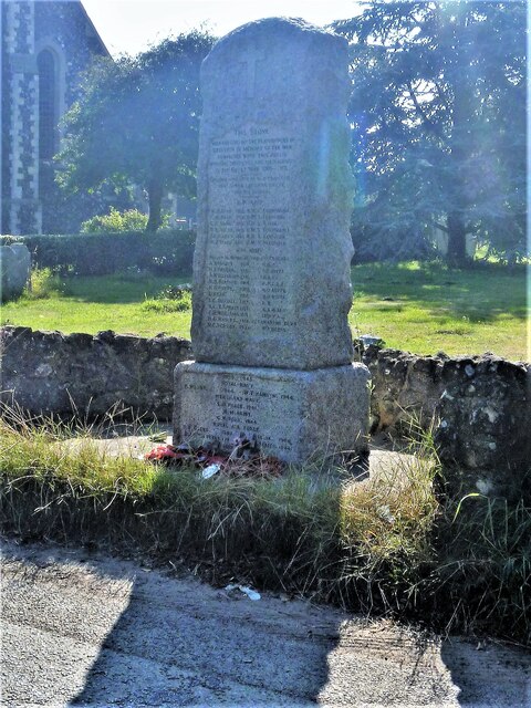
![Hillborough buildings [1] The church of St Mary the Virgin in Reculver Lane was built in 1878. Constructed, as a Gothic Revival church in the Early English style, of knapped flint with limestone dressings under a tile roof. The south doorway is a 13th century one reused from the ancient church at Reculver as are a few stones at the junction of the nave and chancel. Listed, grade II, with details at: <span class="nowrap"><a title="https://historicengland.org.uk/listing/the-list/list-entry/1318906" rel="nofollow ugc noopener" href="https://historicengland.org.uk/listing/the-list/list-entry/1318906">Link</a><img style="margin-left:2px;" alt="External link" title="External link - shift click to open in new window" src="https://s1.geograph.org.uk/img/external.png" width="10" height="10"/></span>
Hillborough is a suburb of the town of Herne Bay, a seaside town on the Thames Estuary, some 6 miles north of Canterbury and about 4 miles east of Whitstable. It neighbours the ancient villages of Herne and Reculver.](https://s1.geograph.org.uk/geophotos/07/05/84/7058417_ad51439f.jpg)
St Mary's Church is located at Grid Ref: TR2269 (Lat: 51.38, Lng: 1.198)
Administrative County: Kent
District: Canterbury
Police Authority: Kent
What 3 Words
///windmills.pokes.spurned. Near Herne Bay, Kent
Nearby Locations
Related Wikis

St Mary's Church, Reculver
St Mary's Church, Reculver, was founded in the 7th century as either a minster or a monastery on the site of a Roman fort at Reculver, which was then at...

Reculver
Reculver is a village and coastal resort about 3 miles (5 km) east of Herne Bay on the north coast of Kent in south-east England. It is in the ward of...

Regulbium
Regulbium was the name of an ancient Roman fort of the Saxon Shore in the vicinity of the modern English resort of Reculver in Kent. Its name derives from...

Chislet Windmill
Chislet windmill was a Grade II listed smock mill in Chislet, Kent, England. It was built in 1744 and burnt down on 15 October 2005. == History == The...
Nearby Amenities
Located within 500m of 51.38,1.198Have you been to St Mary's Church?
Leave your review of St Mary's Church below (or comments, questions and feedback).