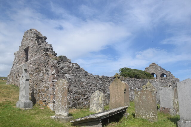
St Mary's Church

Heritage Site in Kincardineshire

Scotland

St Mary's Church

Allerdyce Street (A957), Stonehaven Looking southward.
Allerdyce Street (A957), Stonehaven Credit: Peter Wood

St Mary's Church is a historic heritage site located in the picturesque town of Kincardineshire in Scotland. The church dates back to the 12th century and is considered one of the finest examples of Romanesque architecture in the region.

The church is situated in a prominent position on a hill overlooking the town, offering stunning views of the surrounding countryside. It is built of local sandstone, which gives it a distinctive warm color and adds to its charm and character.

The exterior of St Mary's Church features a striking tower with a spire that can be seen from miles around. The tower is adorned with intricate carvings and decorative elements, showcasing the craftsmanship of the time. The church also has a beautiful arched entrance, which is flanked by stone pillars.

Inside, the church boasts a spacious nave with a wooden roof that showcases the skill of medieval carpenters. The walls are adorned with stained glass windows depicting biblical scenes and saints, adding a touch of color and spirituality to the interior.

St Mary's Church has played an important role in the religious and cultural life of the community for centuries. It continues to hold regular services and is also a popular venue for weddings and other special events.

Visitors to St Mary's Church can enjoy the peace and tranquility of the surroundings, as well as admire the architectural beauty and historical significance of this well-preserved heritage site.

If you have any feedback on the listing, please let us know in the comments section below.

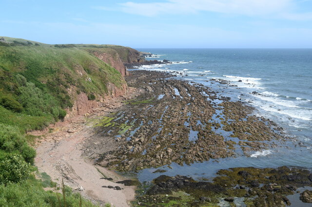
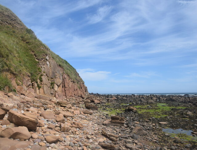
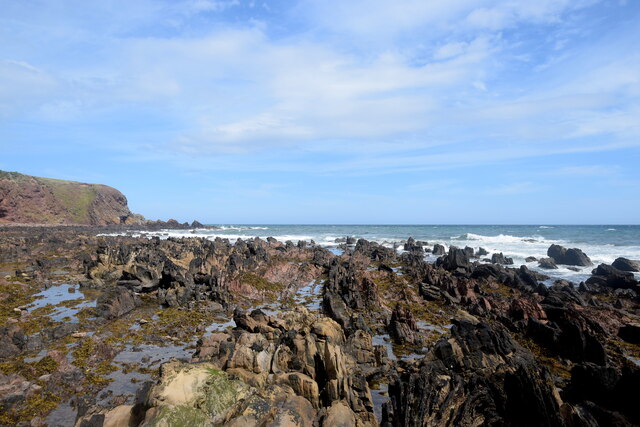
St Mary's Church Images

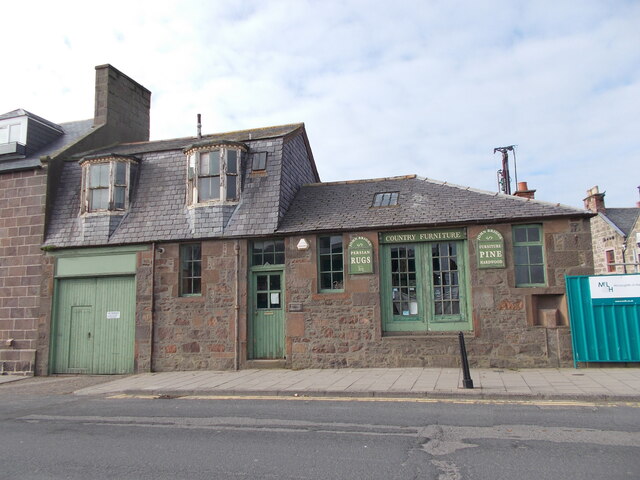
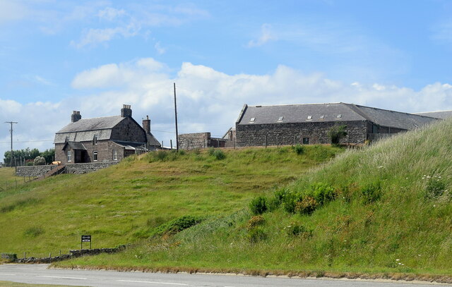
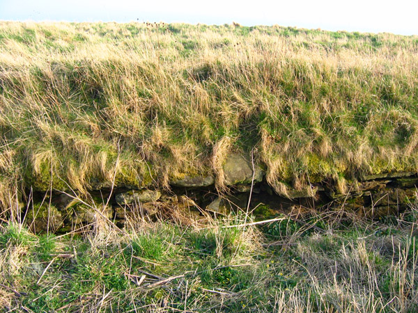
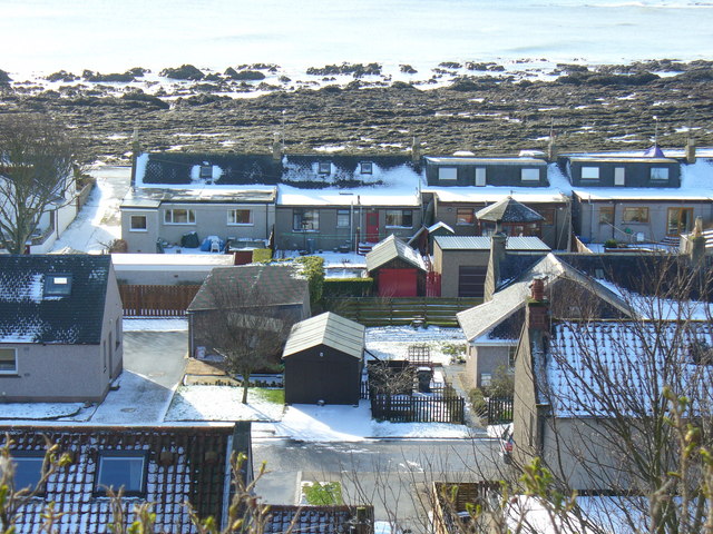
Images are sourced within 2km of 56.978/-2.19 or Grid Reference NO8887. Thanks to Geograph Open Source API. All images are credited.

Allerdyce Street (A957), Stonehaven Looking southward.
Allerdyce Street (A957), Stonehaven
Looking southward.
Stonehaven Bay A view across the bay from the harbour area towards the newer part of  the town.
Stonehaven Bay
A view across the bay from the harbour area towards the newer part of the town.
Aircraft sculpture at Stonehaven There are five such superb sculptures along the sea wall at Stonehaven. This one has a small plaque attached to the rock to say that this is a model of a Norwegian Seaplane which landed in the bay in April 1940, thus escaping the German invasion of Norway. The plane was piloted by Stein Gustavvson Abildso.
Aircraft sculpture at Stonehaven
There are five such superb sculptures along the sea wall at Stonehaven. This one has a small plaque attached to the rock to say that this is a model of a Norwegian Seaplane which landed in the bay in April 1940, thus escaping the German invasion of Norway. The plane was piloted by Stein Gustavvson Abildso.
A Scottish delicacy You may have thought that reports of the deep fried Mars bar being a delicacy in Scotland was a mere myth, but this sign on the wall of a chip shop in Stonehaven would confirm the truth. This contributor wasn't brave enough to try the dish.
A Scottish delicacy
You may have thought that reports of the deep fried Mars bar being a delicacy in Scotland was a mere myth, but this sign on the wall of a chip shop in Stonehaven would confirm the truth. This contributor wasn't brave enough to try the dish.
Old milestone John Briggs used this 'C listed' property at 19 Bridgfield until earlier in 2021.   It is at the south side of the bridge over Carron Water which is undergoing some flood defence works.  In the recess near the blue hoarding is a milestone and below it a slightly recessed stone plaque.   The bridge was built in 1781, widened in 1885 and rebuilt in 1973.
Old milestone
John Briggs used this 'C listed' property at 19 Bridgfield until earlier in 2021. It is at the south side of the bridge over Carron Water which is undergoing some flood defence works. In the recess near the blue hoarding is a milestone and below it a slightly recessed stone plaque. The bridge was built in 1781, widened in 1885 and rebuilt in 1973.
Ordnance Survey Flush Bracket G897 This bracket can be found on the wall of the Town Hall, Stonehaven.
The recorded details give a height of 5.5802 metres above sea level.
For more details see : <span class="nowrap"><a title="https://www.bench-marks.org.uk/bm357" rel="nofollow ugc noopener" href="https://www.bench-marks.org.uk/bm357">Link</a><img style="margin-left:2px;" alt="External link" title="External link - shift click to open in new window" src="https://s1.geograph.org.uk/img/external.png" width="10" height="10"/></span>
Ordnance Survey Flush Bracket G897
This bracket can be found on the wall of the Town Hall, Stonehaven. The recorded details give a height of 5.5802 metres above sea level. For more details see : LinkExternal link
Mains of Cowie The home farm for Cowie House, about 500 metres to the north east.  The farmhouse (LB9387 <span class="nowrap"><a title="http://portal.historicenvironment.scot/designation/LB9387" rel="nofollow ugc noopener" href="http://portal.historicenvironment.scot/designation/LB9387">Link</a><img style="margin-left:2px;" alt="External link" title="External link - shift click to open in new window" src="https://s1.geograph.org.uk/img/external.png" width="10" height="10"/></span> ) and extensive steadings to the right (LB9349 <span class="nowrap"><a title="http://portal.historicenvironment.scot/designation/LB9349" rel="nofollow ugc noopener" href="http://portal.historicenvironment.scot/designation/LB9349">Link</a><img style="margin-left:2px;" alt="External link" title="External link - shift click to open in new window" src="https://s1.geograph.org.uk/img/external.png" width="10" height="10"/></span> ) have separate C-listings.   In the foreground is the former A92 main road to Aberdeen.
Mains of Cowie
The home farm for Cowie House, about 500 metres to the north east. The farmhouse (LB9387 LinkExternal link ) and extensive steadings to the right (LB9349 LinkExternal link ) have separate C-listings. In the foreground is the former A92 main road to Aberdeen.
Former A92 road This was once the main road from Stonehaven to Aberdeen but has been downgraded since the Stonehaven by-pass was built.
Former A92 road
This was once the main road from Stonehaven to Aberdeen but has been downgraded since the Stonehaven by-pass was built.
Geological interest at Cowie Cliffs of the Cowie red sandstone formation (sedimentary bedrock formed approximately 426 to 431 million years ago in the Silurian Period) face onto a wave-cut platform of interbedded Castle Of Cowie sandstone and siltstone, formed at the same time.  In the foreground, much darker rocks of an intrusion of igneous magma, being part of the North Britain Siluro-Devonian calc-alkaline dyke suite: quartz, feldspar and porphyry formed approximately 359 to 444 million years ago in the Devonian and Silurian Periods.  All this happened when the land mass that was to become Scotland was south of the equator.
Geological interest at Cowie
Cliffs of the Cowie red sandstone formation (sedimentary bedrock formed approximately 426 to 431 million years ago in the Silurian Period) face onto a wave-cut platform of interbedded Castle Of Cowie sandstone and siltstone, formed at the same time. In the foreground, much darker rocks of an intrusion of igneous magma, being part of the North Britain Siluro-Devonian calc-alkaline dyke suite: quartz, feldspar and porphyry formed approximately 359 to 444 million years ago in the Devonian and Silurian Periods. All this happened when the land mass that was to become Scotland was south of the equator.
Scene at the Old Kirk Shore Red sandstone cliffs and boulders and a wave-cut platform of interbedded sandstone and mudstone.
Scene at the Old Kirk Shore
Red sandstone cliffs and boulders and a wave-cut platform of interbedded sandstone and mudstone.
Eroded sandstone cliff at the Old Kirk Shore
Wave-cut platform, Old Kirk Shore The interbedded sandstone and mudstone strata have been turned by 90 degrees and eroded to give a striking effect.
Wave-cut platform, Old Kirk Shore
The interbedded sandstone and mudstone strata have been turned by 90 degrees and eroded to give a striking effect.
Colourful sandstone cliff, Old Kirk Shore The ruin of St Mary's Church can just be seen on the hill in the background.
Colourful sandstone cliff, Old Kirk Shore
The ruin of St Mary's Church can just be seen on the hill in the background.
Wave-cut platform The vertical strata of sandstone and mudstone can be clearly seen in the blown-up photo.
Wave-cut platform
The vertical strata of sandstone and mudstone can be clearly seen in the blown-up photo.
Clubhouse, Stonehaven Golf Club
Ruin of St Mary's Chapel, Cowie The chapel associated with Cowie Castle was built in the 13th Century and suppressed after the Reformation although burials continued until the 20th Century.  Scheduled Monument SM5584 <span class="nowrap"><a title="http://portal.historicenvironment.scot/designation/SM5584" rel="nofollow ugc noopener" href="http://portal.historicenvironment.scot/designation/SM5584">Link</a><img style="margin-left:2px;" alt="External link" title="External link - shift click to open in new window" src="https://s1.geograph.org.uk/img/external.png" width="10" height="10"/></span>
Ruin of St Mary's Chapel, Cowie
The chapel associated with Cowie Castle was built in the 13th Century and suppressed after the Reformation although burials continued until the 20th Century. Scheduled Monument SM5584 LinkExternal link
Dead-house, St Mary's Chapel, Cowie The vaulted structure (also called a mort house) in the foreground was built to foil body snatchers supplying corpses to the anatomy schools at the universities in Aberdeen in the early 19th Century. B-listed: LB9383 <span class="nowrap"><a title="http://portal.historicenvironment.scot/designation/LB9383" rel="nofollow ugc noopener" href="http://portal.historicenvironment.scot/designation/LB9383">Link</a><img style="margin-left:2px;" alt="External link" title="External link - shift click to open in new window" src="https://s1.geograph.org.uk/img/external.png" width="10" height="10"/></span> .
Dead-house, St Mary's Chapel, Cowie
The vaulted structure (also called a mort house) in the foreground was built to foil body snatchers supplying corpses to the anatomy schools at the universities in Aberdeen in the early 19th Century. B-listed: LB9383 LinkExternal link .
Memorial to the Stonehaven lifeboat disaster Four of the crew of the lifeboat St George drowned while trying to enter Aberdeen Harbour after going to assist Grace Darling of Blyth, which foundered between Stonehaven and Aberdeen on 27 February 1874.
Memorial to the Stonehaven lifeboat disaster
Four of the crew of the lifeboat St George drowned while trying to enter Aberdeen Harbour after going to assist Grace Darling of Blyth, which foundered between Stonehaven and Aberdeen on 27 February 1874.
Show me another place!

St Mary's Church is located at Grid Ref: NO8887 (Lat: 56.978, Lng: -2.19)

Unitary Authority: Aberdeenshire

Police Authority: North East

What 3 Words

///daring.derailed.intruders. Near Stonehaven, Aberdeenshire

Related Wikis

Chapel of St Mary and St Nathalan

The Chapel of St. Mary and St. Nathalan is a ruined chapel overlooking the North Sea immediately north of Stonehaven, in the Mearns of Scotland, along...

Cowie Castle

Cowie Castle is a ruined fortress in Aberdeenshire, Scotland. The site lies at the northern end of Stonehaven on the North Sea coast. To the immediate...

Cowie, Aberdeenshire

Cowie is an historic fishing village in Kincardineshire, Scotland. This village has existed since the Middle Ages, but in current times it is effectively...

Megray Hill

Megray Hill is a low-lying coastal mountainous landform in Aberdeenshire, Scotland within the Mounth Range of the Grampian Mountains. The peak elevation...

Nearby Amenities

Located within 500m of 56.978,-2.19
Source: PGS
Lat/Long: 56.9745437/-2.1941814
Source: PGS
Lat/Long: 56.9747653/-2.1939097
Source: PGS
Lat/Long: 56.9749715/-2.1934825
Source: PGS
Lat/Long: 56.9750279/-2.1933132
Source: PGS
Lat/Long: 56.9751321/-2.1927739
Source: PGS
Lat/Long: 56.9751407/-2.1924635
Source: PGS
Lat/Long: 56.9753696/-2.1921892
Source: PGS
Lat/Long: 56.9755817/-2.1919447
Source: PGS
Lat/Long: 56.9759248/-2.1916543
Source: PGS
Lat/Long: 56.9762232/-2.1911222
Source: PGS
Lat/Long: 56.9766169/-2.1898754
Source: PGS
Lat/Long: 56.9766007/-2.1896528
Source: PGS
Lat/Long: 56.9765665/-2.1892296
Source: PGS
Lat/Long: 56.9765375/-2.1886292
Source: PGS
Lat/Long: 56.9764085/-2.1881213
Source: PGS
Lat/Long: 56.9766413/-2.1872437
Source: PGS
Lat/Long: 56.9766642/-2.1872105
Source: PGS
Lat/Long: 56.9766805/-2.1872193
Source: PGS
Lat/Long: 56.9768591/-2.1872356
Source: PGS
Lat/Long: 56.9772834/-2.1877226
Source: PGS
Lat/Long: 56.9775528/-2.1884963
Source: PGS
Lat/Long: 56.977969/-2.1884708
Source: PGS
Lat/Long: 56.9781575/-2.1883599
Source: PGS
Lat/Long: 56.9786758/-2.1875175
Source: PGS
Lat/Long: 56.9788142/-2.1865835
Source: PGS
Lat/Long: 56.9789953/-2.1853231
Source: PGS
Lat/Long: 56.97902/-2.1841882
Source: PGS
Lat/Long: 56.9785724/-2.1837775
Source: PGS
Lat/Long: 56.9781122/-2.1831058
Source: PGS
Lat/Long: 56.9786612/-2.1820594
Motorway Junction
Stonehaven North Junction
Lat/Long: 56.980875/-2.1946947
Site of Cowie Castle
Historic: ruins
Wikidata: Q1138213
Wikipedia: en:Cowie Castle
Lat/Long: 56.975315/-2.1929822
Ruthery Head
Place: locality
Lat/Long: 56.9767187/-2.1874614
Craigeven Bay
Natural: bay
Source: NLS-OS-1st_Series
Lat/Long: 56.9775256/-2.1854444
Material: wood
Power: pole
Lat/Long: 56.980928/-2.1955702
Material: wood
Power: pole
Lat/Long: 56.980468/-2.1949615
Material: wood
Power: pole
Lat/Long: 56.9799571/-2.1944885
Material: wood
Power: pole
Lat/Long: 56.9794301/-2.1940155
Material: wood
Power: pole
Lat/Long: 56.9790521/-2.1936104
Power: pole
Lat/Long: 56.978821/-2.1934726
Communication Mobile Phone: yes
Man Made: mast
Tower Type: communication
Lat/Long: 56.9772052/-2.1959813
The data included in this document is from www.openstreetmap.org. The data is made available under ODbL.

Have you been to St Mary's Church?

Leave your review of St Mary's Church below (or comments, questions and feedback).