Short Ditch

Heritage Site in Radnorshire

Wales

Short Ditch

Upland above the Teme Valley Acres of sheep pasture and a few stands of conifers. And a bit of weather coming in.
Upland above the Teme Valley Credit: Jeremy Bolwell

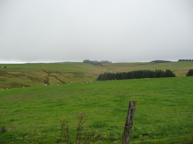
Short Ditch is a heritage site located in Radnorshire, Wales. It is an ancient earthwork that dates back to the Iron Age, making it a significant historical landmark in the region. The ditch is approximately 300 meters long and 3 meters wide, with a depth of around 1.5 meters.

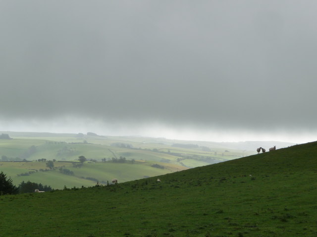
The purpose of Short Ditch is still debated among historians and archaeologists. Some believe it served as a defensive fortification, while others suggest it was used for agricultural purposes. The site is surrounded by picturesque countryside, adding to its charm and historical appeal.

Short Ditch is a popular destination for history enthusiasts, hikers, and nature lovers alike. Visitors can explore the site and learn about its rich history through interpretive signs and informational displays. The area is also home to a variety of wildlife, making it a peaceful and scenic spot to spend a day outdoors.

Overall, Short Ditch is a fascinating heritage site that offers a glimpse into the ancient past of Radnorshire and provides visitors with a unique and educational experience.

If you have any feedback on the listing, please let us know in the comments section below.

Short Ditch Images

Images are sourced within 2km of 52.362/-3.197 or Grid Reference SO1874. Thanks to Geograph Open Source API. All images are credited.

Upland above the Teme Valley Acres of sheep pasture and a few stands of conifers. And a bit of weather coming in.
Upland above the Teme Valley
Acres of sheep pasture and a few stands of conifers. And a bit of weather coming in.
Hillside north of Llangynllo Some sunshine plays over distant slopes but the cloud base skims the hills and the sheep seem to be supporting each other in the adverse conditions.
Hillside north of Llangynllo
Some sunshine plays over distant slopes but the cloud base skims the hills and the sheep seem to be supporting each other in the adverse conditions.
Pond by The Heath An interesting pond fed by a spring above the head of Cwm yr Eurych. The floating plants are Water Crowfoot. The distant horizon is strangely flat, a feature of this great dissected plateau.
Pond by The Heath
An interesting pond fed by a spring above the head of Cwm yr Eurych. The floating plants are Water Crowfoot. The distant horizon is strangely flat, a feature of this great dissected plateau.
Water Crowfoot A fine spread of this interesting water plant. From a distance the masses of floating flowers looked artificial.
Water Crowfoot
A fine spread of this interesting water plant. From a distance the masses of floating flowers looked artificial.
Sheep pasture Sheep grazing the upland pasture, with a view to Fron Rocks in the distance.
Sheep pasture
Sheep grazing the upland pasture, with a view to Fron Rocks in the distance.
Head of the cwm Improved grassland running out at the head of the cwm above Hen Hafod.
Head of the cwm
Improved grassland running out at the head of the cwm above Hen Hafod.
Stream ford on Glyndwr's Way The pool here was busy with maturing tadpoles. Great to see them!
Stream ford on Glyndwr's Way
The pool here was busy with maturing tadpoles. Great to see them!
On Glyndwr's Way With distant views off into England.
On Glyndwr's Way
With distant views off into England.
On Glyndwr's Way near Pool Hill Lovely moorland walking here. Reminiscent of the Berwyns maybe. Though I don't like comparisons.
On Glyndwr's Way near Pool Hill
Lovely moorland walking here. Reminiscent of the Berwyns maybe. Though I don't like comparisons.
On Glyndwr's Way below Pool Hill A solo walker scoots up the path here ahead of us.
On Glyndwr's Way below Pool Hill
A solo walker scoots up the path here ahead of us.
View down the valley below Pool Hill from Glyndwr's Way Nice farms down there.
View down the valley below Pool Hill from Glyndwr's Way
Nice farms down there.
Glyndwr's Way near Pool Hill Sunshine and then cloud shadows.
Glyndwr's Way near Pool Hill
Sunshine and then cloud shadows.
View from Glyndwr's Way A pool lies down there by the plantation edge.
View from Glyndwr's Way
A pool lies down there by the plantation edge.
On Glyndwr's Way I'm heading east here with views into England and even Titterstone Clee Hill is visible at distant Ludlow.
On Glyndwr's Way
I'm heading east here with views into England and even Titterstone Clee Hill is visible at distant Ludlow.
Scene beside Glyndwr's Way Lovely view off to the west.
Scene beside Glyndwr's Way
Lovely view off to the west.
On Glyndwr's Way at the Short Ditch Interesting upland landscape.
On Glyndwr's Way at the Short Ditch
Interesting upland landscape.
Upland view beside Glyndwr's Way Excellent distant views today.
Upland view beside Glyndwr's Way
Excellent distant views today.
On Glyndwr's Way Easy upland walking on a broad track here.
On Glyndwr's Way
Easy upland walking on a broad track here.
Show me another place!

Short Ditch is located at Grid Ref: SO1874 (Lat: 52.362, Lng: -3.197)

Unitary Authority: Powys

Police Authority: Dyfed Powys

What 3 Words

///salads.shops.juicy. Near Knighton, Powys

Nearby Locations

Lanlluest Short Ditch

Related Wikis

Beacon Hill, Powys

Beacon Hill (Welsh: Mynydd Disglair) is a hill in the county of Radnorshire, Wales. It lies within the Powys unitary council area. It is located north...

Llangynllo railway station

Llangynllo railway station is a countryside stop in Powys about 5 miles west of Knighton, on the Heart of Wales Line. The station is located 1.4 miles...

Llanbister Road railway station

Llanbister Road railway station is a countryside stop about 5 miles (8 km) from the village of Llanbister, Powys, Wales. The station is 41+3⁄4 miles (67...

Llangunllo

Llangunllo (sometimes Llangynllo) is a village and community in central Powys (formerly in Radnorshire), Wales, located about 5 miles west of Knighton...

Nearby Amenities

Located within 500m of 52.362,-3.197
The data included in this document is from www.openstreetmap.org. The data is made available under ODbL.

Have you been to Short Ditch?

Leave your review of Short Ditch below (or comments, questions and feedback).