Shinriggie

Heritage Site in Wigtownshire

Scotland

Shinriggie

Storm damage in the woods at High Craigcaffie
Storm damage in the woods at High Craigcaffie Credit: Oliver Dixon

Shinriggie is a historic heritage site located in Wigtownshire, Scotland. This site is known for its well-preserved ruins of a medieval castle, which dates back to the 14th century. The castle was originally built by the McChlery family and later passed into the hands of the Gordon family.

The ruins of Shinriggie Castle stand on a hill overlooking the surrounding countryside, offering stunning views of the landscape. The castle itself consists of a central tower with walls that are several feet thick, as well as remnants of outbuildings and a courtyard.

Visitors to Shinriggie can explore the ruins of the castle and imagine what life was like for the inhabitants centuries ago. The site is also surrounded by beautiful countryside, making it a popular destination for hikers and nature enthusiasts.

Shinriggie is a significant historical site in Wigtownshire, showcasing the rich history of the region and providing a glimpse into the past. It is a must-visit for those interested in medieval architecture and Scottish history.

If you have any feedback on the listing, please let us know in the comments section below.

Shinriggie Images

Images are sourced within 2km of 54.957/-4.975 or Grid Reference NX0966. Thanks to Geograph Open Source API. All images are credited.

Storm damage in the woods at High Craigcaffie
Relics of bombing range This massive concrete wall (partly obscured by more recent buildings) and arrow were part of a WWII bombing range and can be seen just off the road from Innermessan to Penwhirn.
Relics of bombing range
This massive concrete wall (partly obscured by more recent buildings) and arrow were part of a WWII bombing range and can be seen just off the road from Innermessan to Penwhirn.
World War II Bombing Range A closer view of the massive concrete wall which formed part of a World War II bombing range just off the road from Innermessan to Penwhirn. More modern structures of unknown purpose have been built on the south side of the wall.
World War II Bombing Range
A closer view of the massive concrete wall which formed part of a World War II bombing range just off the road from Innermessan to Penwhirn. More modern structures of unknown purpose have been built on the south side of the wall.
World War II building This unlovely building stands beside the Innermessan to Penwhirn road and was almost certainly associated with the World War II bombing range in some way.
World War II building
This unlovely building stands beside the Innermessan to Penwhirn road and was almost certainly associated with the World War II bombing range in some way.
Braid Fell Seen from the Innermessan to Penwhirn road
Braid Fell
Seen from the Innermessan to Penwhirn road
Top of the woods by High Craigcaffie Seen from the lower slopes of Braid Fell.
Top of the woods by High Craigcaffie
Seen from the lower slopes of Braid Fell.
Wall at bombing range on Braid Fell This huge wall is the dominant structure of the World War II bombing range.
Wall at bombing range on Braid Fell
This huge wall is the dominant structure of the World War II bombing range.
Cattle Grid One of many on the way to Penwhirn Reservoir.
Cattle Grid
One of many on the way to Penwhirn Reservoir.
Hill Road to Penwhirn Hill road with a view towards the Target Wall.
Hill Road to Penwhirn
Hill road with a view towards the Target Wall.
Concrete Arrow These were built as a guide from the air for practice on the target wall,this one is less than a hundred yards from the wall.
Concrete Arrow
These were built as a guide from the air for practice on the target wall,this one is less than a hundred yards from the wall.
High Craigcaffie Situated on a hillside high above Loch Ryan.
High Craigcaffie
Situated on a hillside high above Loch Ryan.
Cottage on the lane to Beoch Farm.
Rhins of Galloway on the eastern shores of Loch Ryan.
Lane to Drummuckloch Farm
Shepherd , Beoch Herding lambs and sheep on Beoch Farm.
Shepherd , Beoch
Herding lambs and sheep on Beoch Farm.
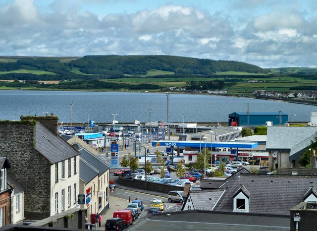
View from Several Moor Looking towards Loch Ryan and Stranraer.
View from Several Moor
Looking towards Loch Ryan and Stranraer.
Several Burn Ruined dry stone wall follows the winds of the burn.
Several Burn
Ruined dry stone wall follows the winds of the burn.
View from Beoch Hill P&O ferry leaving Cairnryan for Larne.
View from Beoch Hill
P&O ferry leaving Cairnryan for Larne.
Show me another place!

Shinriggie is located at Grid Ref: NX0966 (Lat: 54.957, Lng: -4.975)

Unitary Authority: Dumfries and Galloway

Police Authority: Dumfries and Galloway

What 3 Words

///dogs.deny.illogical. Near Cairnryan, Dumfries & Galloway

Related Wikis

Inch, Dumfries and Galloway

Inch is a civil parish in Dumfries and Galloway, southwest Scotland. It lies on the shore of Loch Ryan, in the traditional county of Wigtownshire.The...

Cairnryan

Cairnryan (Scots: The Cairn; Scottish Gaelic: Càrn Rìoghain or Machair an Sgithich) is a village in the historical county of Wigtownshire, Dumfries and...

Cairnryan Harbour

Cairnryan Harbour is a roll-on ferry terminal on Loch Ryan in south west Scotland north of Stranraer. In World War II it was developed as an emergency...

Loch Ryan

Loch Ryan (Scottish Gaelic: Loch Rìoghaine, pronounced [l̪ˠɔx ˈrˠiː.ɛɲə]) is a Scottish sea loch that acts as an important natural harbour for shipping...

Have you been to Shinriggie?

Leave your review of Shinriggie below (or comments, questions and feedback).