Pen-y-Gwryd

Heritage Site in Caernarfonshire

Wales

Pen-y-Gwryd

Lower part of Pyg track on Snowdon, 1962 The Ford Anglia in the photo has pulled off the road and turned round a short distance up the PyG track - probably too far to be legal on this footpath.
Lower part of Pyg track on Snowdon, 1962 Credit: David Hawgood

The requested URL returned error: 429 Too Many Requests

If you have any feedback on the listing, please let us know in the comments section below.
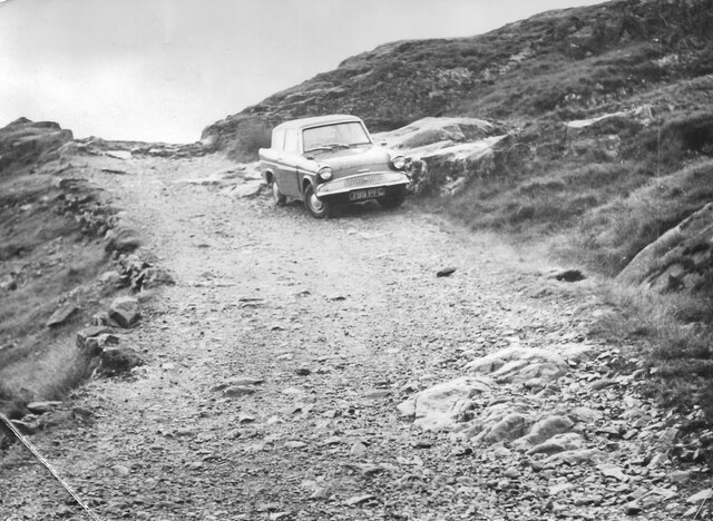
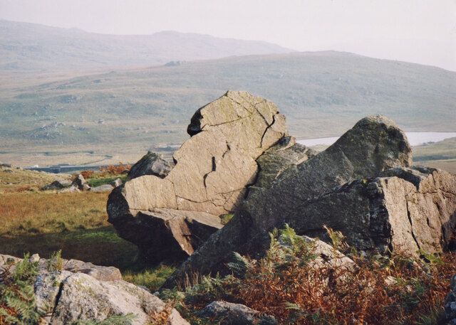
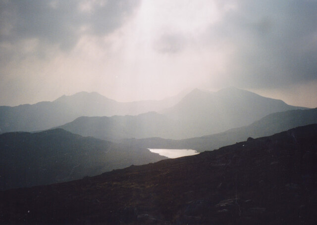
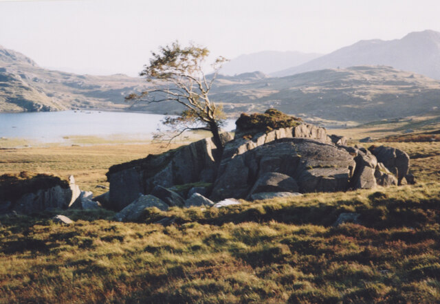
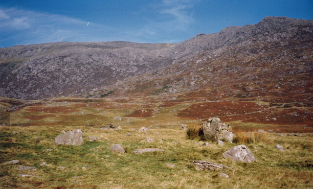
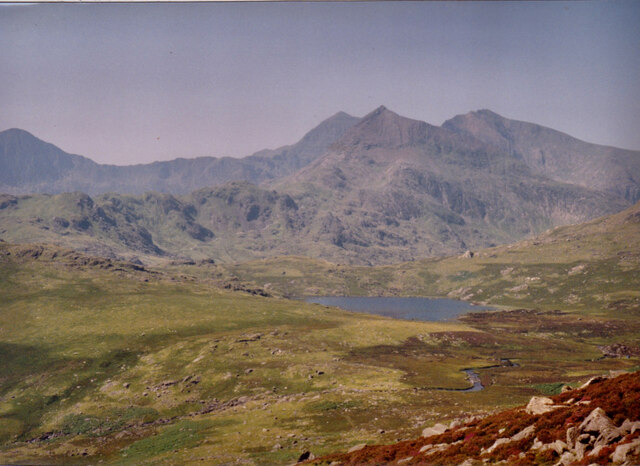
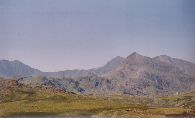
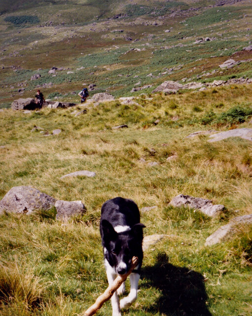
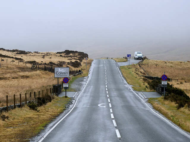
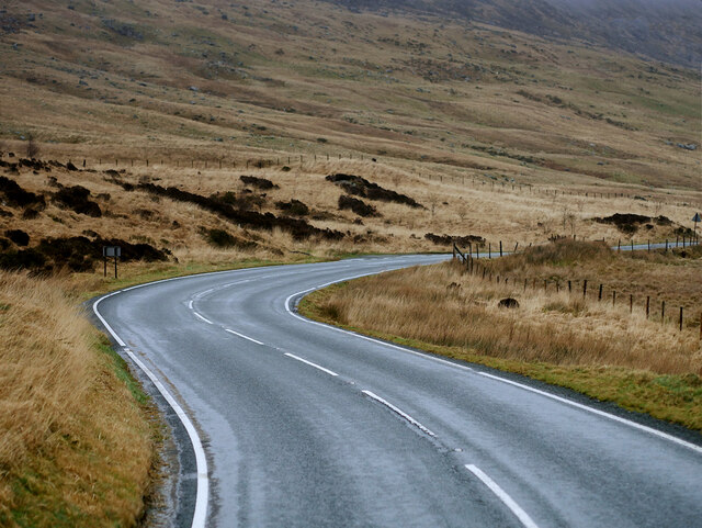
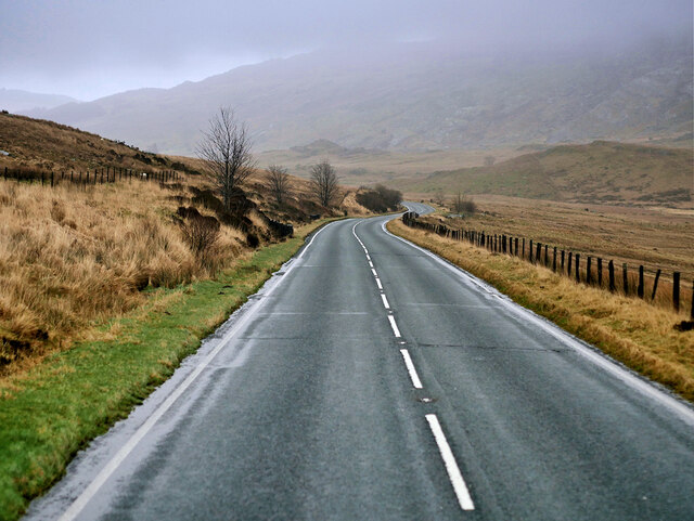
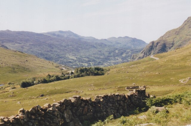
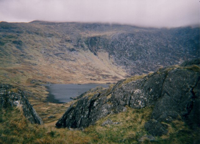
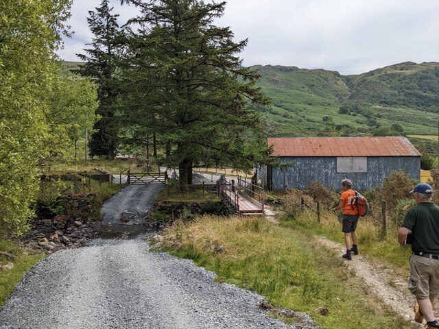
Pen-y-Gwryd Images

Images are sourced within 2km of 53.083/-4.001 or Grid Reference SH6655. Thanks to Geograph Open Source API. All images are credited.

Lower part of Pyg track on Snowdon, 1962 The Ford Anglia in the photo has pulled off the road and turned round a short distance up the PyG track - probably too far to be legal on this footpath.
Lower part of Pyg track on Snowdon, 1962
The Ford Anglia in the photo has pulled off the road and turned round a short distance up the PyG track - probably too far to be legal on this footpath.
Glacial erratics on the lower slopes of Glyder Fach These overlook the valley of Dyffryn Mymbyr where the A4086 crosses Nant Gwyryd, a river which flows out of Llyn Cwmffynnon. The lake on the right is the man made Llyn Lockwood, named after the owner of Pen-y-Gwryd Hotel it was created in the 1920s for the sporting use of the guests. During the past decade it has been uninspiringly renamed as Llyn Pen-y-Gwryd.
Glacial erratics on the lower slopes of Glyder Fach
These overlook the valley of Dyffryn Mymbyr where the A4086 crosses Nant Gwyryd, a river which flows out of Llyn Cwmffynnon. The lake on the right is the man made Llyn Lockwood, named after the owner of Pen-y-Gwryd Hotel it was created in the 1920s for the sporting use of the guests. During the past decade it has been uninspiringly renamed as Llyn Pen-y-Gwryd.
Llyn Cwmffynnon and the Snowdon Massif from the slopes of Glyder Fach
Glacial erratics above Llyn Cwm Ffynnon The tree - one a very few at this elevation - has benefitted from the shelter afforded by these large borders.
Glacial erratics above Llyn Cwm Ffynnon
The tree - one a very few at this elevation - has benefitted from the shelter afforded by these large borders.
Glacial erratics alongside the Miners' Track In the background are the slopes of Glyder Fach and Glyder Fawr.
Glacial erratics alongside the Miners' Track
In the background are the slopes of Glyder Fach and Glyder Fawr.
Afon Nant Gwryd flowing from Llyn Cwmffynnon The image taken from the Miners' Track. The Snowdon Horseshoe forms the background.
Afon Nant Gwryd flowing from Llyn Cwmffynnon
The image taken from the Miners' Track. The Snowdon Horseshoe forms the background.
View due South parallel with the shores of Llyn Cwm Ffynnon The rock bar at the southern end of the lake separates Cwm Ffynnon from the Bwlch Llanberis pass  The Snowdon Horseshoe forms the background.
View due South parallel with the shores of Llyn Cwm Ffynnon
The rock bar at the southern end of the lake separates Cwm Ffynnon from the Bwlch Llanberis pass The Snowdon Horseshoe forms the background.
Leader of the pack approaching a ladder stile on the Miners' Track The remainder of his pack are just making their appearance.
Leader of the pack approaching a ladder stile on the Miners' Track
The remainder of his pack are just making their appearance.
The Pen-y-gwryd Hotel at the junction of the A498 and the A4086 The valley beyond is Nant Gwynant.
The Pen-y-gwryd Hotel at the junction of the A498 and the A4086
The valley beyond is Nant Gwynant.
YHA Snowdon Pen-y-Pass The hostel is at the summit of the Llanberis Pass.
YHA Snowdon Pen-y-Pass
The hostel is at the summit of the Llanberis Pass.
Pass of Llanberis near Bwylch y Gwyddel Retaining walls protecting the road from landslips.
Pass of Llanberis near Bwylch y Gwyddel
Retaining walls protecting the road from landslips.
A4086 passing Pen-y-Gwrd Hotel The A4086 runs for almost 18 miles between Caernarfon and Capel Curig. It is a popular tourist route as it passes through some of the most memorable and famous parts of Snowdonia including the Llanberis Pass.
A4086 passing Pen-y-Gwrd Hotel
The A4086 runs for almost 18 miles between Caernarfon and Capel Curig. It is a popular tourist route as it passes through some of the most memorable and famous parts of Snowdonia including the Llanberis Pass.
A4086, Conwy The A4086 runs for almost 18 miles between Caernarfon and Capel Curig. It is a popular tourist route as it passes through some of the most memorable and famous parts of Snowdonia including the Llanberis Pass.
A4086, Conwy
The A4086 runs for almost 18 miles between Caernarfon and Capel Curig. It is a popular tourist route as it passes through some of the most memorable and famous parts of Snowdonia including the Llanberis Pass.
A4086 The A4086 runs for almost 18 miles between Caernarfon and Capel Curig. It is a popular tourist route as it passes through some of the most memorable and famous parts of Snowdonia including the Llanberis Pass.
A4086
The A4086 runs for almost 18 miles between Caernarfon and Capel Curig. It is a popular tourist route as it passes through some of the most memorable and famous parts of Snowdonia including the Llanberis Pass.
A4086 between Pont y Pas and Capel Curig The A4086 runs for almost 18 miles between Caernarfon and Capel Curig. It is a popular tourist route as it passes through some of the most memorable and famous parts of Snowdonia including the Llanberis Pass.
A4086 between Pont y Pas and Capel Curig
The A4086 runs for almost 18 miles between Caernarfon and Capel Curig. It is a popular tourist route as it passes through some of the most memorable and famous parts of Snowdonia including the Llanberis Pass.
Shelter Belt around the Pen-y-Gwyryd Hotel The hotel is positioned on an exposed site at the interfluve of the Gwryd and Gwynant valleys. The peak directly ahead is Y Cnicht.
Shelter Belt around the Pen-y-Gwyryd Hotel
The hotel is positioned on an exposed site at the interfluve of the Gwryd and Gwynant valleys. The peak directly ahead is Y Cnicht.
Llyn Cwmffynnon and the eastern slopes of Glyder Fach
New ford, new temporary footbridge across Afon Glaslyn There is maintenance work underway on the huge pipeline (see <a title="https://www.geograph.org.uk/photo/7633083)" href="https://www.geograph.org.uk/photo/7633083)">Link</a> which serves the hydro-power station. The new crossings are to enable access for this. The temporary footbridge will eventually be replaced by a new footbridge and the ancient slate 'clapper' bridge will be retired, though not removed.
New ford, new temporary footbridge across Afon Glaslyn
There is maintenance work underway on the huge pipeline (see Link which serves the hydro-power station. The new crossings are to enable access for this. The temporary footbridge will eventually be replaced by a new footbridge and the ancient slate 'clapper' bridge will be retired, though not removed.
Show me another place!

Pen-y-Gwryd is located at Grid Ref: SH6655 (Lat: 53.083, Lng: -4.001)

Unitary Authority: Gwynedd

Police Authority: North Wales

What 3 Words

///surcharge.silly.ages. Near Llanberis, Gwynedd

Related Wikis

Arfon (cantref)

Arfon (or Arvon) was a mediaeval Welsh cantref in north-west Wales. It was the core of the kingdom of Gwynedd. Later it was included in the new county...

Nant Cynnyd

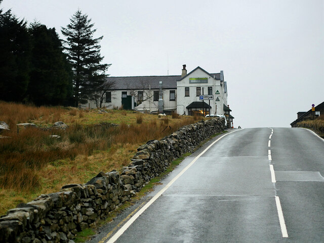
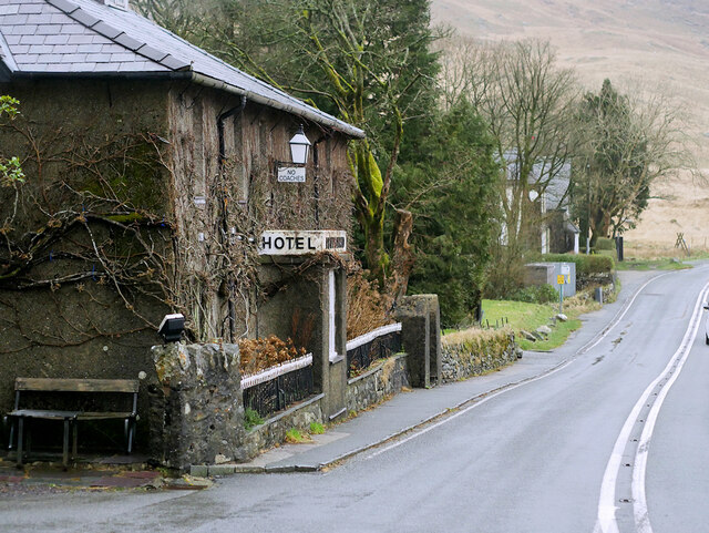
The Nant y Cynnyd is a small river in Gwynedd, north Wales, starting near the Pen-y-Gwryd hotel near Capel Curig. The Ordnance Survey map is not completely...

District of Arfon

The Borough of Arfon was local government district with borough status from 1974 to 1996, being one of five districts in the county of Gwynedd, north-west...
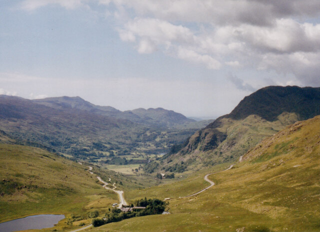
Pen-y-Gwryd

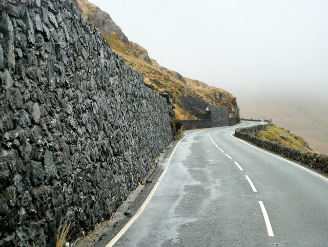
Pen-y-Gwryd is a pass at the head of Nantygwryd and Nant Cynnyd rivers close to the foot of Snowdon in Gwynedd, Wales. The area is located at the junction...

Nearby Amenities

Located within 500m of 53.083,-4.001
Created By: Merkaartor 0.12
Lat/Long: 53.0787159/-4.0030649
Bus Stop
Bus: yes
Naptan AtcoCode: 5400AWD70750
Naptan NaptanCode: gwngamd
Public Transport: platform
Lat/Long: 53.0820622/-4.0018961
WWII Gun Emplacement
Building: bunker
Bunker Type: pillbox
Military: bunker
Source: survey
Lat/Long: 53.0799202/-4.0035886
Post Box
Created By: Merkaartor 0.12
Source: survey
Lat/Long: 53.0824321/-4.001727
Barrier: stile
Lat/Long: 53.083696/-4.0005821
Vending Machine
Vending: parking_tickets
Lat/Long: 53.0837686/-3.9998829
Barrier: stile
Lat/Long: 53.0841864/-3.9957949
Barrier: stile
Lat/Long: 53.0850936/-4.0018904
Barrier: kissing_gate
Lat/Long: 53.0796741/-4.0030964
ROMAN MARCHING CAMP
Historic: archaeological_site
Lat/Long: 53.0816008/-4.0032596
Barrier: stile
Lat/Long: 53.0797405/-4.0026515
Barrier: stile
Lat/Long: 53.0812403/-4.0016637
Power: pole
Lat/Long: 53.0788891/-4.0031575
Power: substation
Lat/Long: 53.083101/-4.00129
Historic: milestone
Lat/Long: 53.0811468/-4.0025881
Direction: 215
Generator Method: photovoltaic
Generator Output Electricity: yes
Generator Solar Modules: 16
Generator Source: solar
Generator Type: solar_photovoltaic_panel
Location: roof
Power: generator
Lat/Long: 53.0832731/-4.0012839
Ford: yes
Lat/Long: 53.0809995/-4.0010195
The data included in this document is from www.openstreetmap.org. The data is made available under ODbL.

Have you been to Pen-y-Gwryd?

Leave your review of Pen-y-Gwryd below (or comments, questions and feedback).