Penystymllyn
Heritage Site in Caernarfonshire
Wales
Penystymllyn

Penystymllyn, located in Caernarfonshire, Wales, is a charming heritage site that offers a glimpse into the rich history and cultural heritage of the region. Situated in the picturesque countryside, Penystymllyn is known for its well-preserved historic buildings and stunning natural surroundings.
The main attraction of Penystymllyn is its 17th-century manor house, which stands as a testament to the architectural style of the era. The manor house features intricate stone carvings, traditional Welsh slate roofs, and beautifully maintained gardens. Visitors can explore the interior of the house, which has been carefully restored to its original grandeur, showcasing period furniture and artworks.
In addition to the manor house, Penystymllyn boasts a range of other historic buildings, including a quaint church dating back to the 14th century. The church is adorned with stained glass windows and houses ancient artifacts, providing visitors with an insight into the religious practices of the past.
The surrounding landscape of Penystymllyn offers breathtaking views of the countryside, with rolling hills, meandering rivers, and lush green fields. Visitors can take leisurely walks along the well-maintained footpaths, enjoying the tranquil atmosphere and observing the local flora and fauna.
Penystymllyn is also a popular venue for cultural events and festivals, celebrating the region's vibrant traditions and customs. These events often showcase traditional music, dance, and crafts, giving visitors an opportunity to immerse themselves in the local culture.
Overall, Penystymllyn in Caernarfonshire is a captivating heritage site that offers a unique blend of history, architecture, and natural beauty. Whether you are a history enthusiast or simply seeking a peaceful retreat in the countryside, Penystymllyn is sure to leave a lasting impression.
If you have any feedback on the listing, please let us know in the comments section below.
Penystymllyn Images
Images are sourced within 2km of 52.926/-4.222 or Grid Reference SH5038. Thanks to Geograph Open Source API. All images are credited.


Penystymllyn is located at Grid Ref: SH5038 (Lat: 52.926, Lng: -4.222)
Unitary Authority: Gwynedd
Police Authority: North Wales
What 3 Words
///terminal.screening.drawn. Near Criccieth, Gwynedd
Nearby Locations
Related Wikis

Penllyn, Gwynedd
Penllyn is a former civil parish in the Welsh county of Gwynedd. The parish was created in 1894 from the part of Criccieth parish that lay outside the...
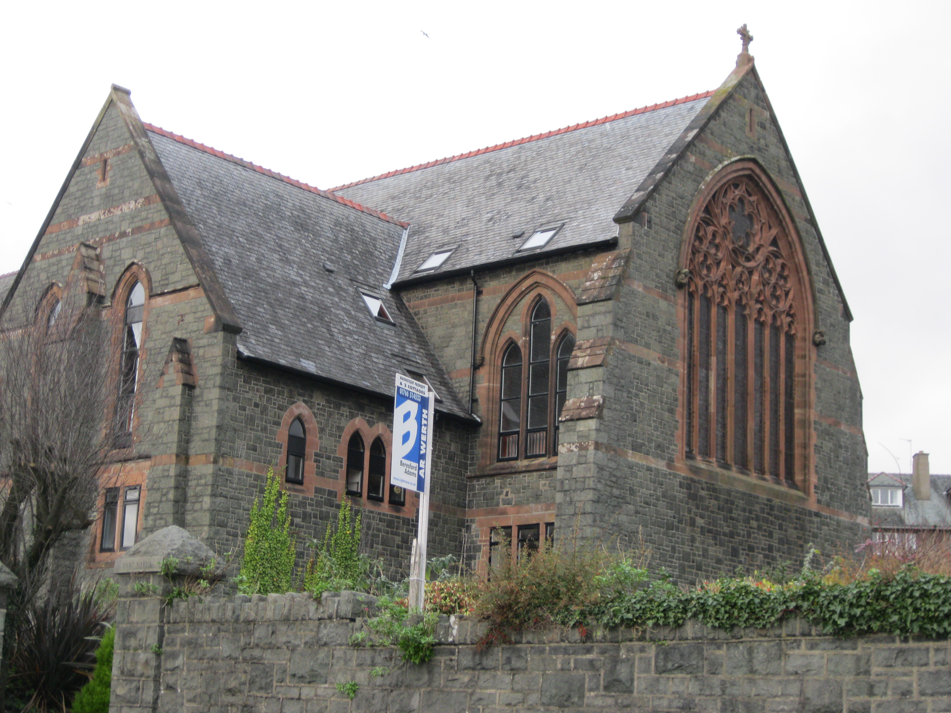
St Deiniol's Church, Criccieth
St Deiniol's Church (Welsh: Eglwys Deiniol Sant), was a church in Criccieth, Gwynedd, Wales (grid reference SH500381). It was built between 1884 and 1887...

Ystumllyn
Ystumllyn is a Grade II* listed house in Criccieth, Wales. Founded in the late-16th-century, and significantly expanded in the early-18th-century, it is...

Criccieth Castle
Criccieth Castle (Welsh: Castell Cricieth; [kastɛɬ ˈkrɪkjɛθ]) is a ruined thirteenth-century castle in Criccieth, Gwynedd, Wales. It is located on a rocky...

Criccieth railway station
Criccieth railway station serves the seaside town of Criccieth on the Llŷn Peninsula in Gwynedd, Wales. == History == The station was opened on 2 September...
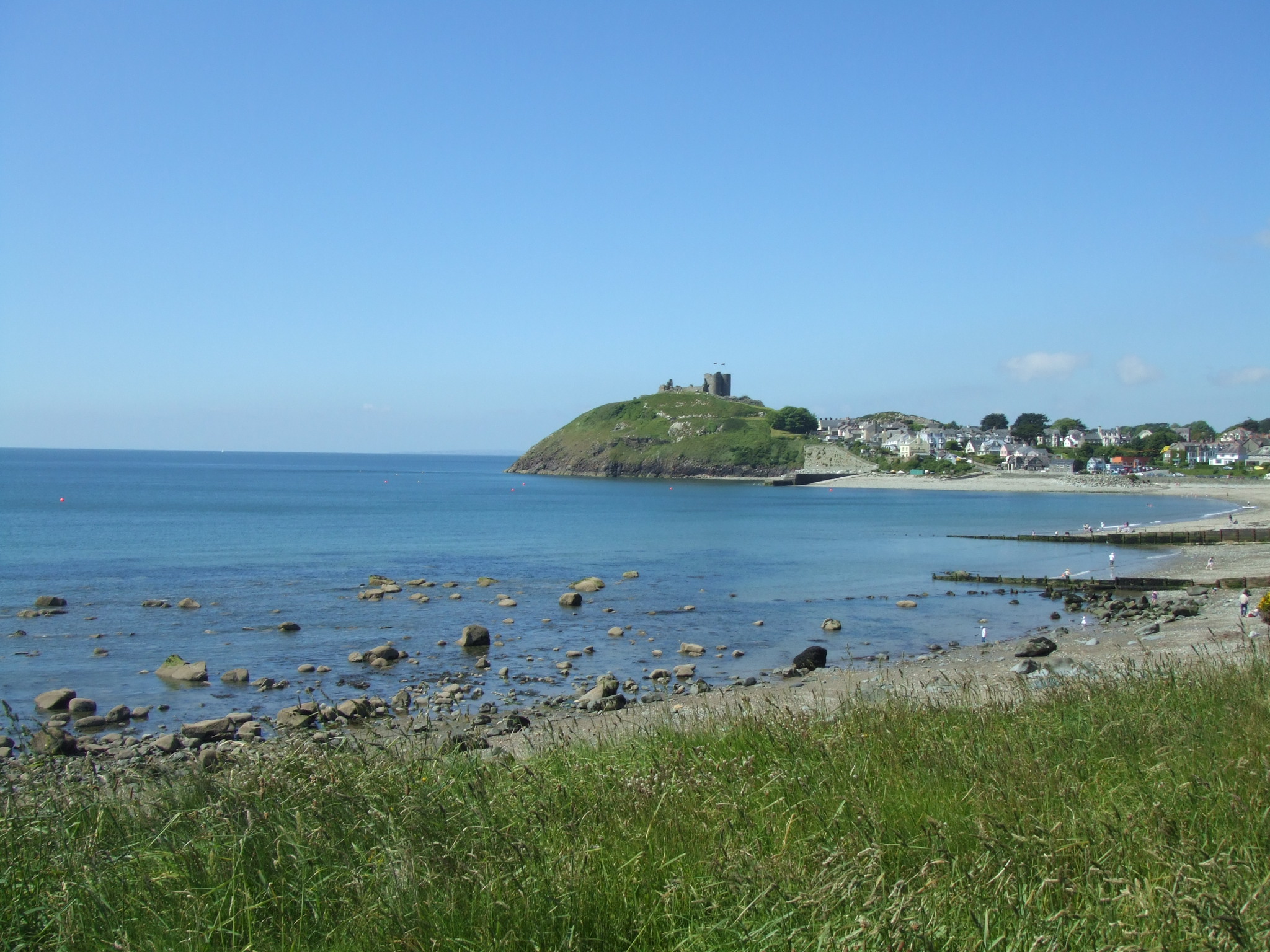
Criccieth
Criccieth (Welsh: Cricieth [ˈkrɪkjɛθ] ) is a town and community in Gwynedd, Wales, on the boundary between the Llŷn Peninsula and Eifionydd. The town is...

Black Rock Halt railway station
Black Rock Halt was a railway station in Gwynedd, located between Criccieth and Porthmadog on the former Aberystwith and Welsh Coast Railway. It served...

St Cynhaearn's Church, Ynyscynhaearn
St Cynhaearn's Church is a redundant church standing in an isolated position on Ynyscynhaearna, a former island in Llyn (Lake) Ystumllyn, 900 metres (980...
Nearby Amenities
Located within 500m of 52.926,-4.222Have you been to Penystymllyn?
Leave your review of Penystymllyn below (or comments, questions and feedback).