Park Hall

Heritage Site in Derbyshire Bolsover

England

Park Hall

Electric vehicle charging points Woodall services.  As with most (if not all) chargers at UK motorway services they are no longer branded by Ecotricity (see <a href="https://www.geograph.org.uk/photo/6993959">SK4780 : Electric Vehicle Charging Points, Woodall Services</a>).  These are provided by "applegreen electric"
Electric vehicle charging points Credit: David Lally

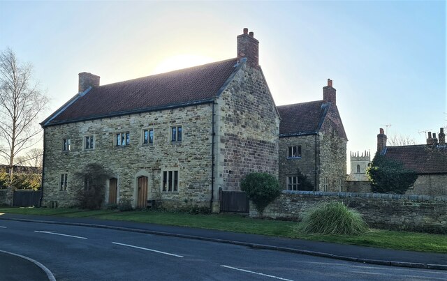
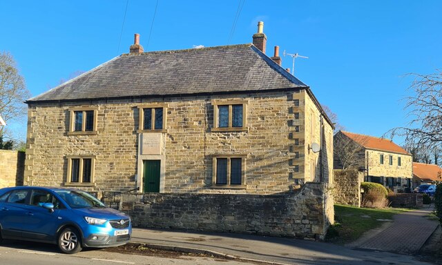
Park Hall is a historic country house located in Derbyshire, England. Set amidst picturesque surroundings, the building dates back to the late 16th century and has been recognized as a Grade II listed heritage site.

The house boasts a stunning architectural design, showcasing a mix of Elizabethan and Jacobean styles. Its red brick façade is adorned with intricate stone detailing, including mullioned windows and decorative chimneys. The interiors are equally impressive, featuring ornate plasterwork, oak paneling, and grand fireplaces, which provide a glimpse into the opulent lifestyle of its former inhabitants.

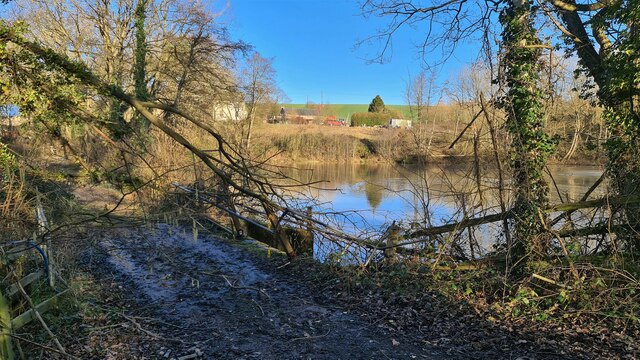
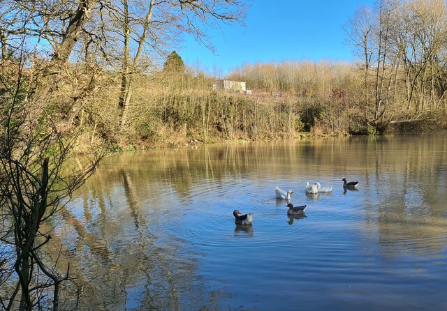
Surrounded by sprawling gardens and parkland, Park Hall offers a serene escape from the bustling city life. The well-maintained grounds are home to a variety of flora and fauna, including ancient trees, vibrant flower beds, and a tranquil lake.

In addition to its architectural significance, Park Hall holds historical importance as well. It was once the residence of prominent families such as the Stanhope and Cavendish families, who played significant roles in the region's history.

Today, Park Hall is open to the public, allowing visitors to explore its rich history and heritage. Guided tours provide insights into the house's past, showcasing its exquisite architecture and notable features. The estate also hosts various events and exhibitions throughout the year, offering a diverse range of cultural experiences to visitors.

Park Hall is not only a testament to the region's architectural heritage but also serves as a cherished community asset, providing a beautiful and educational destination for locals and tourists alike.

If you have any feedback on the listing, please let us know in the comments section below.
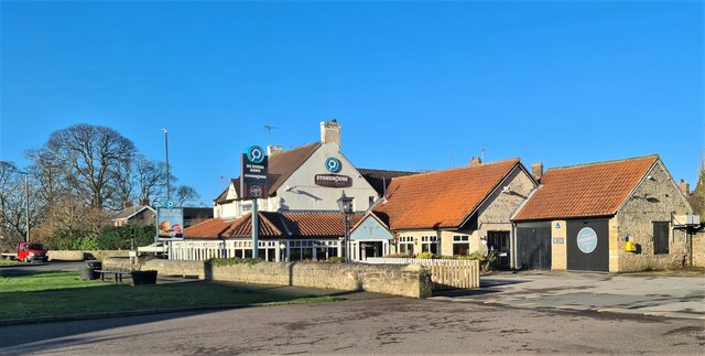
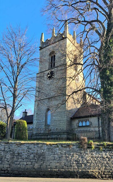
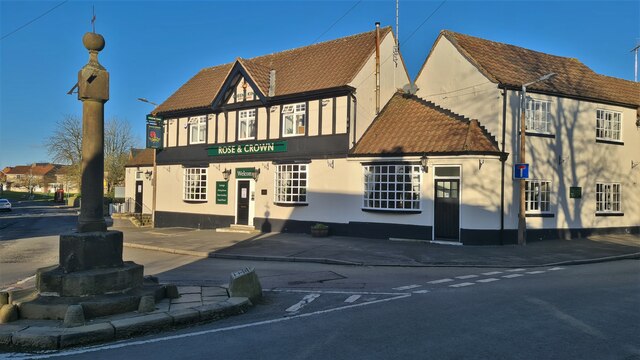
Park Hall Images

Images are sourced within 2km of 53.302/-1.302 or Grid Reference SK4678. Thanks to Geograph Open Source API. All images are credited.

Electric vehicle charging points Woodall services.  As with most (if not all) chargers at UK motorway services they are no longer branded by Ecotricity (see <a href="https://www.geograph.org.uk/photo/6993959">SK4780 : Electric Vehicle Charging Points, Woodall Services</a>).  These are provided by "applegreen electric"
Electric vehicle charging points
Woodall services. As with most (if not all) chargers at UK motorway services they are no longer branded by Ecotricity (see SK4780 : Electric Vehicle Charging Points, Woodall Services). These are provided by "applegreen electric"
Woodall services Starbucks Coffee sign
Woodall services
Starbucks Coffee sign
Woodall Services
Woodall Services
Footbridge at Woodall services. A pit stop.
Footbridge at Woodall services.
A pit stop.
Northbound Woodall Services Northbound Woodall Services on M1
Northbound Woodall Services
Northbound Woodall Services on M1
A6135 at M1 junction roundabout
Fuel Forecourt, Welcome Break Woodall Services  The Woodall Services Area lies between junctions 30 and 31 of the M1 motorway near Sheffield. It was opened in 1968 by Trust House Forte (rebranded as Welcome Break in 1986 <span class="nowrap"><a title="https://en.wikipedia.org/wiki/Welcome_Break#Split_from_Trusthouse_Forte" rel="nofollow ugc noopener" href="https://en.wikipedia.org/wiki/Welcome_Break#Split_from_Trusthouse_Forte">Link</a><img style="margin-left:2px;" alt="External link" title="External link - shift click to open in new window" src="https://s1.geograph.org.uk/img/external.png" width="10" height="10"/></span>  ). It takes its name from the nearby village of Woodall.
Fuel Forecourt, Welcome Break Woodall Services
The Woodall Services Area lies between junctions 30 and 31 of the M1 motorway near Sheffield. It was opened in 1968 by Trust House Forte (rebranded as Welcome Break in 1986 LinkExternal link ). It takes its name from the nearby village of Woodall.
Shell Filling Station, Woodall Services (South) The Woodall Services Area lies between junctions 30 and 31 of the M1 motorway near Sheffield. It was opened in 1968 by Trust House Forte (rebranded as Welcome Break in 1986 <span class="nowrap"><a title="https://en.wikipedia.org/wiki/Welcome_Break#Split_from_Trusthouse_Forte" rel="nofollow ugc noopener" href="https://en.wikipedia.org/wiki/Welcome_Break#Split_from_Trusthouse_Forte">Link</a><img style="margin-left:2px;" alt="External link" title="External link - shift click to open in new window" src="https://s1.geograph.org.uk/img/external.png" width="10" height="10"/></span>  ). It takes its name from the nearby village of Woodall.
Shell Filling Station, Woodall Services (South)
The Woodall Services Area lies between junctions 30 and 31 of the M1 motorway near Sheffield. It was opened in 1968 by Trust House Forte (rebranded as Welcome Break in 1986 LinkExternal link ). It takes its name from the nearby village of Woodall.
Stonehouse, De Rodes Arms restaurant, Barlborough Carvery and pizzas
Stonehouse, De Rodes Arms restaurant, Barlborough
Carvery and pizzas
St James the Great parish church, Barlborough
Rose & Crown and Village Cross, Barlborough
Old cottages, Barlborough But have they been totally rebuilt?
Old cottages, Barlborough
But have they been totally rebuilt?
Old Hospital, Barlborough Dating to 1752
Old Hospital, Barlborough
Dating to 1752
Pile driving equipment, Renishaw
Mount St Mary's College, Spinkhill
Farmland near Barlborough
Fishing lake by Quarrydam Cottages Track blocked by fallen tree after 3 separate gales and heavy rain in a week
Fishing lake by Quarrydam Cottages
Track blocked by fallen tree after 3 separate gales and heavy rain in a week
Ducks on lake below Quarrydam Cottages Fishing pond
Ducks on lake below Quarrydam Cottages
Fishing pond
Show me another place!

Park Hall is located at Grid Ref: SK4678 (Lat: 53.302, Lng: -1.302)

Administrative County: Derbyshire

District: Bolsover

Police Authority: Derbyshire

What 3 Words

///wells.ramps.tumblers. Near Barlborough, Derbyshire

Related Wikis

Spinkhill Tunnel

Spinkhill Tunnel is a disused twin-track railway tunnel south of Spinkhill railway station in Derbyshire, England. == History == The 501 yards long tunnel...

Mount St Mary's College

Mount St Mary's College is an independent, co-educational, day and boarding school situated at Spinkhill, Derbyshire, England. It was founded in 1842 by...

Spinkhill railway station

Spinkhill railway station is a disused railway station in Spinkhill, Derbyshire, England. == History == The station was built by the Lancashire, Derbyshire...

Spinkhill

Spinkhill is a small village in North East Derbyshire, England. It is approximately one mile south of the nearest town, Killamarsh, and half a mile north...

Church of the Immaculate Conception, Spinkhill

Immaculate Conception Church is a Roman Catholic Parish church in Spinkhill, Derbyshire, England. It was built in 1846 and designed by Joseph Hansom. It...

Barlborough Hall

Barlborough Hall is a Grade I listed 16th-century country house in Barlborough, Chesterfield, Derbyshire. It was built in around 1583-84 for Sir Francis...

New Barlborough

New Barlborough is an area of Barlborough village, Bolsover, Derbyshire, England, consisting of several housing estates and a single row of houses along...

Barlborough

Barlborough is a village and civil parish in the Bolsover district of Derbyshire, England. According to the 2001 census it had a population of 3,018,...

Nearby Amenities

Located within 500m of 53.302,-1.302
Power: pole
Source: Bing
Lat/Long: 53.3031362/-1.2953345
Barrier: stile
Lat/Long: 53.3000322/-1.3015724
Barrier: stile
Lat/Long: 53.3014948/-1.2992741
Barrier: stile
Lat/Long: 53.300316/-1.3018958
Note: Goes further.
Lat/Long: 53.3003107/-1.3053935
Power: pole
Lat/Long: 53.2982079/-1.3008955
Power: pole
Lat/Long: 53.2989901/-1.3015446
Power: pole
Lat/Long: 53.2997243/-1.3024485
Power: pole
Lat/Long: 53.3002388/-1.3031298
Power: pole
Lat/Long: 53.3008688/-1.3036233
Power: pole
Lat/Long: 53.3017424/-1.3043341
Power: pole
Lat/Long: 53.3028516/-1.3046882
Power: pole
Lat/Long: 53.3052301/-1.3054901
The data included in this document is from www.openstreetmap.org. The data is made available under ODbL.

Have you been to Park Hall ?

Leave your review of Park Hall below (or comments, questions and feedback).