Moditonham House

Heritage Site in Cornwall

England

Moditonham House

Approaching Vollards Lane, Hatt
Approaching Vollards Lane, Hatt Credit: Paul Barnett

Moditonham House is a historic manor located in Cornwall, England. It is designated as a heritage site due to its architectural significance and cultural value. The house is situated in a picturesque setting, surrounded by lush gardens and tranquil countryside.

Originally built in the 16th century, Moditonham House underwent several renovations and expansions over the years, resulting in a unique blend of architectural styles. The house is a fine example of Elizabethan and Jacobean architecture, with its distinctive mullioned windows, ornate chimneys, and grand entrance hall.

The interior of Moditonham House is equally impressive, featuring beautifully decorated rooms and intricate woodwork. Visitors can explore the house and admire the period furnishings, tapestries, and artwork that reflect its rich history.

The estate surrounding Moditonham House is extensive and offers visitors the chance to explore well-manicured gardens, including a walled garden, herbaceous borders, and a charming orchard. The gardens are known for their stunning displays of flowers and plants, providing a peaceful and serene atmosphere.

In addition to the architectural and natural beauty, Moditonham House has an intriguing past. It has been home to several notable families throughout its history, including the Tremaynes and the Trelawnys. The house also played a role in the English Civil War, with some parts of the building serving as a military hospital.

Today, Moditonham House is open to the public, allowing visitors to experience the grandeur of this historic manor. It serves as a testament to Cornwall's rich heritage and offers a glimpse into the lives of those who once called it home.

If you have any feedback on the listing, please let us know in the comments section below.

Moditonham House Images

Images are sourced within 2km of 50.43/-4.236 or Grid Reference SX4161. Thanks to Geograph Open Source API. All images are credited.
Approaching Vollards Lane, Hatt
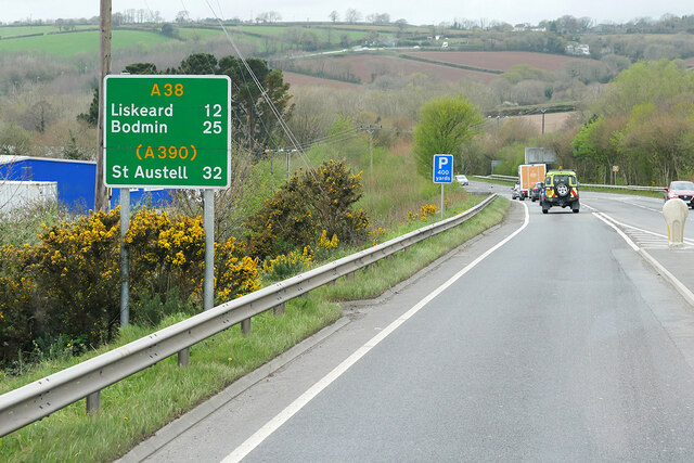
Eastbound A38 near Burraton Blue signs giving advance notice of toll charges on the Tamar Bridge ahead (although traffic will have to negotiate the Saltash Tunnel before reaching the bridge).
Eastbound A38 near Burraton
Blue signs giving advance notice of toll charges on the Tamar Bridge ahead (although traffic will have to negotiate the Saltash Tunnel before reaching the bridge).
Westbound A38 at Carkeel The A38 is a major A-class trunk route. When first designated in 1922, it ran from Derby to Plymouth but it was later extended at both ends so that it now runs for 292 miles from Mansfield in Nottinghamshire to Bodmin in Cornwall.

Prior to the opening of the M5 motorway in the 1960s and 1970s, the A38 formed the main "holiday route" from the Midlands to Somerset, Devon and Cornwall and the south-western section was notorious at holiday times for the congestion. Nowadays, for most of the southern section, the A38 is a fairly quiet road shadowing the M5 extremely closely; often running alongside the motorway as a single carriageway road. The section between Exeter and Plymouth is, however, a busy dual carriageway which serves as the southern extension of the M5 and is known as “the Devon Expressway”.

More information at <span class="nowrap"><a title="http://en.wikipedia.org/wiki/A38_road" rel="nofollow ugc noopener" href="http://en.wikipedia.org/wiki/A38_road">Link</a><img style="margin-left:2px;" alt="External link" title="External link - shift click to open in new window" src="https://s1.geograph.org.uk/img/external.png" width="10" height="10"/></span>  (Wikipedia) and <span class="nowrap"><a title="http://www.sabre-roads.org.uk/wiki/index.php?title=A38" rel="nofollow ugc noopener" href="http://www.sabre-roads.org.uk/wiki/index.php?title=A38">Link</a><img style="margin-left:2px;" alt="External link" title="External link - shift click to open in new window" src="https://s1.geograph.org.uk/img/external.png" width="10" height="10"/></span>  (SABRE).
Westbound A38 at Carkeel
The A38 is a major A-class trunk route. When first designated in 1922, it ran from Derby to Plymouth but it was later extended at both ends so that it now runs for 292 miles from Mansfield in Nottinghamshire to Bodmin in Cornwall. Prior to the opening of the M5 motorway in the 1960s and 1970s, the A38 formed the main "holiday route" from the Midlands to Somerset, Devon and Cornwall and the south-western section was notorious at holiday times for the congestion. Nowadays, for most of the southern section, the A38 is a fairly quiet road shadowing the M5 extremely closely; often running alongside the motorway as a single carriageway road. The section between Exeter and Plymouth is, however, a busy dual carriageway which serves as the southern extension of the M5 and is known as “the Devon Expressway”. More information at LinkExternal link (Wikipedia) and LinkExternal link (SABRE).
St Mary's Church
St Mary's Church
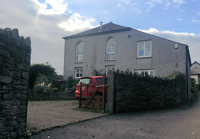
Former Botus Fleming Wesleyan Chapel
Saltash Travelodge
Saltash Travelodge
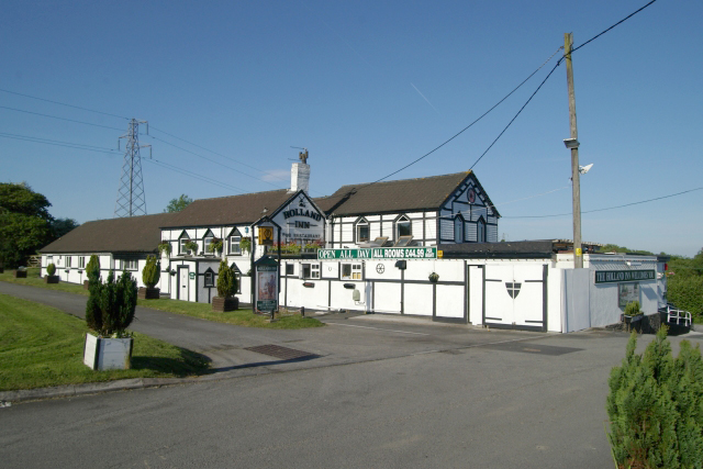
Holland Inn, Hatt, Saltash The Holland Inn, on the A388 at Hatt, near Saltash
Holland Inn, Hatt, Saltash
The Holland Inn, on the A388 at Hatt, near Saltash
Hatt service station, Saltash, Cornwall Hatt service station, just off the A388 at Hatt, near Saltash, Cornwall.
Hatt service station, Saltash, Cornwall
Hatt service station, just off the A388 at Hatt, near Saltash, Cornwall.
Holland Inn, Hatt
Holland Inn, Hatt
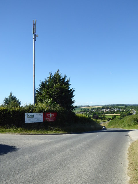
Communications mast near Five Acres
Field of barley above Notter
Lay-by on the road between Hatt and the A38 <a href="https://www.geograph.org.uk/photo/5042844">SX3961 : Communications mast near Five Acres</a> in the next grid square can be seen on the left of the photo.
Lay-by on the road between Hatt and the A38
SX3961 : Communications mast near Five Acres in the next grid square can be seen on the left of the photo.
Old Milestone by the A388, north of Hatt Carved stone post by the A388, in parish of BOTUSFLEMING (CARADON District), North of Hutt, against bank at back of verge, on East side of road. Saltash CS tombstone, erected by the Saltash turnpike trust in the 18th century. 

Inscription reads:-
C
5½
S
4 

Grade II Listed. List Entry Number: 1393081
<span class="nowrap"><a title="https://historicengland.org.uk/listing/the-list/list-entry/1393081" rel="nofollow ugc noopener" href="https://historicengland.org.uk/listing/the-list/list-entry/1393081">Link</a><img style="margin-left:2px;" alt="External link" title="External link - shift click to open in new window" src="https://s1.geograph.org.uk/img/external.png" width="10" height="10"/></span>

Milestone Society National ID: CW_CLSH05.
Old Milestone by the A388, north of Hatt
Carved stone post by the A388, in parish of BOTUSFLEMING (CARADON District), North of Hutt, against bank at back of verge, on East side of road. Saltash CS tombstone, erected by the Saltash turnpike trust in the 18th century. Inscription reads:- C 5½ S 4 Grade II Listed. List Entry Number: 1393081 LinkExternal link Milestone Society National ID: CW_CLSH05.
Road sign to Trematon
Lane to Notter
Lane to Notter
Trees by the A388
Trees by the A388
Ridgecroft
Ridgecroft
Pace filling station, Hatt
Show me another place!

Moditonham House is located at Grid Ref: SX4161 (Lat: 50.43, Lng: -4.236)

Unitary Authority: Cornwall

Police Authority: Devon and Cornwall

What 3 Words

///tolerable.advances.treat. Near Saltash, Cornwall

Nearby Locations

Moditonham House The Marsh

Related Wikis

Carkeel

Carkeel is a hamlet north of Saltash in southeast Cornwall, England. == References ==

Botusfleming

Botus Fleming or Botusfleming (Cornish: Bosflumyes) is a village and civil parish in southeast Cornwall, England, United Kingdom. The 2001 census gives...

Landulph

Landulph (Cornish: Lanndhylyk) is a hamlet and a rural civil parish in south-east Cornwall, England, United Kingdom. It is about 3 miles (5 km) north of...

Hatt, Cornwall

Hatt is a hamlet in the civil parish of Botusfleming in east Cornwall, England, UK. It is on the A388 road from Callington to Saltash. Hatt House was built...

Nearby Amenities

Located within 500m of 50.43,-4.236
Martyn Monument
Historic: monument
Lat/Long: 50.4306731/-4.2424768
Moditonham Dovecote
Historic: monument
Lat/Long: 50.4303235/-4.235224
Power: pole
Lat/Long: 50.4306524/-4.2309835
Power: pole
Lat/Long: 50.4315922/-4.2316675
Power: pole
Lat/Long: 50.4325046/-4.2324534
Power: pole
Lat/Long: 50.4334716/-4.2333613
Power: pole
Lat/Long: 50.4341951/-4.2339675
Power: pole
Lat/Long: 50.4295983/-4.2301789
The data included in this document is from www.openstreetmap.org. The data is made available under ODbL.

Have you been to Moditonham House?

Leave your review of Moditonham House below (or comments, questions and feedback).