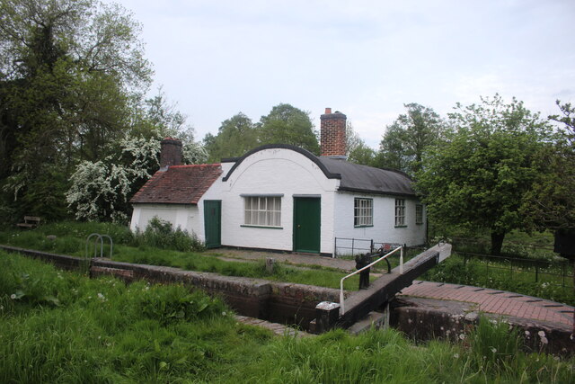
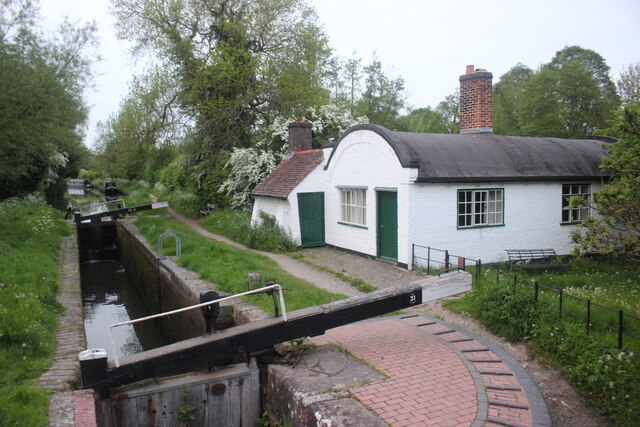
Lock Cottage

Heritage Site in Warwickshire Warwick

England

Lock Cottage

Grand Union Canal near Turner's Green
Grand Union Canal near Turner's Green Credit: Mark Percy

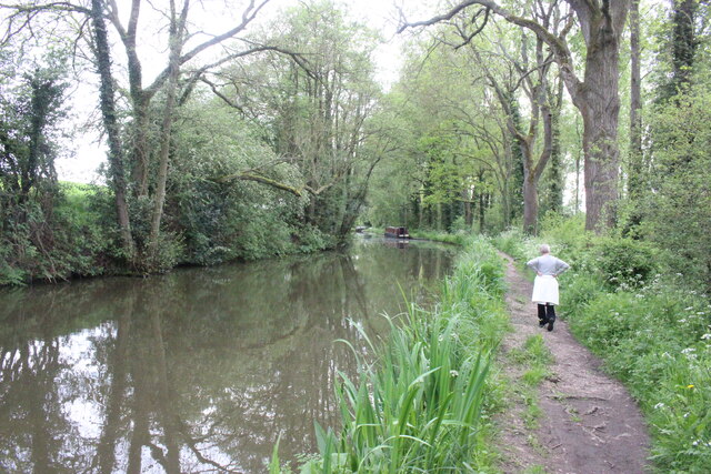
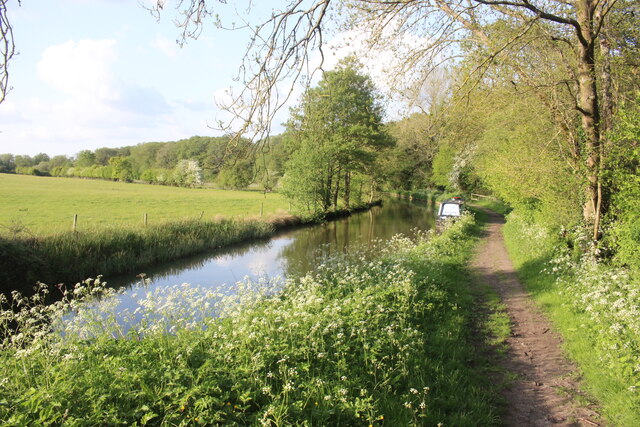
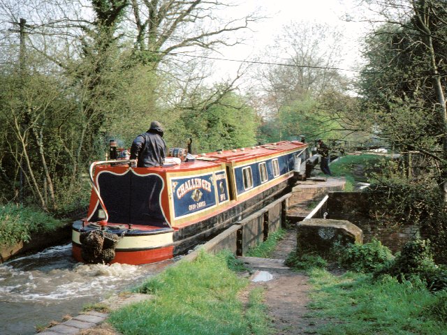
Lock Cottage is a historic and picturesque heritage site nestled in the heart of Warwickshire, England. Located alongside the Grand Union Canal, this charming cottage offers visitors a unique glimpse into the region's rich industrial past.

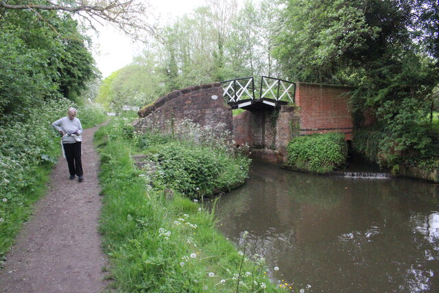
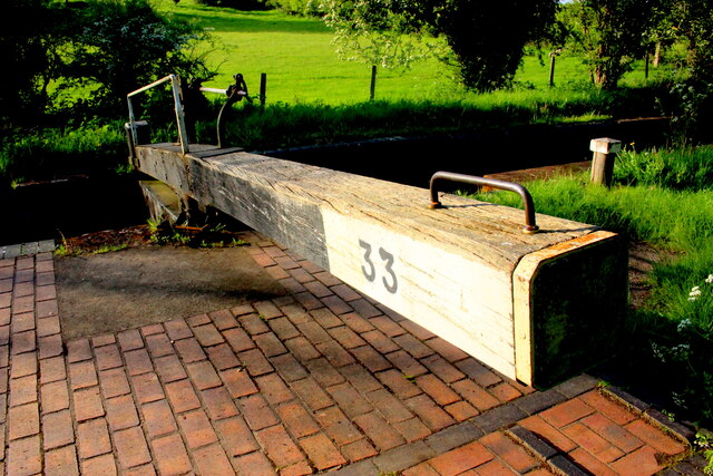
Originally built in the 19th century, Lock Cottage served as the home for the lock keepers who were responsible for operating the nearby Hatton Locks. These locks were an integral part of the canal system, facilitating the transportation of goods and connecting Warwickshire to other parts of the country.

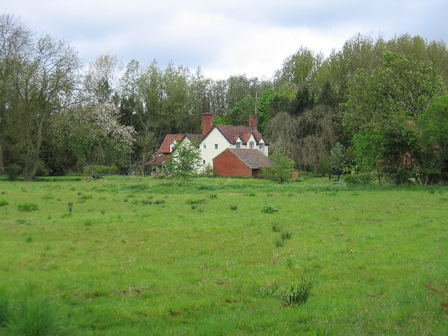
The cottage itself is a fine example of traditional canal architecture, featuring a rustic red-brick exterior with a thatched roof. Inside, the cottage has been lovingly restored to showcase the living conditions of a lock keeper and their family during the Victorian era. Visitors can explore the various rooms, which have been furnished with period-appropriate furniture and decor, offering a glimpse into daily life in the 19th century.

In addition to the cottage, the site also boasts beautifully landscaped gardens that provide a tranquil setting for visitors to relax and enjoy the surrounding countryside. The gardens are adorned with vibrant flowers, manicured lawns, and a variety of native trees and shrubs.

Lock Cottage is not only a testament to Warwickshire's industrial heritage but also serves as an educational resource, offering guided tours and interactive exhibits that delve into the history of the canal system and the daily life of lock keepers.

Overall, Lock Cottage is a must-visit destination for history enthusiasts and nature lovers alike, providing a captivating glimpse into Warwickshire's past while offering a serene escape from the bustle of modern life.

If you have any feedback on the listing, please let us know in the comments section below.
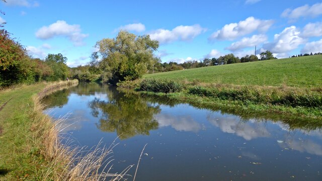
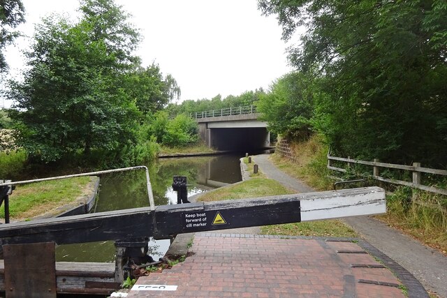
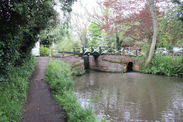
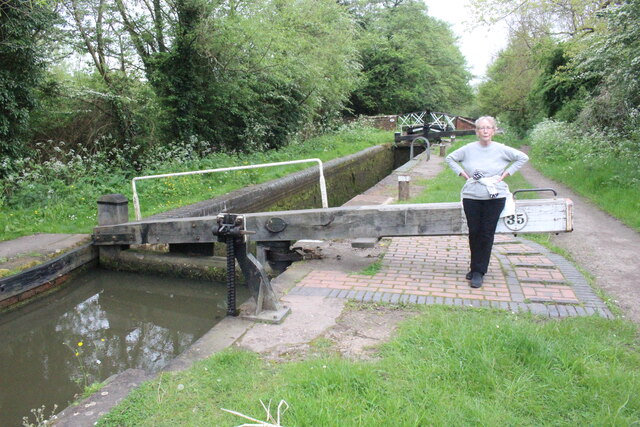
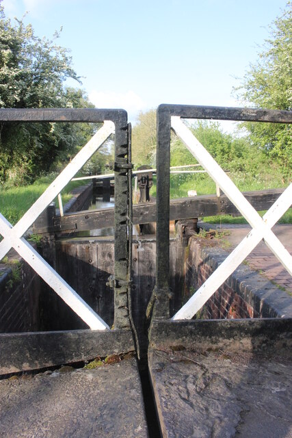
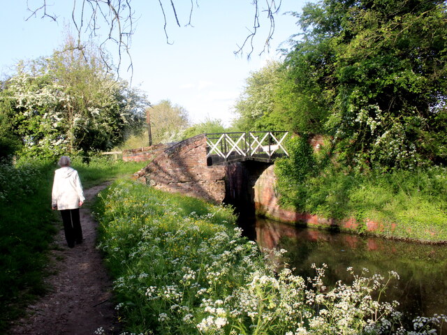
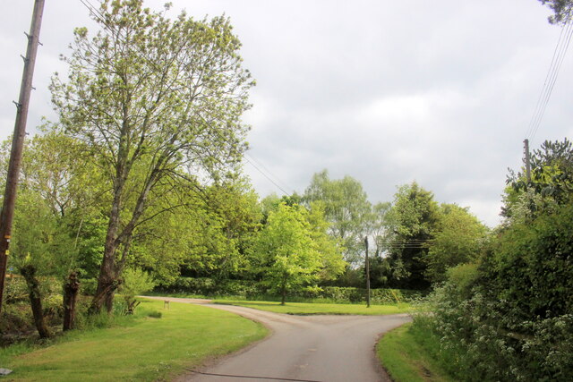
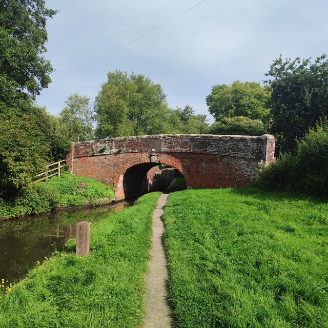
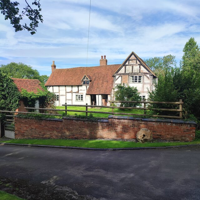
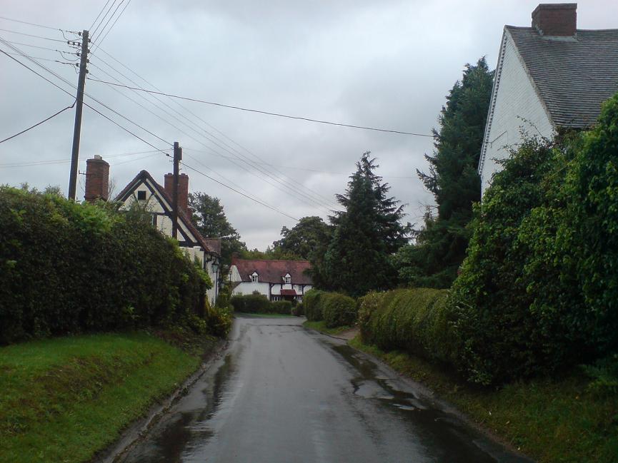
Lock Cottage Images

Images are sourced within 2km of 52.307/-1.726 or Grid Reference SP1867. Thanks to Geograph Open Source API. All images are credited.

Grand Union Canal near Turner's Green
Kingswood-Stratford Canal M40 Motorway Bridge.
Kingswood-Stratford Canal
M40 Motorway Bridge.
Bridge 44A Stratford Upon  Avon  Canal Bridge 44A is at Yarningale Common next to lock 34. At this lock there is an old lock keepers cottage with a barrel vaulted roof that has been incorporated into a modern house. The cottage is called Bucket Lock Cottage.
Bridge 44A Stratford Upon Avon Canal
Bridge 44A is at Yarningale Common next to lock 34. At this lock there is an old lock keepers cottage with a barrel vaulted roof that has been incorporated into a modern house. The cottage is called Bucket Lock Cottage.
Lock 35 Stratford upon Avon Canal Lock 35 is adjacent to Yarningale Farm and a footpath crosses the can by the small bridge at the far end of the lock.
Lock 35 Stratford upon Avon Canal
Lock 35 is adjacent to Yarningale Farm and a footpath crosses the can by the small bridge at the far end of the lock.
Bridge 45 Stratford upon Aven Canal Bridge 45 carries a footpath over the canal and is adjacent to lock 35. The bridge is split so that the canal tow rope can pass through the bridge.
Bridge 45 Stratford upon Aven Canal
Bridge 45 carries a footpath over the canal and is adjacent to lock 35. The bridge is split so that the canal tow rope can pass through the bridge.
Stratford upon Avon Canal This is the centre of the section between Lock 35 and Lock 36 between Preston Bagot and Yarningale.
Stratford upon Avon Canal
This is the centre of the section between Lock 35 and Lock 36 between Preston Bagot and Yarningale.
Stratford Upon Avon Canal Mile Marker This marker is between locks 33 and 34 and shows it is 16 miles to the northern terminus of the canal at Kings Norton.
Stratford Upon Avon Canal Mile Marker
This marker is between locks 33 and 34 and shows it is 16 miles to the northern terminus of the canal at Kings Norton.
Piece of Brunel's Wide Gauge Iron Rail on The Stratford Upon Avon Canal This "U" shaped iron channel which appears to have been used to hold a sign or something similar was at one time a rail that was used on Brunel's wide gauge GWR. When the gauge was reduced from 7ft to 4ft 8 1/2 inches large numbers of the rails were reused for other purposes. This may have come from the nearby line at Claverdon which was a mixed gauge line that opened as part of the Stratford Upon Avon Railway on 10 October 1860. When the wide gauge railways were dismantled, the iron rails were often used elsewhere. A large number of the rails were used in the construction of Clevedon pier.
Piece of Brunel's Wide Gauge Iron Rail on The Stratford Upon Avon Canal
This "U" shaped iron channel which appears to have been used to hold a sign or something similar was at one time a rail that was used on Brunel's wide gauge GWR. When the gauge was reduced from 7ft to 4ft 8 1/2 inches large numbers of the rails were reused for other purposes. This may have come from the nearby line at Claverdon which was a mixed gauge line that opened as part of the Stratford Upon Avon Railway on 10 October 1860. When the wide gauge railways were dismantled, the iron rails were often used elsewhere. A large number of the rails were used in the construction of Clevedon pier.
Lock Keeper's Cottage, Lock 31, Stratford Upon Avon Canal. This is a relatively unaltered barrel roofed lock keeprs cottage located next to the bridge in Lowsonford where the road to Shrewley crosses the canal.
Lock Keeper's Cottage, Lock 31, Stratford Upon Avon Canal.
This is a relatively unaltered barrel roofed lock keeprs cottage located next to the bridge in Lowsonford where the road to Shrewley crosses the canal.
Lock Keeper's Cottage Lock 31 Stratford Upon Avon Canal Barrel roofed cottage located adjacent to the canal lock. Photo taken from the bridge where Narrow Lane crosses the canal.
Lock Keeper's Cottage Lock 31 Stratford Upon Avon Canal
Barrel roofed cottage located adjacent to the canal lock. Photo taken from the bridge where Narrow Lane crosses the canal.
Stratford Upon Avon Canal This is in the middle of the long stretch between lock 33 and lock 32 of the canal.
Stratford Upon Avon Canal
This is in the middle of the long stretch between lock 33 and lock 32 of the canal.
Lock 33 Stratford Upon Avon Canal Traditional timber lock gate but the area around the lock gate has been repaved with red brick.
Lock 33 Stratford Upon Avon Canal
Traditional timber lock gate but the area around the lock gate has been repaved with red brick.
Split Bridge Lock 33 Stratford Upon Avon Canal The split bridge is where the towpath crossed from one side of the canal to the other and the split allowed the tow-rope to pass through the bridge. Over the years the sliding ropes wore deep grooves in the vertical members of the bridge. One or two of the grooves have cut nearly all the way through the vertical member and an iron plate has been bolted on the side of the member to prevent further wear and to reinforce it.
Split Bridge Lock 33 Stratford Upon Avon Canal
The split bridge is where the towpath crossed from one side of the canal to the other and the split allowed the tow-rope to pass through the bridge. Over the years the sliding ropes wore deep grooves in the vertical members of the bridge. One or two of the grooves have cut nearly all the way through the vertical member and an iron plate has been bolted on the side of the member to prevent further wear and to reinforce it.
Lock 33 Stratford Upon Avon Canal This shows the cross-over bridge with the open slot for horse tow ropes that is just next to the lock chamber.
Lock 33 Stratford Upon Avon Canal
This shows the cross-over bridge with the open slot for horse tow ropes that is just next to the lock chamber.
Road Junction in Holywell Holywell is a small village well off the beaten track just north of Claverdon.
Road Junction in Holywell
Holywell is a small village well off the beaten track just north of Claverdon.
Lowsonford Bridge
Lowsonford Bridge
Old House, Yarningale Lane
Yarningale lock and aqueduct Yarningale Lock on the Stratford-upon-Avon canal.  This lock is unusual in that immediately above the lock the canal crosses a small aqueduct, constructed  as an iron trough in the same style as its much longer cousin <a href="https://www.geograph.org.uk/photo/3786">SP1660 : Edstone Aqueduct</a> further down the canal at Bearley.
Yarningale lock and aqueduct
Yarningale Lock on the Stratford-upon-Avon canal. This lock is unusual in that immediately above the lock the canal crosses a small aqueduct, constructed as an iron trough in the same style as its much longer cousin SP1660 : Edstone Aqueduct further down the canal at Bearley.
Show me another place!

Lock Cottage is located at Grid Ref: SP1867 (Lat: 52.307, Lng: -1.726)

Administrative County: Warwickshire

District: Warwick

Police Authority: Warwickshire

What 3 Words

///messed.halt.outhouse. Near Henley in Arden, Warwickshire

Nearby Locations

Lowsonford Lock Cottage

Related Wikis

Lowsonford

Lowsonford is a small village within the parish of Rowington in Warwickshire, England. The village lies 4 miles (6.4 km) north-east of Henley-in-Arden...

Yarningale Aqueduct

Yarningale Aqueduct is one of three aqueducts on a 4 miles (6 km) length of the Stratford-upon-Avon Canal in Warwickshire. It spans the Kingswood Brook...

Bushwood

Bushwood is a hamlet in Warwickshire, located three miles north of Henley in Arden and a mile west of the M40 motorway. There is no village centre as such...

Mercia Mudstone Group

The Mercia Mudstone Group is an early Triassic lithostratigraphic group (a sequence of rock strata) which is widespread in Britain, especially in the English...

Nearby Amenities

Located within 500m of 52.307,-1.726
Seamark Type: gate
Waterway: lock_gate
Lat/Long: 52.3110141/-1.7270725
Waterway: lock_gate
Lat/Long: 52.3030497/-1.7234059
Barrier: stile
Source: survey
Lat/Long: 52.3099971/-1.730721
Mill Lane
Naptan AtcoCode: 4200F041600
Naptan Bearing: N
Naptan BusStopType: CUS
Naptan CommonName: Mill Lane
Naptan Indicator: Opp
Naptan NaptanCode: waratjmd
Naptan Street: Lapworth Street
Naptan Verified: no
Source: naptan_import
Lat/Long: 52.3106135/-1.7281449
Mill Lane
Naptan AtcoCode: 4200F041601
Naptan Bearing: S
Naptan BusStopType: CUS
Naptan CommonName: Mill Lane
Naptan Indicator: Adj
Naptan NaptanCode: wardjpwm
Naptan Street: Lapworth Street
Naptan Verified: no
Source: naptan_import
Lat/Long: 52.3106272/-1.7280414
Waterway: lock_gate
Lat/Long: 52.3032752/-1.7234421
Waterway: lock_gate
Lat/Long: 52.307895/-1.7250923
Seamark Type: gate
Waterway: lock_gate
Lat/Long: 52.3108015/-1.7269904
Waste Disposal
Lat/Long: 52.3072965/-1.7248027
Seamark Type: gate
Waterway: lock_gate
Lat/Long: 52.3076633/-1.7250853
Give Way
Direction: forward
Source: Warwicks CC Aeriaal Imagery 2013
Lat/Long: 52.3073061/-1.726128
Barrier: stile
Lat/Long: 52.3064953/-1.7223227
Post Box
Collection Times: Mo-Fr 16:00; Sa 09:00
Note: I expected to find box B95 16 here but it is definitely 270 (and across the road from "The Old Post Office")
Operator: Royal Mail
Post Box Type: lamp
Ref: B95 270
Royal Cypher: EIIR
Royal Cypher Wikidata: Q33102113
Source: survey
Lat/Long: 52.3103224/-1.7280382
Building: yes
Lat/Long: 52.308038/-1.725284
Bus: yes
Public Transport: stop_position
Lat/Long: 52.3106272/-1.7280958
Defibrillator
Emergency: defibrillator
Fixme: precise location required
Ref GB The Circuit: C2D58570-5CF3-4C2F-B8D2-AE2A00BD97DA
Source: West Midlands Ambulance Service FOI request
Lat/Long: 52.3072208/-1.725583
Defibrillator
Booth: K6
Covered: booth
Defibrillator Location: Inside old red phonebox in Lowsonford.
Disused Amenity: telephone
Emergency: defibrillator
Man Made: telephone_box
Source: survey
Lat/Long: 52.3103362/-1.7280642
Drinking Water: yes
Drinking Water Legal: yes
Man Made: water_tap
Lat/Long: 52.3073048/-1.7249302
Barrier: kissing_gate
Lat/Long: 52.3074157/-1.7244578
Barrier: kissing_gate
Lat/Long: 52.3100628/-1.7215019
Barrier: stile
Lat/Long: 52.3107962/-1.7268976
Generator Method: photovoltaic
Generator Output Electricity: yes
Generator Source: solar
Generator Type: solar_photovoltaic_panel
Location: roof
Power: generator
Lat/Long: 52.306491/-1.7303333
Give Way
Direction: backward
Lat/Long: 52.3104746/-1.7279777
Advertising: board
Lat/Long: 52.3103095/-1.7280392
Information: guidepost
Tourism: information
Lat/Long: 52.3102964/-1.7280312
Leisure: playground
Lat/Long: 52.3090894/-1.7259437
Give Way
Direction: forward
Lat/Long: 52.3077867/-1.7255366
Give Way
Direction: backward
Lat/Long: 52.3076351/-1.7253366
Give Way
Direction: forward
Lat/Long: 52.3076012/-1.7255037
The data included in this document is from www.openstreetmap.org. The data is made available under ODbL.

Have you been to Lock Cottage?

Leave your review of Lock Cottage below (or comments, questions and feedback).