Lochtyn, Llangranog

Heritage Site in Cardiganshire

Wales

Lochtyn, Llangranog

Llangrannog Beach A busy Llangrannog beach
Llangrannog Beach Credit: Shaun Ferguson

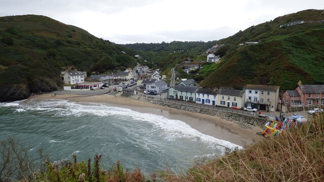
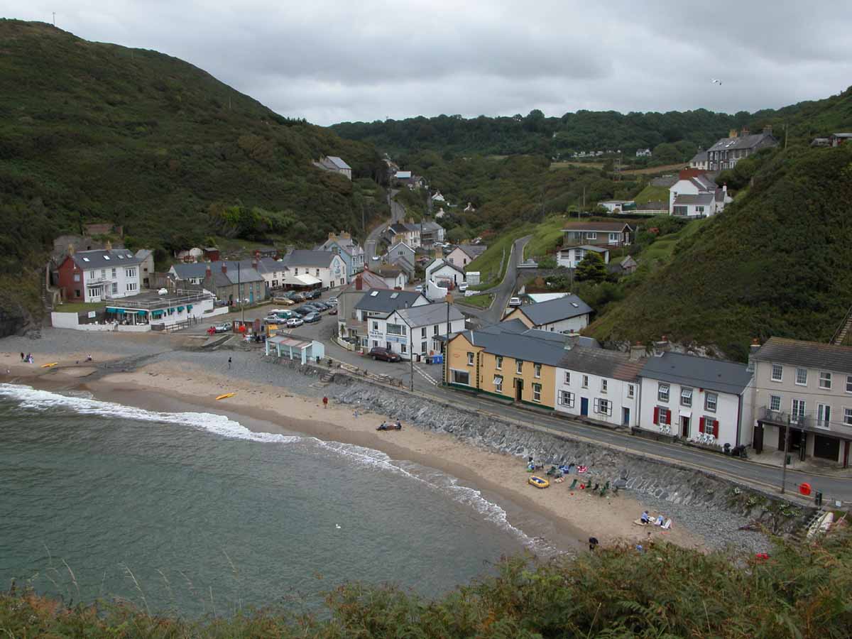
Lochtyn is a charming heritage site located in the village of Llangranog, in the county of Cardiganshire, Wales. Nestled on the stunning Ceredigion coastline, this picturesque site boasts a rich history and breathtaking natural beauty.

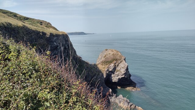
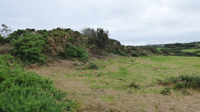
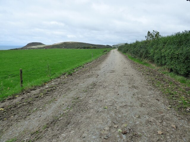
The main attraction of Lochtyn is its ancient hillfort, which dates back to the Iron Age. The hillfort sits atop a prominent hill, offering panoramic views of the surrounding countryside and the beautiful Cardigan Bay. Visitors can explore the remains of the fort's earthworks, defensive walls, and ditches, which provide fascinating insights into the lives of its ancient inhabitants.

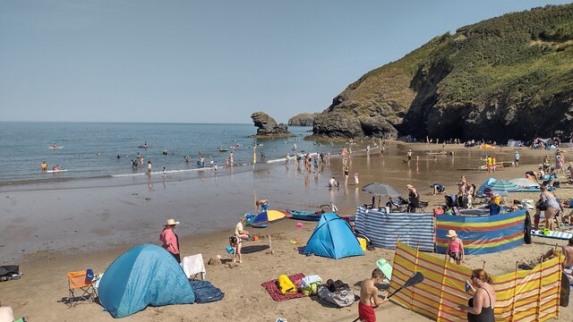
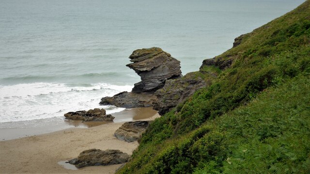
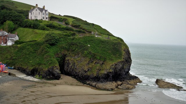
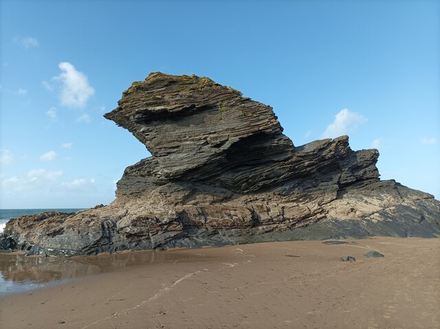
In addition to its historical significance, Lochtyn is also renowned for its natural features. The site is encompassed by lush green meadows, rugged cliffs, and sandy beaches, making it a haven for nature enthusiasts and outdoor lovers. The area is home to a diverse range of flora and fauna, including rare species of birds, plants, and marine life.

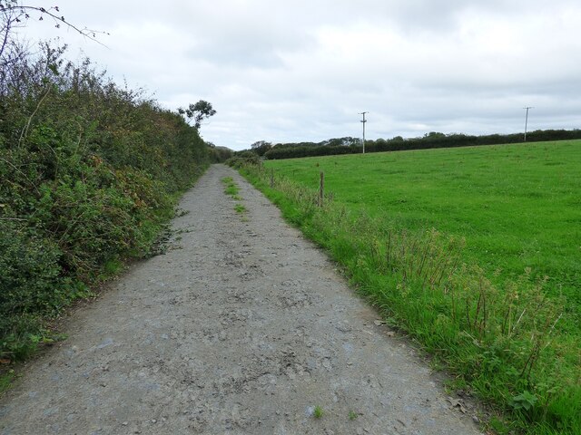
Visitors to Lochtyn can enjoy a variety of activities, such as hiking along the scenic coastal path, birdwatching, or simply relaxing on the sandy shores. The site is also a popular spot for picnics and family outings, with ample space for leisure activities.

Overall, Lochtyn in Llangranog, Cardiganshire, is a captivating heritage site that combines ancient history with breathtaking natural beauty. Whether you're interested in exploring the remains of an Iron Age hillfort or immersing yourself in the tranquility of the Welsh coastline, Lochtyn offers a memorable experience for all.

If you have any feedback on the listing, please let us know in the comments section below.

Lochtyn, Llangranog Images

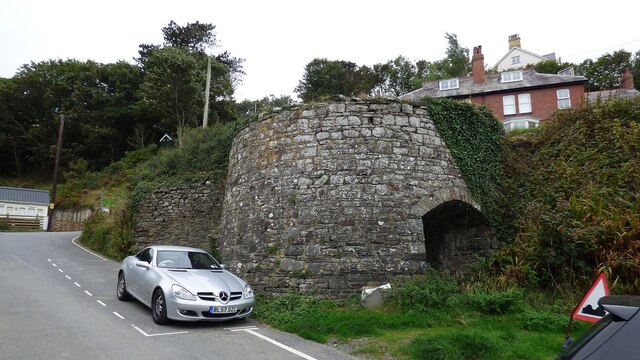
Images are sourced within 2km of 52.163/-4.465 or Grid Reference SN3154. Thanks to Geograph Open Source API. All images are credited.

Llangrannog Beach A busy Llangrannog beach
Llangrannog Beach
A busy Llangrannog beach
Carreg Dol-y-Fran. From the coast path looking to Carreg Dol-y -Fran
Carreg Dol-y-Fran.
From the coast path looking to Carreg Dol-y -Fran
Carreg-y-ty and sandy beach From coast path looking down to  Carreg-y-ty and the sandy beach
Carreg-y-ty and sandy beach
From coast path looking down to Carreg-y-ty and the sandy beach
B4334 heading out of Llangrannog B4334 heading out of Llangrannog passing the park and ride car park. The ride is a minibus down to the beach
B4334 heading out of Llangrannog
B4334 heading out of Llangrannog passing the park and ride car park. The ride is a minibus down to the beach
Llangrannog Beach Time for a swim in a classic Welsh coastal setting
Llangrannog Beach
Time for a swim in a classic Welsh coastal setting
Carreg Bica From the headland coastal path
Carreg Bica
From the headland coastal path
The West Headland View across the small bay. The west headland has a statue of St Carannog above the cliff
The West Headland
View across the small bay. The west headland has a statue of St Carannog above the cliff
Southern rampart of Castell Bach Promontory Fort <span class="nowrap"><a title="https://coflein.gov.uk/en/site/93914/" rel="nofollow ugc noopener" href="https://coflein.gov.uk/en/site/93914/">Link</a><img style="margin-left:2px;" alt="External link" title="External link - shift click to open in new window" src="https://s1.geograph.org.uk/img/external.png" width="10" height="10"/></span>
Southern rampart of Castell Bach Promontory Fort
Lime Kiln at Llangrannog
Llangrannog Village View from the cliff south of the village.
Llangrannog Village
View from the cliff south of the village.
Footpath leading towards Eisteddfa
Footpath leading north from Eisteddfa
Llangrannog Village View from hill to the north of the village.
Llangrannog Village
View from hill to the north of the village.
Ynys-Lochtyn Island and Promontory Fort The fort overlooks the small tidal island and has a single rampart and ditch on the landward side <span class="nowrap"><a title="https://coflein.gov.uk/en/site/408279/" rel="nofollow ugc noopener" href="https://coflein.gov.uk/en/site/408279/">Link</a><img style="margin-left:2px;" alt="External link" title="External link - shift click to open in new window" src="https://s1.geograph.org.uk/img/external.png" width="10" height="10"/></span>
Ynys-Lochtyn Island and Promontory Fort
The fort overlooks the small tidal island and has a single rampart and ditch on the landward side LinkExternal link
Pendinaslochdyn Iron Age Hillfort <span class="nowrap"><a title="https://www.megalithic.co.uk/article.php?sid=17596" rel="nofollow ugc noopener" href="https://www.megalithic.co.uk/article.php?sid=17596">Link</a><img style="margin-left:2px;" alt="External link" title="External link - shift click to open in new window" src="https://s1.geograph.org.uk/img/external.png" width="10" height="10"/></span>
Pendinaslochdyn Iron Age Hillfort
Llangrannog Dry Ski Slope Not really the sort of thing you expect to see when walking along a coastal path.
Llangrannog Dry Ski Slope
Not really the sort of thing you expect to see when walking along a coastal path.
Rocks in the Sea Perfect spot for sea birds to rest between feeds.
Rocks in the Sea
Perfect spot for sea birds to rest between feeds.
Rock formation in Llangrannog An interesting formation of rocks on the beach in Llangrannog.
Rock formation in Llangrannog
An interesting formation of rocks on the beach in Llangrannog.
Show me another place!

Lochtyn, Llangranog is located at Grid Ref: SN3154 (Lat: 52.163, Lng: -4.465)

Unitary Authority: Ceredigion

Police Authority: Dyfed Powys

What 3 Words

///stylists.clinic.storeroom. Near Aberporth, Ceredigion

Related Wikis

Nearby Amenities

Located within 500m of 52.163,-4.465
Source: PGS
Lat/Long: 52.1667837/-4.4675275
Source: PGS
Lat/Long: 52.1663632/-4.4675222
Source: PGS
Lat/Long: 52.1656806/-4.4676786
Source: PGS
Lat/Long: 52.1655565/-4.468085
Source: PGS
Lat/Long: 52.1651663/-4.4684473
Source: PGS
Lat/Long: 52.1647688/-4.4684771
Source: PGS
Lat/Long: 52.1639562/-4.4690866
Source: PGS
Lat/Long: 52.1638934/-4.4690389
Source: PGS
Lat/Long: 52.163902/-4.4684758
Source: PGS
Lat/Long: 52.1633189/-4.4688587
Source: PGS
Lat/Long: 52.1630713/-4.4694612
Source: PGS
Lat/Long: 52.162859/-4.469748
Source: PGS
Lat/Long: 52.1626527/-4.4702709
Source: PGS
Lat/Long: 52.1616923/-4.4702556
Source: PGS
Lat/Long: 52.1613003/-4.4713955
Source: PGS
Lat/Long: 52.1605547/-4.4709079
Source: PGS
Lat/Long: 52.16047/-4.4708305
Llangrannog
Is In: Ceredigion, Wales, UK
Name Cy: Llangrannog
Place: village
Source: npe
Lat/Long: 52.1590097/-4.4665269
Waterway: waterfall
Lat/Long: 52.1588341/-4.4643826
Stop
Direction: backward
Lat/Long: 52.1587287/-4.4631512
Post Box
Post Box Type: wall
Royal Cypher: GR
Royal Cypher Wikidata: Q33102273
Lat/Long: 52.158962/-4.4655068
Barrier: stile
Foot: yes
Source: survey
Lat/Long: 52.16083/-4.4687098
Barrier: stile
Foot: yes
Source: survey
Lat/Long: 52.1612356/-4.4652705
Pen Llangrannog
Ele: 167
Name Cy: Pen Llangrannog
Natural: peak
Wikidata: Q106711138
Lat/Long: 52.163481/-4.4592933
Pen Y Badell
Ele: 156
Name Cy: Pen Y Badell
Natural: peak
Lat/Long: 52.1655622/-4.4646734
Carreg Bica
Name Cy: Carreg Bica
Natural: rock
Lat/Long: 52.1614338/-4.4716979
Tourism: viewpoint
Lat/Long: 52.1613015/-4.4706413
Addr Housename: Manorafon Isaf
Lat/Long: 52.1594179/-4.4689303
Addr Housename: Manorafon Uchaf
Lat/Long: 52.1593809/-4.4688579
Addr Housename: Cilrhiw
Lat/Long: 52.159677/-4.4695834
Cilborth Beach
Natural: beach
Wikidata: Q107356898
Lat/Long: 52.1619103/-4.4705114
Direction: 195
Generator Method: photovoltaic
Generator Output Electricity: yes
Generator Solar Modules: 12
Generator Source: solar
Generator Type: solar_photovoltaic_panel
Location: roof
Power: generator
Lat/Long: 52.1589161/-4.465536
Direction: 195
Generator Method: photovoltaic
Generator Output Electricity: yes
Generator Solar Modules: 9
Generator Source: solar
Generator Type: solar_photovoltaic_panel
Location: roof
Power: generator
Lat/Long: 52.1588951/-4.4654093
Direction: 195
Generator Method: photovoltaic
Generator Output Electricity: yes
Generator Solar Modules: 15
Generator Source: solar
Generator Type: solar_photovoltaic_panel
Location: roof
Power: generator
Lat/Long: 52.1588634/-4.4652075
Tourism: viewpoint
Lat/Long: 52.1614297/-4.4707141
The data included in this document is from www.openstreetmap.org. The data is made available under ODbL.

Have you been to Lochtyn, Llangranog?

Leave your review of Lochtyn, Llangranog below (or comments, questions and feedback).