Llyndy, Nantgwynant

Heritage Site in Caernarfonshire

Wales

Llyndy, Nantgwynant

Winter birches on Nantgwynant The marshy land between the public footpath and Llyn Dinas on its southeast shore is dotted with Downy Birch - the species of birch (of our two natives) better adapted to such wet soils. On a wet day like this when the higher parts of Snowdonia are unattractive to walkers, lower level paths like this one present opportunties to have the trees stand out against the low-contrast background, and close examination shows that every twig is adorned with droplets of water catching the light from the low clouds.
Winter birches on Nantgwynant Credit: Andy Waddington

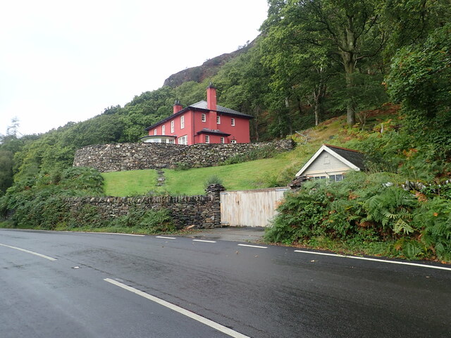
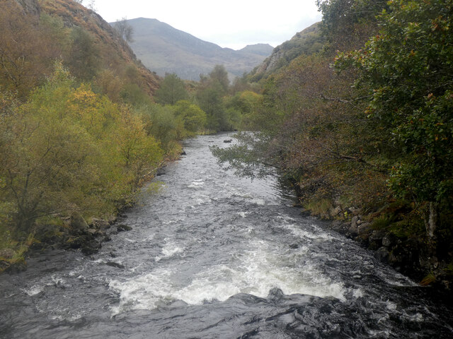
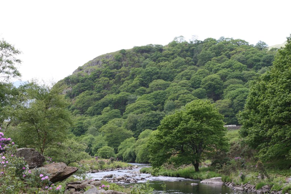
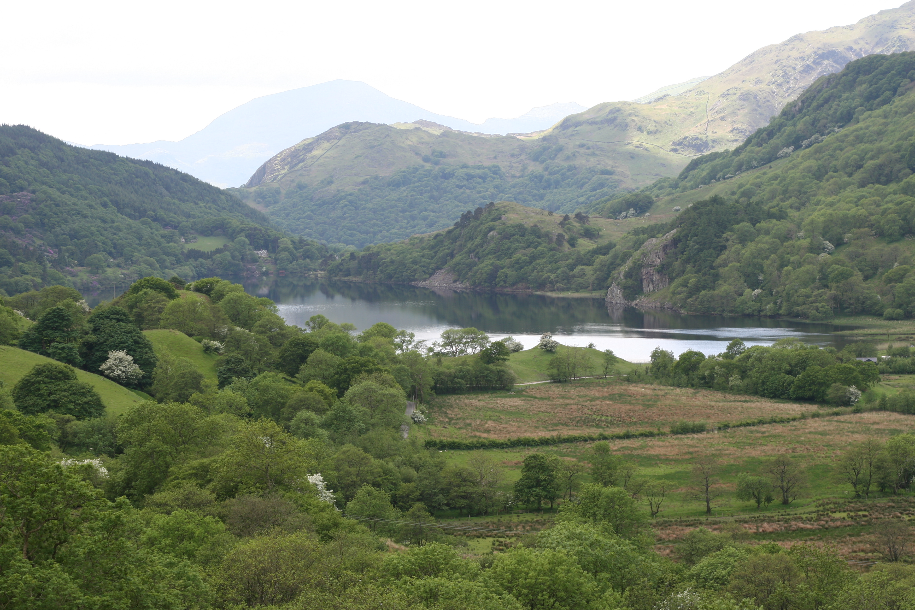
Llyndy, located in Nantgwynant, Caernarfonshire, is a historic heritage site nestled in the heart of Snowdonia National Park, Wales. This picturesque location offers visitors a glimpse into the rich cultural and natural heritage of the region.

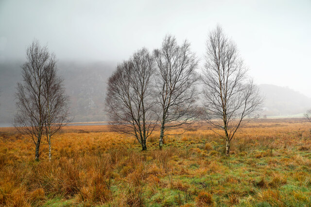
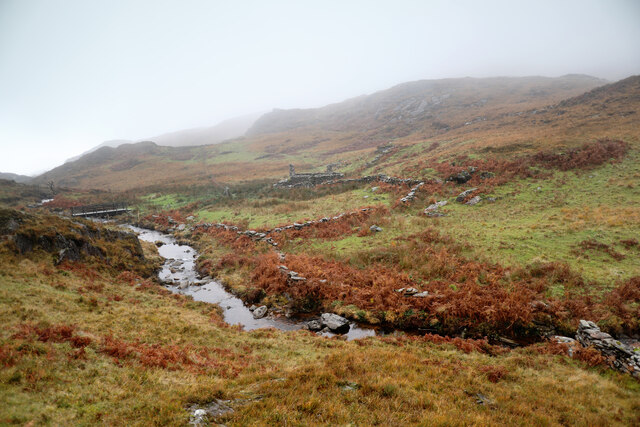
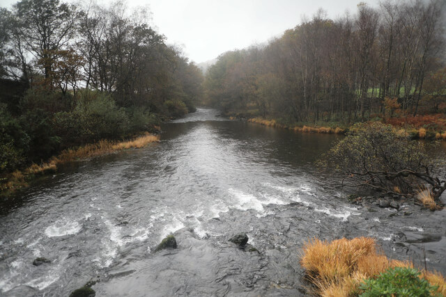
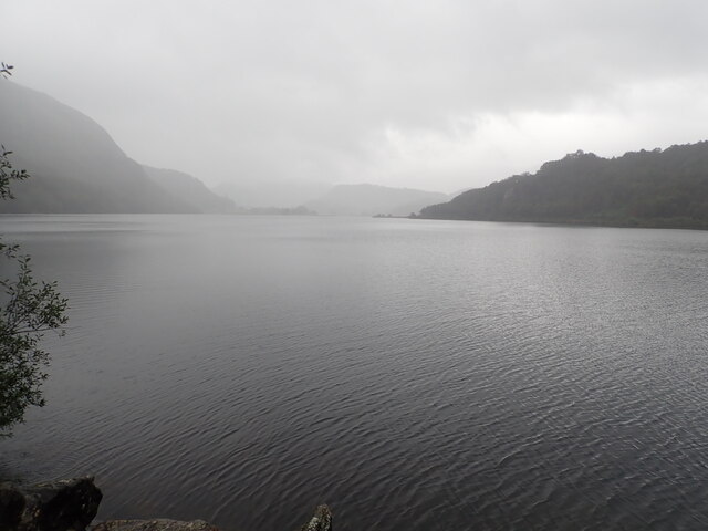
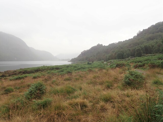
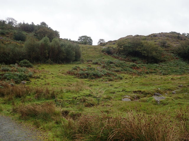
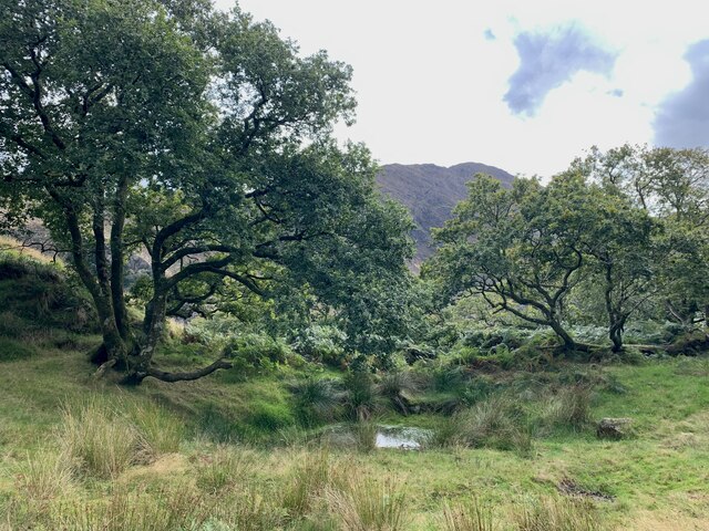
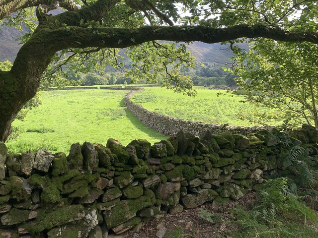
The estate of Llyndy covers an area of approximately 614 acres, encompassing stunning landscapes of mountains, lakes, woodlands, and pastures. It is known for its exceptional beauty and diverse wildlife, making it a popular destination for nature enthusiasts and hikers. The site is also home to a variety of rare and protected plant species, adding to its ecological significance.

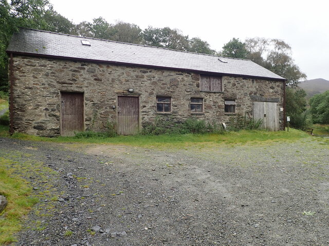
The history of Llyndy dates back to the 19th century when it was owned by the Assheton Smith family, who were prominent landowners in the area. The estate was primarily used for agricultural purposes, with traditional Welsh farming practices being carried out on the land. Today, the farm buildings and historic features serve as a reminder of this rich farming heritage.

Llyndy has undergone restoration and conservation efforts in recent years to preserve its historical significance and natural landscapes. The site is now managed by the National Trust, which ensures the protection and maintenance of the estate for future generations to enjoy.

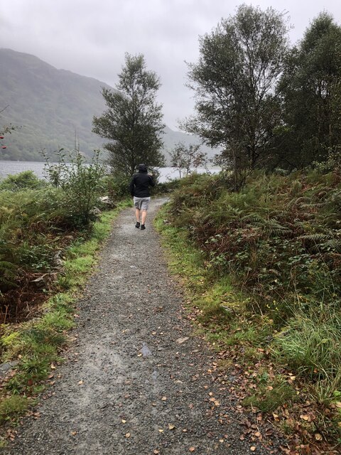
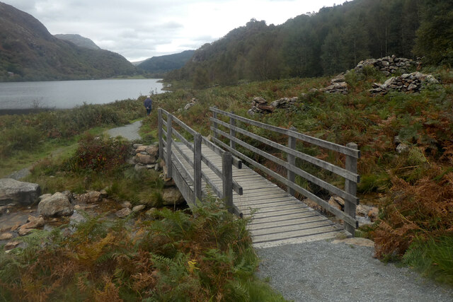
Visitors to Llyndy can explore the various walking trails that wind through the estate, offering breathtaking views of the surrounding mountains and lakes. The site also provides opportunities for wildlife spotting, birdwatching, and picnicking in peaceful surroundings.

Overall, Llyndy in Nantgwynant, Caernarfonshire, is a captivating heritage site that showcases the beauty of Snowdonia National Park while preserving its agricultural and cultural history.

If you have any feedback on the listing, please let us know in the comments section below.

Llyndy, Nantgwynant Images

Images are sourced within 2km of 53.02/-4.059 or Grid Reference SH6148. Thanks to Geograph Open Source API. All images are credited.

Winter birches on Nantgwynant The marshy land between the public footpath and Llyn Dinas on its southeast shore is dotted with Downy Birch - the species of birch (of our two natives) better adapted to such wet soils. On a wet day like this when the higher parts of Snowdonia are unattractive to walkers, lower level paths like this one present opportunties to have the trees stand out against the low-contrast background, and close examination shows that every twig is adorned with droplets of water catching the light from the low clouds.
Winter birches on Nantgwynant
The marshy land between the public footpath and Llyn Dinas on its southeast shore is dotted with Downy Birch - the species of birch (of our two natives) better adapted to such wet soils. On a wet day like this when the higher parts of Snowdonia are unattractive to walkers, lower level paths like this one present opportunties to have the trees stand out against the low-contrast background, and close examination shows that every twig is adorned with droplets of water catching the light from the low clouds.
Afon y Cwm The very generic name for this stream fails to mention that the Cwm in question is Cwm y Bleiddiaid behind the photographer to the NNE. The permissive path which reaches this point starting at a junction on the Watkin path up Snowdon, branches just ahead, with one route crossing to the ruins across the stream whilst the other continues as a substantial track offering the hope (for those who have had about enough of this weather) of a direct descent to the road via Hafod-y-porth. Such hope is in vain, as the permissive path sticks to the CROW Access Land, with fierce deterrent signs guarding against the more direct route, so your destination is Craflwyn, just the same as that of the path over the footbridge.
Afon y Cwm
The very generic name for this stream fails to mention that the Cwm in question is Cwm y Bleiddiaid behind the photographer to the NNE. The permissive path which reaches this point starting at a junction on the Watkin path up Snowdon, branches just ahead, with one route crossing to the ruins across the stream whilst the other continues as a substantial track offering the hope (for those who have had about enough of this weather) of a direct descent to the road via Hafod-y-porth. Such hope is in vain, as the permissive path sticks to the CROW Access Land, with fierce deterrent signs guarding against the more direct route, so your destination is Craflwyn, just the same as that of the path over the footbridge.
Afon Glaslyn The view is downstream from the middle of the small road bridge leading to Sygun Copper Mine and Ty-hên about 900m downstream of the river's exit from Llyn Dinas (the usual put-on for paddlers on this section of river). This is the generally flat and easy section of the river before it meets the Afon Colwyn at Beddgelert where it picks up a notch. Those seeking an easy river trip are well-advised to get off before the Aberglaslyn gorge where it picks up rather more than another notch and with enough water to paddle the section seen here (where there isn't enough at the moment despite the miserable weather), is quite a serious undertaking. There are handy signs dotted about at likely access points indicating the whereabouts of gauges (green for levels where paddlers are no threat to the river, red for low levels where paddlers may damage the environment) and suggesting the existence of an illegal attempt to ban navigation of the gorge in summer.
Afon Glaslyn
The view is downstream from the middle of the small road bridge leading to Sygun Copper Mine and Ty-hên about 900m downstream of the river's exit from Llyn Dinas (the usual put-on for paddlers on this section of river). This is the generally flat and easy section of the river before it meets the Afon Colwyn at Beddgelert where it picks up a notch. Those seeking an easy river trip are well-advised to get off before the Aberglaslyn gorge where it picks up rather more than another notch and with enough water to paddle the section seen here (where there isn't enough at the moment despite the miserable weather), is quite a serious undertaking. There are handy signs dotted about at likely access points indicating the whereabouts of gauges (green for levels where paddlers are no threat to the river, red for low levels where paddlers may damage the environment) and suggesting the existence of an illegal attempt to ban navigation of the gorge in summer.
Llyn Dinas North of Beddgelert in the Nant Gwynant Pass, Llyn Dinas is a mountain lake with a footpath around its eastern shore. It is a fairly shallow lake, covering an area of 60 acres.
Llyn Dinas
North of Beddgelert in the Nant Gwynant Pass, Llyn Dinas is a mountain lake with a footpath around its eastern shore. It is a fairly shallow lake, covering an area of 60 acres.
Llyn Dinas North of Beddgelert in the Nant Gwynant Pass, Llyn Dinas is a mountain lake with a footpath around its eastern shore. It is a fairly shallow lake, covering an area of 60 acres. This is looking north from the footbridge which crosses the River Glaslyn
Llyn Dinas
North of Beddgelert in the Nant Gwynant Pass, Llyn Dinas is a mountain lake with a footpath around its eastern shore. It is a fairly shallow lake, covering an area of 60 acres. This is looking north from the footbridge which crosses the River Glaslyn
Llyn Dinas A bit of a damp walk by the lake
Llyn Dinas
A bit of a damp walk by the lake
Footpath round the eastern side of Llyn Dinas
Walking around Llyn Dinas
Moorland and hillocks, near Llyn Dinas
Barn at Llyndy Isaf
Barn at Llyndy Isaf
Glan Llyn Standing proud above the A498
Glan Llyn
Standing proud above the A498
Dinas Emrys The pool on the top of Dinas Emrys, beneath which the dragons are said to sleep, ready to rise up and fight.
Dinas Emrys
The pool on the top of Dinas Emrys, beneath which the dragons are said to sleep, ready to rise up and fight.
Caeau, Craflwyn The fields and walls of the Craflwyn estate.
Caeau, Craflwyn
The fields and walls of the Craflwyn estate.
Pont droed dros Afon Goch / Footbridge over Afon Gogh
Afon Glaslyn
Afon Glaslyn
Bonyn derwen / An oak stump
Caws llyffant / Toadstools (1)
Caws llyffant / Toadstools (2)
Show me another place!

Llyndy, Nantgwynant is located at Grid Ref: SH6148 (Lat: 53.02, Lng: -4.059)

What 3 Words

///rushed.founders.intention. Near Blaenau-Ffestiniog, Gwynedd

Nearby Locations

Llyndy, Nantgwynant

Related Wikis

Llyn Dinas

Llyn Dinas is a lake near Beddgelert, Gwynedd in north Wales. It is formed by the River Glaslyn. Llyn Dinas lies on the valley floor a few miles north...

Dinas Emrys

Dinas Emrys (Welsh for 'Emrys's city') is a rocky and wooded hillock near Beddgelert in Gwynedd, north-west Wales. Rising some 76 m (250 ft) above the...

Sygun Copper Mine

Sygun Copper Mine is a Victorian copper mine which closed in 1903 but was renovated and reopened by the Amies family as a tourist attraction in 1986, focusing...

Beddgelert Fault

Beddgelert Fault First reported in a Memoir of the British Geological Survey activity ref. Ramsay 1881. It is a SW-NE trending volcanotectonic fault in...

Plas Gwynant

Plas Gwynant is an educational resort in Snowdonia, Wales. This country estate also includes a woodland and riverside walks, as well as a parkland and...

Nant Gwynant

Nant Gwynant (also spelt Nantgwynant) is a valley in northern Wales. The A498 road descends 600 feet (180 m) into the valley in about two miles (3 km)...

A498 road

The A498 is a 16-mile road between Pen-y-Gwryd and Porthmadog in North Wales. At Pen-y-Gwryd, the A4086 Llanberis Pass route bears off to the north. The...

Yr Arddu (South)

Yr Arddu is a large hill in Snowdonia, Wales (Not to be confused with the 589 metre Yr Arddu (North) to the east of Snowdon). It lies approximately 2.5...

Related Videos

Holiday To North wales Day 2. Trip 2: Watkin path waterfall 🤗

In our day 2 of holiday to north Wales... we made to mountain railway to snowden Mountain in morning and later from there we ...

Have you ever been to the sygun copper mine? | Travel to Wales | November 2020

The sygun copper mine is in the Snowdonia Nationalpark. You can make self guided tours through the upper mine and discover ...

Beddgelert to Llyn Dinas river walk - 25/2/24 - GoPro edit

Alfie was knackered from Snowdon the day before so he chilled at the cottage while I went on a chilled hike from Beddgelert along ...

Nearby Amenities

Located within 500m of 53.02,-4.059
Barrier: stile
Lat/Long: 53.0236365/-4.0625233
Barrier: stile
Lat/Long: 53.0239054/-4.0597607
Bench
Backrest: no
Lat/Long: 53.0239227/-4.0599203
Mynydd Llyndy
Place: locality
Lat/Long: 53.0157771/-4.0570824
Ford: yes
Lat/Long: 53.0232845/-4.0560303
The data included in this document is from www.openstreetmap.org. The data is made available under ODbL.

Have you been to Llyndy, Nantgwynant?

Leave your review of Llyndy, Nantgwynant below (or comments, questions and feedback).