Llanddewi Court

Heritage Site in Monmouthshire

Wales

Llanddewi Court

Traffic lights at the western end of Chapel Lane, Cwmbran At the Avondale Road junction.
Traffic lights at the western end of Chapel Lane, Cwmbran Credit: Jaggery

Llanddewi Court is a historic heritage site located in Monmouthshire, Wales. It is a Grade II* listed building that dates back to the 16th century and has been remarkably preserved over the centuries. The court is situated in the rural hamlet of Llanddewi Rhydderch, surrounded by picturesque countryside.

The architecture of Llanddewi Court reflects its rich history. The house is built in the traditional Welsh longhouse style, with a distinctive combination of stone and timber framing. The original timber-framed structure is still visible, showcasing the craftsmanship of the era. The building has undergone some renovations and alterations over time, but its traditional character has been largely maintained.

The interior of Llanddewi Court boasts many original features. The great hall is particularly impressive, with its high, timbered ceiling and large stone fireplace. The house also contains a number of historical artifacts, including furniture, paintings, and tapestries, which provide insight into the lifestyle of its past occupants.

The surrounding gardens and grounds of Llanddewi Court are equally noteworthy. The site includes a walled garden, which features a variety of plants and flowers, creating a peaceful and charming atmosphere. There are also several outbuildings, including a traditional barn and a dovecote, which further enhance the historical ambiance of the estate.

Llanddewi Court is open to the public, allowing visitors to explore its fascinating history and architecture. Guided tours are available, providing detailed information about the site and its significance. The court is not only a valuable historical landmark but also a testament to the enduring heritage of Monmouthshire.

If you have any feedback on the listing, please let us know in the comments section below.

Llanddewi Court Images

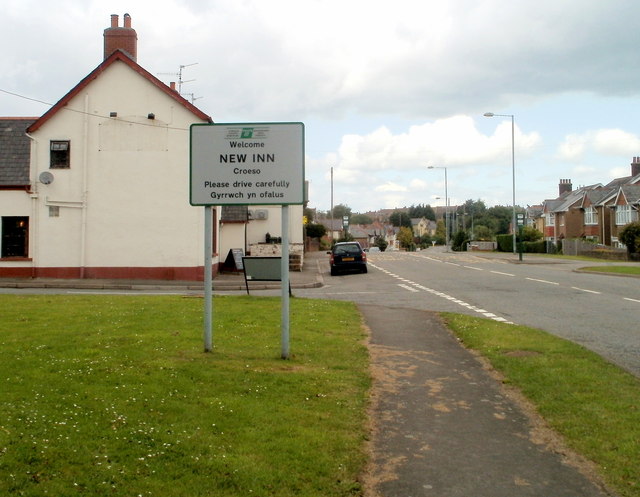
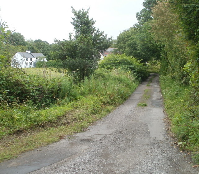
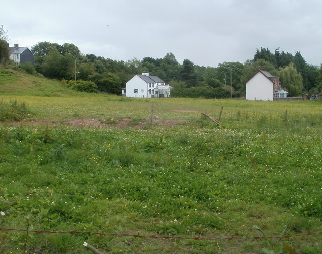
Images are sourced within 2km of 51.672/-2.99 or Grid Reference ST3197. Thanks to Geograph Open Source API. All images are credited.

Traffic lights at the western end of Chapel Lane, Cwmbran At the Avondale Road junction.
Traffic lights at the western end of Chapel Lane, Cwmbran
At the Avondale Road junction.
Football pitch Near Croesyceiliog.
Football pitch
Near Croesyceiliog.
Old bridge on Chapel Lane Over Afon Lwyd.
Old bridge on Chapel Lane
Over Afon Lwyd.
Factory at Pontyfelin
Knauf Insulation, Cwmbran A manufacturing plant, in German ownership.
Knauf Insulation, Cwmbran
A manufacturing plant, in German ownership.
Newport to Abergavenny railway Looking north, near Sebastopol.
Newport to Abergavenny railway
Looking north, near Sebastopol.
Ashbridge Inn, Pontrhydyrun, Cwmbran Located on the east side of Avondale Road, about 100 metres south of the Cwmbran Drive roundabout.
Ashbridge Inn, Pontrhydyrun, Cwmbran
Located on the east side of Avondale Road, about 100 metres south of the Cwmbran Drive roundabout.
Knauf Insulation, Cwmbran Viewed from Avondale Road, north of the Cwmbran Drive roundabout. The site is situated between the A4051 on the west and the Afon Lwyd and Craig-y-Felin wood on the east. Glass mineral wool insulation is made here.
Knauf Insulation, Cwmbran
Viewed from Avondale Road, north of the Cwmbran Drive roundabout. The site is situated between the A4051 on the west and the Afon Lwyd and Craig-y-Felin wood on the east. Glass mineral wool insulation is made here.
Avondale Crescent, Cwmbran Avondale Crescent, a short cul-de-sac, curves away from the east side of Avondale Road.
Avondale Crescent, Cwmbran
Avondale Crescent, a short cul-de-sac, curves away from the east side of Avondale Road.
Lower New Inn pub, Lower New Inn, Pontypool Located a few metres inside the SE boundary of New Inn, on the corner of Newport Road and Lancaster Road.
Lower New Inn pub, Lower New Inn, Pontypool
Located a few metres inside the SE boundary of New Inn, on the corner of Newport Road and Lancaster Road.
Houses at the SE edge of residential New Inn, Pontypool These Newport Road houses are adjacent to the New Inn boundary. From here south to Cwmbran is mostly agricultural land, with a few houses here and there.
Houses at the SE edge of residential New Inn, Pontypool
These Newport Road houses are adjacent to the New Inn boundary. From here south to Cwmbran is mostly agricultural land, with a few houses here and there.
Short drainage channel near New Inn, Pontypool The 40-metre long concrete-lined channel is on the side of Newport Road, a few tens of metres from the edge of residential New Inn. <a title="https://www.geograph.org.uk/photo/2474116" href="https://www.geograph.org.uk/photo/2474116">Link</a> The channel ends at a culvert under the road ahead. <a title="https://www.geograph.org.uk/photo/2475081" href="https://www.geograph.org.uk/photo/2475081">Link</a>
Short drainage channel near New Inn, Pontypool
The 40-metre long concrete-lined channel is on the side of Newport Road, a few tens of metres from the edge of residential New Inn. Link The channel ends at a culvert under the road ahead. Link
Old Newport Road near New Inn, Pontypool Still shown on maps as Newport Road, this is now a lightly-trafficked road since the opening of the A4042. Most of the traffic using the road is to and from the Pimlico Furniture premises about 500 metres away.
Old Newport Road near New Inn, Pontypool
Still shown on maps as Newport Road, this is now a lightly-trafficked road since the opening of the A4042. Most of the traffic using the road is to and from the Pimlico Furniture premises about 500 metres away.
Unnamed road to the A4042 and A4051 near New Inn, Pontypool Before the opening of the A4042, the left turn into Newport Road was the main road. Now most traffic continues ahead, down an unnamed road to the roundabout about 500 metres away, where the A4042 and A4051 meet.
A short drainage channel <a title="https://www.geograph.org.uk/photo/2474125" href="https://www.geograph.org.uk/photo/2474125">Link</a> ends at a culvert under Newport Road. The New Inn boundary <a title="https://www.geograph.org.uk/photo/2475084" href="https://www.geograph.org.uk/photo/2475084">Link</a> is a few tens of metres behind the camera.
Unnamed road to the A4042 and A4051 near New Inn, Pontypool
Before the opening of the A4042, the left turn into Newport Road was the main road. Now most traffic continues ahead, down an unnamed road to the roundabout about 500 metres away, where the A4042 and A4051 meet. A short drainage channel Link ends at a culvert under Newport Road. The New Inn boundary Link is a few tens of metres behind the camera.
Southern boundary of New Inn, Pontypool Newport Road reaches the edge of New Inn. The building on the left is the Lower New Inn <a title="https://www.geograph.org.uk/photo/2474109" href="https://www.geograph.org.uk/photo/2474109">Link</a> which is also the name of this area of New Inn.
Southern boundary of New Inn, Pontypool
Newport Road reaches the edge of New Inn. The building on the left is the Lower New Inn Link which is also the name of this area of New Inn.
Entrance to Shanks premises, Pontypool This is the Pont-y-felin Road entrance to the Pontypool office of Shanks. With premises in Belgium, Canada, Netherlands and the UK, Shanks provide a range of recycling and energy recovery services for customers in the public and private sectors.
Entrance to Shanks premises, Pontypool
This is the Pont-y-felin Road entrance to the Pontypool office of Shanks. With premises in Belgium, Canada, Netherlands and the UK, Shanks provide a range of recycling and energy recovery services for customers in the public and private sectors.
Pont-y-felin Lane, Lower New Inn, Pontypool The view SSE along Pont-y-felin Lane from a metal barrier <a title="https://www.geograph.org.uk/photo/2475118" href="https://www.geograph.org.uk/photo/2475118">Link</a> at the eastern end of a track from Pont-y-felin Road and the Afon Lwyd.
Pont-y-felin Lane, Lower New Inn, Pontypool
The view SSE along Pont-y-felin Lane from a metal barrier Link at the eastern end of a track from Pont-y-felin Road and the Afon Lwyd.
Field and houses, Pont-y-felin Lane, Pontypool The view south from a lane leading to Lancaster Road, Lower New Inn. The houses are on Pont-y-felin Lane.
Field and houses, Pont-y-felin Lane, Pontypool
The view south from a lane leading to Lancaster Road, Lower New Inn. The houses are on Pont-y-felin Lane.
Show me another place!

Llanddewi Court is located at Grid Ref: ST3197 (Lat: 51.672, Lng: -2.99)

What 3 Words

///shiver.beaks.pushing. Near New Inn, Torfaen

Nearby Locations

Llanddewi Court

Related Wikis

Llanddewi Court

Llanddewi Court, Llanddewi Skirrid, Monmouthshire, Wales, is a Grade II* listed house dating from the late 16th century. It is an example of a "double...

District of Monmouth

Monmouth District (Welsh: Trefynwy) was one of five local government districts in the county of Gwent in Wales between 1974 and 1996. In 1988 the district...

Monmouthshire (historic)

Until 1974, Monmouthshire (), also formerly known as the County of Monmouth (; Welsh: Sir Fynwy), was an administrative county in the south-east of Wales...

Diocese of Monmouth

The Diocese of Monmouth is a diocese of the Church in Wales. Despite the name, its cathedral is located not in Monmouth but in Newport — the Cathedral...

Nearby Amenities

Located within 500m of 51.672,-2.99
Created By: GPSBabel-1.3.6
Lat/Long: 51.667621/-2.990674
Created By: GPSBabel-1.3.6
Lat/Long: 51.667692/-2.990004
Power: tower
Lat/Long: 51.6730741/-2.9860819
Power: tower
Lat/Long: 51.6699302/-2.9859799
Power: pole
Lat/Long: 51.6741046/-2.9849996
Power: pole
Lat/Long: 51.6751633/-2.9880546
Power: pole
Lat/Long: 51.6756864/-2.9895365
Direction: 170
Generator Method: photovoltaic
Generator Output Electricity: yes
Generator Solar Modules: 29
Generator Source: solar
Generator Type: solar_photovoltaic_panel
Location: roof
Power: generator
Lat/Long: 51.6724628/-2.9881498
The data included in this document is from www.openstreetmap.org. The data is made available under ODbL.

Have you been to Llanddewi Court?

Leave your review of Llanddewi Court below (or comments, questions and feedback).