Lewis King's Grove, West Stow

Heritage Site in Suffolk

England

Lewis King's Grove, West Stow

West Stow: Field used for grazing
West Stow: Field used for grazing Credit: Michael Garlick

Lewis King's Grove is a significant heritage site located in West Stow, Suffolk, England. This ancient woodland, covering approximately 50 acres, is renowned for its historical and ecological importance. The grove is named after Lewis King, a local landowner who played a crucial role in preserving the area.

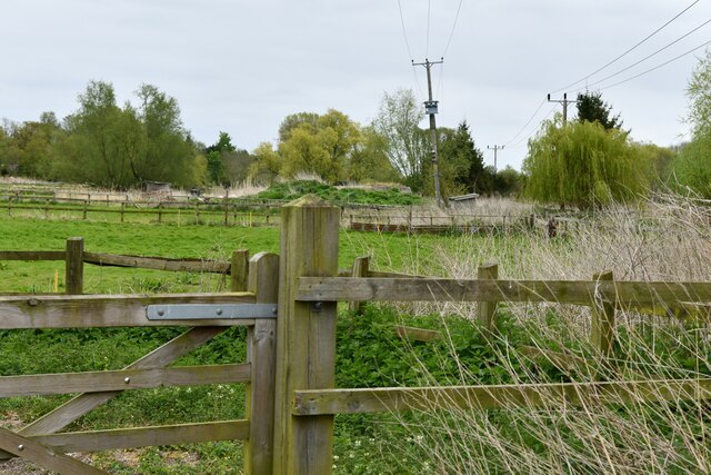
The site boasts a diverse range of flora and fauna, offering a unique habitat for various species. The woodland is predominantly composed of oak trees, interspersed with beech, ash, and hazel. The dense canopy provides a haven for birdlife, including woodpeckers, owls, and various songbirds. Rare and protected species such as dormice and bats also call this grove home.

Lewis King's Grove is not only celebrated for its natural beauty but also for its historical significance. The woodland is believed to have been in existence for over 2,000 years, with evidence of human activity dating back to the Iron Age. Archaeological excavations have revealed ancient earthworks, pottery, and tools, providing insights into the lives of past civilizations.

The grove offers visitors a chance to immerse themselves in the tranquil surroundings, with several well-maintained walking trails meandering through the woodland. Interpretive signs along these paths provide information about the area's natural and cultural heritage. Additionally, the site offers educational programs and guided tours to enhance visitors' knowledge and appreciation of this treasured landscape.

Lewis King's Grove stands as a testament to the importance of preserving our natural and historical heritage, offering a unique and enriching experience for all who explore its captivating grounds.

If you have any feedback on the listing, please let us know in the comments section below.

Lewis King's Grove, West Stow Images

Images are sourced within 2km of 52.301/0.667 or Grid Reference TL8170. Thanks to Geograph Open Source API. All images are credited.

West Stow: Field used for grazing
Wordwell, All Saints Church: The nave
Wordwell, All Saints Church: Norman font on unusual three-legged support
Wordwell, All Saints Church: Bench end 1
Wordwell, All Saints Church: Bench end 2
Wordwell, All Saints Church: Bench end 3
Wordwell, All Saints Church: Bench end 4
Wordwell, All Saints Church: Bench end 5
Wordwell, All Saints Church: Bench end 6
Wordwell, All Saints Church: Bench end 7
Wordwell, All Saints Church: Bench end 8
Wordwell, All Saints Church: Bench end 9
Wordwell, All Saints Church: Bench end 10
Wordwell, All Saints Church: Norman font
Wordwell, All Saints Church: The nave and Norman font
Wordwell, All Saints Church: Poppy head 1
Wordwell, All Saints Church: The altar
Show me another place!

Lewis King's Grove, West Stow is located at Grid Ref: TL8170 (Lat: 52.301, Lng: 0.667)

Police Authority: Suffolk

What 3 Words

///pipeline.pythons.intrigued. Near Bury St Edmunds, Suffolk

Related Wikis

West Stow

West Stow is a small village and civil parish in West Suffolk, England. The village lies north of Bury St. Edmunds, south of Mildenhall and Thetford and...

West Stow Hall

West Stow Hall is a Tudor manor house in West Stow, Suffolk, England, near Bury St Edmunds. It was begun in around 1520 for Sir John Croftes, Master of...

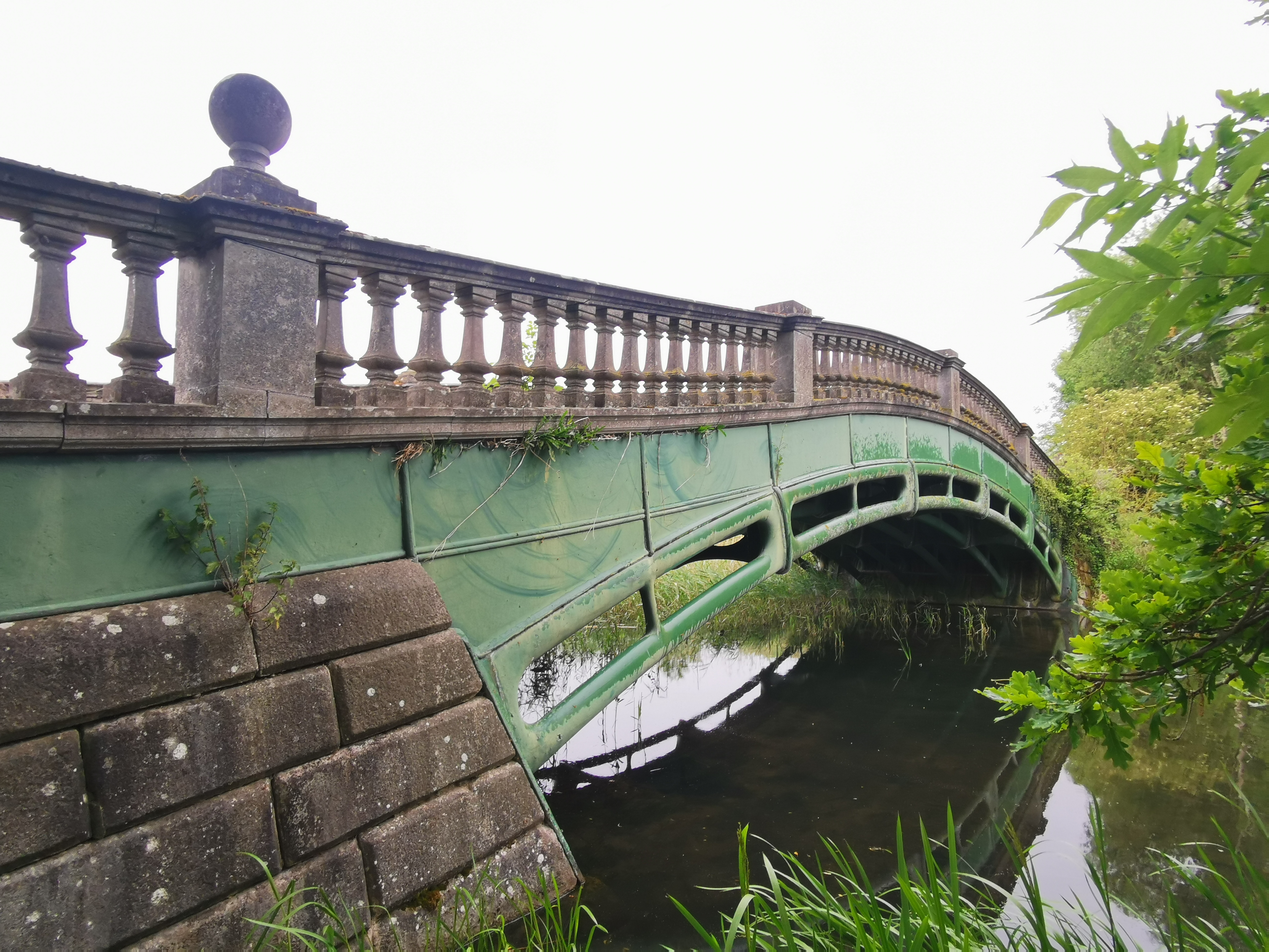
The Iron Bridge, Culford Park

The Iron Bridge is a grade I listed early cast iron bridge crossing a tributary of the River Lark in grounds of Culford Park in the village of Culford...

Flempton

Flempton is a village and civil parish in the West Suffolk district of Suffolk, England. It is on the A1101 road 5 miles NW from Bury St Edmunds. Flempton...

Nearby Amenities

Located within 500m of 52.301,0.667
West Stow
Created By: Potlatch 0.10b
Place: village
Wikidata: Q1003608
Lat/Long: 52.3054689/0.6672851
Bus Stop
Icklingham Road
Naptan AtcoCode: 390050605
Naptan Bearing: S
Naptan CommonName: Icklingham Road
Naptan Indicator: opp
Naptan Landmark: Icklingham Road
Naptan NaptanCode: sufgjdmg
Naptan Street: Ingham Road
Naptan Verified: no
Source: naptan_import
Lat/Long: 52.3043841/0.6686645
Icklingham Road
Naptan AtcoCode: 390050606
Naptan Bearing: N
Naptan BusStopType: CUS
Naptan CommonName: Icklingham Road
Naptan Indicator: adj
Naptan Landmark: Icklingham Road
Naptan NaptanCode: sufgjdmj
Naptan Street: Ingham Road
Naptan Verified: no
Source: naptan_import
Lat/Long: 52.3044671/0.6685701
Power: pole
Lat/Long: 52.2996304/0.6640708
Power: pole
Lat/Long: 52.2982705/0.6659148
Power: pole
Lat/Long: 52.2976635/0.6669367
Power: pole
Lat/Long: 52.2989331/0.6649814
Power: pole
Lat/Long: 52.2969697/0.6677949
Power: pole
Lat/Long: 52.3010513/0.6622441
Power: pole
Lat/Long: 52.3009965/0.662173
Power: pole
Lat/Long: 52.2976061/0.6668482
Power: pole
Lat/Long: 52.2996942/0.6641433
Power: pole
Lat/Long: 52.2990086/0.6650484
Power: pole
Lat/Long: 52.2970025/0.6678673
Power: pole
Lat/Long: 52.2983393/0.6659872
Power: pole
Lat/Long: 52.3003644/0.6631998
Power: pole
Lat/Long: 52.3013986/0.6609625
Power: pole
Lat/Long: 52.3013537/0.6608275
Power: pole
Lat/Long: 52.3003295/0.6631094
Barrier: stile
Lat/Long: 52.3047427/0.6650349
Barrier: stile
Lat/Long: 52.3017986/0.6635731
West Stowe
Man Made: village_sign
Lat/Long: 52.3044648/0.6685301
Bus Stop
Lat/Long: 52.3027809/0.6682917
Chimney Mill Gallery & Framing
Shop: art
Lat/Long: 52.2972281/0.670644
Barrier: kissing_gate
Lat/Long: 52.3030149/0.6683139
Bench
Lat/Long: 52.3024539/0.6719792
Power: pole
Lat/Long: 52.2994533/0.6660196
Power: pole
Lat/Long: 52.3010544/0.6688882
The data included in this document is from www.openstreetmap.org. The data is made available under ODbL.

Have you been to Lewis King's Grove, West Stow?

Leave your review of Lewis King's Grove, West Stow below (or comments, questions and feedback).