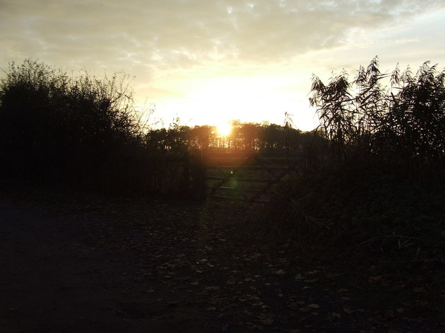
Flempton

Settlement in Suffolk West Suffolk

England

Flempton

West Stow: Field used for grazing
West Stow: Field used for grazing Credit: Michael Garlick

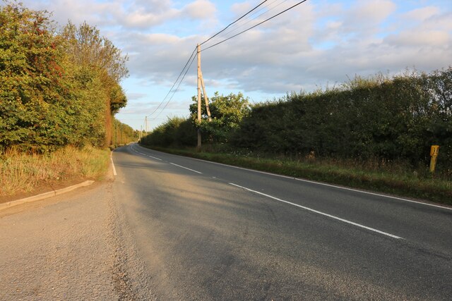
Flempton is a small village located in the county of Suffolk, England. Situated approximately 12 miles northeast of the town of Bury St Edmunds, Flempton is a picturesque and tranquil rural community. The village is surrounded by stunning countryside, characterized by rolling hills, open fields, and meandering streams.

With a population of around 400 residents, Flempton maintains a close-knit and friendly atmosphere. The village is known for its charming cottages, many of which date back several centuries, adding to its historical appeal. The local architecture is predominantly traditional, with a mix of thatched roofs and red-brick facades.

Flempton is home to the All Saints Church, a beautiful medieval parish church that is a prominent feature of the village. The church, with its striking tower and intricate stained glass windows, serves as a reminder of Flempton's rich history.

The village offers a range of amenities to its residents and visitors. There is a local pub, The Greyhound Inn, which provides a warm and welcoming environment for patrons to enjoy a drink or a meal. Additionally, Flempton has a village hall that hosts various community events throughout the year, including social gatherings, clubs, and charity fundraisers.

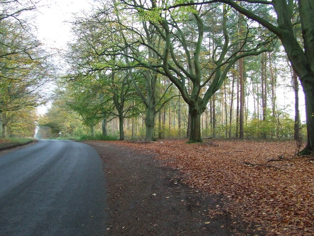
Flempton's idyllic location makes it a popular destination for outdoor enthusiasts. The surrounding countryside offers ample opportunities for walking, cycling, and horseback riding. The village is also conveniently located near Thetford Forest Park, a vast woodland area renowned for its scenic trails and wildlife.

Overall, Flempton is a charming and peaceful village that offers a serene escape from the hustle and bustle of city life. Its rich history, natural beauty, and strong sense of community make it a truly special place in Suffolk.

If you have any feedback on the listing, please let us know in the comments section below.

Flempton Images

Images are sourced within 2km of 52.298187/0.65873024 or Grid Reference TL8170. Thanks to Geograph Open Source API. All images are credited.

West Stow: Field used for grazing
West Stow Hall West Stow Hall is a Grade I listed, see: <span class="nowrap"><a title="https://historicengland.org.uk/listing/the-list/list-entry/1031269?section=official-list-entry" rel="nofollow ugc noopener" href="https://historicengland.org.uk/listing/the-list/list-entry/1031269?section=official-list-entry">Link</a><img style="margin-left:2px;" alt="External link" title="External link - shift click to open in new window" src="https://s1.geograph.org.uk/img/external.png" width="10" height="10"/></span>  The gatehouse dates from around 1520 and was built by Sir John Crofts, Master of the Horse to the sister of Henry VIII, Mary Tudor, who was briefly Queen of France, and subsequently the wife of Charles Brandon, Duke of Suffolk.
West Stow Hall
West Stow Hall is a Grade I listed, see: LinkExternal link The gatehouse dates from around 1520 and was built by Sir John Crofts, Master of the Horse to the sister of Henry VIII, Mary Tudor, who was briefly Queen of France, and subsequently the wife of Charles Brandon, Duke of Suffolk.
Double Decker Hide, Lackford Lakes See <a href="https://www.geograph.org.uk/photo/7286761">TL8070 : View from the Double Decker Hide</a>
Double Decker Hide, Lackford Lakes
View from the Double Decker Hide Looking towards the Slough.
View from the Double Decker Hide
Looking towards the Slough.
Bury Road at the entrance to Lackford Lakes
View from Culford school building Culford School, clearly based on a former mansion and its parkland, is now big enough to be a village in itself, although it is actually in the middle of the village of Culford. This is the view from the old main building, from a large room that was perhaps a ballroom.
View from Culford school building
Culford School, clearly based on a former mansion and its parkland, is now big enough to be a village in itself, although it is actually in the middle of the village of Culford. This is the view from the old main building, from a large room that was perhaps a ballroom.
View from corridor end, Culford School A view across the very neat lawns and over the small valley containing the lake.
View from corridor end, Culford School
A view across the very neat lawns and over the small valley containing the lake.
Parkland at Culford School Viewed from just in front of the original old building, this gives an idea of a small part of the surroundings of this private school. 

I would have loved to attend a school with these kind of facilities - I wonder if the current pupils appreciate what they have got. However it must be a nightmare for staff if pupils decide to wander off.

There are cars parked on the grass due to the high attendance at one of the regular Art Deco and Retro fairs.
Parkland at Culford School
Viewed from just in front of the original old building, this gives an idea of a small part of the surroundings of this private school. I would have loved to attend a school with these kind of facilities - I wonder if the current pupils appreciate what they have got. However it must be a nightmare for staff if pupils decide to wander off. There are cars parked on the grass due to the high attendance at one of the regular Art Deco and Retro fairs.
Art Deco and Retro Fair in school building While one might be envious of having spectacular buildings like this for a school room, it has to be admitted that Culford School have done a very good job of keeping it in good condition.
Art Deco and Retro Fair in school building
While one might be envious of having spectacular buildings like this for a school room, it has to be admitted that Culford School have done a very good job of keeping it in good condition.
Ceiling detail, Culford School A spectacular ceiling in perfect condition. With very neat uplighting to show it off. Photographed during an Art Deco and Retro Fair.
Ceiling detail, Culford School
A spectacular ceiling in perfect condition. With very neat uplighting to show it off. Photographed during an Art Deco and Retro Fair.
Wall decorations, Culford School Really impressive decoration in perfect state of preservation. 

Photo taken during an Art Deco and Retro fair.
Wall decorations, Culford School
Really impressive decoration in perfect state of preservation. Photo taken during an Art Deco and Retro fair.
Country Road Minor road near to West Stow, Suffolk.
Country Road
Minor road near to West Stow, Suffolk.
Suffolk Wildlife Trust Visitor centre of the Suffolk Wildlife Trust at Lackford Lakes near to Lackford, Suffolk. For info about this nature reserve see <span class="nowrap"><a title="http://www.suffolkwildlifetrust.org/reserves-and-visitor-centres/lackford-lakes/" rel="nofollow ugc noopener" href="http://www.suffolkwildlifetrust.org/reserves-and-visitor-centres/lackford-lakes/">Link</a><img style="margin-left:2px;" alt="External link" title="External link - shift click to open in new window" src="https://s1.geograph.org.uk/img/external.png" width="10" height="10"/></span>
Suffolk Wildlife Trust
Visitor centre of the Suffolk Wildlife Trust at Lackford Lakes near to Lackford, Suffolk. For info about this nature reserve see LinkExternal link
Open Gates Gates at the end of the road from Suffolk Wildlife Trust at Lackford lakes near to Lackford, Suffolk.
Open Gates
Gates at the end of the road from Suffolk Wildlife Trust at Lackford lakes near to Lackford, Suffolk.
Sunset Sunset near to Lackford, suffolk.
Sunset
Sunset near to Lackford, suffolk.
River Lark, West Stow The diminutive River Lark, seen from West Stow Road bridge. It is a tributary of the River Great Ouse, joining it just north of Ely.
River Lark, West Stow
The diminutive River Lark, seen from West Stow Road bridge. It is a tributary of the River Great Ouse, joining it just north of Ely.
Cycling across Weststow Heath A cyclist's reflective jacket provides a splash of colour as he passes through the southern tip of the King's Forest.
Cycling across Weststow Heath
A cyclist's reflective jacket provides a splash of colour as he passes through the southern tip of the King's Forest.
River Lark, West Stow The bridge carries West Stow Road over the narrow river.
River Lark, West Stow
The bridge carries West Stow Road over the narrow river.
Show me another place!

Flempton is located at Grid Ref: TL8170 (Lat: 52.298187, Lng: 0.65873024)

Administrative County: Suffolk

District: West Suffolk

Police Authority: Suffolk

What 3 Words

///geology.grandest.squeezed. Near Bury St Edmunds, Suffolk

Related Wikis

Flempton

Flempton is a village and civil parish in the West Suffolk district of Suffolk, England. It is on the A1101 road 5 miles NW from Bury St Edmunds. Flempton...

West Stow

West Stow is a small village and civil parish in West Suffolk, England. The village lies north of Bury St. Edmunds, south of Mildenhall and Thetford and...
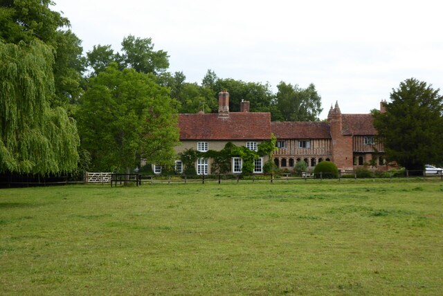
West Stow Hall

West Stow Hall is a Tudor manor house in West Stow, Suffolk, England, near Bury St Edmunds. It was begun in around 1520 for Sir John Croftes, Master of...
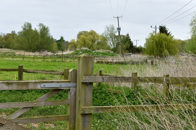
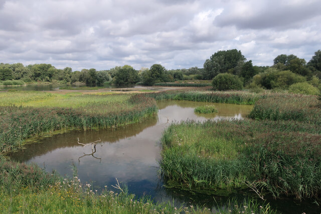
Lackford Lakes

Lackford Lakes is a 105.8-hectare (261-acre) biological Site of Special Scientific Interest (SSSI) north and east of Lackford in Suffolk. The SSSI is part...

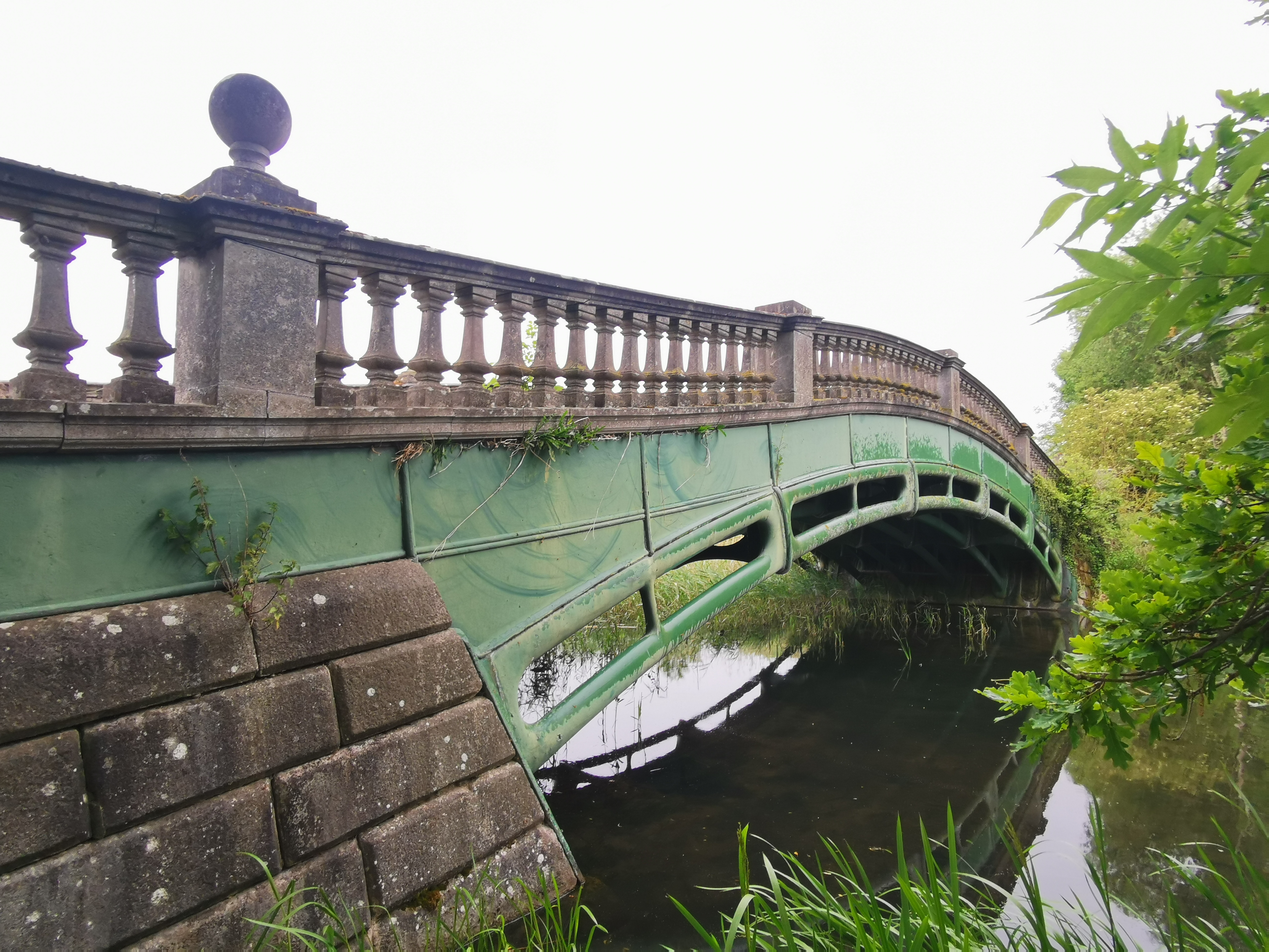
The Iron Bridge, Culford Park

The Iron Bridge is a grade I listed early cast iron bridge crossing a tributary of the River Lark in grounds of Culford Park in the village of Culford...
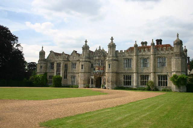
Hengrave Hall

Hengrave Hall is a Grade I listed Tudor manor house in Hengrave near Bury St. Edmunds in Suffolk, England and was the seat of the Kitson and Gage families...

Church of St John Lateran, Hengrave

The Church of St John Lateran, Hengrave is the former parish church of Hengrave, Suffolk. In 1589 this parish was consolidated with that of adjacent Flempton...
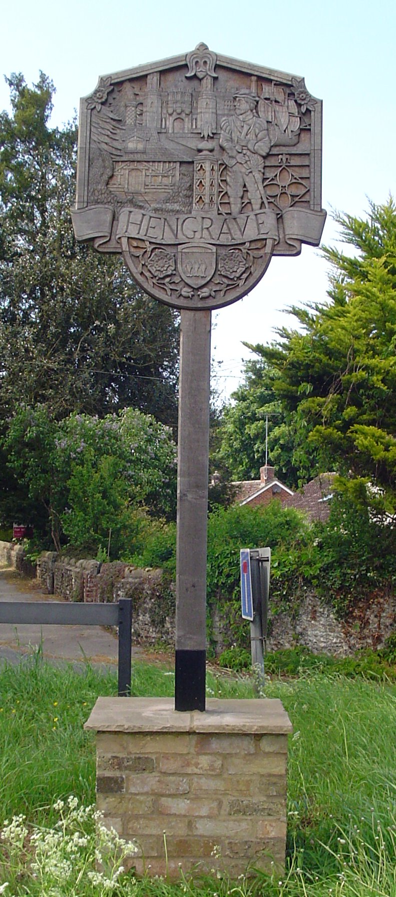
Hengrave

Hengrave is a small village and civil parish in the West Suffolk district, in the county of Suffolk, England. It is to the North the town of Bury St Edmunds...

Nearby Amenities

Located within 500m of 52.298187,0.65873024
Flempton
Created By: Potlatch 0.10b
Place: village
Source: NPE
Wikidata: Q1947707
Lat/Long: 52.2962199/0.6567697
Bus Stop
Church
Naptan AtcoCode: 390050607
Naptan Bearing: SE
Naptan CommonName: Church
Naptan Indicator: Near
Naptan Landmark: Church
Naptan NaptanCode: sufgjdmp
Naptan Street: A1101
Source: naptan_import;survey
Lat/Long: 52.2977747/0.6565169
Bus Stop
Church
Bus: yes
Naptan AtcoCode: 390050608
Naptan Bearing: NW
Naptan BusStopType: CUS
Naptan CommonName: Church
Naptan Indicator: opp
Naptan Landmark: Church
Naptan NaptanCode: sufgjdmt
Naptan Street: A1101
Naptan Verified: no
Public Transport: platform
Source: naptan_import
Lat/Long: 52.297336/0.6569936
Bus Stop
Church
Naptan AtcoCode: 390050609
Naptan Bearing: SE
Naptan CommonName: Church
Naptan Indicator: adj
Naptan Landmark: Church
Naptan NaptanCode: sufgjdmw
Naptan Street: A1101
Naptan Verified: no
Shelter: yes
Source: naptan_import
Lat/Long: 52.2970502/0.6578252
Turning Circle
Lat/Long: 52.2986307/0.6561699
Power: pole
Lat/Long: 52.3015706/0.6567926
Power: pole
Lat/Long: 52.3017018/0.658241
Power: pole
Lat/Long: 52.2995974/0.6640453
Power: pole
Lat/Long: 52.2982705/0.6659148
Power: pole
Lat/Long: 52.3016969/0.6593943
Power: pole
Lat/Long: 52.2989331/0.6649814
Power: pole
Lat/Long: 52.3013115/0.6540782
Power: pole
Lat/Long: 52.3014427/0.6554676
Power: pole
Lat/Long: 52.3014853/0.6568221
Power: pole
Lat/Long: 52.3010261/0.6621892
Power: pole
Lat/Long: 52.3009687/0.6621033
Power: pole
Lat/Long: 52.3016149/0.6582517
Power: pole
Lat/Long: 52.2996548/0.6641418
Power: pole
Lat/Long: 52.2990086/0.6650484
Power: pole
Lat/Long: 52.2983393/0.6659872
Power: pole
Lat/Long: 52.300347/0.6631279
Power: pole
Lat/Long: 52.3013574/0.6609339
Power: pole
Lat/Long: 52.3013115/0.6607837
Power: pole
Lat/Long: 52.3003011/0.6630555
Power: pole
Lat/Long: 52.3013558/0.6554649
Power: pole
Lat/Long: 52.3012377/0.6541023
Power: pole
Lat/Long: 52.3018035/0.6593621
Power: pole
Lat/Long: 52.2969271/0.6591876
Power: pole
Lat/Long: 52.294938/0.6609953
Power: pole
Lat/Long: 52.2973225/0.6589221
Power: pole
Lat/Long: 52.2971108/0.6578385
Power: pole
Lat/Long: 52.2993828/0.6598607
The Greyhound
Addr Postcode: IP28 6EL
Addr Street: The Green
Disused Amenity: pub
Phone: +44 1284 728400
Wikidata: Q26282790
Lat/Long: 52.2979301/0.6581451
Power: pole
Lat/Long: 52.2942961/0.6620092
Power: pole
Lat/Long: 52.2965449/0.6594666
Power: pole
Lat/Long: 52.2954939/0.6600888
Power: pole
Lat/Long: 52.2958658/0.6599038
Power: pole
Lat/Long: 52.298661/0.6592975
Power: pole
Lat/Long: 52.2977145/0.6586995
Power: pole
Lat/Long: 52.2982722/0.6590535
Power: pole
Lat/Long: 52.2990252/0.6595335
Power: pole
Lat/Long: 52.2962037/0.6596865
Post Box
Collection Times: Mo-Fr 16:00; Sa 10:00
Post Box Mounting: pier
Post Box Type: lamp
Ref: IP28 2162
Royal Cypher: EIIR
Royal Cypher Wikidata: Q33102113
Lat/Long: 52.2976798/0.6567447
Telephone
Booth: K6
Covered: booth
Listed Status: Grade II
Phone: +44 1284 728293
Lat/Long: 52.2977141/0.6566936
The data included in this document is from www.openstreetmap.org. The data is made available under ODbL.

Have you been to Flempton?

Leave your review of Flempton below (or comments, questions and feedback).