Lady's Well

Heritage Site in Dorset

England

Lady's Well

Benchmark on Remedy House, near Hermitage Ordnance Survey benchmark, described on database at <span class="nowrap"><a title="http://www.bench-marks.org.uk/bm71318" rel="nofollow ugc noopener" href="http://www.bench-marks.org.uk/bm71318">Link</a><img style="margin-left:2px;" alt="External link" title="External link - shift click to open in new window" src="https://s1.geograph.org.uk/img/external.png" width="10" height="10"/></span>. See also <a href="https://www.geograph.org.uk/photo/4723466">ST6405 : Remedy House gate, near Hermitage</a>.
Benchmark on Remedy House, near Hermitage Credit: Becky Williamson

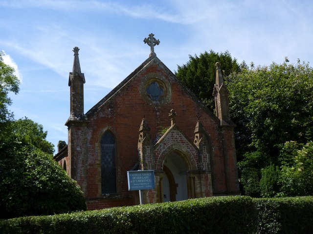
Lady's Well is a significant heritage site located in the county of Dorset, England. Nestled in the picturesque village of Sherborne, this historic well holds great cultural and religious significance. The well is believed to date back to the medieval period and has been a place of pilgrimage for centuries.

The well is named after the Lady Chapel of Sherborne Abbey, which overlooks it. According to local folklore, the well was discovered by Saint Aldhelm, the first Bishop of Sherborne, in the 7th century. It is said that he blessed the well and declared it to possess healing properties.

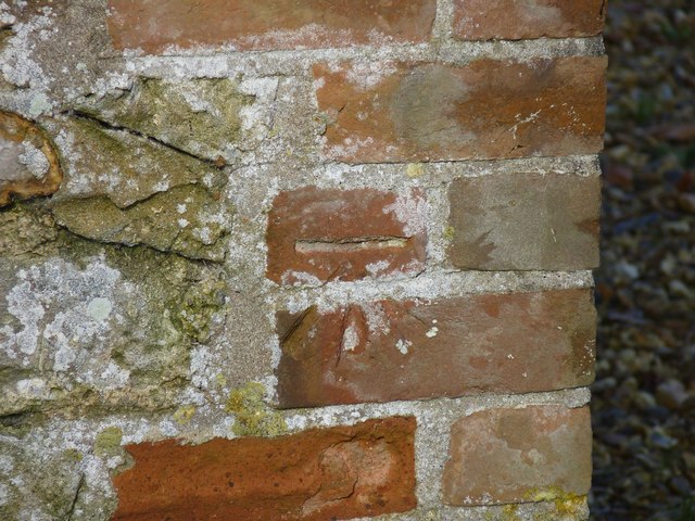
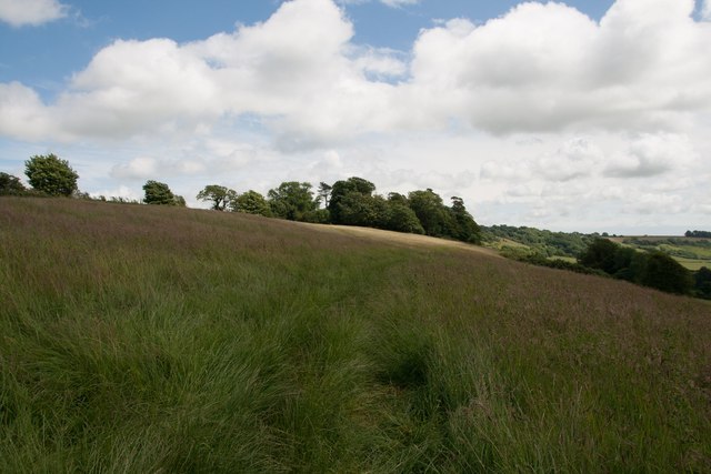
Lady's Well consists of a stone structure with a small pool of water at its center. The water is crystal clear and is said to have healing powers, attracting visitors seeking spiritual or physical rejuvenation. The well is surrounded by lush greenery and a peaceful ambiance, providing a serene and tranquil environment for visitors.

The site is also adorned with religious artifacts such as crosses and rosaries left by pilgrims over the years. These tokens serve as a testament to the deep-rooted religious beliefs associated with Lady's Well.

Today, Lady's Well continues to attract visitors from near and far, both for its historical significance and its natural beauty. It is a place where visitors can reflect, find solace, and connect with the spiritual heritage of the region. The site is well-maintained by local authorities and is accessible to the public, ensuring that its legacy is preserved for future generations.

If you have any feedback on the listing, please let us know in the comments section below.
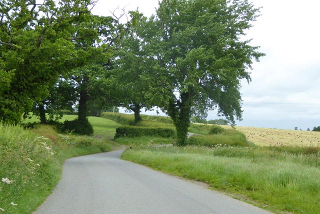
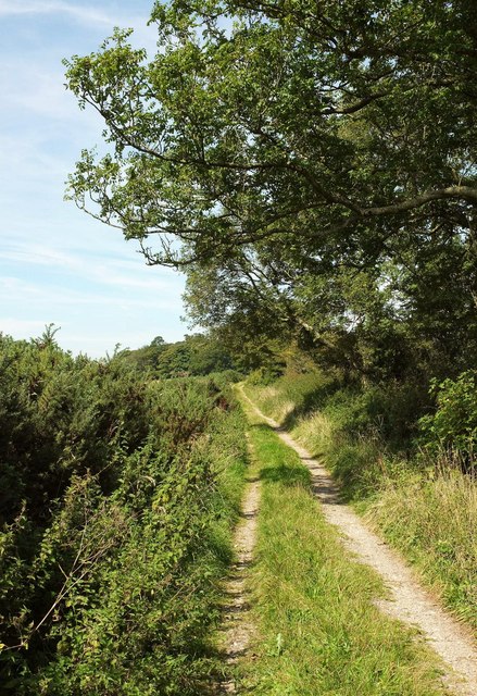
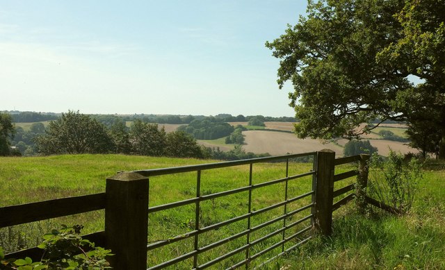
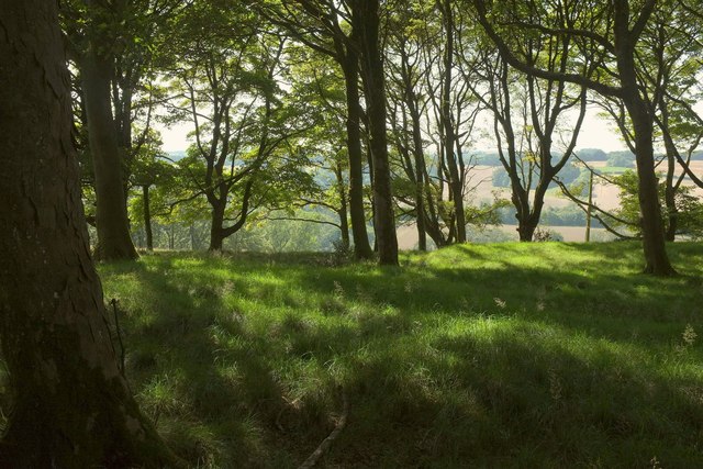
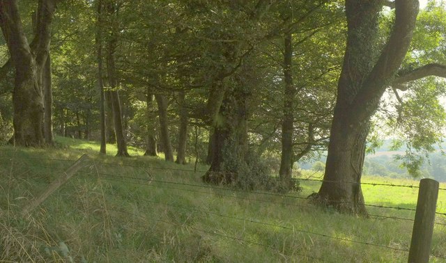
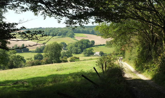
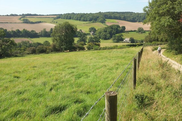
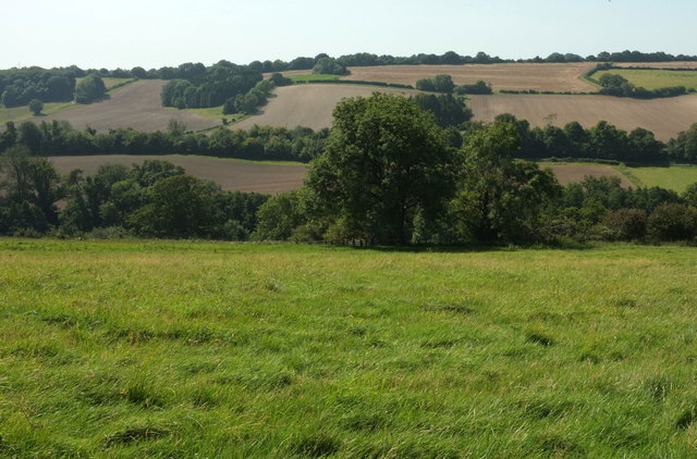
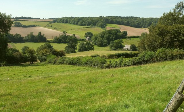
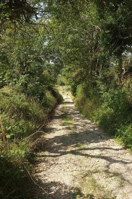
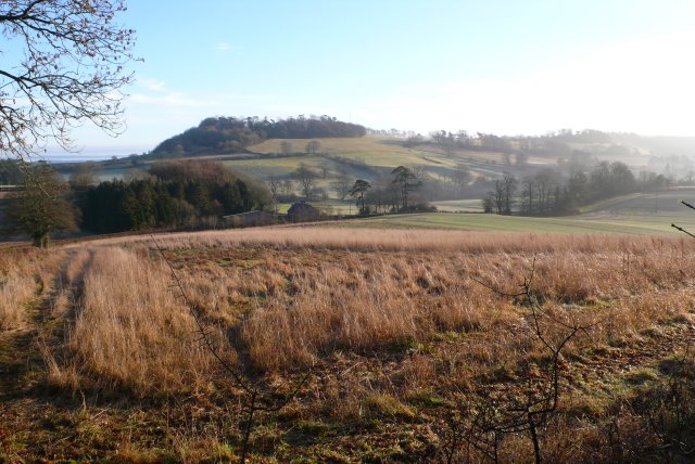
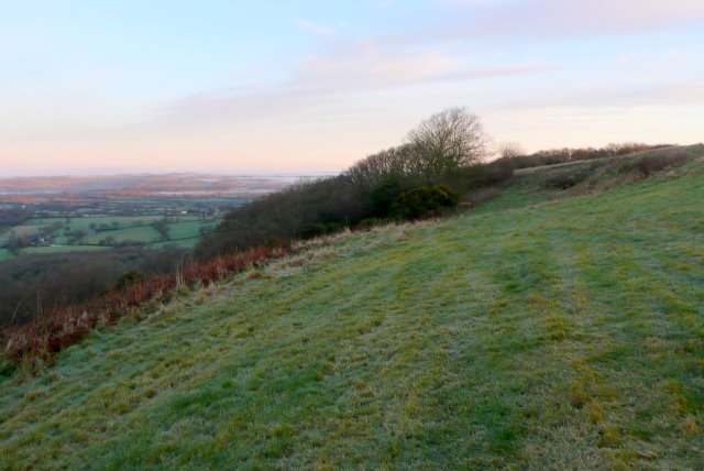
Lady's Well Images

Images are sourced within 2km of 50.857/-2.49 or Grid Reference ST6506. Thanks to Geograph Open Source API. All images are credited.

Benchmark on Remedy House, near Hermitage Ordnance Survey benchmark, described on database at <span class="nowrap"><a title="http://www.bench-marks.org.uk/bm71318" rel="nofollow ugc noopener" href="http://www.bench-marks.org.uk/bm71318">Link</a><img style="margin-left:2px;" alt="External link" title="External link - shift click to open in new window" src="https://s1.geograph.org.uk/img/external.png" width="10" height="10"/></span>. See also <a href="https://www.geograph.org.uk/photo/4723466">ST6405 : Remedy House gate, near Hermitage</a>.
Benchmark on Remedy House, near Hermitage
Ordnance Survey benchmark, described on database at LinkExternal link. See also ST6405 : Remedy House gate, near Hermitage.
Remedy House gate, near Hermitage There is an Ordnance Survey benchmark on the right-hand side of the gable end of this house. See <a href="https://www.geograph.org.uk/photo/4723461">ST6405 : Benchmark on Remedy House, near Hermitage</a>
Ordnance Survey benchmark, described on database at <span class="nowrap"><a title="http://www.bench-marks.org.uk/bm71318" rel="nofollow ugc noopener" href="http://www.bench-marks.org.uk/bm71318">Link</a><img style="margin-left:2px;" alt="External link" title="External link - shift click to open in new window" src="https://s1.geograph.org.uk/img/external.png" width="10" height="10"/></span>.
Remedy House gate, near Hermitage
There is an Ordnance Survey benchmark on the right-hand side of the gable end of this house. See ST6405 : Benchmark on Remedy House, near Hermitage Ordnance Survey benchmark, described on database at LinkExternal link.
St Lawrence's Catholic Church, Middlemarsh There is an Ordnance Survey benchmark on this building, see <a title="https://www.geograph.org.uk/photo/4547331" href="https://www.geograph.org.uk/photo/4547331">Link</a>.
St Lawrence's Catholic Church, Middlemarsh
There is an Ordnance Survey benchmark on this building, see Link.
Little Minterne Hill
Crops at Telegraph Hill
Hermitage Lane Heading towards Hermitage.
Hermitage Lane
Heading towards Hermitage.
Lane north from Hermitage A field cut for silage on the right has attracted a great many rooks.
Lane north from Hermitage
A field cut for silage on the right has attracted a great many rooks.
Hardy Way Running along a ridgetop public access route towards Dogbury Hill.
Hardy Way
Running along a ridgetop public access route towards Dogbury Hill.
Field and gate, Dogbury Hill Where the Hardy Way enters Dogbury Plantation, with a glimpsed of the Cerne valley near Minterne Magna.
Field and gate, Dogbury Hill
Where the Hardy Way enters Dogbury Plantation, with a glimpsed of the Cerne valley near Minterne Magna.
Dogbury Plantation Seen from the Hardy Way, with the Cerne valley in the background.
Dogbury Plantation
Seen from the Hardy Way, with the Cerne valley in the background.
Hardy Way in Dogbury Plantation Climbing a route with public access. <a href="https://www.geograph.org.uk/photo/5521392">ST6605 : Dogbury Plantation</a> looks right from this stretch of the track.
Hardy Way in Dogbury Plantation
Climbing a route with public access. ST6605 : Dogbury Plantation looks right from this stretch of the track.
Dogbury Plantation Looking right from where <a href="https://www.geograph.org.uk/photo/5521405">ST6605 : Hardy Way in Dogbury Plantation</a> was taken.
Dogbury Plantation
Looking right from where ST6605 : Hardy Way in Dogbury Plantation was taken.
Approaching Dogbury Gate The Hardy Way drops down a route with public access into the Cerne valley. The building right of centre with the bellcote is the former Minterne Magna School <span class="nowrap"><a title="https://www.historicengland.org.uk/listing/the-list/list-entry/1118816" rel="nofollow ugc noopener" href="https://www.historicengland.org.uk/listing/the-list/list-entry/1118816">Link</a><img style="margin-left:2px;" alt="External link" title="External link - shift click to open in new window" src="https://s1.geograph.org.uk/img/external.png" width="10" height="10"/></span> . The wood across the valley is Minterne Seat Coppice.
Approaching Dogbury Gate
The Hardy Way drops down a route with public access into the Cerne valley. The building right of centre with the bellcote is the former Minterne Magna School LinkExternal link . The wood across the valley is Minterne Seat Coppice.
Cerne valley near Dogbury Gate The Hardy Way descends a route with public access into the Cerne valley. Right of centre is the school house also seen in <a href="https://www.geograph.org.uk/photo/5521426">ST6505 : Approaching Dogbury Gate</a>  <span class="nowrap"><a title="https://www.historicengland.org.uk/listing/the-list/list-entry/1118816" rel="nofollow ugc noopener" href="https://www.historicengland.org.uk/listing/the-list/list-entry/1118816">Link</a><img style="margin-left:2px;" alt="External link" title="External link - shift click to open in new window" src="https://s1.geograph.org.uk/img/external.png" width="10" height="10"/></span> . Again, the wood across the valley is Minterne Seat Coppice.
Cerne valley near Dogbury Gate
The Hardy Way descends a route with public access into the Cerne valley. Right of centre is the school house also seen in ST6505 : Approaching Dogbury Gate LinkExternal link . Again, the wood across the valley is Minterne Seat Coppice.
Cerne valley near Dogbury Gate Looking left from where <a href="https://www.geograph.org.uk/photo/5521524">ST6505 : Cerne valley near Dogbury Gate</a> was taken. The further line of trees, along the A52 Sandy Lane, and the land beyond, is in <a href="https://www.geograph.org.uk/gridref/ST6504">ST6504</a>
Cerne valley near Dogbury Gate
Looking left from where ST6505 : Cerne valley near Dogbury Gate was taken. The further line of trees, along the A52 Sandy Lane, and the land beyond, is in ST6504
Cerne valley near Dogbury Gate From the Hardy Way descending the track shown in <a href="https://www.geograph.org.uk/photo/5521524">ST6505 : Cerne valley near Dogbury Gate</a>, again with the school house and its bellcote  <span class="nowrap"><a title="https://www.historicengland.org.uk/listing/the-list/list-entry/1118816" rel="nofollow ugc noopener" href="https://www.historicengland.org.uk/listing/the-list/list-entry/1118816">Link</a><img style="margin-left:2px;" alt="External link" title="External link - shift click to open in new window" src="https://s1.geograph.org.uk/img/external.png" width="10" height="10"/></span> right of centre, and Lane Cottages in the centre.
Cerne valley near Dogbury Gate
From the Hardy Way descending the track shown in ST6505 : Cerne valley near Dogbury Gate, again with the school house and its bellcote LinkExternal link right of centre, and Lane Cottages in the centre.
Hardy Way approaching Dogbury Gate The route with public access shown in <a href="https://www.geograph.org.uk/photo/5521524">ST6505 : Cerne valley near Dogbury Gate</a>, seen from close to where <a href="https://www.geograph.org.uk/photo/5522708">ST6505 : Cerne valley near Dogbury Gate</a> was taken.
Hardy Way approaching Dogbury Gate
The route with public access shown in ST6505 : Cerne valley near Dogbury Gate, seen from close to where ST6505 : Cerne valley near Dogbury Gate was taken.
Hardy Way to Dogbury Hill A reverse view of <a href="https://www.geograph.org.uk/photo/5522940">ST6505 : Hardy Way approaching Dogbury Gate</a> with the Way climbing the route with public access, seen from the junction with bridleway S31 14 and footpath S31 13.
Hardy Way to Dogbury Hill
A reverse view of ST6505 : Hardy Way approaching Dogbury Gate with the Way climbing the route with public access, seen from the junction with bridleway S31 14 and footpath S31 13.
Show me another place!

Lady's Well is located at Grid Ref: ST6506 (Lat: 50.857, Lng: -2.49)

Unitary Authority: Dorset

Police Authority: Dorset

What 3 Words

///kept.hasten.regretted. Near Yetminster, Dorset

Related Wikis

Hermitage, Dorset

Hermitage is a small village and civil parish in the county of Dorset in southern England. It is situated in the Blackmore Vale under the scarp of the...

Dogbury Hill

At 248 metres (814 ft), Dogbury Hill is one of the highest hills in the county of Dorset, England. It is the site of a prehistoric hill fort. == Location... ==

Telegraph Hill, Dorset

Telegraph Hill (267 metres, 876 feet high) is a hill about 1 mile northwest of Minterne Magna and about 10 miles north of Dorchester in the county of Dorset...

Cosmore

Cosmore is a small village in Dorset, situated just off the main A352 Sherborne-Dorchester road. It sits at the foot of Dogbury Hill, one of Dorset's...

River Cerne

The River Cerne is a ten mile long river in Dorset, England, which rises in the Chalk hills of the Dorset Downs at Minterne Magna, between High Stoy and...

Minterne Magna

Minterne Magna is a village and civil parish in Dorset, England, situated midway between Dorchester and Sherborne. In the 2011 census the parish had a...

Cerne, Totcombe and Modbury Hundred

Cerne, Totcombe and Modbury Hundred was a hundred in the county of Dorset, England. Some of its tithings and parishes were exclaves which indicates that...

Hilfield

Hilfield is a small, scattered village and civil parish in west Dorset, England, situated under the scarp face of the Dorset Downs 7 miles (11 km) south...

Related Videos

Minterne House & Gardens. Autumn Colors, Dorset, UK 25/10/2020

2020 has been a strange and quite depressing year with COVID19. Usually I visit different countries, at least 2 European countries ...

Liam + Caroline ~ The Vow ~ Minterne House Minterne Magna Dorset Wedding Highlights Film Videography

Liam + Caroline ~ The Vow ~ Minterne House Minterne Magna Dorset Wedding Highlights Film ~ Fire Dove Films Ltd / Dorset, ...

Minterne House Wedding | James & Ella | Devon Wedding Films

This was the wedding of James and Ella shot at Minterne House, Dorset. All filmed solo with 2 x Sony A7iii's and a Sony A6500.

Have you been to Lady's Well?

Leave your review of Lady's Well below (or comments, questions and feedback).