Lady's Well

Heritage Site in Gloucestershire Gloucester

England

Lady's Well

The entrance to Gloucester Docks The River Severn is in flood and is in danger of getting higher than the water level in the lock into Gloucester Docks <span class="nowrap"><a title="http://www.gloucesterdocks.me.uk/gloucester/docks.htm" rel="nofollow ugc noopener" href="http://www.gloucesterdocks.me.uk/gloucester/docks.htm">Link</a><img style="margin-left:2px;" alt="External link" title="External link - shift click to open in new window" src="https://s1.geograph.org.uk/img/external.png" width="10" height="10"/></span> so defences have been erected! The Quay, normally visible on the right is submerged. On the other side of the road is Gloucester Gaol.
The entrance to Gloucester Docks Credit: David Stowell

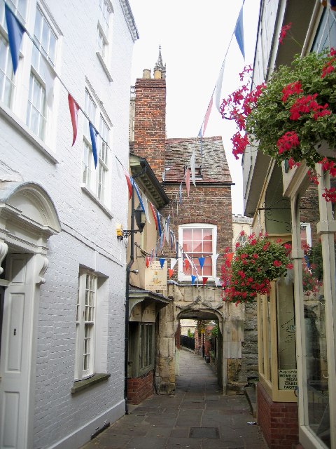
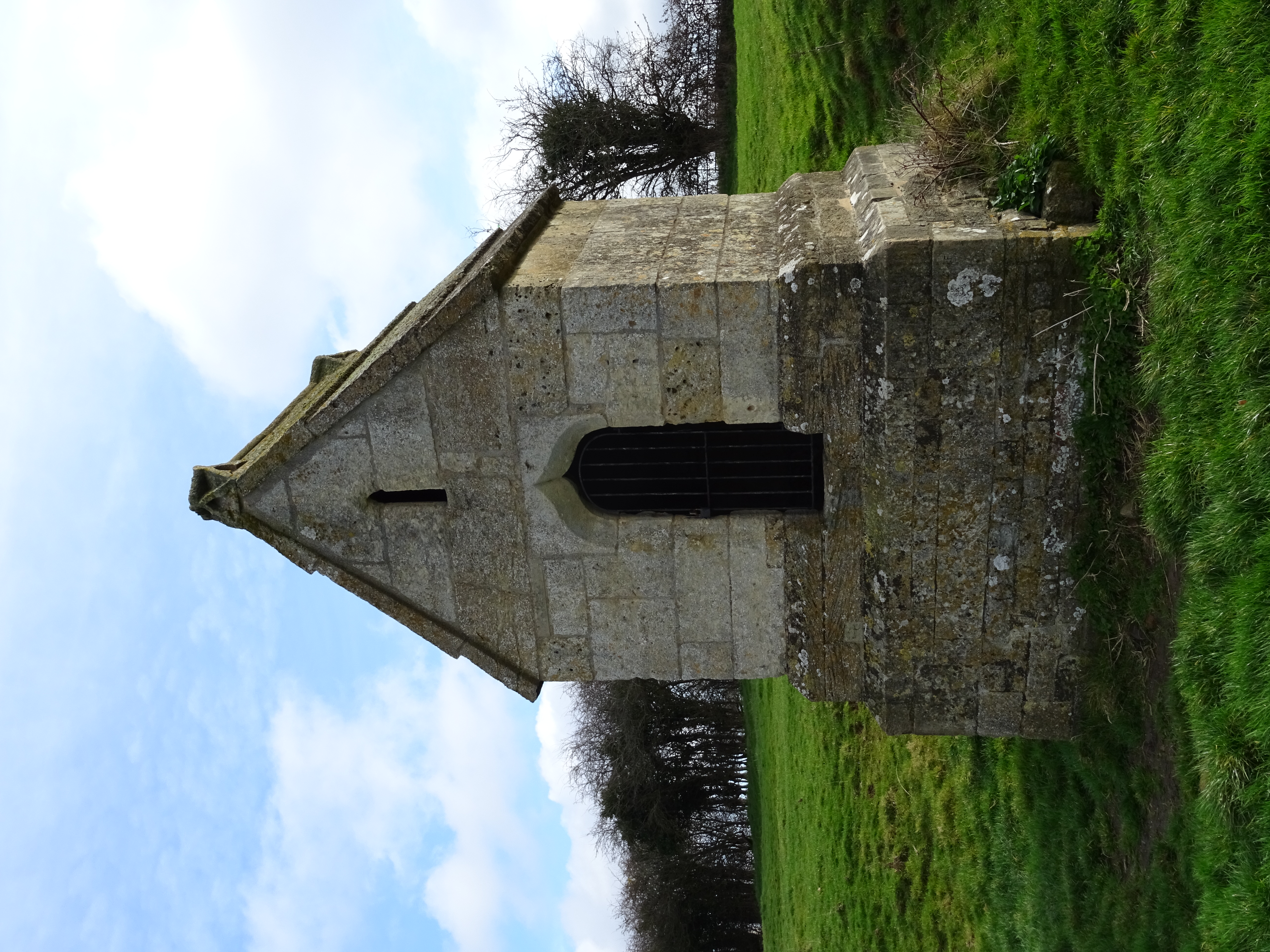
Lady's Well is a historic site located in Gloucestershire, England. Situated near the village of Coberley, it is a significant heritage site due to its rich history and cultural importance. The well is believed to date back to the medieval period and is dedicated to the Virgin Mary, hence the name "Lady's Well."

The well is nestled in a picturesque setting, surrounded by lush greenery and a peaceful atmosphere. It consists of a small stone structure enclosing the natural spring that has been revered for centuries. The well is adorned with a simple iron gate and a plaque explaining its historical significance.

Throughout the years, Lady's Well has been a place of pilgrimage and devotion for locals and visitors alike. People would come to the well to seek healing, particularly for eye ailments, as it was believed that the water possessed medicinal properties. The well also held religious significance, and it is said that visitors would leave offerings or tokens of their faith.

Today, Lady's Well remains a popular site for tourists and history enthusiasts. It offers a glimpse into the region's past and provides a tranquil retreat for those seeking solace. The site is well-maintained, and visitors can enjoy the serene surroundings while learning about the well's fascinating history.

Lady's Well is a testament to the enduring cultural heritage of Gloucestershire and serves as a reminder of the significance of ancient traditions in modern times.

If you have any feedback on the listing, please let us know in the comments section below.
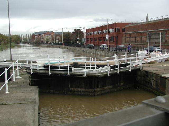
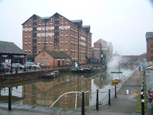
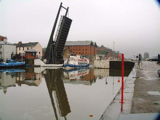
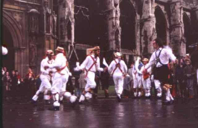
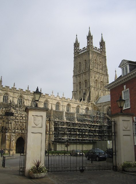
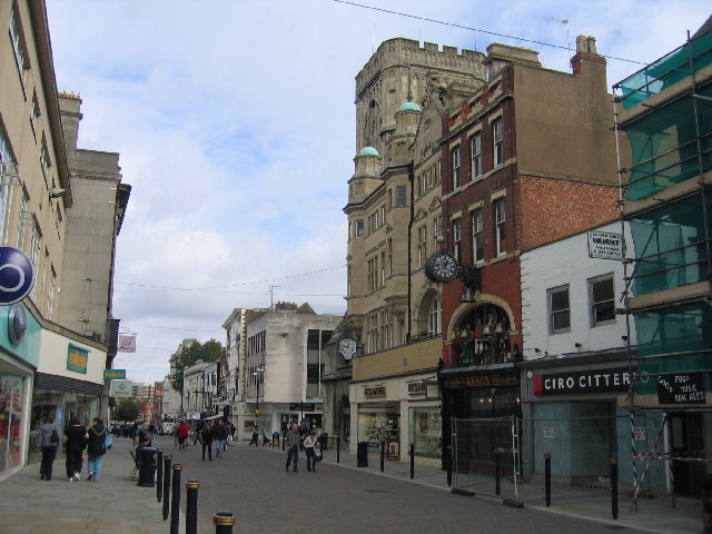
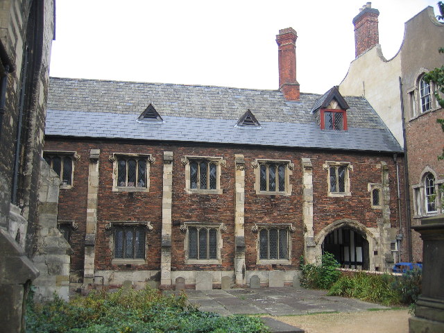
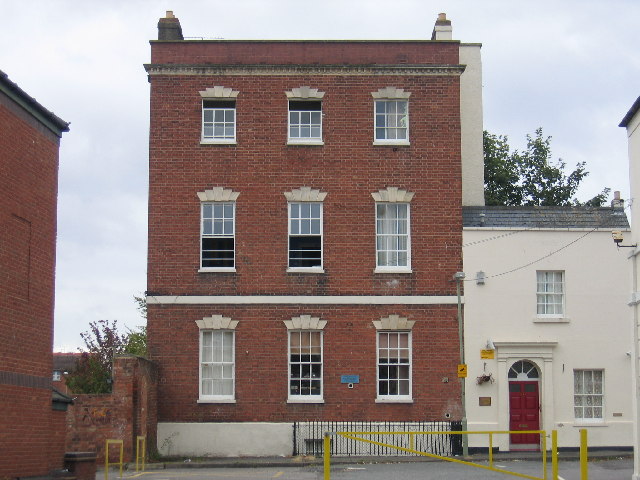
Lady's Well Images

Images are sourced within 2km of 51.855/-2.268 or Grid Reference SO8117. Thanks to Geograph Open Source API. All images are credited.

The entrance to Gloucester Docks The River Severn is in flood and is in danger of getting higher than the water level in the lock into Gloucester Docks <span class="nowrap"><a title="http://www.gloucesterdocks.me.uk/gloucester/docks.htm" rel="nofollow ugc noopener" href="http://www.gloucesterdocks.me.uk/gloucester/docks.htm">Link</a><img style="margin-left:2px;" alt="External link" title="External link - shift click to open in new window" src="https://s1.geograph.org.uk/img/external.png" width="10" height="10"/></span> so defences have been erected! The Quay, normally visible on the right is submerged. On the other side of the road is Gloucester Gaol.
The entrance to Gloucester Docks
The River Severn is in flood and is in danger of getting higher than the water level in the lock into Gloucester Docks LinkExternal link so defences have been erected! The Quay, normally visible on the right is submerged. On the other side of the road is Gloucester Gaol.
Gloucester Docks National Waterways Museum. Steam dredger getting up a head of steam in the National waterways Museum
Gloucester Docks
National Waterways Museum. Steam dredger getting up a head of steam in the National waterways Museum
Gloucester Docks Gloucester Docks. Boat trip returning into the basin through a lifting road bridge.
Gloucester Docks
Gloucester Docks. Boat trip returning into the basin through a lifting road bridge.
Gloucester Cathedral  Precinct This was Christmas Day 1969. The cathedral was closed for the day so the dancers were the only attraction for the kids in the party
Gloucester Cathedral Precinct
This was Christmas Day 1969. The cathedral was closed for the day so the dancers were the only attraction for the kids in the party
Docks at Gloucester Recently refurbished and turned into a tourist attraction with new waterfront flats.
Docks at Gloucester
Recently refurbished and turned into a tourist attraction with new waterfront flats.
High Orchard Derelict buildings in Gloucester's dockland, looking north
High Orchard
Derelict buildings in Gloucester's dockland, looking north
Gloucester and Sharpness Canal Two Mile Bend The canal runs parallel to the Bristol Road out of Gloucester in this square before executing a sharp "S" bend to the left of the photographer.  The excavations visible on the other side of the canal are to straighten out this sharp bend, <span class="nowrap"><a title="http://www.gloucesterdocks.me.uk/canal/twomilecut/2mcutplans.htm" rel="nofollow ugc noopener" href="http://www.gloucesterdocks.me.uk/canal/twomilecut/2mcutplans.htm">Link</a><img style="margin-left:2px;" alt="External link" title="External link - shift click to open in new window" src="https://s1.geograph.org.uk/img/external.png" width="10" height="10"/></span> unfortunately not led by the needs of the sea going ships which have used this canal, but instead to gain the necessary clearances to build a new western road bypass for Gloucester!
Gloucester and Sharpness Canal Two Mile Bend
The canal runs parallel to the Bristol Road out of Gloucester in this square before executing a sharp "S" bend to the left of the photographer. The excavations visible on the other side of the canal are to straighten out this sharp bend, LinkExternal link unfortunately not led by the needs of the sea going ships which have used this canal, but instead to gain the necessary clearances to build a new western road bypass for Gloucester!
St Michael's Gate, Gloucester This was the entrance to the lay cemetery of St Peter's Abbey, with which Gloucester Cathedral was associated, and was also used by Pilgrims to the shrine of Edward II. Beatrix Potter's 'Tailor of Gloucester' "lived" in the shop visible on the left just before the gateway.
St Michael's Gate, Gloucester
This was the entrance to the lay cemetery of St Peter's Abbey, with which Gloucester Cathedral was associated, and was also used by Pilgrims to the shrine of Edward II. Beatrix Potter's 'Tailor of Gloucester' "lived" in the shop visible on the left just before the gateway.
Gloucester Cathedral from King Edward's Gate The modern iron gates here are on the site of the ancient gateway which gave access from the medieval main street of Gloucester to the precinct of St Peter's Abbey.  The gateway derived its name from the fact that it was here that the abbot received the body of King Edward II for burial after the King's murder at Berkeley  Castle in 1327.
Gloucester Cathedral from King Edward's Gate
The modern iron gates here are on the site of the ancient gateway which gave access from the medieval main street of Gloucester to the precinct of St Peter's Abbey. The gateway derived its name from the fact that it was here that the abbot received the body of King Edward II for burial after the King's murder at Berkeley Castle in 1327.
The Cross, Gloucester The centre of the old Roman town, looking from Southgate Street into Northgate Street, with Eastgate Street to the right just beyond the tower, and Westgate Street off to the left on the opposite side.
The Cross, Gloucester
The centre of the old Roman town, looking from Southgate Street into Northgate Street, with Eastgate Street to the right just beyond the tower, and Westgate Street off to the left on the opposite side.
The Old Crypt School Room The original school room of the Crypt School, founded in 1539, attached to St Mary de Crypt church from which the school derived its name (see also <a href="https://www.geograph.org.uk/photo/61861">SO8318 : Plaque on Old Crypt Schoolroom</a> ). Since 1944 the school has been sited at Podsmead nearer the outskirts of the city see <a href="https://www.geograph.org.uk/photo/59401">SO8215 : The Crypt School, Gloucester.</a>
The Old Crypt School Room
The original school room of the Crypt School, founded in 1539, attached to St Mary de Crypt church from which the school derived its name (see also SO8318 : Plaque on Old Crypt Schoolroom ). Since 1944 the school has been sited at Podsmead nearer the outskirts of the city see SO8215 : The Crypt School, Gloucester.
Richleigh, Barton Street, Gloucester The former site of Sir Thomas Rich's school from 1889 to 1964 before it moved to Oxleaze - see <a href="https://www.geograph.org.uk/photo/59396">SO8519 : Sir Thomas Rich's School, Gloucester</a>. The blue plaque explains the history and can be seen on more detail on <a href="https://www.geograph.org.uk/photo/61709">SO8318 : Plaque on the front of Richleigh</a>
Richleigh, Barton Street, Gloucester
The former site of Sir Thomas Rich's school from 1889 to 1964 before it moved to Oxleaze - see SO8519 : Sir Thomas Rich's School, Gloucester. The blue plaque explains the history and can be seen on more detail on SO8318 : Plaque on the front of Richleigh
Plaque on the front of Richleigh The plaque visible on the front of the building in <a href="https://www.geograph.org.uk/photo/61708">SO8318 : Richleigh, Barton Street, Gloucester</a>
Plaque on the front of Richleigh
The plaque visible on the front of the building in SO8318 : Richleigh, Barton Street, Gloucester
Plaque on Old Crypt Schoolroom This plaque is mounted on the wall of the old schoolroom <a href="https://www.geograph.org.uk/photo/61705">SO8318 : The Old Crypt School Room</a> under the archway over St Mary's Lane (also known as Marylebone).
Plaque on Old Crypt Schoolroom
This plaque is mounted on the wall of the old schoolroom SO8318 : The Old Crypt School Room under the archway over St Mary's Lane (also known as Marylebone).
Semi-circular seat, St Mary de Crypt Churchyard, Gloucester An unusual item of stone-masonry in this historic churchyard.
Semi-circular seat, St Mary de Crypt Churchyard, Gloucester
An unusual item of stone-masonry in this historic churchyard.
St Mary de Crypt Church, Southgate Street, Gloucester The church seen looking north along Southgate Street, with the Old Crypt Schoolroom beyond.  The church was first recorded c1140 when it was known as the Church of the Blessed Mary within the Southgate.  The present structure is the result of a major rebuilding that took place in the late 14th century.  It incorporated some of the earlier 12th and 13th century work.  Further alterations took place in the 15th and 16th centuries. Below the western end of the nave lies the crypt alluded to in the name of the church.

Gloucester's famous 18th century preacher, George Whitefield delivered his first sermon after ordination in 1734 from the 17th century pulpit in the nave. See also <span class="nowrap"><a title="http://www.citybenefice.com/smdc_history.html" rel="nofollow ugc noopener" href="http://www.citybenefice.com/smdc_history.html">Link</a><img style="margin-left:2px;" alt="External link" title="External link - shift click to open in new window" src="https://s1.geograph.org.uk/img/external.png" width="10" height="10"/></span>
St Mary de Crypt Church, Southgate Street, Gloucester
The church seen looking north along Southgate Street, with the Old Crypt Schoolroom beyond. The church was first recorded c1140 when it was known as the Church of the Blessed Mary within the Southgate. The present structure is the result of a major rebuilding that took place in the late 14th century. It incorporated some of the earlier 12th and 13th century work. Further alterations took place in the 15th and 16th centuries. Below the western end of the nave lies the crypt alluded to in the name of the church. Gloucester's famous 18th century preacher, George Whitefield delivered his first sermon after ordination in 1734 from the 17th century pulpit in the nave. See also LinkExternal link
Westgate Street, Gloucester Looking west along Westgate Street from near the cross. Part of the frontage of the Shire hall can be seen protruding on the left.  College Street, leading up to the Cathedral, is to the right just beyond the tall black and white building.  The church tower is that of St Nicholas - for more information see <span class="nowrap"><a title="http://www.sacred-destinations.com/england/gloucester-st-nicholas-church.htm" rel="nofollow ugc noopener" href="http://www.sacred-destinations.com/england/gloucester-st-nicholas-church.htm">Link</a><img style="margin-left:2px;" alt="External link" title="External link - shift click to open in new window" src="https://s1.geograph.org.uk/img/external.png" width="10" height="10"/></span>
Westgate Street, Gloucester
Looking west along Westgate Street from near the cross. Part of the frontage of the Shire hall can be seen protruding on the left. College Street, leading up to the Cathedral, is to the right just beyond the tall black and white building. The church tower is that of St Nicholas - for more information see LinkExternal link
Gloucester Cathedral Seen from the west through the archway leading into College Green.
Gloucester Cathedral
Seen from the west through the archway leading into College Green.
Show me another place!

Lady's Well is located at Grid Ref: SO8117 (Lat: 51.855, Lng: -2.268)

Administrative County: Gloucestershire

District: Gloucester

Police Authority: Gloucestershire

What 3 Words

///pardon.anyone.kept. Near Gloucester, Gloucestershire

Nearby Locations

Lady's Well Hempsted

Related Wikis

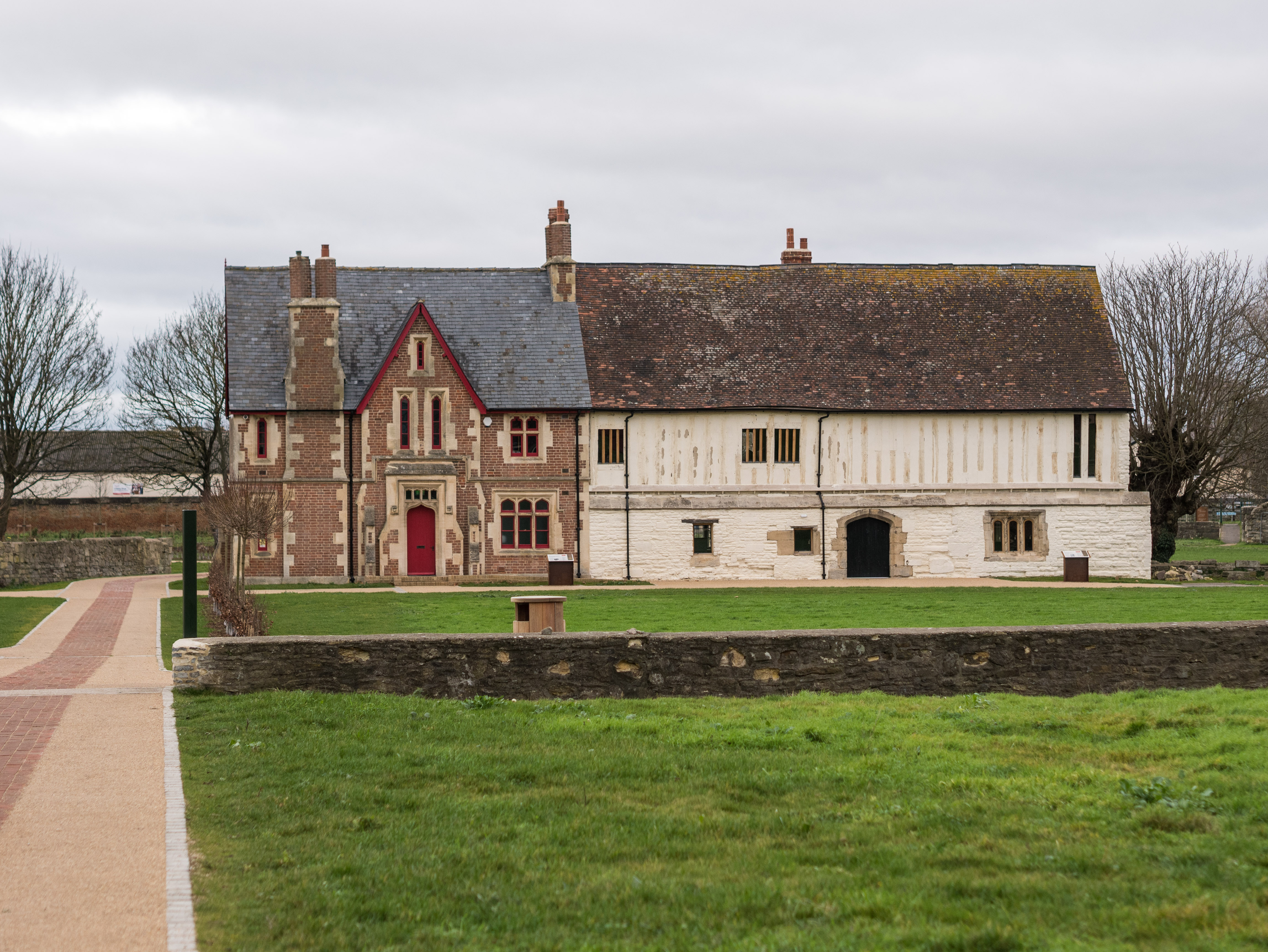
Our Lady's Well, Hempsted

Our Lady's Well (also known as Saint Anne's Well) is a holy well house in Hempsted, Gloucester. It was designated as a Grade I listed building in January...

Hempsted

Hempsted is a suburban village and former civil parish, on the edge of Gloucester in the county of Gloucestershire, England. The parish was abolished in...
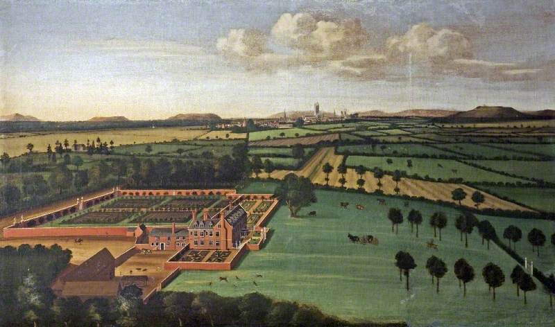
Hempsted Court

Hempsted Court was a country house at Hempsted near Gloucester in England. It was the home of the Lysons family. It was demolished in 1962 and replaced...

Meadow Park, Gloucester

Meadow Park is a football stadium in Hempsted, Gloucester. It has been home to Gloucester City A.F.C. from 1986 to 2007. It was destroyed by flooding in...

Bristol Road

Bristol Road in the City of Gloucester dates from the medieval period. It runs between Southgate Street in the north and Quedgeley in the south where it...

High Orchard

High Orchard was an industrial area of the city of Gloucester in England that was developed in the 19th century on the former orchard of the Priory of...

High Orchard Bridge

High Orchard Bridge is a bascule bridge over the Gloucester and Sharpness Canal in High Orchard in the city of Gloucester, England. It was opened in 2008...

Llanthony Secunda Priory

Llanthony Secunda Priory was a house of Augustinian canons in the parish of Hempsted, Gloucestershire, England, situated about 1/2 a mile south-west of...

Nearby Amenities

Located within 500m of 51.855,-2.268
Crossing
Button Operated: yes
Crossing: traffic_signals
Crossing Ref: pelican
Tactile Paving: yes
Traffic Signals Sound: no
Traffic Signals Vibration: yes
Lat/Long: 51.857135/-2.2616511
Traffic Signals
Lat/Long: 51.8547698/-2.261178
Post Box
Collection Times: Mo-Fr 09:00; Sa 07:00
Post Box Type: lamp
Ref: GL2 107
Lat/Long: 51.8550326/-2.2642366
Traffic Calming: table
Lat/Long: 51.851088/-2.264624
Hempsted
Is In: Gloucester, Gloucestershire, England, UK
Place: suburb
Postal Code: GL2 5
Lat/Long: 51.8506491/-2.2690218
Bus Stop
Hempsted Village Stores
Naptan AtcoCode: 1600GL2441
Naptan Bearing: SW
Naptan CommonName: Hempsted Village Stores
Naptan Indicator: Opp
Naptan NaptanCode: gloawgpm
Naptan PlusbusZoneRef: GLOSTER
Naptan Street: Hempsted Lane
Naptan Verified: no
Source: naptan_import
Lat/Long: 51.8508397/-2.2683711
Bus Stop
Hempsted Village Stores
Naptan AtcoCode: 1600GL2442
Naptan Bearing: NE
Naptan CommonName: Hempsted Village Stores
Naptan NaptanCode: gloawgpj
Naptan PlusbusZoneRef: GLOSTER
Naptan Street: Hempsted Ln
Naptan Verified: no
Source: naptan_import
Lat/Long: 51.8508304/-2.2684872
Bus Stop
Monk Meadow Trading Estate
Bench: yes
Bin: no
Lit: yes
Naptan AtcoCode: 1600GLA06105
Naptan Bearing: S
Naptan CommonName: Monk Meadow Trading Estate
Naptan NaptanCode: glogpdwp
Naptan PlusbusZoneRef: GLOSTER
Naptan Street: Secunda Way
Naptan Verified: no
Shelter: yes
Source: naptan_import
Tactile Paving: no
Lat/Long: 51.8556804/-2.2613016
Bus Stop
Monk Meadow Trading Estate
Bench: yes
Bin: no
Lit: yes
Naptan AtcoCode: 1600GLA06106
Naptan Bearing: N
Naptan CommonName: Monk Meadow Trading Estate
Naptan NaptanCode: glogpdwt
Naptan PlusbusZoneRef: GLOSTER
Naptan Street: Secunda Way
Naptan Verified: no
Shelter: yes
Source: naptan_import
Tactile Paving: no
Lat/Long: 51.8556584/-2.2616293
Bus Stop
Monks Corner
Naptan AtcoCode: 1600GLA90843
Naptan Bearing: SW
Naptan CommonName: Monks Corner
Naptan NaptanCode: glogpatj
Naptan PlusbusZoneRef: GLOSTER
Naptan Street: Hempsted Ln
Naptan Verified: no
Source: naptan_import
Lat/Long: 51.8566343/-2.2624668
Bus Stop
Monks Corner
Naptan AtcoCode: 1600GLA90844
Naptan Bearing: NE
Naptan CommonName: Monks Corner
Naptan NaptanCode: glogpatm
Naptan PlusbusZoneRef: GLOSTER
Naptan Street: Hempsted Ln
Naptan Verified: no
Source: naptan_import
Lat/Long: 51.8566701/-2.2625396
Bus Stop
Newark Farm
Naptan AtcoCode: 1600GLB467
Naptan Bearing: SW
Naptan CommonName: Newark Farm
Naptan NaptanCode: gloawjad
Naptan PlusbusZoneRef: GLOSTER
Naptan Street: Hempsted Lane
Naptan Verified: no
Source: naptan_import
Lat/Long: 51.852994/-2.2659883
Bus Stop
Newark Farm
Naptan AtcoCode: 1600GLB468
Naptan Bearing: NE
Naptan CommonName: Newark Farm
Naptan Indicator: Opp
Naptan NaptanCode: gloawgwp
Naptan PlusbusZoneRef: GLOSTER
Naptan Street: Hempsted Lane
Naptan Verified: no
Source: naptan_import
Lat/Long: 51.8528129/-2.2665244
Bus Stop
Sandalwood Drive
Naptan AtcoCode: 1600GLB469
Naptan Bearing: SW
Naptan CommonName: Sandalwood Drive
Naptan NaptanCode: gloawjdm
Naptan PlusbusZoneRef: GLOSTER
Naptan Street: Hempsted Lane
Naptan Verified: no
Source: naptan_import
Lat/Long: 51.8550028/-2.2643158
Bus Stop
Sandalwood Drive
Naptan AtcoCode: 1600GLB470
Naptan Bearing: NE
Naptan CommonName: Sandalwood Drive
Naptan Indicator: Opp
Naptan NaptanCode: gloawjdj
Naptan PlusbusZoneRef: GLOSTER
Naptan Street: Hempsted Lane
Naptan Verified: no
Source: naptan_import
Lat/Long: 51.8549033/-2.2645766
Lady Well
Historic: well
Lat/Long: 51.854167/-2.2707515
Barrier: kissing_gate
Lat/Long: 51.8523452/-2.2713464
Barrier: kissing_gate
Lat/Long: 51.8527356/-2.2716527
Barrier: kissing_gate
Lat/Long: 51.8531809/-2.2714038
Barrier: kissing_gate
Note: Both
Lat/Long: 51.8561073/-2.2690349
Barrier: kissing_gate
Lat/Long: 51.8558581/-2.2697988
Bench
Dedication: Higgs
Lat/Long: 51.8519138/-2.2714038
Bench
Lat/Long: 51.8513306/-2.2716527
Landuse: residential
Note: Unknown house - with a gravel track leading to it.
Lat/Long: 51.8531544/-2.2717729
Post Box
Post Box Type: pillar
Ref: GL2 100
Royal Cypher: EIIR
Royal Cypher Wikidata: Q33102113
Source: survey
Lat/Long: 51.8508931/-2.2684902
Bench
Dedication: Lilley
Source: survey
Lat/Long: 51.8513571/-2.2715068
Telephone
Booth: KX300
Covered: booth
Phone: +44 1452522691
Postal Code: GL2 5LJ
Lat/Long: 51.8508916/-2.2703068
Power: pole
Source: Bing
Lat/Long: 51.854246/-2.2740807
Power: pole
Source: Bing
Lat/Long: 51.8550336/-2.2733101
Power: pole
Source: Bing
Lat/Long: 51.8558861/-2.2724586
Power: pole
Source: Bing
Lat/Long: 51.8566214/-2.2713722
Power: pole
Source: Bing
Lat/Long: 51.8541611/-2.2738493
Power: pole
Source: Bing
Lat/Long: 51.8549433/-2.2730802
Power: pole
Source: Bing
Lat/Long: 51.8557805/-2.2722489
Power: pole
Source: Bing
Lat/Long: 51.8565094/-2.2711832
Power: pole
Source: Bing
Lat/Long: 51.8573863/-2.2698875
Power: pole
Source: Bing
Lat/Long: 51.8580069/-2.268968
Power: pole
Source: Bing
Lat/Long: 51.8588397/-2.2677341
Power: pole
Source: Bing
Lat/Long: 51.8574919/-2.2700754
Power: pole
Source: Bing
Lat/Long: 51.8581145/-2.2691513
Power: pole
Source: Bing
Lat/Long: 51.8589489/-2.2679293
Barrier: stile
Foot: yes
Lat/Long: 51.8575269/-2.2665917
Barrier: stile
Foot: yes
Lat/Long: 51.8585786/-2.2679872
Generator Method: photovoltaic
Generator Output Electricity: yes
Generator Source: solar
Generator Type: solar_photovoltaic_panel
Location: roof
Power: generator
Lat/Long: 51.8532993/-2.2660857
Generator Method: photovoltaic
Generator Output Electricity: yes
Generator Source: solar
Generator Type: solar_photovoltaic_panel
Location: roof
Power: generator
Lat/Long: 51.852123/-2.2681403
Generator Method: photovoltaic
Generator Output Electricity: yes
Generator Source: solar
Generator Type: solar_photovoltaic_panel
Location: roof
Power: generator
Lat/Long: 51.8518413/-2.2673947
Generator Method: photovoltaic
Generator Output Electricity: yes
Generator Source: solar
Generator Type: solar_photovoltaic_panel
Location: roof
Power: generator
Lat/Long: 51.8545899/-2.264632
Generator Method: photovoltaic
Generator Output Electricity: yes
Generator Source: solar
Generator Type: solar_photovoltaic_panel
Location: roof
Power: generator
Lat/Long: 51.8547787/-2.2627223
Generator Method: photovoltaic
Generator Output Electricity: yes
Generator Source: solar
Generator Type: solar_photovoltaic_panel
Location: roof
Power: generator
Lat/Long: 51.8547622/-2.2626445
Generator Method: photovoltaic
Generator Output Electricity: yes
Generator Source: solar
Generator Type: solar_photovoltaic_panel
Location: roof
Power: generator
Lat/Long: 51.8547456/-2.2624943
Marker: aerial
Operator: CLH
Operator Old: GPSS
Ref: MP 1806
Source: survey
Utility: oil
Lat/Long: 51.8567568/-2.2622434
Marker: pedestal
Operator: CLH
Operator Old: GPSS
Utility: oil
Lat/Long: 51.8571989/-2.2624377
Marker: pedestal
Operator: CLH
Operator Old: GPSS
Utility: oil
Lat/Long: 51.8571537/-2.2624139
Marker: aerial
Operator: CLH
Operator Old: GPSS
Ref: MP 2987
Source: survey
Utility: oil
Lat/Long: 51.8569438/-2.2622965
Marker: pedestal
Operator: CLH
Operator Old: GPSS
Ref: MP 2504
Source: survey
Utility: oil
Lat/Long: 51.8576459/-2.2624377
Marker: pedestal
Operator: CLH
Operator Old: GPSS
Ref: MP 1805
Source: survey
Utility: oil
Lat/Long: 51.85774/-2.2624192
Marker: aerial
Operator: CLH
Operator Old: GPSS
Ref: MP 6227
Ref GPSS: 15213
Source: survey
Utility: oil
Lat/Long: 51.8577497/-2.2624151
Marker: pedestal
Operator: CLH
Operator Old: GPSS
Source: survey
Utility: oil
Lat/Long: 51.8550591/-2.2616728
Marker: pedestal
Operator: CLH
Operator Old: GPSS
Ref: MP 4090
Source: survey
Utility: oil
Lat/Long: 51.8521586/-2.2624936
Marker: pedestal
Operator: CLH
Operator Old: GPSS
Ref: MP 4091
Source: survey
Utility: oil
Lat/Long: 51.8523719/-2.2632218
Marker: aerial
Operator: CLH
Operator Old: GPSS
Ref: MP 2864
Source: survey
Utility: oil
Lat/Long: 51.8524539/-2.2631635
Barrier: yes
Lat/Long: 51.8528792/-2.2688194
Crossing
Lat/Long: 51.8536738/-2.2615696
Historic: market_cross
Lat/Long: 51.8508336/-2.270455
Crossing
Crossing Ref: zebra
Lat/Long: 51.8518511/-2.2704514
Traffic Calming: choker
Lat/Long: 51.8540647/-2.2665404
Outlet: yes
Lat/Long: 51.8545617/-2.2659894
Outlet: yes
Lat/Long: 51.8544724/-2.2661115
Street Lamp
Ref: 4
Lat/Long: 51.8549693/-2.2658095
Street Lamp
Ref: 1
Lat/Long: 51.854799/-2.2650974
Street Lamp
Ref: 2
Lat/Long: 51.8548197/-2.2654943
The data included in this document is from www.openstreetmap.org. The data is made available under ODbL.

Have you been to Lady's Well?

Leave your review of Lady's Well below (or comments, questions and feedback).