King Lud's Entrenchments
Heritage Site in Leicestershire Melton
England
King Lud's Entrenchments

King Lud's Entrenchments, located in Leicestershire, is a significant heritage site that holds historical and archaeological importance. These entrenchments are believed to be remnants of an Iron Age hillfort, dating back to around 500 BC. The site covers an area of approximately 20 acres and is situated on a prominent ridge overlooking the Soar Valley.
The entrenchments consist of a series of earthworks, including a deep ditch and a rampart that encircles the hilltop. The ditch measures about 20 meters wide and 4 meters deep, while the rampart stands at a height of around 2 meters. The overall layout of the fortification is roughly circular, with an entrance on the eastern side.
Archaeological excavations at King Lud's Entrenchments have uncovered evidence of occupation and defensive structures, such as postholes and storage pits. These findings suggest that the site was inhabited during the Iron Age period, possibly by a small community engaged in agriculture and trade.
The name "King Lud's Entrenchments" is derived from local folklore, which associates the site with the legendary British king, King Lud. However, there is no historical evidence to support this claim.
Today, King Lud's Entrenchments are a popular destination for visitors interested in exploring and learning about Leicestershire's ancient history. The site offers stunning panoramic views of the surrounding countryside, making it an ideal spot for walks and picnics. Efforts have been made to preserve and protect the entrenchments, ensuring their continued significance as a heritage site for future generations to appreciate.
If you have any feedback on the listing, please let us know in the comments section below.
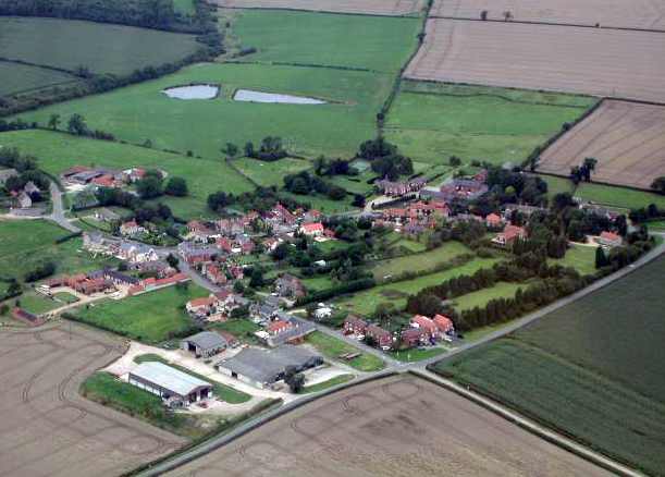
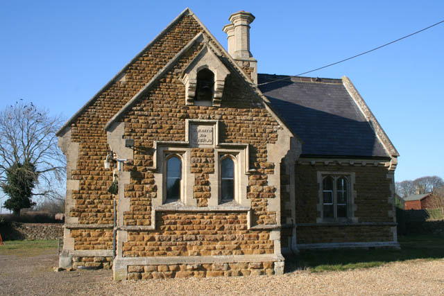
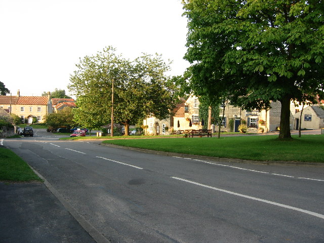
King Lud's Entrenchments Images
Images are sourced within 2km of 52.837/-0.715 or Grid Reference SK8627. Thanks to Geograph Open Source API. All images are credited.


King Lud's Entrenchments is located at Grid Ref: SK8627 (Lat: 52.837, Lng: -0.715)
Administrative County: Leicestershire
District: Melton
Police Authority: Leicestershire
What 3 Words
///lions.eliminate.lately. Near Colsterworth, Lincolnshire
Nearby Locations
Related Wikis
King Lud's Entrenchments and The Drift
King Lud's Entrenchments and The Drift is a 23.9 hectares (59 acres) biological Site of Special Scientific Interest which straddles the border between...

RAF Saltby
Royal Air Force Saltby or more simply RAF Saltby is a former Royal Air Force station located near Saltby, Leicestershire, England The following units were...
Buckminster Gliding Club
The Buckminster Gliding Club (BGC) is a gliding club based at Saltby Airfield on the Leicestershire / Lincolnshire border, England. It is affiliated with...
Saltby
Saltby is a village and former civil parish, now in the parish of Sproxton, in the Melton borough of Leicestershire, England. It lies close to the River...

Sproxton Quarry
Sproxton Quarry is a 5.4 hectares (13 acres) geological Site of Special Scientific Interest north-east of Sproxton in Leicestershire. It is a Geological...
Sproxton, Leicestershire
Sproxton () is a village and civil parish within the Borough of Melton in Leicestershire, England, close to the border with Lincolnshire. It has approximately...

Croxton Abbey
Croxton Abbey, near Croxton Kerrial, Leicestershire, was a Premonstratensian monastery founded by William I, Count of Boulogne. == History == Croxton Abbey...
Skillington
Skillington is a village and civil parish in the South Kesteven district of Lincolnshire, England. The population of the civil parish at the 2021 census...
Have you been to King Lud's Entrenchments?
Leave your review of King Lud's Entrenchments below (or comments, questions and feedback).