Middle Crackington

Settlement in Cornwall

England

Middle Crackington

On the coastal path at Cleave A sea fog completely obscuring the view over the cliff edge.
On the coastal path at Cleave Credit: David Martin

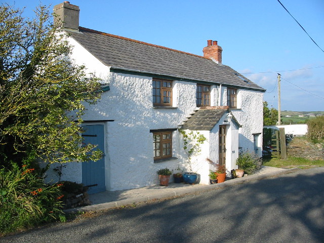
Middle Crackington is a picturesque village located in the county of Cornwall, England. Situated on the rugged north coast, it is positioned between the larger towns of Bude and Boscastle. The village is known for its stunning natural beauty and its charming, traditional atmosphere.

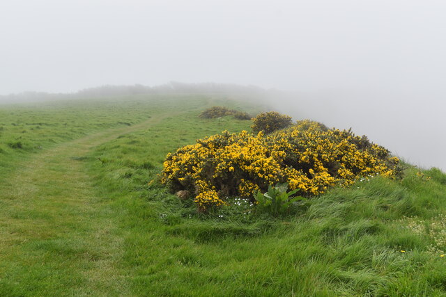
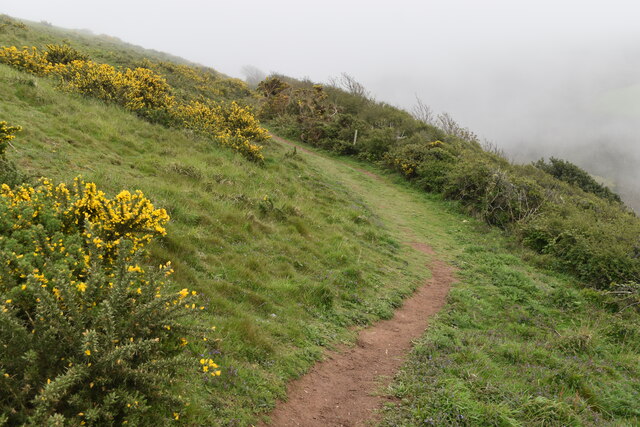
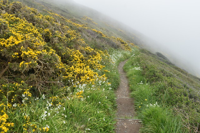
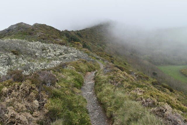
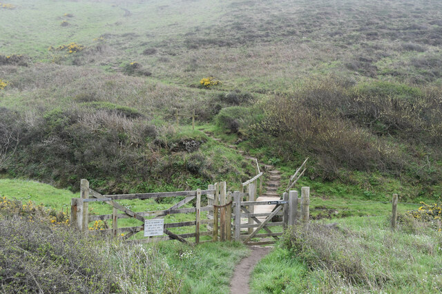
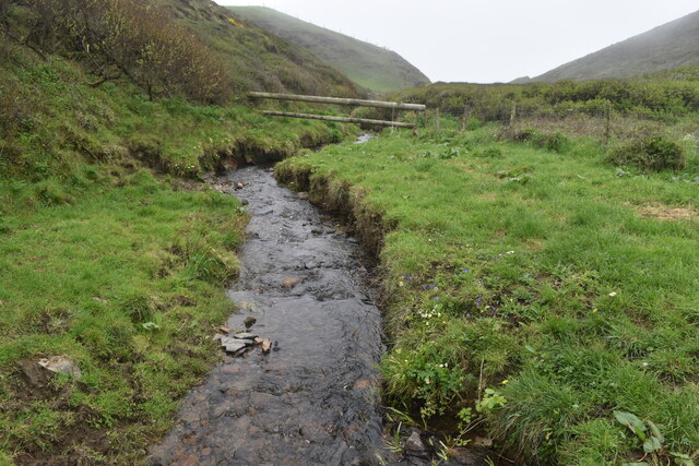
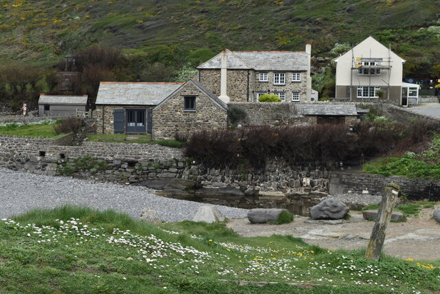
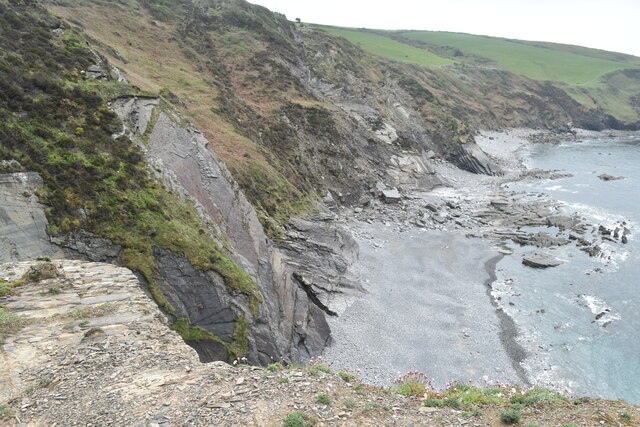
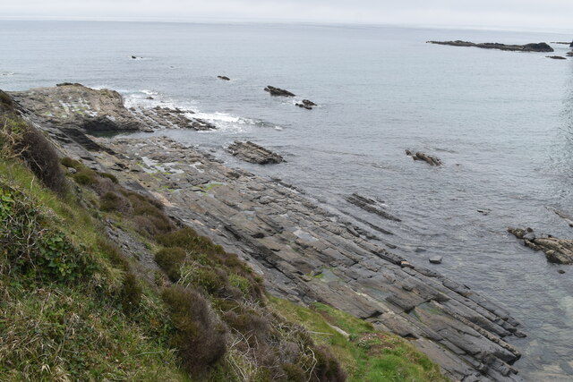
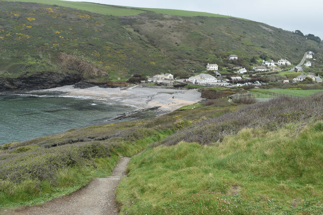
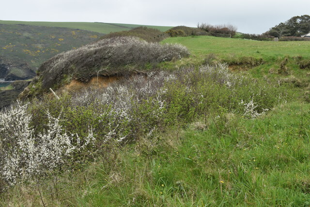
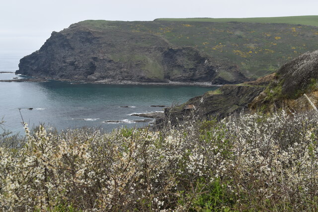
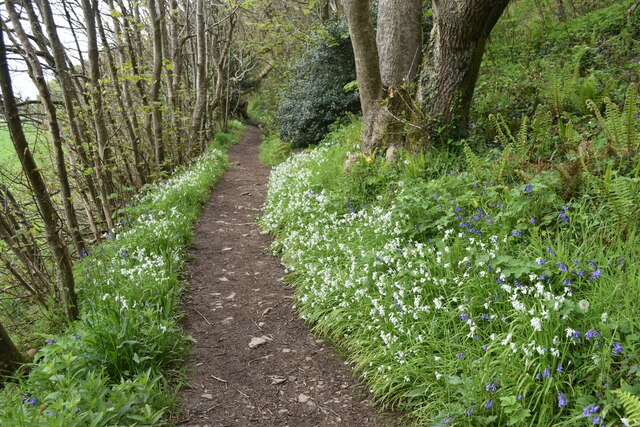
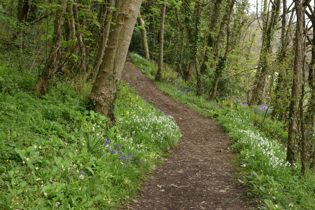
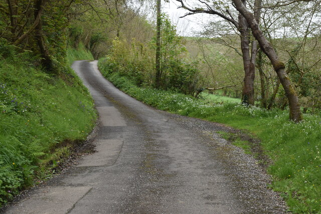
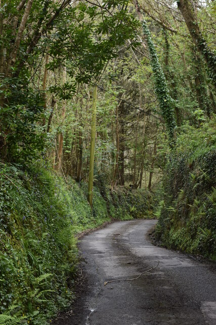
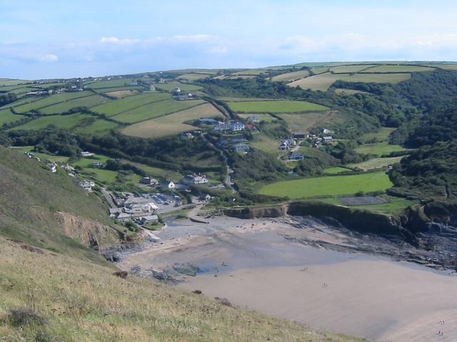
Middle Crackington is nestled amidst rolling hills and lush countryside, making it a popular destination for nature lovers and outdoor enthusiasts. The village is surrounded by breathtaking landscapes, including expansive fields, meandering streams, and majestic cliffs that overlook the Atlantic Ocean.

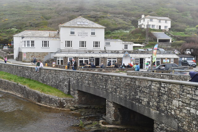
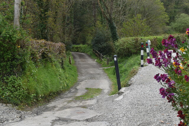
The local community in Middle Crackington is small and tight-knit, with a friendly and welcoming atmosphere. The village has a few amenities, including a quaint pub, a village hall, and a small convenience store, catering to the needs of both residents and visitors. The pub is a hub of activity, serving as a gathering place for locals and a welcoming spot for tourists to enjoy a drink and soak in the village's authentic atmosphere.

For those seeking outdoor adventures, Middle Crackington offers plenty of opportunities. The nearby coastline boasts stunning sandy beaches and rugged cliffs, perfect for long walks, picnics, or even adventurous hiking. The village is also in close proximity to various hiking trails and nature reserves, providing ample opportunities for exploration and wildlife spotting.

In conclusion, Middle Crackington is a charming village in Cornwall that offers a delightful combination of natural beauty, a close-knit community, and outdoor activities. Whether it's a peaceful stroll along the coastline or a friendly chat in the local pub, Middle Crackington welcomes visitors to experience its idyllic charm.

If you have any feedback on the listing, please let us know in the comments section below.

Middle Crackington Images

Images are sourced within 2km of 50.732266/-4.618138 or Grid Reference SX1595. Thanks to Geograph Open Source API. All images are credited.

On the coastal path at Cleave A sea fog completely obscuring the view over the cliff edge.
On the coastal path at Cleave
A sea fog completely obscuring the view over the cliff edge.
On the coastal path near Cleave The path turns briefly inland in order to descend onto the ridge leading to Castle Point.
On the coastal path near Cleave
The path turns briefly inland in order to descend onto the ridge leading to Castle Point.
On the coastal path above Crackington Haven Sea fog obscures the view of the village below.
On the coastal path above Crackington Haven
Sea fog obscures the view of the village below.
On the ridge between Castle Point and Cleave Here looking inland, away from the Castle Point summit.
On the ridge between Castle Point and Cleave
Here looking inland, away from the Castle Point summit.
Footbridge carrying coastal path over stream below Castle Point
Stream in valley south of Castle Point This stream descends over a waterfall onto Little Barton Strand.
Stream in valley south of Castle Point
This stream descends over a waterfall onto Little Barton Strand.
The Coombe Barton Inn, Crackington Haven
Houses overlooking the river mouth, Crackington Haven
Coast southwest of Bray's Point
Wave-cut platform beneath Bray's Point
Crackington Haven
Crackington Haven
Clifftop field southwest of Crackington Haven The coast path passes through this field around a sizeable landslip which has left fenceposts dangling in mid-air.
Clifftop field southwest of Crackington Haven
The coast path passes through this field around a sizeable landslip which has left fenceposts dangling in mid-air.
Pencannow Point, seen across the mouth of Crackington Haven
Footpath in valley near Congdons Bridge
Path climbing valley side near Congdons Bridge
Track over the bridge at Mineshop The route ahead leads over the bridge, while the track on the right becomes the footpath towards Crackington Haven.
Track over the bridge at Mineshop
The route ahead leads over the bridge, while the track on the right becomes the footpath towards Crackington Haven.
Lane north from Mineshop
Steep lane descending from Tremayna Farm towards Mineshop
Show me another place!

Middle Crackington is located at Grid Ref: SX1595 (Lat: 50.732266, Lng: -4.618138)

Unitary Authority: Cornwall

Police Authority: Devon and Cornwall

What 3 Words

///unhelpful.flats.dining. Near Jacobstow, Cornwall

Related Wikis

Sweets, Cornwall

Sweets is a hamlet between Middle Crackington and Higher Crackington in north Cornwall, England, United Kingdom. == References ==

Mineshope

Mineshope is a hamlet in the parish of St Gennys, Cornwall, England. == References ==

Coxford, Cornwall

Coxford is a hamlet in the parish of St Gennys (where the 2011 census population was included ) in north Cornwall, England. == References ==

St Gennys

St Gennys (Standard Written Form: S. Gwynnas) is a coastal civil parish and small settlement in north Cornwall, England, United Kingdom. The village of...

Related Videos

Tour of Darzona Holiday Cottage at Pencuke Farm, Crackington Haven, Cornwall

1 bedroom holiday cottage in Crackington Haven, Cornwall. See more at www.pencukefarm.co.uk.

Crackington and St Gennys headland walk

late April 2021 on a calm warm sunny day.

Tour of Skyber Barn Holiday Cottage at Pencuke Farm, Crackington Haven, Cornwall

Tour of Skyber Barn Holiday Cottage at Pencuke Farm, Crackington Haven, Cornwall. See more at www.pencukefarm.co.uk.

VLOG 36 - Full week in Boscastle, Crackington Haven coastal hike, friendly lambs & angry bulls

Subscribe & Turn on Notifications for more! ❤ Camera that I filmed this video on - https://bit.ly/38bv2xP ❤ WHERE ELSE TO FIND ...

Nearby Amenities

Located within 500m of 50.732266,-4.618138
Ford: yes
Lat/Long: 50.7326128/-4.621317
Bus Stop
Junction Haven Road
Bench: no
Bin: no
Lit: yes
Naptan AtcoCode: 0800COA10042
Naptan Bearing: S
Naptan CommonName: Junction Haven Road
Naptan Crossing: Long Arrow Close
Naptan NaptanCode: cordpagd
Naptan Street: Haven Road
Naptan Verified: no
Shelter: no
Source: naptan_import
Tactile Paving: no
Lat/Long: 50.7323403/-4.6180081
Post Office
Brand: Post Office
Brand Wikidata: Q1783168
Source: survey
Lat/Long: 50.7295901/-4.6147879
Middle Crackington
Name Kw: Kragen Gres
Place: village
Lat/Long: 50.7327704/-4.6170911
Higher Crackington
Name Kw: Kragen Wartha
Place: village
Lat/Long: 50.7295058/-4.6142443
Crackington Village General Stores
Opening Hours: Mo-Sa 08:30-18:00; Su 09:00-12:00; PH off
Shop: convenience
Lat/Long: 50.7296538/-4.6147817
Post Box
Brand: Royal Mail
Brand Wikidata: Q638098
Collection Times: Mo-Fr 15:00; Sa 10:00
Operator: Royal Mail
Operator Wikidata: Q638098
Post Box Mounting: pier
Post Box Type: lamp
Ref: EX23 69
Royal Cypher: EIIR
Royal Cypher Wikidata: Q33102113
Lat/Long: 50.7298648/-4.6146409
Post Box
Brand: Royal Mail
Brand Wikidata: Q638098
Collection Times: Mo-Fr 15:00; Sa 07:15
Operator: Royal Mail
Operator Wikidata: Q638098
Post Box Mounting: pier
Post Box Type: lamp
Ref: EX23 180
Royal Cypher: EIIR
Royal Cypher Wikidata: Q33102113
Survey Date: 2022-12-17
Lat/Long: 50.7325241/-4.6181076
Fire Hydrant
Emergency: fire_hydrant
Fire Hydrant Diameter: 3"
Fire Hydrant Position: lane
Fire Hydrant Type: underground
Survey Date: 2022-12-17
Lat/Long: 50.7340213/-4.6219352
Grit Bin
Survey Date: 2022-12-17
Lat/Long: 50.7340086/-4.6219572
Bench
Backrest: yes
Survey Date: 2022-12-17
Lat/Long: 50.7298575/-4.6146242
Waste Basket
Survey Date: 2022-12-17
Waste: dog_excrement
Lat/Long: 50.7323489/-4.6179768
Waste Basket
Survey Date: 2022-12-17
Lat/Long: 50.7300784/-4.6147546
Barrier: stile
Material: wood
Step Count: 3
Stile: stepover
Lat/Long: 50.7341522/-4.6220294
Crossing
Lat/Long: 50.7300615/-4.613839
The data included in this document is from www.openstreetmap.org. The data is made available under ODbL.

Have you been to Middle Crackington?

Leave your review of Middle Crackington below (or comments, questions and feedback).