Ilam Park

Heritage Site in Staffordshire Staffordshire Moorlands

England

Ilam Park

Signpost on the Manifold Way Approaching Coldwall Bridge with the River Dove currently over to the left.
Signpost on the Manifold Way Credit: Bill Boaden

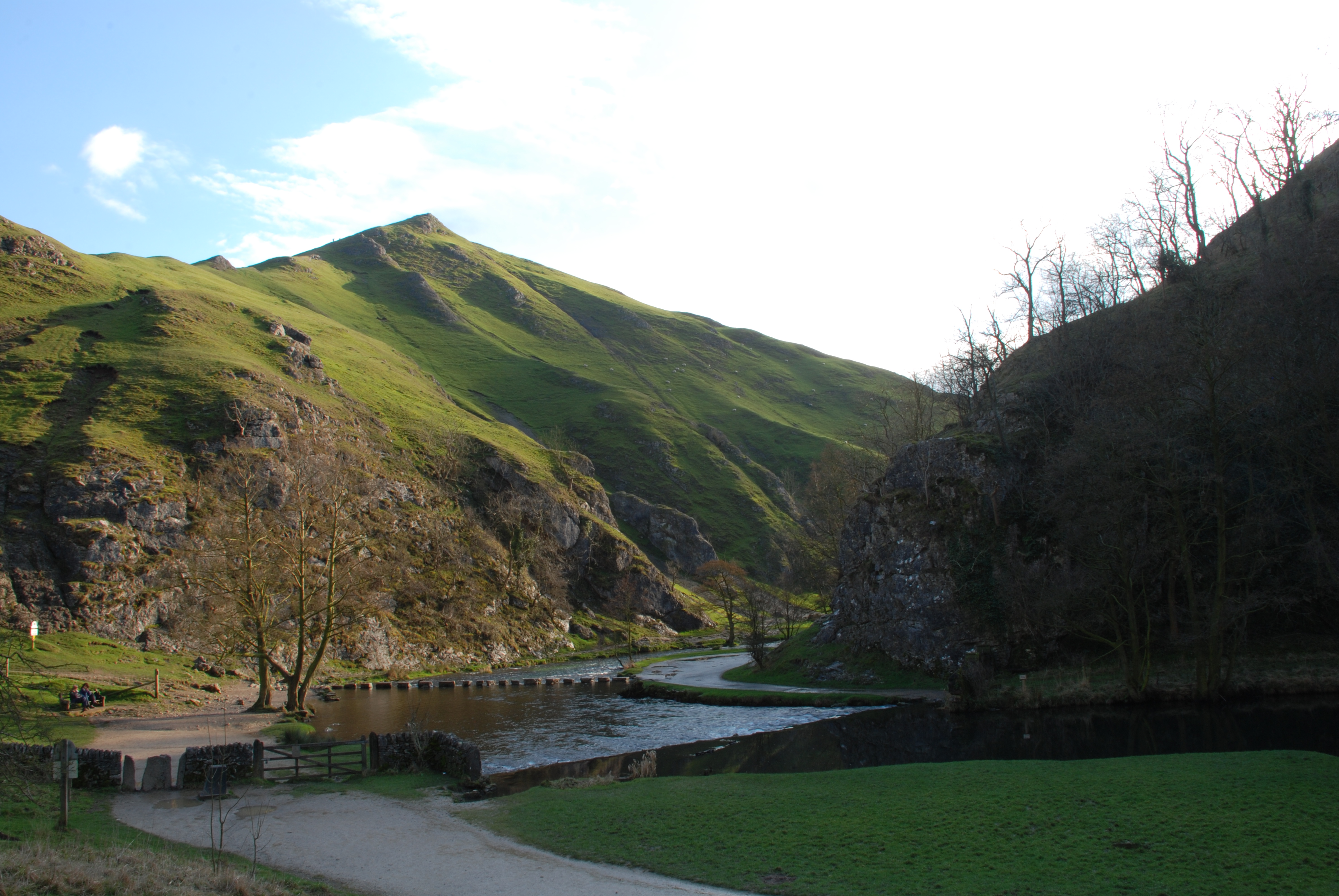
Ilam Park is a breathtaking heritage site located in the county of Staffordshire, England. Situated on the banks of the River Manifold, this historic estate covers an area of approximately 158 acres and is owned and managed by the National Trust.

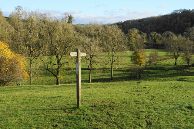
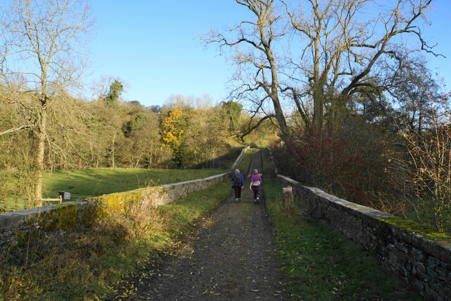
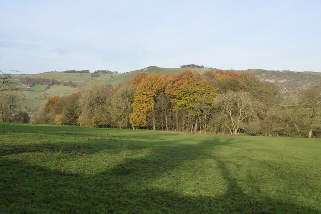
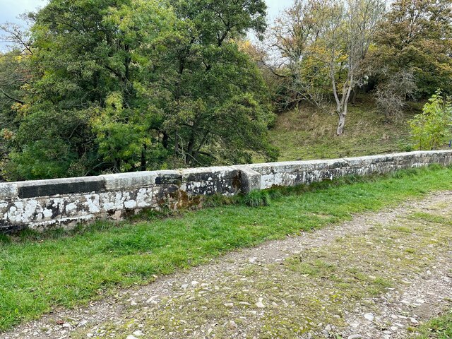
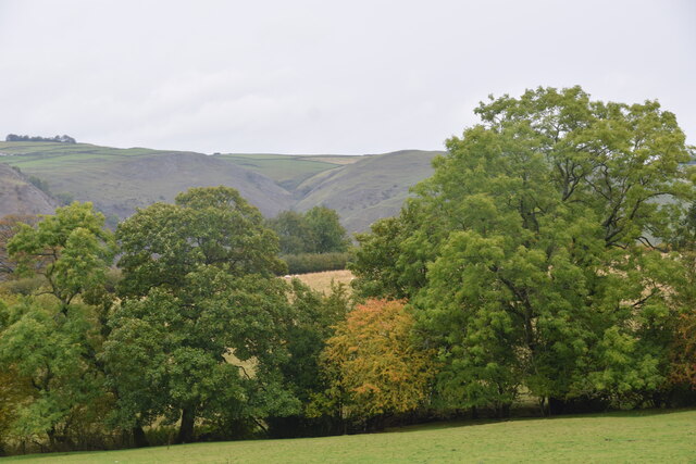
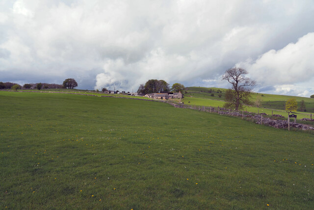
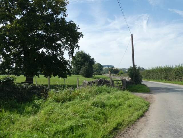
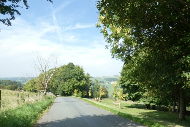
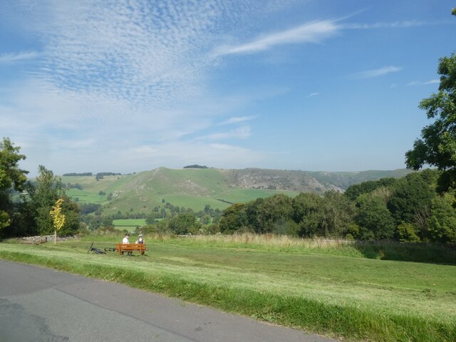
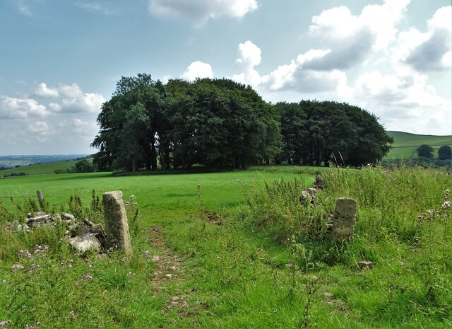
The park offers visitors a unique blend of natural beauty, rich history, and stunning landscapes. It is renowned for its picturesque views, with rolling hills, meandering rivers, and lush green meadows. The park is home to a diverse range of flora and fauna, making it a haven for nature enthusiasts.

The centerpiece of Ilam Park is the magnificent Ilam Hall, an impressive gothic mansion that dates back to the 1820s. This grand house, designed by renowned architect James Trubshaw, is a testament to the Georgian era and offers a glimpse into the lives of the wealthy families who once resided here.

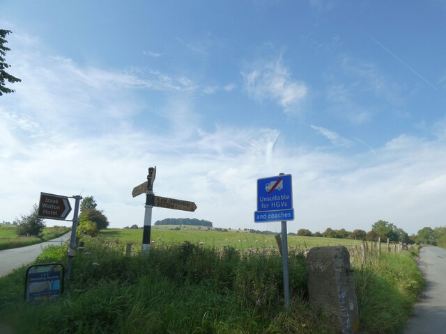
Visitors can explore the park's extensive network of walking trails, which meander through woodlands, along the river, and up to the hilltops, providing breathtaking views of the surrounding countryside. The park also offers opportunities for outdoor activities such as cycling, picnicking, and wildlife spotting.

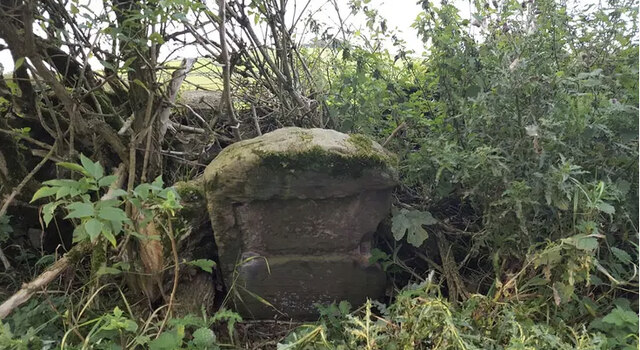
Ilam Park is not only a place of natural beauty but also a site of historical significance. It has connections to notable figures such as David Pike Watts, who played a crucial role in the development of the park, and Reverend Charles Keith, who established a pioneering school for boys here in the early 19th century.

In addition to its natural and historical attractions, Ilam Park hosts a range of events and activities throughout the year, including guided tours, workshops, and exhibitions, making it an ideal destination for both locals and tourists seeking a memorable experience.

If you have any feedback on the listing, please let us know in the comments section below.

Ilam Park Images

Images are sourced within 2km of 53.053/-1.805 or Grid Reference SK1350. Thanks to Geograph Open Source API. All images are credited.

Signpost on the Manifold Way Approaching Coldwall Bridge with the River Dove currently over to the left.
Signpost on the Manifold Way
Approaching Coldwall Bridge with the River Dove currently over to the left.
Track onto Coldwall Bridge Part of the Limestone Way which will cross the River Dove.
Track onto Coldwall Bridge
Part of the Limestone Way which will cross the River Dove.
Autumn view from Blore Pastures  Taken from Blore Pastures Picnic site looking across towards Bunster Hill and the mouth of Dovedale.
Autumn view from Blore Pastures
Taken from Blore Pastures Picnic site looking across towards Bunster Hill and the mouth of Dovedale.
Benchmark, Coldwall Bridge Detail of the Ordnance Survey rivet benchmark on the north parapet of Coldwall Bridge. The rivet is missing and the cut arrow is unusually elaborate. The benchmark is located on the county boundary of Staffordshire and Derbyshire, it marks a height of 135.0173m above mean sea level (Ordnance Datum Newlyn) last verified in 1949 (location photograph <a href="https://www.geograph.org.uk/photo/7326506">SK1449 : Boundary stone, Coldwall Bridge</a>).
Benchmark, Coldwall Bridge
Detail of the Ordnance Survey rivet benchmark on the north parapet of Coldwall Bridge. The rivet is missing and the cut arrow is unusually elaborate. The benchmark is located on the county boundary of Staffordshire and Derbyshire, it marks a height of 135.0173m above mean sea level (Ordnance Datum Newlyn) last verified in 1949 (location photograph SK1449 : Boundary stone, Coldwall Bridge).
Boundary stone, Coldwall Bridge Coldwall Bridge carried the Blythe Marsh, Oakamoor to Thorpe turnpike road over the River Dove.  The county boundary between Staffordshire and Derbyshire which follows the centre of the River is marked by the projecting boundary stone, upon the top of which is an Ordnance Survey rivet benchmark (detail photograph <a href="https://www.geograph.org.uk/photo/7087421">SK1449 : Benchmark, Coldwall Bridge</a>).
This section of the turnpike road, now in places only used as a farm track, fell into disuse as early motor vehicles struggled with the gradients, road users preferring to use alternative routes.
Boundary stone, Coldwall Bridge
Coldwall Bridge carried the Blythe Marsh, Oakamoor to Thorpe turnpike road over the River Dove. The county boundary between Staffordshire and Derbyshire which follows the centre of the River is marked by the projecting boundary stone, upon the top of which is an Ordnance Survey rivet benchmark (detail photograph SK1449 : Benchmark, Coldwall Bridge). This section of the turnpike road, now in places only used as a farm track, fell into disuse as early motor vehicles struggled with the gradients, road users preferring to use alternative routes.
View towards Dove Dale  Taken from the picnic area on Blore Pasture.
View towards Dove Dale
Taken from the picnic area on Blore Pasture.
The Waterings Farm The farm is off Blore Lane and has a good view across and down the valley.
The Waterings Farm
The farm is off Blore Lane and has a good view across and down the valley.
Looking along Blore Lane Looking back down the road from the position of the previous submission <a href="https://www.geograph.org.uk/photo/7479439">SK1249 : The Waterings Farm</a>.
Looking along Blore Lane
Looking back down the road from the position of the previous submission SK1249 : The Waterings Farm.
Old Milestone by Ilam-Moor Lane, west of Blore Stone post (plate lost) by the UC road, Ilam-Moor Lane, in parish of Blore with Swinscoe (Staffordshire Moorlands District), West of Blore cross-roads, on grass verge, on South side of road. Cheadle iron plate, erected by the Cheadle to Butterton Moor (District of Cheadle) turnpike trust in the 19th century. 

Inscription once read:-
(CHEADLE)
(10)

Staffordshire HER.
HER Number: 20672 <span class="nowrap"><a title="https://www.heritagegateway.org.uk/Gateway/Results_Single.aspx?uid=MST5936&resourceID=1010" rel="nofollow ugc noopener" href="https://www.heritagegateway.org.uk/Gateway/Results_Single.aspx?uid=MST5936&resourceID=1010">Link</a><img style="margin-left:2px;" alt="External link" title="External link - shift click to open in new window" src="https://s1.geograph.org.uk/img/external.png" width="10" height="10"/></span>

Milestone Society National ID: ST_CDBM10
Old Milestone by Ilam-Moor Lane, west of Blore
Stone post (plate lost) by the UC road, Ilam-Moor Lane, in parish of Blore with Swinscoe (Staffordshire Moorlands District), West of Blore cross-roads, on grass verge, on South side of road. Cheadle iron plate, erected by the Cheadle to Butterton Moor (District of Cheadle) turnpike trust in the 19th century. Inscription once read:- (CHEADLE) (10) Staffordshire HER. HER Number: 20672 LinkExternal link Milestone Society National ID: ST_CDBM10
Verge and field gate near Coldwall Farm
An addendum to the road sign, near Blore Hall Unsuitable for HGVs on the original sign, with the addition "And coaches"; presumably in the past some coach drivers thought that they could use the road
An addendum to the road sign, near Blore Hall
Unsuitable for HGVs on the original sign, with the addition "And coaches"; presumably in the past some coach drivers thought that they could use the road
Road across Blore Pastures
Seat on Blore Pastures, and view north-east
Copse above Rushley Wood
Spring on the side of Bunster Hill Trickling gently next to the path climbing out of the Manifold Valley above Ilam.
Spring on the side of Bunster Hill
Trickling gently next to the path climbing out of the Manifold Valley above Ilam.
Footpath across a ridge and furrow field Evidence of medieval ploughing picked out by the footsteps of walkers.
Footpath across a ridge and furrow field
Evidence of medieval ploughing picked out by the footsteps of walkers.
Ilam Cross, The Mary Watts-Russell Memorial
Show me another place!

Ilam Park is located at Grid Ref: SK1350 (Lat: 53.053, Lng: -1.805)

Administrative County: Staffordshire

District: Staffordshire Moorlands

Police Authority: Staffordshire

What 3 Words

///vehicle.hound.burns. Near Ashbourne, Derbyshire

Related Wikis

Ilam Park

Ilam Park is a 158-acre (0.64 km2) country park situated in Ilam, on both banks of the River Manifold five miles (8 km) north west of Ashbourne, England...

White Peak Estate

The White Peak Estate (previously known as the South Peak Estate) of the National Trust comprises several land holdings in the Southern Peak District....

Ilam, Staffordshire

Ilam ( ) is a village in the Staffordshire Peak District of England, lying on the River Manifold. The population of the civil parish as taken at the 2011...

River Manifold

The River Manifold is a river in Staffordshire, England. It is a tributary of the River Dove (which also flows through the Peak District, forming the boundary...

Thorpe Cloud

Thorpe Cloud is an isolated limestone hill (a reef knoll) lying between the villages of Thorpe and Ilam on the Derbyshire/Staffordshire border at the southern...

Blore with Swinscoe

Blore with Swinscoe is a civil parish north-west of Ashbourne, in the Staffordshire Moorlands district of Staffordshire, England, on the edge of the Peak...

Dovedale

Dovedale is a valley in the Peak District of England. The land is owned by the National Trust and attracts a million visitors annually. The valley was...

Blore

Blore (grid reference SK137493) is a small village and parish in the Staffordshire Moorlands District of England. It is on an acclivity above Dovedale...

Nearby Amenities

Located within 500m of 53.053,-1.805
Ilam
Place: village
Lat/Long: 53.0555155/-1.8001501
Barrier: cattle_grid
Bicycle: yes
Foot: yes
Motorcar: yes
Motorcycle: yes
Lat/Long: 53.0526604/-1.7995376
Ilam Cross
Historic: monument
Lat/Long: 53.0546759/-1.7995666
Ilam Hall Youth Hostel
Brand: YHA
Brand Wikidata: Q8059214
Contact Website: https://www.yha.org.uk/hostel/yha-ilam-hall
Operator: Youth Hostels Association
Source: local_knowledge
Tourism: hostel
Lat/Long: 53.0530347/-1.8053559
Bus Stop
Cross
Bus: yes
Naptan AtcoCode: 3800C808400
Naptan Bearing: NW
Naptan CommonName: Cross
Naptan Indicator: Adj
Naptan Landmark: Cross
Naptan Street: Orchard View
Naptan Verified: no
Public Transport: platform
Source: naptan_import
Lat/Long: 53.0547914/-1.8003295
Bus Stop
Cross
Bus: yes
Naptan AtcoCode: 3800C808401
Naptan Bearing: SE
Naptan CommonName: Cross
Naptan Indicator: Opp
Naptan Landmark: Cross
Naptan Street: Orchard View
Naptan Verified: no
Public Transport: platform
Source: naptan_import
Lat/Long: 53.0548991/-1.8002246
Post Box
Brand: Royal Mail
Brand Wikidata: Q638098
Collection Times: Mo-Fr 16:00, Sa 07:15
Drive Through: no
Operator: Royal Mail
Operator Wikidata: Q638098
Post Box Type: lamp
Ref: DE6 875
Royal Cypher: EIIR
Royal Cypher Wikidata: Q33102113
Source: Bing
Lat/Long: 53.0549079/-1.7991789
Waterway: weir
Lat/Long: 53.0520741/-1.8052619
Parking
Ilam Hall overflow car park
Operator: National Trust
Lat/Long: 53.0541145/-1.806608
Toilets
Changing Table: yes
Changing Table Fee: no
Fee: no
Toilets Disposal: flush
Toilets Position: seated;urinal
Toilets Wheelchair: yes
Lat/Long: 53.0528926/-1.8059529
Cafe
Cuisine: coffee_shop
Lat/Long: 53.0526918/-1.8058175
Barrier: kissing_gate
Lat/Long: 53.0535029/-1.8036365
Barrier: stile
Material: wood
Source: survey;bing;gps
Stile: stepover
Lat/Long: 53.0556259/-1.8018813
Entrance: main
Lat/Long: 53.0526695/-1.8057775
Check Date: 2021-08-10
Note: gate and fence now gone
Lat/Long: 53.0500661/-1.8005145
Tourism: information
Lat/Long: 53.0527563/-1.80593
Tourism: picnic_site
Lat/Long: 53.0525693/-1.8058294
Natural: spring
Lat/Long: 53.0525116/-1.8034265
Saxon Cross
Historic: monument
Lat/Long: 53.0523123/-1.8092085
Hiking: yes
Information: guidepost
Source: GPS survey
Tourism: information
Lat/Long: 53.0513957/-1.7999031
Defibrillator
Defibrillator Location: On outside wall. Available 24/7.
Emergency: defibrillator
Lat/Long: 53.055172/-1.8008783
Barrier: kissing_gate
Lat/Long: 53.0531804/-1.8038105
Bench
Backrest: no
Material: wood
Lat/Long: 53.0523073/-1.8091141
Fixme: refine location
Man Made: beehive
Lat/Long: 53.0518355/-1.8071625
Fixme: refine location
Man Made: beehive
Lat/Long: 53.0517958/-1.8071685
Defibrillator
Access: permissive
Defibrillator Location: Outside Ilam primary school
Emergency: defibrillator
Indoor: no
Ref GB The Circuit: 52C857B0-77AF-47A7-99B8-CC41456914CE
Lat/Long: 53.0558639/-1.8014028
Telephone
Booth: K6
Covered: booth
Operator: BT
Operator Wikidata: Q593786
Phone: +44 1335 350346
Lat/Long: 53.0545831/-1.7996371
Ilam Hall Bunkhouse
Operator: National Trust
Tourism: bunkhouse
Lat/Long: 53.0527961/-1.8059868
Bench
Lat/Long: 53.0547493/-1.8001501
The data included in this document is from www.openstreetmap.org. The data is made available under ODbL.

Have you been to Ilam Park?

Leave your review of Ilam Park below (or comments, questions and feedback).